understanding australia’s tropical rivers live, and is important for their movement, growth and...
TRANSCRIPT
UNDERSTANDING AUSTRALIA’SUNDERSTANDING AUSTRALIA’S TROPICAL RIVERS
WATER MANAGEMENT IN NORTH AUSTRALIAWATER MANAGEMENT IN NORTH AUSTRALIA
Module 1.2
This module provides a brief introduction to the tropical rivers of north Australia. It demonstrates the seasonal flow
characteristics of tropical rivers and how the different parts of the system play important roles in sustaining the
environment, particularly in the dry season. This information is used to demonstrate the concept of environmental flow
and its importance in sustaining biodiversity and landscape health. This module provides a foundation for recognising the
need of water plans to allocate and maintain the availability of water in the environmentneed of water plans to allocate and maintain the availability of water in the environment.
To respect copyright and cultural protocols, photos captioned © TRaCK or NAILSMA cannot be copied or reproduced in any way without written permission.
WHAT DO YOU NEED TO KNOW ABOUT TROPICAL RIVERS?
Indigenous livelihoods and economies, as well as major industries like tourism and pastoralism, depend on maintaining
the health of our unique tropical rivers.
Most tropical rivers have seasonal flows, so river features like waterholes and floodplains play a crucial role during
periods of low water availabilityperiods of low water availability.
Environmental flow is the amount and quality of water that moves through the rivers and landscape and sustains the
different parts of the river and its biodiversity, from the channels to the streams to the floodplains to the estuaries.
The need to maintain patterns of environmental flow may limit the amount of water that can be removed at different
times of the year.
WATER IN NORTH AUSTRALIA
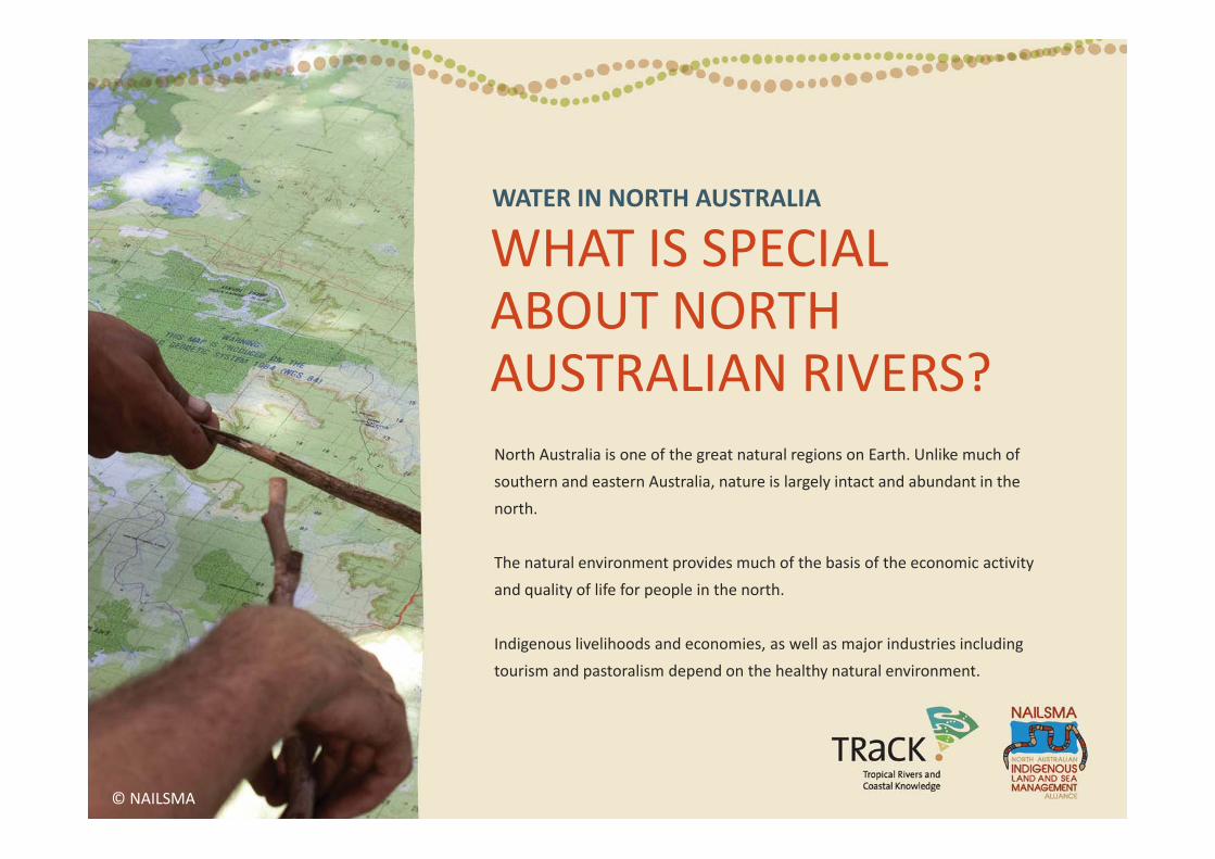
WHAT IS SPECIALWHAT IS SPECIAL ABOUT NORTH AUSTRALIAN RIVERS? North Australia is one of the great natural regions on Earth. Unlike much of
southern and eastern Australia, nature is largely intact and abundant in the
north.
The natural environment provides much of the basis of the economic activity
and quality of life for people in the north.
Indigenous livelihoods and economies, as well as major industries including
tourism and pastoralism depend on the healthy natural environment.
© NAILSMA
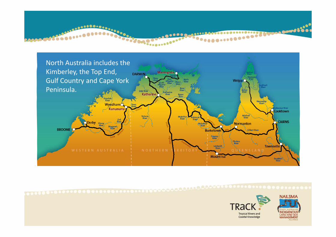
North Australia includes theNorth Australia includes the Kimberley, the Top End, Gulf Country and Cape York Peninsula.Peninsula.
WET AND DRY SEASONS IN THE TROPICS
The climate across the north is known as monsoonal. This means it has a short but intense wet season followed by a long dry season.
More than 94 percent of annual rainfall falls between November and April with many areas receivingMore than 94 percent of annual rainfall falls between November and April, with many areas receiving little or no rain for three to six months of the year.
The wet‐dry seasons mean that there is varying amounts of water flowing through the landscape. Many plant and animal species depend on particular water levels at different times of the year. y p p p p y
The different flow patterns of tropical rivers are critical for maintaining ecological connections, and keeping the country healthy.
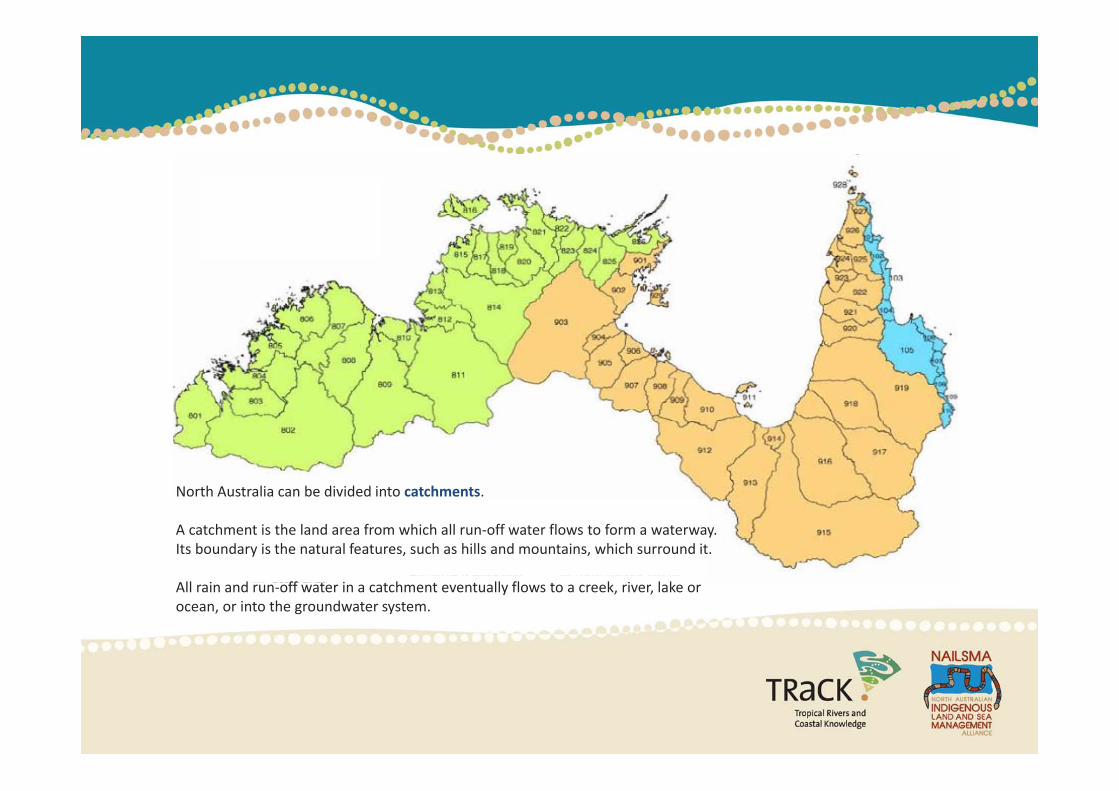
North Australia can be divided into catchments.
A catchment is the land area from which all run‐off water flows to form a waterway. Its boundary is the natural features, such as hills and mountains, which surround it.
All rain and run‐off water in a catchment eventually flows to a creek, river, lake or ocean, or into the groundwater system.
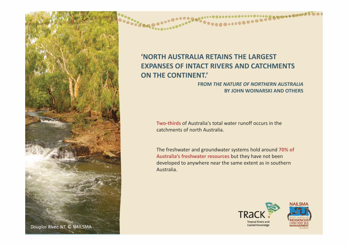
‘NORTH AUSTRALIA RETAINS THE LARGEST EXPANSES OF INTACT RIVERS AND CATCHMENTSEXPANSES OF INTACT RIVERS AND CATCHMENTS ON THE CONTINENT.’
FROM THE NATURE OF NORTHERN AUSTRALIABY JOHN WOINARSKI AND OTHERS
Two thirds of Australia's total water runoff occurs in theTwo‐thirds of Australia s total water runoff occurs in the catchments of north Australia.
The freshwater and groundwater systems hold around 70% ofThe freshwater and groundwater systems hold around 70% of Australia’s freshwater resources but they have not been developed to anywhere near the same extent as in southern Australia.
Douglas River, NT. © NAILSMA
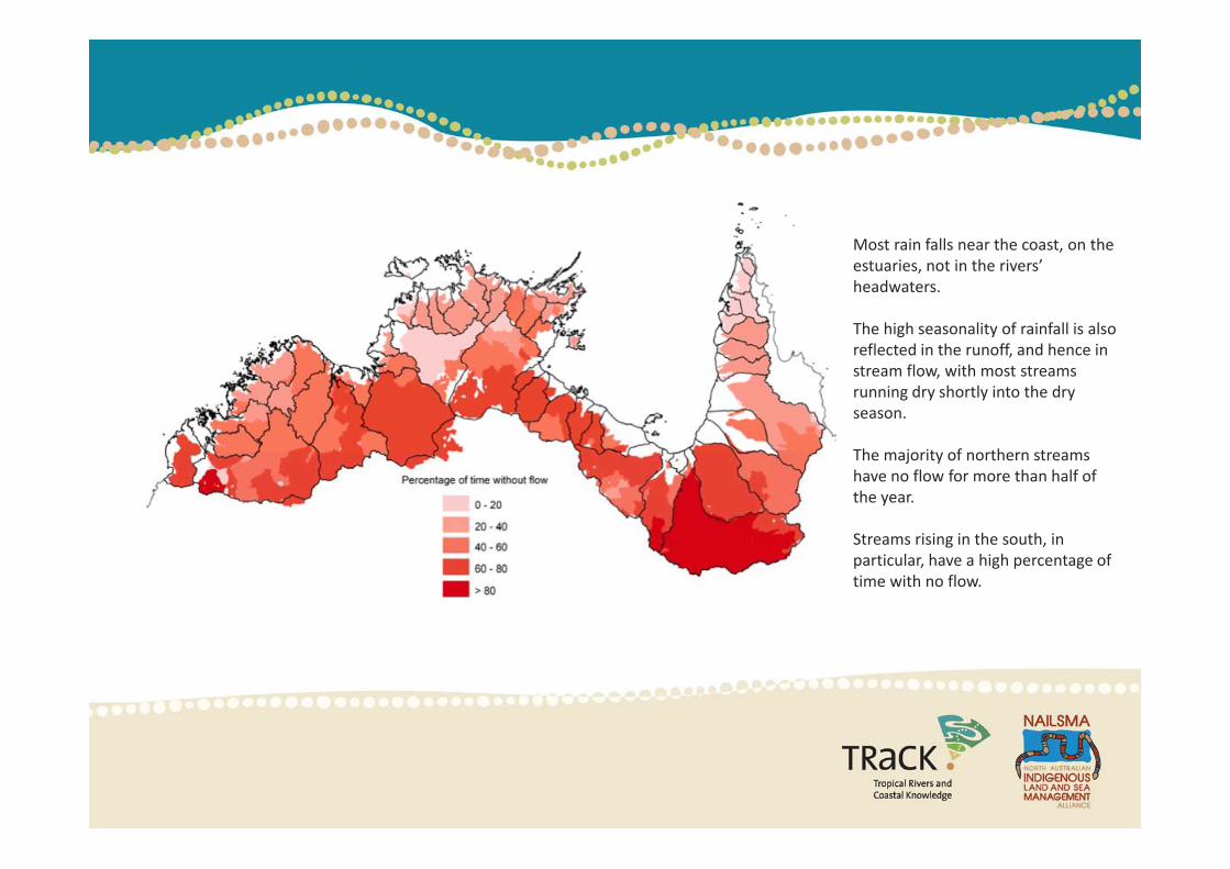
Most rain falls near the coast, on the estuaries, not in the rivers’ headwaters.
The high seasonality of rainfall is also g yreflected in the runoff, and hence in stream flow, with most streams running dry shortly into the dry season.
The majority of northern streams have no flow for more than half of the year.
i i i h h iStreams rising in the south, in particular, have a high percentage of time with no flow.
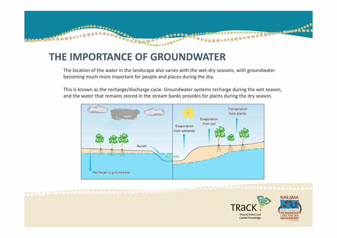
THE IMPORTANCE OF GROUNDWATERThe location of the water in the landscape also varies with the wet‐dry seasons, with groundwater becoming much more important for people and places during the dry.
This is known as the recharge/discharge cycle. Groundwater systems recharge during the wet season, g g y y g gand the water that remains stored in the stream banks provides for plants during the dry season.
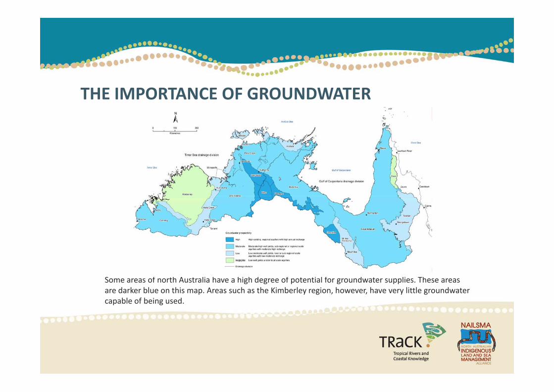
THE IMPORTANCE OF GROUNDWATER
Some areas of north Australia have a high degree of potential for groundwater supplies. These areas are darker blue on this map. Areas such as the Kimberley region, however, have very little groundwater capable of being used.
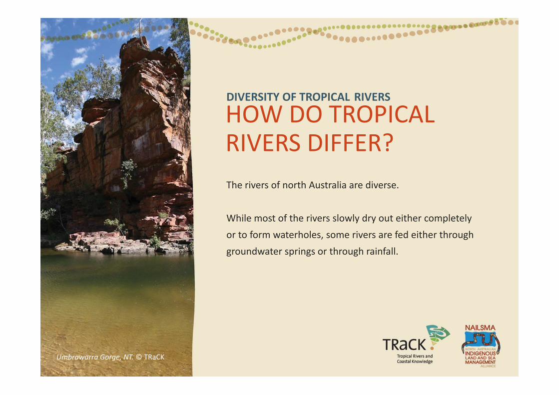
DIVERSITY OF TROPICAL RIVERS
HOW DO TROPICALHOW DO TROPICAL RIVERS DIFFER?The rivers of north Australia are diverse.
While most of the rivers slowly dry out either completely
or to form waterholes, some rivers are fed either through
groundwater springs or through rainfall.
Umbrawarra Gorge, NT. © TRaCK
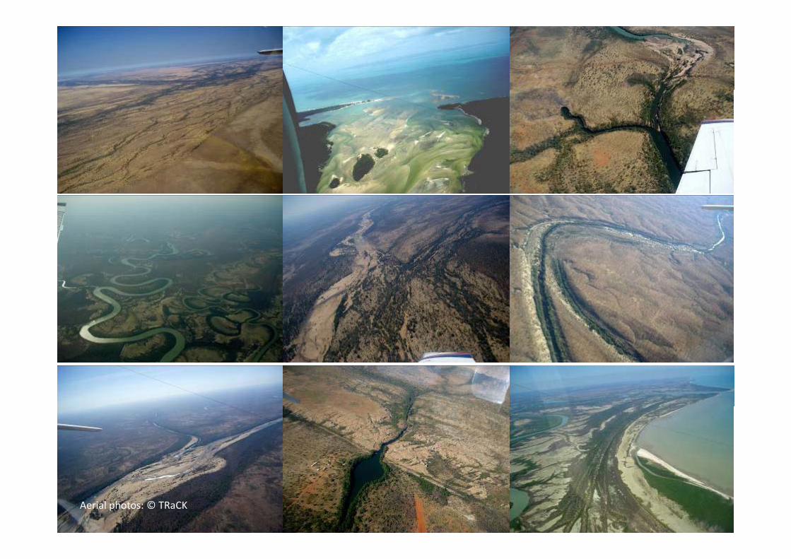
Aerial photos: © TRaCK
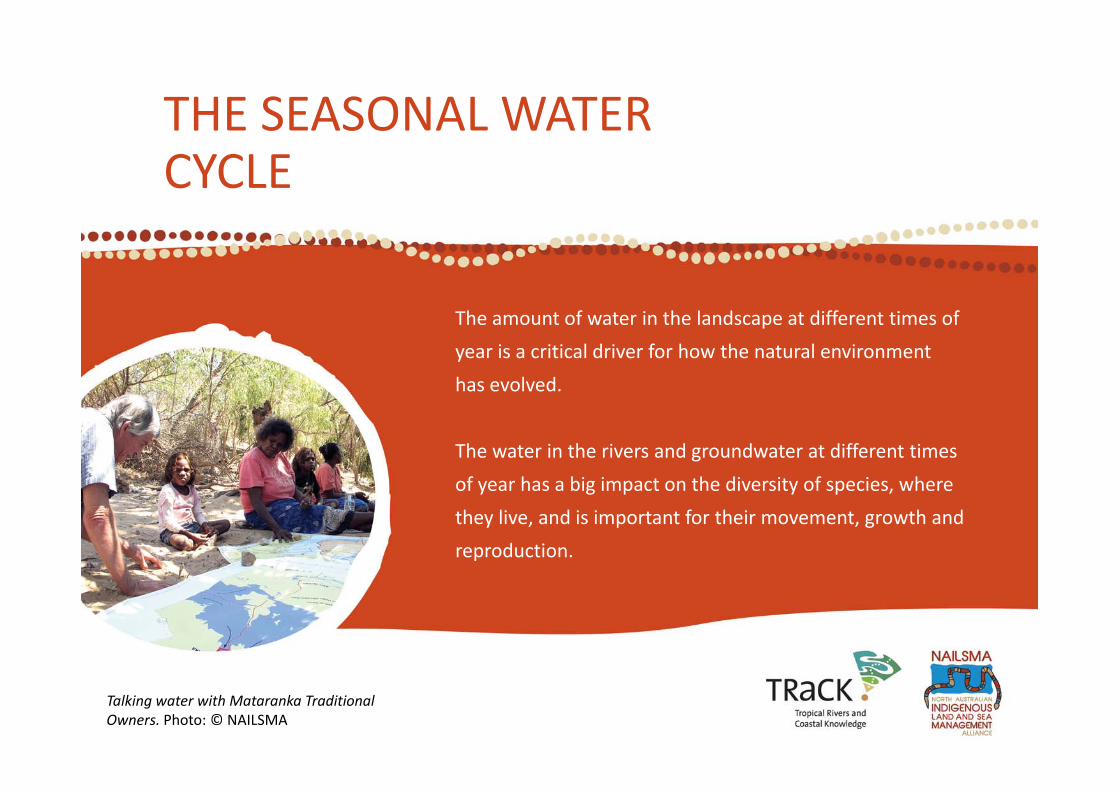
THE SEASONAL WATERTHE SEASONAL WATER CYCLE
The amount of water in the landscape at different times of
year is a critical driver for how the natural environment
has evolved.
The water in the rivers and groundwater at different times
of year has a big impact on the diversity of species whereof year has a big impact on the diversity of species, where
they live, and is important for their movement, growth and
reproduction.
Talking water with Mataranka Traditional Owners. Photo: © NAILSMA

Tropical river systems have different component parts including the waterholes, floodplains, the estuary and the
THE PARTS OF TROPICAL RIVERSTropical river systems have different component parts including the waterholes, floodplains, the estuary and the coast.
Each of these parts has a different role to play in sustaining the environment. Conceptual model: © TRaCK
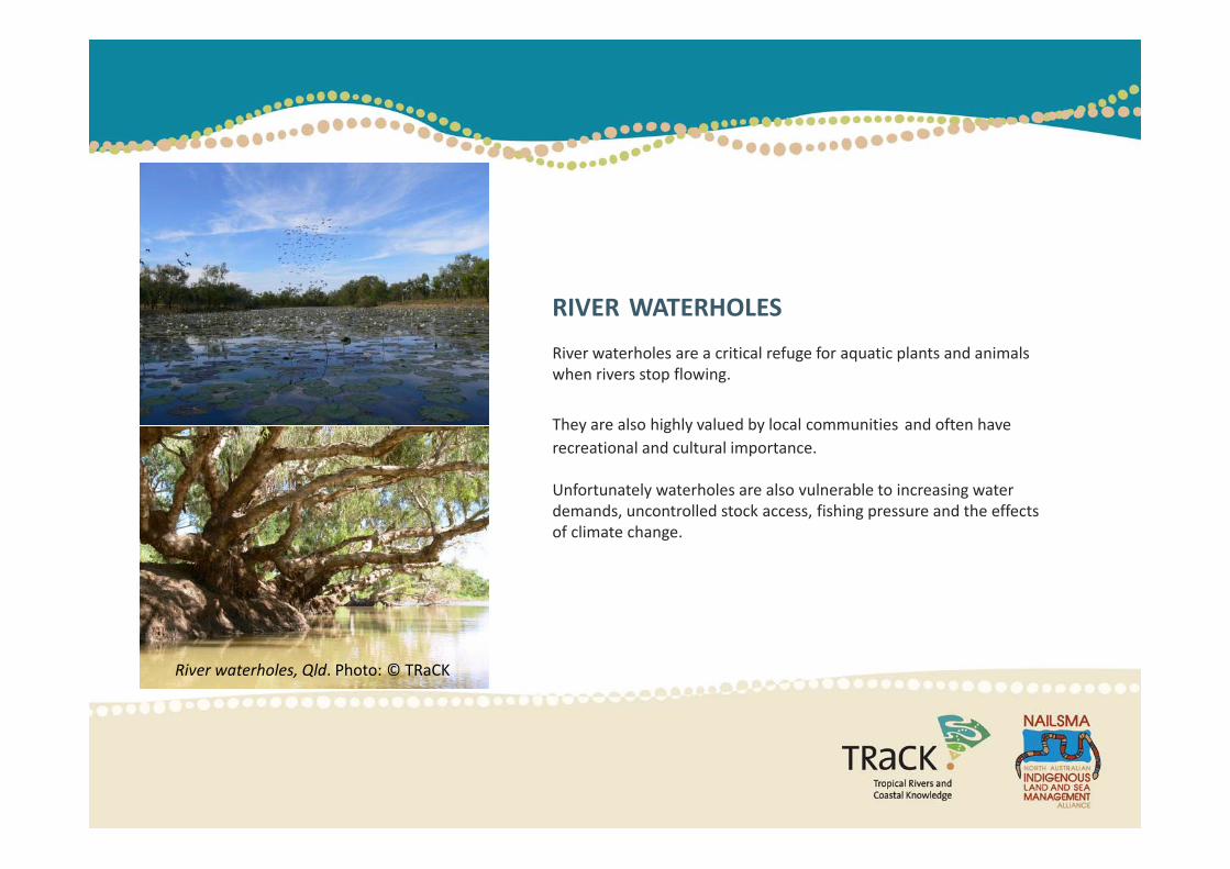
RIVER WATERHOLES
River waterholes are a critical refuge for aquatic plants and animals when rivers stop flowing.
They are also highly valued by local communities and often have recreational and cultural importance.
Unfortunately waterholes are also vulnerable to increasing water demands, uncontrolled stock access, fishing pressure and the effects of climate changeof climate change.
River waterholes, Qld. Photo: © TRaCK
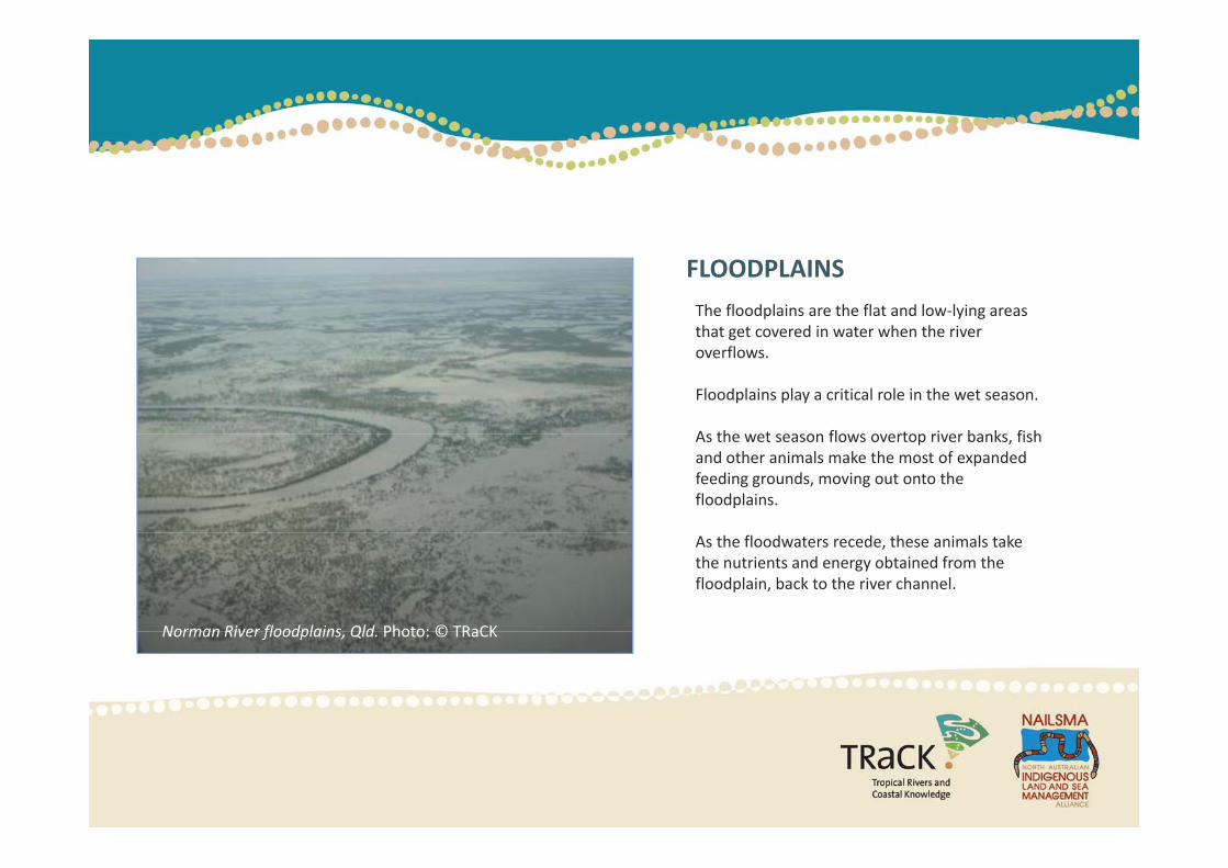
The floodplains are the flat and low‐lying areas that get covered in water when the river
FLOODPLAINS
that get covered in water when the river overflows.
Floodplains play a critical role in the wet season.
As the wet season flows overtop river banks fishAs the wet season flows overtop river banks, fish and other animals make the most of expanded feeding grounds, moving out onto the floodplains.
As the floodwaters recede, these animals take the nutrients and energy obtained from the floodplain, back to the river channel.
Norman River floodplains Qld Photo: © TRaCKNorman River floodplains, Qld. Photo: © TRaCK
ESTUARIES
The lower reaches of a river, where the saltwater and freshwater meets, is called the estuary.
Estuaries are vital for fish species breeding and migration, and flows from the rivers into this region are important for seagrass beds.
Water that flows out to sea is not wasted – it is essential to maintain the health of the estuaries and saltwater country.
The flow of water through the rivers sustains the different parts of the river, from the channels to the streams to the floodplains to the estuaries, is called the environmental flow.
ENVIRONMENTAL FLOW
the floodplains to the estuaries, is called the environmental flow.
Water planners determine how much water and the nature of the flow (including water quality and timing) is needed at different times of the year and at different parts of the river to maintain its natural patterns and environmental health.
This helps to work out if more water can be allocated to businesses or other users, or if the current water use is a risk to the environment.
Environmental flows are difficult to work out, because they depend on the different water requirements to support different natural functions, like fish breeding or sustaining a wetland area.
The need to maintain patterns of environmental flow may limit the amount of water that can be removed at different times of the year.
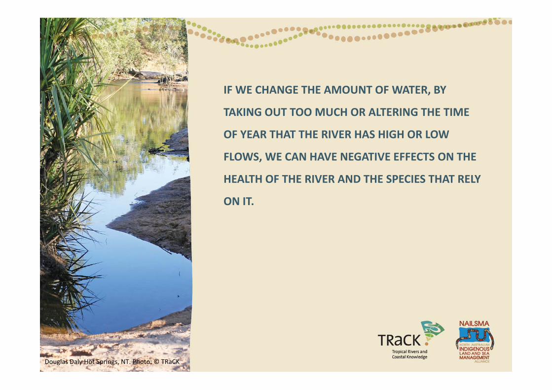
IF WE CHANGE THE AMOUNT OF WATER, BY
TAKING OUT TOO MUCH OR ALTERING THE TIME
OF YEAR THAT THE RIVER HAS HIGH OR LOW
FLOWS, WE CAN HAVE NEGATIVE EFFECTS ON THE
HEALTH OF THE RIVER AND THE SPECIES THAT RELY
ON IT.
Douglas Daly Hot Springs, NT. Photo: © TRaCK
This module is based on work conducted by various TRaCK Research Projects More information is available
REFERENCES
This module is based on work conducted by various TRaCK Research Projects. More information is availableonline at www.track.org.au
Groundwater productivity map and Recharge/Discharge cycle diagram: from Cresswell, R. et al., 2009. Water Resources in Northern Australia. In Northern Australia Land and Water Science Review.
Woinarski, J. C. Z., B. Mackey, H. Nix and B. Traill, 2007. The Nature of northern Australia: Natural Values, Ecological Processes and Future Prospects. Darwin, Tropical Savannas CRC, The Wilderness Society, The Myer Foundation and Charles Darwin University.
Historical, mean, stream cease‐to‐flow determined for sub‐catchments across northern Australia map: from Cresswell, R. et al., 2009. Water Resources in Northern Australia”. In Northern Australia Land and Water Science Review.
Catchment Diagram: Tracey Saxby IAN Image Library (ian umces edu/imagelibrary/) Used under a CreativeCatchment Diagram: Tracey Saxby, IAN Image Library (ian.umces.edu/imagelibrary/). Used under a Creative Commons License.