un-spider crisis response journal guest article: earth observation
DESCRIPTION
The potential contribution of space-based information to disaster risk management is not being fully exploited by all countries. This article describes the importance of space-based information for disaster risk reduction.TRANSCRIPT

¡
The international resource for resilience, response and security planning
print • online • digital
Now in its tenth year
Read Crisis Response Journal in print, on iPad, Android or online
Individual, institutional (including unlimited digital downloads), digital only and student rates available
Subscribe now: Contact us on +44 (0)20816691690 or email: [email protected]
CR
ISIS
| RE
SP
ON
SE
V
O L
: 10 | I S
S U
E : 1 | S
EP
TE
MB
ER
20
14
CRISIS | RESPONSE V O L : 1 0 | I S S U E : 1 | S E P T E M B E R 2 0 1 4 W W W . C R I S I S - R E S P O N S E . C O M J O U R N A L
CRJ IS TEN YEARS OLDA decade of exploring crisis response lifelines
PLUS � India building collapse � Search & Rescue in Iran � Queensland climate adaptation � Terrorism in Pakistan � Bioweapons & bacterial resistance
� Training Syria’s rescuers � Interview: Sir David King � Smart, resilient cities � Future technology
Ten
th a
nn
ive
rsa
ry e
ditio
n | In
dia
bu
ildin
g c
olla
ps
e | C
lima
te c
ha
ng
e in
Au
stra
lia | S
ma
rt, res
ilien
t citie
s fe
atu
re | F
utu
re te
ch
no
log
y fe
atu
re | S
yria
’s re
sc
ue
rs
CRISIS | RESPONSERESPONSERESPONSERESPONSERESPONSERESPONSERESPONSERESPONSERESPONSERESPONSERESPONSERESPONSERESPONSERESPONSERESPONSERESPONSERESPONSERESPONSERESPONSERESPONSERESPONSERESPONSERESPONSERESPONSERESPONSERESPONSERESPONSERESPONSERESPONSERESPONSE S E P T E M B E R 2 0 1 4 S E P T E M B E R 2 0 1 4 S E P T E M B E R 2 0 1 4 S E P T E M B E R 2 0 1 4 S E P T E M B E R 2 0 1 4 S E P T E M B E R 2 0 1 4 S E P T E M B E R 2 0 1 4 S E P T E M B E R 2 0 1 4
| S E P T E M B E R 2 0 1 4
| W W W . C R I S I S - R E S P O N S E . C O MW W W . C R I S I S - R E S P O N S E . C O MW W W . C R I S I S - R E S P O N S E . C O M J O U R N A L J O U R N A L J O U R N A L J O U R N A L
RESILIENCEVisionary crisis leadership
EVOLUTIONFuture disaster medicine
SENTIENCECities empowering people
CRISIS | RESPONSE
WE ARE ENTERING our tenth volume of CRJ, which was
launched a decade ago. The nature of the publication means celebration is inappropriate; too many incidents have occurred over this time, too many lives lost. But it is, nonetheless, a gratifying milestone.
Our founding ethos still holds true: to bridge any institutional, organisational and national gaps, to share information, enhance partnership working and improve communication. It has been good to see how dialogue between various disciplines and organisations has evolved, as shown by the increasing diversity of actors and stakeholders who have become involved in the conversation through our pages.
Despite this, in many ways the world feels no safer. The Hydra of wicked problems sometimes appears invincible, the same incidents repeating themselves, locked in a dispiritingly familiar cycle. Each time we absorb the horror of a disaster or terrorist attack, a bigger, more destructive one seems to surpass it.
The risk landscape has shifted in a decade: climate change has been added to the list of threats, exacerbating existing hazards. But the response, resilience and emergency planning community has developed accordingly in terms of leadership acuity, interagency co-operation, mutual assistance and business continuity.
And it is fascinating to observe the proliferation of emerging technology – ten years ago we hadn’t heard of Twitter, YouTube, the Internet of Things, smart cities… Of course, these bring their own vulnerabilities and can be exploited to cause harm, but their potential for improving safety and resilience should not be overlooked.
So is with gratitude that we thank our sponsors, many of whom helped to launch CRJ ten years ago. Thanks also to our Editorial Advisory Panel – those who have been with us since the start and those who joined us along the way – and to the writers who have generously shared their thoughts, knowledge and experience. And an immense thank you to our subscribers.
To paraphrase Camus, most people are good rather than bad; it is usually ignorance that causes harm, despite good intentions. And this is why sharing experience and information is so vital: you are all working to eradicate ignorance and make the world a safer place.
It is a privilege to observe and report on this. Emily Hough
comment
@SyriaCivilDef Keryn van der Walt | National Sea Rescue Institute
Rescue in conditions of war p70 Bhopal 30 years on p81
contents Cover story: CRJ’s Tenth anniversary
Main artwork: Neil Webb Inset images: Eureka Entertainment | Shutterstock
A look at Johannesburg.................................46Is Johannesburg a world-class African city? Yes, and no, according to Hilary Phillips
A living laboratory.........................................50The campus of Lille University in Northern France has been turned into an experiment to demonstrate smart city concepts, write Isam Shahrour and his team
Future technologyEmpowering people ......................................52The day when cities become smarter than their citizens are approaching, according to Robert Ouellette
Spatial services ............................................55Dr Hervé Borrion says spatialised social networks might protect people and provide help in emergencies
Evolution of disaster medicine ......................56There is an increased imperative to develop and implement novel technologies to help medical professionals in disaster situations. Here’s a glimpse of the future
Emerging technologies .................................61J P Vielleux describes real-time innovations in disasters
Human-agent collectives ..............................62David Jones describes a project that looks at forming symbiotic relationships between increasingly independent computer systems and user communities
Unleashing the power of UAVs ......................64Glenn Smith joins the debate, exploring the positive potential of drones in emergency situations
Earth observation ......................................... 66The potential contribution of space-based information to disaster risk management is not being fully exploited, say Antje Hecheltjen and Anne Pustina
In depthBusiness excellence and new technology .....68Mike Hall says it is time to embrace the business benefi ts that emerging technology can bring
USAR in an active war zone ..........................70James Le Mesurier looks at how community responders in Syria are being trained in urban search and rescue
Beyond the resilience apex ...........................72Brett Lovegrove refl ects on how leaders need to think more differently today than ever before when approaching business resilience and continuity
Facing biological risk ....................................74Nicolae Steiner looks at the twin threats of biological attacks and of increasing bacterial resistance to antibiotics, and the prospect of an interaction between the two
Civil protection in Georgia ............................76The Republic of Georgia is the fi rst country to be profi led by this new series on the International Civil Defence Organisation and its members
RegularsEvents ...........................................................78EU response to Balkan floods .......................80Looking back: Bhopal ....................................81Frontline ........................................................82
3 Crisis Response Journal 10:1
Editor in ChiefEmily [email protected]
Sales ManagerSacha [email protected]
Design and ProductionTim Baggaleywww.graphicviolence.co.uk
Subscriptions and administration Emma [email protected]
Director Colin [email protected]
DirectorPeter [email protected]
SubscriptionsCrisis Response Journal is published quarterly; it is available by subscription in hard copy, digital format and online. Association discounts, institutional and multiple rates are available; visit our website or contact us for more detailsTel: +44 (0) 208 1661690subs@fi re.org.uk
Back issuesExisting subscribers: £25 (US$45; €36) per issueNon subscribers: £40 (US$72; €58) per issueTel: +44 (0) 208 1661690backissues@fi re.org.uk
Published by FireNet International LtdPOB 6269, Thatcham, RG19 9JXUnited KingdomTel: +44 (0) 208 1661690mail@fi re.org.uk www.crisis-response.comwww.fi re.org.uk
COPYRIGHT FireNet International Ltd 2014 Articles published in Crisis Response Journal may not be reproduced in any form without the prior written permission of the Editor in ChiefPrinted in England by Buxton PressISSN 1745-8633
Resources, links, pictures, videos and much more are available for subscribers in our digital and online editions
www.crisis-response.com join the CRJ LinkedIn group
follow us on twitter @editorialcrj
September 2014 | vol:10 | issue:1
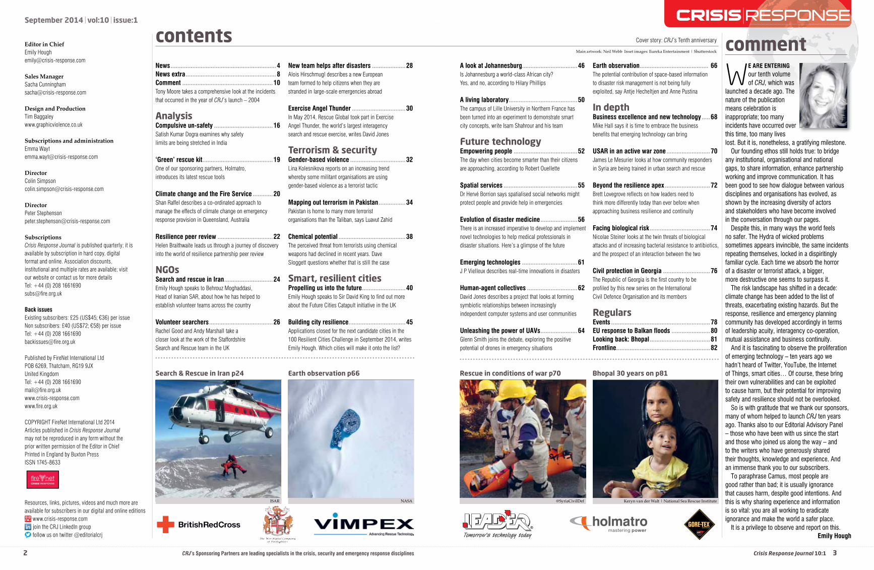
Earth observation p66Search & Rescue in Iran p24
ISAR NASA
CRJ’s Sponsoring Partners are leading specialists in the crisis, security and emergency response disciplines
contentsNews ...............................................................4News extra ......................................................8Comment ......................................................10Tony Moore takes a comprehensive look at the incidents that occurred in the year of CRJ’s launch – 2004
AnalysisCompulsive un-safety ...................................16Satish Kumar Dogra examines why safety limits are being stretched in India
‘Green’ rescue kit ..........................................19One of our sponsoring partners, Holmatro, introduces its latest rescue tools
Climate change and the Fire Service ............20Shan Raffel describes a co-ordinated approach to manage the effects of climate change on emergency response provision in Queensland, Australia
Resilience peer review .................................22Helen Braithwaite leads us through a journey of discovery into the world of resilience partnership peer review
NGOsSearch and rescue in Iran .............................24Emily Hough speaks to Behrouz Moghaddasi, Head of Iranian SAR, about how he has helped to establish volunteer teams across the country
Volunteer searchers ......................................26Rachel Good and Andy Marshall take a closer look at the work of the Staffordshire Search and Rescue team in the UK
New team helps after disasters ....................28Alois Hirschmugl describes a new European team formed to help citizens when they are stranded in large-scale emergencies abroad
Exercise Angel Thunder ................................30In May 2014, Rescue Global took part in Exercise Angel Thunder, the world’s largest interagency search and rescue exercise, writes David Jones
Terrorism & securityGender-based violence .................................32Lina Kolesnikova reports on an increasing trend whereby some militant organisations are using gender-based violence as a terrorist tactic
Mapping out terrorism in Pakistan ................34Pakistan is home to many more terrorist organisations than the Taliban, says Luavut Zahid
Chemical potential ........................................38The perceived threat from terrorists using chemical weapons had declined in recent years. Dave Sloggett questions whether that is still the case
Smart, resilient cities Propelling us into the future ..........................40Emily Hough speaks to Sir David King to fi nd out more about the Future Cities Catapult initiative in the UK
Building city resilience ..................................45Applications closed for the next candidate cities in the 100 Resilient Cities Challenge in September 2014, writes Emily Hough. Which cities will make it onto the list?
2

66 Resources, links, pictures, videos and much more are available for subscribers in our digital and online editions www.crisis-response.com
Droughts and fl oods can have a massive impact for populations in terms of livelihoods, food and water security,
physical security or sustainable development. Hydrometeorological events affect many countries around the world and create massive damage, as recent examples show. These include fl oods in: Central Europe, June 2013; the UK, February 2014; the Balkans, May 2014 (see p81); and following super typhoon Haiyan in the Philippines in November 2013. They also include drought, such as that experienced in Eastern Africa in 2011 and Bolivia in 2013.
Effective disaster risk management helps to prevent natural hazards like these from turning into disasters. Space technologies, especially Earth observation and global navigation satellite systems, provide information that can be used for a more effective risk assessment.
The potential contribution of space-based information to disaster risk management is, however, not yet fully exploited – technical solutions are not suffi ciently tailored to assess hazards and the exposure of elements vulnerable to them, nor is this information easily accessible for disaster risk managers.
Researchers, practitioners, disaster risk managers and space technology experts from all over the world must work together to fi nd solutions to tackle the risks associated with fl oods, droughts and other natural hazards that threaten countries and regions all over the globe and which do not stop at national borders.
The United Nations Platform for Space-based Information for Disaster Management and Emergency Response (UN-SPIDER), which is a programme implemented by the United Nations Offi ce for Outer Space Affairs (UNOOSA), organised an Expert Meeting on Space Technologies for Drought and Flood Risk Reduction in Bonn, Germany, earlier this year. The event brought together nearly 60 international experts from various national and international organisations from Africa, Asia, Latin America, Europe and North America. Twelve keynote and plenary presentations and several working groups
allowed the experts to exchange and discuss various approaches and methods in depth.
In contrast to disaster response efforts, which are reactive, risk management focuses on ways to assess risks before they turn into disasters, so as to minimise their effects. The goal was to exchange information and experiences on the most up-to-date satellite technologies, including Earth observation, to enable countries to assess and reduce risks of both fl oods and droughts more successfully.
Hazard assessmentDuring the meeting, experts discussed how satellite technologies can generally contribute to the assessment of fl ood and drought hazards, exposure, and vulnerability and how to use such technologies to track changes in the level of risk over time. One of the sessions of the meeting was also dedicated to identifying elements to contribute to the Post 2015 framework for disaster risk reduction (HFA-2) and to the upcoming World Conference on Disaster Risk Reduction in Sendai, Japan, in March 2015.
Disaster risk is worked out by combining information on hazards, along with exposure of vulnerable elements or assets and their degree of vulnerability. Space technologies can contribute to assessing hazards and exposure, and are particularly useful in tracking how these change over time, owing to development trends in countries around the world. Taking a birds-eye perspective, satellites can be used to detect, map, monitor and visualise indicators relevant to risk analysis on a global scale. These include indicators related to infrastructure and land use (topography, urbanisation trends, transportation networks, types of crops, deforestation), along with atmospheric and environmental variables (soil moisture, precipitation, temperature). Satellites offer an unparalleled opportunity to track and assess the extent of changes over time caused by both
Earth observationThe potential contribution of space-based information to disaster risk management is not being fully exploited, and what information is available is rarely easily accessible for disaster risk managers, explain Antje Hecheltjen and Anne Pustina
67 join the CRJ LinkedIn group follow us on twitter @editorialcrj Crisis Response Journal 10:1
planned development and unforeseen crises.Global multi-hazard maps are already
available, but the more precise identifi cation of high-risk areas is still an ongoing activity. A key parameter that can be assessed using satellite imagery is the exposure of vulnerable elements. Earth observation can quantify the number of vulnerable elements or assets within a specifi c geographic area and which are exposed to a particular hazard.
However, vulnerability assessment requires socioeconomic data, which needs to be assessed on the ground.
Overall, hazard, vulnerability and risk assessments are complex tasks, which usually require a combination of different satellite data sets, including low and high resolution imagery, optical and Synthetic Aperture Radar data in combination with ancillary ground-based or airborne data.
Flood risk reduction is achieved through several ways, including through the incorporation of strong land-use planning regulations to reduce the number of vulnerable assets or exposed elements. Furthermore, it includes reducing the degree of vulnerability of these elements or assets and the incorporation of physical measures, such as levees, as a way to control the extent of fl oods in particular geographic regions. Satellite data can support these efforts through the provision of reliable and precise data to national authorities, civil protection agencies or communities.
For example, satellite-derived fl ood masks from historic or recent fl oods can be used in fl ood hazard management. However, they need to be complemented by a thorough hazard assessment, including probabilities of fl ood events. Digital Elevation Models (DEMs) generated through satellite data have the potential to estimate fl ood depth, but the available data is not yet precise enough to create reliable models, as small errors in the DEM will lead to large errors in the depth estimation. The assessment of changes in land-use and land-cover over time using Earth observation methods can supply data
for hydrological and hydraulic models to help track how processes such as urbanisation are affecting spatial and temporal fl ood behaviour.
Earth observations are unique in allowing international or regional organisations and governments to identify key hot spots around the world where drought may affect agriculture or livestock. Satellite imagery can be used to track changes in soil moisture and to assess the effects of droughts.
Several indicators have been developed to combine the use of archived and up-to-date imagery as a way to contribute to drought early warning systems by monitoring vegetation health and soil moisture. Ministries of Agriculture and food security organisations can use Earth observation techniques to map the geographical extent of specifi c crops and develop drought vulnerability maps. This, of course, requires solid databases on specifi c
crops and their vulnerability to droughts, as well as access to high resolution imagery. On the basis of such maps, more drought-resistant crops could be planted in areas identifi ed as being prone to drought, thus reducing vulnerability and enhancing food security.
As space technologies can provide relevant data to monitor changes on a large scale and with unique precision, UN-SPIDER strongly promotes the explicit incorporation of these technologies in internationally recognised frameworks on disaster risk reduction and sustainable development, which will emerge in 2015. Efforts to reduce disaster risks and to achieve sustainable development worldwide can be periodically reviewed and monitored using satellite information.
With geospatial and space-based information, decision-makers are better able to monitor indicators relevant to risk analysis on a global scale. Space technologies can contribute towards mapping the uneven distribution of risk across national borders in an objective way. They can be used in geographic areas where no ground-based measurements are available. And with the capacity to access more than three decades of archived imagery, decision-makers can track changes in the level of risks of communities worldwide.
Today, there are still gaps with regard to awareness on the usefulness of satellite information, access to the data and products and the capacities to fully benefi t from them, owing to issues such as restricted budgets or a lack of qualifi ed personnel. It is for this reason that UN-SPIDER conducts expert meetings, workshops, technical advisory missions and other events worldwide. These events promote the value of space-based information and the recognition that this information can avoid risks turning into disasters. CRJ
■ www.un-spider.org
AuthorsAntje Hecheltjen, Associate Expert, GIS and Remote Sensing and Anne Pustina, Associate Expert, Information and Media, UNOOSA
future technology
Restricted budgets and a lack of quali� ed personnel mean that there are still gaps with regards to general
awareness of how useful satellite information, data and capacities can be in risk management. UN-SPIDER
is working hard to raise awareness in this � eld
Opposite: Arctic melt pond atop a glacier in south-eastern Alaska, July 2014. Above: Soil moisture conditions in August 2013; such data can help to develop drought vulnerability maps.
MABEL | NASA’s Goddard Science Visualisation Studio
Earth observation mapping