transit and trails - california department of parks and ... and trails.pdf7/11/2011 1 transit &...
TRANSCRIPT

7/11/2011
1
Transit & Trails
Find, Plan and Share Outdoor Activities on Public Transportation
ryan [email protected]
transitandtrails.orgfacebook.com/transitandtrailstwitter.com/transitandtrail
CA Trails and Greenways ConferenceApril 11, 2011
7/11/2011
2
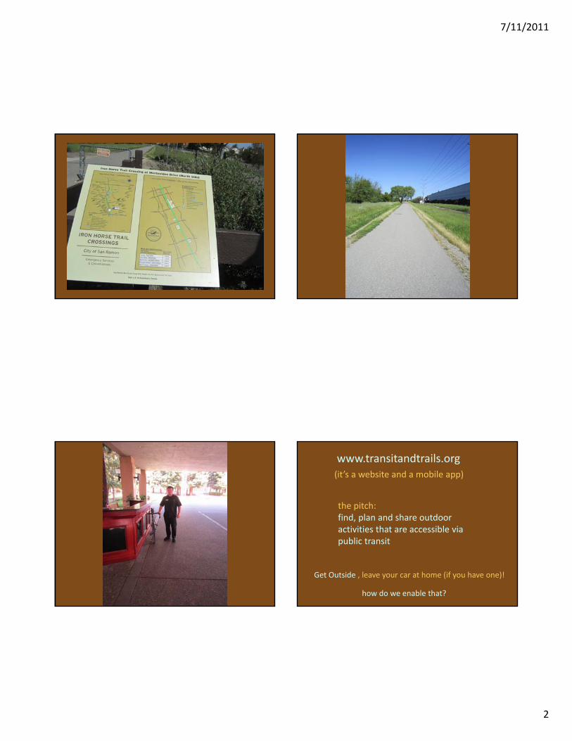
www.transitandtrails.org
Get Outside , leave your car at home (if you have one)!
(it’s a website and a mobile app)
the pitch:find, plan and share outdoor activities that are accessible via public transit
how do we enable that?

7/11/2011
3

7/11/2011
4
Camping without a car?
How does that work?
Sausalito to Stinson Beach
•2 people•2.5 days, 2 nights•20 mile hike•redwoods•zen center garden•ocean views•beer?!•beach

7/11/2011
5

7/11/2011
6

7/11/2011
7
Driving instead of Transit?
•2 cars•150 miles•7 gallons of gas•134 lbs of CO2•bridge tolls•parking•less fun?
•15 trips 2‐20 miles•215 trailheads•35 campgrounds
Within 20 miles of downtown SF
10 bay area counties
•30+ trips•550+ trailheads•150+ campgrounds

7/11/2011
8
Who here enjoys to hike?
Ever taken public transit to get there?
How do you typically get there?
How is public transit in your area?
A little history
(Why did we do this?)
Prehistory
1991 – Bay Area Open Space Council
A collaborative of 60 land management agencies in the SF Bay Area:
For the health of our land, water, and people, we the Bay Area Open Space Council foster an interconnected system of healthy communities with parks, trails, agricultural lands, and natural areas throughout the region.
1995 ‐ Transit Outdoors Print Map – First Grant!
2001 – Enhanced Transit to Trails Map with Bay Nature/GreenInfo Network
Spring of 2008
•Update the Transit to Trails Map
•Introduced project to Jereme Monteau – All Things Web
•Jereme – “Wow, this would be a cool website!”
•Went on a couple of transit hikes and it clicked!
7/11/2011
9
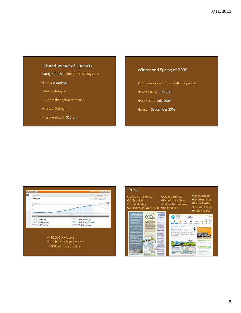
Fall and Winter of 2008/09
•Google Transit launches in SF Bay Area
•Built a prototype
•Hired a designer
•Built trailhead/trip database
•Started Coding
•Integrated with 511.org
Winter and Spring of 2009
•1,000 hours over 6‐8 months (2 people)
•Private Beta June 2009
•Public Beta July 2009
•Launch September 2009
•~90,000 + visitors•~5‐8k visitors per month•~600 registered users
Press•Contra Costa Times•SF Chronicle•SF Streets Blog•Google Maps Mania Blog
•Oakland Tribune•Silicon Valley News•Mother Nature News•Triple Pundit
•Green Impact•Bay Hiker Blog•NorCal Hostels•Channel 5 Blog•Many more….

7/11/2011
10
Some of our Partners•511.org – transit routing integration•MTC – links, sponsorship•Bay Nature – print map and links•GreenInfo Network – data/links (parks, campgrounds)•Greenbelt Alliance – links•Bay Area Ridge Trail Council – events•East Bay Regional Parks – links, events•BaHiker.com – links, tons of traffic•New Belgium Brewery – sponsored event•BART – links•AC Transit– links•REI – sponsored events•Rails to Trails – sponsored events•Transform– links, parntership•CA State Coastal Conservancy – funding•Packard Foundation – funding•San Francisco Foundation – funding
The Need
•Climate Change –reduce carbon footprint
•More people choosing to live in cities
•Some folks choosing to live without a car or can’t afford a car
•Public Health – Get folks outside and active
•Save $$ ‐ Can be a lot cheaper than driving
Smart Phone?
Thinking of getting one?
Check your email?
Use driving directions?
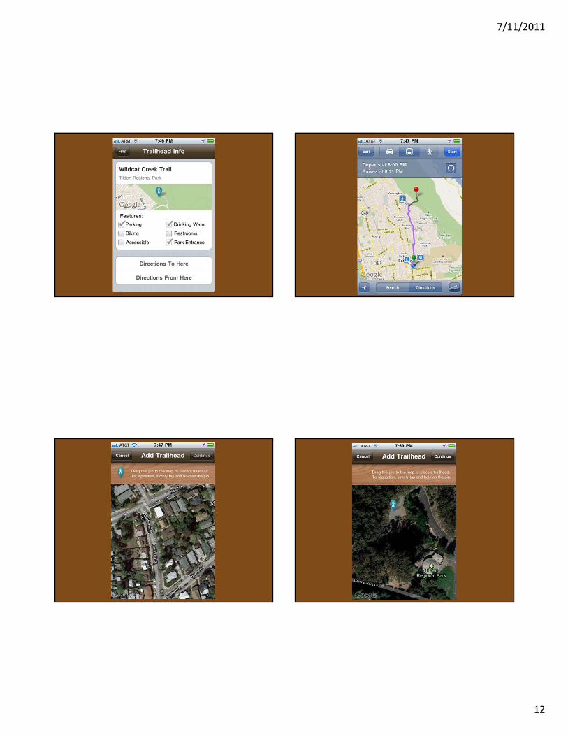
The iPhone App is here!
Android in 2011

7/11/2011
11
7/11/2011
12
7/11/2011
13
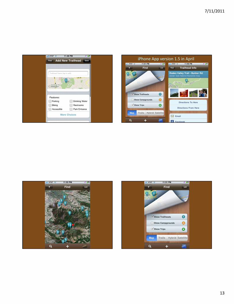
iPhone App version 1.5 in April
7/11/2011
14
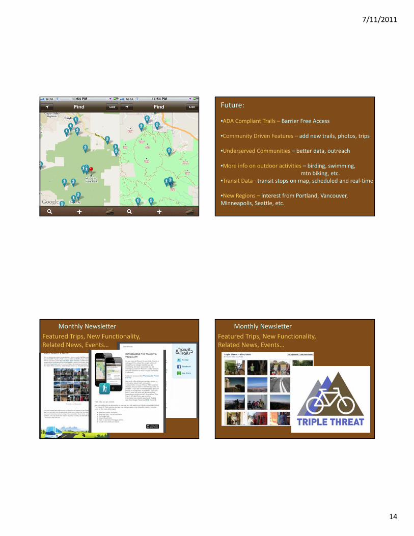
Future:
•ADA Compliant Trails – Barrier Free Access
•Community Driven Features – add new trails, photos, trips
•Underserved Communities – better data, outreach
•More info on outdoor activities – birding, swimming, mtn biking, etc.
•Transit Data– transit stops on map, scheduled and real‐time
•New Regions – interest from Portland, Vancouver, Minneapolis, Seattle, etc.
Monthly NewsletterFeatured Trips, New Functionality, Related News, Events…
Monthly NewsletterFeatured Trips, New Functionality, Related News, Events…

7/11/2011
15
Going on a TnT Hike1. Transit Pass2. Bus Schedule3. Small bills, change4. Phone (mobile app)5. Trail Map6. Credit Card, ID7. Food, water8. Sunscreen9. Hiking shoes, poles10.Hat11.Warm clothes12.Rain Gear
Recent EventsTransit to Ridge TrailSaturday April 2, 2011

7/11/2011
16

7/11/2011
17

7/11/2011
18
Recent EventsTransit to Ridge TrailSaturday March 31, 2010

7/11/2011
19
Any bikers in the audience?
Like adventure?

7/11/2011
20
Upcoming Events
3 Bay Area Peaks, No Cars, One Day Saturday June 18, 2011
Transitandtrails.org/triplethreat
Upcoming Events
It’s been done! Not easy, but a lot of fun
Transitandtrails.org/triplethreat
5,000 postcard sized brochures
How to Video on homepage
Shooting a webisode this spring!

7/11/2011
21
Website Redesign in April

7/11/2011
22
Thanks for listening
•Questions?
•Advice?
•Ideas?
•New Partners?
Register!
Become a Fan on FBFollow us on Twitter
Transit & Trails
Find, Plan and Share Outdoor Activities on Public Transportation
ryan [email protected]
transitandtrails.orgfacebook.com/transitandtrailstwitter.com/transitandtrail
CA Trails and Greenways ConferenceApril 11, 2011