tr log b e o i atuan u n ap i g - warungeo gunung...
TRANSCRIPT

ETROLO
U NA P
[TGS7404]
Dr. Hill. Gendoet Hartono
Semester 7, 2017-2018
2 SKS teori
GI BA
GI
T UAN

PENDAHULUAN 1X
Berisi tentang latarbelakang, bumi, batuan beku dan
batuan gunung api, dan kedudukan di bidang geologi
TATAAN TEKTONIK 2X
Berisi tentang tektonik global, regim tektonik, dan
peranannya dalam magmatisme dan volkanisme
GENERASI MAGMA 2X
Berisi tentang magmatisme, diagram fase
KLASIFIKASI 2X
Klasifikasi magma atau afinitas magma
Rock Forming Mineral 1X
Kimia Mineral Pembentuk Batuan 1X
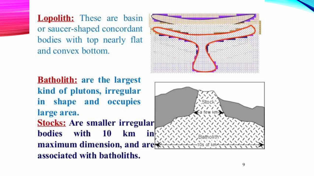
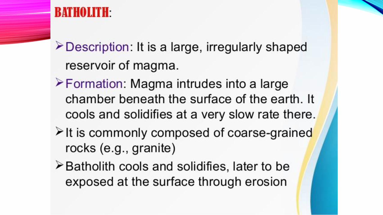
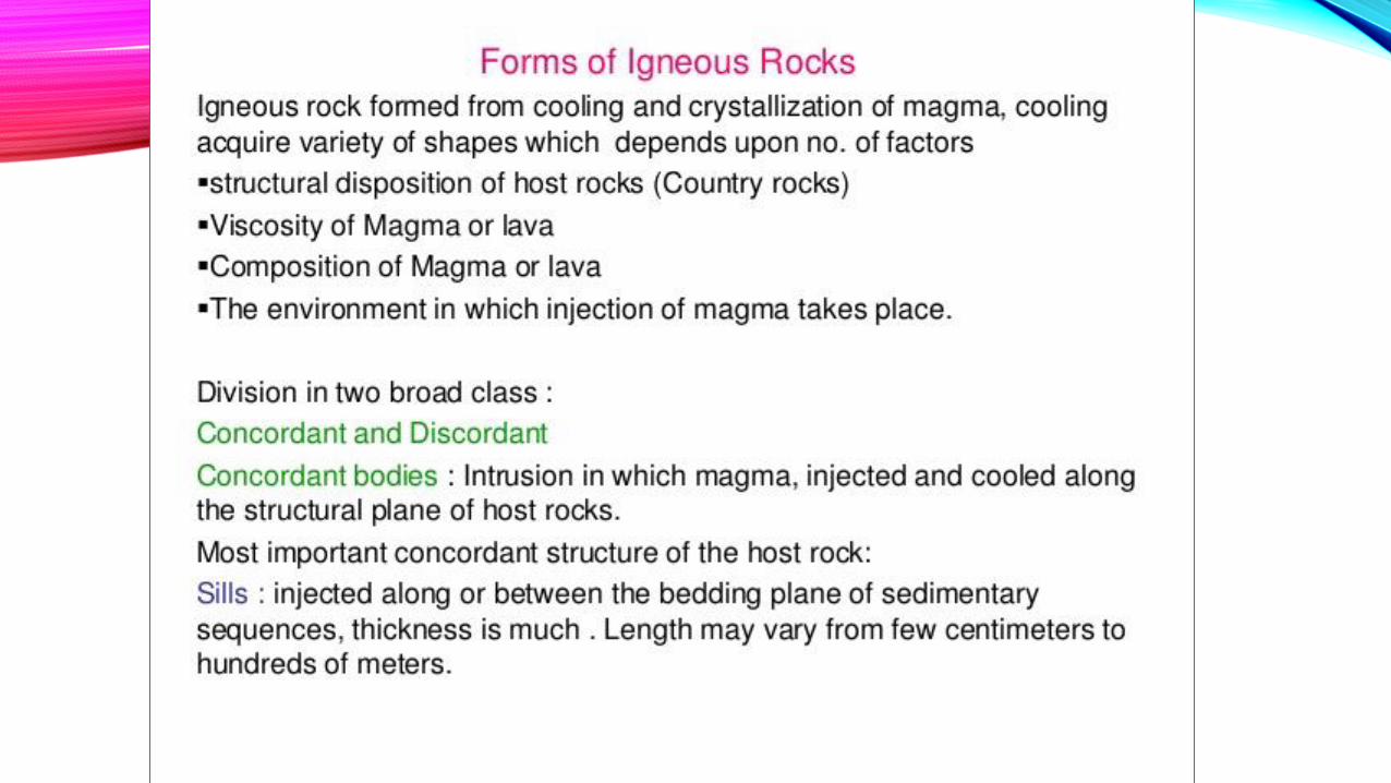
Petrologi Batuan Intrusi Dangkal 2X
Petrologi Batuan Ekstrusi 2X
Alterasi Batuan Gunung Api 1X


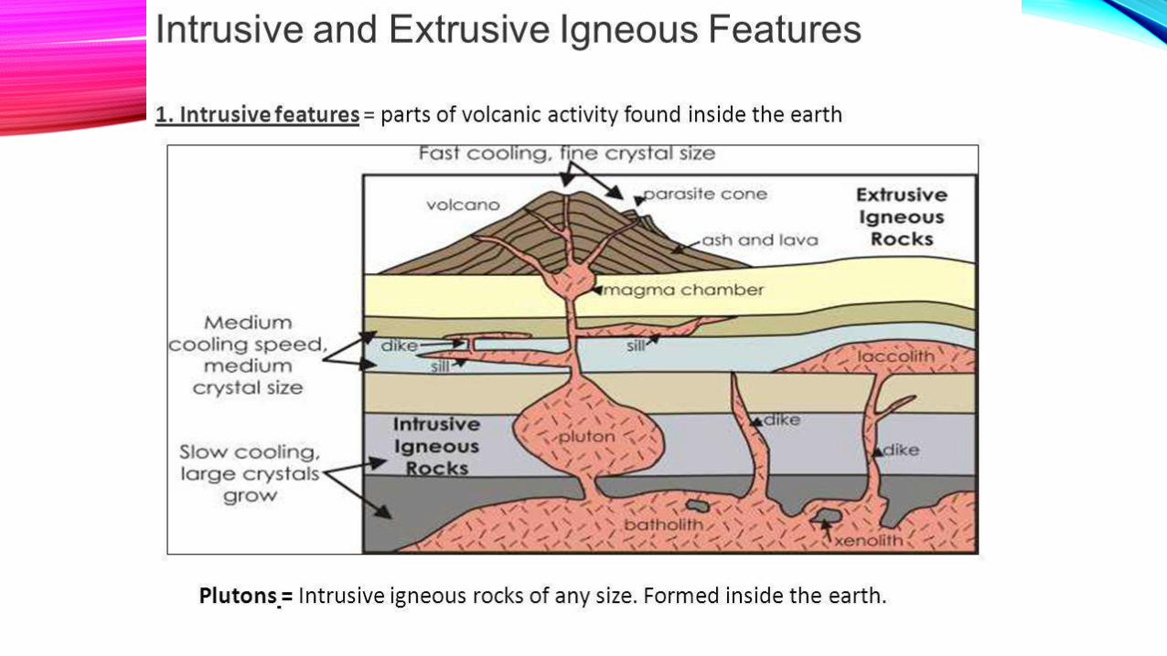
Igneous rocks are classified on the basis of mineralogy, chemistry,
and texture. As discussed earlier, texture is used to subdivide
igneous rocks into two major groups:
(1) the plutonic rocks, with mineral grain sizes that are visible to the
naked eye, and
(2) the volcanic rocks, which are usually too fine-grained or glassy
for their mineral composition to be observed without the use of
a petrographic microscope. As noted in the sidebar to the left,
this is largely a genetic classification based on the depth of
origin of the rock (volcanic at or near the surface, and plutonic
at depth). Remember that porphyritic rocks have spent time in
both worlds. Let's first examine the classification of plutonic
rocks.

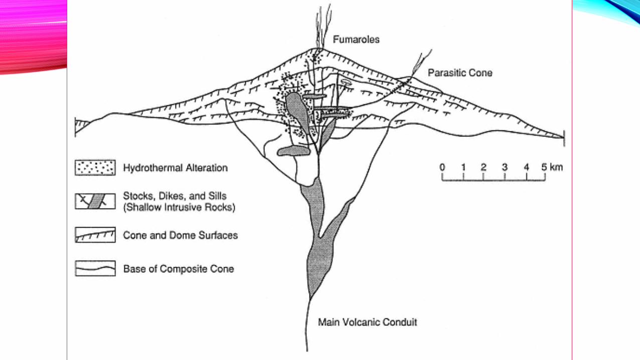
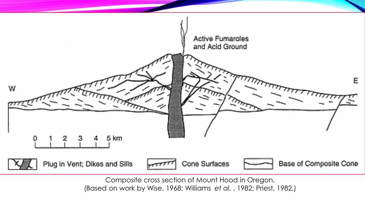
Composite cross section of Mount Hood in Oregon.
(Based on work by Wise, 1968; Williams et al. , 1982; Priest, 1982.)


Block diagram illustrating the
various scenarios of volcano
emplacement along faults
discussed for examples of the
Newer Volcanics Province. a)
Crustal fault parallel to σ1
creating a pathway to the surface
and preventing the dike stalling
and forming a sill. b) Crustal fault
perpendicular to σ1 creating a
pathway to the surface, with
shallow sill formation occurring in
the poorly consolidated basin
sediments (i.e. Otway Basin). c)
Pre-existing structure acted upon
by compressive forces forming
transtensional zone acting as a
pathway for magma transport to
the surface (Van Otterloo et al.,
2014), and potentially causing
batch melting (Lesti et al., 2008)
(Trajectory of transtension zone
through lithosphere is not to
scale).

(a)Map of the British and Irish
Palaeogene Igneous
Province highlighting the
positions of plateau basalts,
central complexes
(including Ardnamurchan,
Mull and Skye) and the
NW–SE regional dyke
swarm (after Emeleus and
Bell, 2005).
(b)Cone sheet emplacement
model (after Anderson,
1936) where overpressure
within the magma
chamber imparts a local
stress field favouring
formation of new inverted
conical fractures, intruded
to form cone sheets.
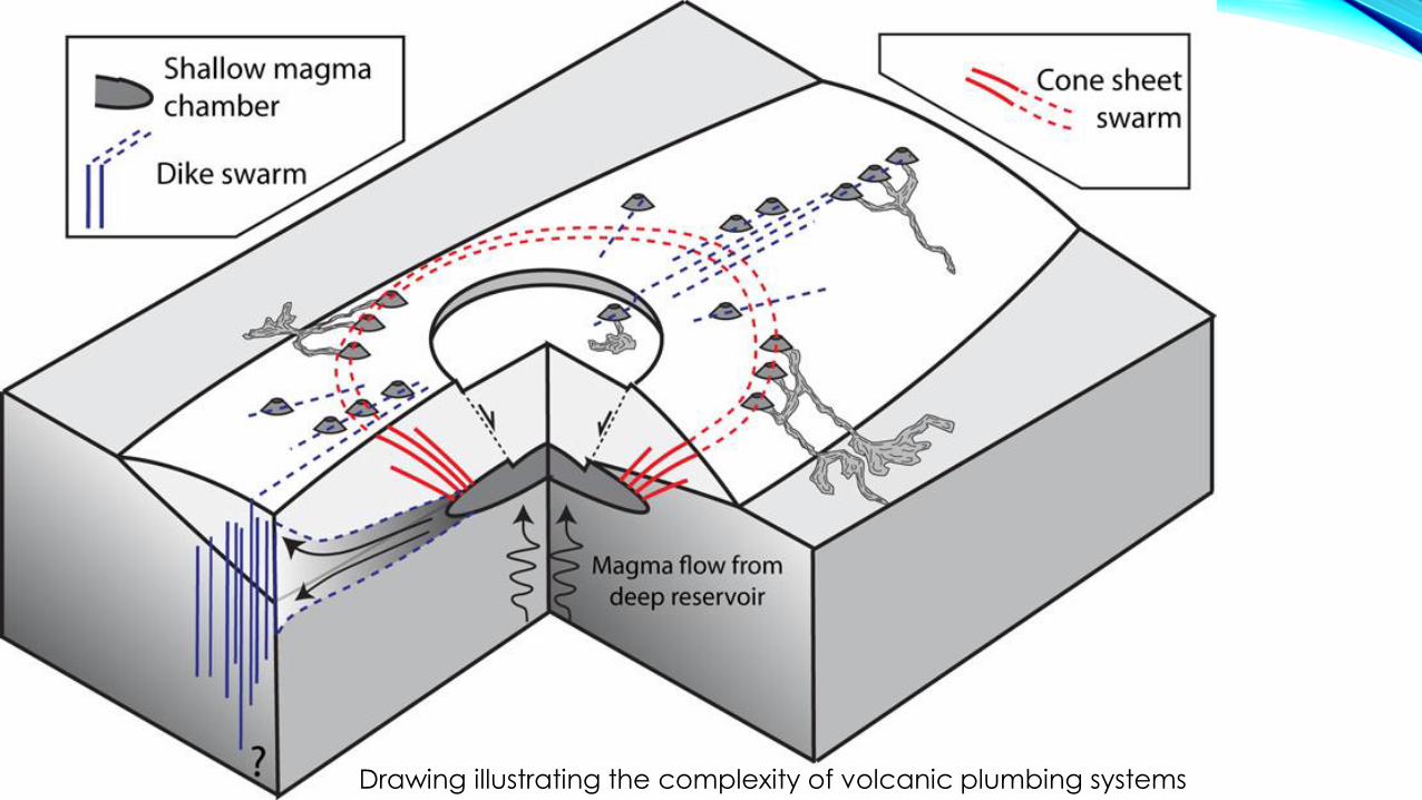
Drawing illustrating the complexity of volcanic plumbing systems