tmap – wfd workshop reference values hamburg 29 – 30 november 2004 overview wfd implementation...
TRANSCRIPT
TMAP – WFD Workshop Reference Values Hamburg 29 – 30 November 2004
Overview WFD Implementation
Harald Marencic
Common Wadden Sea Secretariat

RiverBasin Districts
(Status November 2003)
Delimitations

River Basin Districts (RBD)in the Wadden Sea(coastal and transitional waters, up to 1 sm)(Inland areas and Helgoland not included)
Delimitations RBD Wadden Sea
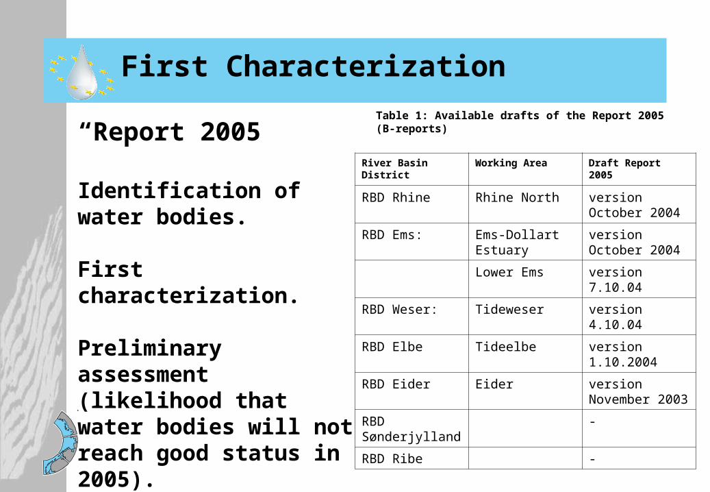
“Report 2005”
Identification of water bodies.
First characterization.
Preliminary assessment (likelihood that water bodies will not reach good status in 2005).
First Characterization
Table 1: Available drafts of the Report 2005 (B-reports)
River Basin District Working Area Draft Report 2005
RBD Rhine Rhine North version October 2004
RBD Ems: Ems-Dollart Estuary
version October 2004
Lower Ems version 7.10.04
RBD Weser: Tideweser version 4.10.04
RBD Elbe Tideelbe version 1.10.2004
RBD Eider Eider version November 2003
RBD Sønderjylland
-
RBD Ribe -

Criteria:
• Salinity
• Exposition
Water Body Types

Preliminary Designation:
Heavily Modified Water Bodies (HMWB)
Discussion in NL: Loss of salt marshes due to embankments: Wadden Sea as HMWB ?
• Transitional waters as „HMBW“ (Ems, Weser, Elbe, Eider)
• Coastal Waters as „Natural Waters“
Criteria:
• Hydro-Morphology significantly changed
• Human uses (shipping, harbor, drainage..)

Preliminary conclusions Draft Reports 2005 (RBD Ems, Weser, Elbe, Eider)
“Wadden Sea will probably not reach the environmental objectives / good status by 2015“
Assessment Ecological Status
Schiermonnikoog2005
Stade1997
Main reasons:- High nutrient inputs- High concentrations of specific pollutants
But: - Gaps of information / monitoring data - Lacking of reference values and quantitative
criteria

WFD Objective
„Good ecological status by 2015“
Assessment Ecological Status
Good ecological status is a condition in which:
- Biological quality elements show only slight deviation from the type-specific reference condition
- Physico-chemical elements are at levels capable of supporting the functioning of the type-specific ecosystem
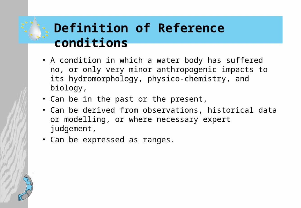
Definition of Reference conditions
• A condition in which a water body has suffered no, or only very minor anthropogenic impacts to its hydromorphology, physico-chemistry, and biology,
• Can be in the past or the present,• Can be derived from observations, historical data or
modelling, or where necessary expert judgement,• Can be expressed as ranges.
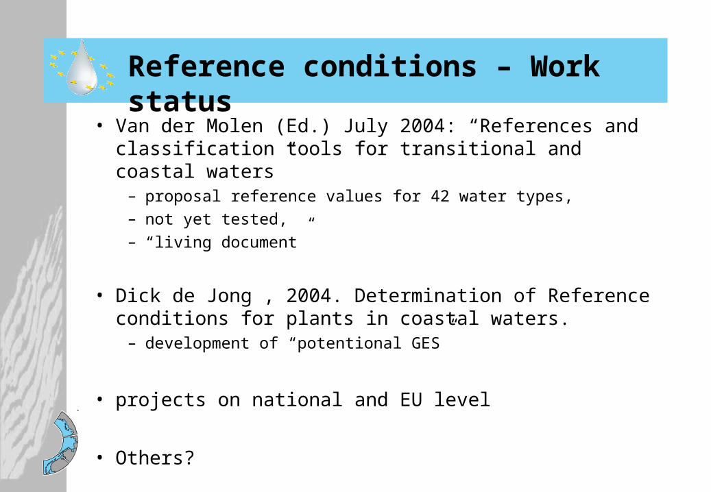
Reference conditions – Work status
• Van der Molen (Ed.) July 2004: “References and classification tools for transitional and coastal waters”
– proposal reference values for 42 water types, – not yet tested, – “living document”
• Dick de Jong , 2004. Determination of Reference conditions for plants in coastal waters.
– development of “potentional GES”
• projects on national and EU level
• Others?
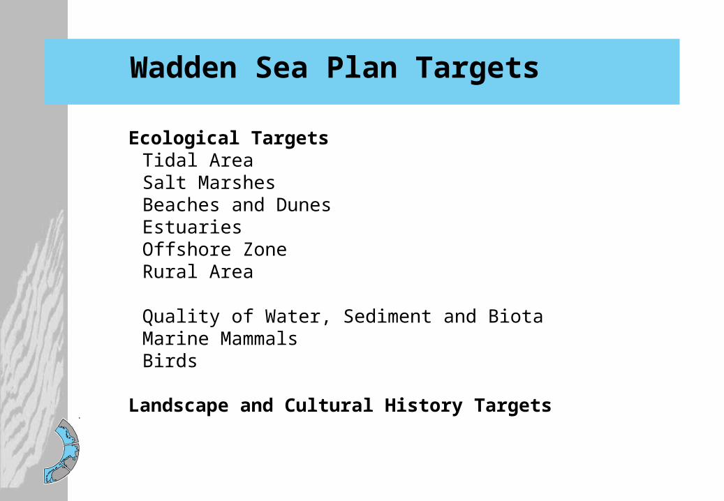
Wadden Sea Plan Targets
Ecological TargetsTidal AreaSalt MarshesBeaches and DunesEstuariesOffshore ZoneRural Area
Quality of Water, Sediment and BiotaMarine MammalsBirds
Landscape and Cultural History Targets

Wadden Sea Plan Targets10 Years Experience
Applicability in Policy and Management
Suitability for Communication with Stakeholders
Good: No scientific conflicts
Good: Structuring of assessment and monitoringStructuring Policy and ManagementGuidance development of measuresRegional specification
Good: Regional and Sectoral Specification possible General Support
Scientific Credibility

Water Framework Directive and Wadden Sea
Guidance from EU LevelCIS Guidance documents (monitoring, reference condition, typology, classification)
Intercalibration process (metrics, class boundaries)
Eutrophication assessment guidance
NL: Rhine North, Ems
Lower Saxony: Ems, Weser, Elber
Hamburg: Elbe
Schleswig-Holstein: Elbe, Eider
Denmark: Ribe, S-Jutl.,, Eider
Differences in interpretation and specification on RBD level

Water Framework Directive and Wadden Sea
Guidance from EU LevelCIS Guidance documents (monitoring, reference values, typology, classification)
Intercalibration process (metrics, class boundaries)
Eutrophication assessment guidance
NL: Rhine North, Ems
Lower Saxony: Ems, Weser, Elber
Hamburg: Elbe
Schleswig-Holstein: Elbe, Eider
Denmark: Ribe, S-Jutl.,, Eider
Trilateral Cooperation / TMAP as „Platform“ to support RBD to find a common Wadden Sea approach.

Wadden Sea Symposium 2005
11th International Wadden Sea SymposiumEsbjerg, 4 – 8 April 2005Organized by: National Environmental Research Institute (NERI)
Monitoring and Assessment in the Wadden Sea –Foundations and Perspectives
Call for papers / Registration: 15 February 2005
Preliminary Program and Registration Form:
www.waddensea-secretariat.org