tiffany falls -virtual field trip- - mcmaster university · tiffany falls-virtual field trip-school...
TRANSCRIPT

Tiffany FallsTiffany Falls--Virtual Field TripVirtual Field Trip--
School of School of
GEOGRAPHY & GEOLOGYGEOGRAPHY & GEOLOGY
Prepared by Prepared by Zachary Windus Zachary Windus
and Liz Kenny and Liz Kenny Carolyn Eyles & Susan VajoczkiCarolyn Eyles & Susan Vajoczki

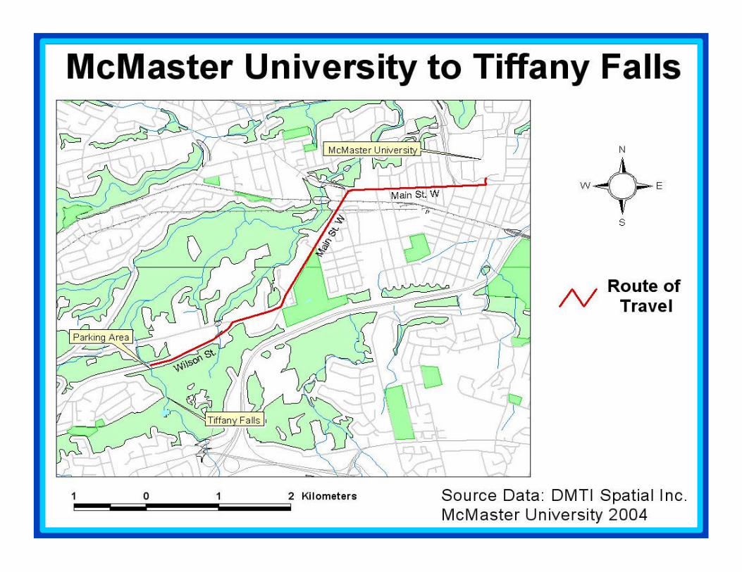
From McMaster University turn right onto Main Street West Main Street West towards Ancaster. Follow Main Street West by turning left at the major
intersection just past the Main West Mall (travelling straight will take you onto Osler Drive, Dundas). Main Street West becomes Wilson Wilson
Street Street as you reach the bottom of the escarpment. Follow Wilson Street approximately half way up the escarpment. The parking area for Tiffany
Falls is on the left-hand side of Wilson Street.
The falls are located within a forested area approximately 400m from the parking lot. The trail to the falls is narrow and quite steep in places and is only suggested for those with appropriate footwear and some
hiking experience. Hard hats are recommended for close examination of rock faces due to frequent rock falls at this site.
Directions:Directions:McMaster to Tiffany FallsMcMaster to Tiffany Falls

?? The uppermost geological units of the Niagara Escarpment are visThe uppermost geological units of the Niagara Escarpment are visible from ible from the base of the falls. (Thorold Formation (Fm) through Lockport the base of the falls. (Thorold Formation (Fm) through Lockport Fm).Fm).
?? The creek meanders through the gorge where fluvial processes andThe creek meanders through the gorge where fluvial processes andlandforms can be observed. Steep cut banks, debris dams, and declandforms can be observed. Steep cut banks, debris dams, and decreasing reasing clast sizes in fluvial deposits are evident downstream of the faclast sizes in fluvial deposits are evident downstream of the falls.lls.
?? Talus slopes, slumps, and JTalus slopes, slumps, and J--shaped trees can be observed on the steep shaped trees can be observed on the steep walls of the gorge.walls of the gorge.
Features at this site…Features at this site…

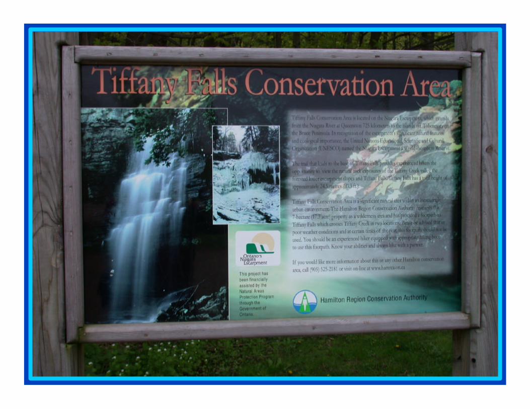
Tiffany FallsTiffany Falls

More views More views of Tiffany of Tiffany
FallsFalls

Schematic Section of
Tiffany Falls
Highlighted formations are visible at this site.

Lockport Fm
Thorold Fm
Irondequoit Fm
Rochester Fm
Reynales Fm
GEOLOGICAL UNITS EXPOSED AT TIFFANY FALLS

Lockport FormationLockport FormationAncaster Member
Gasport MemberThe Lockport The Lockport Formation Formation forms the forms the
upper part of upper part of the gorge at the gorge at
this site. this site.

Rochester FormationRochester Formation
The Rochester shale is easily eroded and allows undercutting of the more resistant Lockport dolostone above. This causes
collapse of the overlying materials and gives the escarpment its steep
face.

Irondequoit FormationIrondequoit Formation
The Irondequoit dolostone is well exposed around the gorge. At this site, the formation is particularly massive,
showing few fractures or joints.

Reynales FormationReynales Formation Reynales Formation consists of medium-grained, dark
grey/brown dolostone with thin shale interbeds.
Sediments deposited in warm shallow seas under conditions of changing
wave and current energies.

Thorold Thorold FormationFormation
Interbedded sandstone and shale of the Thorold
Formation are well exposed at the waterfall, but are
buried by talus around the rest of the gorge.

Red-brown stained tufa deposits (calcium carbonate
precipitates) can be observed on the surface of
exposed bedrock.
Fallen rocks at the base of the falls; angular dolostone blocks of the
Lockport Formation.

Downstream of the falls, Tiffany Creek meanders within the gorge.

Tiffany Creek
High Flow
Low Flow

J-shaped trees and talus
JJ--shaped treesshaped trees
talustalus
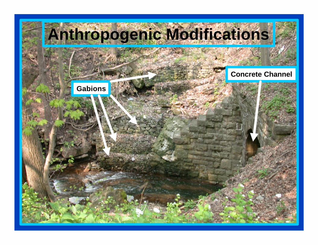
Anthropogenic Modifications
Gabions
Concrete Channel

Acknowledgements:Acknowledgements:
Map Source Data: DMTI Spatial Inc.Map Source Data: DMTI Spatial Inc.
Photographs by Ben Cowie, Photographs by Ben Cowie, Luisa DaSilva, Liz Kenny, Luisa DaSilva, Liz Kenny,
and Zachary Windusand Zachary Windus
Field Assistance from Mark Francisco Field Assistance from Mark Francisco
Based on earlier slide field trip prepared Based on earlier slide field trip prepared by Alvin Chan and Sandra Rolphby Alvin Chan and Sandra Rolph