the university of florida unmanned aircraft systems
TRANSCRIPT

The University of Florida Unmanned Aircraft Systems Research Program:Lessons Learned and an Update on Selected
Natural Resources Applications
Matthew A. Burgess
R.R. Carthy, B.E. Wilkinson, T.J. Whitley, T.S. Ward, J.G. DiRodio, P.C. Frederick, P.G. Ifju, S.E. Smith, A.H. Abd-Elrahman, and H.F. Percival
University of Florida – Gainesville, Florida

-In our 15th year of existence-Natural resource-based applications from the
very beginning-Approach from the natural resource scientist
point of view; simplicity of use and budget-Over last seven years, interest in sUAS for natural
resources has grown exponentially-Truly interdisciplinary research program-As of March 13, 2015, we have 14 active FAA
Certificates of Authorization; three additional pending
Brief Overview of the UFUASRP

-Extremely lengthy list of lessons learned…-15 years of experience provides that
-Three major lessons:
1) One Size Does Not Fit All
2) Start With the Scientific Question
3) Be Patient and Adaptive
Lessons Learned

-Airframe1) Design
-Fixed-wing-Rotor-wing
2) Power Source-Liquid (wet) fuel-Battery
3) Physical Size-Micro UAS-Large UAS
4) Altitude/Temperature
1) One Size Does Not Fit All

UFUASRP AirframeEvolution
UF Tadpole(2004-5)
UF Polaris/Nova(2006-8)
UF Nova 2(2008-9)
MLB Fold Bat(2002-3)

UF Nova 2.1 sUAS
-9 ft. wingspan-14 lbs. fully loaded
-Hand launchable-Built in-house
-Amphibious-50 min. runtime

DJI Spreading Wings S1000+ Octocopter sUAS
-3.5 ft. diameter-10→24 lbs. takeoff
-Portable-Rugged
-Autonomous-20 min. runtime

-Sensor Payload1) RGB and NIR
-Resolution-Triggering
2) Multispectral and Hyperspectral-Spectral Range-Triggering
- -Cost3) Thermal
-Resolution-Georeferencing
1) One Size Does Not Fit All

UFUASRP Optical Payloads – Evolution
Canon Elura 2 MC
Canon PowerShot A640
Olympus E-420

Optical Sensor RGB and NIR – Evolution
Olympus E-420 Sony A7RCanon EOS 2Ti
Canon EOS-M Canon EOS SL1Sony A6000

Optical Sensor—Thermal, Multispectral and Hyperspectral, and HD Video
RikolaHyperspectral
GoPro Hero 4FLIR A65 SC
Thermal
Imperx B6640Multispectral
GoPro Hero 3FLIR PhotonThermal

2) Start With the Scientific Question

2) Start With the Scientific Question
Start

2) Start With the Scientific Question
Start End

2) Start With the Scientific Question
Start End

2) Start With the Scientific Question
Start (SCIENTIFIC QUESTION) End

2) Start With the Scientific Question
Start (SCIENTIFIC QUESTION) End
Start End

2) Start With the Scientific Question
Start (SCIENTIFIC QUESTION) End
Start (AIRFRAME) End

2) Start With the Scientific Question
Start (SCIENTIFIC QUESTION) End
Start (AIRFRAME) End

2) Start With the Scientific Question
Start (SCIENTIFIC QUESTION) End
Start (AIRFRAME) End
Start End

2) Start With the Scientific Question
Start (SCIENTIFIC QUESTION) End
Start (AIRFRAME) End
Start (SENSOR) End

2) Start With the Scientific Question
Start (SCIENTIFIC QUESTION) End
Start (AIRFRAME) End
Start (SENSOR) End

2) Start With the Scientific Question
Start (SCIENTIFIC QUESTION) End
Start (AIRFRAME) End
Start (SENSOR) End
QUESTION

2) Start With the Scientific Question
Start (SCIENTIFIC QUESTION) End
Start (AIRFRAME) End
Start (SENSOR) End
QUESTION SENSOR

2) Start With the Scientific Question
Start (SCIENTIFIC QUESTION) End
Start (AIRFRAME) End
Start (SENSOR) End
QUESTION SENSOR AIRFRAME

2) Start With the Scientific Question
Start (SCIENTIFIC QUESTION) End
Start (AIRFRAME) End
Start (SENSOR) End
QUESTION SENSOR AIRFRAME PRODUCT

2) Start With the Scientific Question
Start (SCIENTIFIC QUESTION) End
Start (AIRFRAME) End
Start (SENSOR) End
QUESTION SENSOR AIRFRAME PRODUCT

-What is your SCIENTIFIC QUESTION? Define your target!
-What is your desired END PRODUCT? Individual images (samples), a mosaic (contiguous map or layer), a video (documentation of behavior), etc.
-What KINDS OF DATA do you need to collect to produce your end product? Identify the sensors that can deliver those data.
2) Start With the Scientific Question

-Based on your sensor or sensor suite, select a SUITABLE AIRFRAME as a platform for your sensors. Capacity, runtime, sound, area, etc.
-What is your plan to collect SCIENTIFICALLY SIGNIFICANT DATA? Consult your statistician before you head out into the field!
-What is your plan for POST-PROCESSING the data collected? Do it yourself, contract it out to an expert, have a student do it, etc.
-What do you intend to do about ARCHIVING the data? File sizes are getting bigger…
2) Start With the Scientific Question

-Emerging Technology
1) Authorizations/Regulations/Approvals
2) Perceptions/Misinformation
3) Contentious/Touchy
4) Adaptation/Compliance/Murphy’s Law
-Use ‘Due Diligence’
3) Be Patient and Adaptive

-Certificate of Authorization-Aircraft Airworthiness-Crew Certification-Local Permission-Notice to Airmen-Flight Restrictions-Failsafe Approvals-Bureau/Service Rules
-International Traffic in Arms Regulations (ITAR)-Export Administration Regulations (EAR)
» United States Munitions List; Commerce Control List
Authorizations/Regulations/Approvals

Authorizations/Regulations/Approvals
Office of Aviation Services (OAS)

- American White Pelican Nesting in Idaho
- Brown Pelican Nesting off the Florida Gulf Coast
- Precision Agriculture
- Emergent Wetland Vegetation Classification
- Temporal Aerial Imagery of Selected Rehabilitation Efforts in the Greater Everglades
Update on Several Applications

American White Pelican Nesting

American White Pelican Nesting

American White Pelican Nesting

Brown Pelican Nesting

Brown Pelican Nesting

Precision Agriculture

Wetland Vegetation Classification

Wetland Vegetation Classification

Temporal Imagery Analysis

Be Adaptive:Payload Options – Manned Aircraft

Temporal Imagery Analysis

Temporal Imagery Analysis
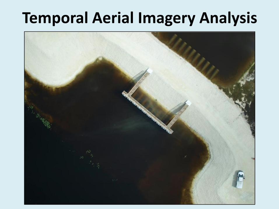
Temporal Aerial Imagery Analysis

Temporal Aerial Imagery Analysis

What is Your Target?

Dr. H. Franklin Percival, UF WEC/Program DirectorMr. Matthew A. Burgess, UF WEC/Program CoordinatorDr. Raymond R. Carthy, UF WEC/Wildlife LeadMr. Joseph G. DiRodio, UF WEC/Chief PilotDr. Peter C. Frederick, UF WEC/Avian LeadDr. Peter G. Ifju, UF Aerospace/Aerospace LeadMr. Travis J. Whitley, UF Aerospace/Airframe and Controls SpecialistMr. Tyler S. Ward, UF Aerospace/Payload and Sensor SpecialistDr. Amr H. Abd-Elrahman, UF Geomatics/GIS LeadMs. Tiziana W. Munene, UF Geomatics/Imagery Processing SpecialistDr. Bon A. Dewitt, UF Geomatics/Photogrammetry LeadDr. Scot E. Smith, UF Geomatics/Remote Sensing LeadDr. Benjamin E. Wilkinson, UF Geomatics/Imagery Processing LeadMr. Yun Ye, UF Geomatics/Remote Sensing SpecialistDr. Robert M. Dorazio, UF Statistics/Statistics Lead
UF UAS Research Program

Questions?
Matthew A. [email protected]
Department of Wildlife Ecology and ConservationUniversity of Florida
U.S.G.S. – Florida Cooperative Fish and Wildlife Research Unithttp://uav.ifas.ufl.edu/