the spot image solution alan kittson and drew hopwood spot image corporation (703) 715-3100...
TRANSCRIPT

The Spot Image Solution
Alan Kittson and Drew HopwoodSpot Image Corporation
(703) 715-3100
Statewide Digital Mapping InitiativeImagery Workshop
1
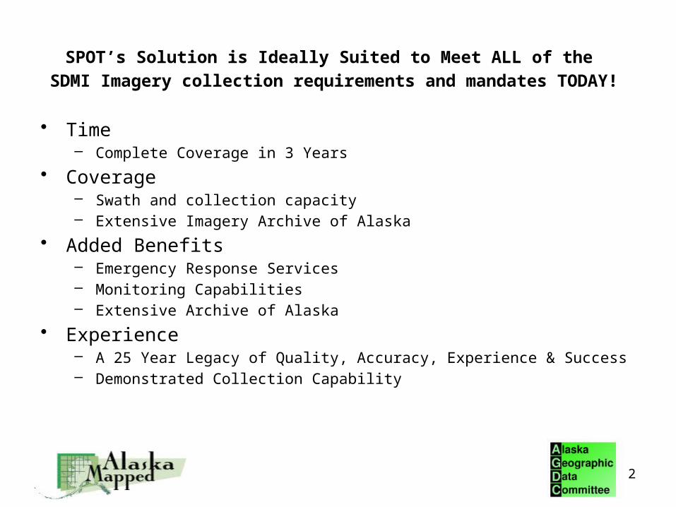
SPOT’s Solution is Ideally Suited to Meet ALL of the
SDMI Imagery collection requirements and mandates TODAY!
• Time– Complete Coverage in 3 Years
• Coverage– Swath and collection capacity– Extensive Imagery Archive of Alaska
• Added Benefits– Emergency Response Services– Monitoring Capabilities– Extensive Archive of Alaska
• Experience– A 25 Year Legacy of Quality, Accuracy, Experience & Success– Demonstrated Collection Capability
2
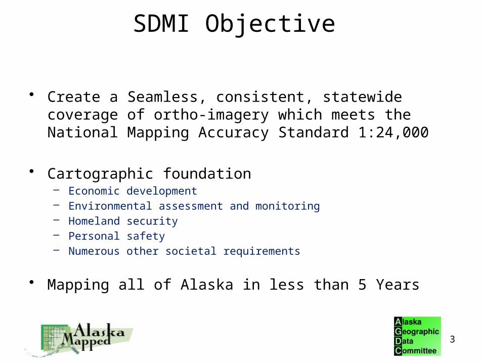
SDMI Objective
• Create a Seamless, consistent, statewide coverage of ortho-imagery which meets the National Mapping Accuracy Standard 1:24,000
• Cartographic foundation– Economic development– Environmental assessment and monitoring– Homeland security– Personal safety– Numerous other societal requirements
• Mapping all of Alaska in less than 5 Years
3
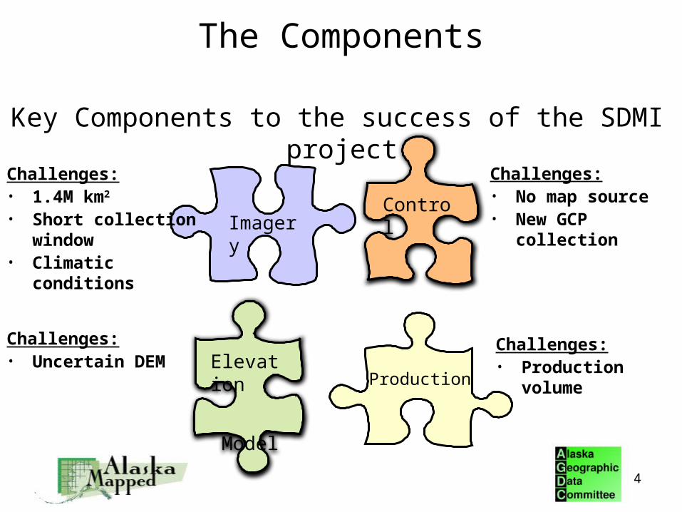
Key Components to the success of the SDMI project:
The Components
Control
Elevation
Model
Imagery
Production
Challenges:• 1.4M km2 • Short collection
window• Climatic conditions
Challenges:• No map source• New GCP collection
Challenges:• Uncertain DEM
Challenges:• Production volume
4

Imagery Overview • You Need 1.4M km2 of coverage in < 5 years
• Product characteristics– Spectral bands– Resolution– Sensor capability– Revisit and Swath Width
• Accuracy– Native Horizontal– Improved Horizontal
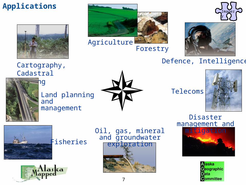
• Applications– Land Cover– Transportation and Infrastructure– Environmental Analysis– Public Safety and Military
5
Imagery

SPOT-5 Characteristics• We offer SPOT-5• SPOT-5 contains four sensors
– Two High Resolution Geometry (HRG) sensors – High Resolution Stereo (HRS) sensor– 1km Vegetation (VGT) sensor
• HRG data will be used for the SDMI– Resolution
• 2.5m and 5m Panchromatic– Pan (0.48-0.71 μm)
• 10m Multispectral– Green (0.50-0.59μm)– Red (0.61-0.68 μm)– NIR (0.78-0.89 μm)– SWIR (1.58-1.75 μm)
– Scene Size at nadir• 60km x 60km
– Accuracy • Native - 41m CE95• Improved – 12m CE95
HRG sensors
HRS sensorVGT sensor
Imagery
6
7
Cartography, Cadastral Mapping
Defence, Intelligence
AgricultureForestry
Land planning and management
Telecoms
Oil, gas, mineral and groundwater exploration
Disaster management and mitigation
Fisheries
ApplicationsImagery

Imagery – Direct Receiving Station
• SDMI needs 1.4M km2 of coverage in < 5 years
• Our solution is a Telemetry Agreement– Spot recommends a Direct Receiving Station (DRS) solution to
meet the stated goals of the SDMI• Lowest cost solution• Maximize acquisition of imagery• Rapid delivery in emergency situations• Monitoring capability at no additional expense
• A DRS provides the foundation for creating a long term mapping program for the State of Alaska
Imagery
8
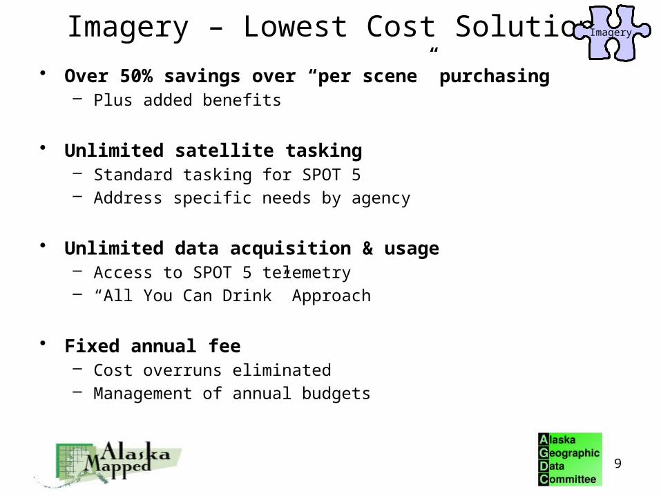
Imagery – Lowest Cost Solution
• Over 50% savings over “per scene” purchasing– Plus added benefits
• Unlimited satellite tasking– Standard tasking for SPOT 5– Address specific needs by agency
• Unlimited data acquisition & usage– Access to SPOT 5 telemetry– “All You Can Drink” Approach
• Fixed annual fee– Cost overruns eliminated – Management of annual budgets
Imagery
9

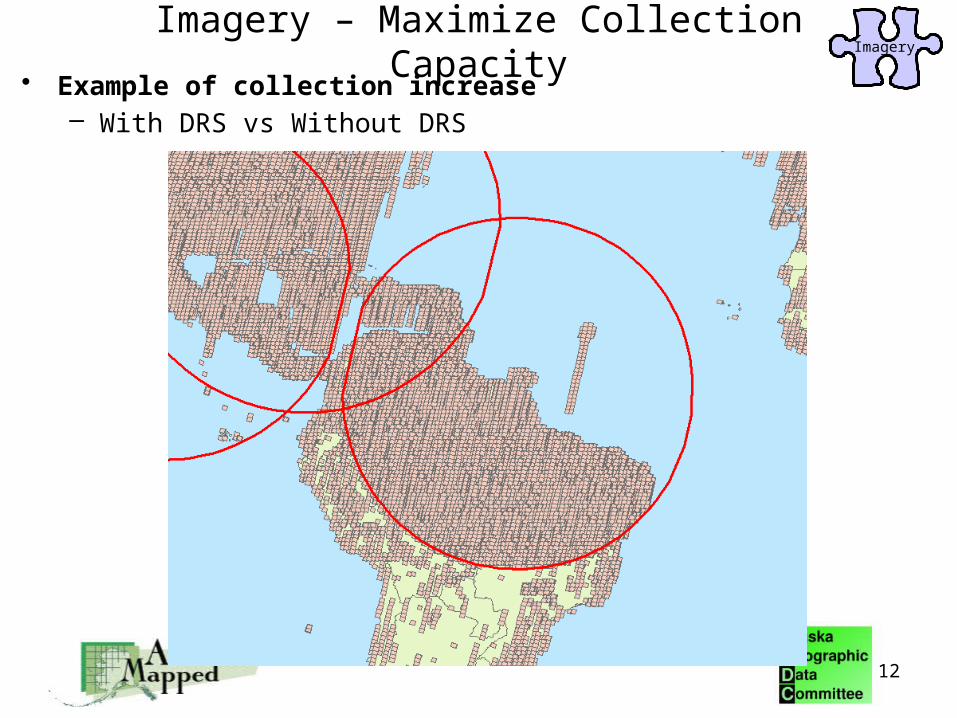
Imagery – Maximize Collection Capacity
50% More Collection Capacity Using a DRS Solution
10

• Up to 5 channels of data can be collected at a time
– 2 channel transmitted to the ground– 3 channels recorded on board simultaneously
transmission to the ground
OB memory
on board recording
channelsHRG1 multispectral
HRG1 panchro A
HRG1 panchro B
HRG2 multispectral
HRG2 panchro A
HRG2 panchro B
HRS
HR
G 1
HR
G 2
7 Possible Acquisition Channels
Imagery
11
Imagery – Maximize Collection Capacity
Imagery
12
Imagery – Maximize Collection Capacity• Example of collection increase
– With DRS vs Without DRS

13
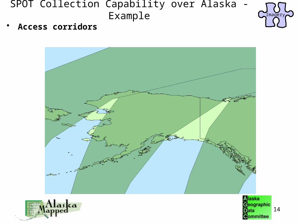
SPOT Collection Capability over Alaska - Example
• Visibility circle over Alaska
SPOT Collection Capability over Alaska - ExampleImagery
14
• Access corridors

Illustration of one week’s collection with SPOT 4 & 5 over Alaska
SPOT Collection Capability over Alaska - ExampleImagery
15
• Fact Collection Capacity is key, due to
the short collection season
Benefits of a SPOT Direct Receiving Station
• Access to telemetry from SPOT 5
• Unlimited satellite tasking for SPOT 5
• Unlimited imagery acquisition from SPOT 5– Creation of sustainable image archive
• Ability to map the ENTIRE state of Alaska in 3 years or less
• Ability to support ongoing state and federal imagery requirements (DNR, NOAA, Weather Service, BLM)
16
Imagery

• Long term mapping and imagery capability– ~60% Annual Refresh Collection– Disaster Support – Environmental Monitoring– Economic Development
• Additional Benefits– Monitoring – Near Real Time Imagery Support
17
ImageryBenefits of a SPOT Direct Receiving Station

18
Additional Benefits – SPOT 4
• Access to telemetry from SPOT 4
• Unlimited satellite tasking for SPOT 4
• Increased support of ongoing state and federal imagery requirements (DNR, NOAA, Weather Service, BLM)

Control Options
• Currently no reliable GCP’s
• Currently no reliable map source
• Spot Image has identified two sources of control we recommend1) Surveyed GCPs
2) Reference3D CIB (no GCP’s required)
• Spot Image estimates as few as 100 GCPs could be needed throughout Alaska.
19
Control

• Spot Imagery requires a DTED level 2 (~30m) DEM to produce ortho images that meet the 1:24,000 NMAS
• Spot Image foresees several DEM source options– ASTER GDEM– Future NED DEM– Reference3D DEM
Digital Elevation Model Requirement Elevation
Model
20

Possible DEM Sources
• ASTER GDEM– Designed to meet DTED-2 specification– Scheduled for release in 2009– Minimal cost (Free)– Complete coverage of Alaska
• DEM solution to replace the current NED– Unknown specification– Unknown delivery date
• Reference3D DEM– Identified and utilized by the NGA to cost effectively cover large areas– Processing is done without ground control points (GCPs)– Greater than 83% of source data collected over Alaska
• Expected completion 2009
Elevation
Model
21

Reference3D – DTED Level 2 (DEM)
• On-going, Pro-active, SPOT5 HRS Stereo Collection Campaign
• Today: 83% of Alaska covered with cloud-free stereo pairs
• Collection expected to be completed Summer 2009
22
Elevation
Model
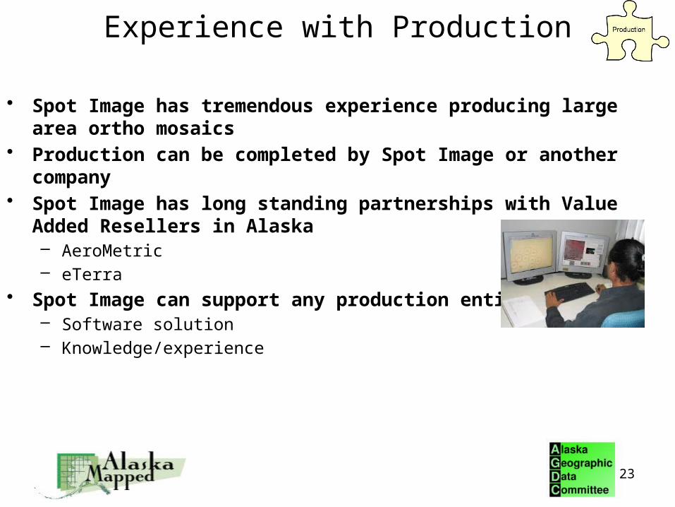
Experience with Production
• Spot Image has tremendous experience producing large area ortho mosaics
• Production can be completed by Spot Image or another company• Spot Image has long standing partnerships with Value Added
Resellers in Alaska– AeroMetric– eTerra
• Spot Image can support any production entity– Software solution– Knowledge/experience
23

Robust Production Solution is Required
• You Need Seamless Ortho-Mosaic Production Capability
• Block Bundle Processing• Reduced GCPs
– 100 GCPs statewide– No GCPs are needed when using Reference3D
• Spot Image uses Pixel Factory to build large ortho mosaics– Pixel Factory allows
Semi-automated production of ortho mosaic Color balanced across the production block
False and Natural Color options Scalable production volume
Starting at 500,000km2 per month
• All COTS Image Processing Software are compliant with SPOT data
24

SPOT Proposed Solution
Control
Elevation
Model
Imagery
Production
25
Solution:• SPOT DRS
Solution:• GCPs• Reference3D
Solution:• ASTER GDEM• Future NED• Reference3D
Solution:• Pixel Factory• Other COTS
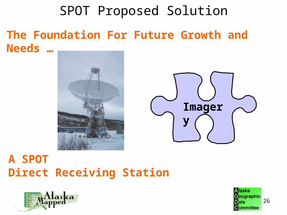
The Foundation For Future Growth and Needs …
A SPOTDirect Receiving Station
Imagery
26
SPOT Proposed Solution

Spot Image Corporation
Spot Image Corporation
A Recognized Leader With A Long History of Success
In the Earth Observatory Industry
27
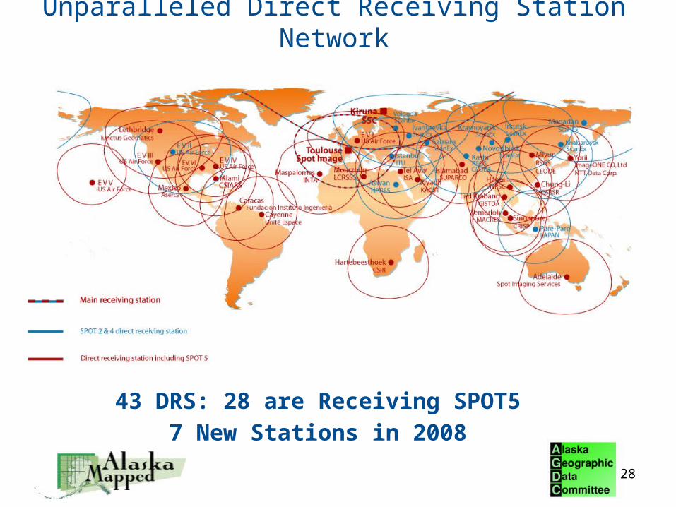
Unparalleled Direct Receiving Station Network
28
43 DRS: 28 are Receiving SPOT5
7 New Stations in 2008

Experience with Large Collections
• This is what Spot Image does best
• Collections over Alaska– 2007 – Collected ~2.96M km2 of data– 2008 – Collected >3M km2 of data
• History of large collection campaigns over North America– 1999 - 2000: Complete collection of CONUS (near cloudfree) – 2003: Complete Coverage of Alberta, Canada (660,000km2)– 2004: Completely new coverage of Alberta, Canada (660,000km2)– 2005: Collected ~9M km2 of 2.5m Pan data over North America with less then
10% cloud cover– 2006 & 2007: Collected ~3.2M km2 of cloud free data over Canada
29
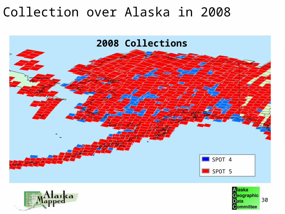
Collection over Alaska in 2008
SPOT 4
SPOT 5
2008 Collections
30

Countrywide ortho production
• In 2006 Spot Image started production of the SPOTMaps– A 2.5m natural color base map product– Seamless natural color ortho mosaic– Suitable for working at scales between 1:10,000 and 1:20,000– For production Spot Image selected Pixel Factory™ for its capacity to
process large numbers of images automatically– Spot Image is capable of producing 3.5M km2 of SPOTMaps per month
31
SPOTMaps coverage62 countries and growing
Afghanistan (South) Cyprus Iraq Mauritania Romania Taiwan
Algeria (North) Czech Republic Israel Mexico Serbia Tunisia
Australia Djibouti Italy Moldavia Slovakia Turkey
Belgium Egypt Jordan Montenegro Slovenia Turkmenistan
Bosnia and Herzegovina Eritrea Kuwait Morocco South Africa UAE
Botswana France Lebanon Namibia South Korea Uzibekistan
Brazil Gaza Lesotho North Korea Spain West Bank
Chile (North) Greece Libya Oman Sudan Yemen
China (Beijing) Hungary Luxembourg Pakistan Swaziland Zambia
China (Shanghai) India Malta Portugal Syria Zimbabwe
Croatia Iran

32
Barcelona, Spain
SPOTMaps

33
SPOTMaps
Port d’Anvers, Belgium
© CNES 2004-2007 / Spot Image

NGA CCAP Evaluation in 2006
• Report concluded Spot 5 data accuracy
meets or exceeds vendors stated accuracy
• Results - Improved horizontal accuracy
of 8.8m at CE90
34

SPOT Image – Corporate Overview• Strong US presence
• Increased ownership of EADS/Astrium Services (81%)
• Strong Worldwide Presence• 5 subsidiaries and 2 offices
• 3 satellites in Full Operation: Spot 2, 4 and 5• 43 active direct receiving stations• Distribution rights for other satellites: TerraSAR-X, Formosat-2, Kompsat-2
35
SPOT2
SPOT4SPOT5

SPOT Satellite Constellation – Assured Mission Continuity
SPOT2
SPOT4SPOT5
Pléiades 1 & 2SPOT 6&7SPOT 2, 4 & 5 Satellites
Very High Resolution Dual Program 2 Satellites Data
60cm Pan 2.8m XI 4-Bands 20km Swath
Automatic 50cm Ortho Direct Tasking Launch Date Q1 2010
High Resolution Large Swath Privately Funded 2 Satellites Data
2m Pan 8m XI 4-bands 60km Swath
Collection : 3M km2 / Day Stereo Capability Launch Date Q1 2012
36
3 Satellites Currently in Operation SPOT 2 & 4 10 & 20m SPOT 5 2.5m 60km Swath
SPOT 5 Extended to 2015 Data Distribution for TerrSAR-X,
Formasat-2, Kompsat-2 Extensive Worldwide Coverage 25 Years of experience
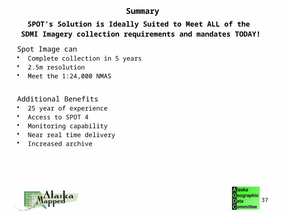
Summary
SPOT’s Solution is Ideally Suited to Meet ALL of the
SDMI Imagery collection requirements and mandates TODAY!
Spot Image can• Complete collection in 5 years• 2.5m resolution• Meet the 1:24,000 NMAS
Additional Benefits• 25 year of experience• Access to SPOT 4 • Monitoring capability• Near real time delivery• Increased archive
37

38

39
Questions?

Thank You
40