the latest innovations from - leica geosystems
TRANSCRIPT
The latest innovations from
Leica GeoMoS
M. Rutschmann, Senior Product Manager
11, October, 2016
Confidential3
Confidential4
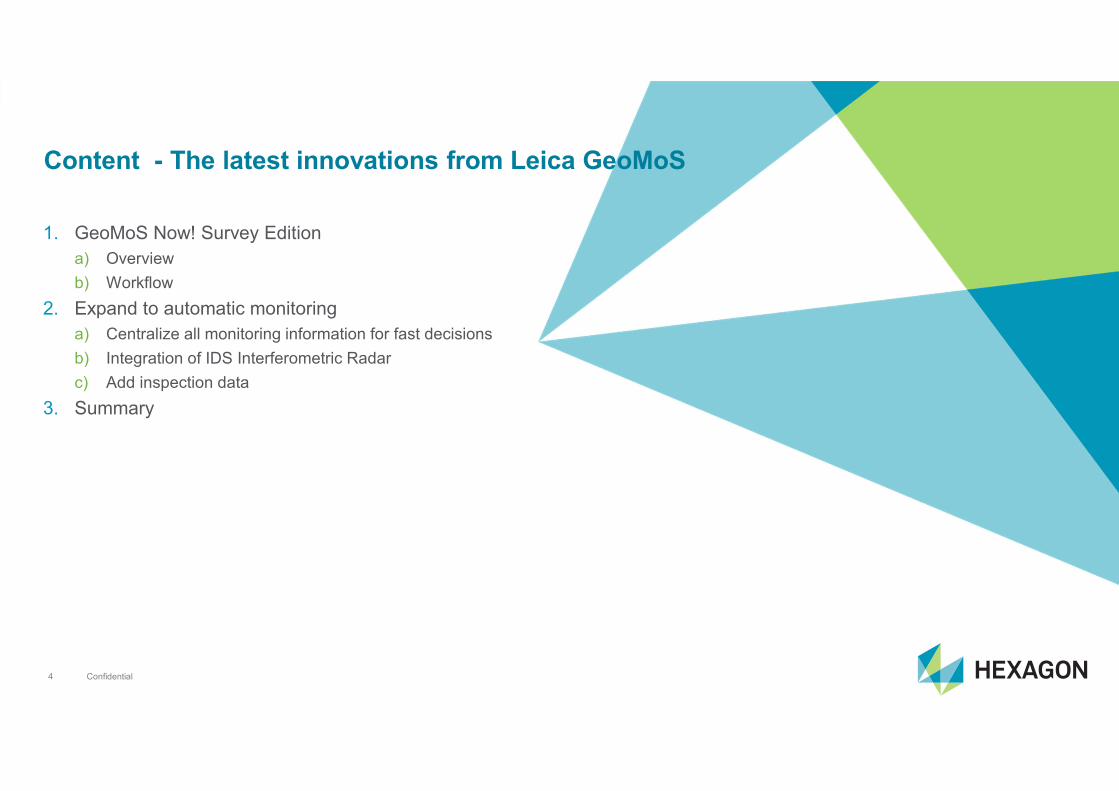
1. GeoMoS Now! Survey Edition
a) Overview
b) Workflow
2. Expand to automatic monitoring
a) Centralize all monitoring information for fast decisions
b) Integration of IDS Interferometric Radar
c) Add inspection data
3. Summary
Content - The latest innovations from Leica GeoMoS
Confidential5
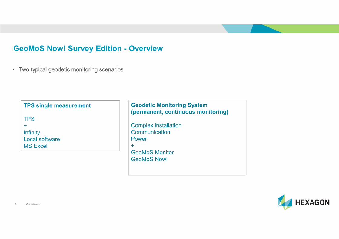
GeoMoS Now! Survey Edition - Overview
• Two typical geodetic monitoring scenarios
TPS single measurement
TPS
+
Infinity
Local software
MS Excel
Geodetic Monitoring System
(permanent, continuous monitoring)
Complex installation
Communication
Power
+
GeoMoS Monitor
GeoMoS Now!

Confidential6
GeoMoS Now! Survey Edition - Overview
• We offer solution for simplest monitoring setup
TPS single measurement
TPS
+
Infinity
Local software
MS Excel
Geodetic Monitoring System
(permanent, continuous monitoring)
Complex installation
Communication
Power
+
GeoMoS Monitor
GeoMoS Now!Campaign monitoring
Repeated deformation measurements
One or more TPS/level
+
GeoMoS Now! Survey Edition
Confidential7
GeoMoS Now! Survey Edition - Overview
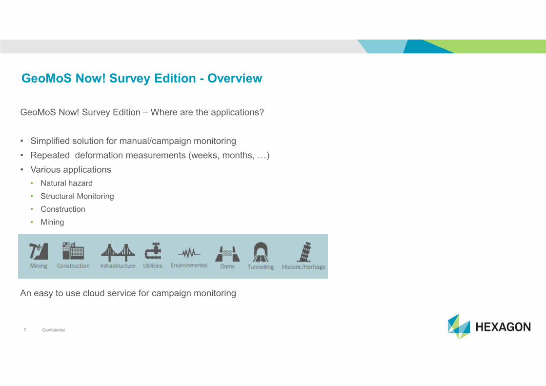
GeoMoS Now! Survey Edition – Where are the applications?
• Simplified solution for manual/campaign monitoring
• Repeated deformation measurements (weeks, months, ;)
• Various applications
• Natural hazard
• Structural Monitoring
• Construction
• Mining
An easy to use cloud service for campaign monitoring
Confidential8
GeoMoS Now! Survey Edition - Overview
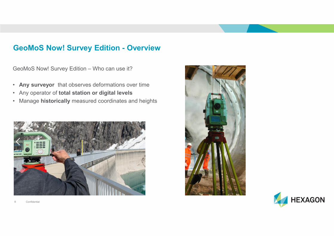
GeoMoS Now! Survey Edition – Who can use it?
• Any surveyor that observes deformations over time
• Any operator of total station or digital levels
• Manage historically measured coordinates and heights

Confidential9
GeoMoS Now! Survey Edition - Interfaces
GeoMoS Now! Survey Edition - What is new?
New!
TPS Monitoring App
New!
Survey Edition
Any
CSV File
Leica
Infinity
(Option)

Confidential10
GeoMoS Now! Survey Edition - Workflow
TPS Monitoring App - On-board the instrument
• Supported on Captivate and SmartWorx

Confidential11
GeoMoS Now! Survey Edition - Workflow
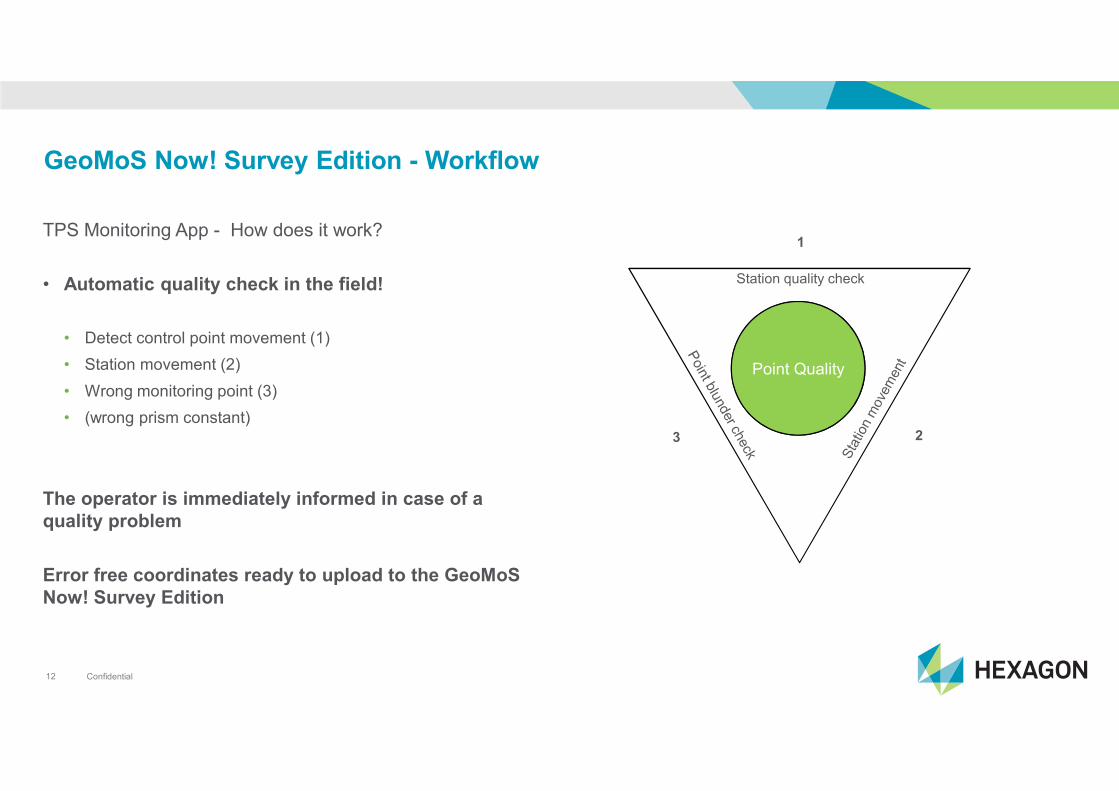
GeoMoS Now! Survey Edition - How does it work?
• From TPS to Cloud
TPS Monitoring App
Survey Edition
Smartphone View
Confidential12
GeoMoS Now! Survey Edition - Workflow
TPS Monitoring App - How does it work?
• Automatic quality check in the field!
• Detect control point movement (1)
• Station movement (2)
• Wrong monitoring point (3)
• (wrong prism constant)
The operator is immediately informed in case of a
quality problem
Error free coordinates ready to upload to the GeoMoS
Now! Survey Edition
PUNKT
QUALITAET
Station quality check
Point Quality
3 2
1

Confidential13
GeoMoS Now! Survey Edition - Workflow
TPS Monitoring App - Benefits
• Predefined point groups speed up the repeated
measurements
• TPS Monitoring App integrated part of Captivate and
SmartWorx
• Semi-automatic measurements
• Fast, error-free data acquisition
• Automatic over hours
• Status information with an advanced error
management (outliers, point status, instrument stability)
• Direct data file upload to GeoMoS Now! Survey Edition
• Save the job for future campaigns
• Save the job on USB or SD card
• GeoMoS Format File for direct export with Flexline
Confidential14
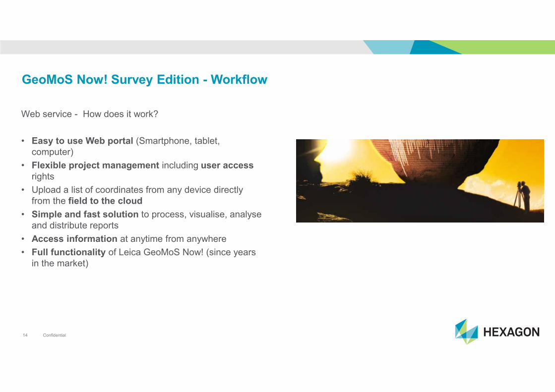
GeoMoS Now! Survey Edition - Workflow
Web service - How does it work?
• Easy to use Web portal (Smartphone, tablet,
computer)
• Flexible project management including user access
rights
• Upload a list of coordinates from any device directly
from the field to the cloud
• Simple and fast solution to process, visualise, analyse
and distribute reports
• Access information at anytime from anywhere
• Full functionality of Leica GeoMoS Now! (since years
in the market)
Confidential15
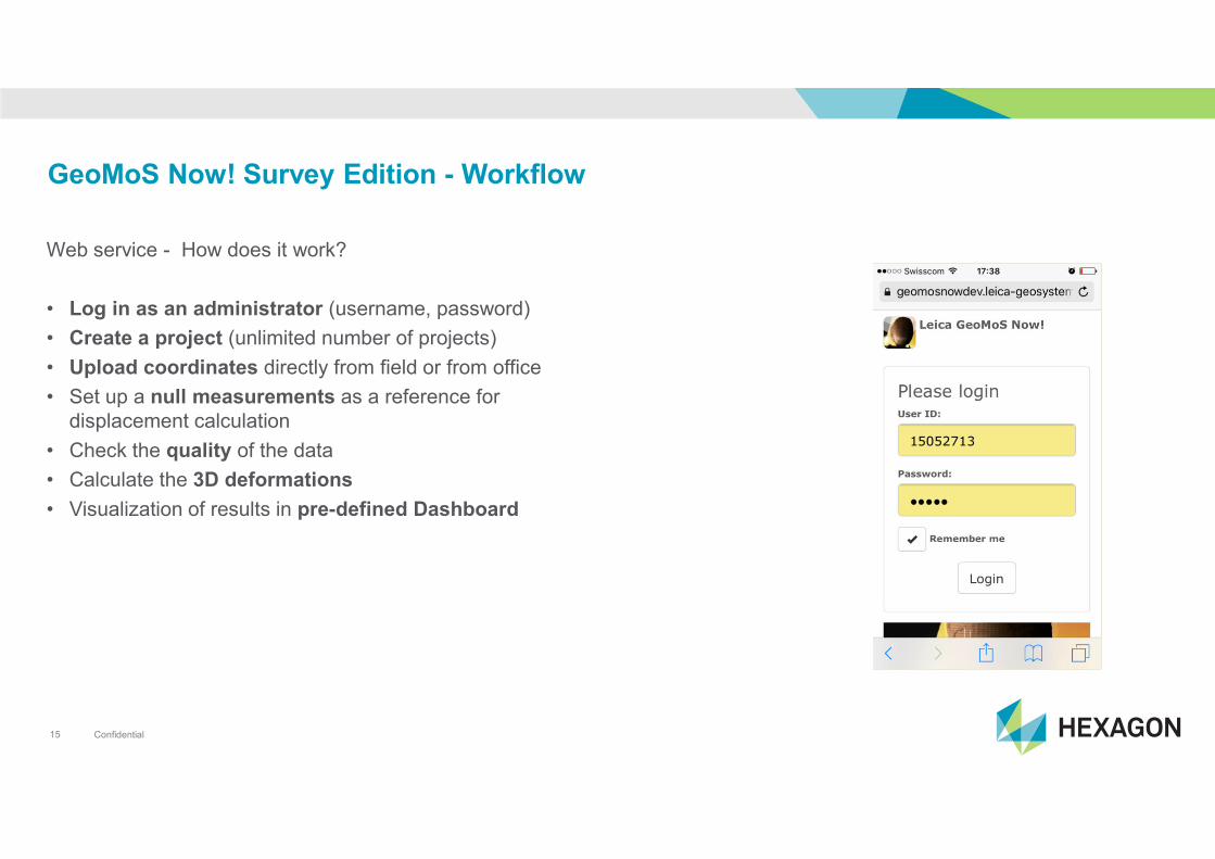
GeoMoS Now! Survey Edition - Workflow
Web service - How does it work?
• Log in as an administrator (username, password)
• Create a project (unlimited number of projects)
• Upload coordinates directly from field or from office
• Set up a null measurements as a reference for
displacement calculation
• Check the quality of the data
• Calculate the 3D deformations
• Visualization of results in pre-defined Dashboard
Confidential16
GeoMoS Now! Survey Edition - Workflow
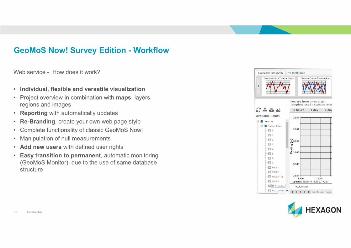
Web service - How does it work?
• Individual, flexible and versatile visualization
• Project overview in combination with maps, layers,
regions and images
• Reporting with automatically updates
• Re-Branding, create your own web page style
• Complete functionality of classic GeoMoS Now!
• Manipulation of null measurements
• Add new users with defined user rights
• Easy transition to permanent, automatic monitoring
(GeoMoS Monitor), due to the use of same database
structure
Confidential17
GeoMoS Now! Survey Edition - Workflow
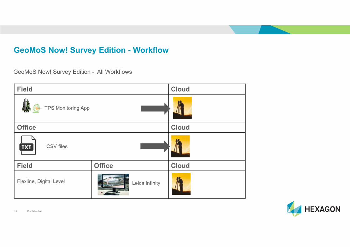
GeoMoS Now! Survey Edition - All Workflows

Confidential18
GeoMoS Now! Survey Edition – Look & Feel
TPS Monitoring App
Confidential19
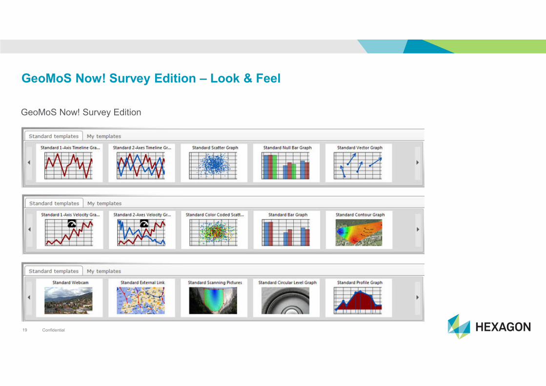
GeoMoS Now! Survey Edition – Look & Feel
GeoMoS Now! Survey Edition

Confidential20
Monitor, Analyze and Visualize
• All included
• From any data to final information
• Web based application
• Access information on any device
Expand to automatic monitoring – Centralize to single server
Leica GeoMoS
Monitor
Leica GeoMoS
Now!
Confidential21
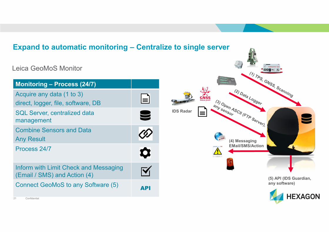
Expand to automatic monitoring – Centralize to single server
Leica GeoMoS Monitor
Monitoring – Process (24/7)
Acquire any data (1 to 3)
direct, logger, file, software, DB
SQL Server, centralized data
management
Combine Sensors and Data
Any Result
Process 24/7
Inform with Limit Check and Messaging
(Email / SMS) and Action (4)
Connect GeoMoS to any Software (5)API
(5) API (IDS Guardian,
any software)
(4) Messaging
EMail/SMS/Action
IDS Radar
Confidential22
Expand to automatic monitoring – Centralize to single server
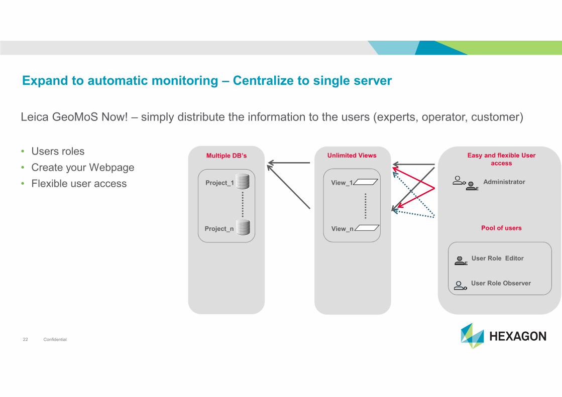
Leica GeoMoS Now! – simply distribute the information to the users (experts, operator, customer)
• Users roles
• Create your Webpage
• Flexible user access Project_1
Project_n
Multiple DB’s
View_1
View_n
Unlimited Views Easy and flexible User
access
Pool of users
User Role Editor
User Role Observer
Administrator
Confidential23
Expand to automatic monitoring – Centralize to single server
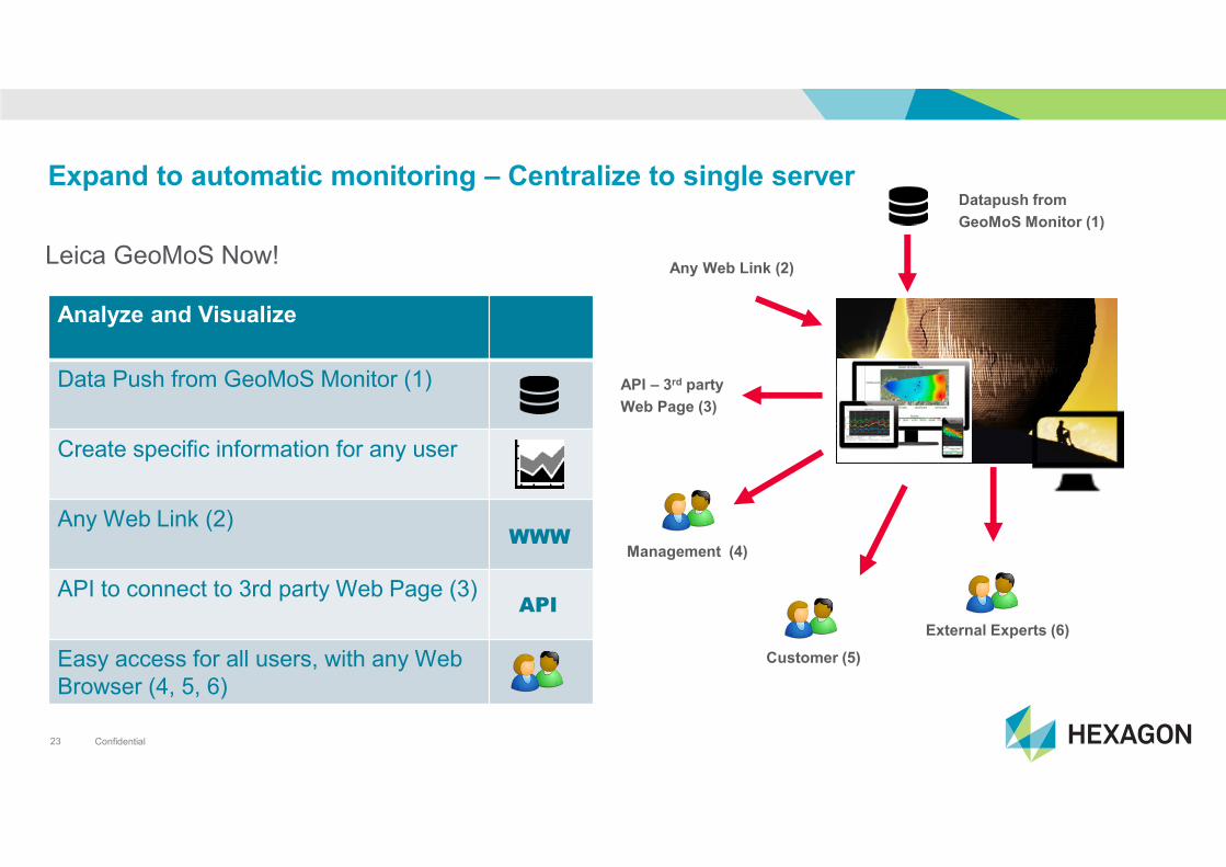
Leica GeoMoS Now!
Analyze and Visualize
Data Push from GeoMoS Monitor (1)
Create specific information for any user
Any Web Link (2)
API to connect to 3rd party Web Page (3)
Easy access for all users, with any Web
Browser (4, 5, 6)
WWW
API
Management (4)
Customer (5)
External Experts (6)
Any Web Link (2)
Datapush from
GeoMoS Monitor (1)
API – 3rd party
Web Page (3)
Confidential24
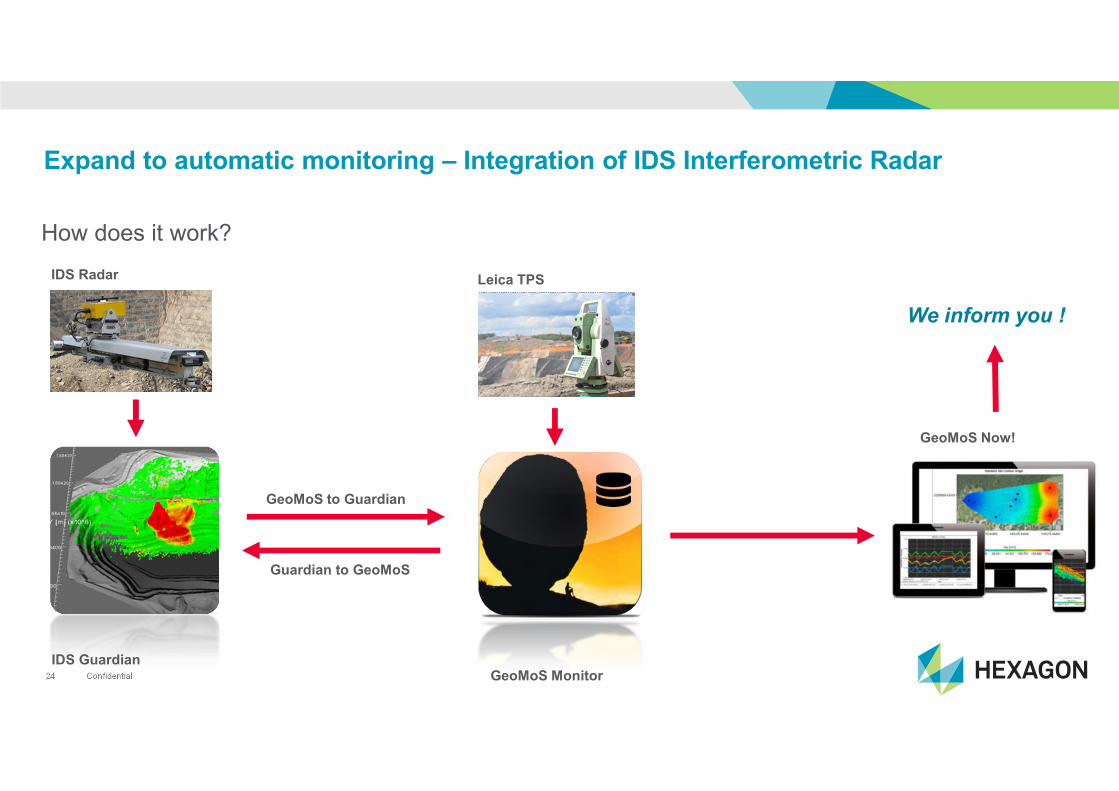
Expand to automatic monitoring – Integration of IDS Interferometric Radar
How does it work?
GeoMoS MonitorIDS Guardian
IDS Radar
GeoMoS to Guardian
Guardian to GeoMoS
Leica TPS
GeoMoS Now!
We inform you !
Confidential25
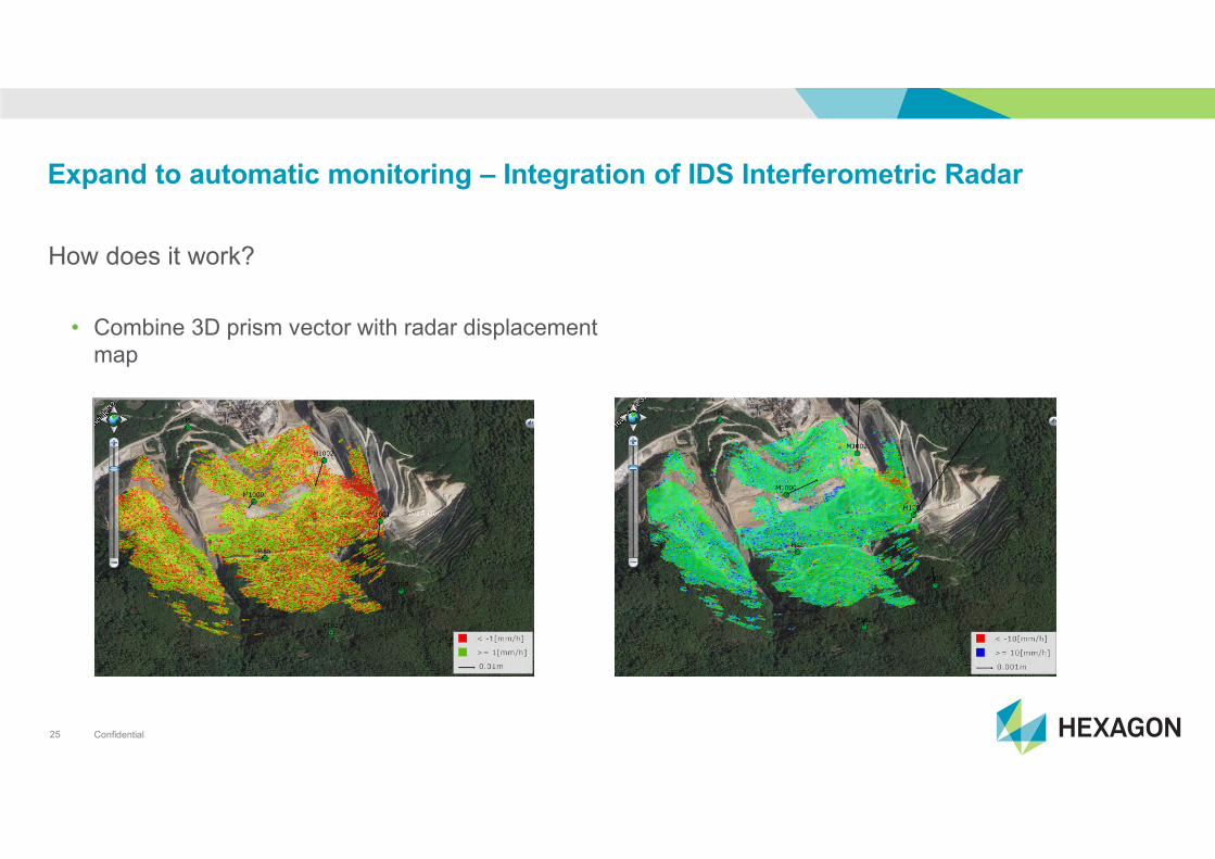
Expand to automatic monitoring – Integration of IDS Interferometric Radar
How does it work?
• Combine 3D prism vector with radar displacement
map
Confidential26
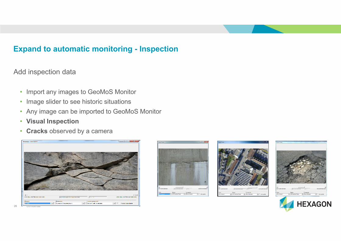
Expand to automatic monitoring - Inspection
Add inspection data
• Import any images to GeoMoS Monitor
• Image slider to see historic situations
• Any image can be imported to GeoMoS Monitor
• Visual Inspection
• Cracks observed by a camera
Confidential27
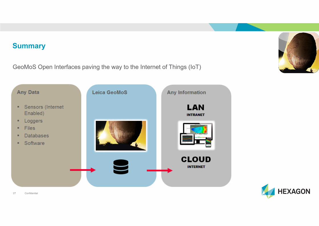
Summary
GeoMoS Open Interfaces paving the way to the Internet of Things (IoT)

Confidential28