the land where continents collided - lobos...
TRANSCRIPT
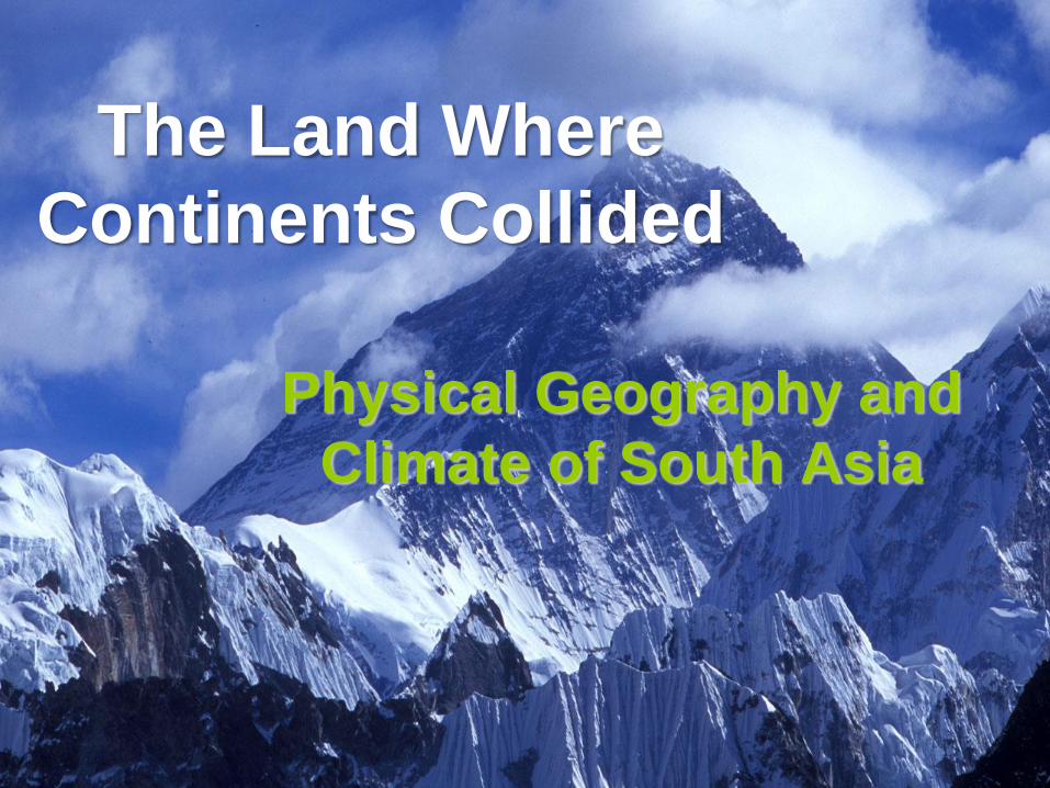
The Land Where
Continents Collided
Physical Geography and
Climate of South Asia
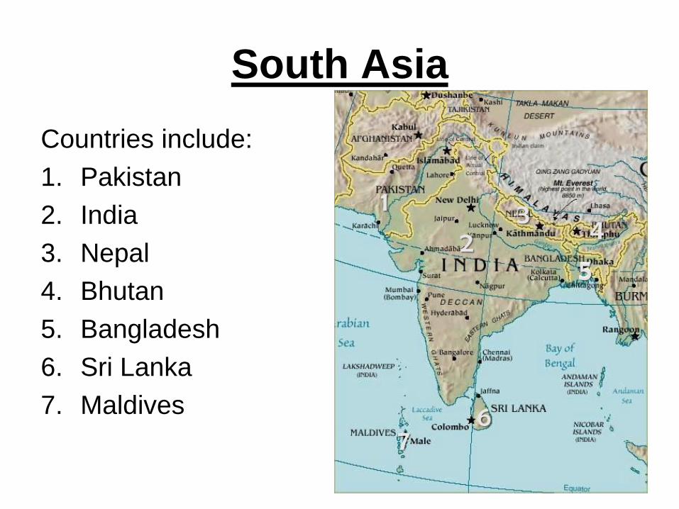
South Asia
Countries include:
1. Pakistan
2. India
3. Nepal
4. Bhutan
5. Bangladesh
6. Sri Lanka
7. Maldives
1
2 3
4
5 5
6 7
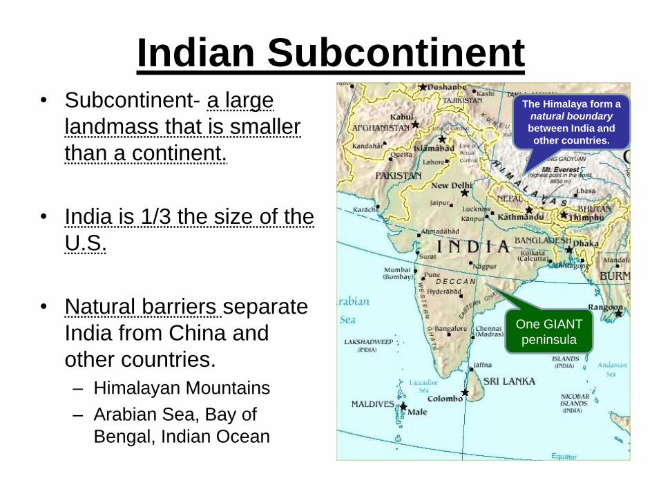
Indian Subcontinent • Subcontinent- a large
landmass that is smaller
than a continent.
• India is 1/3 the size of the
U.S.
• Natural barriers separate
India from China and
other countries.
– Himalayan Mountains
– Arabian Sea, Bay of
Bengal, Indian Ocean
One GIANT
peninsula
The Himalaya form a
natural boundary
between India and
other countries.

Himalaya Mountains • 50 million years ago, the
Indian subcontinent was
an island east of Africa.
– Tectonic forces caused the
subcontinent to drift
northward from Africa to
Asia.
– The collision between the
Indian subcontinent and
Asia created the Himalayan
mountain range.
physical
process
In which sphere
do earthquakes
occur?
TQ
Himalaya-
house of snow
TQ
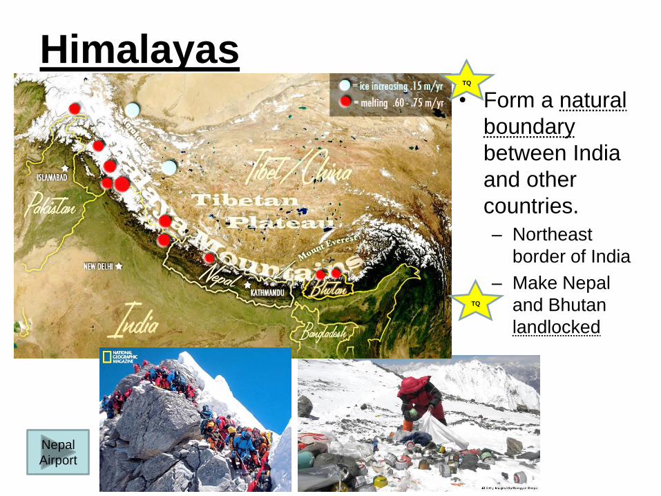
Himalayas • Form a natural
boundary
between India
and other
countries.
– Northeast
border of India
– Make Nepal
and Bhutan
landlocked
Nepal
Airport
TQ
TQ
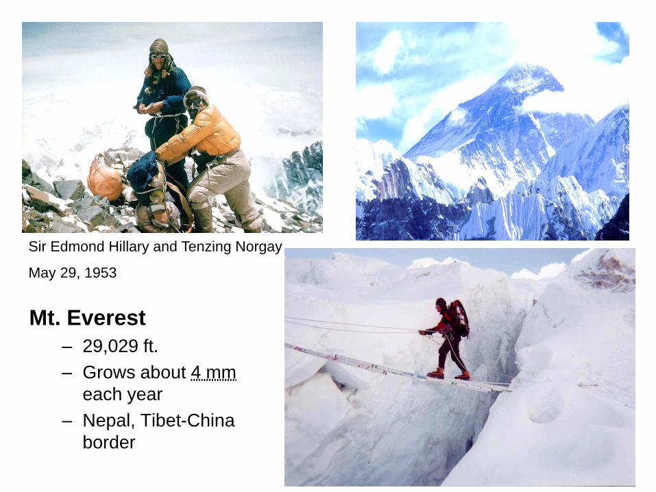
Sir Edmond Hillary and Tenzing Norgay
May 29, 1953
Mt. Everest
– 29,029 ft.
– Grows about 4 mm
each year
– Nepal, Tibet-China
border
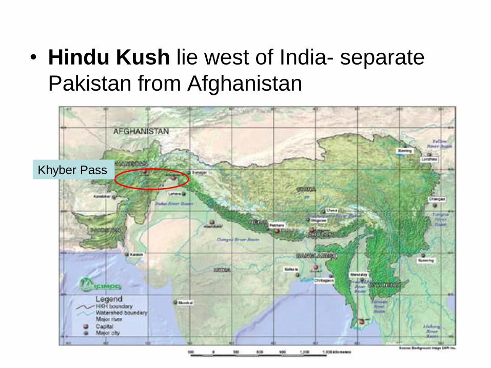
• Hindu Kush lie west of India- separate
Pakistan from Afghanistan
Khyber Pass
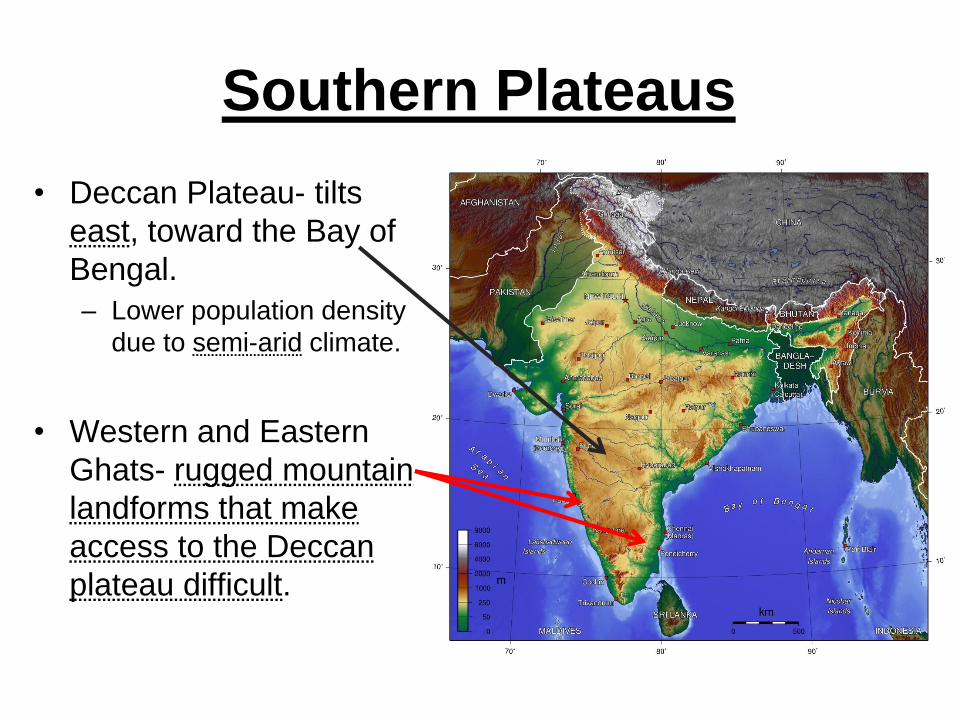
Southern Plateaus
• Deccan Plateau- tilts
east, toward the Bay of
Bengal.
– Lower population density
due to semi-arid climate.
• Western and Eastern
Ghats- rugged mountain
landforms that make
access to the Deccan
plateau difficult.

Pop Quiz 1. True or False. The Place where a river
begins is the origin.
2. The place where a river opens up into
the sea is an estuary or mouth.
Trick Question! It’s both. An estuary is the broadened seaward end of a river, where the river’s currents meet the ocean’s tides.

Great Rivers of the Indian Subcontinent
• Origins in the Himalayas
• Indus River flows
southwest through
Pakistan, into the Arabian
Sea.
• Ganges River flows
eastward across India to
the Bay of Bengal.
• Brahmaputra River winds
through Bangladesh.
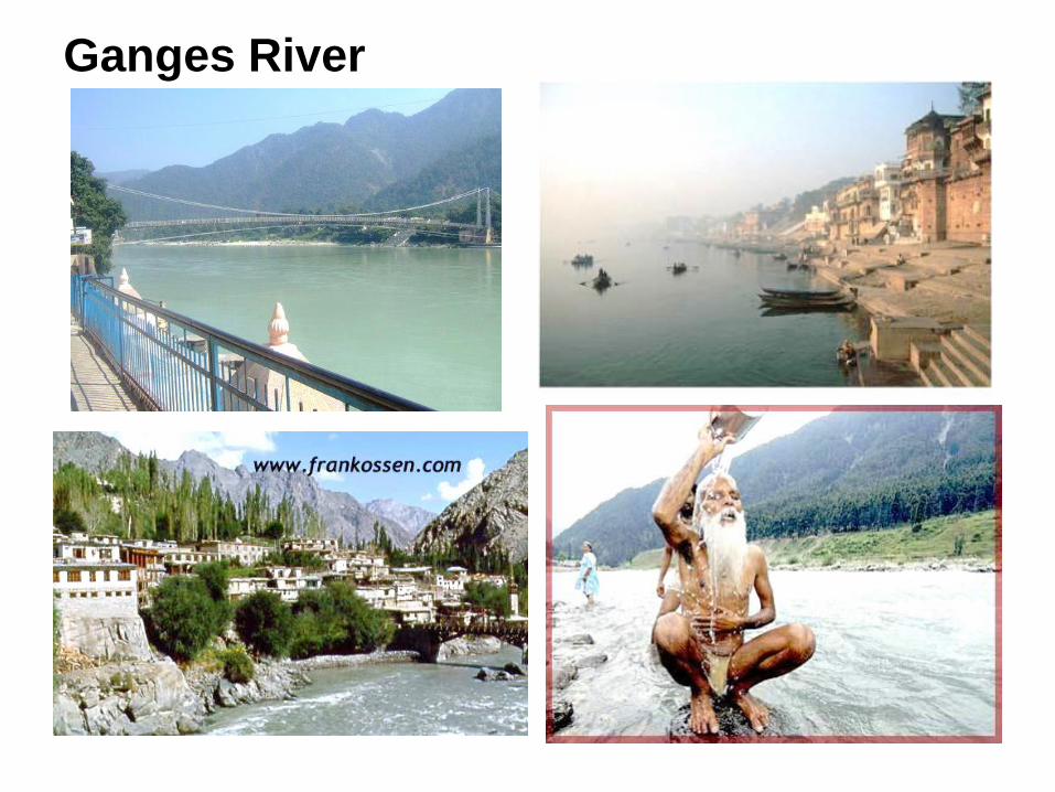
Ganges River
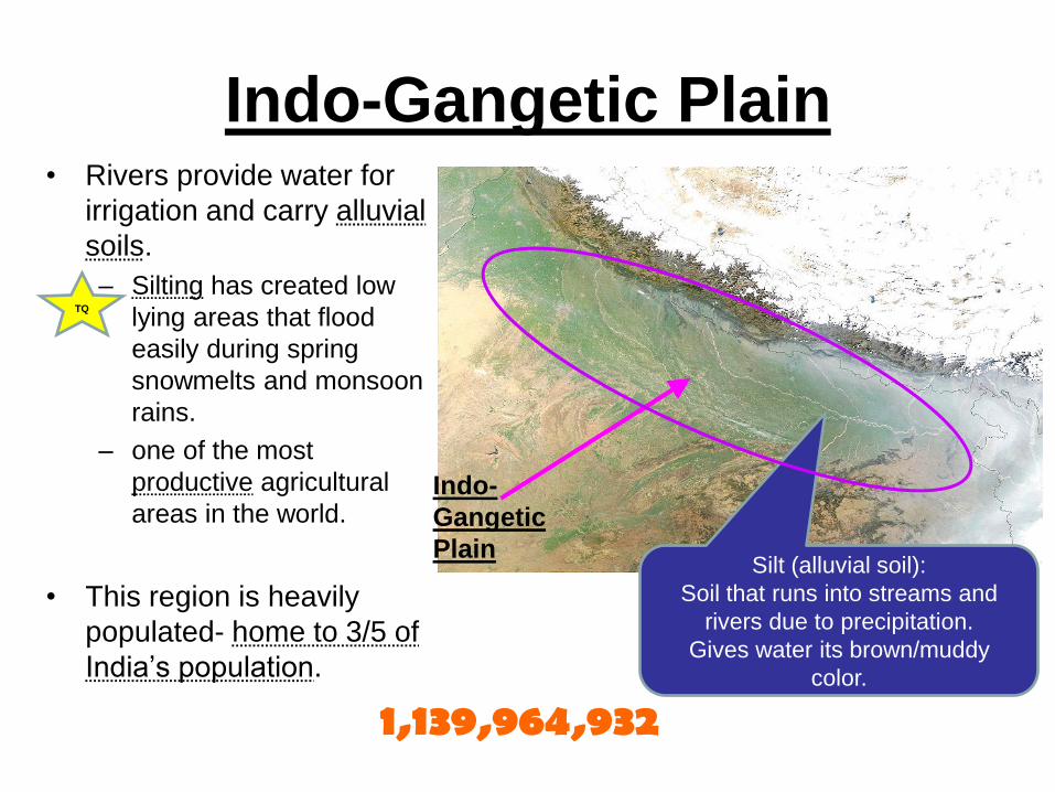
Indo-Gangetic Plain • Rivers provide water for
irrigation and carry alluvial
soils.
– Silting has created low
lying areas that flood
easily during spring
snowmelts and monsoon
rains.
– one of the most
productive agricultural
areas in the world.
• This region is heavily
populated- home to 3/5 of
India’s population.
1,139,964,932
Indo-
Gangetic
Plain Silt (alluvial soil):
Soil that runs into streams and
rivers due to precipitation.
Gives water its brown/muddy
color.
TQ
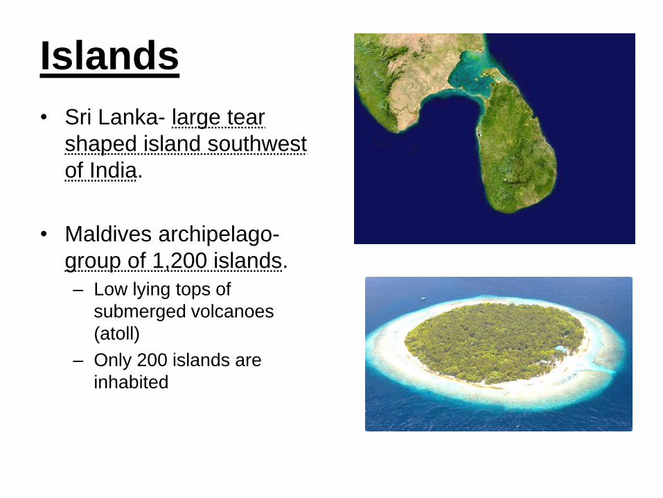
Islands
• Sri Lanka- large tear
shaped island southwest
of India.
• Maldives archipelago-
group of 1,200 islands.
– Low lying tops of
submerged volcanoes
(atoll)
– Only 200 islands are
inhabited

II. Natural Resources • Approximately of 50% of
India’s population relies
on primary industries for
survival.
• 56% of India has arable
land
– Sugarcane
– Rice
– Tobacco
– Tea
Arable:
land suitable
for plowing or
tilling
(farming)
Where in India
would you find
most of the
arable land?
Which South
Asian country
has the least
amount of
arable land?
TQ

III. South Asia’s Climate
• South Asia has 5 climate
zones.
– Highland- Himalayas and other
mountains
– Arid- Thar Desert, less than 10
inches of rain a year
– Humid subtropical–
Bangladesh and northeastern
India.
– Cherrapunji, India holds the
world record for most rainfall-
366 inches a year.
– Semi-arid- Central India,
fringes of the Thar Desert.
– Tropical wet– southwestern
India

• Monsoons
– Seasonal winds that bring rain.
– Winter monsoon (October-February), dry winds blow
from the northeast (Himalaya), push precipitation
away from South Asia, causing dry weather.
– Summer monsoon (June-September), winds from the
southwest (Arabian Sea) bring heavy rainfall. Bangladeshi houses on
stilts:
adaptation or modification?
TQ
TQ
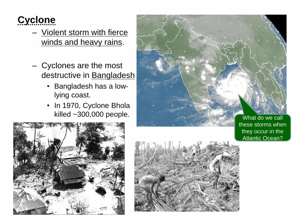
Cyclone
– Violent storm with fierce
winds and heavy rains.
– Cyclones are the most
destructive in Bangladesh
• Bangladesh has a low-
lying coast.
• In 1970, Cyclone Bhola
killed ~300,000 people. What do we call
these storms when
they occur in the
Atlantic Ocean?
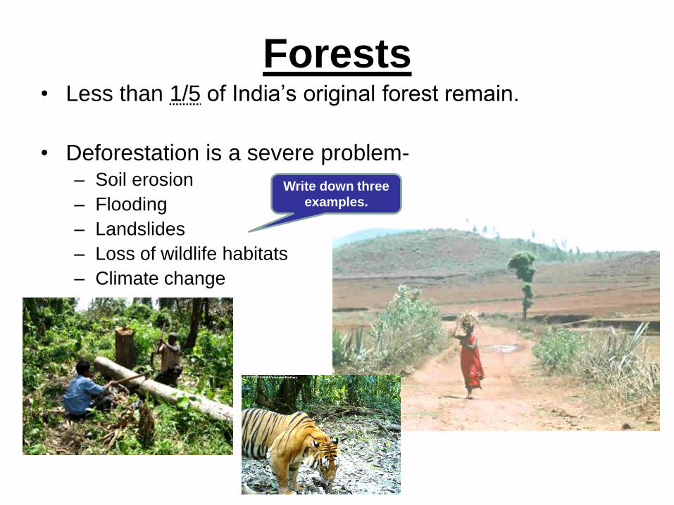
Forests • Less than 1/5 of India’s original forest remain.
• Deforestation is a severe problem- – Soil erosion
– Flooding
– Landslides
– Loss of wildlife habitats
– Climate change
Write down three
examples.

Warm-UP
1. True or False. Mt. Everest is the highest
peak in the world.
2. Which is the largest country in South
Asia?
3. True or False. Monsoons are strong
winds that bring heavy rains.