the elections and boundaries commission (local government ... · boundaries commission (local...
TRANSCRIPT

Legal Notice No.
REPUBLIC OF TRINIDAD AND TOBAGO
THE ELECTIONS AND BOUNDARIES COMMISSION (LOCAL GOVERNMENT
AND TOBAGO HOUSE OF ASSEMBLY) ACT, CHAP. 25:50
DRAFT ORDER
Made by the President under section 4 of the Elections and Boundaries Commission
(Local Government and Tobago House of Assembly) Act
THE ELECTIONS AND BOUNDARIES COMMISSION (LOCAL GOVERNMENT
AND TOBAGO HOUSE OF ASSEMBLY) (TOBAGO) ORDER, 2012
Chap. 1:01
Chap. 22:50
WHEREAS under section 71 of the Constitution of the Republic of Trinidad
and Tobago there is established an Elections and Boundaries Commission
(hereinafter referred to as “the Commission”):
And whereas under subsection (1) of section 4 of the Elections and
Boundaries Commission (Local Government and Tobago House of
Assembly) Act (hereinafter referred to as “the Act”), it is provided inter alia
that the Commission shall define and review the boundaries of the electoral
districts into which an electoral area is, or is to be, divided and shall submit
to the Minister reports either –
“(a) showing the constituencies into which it recommends that an
electoral area should be divided in order to give effect to the
Rules set out in the Second Schedule; or
(b) stating that, in the opinion of the Commission, no alteration
is required to the existing number of boundaries of electoral
districts in order to give effect to the said Rules”:
And whereas in accordance with subsection (1) of the said section 4 of
the Act, the Commission, on the 22nd
December, 2008, submitted to the
Minister a report in which it recommended that for the purposes of elections
to the Tobago House of Assembly no alteration is required to the existing
number of electoral districts into which the electoral area mentioned in Part
III of the First Schedule to the Act is divided and should be as defined in the
Schedule to this Order:
And whereas by subsection (3) of section 4 of the Act, it is provided
that as soon as may be after the Commission has submitted a report under
subsection (1), the Minister shall lay before the House of Representatives for
its approval, the draft of an Order for giving effect, whether with or without
modification, to the recommendations contained in the report:
And whereas a draft of this Order giving effect to the
recommendations contained in the Ninth Report of the Commission was laid
before the House of Representatives for its approval by the Minister on
the day of , 2012 and was approved by resolution of
the House of Representatives on the day of , 2012:

2
Now, therefore, I, GEORGE MAXWELL RICHARDS, President, do
hereby order as follows:
Citation 1. This Order may be cited as the Elections and
Boundaries Commission (Local Government and Tobago
House of Assembly) (Tobago) Order, 2012.
Boundaries
First Schedule 2. The boundaries of the electoral districts comprising
the electoral area mentioned in Part III of the First
Schedule to the Elections and Boundaries Commission
(Local Government and Tobago House of Assembly) Act
are defined in the Schedule to this Order.
SCHEDULE
NINTH REPORT OF THE ELECTIONS AND BOUNDARIES COMMISSION
ON ITS DEFINITION AND REVIEW OF THE BOUNDARIES OF THE
ELECTORAL DISTRICTS IN THE ELECTORAL AREA OF TOBAGO
To:
The Honourable Hazel Manning,
Minister of Local Government,
Kent House,
MARAVAL.
1. In accordance with Section 4 of the Elections and Boundaries Commission (Local
Government) Act, Chap. 25:50 as amended by the Elections and Boundaries Commission (Local
Government and Tobago House of Assembly) (Amendment and Validation) Act, 2008: Act No.
27 of 2008 (the Act), the Elections and Boundaries Commission (the Commission) submits its
Ninth Report on the definition and review of the boundaries of the electoral districts in the
electoral area of Tobago.
2. Section 4 of the Act provides inter alia as follows:
4. (1) The Commission shall define and review the boundaries of
the electoral districts into which an electoral area is, or is to be, divided
and shall submit to the Minister reports either –
(a) showing the constituencies into which it recommends that
an electoral area should be divided in order to give effect to
the Rules set out in the Second Schedule; or
(b) stating that, in the opinion of the Commission, no alteration
is required to the existing number of boundaries of electoral
districts in order to give effect to the said Rules.

3
(2) Reports under subsection (1) shall be submitted by the
Commission –
(a) in the case of its first report after the commencement of this
Act, not later than six months after the date of the
commencement;
(b) in the case of any subsequent report, not less than two nor
more than three years from the date of the submission of its
last report; and
(c) in the case of a report in reference to Tobago, not less than
two nor more than four years from the date of submission
of the last report.
3. The Commission’s last Report on the electoral area of Tobago was submitted to the
Honourable Minister of Local Government on August 23, 2004. However, the deadline of
August 22, 2008 for the presentation of this the Ninth Report could not be met because it became
necessary to enact legislation to correct the lacunae in the Elections and Boundaries Commission
(Local Government) Act, Chap. 25:50 discovered by the Commission shortly before the deadline
referred to in the foregoing. Such correction came in the form of Act No. 27 of 2008: The
Elections and Boundaries Commission (Local Government and Tobago House of Assembly)
(Amendment and Validation) Act, 2008, “An Act to amend the Elections and Boundaries
Commission (Local Government) Act, Chap. 25:50 to provide for the review and definition of
boundaries in the electoral area of Tobago for the purposes of elections in relation to the Tobago
House of Assembly and to validate certain Reports of the Elections and Boundaries Commission
in respect of the electoral area of Tobago”. The Act was assented to on December 12, 2008.
4. The Honourable Minister should note that because the instant report is submitted out of
time it may not be presented to Parliament for consideration unless its submission out of time is
first validated. A similar validation was enacted by Act No. 31 of 1996: An Act to validate the
Sixth Report of the Elections and Boundaries Commission (Tobago) Act, 1996.
5. For the present purposes, the effect of the relevant provisions of the Act is as follows:
(i) Tobago is divided into twelve electoral districts; and
(ii) the Commission may in consideration of Rule 3 of the Second Schedule of the
Act vary the number of electors in any electoral district “provided that in no case
shall the number of electors in any one electoral district of an electoral area
exceed or be less than the number of electors in any other electoral district of that
electoral area by more than twenty-five percent”.

4
Rule 3 referred to above, provides as follows:-
“In the division of electoral districts in regional electoral areas natural
boundaries such as major highways and rivers shall be used wherever
possible.”
6. For the purpose of considering its recommendations, the Commission compared the
electorate of 2004 with that of 2008. The relevant data are set out in the table attached hereto
and marked Appendix A. They reveal, inter alia, that the:
(a) electorate in the 12 electoral districts of Tobago rose from 38,142 to 41,899, an increase
of 3,757 or approximately 9%;
(b) highest electorate is 3,853 and the lowest electorate is 3,243;
(c) highest electorate exceeds the lowest by 18.8 percent (%);
(d) highest electorate being 3,853, the minimum electorate permissible is 2,890;
(e) lowest electorate being 3,243, the maximum electorate permissible is 4,054; and
(f) electorate in each electoral district falls within the maximum and minimum levels
permitted.
7. Consequently, the Commission considers that no adjustment is necessary to the
boundaries of any of the electoral districts in the electoral area of Tobago.
8. However, the Commission, having observed that the community of Belle Garden
straddles both the electoral districts of Belle Garden/Goodwood and Roxborough/Delaford with
the western portion falling in Belle Garden/Goodwood and the eastern portion in
Roxborough/Delaford, considers that the names of the two electoral districts should be changed
to more accurately reflect that fact. The Commission, accordingly considers that the name Belle
Garden/Goodwood should be changed to Goodwood/Belle Garden West and the name
Roxborough/Delaford be changed to Belle Garden East/Roxborough/Delaford.
9. The Commission accordingly recommends that:
(a) there should be no change in the boundaries of the 12 electoral districts in the electoral
area of Tobago;
(b) the names of the electoral districts now known as Belle Garden/Goodwood and
Roxborough/Delaford should be changed to Goodwood/Belle Garden West and Belle
Garden East/Roxborough/Delaford, respectively;
(c) each of the said twelve electoral districts for the electoral area of Tobago should carry the
names as shown in Appendix B attached hereto;
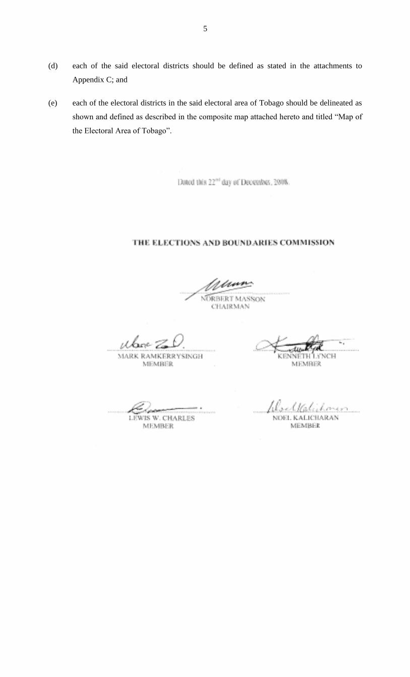
5
(d) each of the said electoral districts should be defined as stated in the attachments to
Appendix C; and
(e) each of the electoral districts in the said electoral area of Tobago should be delineated as
shown and defined as described in the composite map attached hereto and titled “Map of
the Electoral Area of Tobago”.

6
APPENDIX A
DATA ON THE DISTRIBUTION OF THE ELECTORATE IN EXISTING ELECTORAL DISTRICTS IN TOBAGO
…………………………………………………………………………………………………………………
Electorate as at Electorate as at August 23, 2004 June 25, 2008 ………………………………………………………………………………………………………………… Electoral Districts 2004 2008 ………………………………………………………………………………………………………………… 1. Bacolet/Mt. St. George 2,961 3,243 2. Belle Garden/Goodwood 3,300 3,626 3. Bethel/Mt. Irvine 3,326 3,514 4. Black Rock/Whim/Spring Garden 3,345 3,853 5. Buccoo/Mt. Pleasant 2,901 3,475 6. Canaan/Bon Accord 3,178 3,321 7. Lambeau/Signal Hill 3,334 3,675 8. Parlatuvier/L’anse Fourmi/Speyside 3,098 3,313 9. Plymouth/Golden Lane 3,107 3,370 10. Providence/Mason Hall/Moriah 3,325 3,661 11. Roxborough/Delaford 3,060 3,349 12. Scarborough/Calder Hall 3,207 3,499 TOTALS 38,142 41,899

7
THIS PAGE IS INTENTIONALLY LEFT BLANK

8
APPENDIX B
NAMES OF ELECTORAL DISTRICTS RECOMMENDED FOR TOBAGO AND THE NUMBER OF ELECTORS PROPOSED FOR EACH SUCH DISTRICT
Total Electorate … … … … … … … 41,899
Highest Electorate in an Electoral Area … … … … 3,853
Lowest Electorate in an Electoral Area … … … … 3,243 Maximum Electorate permissible in an Electoral District … … 4,054 Minimum Electorate permissible in an Electoral District … … 2,890 …………………………………………………………………………………………………………………... NAME OF ELECTORAL DISTRICT NO. OF ELECTORS …………………………………………………………………………………………………………………... BACOLET/MT. ST. GEORGE … … … 3,243
BELLE GARDEN EAST/ROXBOROUGH/DELAFORD … … 3,349
BETHEL/MT. IRVINE … … … 3,514
BLACK ROCK/WHIM/SPRING GARDEN … … … 3,853
BUCCOO/MT. PLEASANT … … … 3,475
CANAAN/BON ACCORD … … … 3,321
GOODWOOD/BELLE GARDEN WEST … … … 3,626
LAMBEAU/SIGNALHILL … … … 3,675
PARLATUVIER/L’ANSE FOURMI/SPEYSIDE … … … 3,313
PLYMOUTH/GOLDEN LANE … … … 3,370
PROVIDENCE/MASON HALL/MORIAH … … … 3,661
SCARBOROUGH/CALDER HALL … … … 3,499
TOTAL 41,899

9
THIS PAGE IS INTENTIONALLY LEFT BLANK
10
APPENDIX C
BOUNDARIES OF PROPOSED ELECTORAL DISTRICTS

11
THIS PAGE IS INTENTIONALLY LEFT BLANK
12
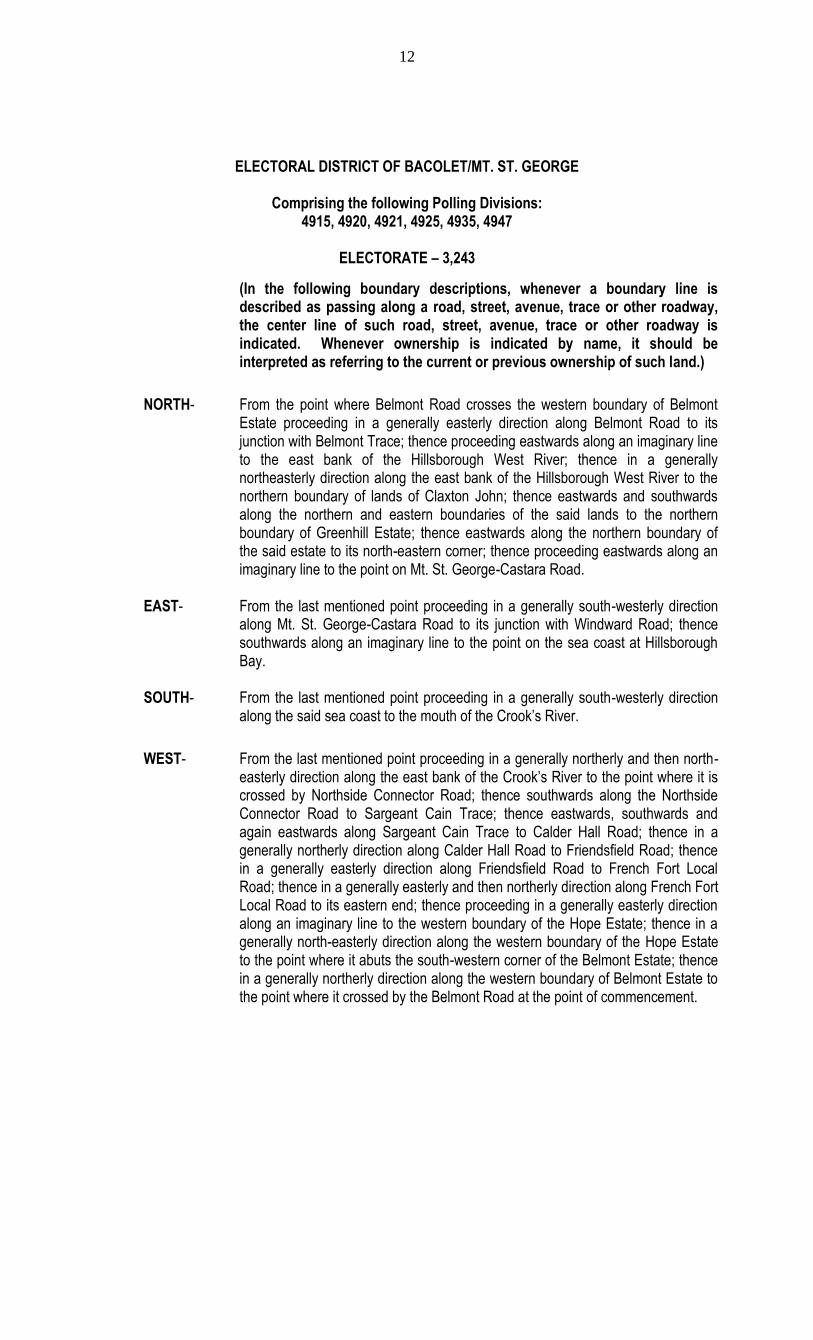
ELECTORAL DISTRICT OF BACOLET/MT. ST. GEORGE
Comprising the following Polling Divisions: 4915, 4920, 4921, 4925, 4935, 4947
ELECTORATE – 3,243
(In the following boundary descriptions, whenever a boundary line is described as passing along a road, street, avenue, trace or other roadway, the center line of such road, street, avenue, trace or other roadway is indicated. Whenever ownership is indicated by name, it should be interpreted as referring to the current or previous ownership of such land.)
NORTH- From the point where Belmont Road crosses the western boundary of Belmont Estate proceeding in a generally easterly direction along Belmont Road to its junction with Belmont Trace; thence proceeding eastwards along an imaginary line to the east bank of the Hillsborough West River; thence in a generally northeasterly direction along the east bank of the Hillsborough West River to the northern boundary of lands of Claxton John; thence eastwards and southwards along the northern and eastern boundaries of the said lands to the northern boundary of Greenhill Estate; thence eastwards along the northern boundary of the said estate to its north-eastern corner; thence proceeding eastwards along an imaginary line to the point on Mt. St. George-Castara Road.
EAST- From the last mentioned point proceeding in a generally south-westerly direction
along Mt. St. George-Castara Road to its junction with Windward Road; thence southwards along an imaginary line to the point on the sea coast at Hillsborough Bay.
SOUTH- From the last mentioned point proceeding in a generally south-westerly direction
along the said sea coast to the mouth of the Crook’s River.
WEST- From the last mentioned point proceeding in a generally northerly and then north-easterly direction along the east bank of the Crook’s River to the point where it is crossed by Northside Connector Road; thence southwards along the Northside Connector Road to Sargeant Cain Trace; thence eastwards, southwards and again eastwards along Sargeant Cain Trace to Calder Hall Road; thence in a generally northerly direction along Calder Hall Road to Friendsfield Road; thence in a generally easterly direction along Friendsfield Road to French Fort Local Road; thence in a generally easterly and then northerly direction along French Fort Local Road to its eastern end; thence proceeding in a generally easterly direction along an imaginary line to the western boundary of the Hope Estate; thence in a generally north-easterly direction along the western boundary of the Hope Estate to the point where it abuts the south-western corner of the Belmont Estate; thence in a generally northerly direction along the western boundary of Belmont Estate to the point where it crossed by the Belmont Road at the point of commencement.

13
ELECTORAL DISTRICT OF BELLE GARDEN EAST/ROXBOROUGH/DELAFORD
Comprising the following Polling Divisions: 5025, 5030, 5035, 5040, 5045
ELECTORATE – 3,349
(In the following boundary descriptions, whenever a boundary line is described as passing along a road, street, avenue, trace or other roadway, the center line of such road, street, avenue, trace or other roadway is indicated. Whenever ownership is indicated by name, it should be interpreted as referring to the current or previous ownership of such land.)
NORTH- From the point on the crest of the main ridge of hills, at the source of the Belle River proceeding in a generally north-easterly direction along the said crest of the main ridge of hills to the point where an imaginary line drawn northwards from the point where Windsor Local Road crosses the southern boundary of the Tobago Forest Reserve meets it.
EAST- From the last mentioned point proceeding in a generally southerly direction along
the said imaginary line to the point where Windsor Local Road crosses the southern boundary of the Tobago Forest Reserve; thence in a generally southerly direction along Windsor Local Road to Windward Road; thence in a generally north-easterly direction along Windward Road to Delaford Bay Street; thence in a generally south-westerly direction along Delaford Bay Street to its southern end; thence in a generally south-easterly direction along an imaginary line to the point on the sea coast at Delaford Bay.
SOUTH- From the last mentioned point proceeding in a generally southerly and then south-
westerly direction along the said sea coast to the point at the southern end of Belle Garden Bay Road.
WEST- From the last mentioned point proceeding in a generally north-westerly direction along Belle Garden Bay Road to Windward Road; thence in a generally north-westerly direction along Windward Road to Zion Hill Road; thence in a generally north-westerly direction along Zion Hill Road to the point where it crosses the east bank of the Belle River; thence in a generally northerly direction along the east bank of the Belle River to the point at its source on the crest of the main ridge of hills at the point of commencement.

14
ELECTORAL DISTRICT OF BETHEL/MT. IRVINE
Comprising the following Polling Divisions: 4865, 4866, 4870, 4875, 4876
ELECTORATE – 3,514
(In the following boundary descriptions, whenever a boundary line is described as passing along a road, street, avenue, trace or other roadway, the center line of such road, street, avenue, trace or other roadway is indicated. Whenever ownership is indicated by name, it should be interpreted as referring to the current or previous ownership of such land.)
NORTH From the point on the sea coast where an imaginary line drawn westwards from & the western end of Courland Bush Trace meets it proceeding in a generally
easterly direction along the said imaginary line to the western end of Courland Bush Trace; thence proceeding in a generally south-easterly direction along Courland Bush Trace to its junction with Grafton Road and Mount Hay Trace at LP #50; thence in a generally south-easterly direction along Mount Hay Trace to its junction with Orange Hill Road at the 3 Mile Mark; thence in a generally southerly direction along an imaginary line to the point where an Estate Trace crosses the southern boundary of the Prospect Estate; thence in a generally south-westerly direction along the said Estate Trace passing through Riseland Estate to the point where it meets the north-eastern corner of the Sherwood Estate; thence in a generally southerly direction along the eastern boundary of the Sherwood Estate to its south-eastern corner where it abuts the Auchenskeoch-Buccoo Bay Road.
SOUTH- From the last mentioned point proceeding in a generally westerly direction along
the Auchenskeoch-Buccoo Bay Road to Buccoo Road; thence in a generally westerly direction along Buccoo Road to its junction with Shirvan Road.
WEST- From the last mentioned point proceeding in a generally northerly direction along
Shirvan Road to Grafton Road; thence in a generally north-easterly direction along Grafton Road to its junction with Orange Hill Road; thence in a generally westerly direction along an imaginary line to the point on the sea coast; thence in a generally northerly and then north-easterly direction along the said sea coast to the point where an imaginary line drawn westwards from the western end of Courland Bush Trace meets it at the point of commencement.
EAST-

15
ELECTORAL DISTRICT OF BLACK ROCK/WHIM/SPRING GARDEN
Comprising the following Polling Divisions:
4871, 4890, 4892, 4895, 4896, 4950, 4951
ELECTORATE – 3,853
(In the following boundary descriptions, whenever a boundary line is described as passing along a road, street, avenue, trace or other roadway, the center line of such road, street, avenue, trace or other roadway is indicated. Whenever ownership is indicated by name, it should be interpreted as referring to the current or previous ownership of such land.)
NORTH- From the point on the sea coast at the mouth of the Courland River at Courland Bay proceeding in a generally north-easterly direction along the south bank of the Courland River to an Estate Trace which runs through the lands of Thomas Sandy and the Franklyn’s Estate; thence in a generally north-easterly direction along the said Estate Trace passing through lands of Thomas Sandy and the Franklyn’s Estate to Franklyn Road; thence in a generally northerly direction along Franklyn Road to Arnos Vale Road; thence in a generally north-easterly direction along Arnos Vale Road to its junction with Providence Road.
EAST- From the last mentioned point proceeding in a generally south-easterly, easterly and then southerly direction along Providence Road to its junction with Mt. Pellier Trace; thence in a generally westerly direction along Mt. Pellier Trace to its western end at LP #1; thence in a generally westerly direction along an imaginary line to the northern end of Logwood Park Trace; thence in a generally southerly and then westerly direction along Logwood Park Trace to Glen Road; thence in a generally north-westerly and then westerly direction along Glen Road to its junction with Plymouth Road at LP #30; thence in a generally south-easterly direction along Plymouth Road to its junction with Milford Road: thence in a generally southerly direction along an imaginary line to the point on the sea coast.
SOUTH- From the last mentioned point proceeding in a generally south-westerly direction along the said sea coast to the point where an imaginary line drawn southwards from the junction of Milford Road and Orange Hill Road meets it.
WEST- From the last mentioned point proceeding in a generally northerly direction along the said imaginary line to the junction of Milford Road and Orange Hill Road; thence in a generally north-westerly direction along Orange Hill Road to its junction with the Claude Noel Highway; thence in a generally north-easterly direction along the Claude Noel Highway to its junction with Spring Garden Trace Extension at LP #315, west of the Mt. Marie Walkover; thence in a generally northerly direction along Spring Garden Trace Extension to Spring Garden Trace; thence in a generally northerly direction along Spring Garden Trace to its junction with Plymouth Road at LP #61; thence in a north-westerly direction along Plymouth Road to Union Village Trace; thence in a generally south-westerly direction along Union Village Trace to Orange Hill Road; thence in a generally south-westerly direction along Orange Hill Road to its junction with Mount Hay Trace at the 3 Mile Mark; thence in a generally north-westerly direction along Mount Hay Trace to its junction with Grafton Road and Courland Bush Trace at LP #50; thence in a generally north-westerly direction along Courland Bush Trace to its western end; thence in a generally westerly direction along an imaginary line to the point on the sea coast; thence in a generally north-easterly direction along the said sea coast to the mouth of the Courland River at Courland Bay at the point of commencement.
16
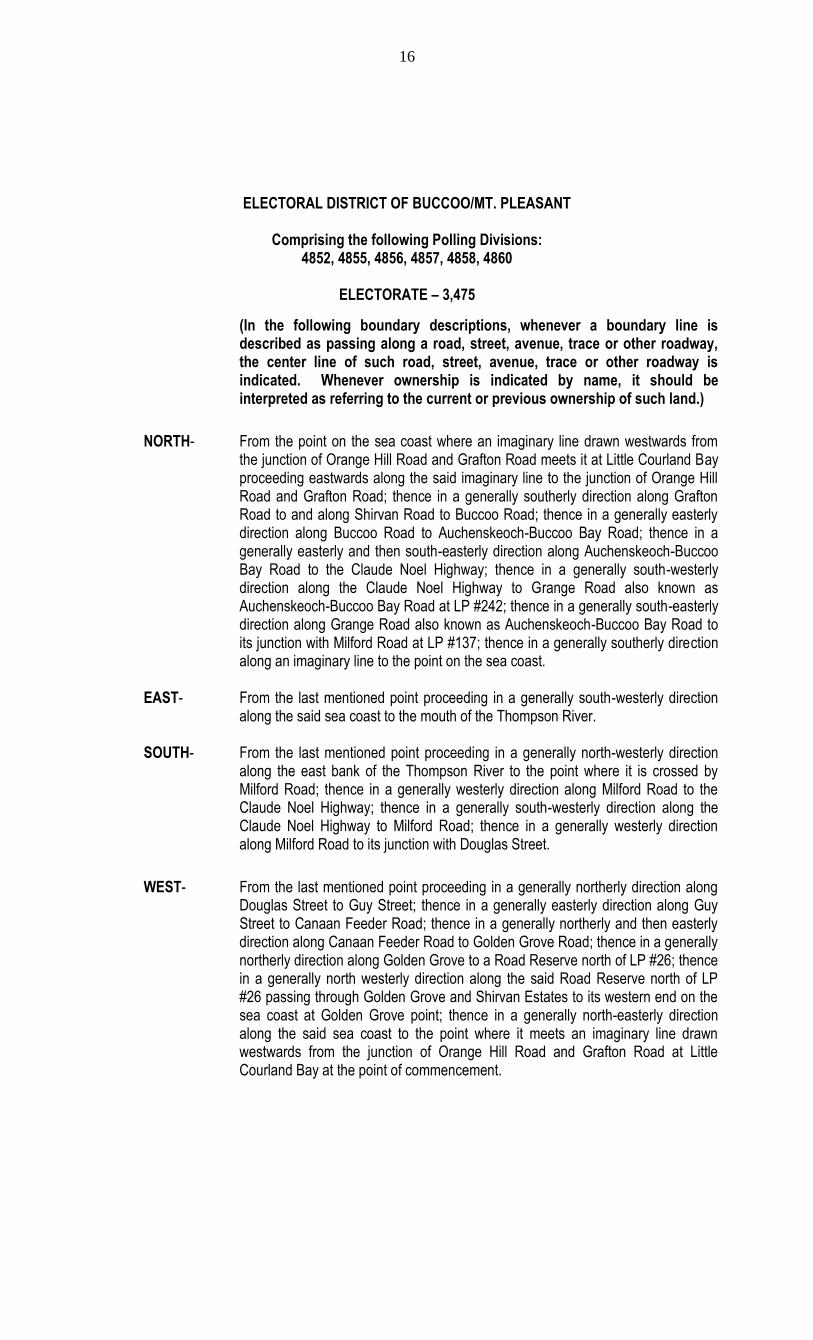
ELECTORAL DISTRICT OF BUCCOO/MT. PLEASANT
Comprising the following Polling Divisions:
4852, 4855, 4856, 4857, 4858, 4860
ELECTORATE – 3,475
(In the following boundary descriptions, whenever a boundary line is described as passing along a road, street, avenue, trace or other roadway, the center line of such road, street, avenue, trace or other roadway is indicated. Whenever ownership is indicated by name, it should be interpreted as referring to the current or previous ownership of such land.)
NORTH- From the point on the sea coast where an imaginary line drawn westwards from the junction of Orange Hill Road and Grafton Road meets it at Little Courland Bay proceeding eastwards along the said imaginary line to the junction of Orange Hill Road and Grafton Road; thence in a generally southerly direction along Grafton Road to and along Shirvan Road to Buccoo Road; thence in a generally easterly direction along Buccoo Road to Auchenskeoch-Buccoo Bay Road; thence in a generally easterly and then south-easterly direction along Auchenskeoch-Buccoo Bay Road to the Claude Noel Highway; thence in a generally south-westerly direction along the Claude Noel Highway to Grange Road also known as Auchenskeoch-Buccoo Bay Road at LP #242; thence in a generally south-easterly direction along Grange Road also known as Auchenskeoch-Buccoo Bay Road to its junction with Milford Road at LP #137; thence in a generally southerly direction along an imaginary line to the point on the sea coast.
EAST- From the last mentioned point proceeding in a generally south-westerly direction
along the said sea coast to the mouth of the Thompson River. SOUTH- From the last mentioned point proceeding in a generally north-westerly direction
along the east bank of the Thompson River to the point where it is crossed by Milford Road; thence in a generally westerly direction along Milford Road to the Claude Noel Highway; thence in a generally south-westerly direction along the Claude Noel Highway to Milford Road; thence in a generally westerly direction along Milford Road to its junction with Douglas Street.
WEST- From the last mentioned point proceeding in a generally northerly direction along Douglas Street to Guy Street; thence in a generally easterly direction along Guy Street to Canaan Feeder Road; thence in a generally northerly and then easterly direction along Canaan Feeder Road to Golden Grove Road; thence in a generally northerly direction along Golden Grove to a Road Reserve north of LP #26; thence in a generally north westerly direction along the said Road Reserve north of LP #26 passing through Golden Grove and Shirvan Estates to its western end on the sea coast at Golden Grove point; thence in a generally north-easterly direction along the said sea coast to the point where it meets an imaginary line drawn westwards from the junction of Orange Hill Road and Grafton Road at Little Courland Bay at the point of commencement.
17
ELECTORAL DISTRICT OF CANAAN/BON ACCORD
Comprising the following Polling Divisions: 4845, 4846, 4847, 4850, 4851
ELECTORATE – 3,321
In the following boundary descriptions, whenever a boundary line is described as passing along a road, street, avenue, trace or other roadway, the center line of such road, street, avenue, trace or other roadway is indicated. Whenever ownership is indicated by name, it should be interpreted as referring to the current or previous ownership of such land.)
NORTH From the point on the sea coast at Golden Grove Point where an imaginary line
drawn westwards from the western end of a Road Reserve meets it proceeding in a generally easterly direction along the said imaginary line to the western end of the Road Reserve; thence in a generally easterly and then south-easterly direction along the said Road Reserve passing through the Golden Grove and Shirvan Estates to its junction with Golden Grove Road north of LP #26; thence in a generally southerly direction along Golden Grove Road to Canaan Feeder Road; thence in a generally westerly and then southerly direction along Canaan Feeder Road to Guy Street; thence in a generally westerly direction along Guy Street to Douglas Street; thence in a generally southerly direction along Douglas Street to Milford Road; thence in a generally easterly direction along Milford Road to the Claude Noel Highway; thence in a generally north-easterly direction along the Claude Noel Highway to Milford Road; thence in a generally easterly direction along Milford Road to the point where it crosses the south bank of the Thompson River; thence in a generally easterly direction along the south bank of the Thompson River to its mouth on the sea coast.
EAST, From the last mentioned point proceeding in a generally southerly, westerly,
northerly and then easterly direction along the said sea coast to the point where an imaginary line drawn westwards from the western end of a Road Reserve at Golden Grove Point meets it at the point of commencement.
SOUTH &
WEST-

18
ELECTORAL DISTRICT OF GOODWOOD/BELLE GARDEN WEST
Comprising the following Polling Divisions: 4930, 5050, 5055, 5060, 5065
ELECTORATE – 3,626
(In the following boundary descriptions, whenever a boundary line is described as passing along a road, street, avenue, trace or other roadway, the center line of such road, street, avenue, trace or other roadway is indicated. Whenever ownership is indicated by name, it should be interpreted as referring to the current or previous ownership of such land.)
NORTH- From the point on the crest of the main ridge of hills at the northern end of Mt. St. George-Castara Road proceeding in a generally easterly direction along the said ridge of hills to the point at the source of the Belle River.
EAST- From the last mentioned point proceeding in a generally southerly direction along
the west bank of the Belle River to the point where it is crossed by Zion Hill Road; thence in a generally south-easterly direction along Zion Hill Road to Windward Road; thence south-eastwards along Windward Road to Belle Garden Bay Road; thence in a generally south-easterly direction along the Belle Garden Bay Road to its southern end on the sea coast at Mangrove Bay.
SOUTH- From the mast mentioned point proceeding in a generally south-westerly direction
along the said sea coast to the point where an imaginary line drawn southwards from the junction of the Mt. St. George-Castara Road and Windward Road meets the sea coast at Hillsborough Bay.
WEST- From the last mentioned point proceeding northwards along the said imaginary line to the junction of Mt. St. George-Castara Road and Windward Road; thence in a generally north-easterly and then north-westerly direction along Mt. St. George-Castara Road to the point where it crosses the crest of the main ridge of hills at the point of commencement.

19
ELECTORAL DISTRICT OF LAMBEAU/SIGNAL HILL
Comprising the following Polling Divisions: 4880, 4881, 4885, 4886, 4887, 4891
ELECTORATE – 3,675
(In the following boundary descriptions, whenever a boundary line is described as passing along a road, street, avenue, trace or other roadway, the center line of such road, street, avenue, trace or other roadway is indicated. Whenever ownership is indicated by name, it should be interpreted as referring to the current or previous ownership of such land.)
NORTH- From the junction of Mount Hay Trace and Orange Hill Road at the 3 Mile Mark proceeding in a generally north-easterly direction along Orange Hill Road to Union Village Trace; thence in a generally north-easterly direction along Union Village Trace to Plymouth Road; thence in a generally south-easterly direction along Plymouth Road to its junction with Spring Garden Trace at LP #61.
EAST- From the last mentioned point proceeding in a generally southerly direction along
Spring Garden Trace to Spring Garden Trace Extension; thence in a generally southerly direction along Spring Garden Trace Extension to its junction with Claude Noel Highway at LP #315 west of the Mt. Marie Walkover; thence in a generally south-westerly direction along the Claude Noel Highway to Orange Hill Road; thence in a generally south-easterly direction along Orange Hill Road to its junction with Milford Road; thence in a generally south-easterly direction along an imaginary line to the point on the sea coast.
SOUTH- From the mast mentioned point proceeding in a generally south-westerly direction
along the said sea coast to the point where an imaginary line drawn in a generally south-easterly direction from the junction of Milford Road and Auchenskeoch-Buccoo Bay Road meets it.
WEST- From the last mentioned point proceeding in a generally north-westerly direction along the said imaginary line to the junction of Milford Road and Auchenskeoch-Buccoo Bay Road at LP #137; thence in a generally north-westerly direction along Auchenskeoch-Buccoo Bay Road also known as Grange Road to the Claude Noel Highway at LP #242; thence in a generally north-easterly direction along the Claude Noel Highway to Auchenskeoch-Buccoo Bay Road; thence in a generally north-westerly direction along Auchenskeoch-Buccoo Bay Road to the point where it abuts the south-western corner of the Diamond Estate; thence in a generally northerly direction along the western boundary of the Diamond Estate to its north-western corner at the southern end of an Estate Trace; thence in a generally north-easterly direction along the said Estate Trace passing through Riseland to its northern end at the southern boundary of the Prospect Estate; thence in a generally northerly direction along an imaginary line to the junction of Mount Hay Trace and Orange Hill Road at the 3 Mile Mark at the point of commencement.
20
ELECTORAL DISTRICT OF PARLATUVIER/L’ANSE FOURMI/SPEYSIDE
Comprising the following Polling Divisions:
4985, 4990, 4995, 5000, 5005, 5010, 5020
ELECTORATE – 3,313
In the following boundary descriptions, whenever a boundary line is described as passing along a road, street, avenue, trace or other roadway, the center line of such road, street, avenue, trace or other roadway is indicated. Whenever ownership is indicated by name, it should be interpreted as referring to the current or previous ownership of such land.)
NORTH, From the point on the sea coast at the mouth of the Mount Dillon River at Castara
Bay, proceeding in a generally north-easterly and then in a generally south-westerly direction along the said sea coast to the point where it meets an imaginary line drawn in a generally south-easterly direction from the southern end of Delaford Bay Street at Delaford Bay; thence in a generally north-westerly direction along the said imaginary line to the southern end of Delaford Bay Street; thence in a generally north-easterly direction along Delaford Bay Street to Windward Road; thence in a generally north-westerly direction along Windward Road to its junction with Windsor Local Road.
WEST- From the last mentioned point proceeding in a generally northerly direction along Windsor Local Road to its northern end where it meets the southern boundary of the Forest Reserve; thence in a generally northerly direction along an imaginary line to the point on the crest of the main ridge of hills; thence in a generally south-westerly direction along the crest of the main ridge of hills to the point where it abuts the eastern end of Rousseau Trace; thence in a generally westerly direction along Rousseau Trace to the point where it crosses the eastern boundary of lands of Wilfred Lyons; thence in a generally northerly direction along the eastern boundary of lands of Wilfred Lyons to its north-eastern corner at the north bank of the Mount Dillon River; thence in a generally north-westerly direction along the north bank of the Mount Dillon River to its mouth on the sea coast at Castara Bay at the point of commencement.
This Electoral District also includes Little Tobago, Goat Island, St. Giles or Melville Island and all other small islands as lie in close proximity to the said Electoral District.
EAST &
SOUTH-
21
ELECTORAL DISTRICT OF PLYMOUTH/GOLDEN LANE
Comprising the following Polling Divisions:
4955, 4960, 4965, 4970
ELECTORATE – 3,370
(In the following boundary descriptions, whenever a boundary line is described as passing along a road, street, avenue, trace or other roadway, the center line of such road, street, avenue, trace or other roadway is indicated. Whenever ownership is indicated by name, it should be interpreted as referring to the current or previous ownership of such land.)
NORTH From the point on the sea coast at the mouth of the Courland River at Courland Bay proceeding in a generally north-easterly direction along the said sea coast to the point where King Peter’s Bay Road meets it at King Peter’s Bay.
EAST- From the last mentioned point proceeding southwards along an imaginary line to
the point at the junction of Arnos Vale Road and Culloden Road; thence proceeding in a south-westerly direction along Arnos Vale Road to the 4 Mile Mark where the said road runs parallel to the Courland River; thence proceeding due south by an imaginary line to the west bank of the Courland River; thence in a generally south-westerly direction along the west bank of the Courland River to the point where it crosses the eastern boundary of lands of J. de Houllain (6a. 0r. 13p).
SOUTH- From the mentioned point proceeding northwards along the eastern boundary of
the said lands to the point where it meets Providence Road; thence in a generally north-westerly direction along Providence Road to Arnos Vale Road; thence in a generally south-westerly direction along Arnos Vale Road to Franklyn Road; thence in a generally southerly direction along Franklyn Road to an unnamed trace which runs through lands of Thomas Sandy and Franklyn’s Estate; thence in a generally south-westerly direction along the said unnamed trace passing through lands of Thomas Sandy and Franklyn’s Estate to the north bank of the Courland River; thence in a generally westerly direction along the north bank of the Courland River to the point at its mouth at the sea coast at the point of commencement.
&
WEST-
22
ELECTORAL DISTRICT OF PROVIDENCE/MASON HALL/MORIAH
Comprising the following Polling Divisions:
4906, 4940, 4946, 4975, 4976, 4980
ELECTORATE – 3,661
(In the following boundary descriptions, whenever a boundary line is described as passing along a road, street, avenue, trace or other roadway, the center line of such road, street, avenue, trace or other roadway is indicated. Whenever ownership is indicated by name, it should be interpreted as referring to the current or previous ownership of such land.)
NORTH- From the point on the sea coast where King Peter’s Bay Road meets it at King Peter’s Bay proceeding in a generally north-easterly direction along the said sea coast to the point at the mouth of the Mount Dillon River at Castara Bay; thence in a generally south-easterly direction along the south bank of the Mount Dillon River to the point where it abuts the north-eastern corner of lands of Wilfred Lyons; thence in a generally southerly direction along the eastern boundary of lands of Wilfred Lyons to its south-eastern corner where it abuts Rousseau Trace; thence in a generally easterly direction along Rousseau Trace to the point on the crest of the main ridge of hills; thence in a generally easterly direction along the crest of the main ridge of hills to the point at the northern end of the Mount St. George-Castara Road.
EAST- From the last mentioned point proceeding in a generally south-easterly
direction along the Mount St. George-Castara Road to the point where an imaginary line drawn due east from the north-eastern corner of the Green Hill
Estate meets it. SOUTH - From the last mentioned point proceeding in a generally westerly direction
along the said imaginary line to the north-eastern corner of the Green Hill Estate; thence in a generally westerly direction along the northern boundary of the Green Hill Estate to the eastern boundary of lands of Claxton John; thence in a generally northerly and then westerly direction along the eastern and northern boundaries of
lands of Claxton John to the point where it meets the east bank of the Hillsborough West River; the in a generally southerly direction along the east bank of the Hillsborough West River to the point where it meets an imaginary line drawn eastwards from the junction of Belmont Trace and Belmont Local Road; thence in a generally westerly direction along the said imaginary line to the junction of Belmont Trace and Belmont Local Road; thence in a generally westerly direction along Belmont Local Road to Northside Road; thence in a generally south-westerly direction along Northside Road to its junction with Providence Road.
WEST- From the last mentioned point proceeding in a generally westerly and then
north-westerly direction along Providence Road to the point where it crosses the east bank of the Courland River; thence in a generally north-easterly direction
along the east bank of the Courland River to the point where it runs parallel to the Arnos Vale Road; thence in a generally northerly direction along an imaginary line to the point on Arnos Vale Road at the 4 Mile Mark; thence in a generally north-easterly direction along Arnos Vale Road to its junction with Culloden Road; thence in a generally north-westerly direction along an imaginary line to the point on the sea coast where King Peter’s Bay Road meets it at King Peter’s Bay at the point of commencement.

23
ELECTORAL DISTRICT OF SCARBOROUGH/CALDER HALL
Comprising the following Polling Divisions: 4900, 4901, 4905, 4910, 4945
ELECTORATE – 3,499
(In the following boundary descriptions, whenever a boundary line is described as passing along a road, street, avenue, trace or other roadway, the center line of such road, street, avenue, trace or other roadway is indicated. Whenever ownership is indicated by name, it should be interpreted as referring to the current or previous ownership of such land.)
NORTH- From the junction of Plymouth Road and Glen Road at LP #30 proceeding in a
generally north-easterly and then in a generally south-easterly direction along Glen Road to Logwood Park Trace; thence in a generally easterly and then northerly direction along Logwood Park Trace to its northern end; thence in a generally easterly direction along an imaginary line to the western end of Mt. Pellier Trace at LP #1; thence in a generally easterly direction along Mt. Pellier Trace to Providence Road; thence in a generally northerly direction along Providence Road to Providence Branch Road; thence in a generally north-easterly direction along Providence Branch Road to Northside Road; thence in a generally north-easterly direction along Northside Road to Belmont Local Road; thence in a generally easterly direction along Belmont Local Road to the point where it crosses the western boundary of the Belmont Estate.
EAST- From the last mentioned point proceeding in a generally southerly direction along
the western boundary of the Belmont Estate to the northern boundary of the Hope Estate; thence in a generally south-westerly direction along the northern boundary of the Hope Estate to its north- western corner; thence in a generally southerly direction along the western boundary of the Hope Estate to the point where an imaginary line drawn in an easterly direction from the eastern end of French Fort Local Road meets it.
SOUTH - From the last mentioned point proceeding in a generally westerly direction
along the said imaginary line to the eastern end of French Fort Local Road; thence in a generally south-westerly direction along French Fort Local Road to
Friendsfield Road; thence in a generally westerly direction along Friendsfield Road to Calder Hall Road; thence in a generally south- westerly direction along Calder Hall Road to Sargeant Cain Trace; thence in a generally westerly, northerly and again westerly direction along Sargeant Cain Trace to the Northside Connector Road; thence in a generally northerly direction along the Northside Connector Road to the point where it crosses the west bank of the Crook’s River; thence in a generally southerly direction along the west bank of the Crook’s River to the point at its mouth on the sea coast; thence in a generally north-westerly direction along the said sea coast to the point where an imaginary line drawn in a generally south-easterly direction from the junction of Milford Road and Plymouth Road meets it.
WEST- From the last mentioned point proceeding in a generally north-westerly
direction along the said imaginary line to the junction of Milford Road and Plymouth Road; thence in a generally north-westerly direction along Plymouth Road to its junction with Glen Road at LP #30 at the point of commencement.

24
THIS PAGE IS INTENTIONALLY LEFT BLANK

25
APPENDIX D
COMPOSITE MAP SHOWING THE RECOMMENDED ELECTORAL DISTRICTS IN TOBAGO

26