the best practices for landslide monitoring and warning in
TRANSCRIPT

Geohazards Operation Center
Department of Mineral Resources of Thailand
The Best Practices for Landslide Monitoring and Warning
in Maephun Subdistrict, Lublae District, Uttaradit Province
Tinnakorn Tatong
Director of Geohazards Operation Center
Bureau of Environmental Geology
Department of Mineral Resources of Thailand
Ministry of Natural Resources and Environment

Geohazards Operation Center
Department of Mineral Resources of Thailand
Lubrae, Thapla,
Muang Uttaradit, 22 May 2006
Large Landslide Events in Uttaradit Province
Nampad 9 September 2011

Geohazards Operation Center
Department of Mineral Resources of Thailand
Large landslide in Uttaladit, Sukhothai and Phrae Province
Date: 23 May 2006
Impacts: 83 casualties, 33 missing, 673 destroyed houses and 308 million Baht of total damage
Geohazards Operation Center
Department of Mineral Resources of Thailand
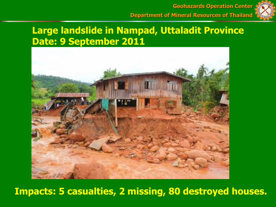
Large landslide in Nampad, Uttaladit Province Date: 9 September 2011
Impacts: 5 casualties, 2 missing, 80 destroyed houses.
Geohazards Operation Center
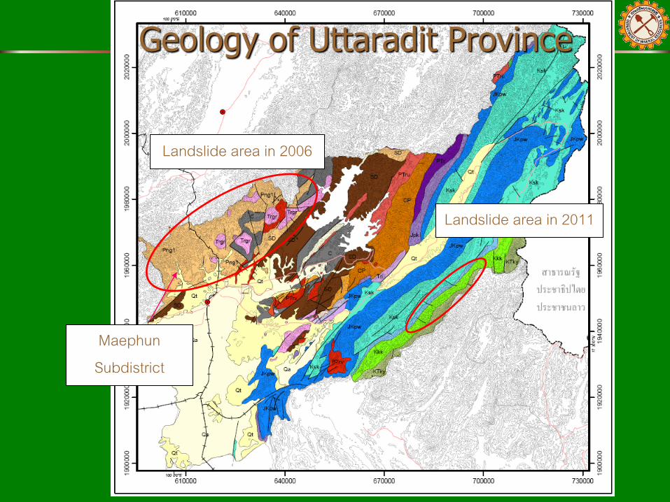
Department of Mineral Resources of Thailand Geology of Uttaradit Province
Landslide area in 2006
Landslide area in 2011
Maephun Subdistrict

Geohazards Operation Center
Department of Mineral Resources of Thailand
Rainfall Data of 2006 Event - Starting from 21 May 2006, the Uttaradit Province was covered by thick cloud and torrential rainfall due to the Intertropical Convergence Zone.
-The rainfall graph at Kung Trapoa station showed that the heavy rainfall started from the evening of 22 May 2006 to the early morning of 23 May 2006.
-The highest rainfall for 24 hrs was recorded in the morning of 23 May 2006.
-The rainfall broke 38 year record with the highest amount of 330 mm at Lublae station.

Geohazards Operation Center
Department of Mineral Resources of Thailand
50+100 in 24 hr
Rainfall graph at Kung Trapoa station from 06.00 am of 21 May 2006 to 12.00 am of 24 May 2006
www.thaiwater.net

Geohazards Operation Center
Department of Mineral Resources of Thailand
Present Landuse
- mountainous areas : mix orchards (Durian, Long Gong and Mafai)
- hilly areas: settlements and
- lowland areas: paddy fields

Geohazards Operation Center
Department of Mineral Resources of Thailand
Landslide Monitoring and Warning in Uttaradit Province
- Establishing the Landslide Watch Networks in 2006
- Landslide Drill in 2010
- Landslide Risk Mapping in community level in 2011
(extending the networks to cover up/middle/down stream)
Uttaradit Province; 798 volunteers in 64 villages from 3 districts (Lublae, Thapla, Muang and Nampad)
Maephun Subdistrict; 160 volunteers in 11 villages or every village in subdistrict.

Geohazards Operation Center
Department of Mineral Resources of Thailand
The Landslide Watch Network of Mae Phun Subdistrict
Geohazards Operation Center
Department of Mineral Resources of Thailand
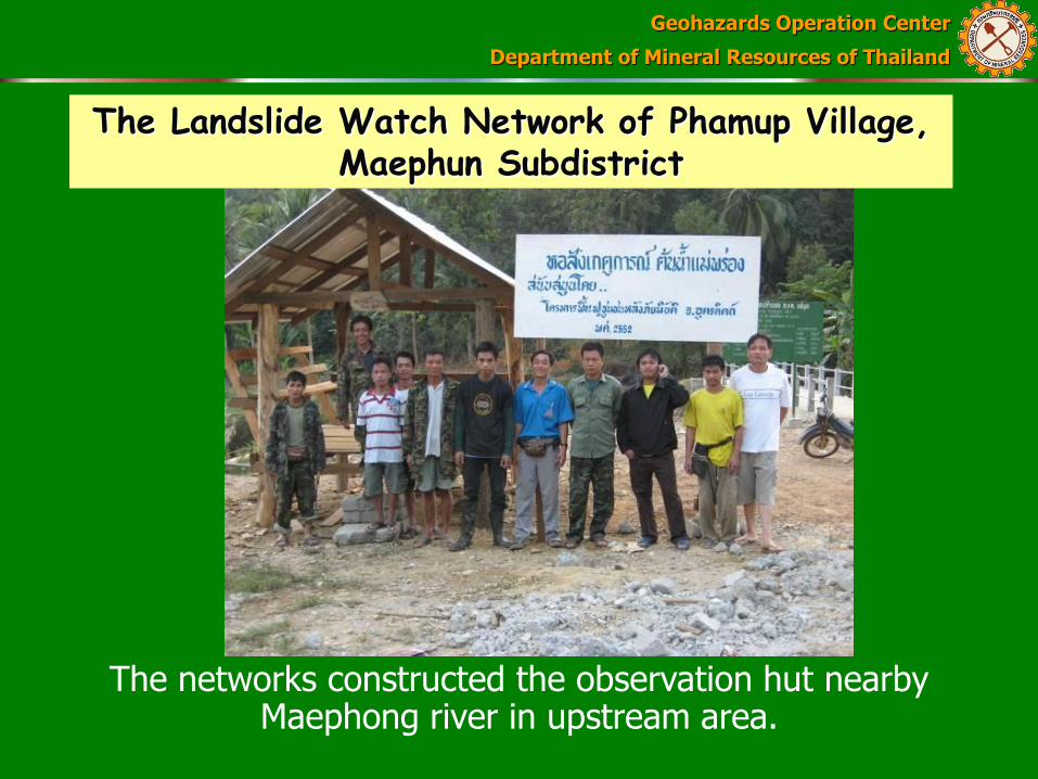
The Landslide Watch Network of Phamup Village, Maephun Subdistrict
The networks constructed the observation hut nearby Maephong river in upstream area.
Geohazards Operation Center
Department of Mineral Resources of Thailand
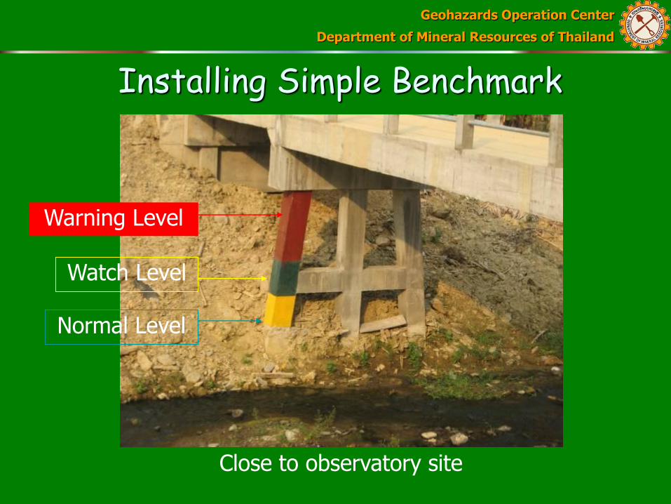
Installing Simple Benchmark
Close to observatory site
Warning Level
Watch Level
Normal Level

Geohazards Operation Center
Department of Mineral Resources of Thailand
The networks will only be at the observatory site in the heavy rain night or will be informed by GOC.
Geohazards Operation Center
Department of Mineral Resources of Thailand
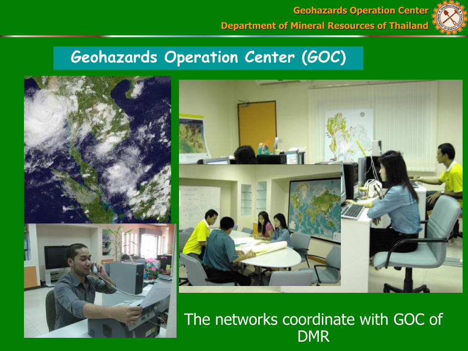
Geohazards Operation Center (GOC)
The networks coordinate with GOC of DMR

Geohazards Operation Center
Department of Mineral Resources of Thailand
DMR Networks
Rainfall monitoring
Stream monitoring Catch signs of
landslide
Head of village Warning
Inform relevant agencies
Inform down stream villages
GOC DMR
Watch Bulletin (heavy rain)
Village speakers & Sirens
Network Flowchart
Mayor of Tambon Administration Office
or Municipality
Warning and evacuation authorization

Geohazards Operation Center
Department of Mineral Resources of Thailand
The Results of Maephun Networks May 2007 flash flood warning from cyclone O1B
August 2010 flash flood warning from Mindulle tropical storm
August 2011 flash flood warning from Nock-ten Typhoon
2 August 2011 Nock-ten Typhoon influenced Nan and Uttaradit Province
The networks were informed by GOC
They were on the observation point and at evening of the same day water level in Maephong river raised
They used walky-talky to warn the networks and the heads of villages announce the warning through village speakers.
Villagers and properties in risk areas were moved to high ground before flash flood occurring.

Geohazards Operation Center
Department of Mineral Resources of Thailand
From the Best Results The village established landslide warning fund for them;
the villagers have donated 2-3 Durian fruits/house to the fund. Then the Durians have be transformed to be small money for supporting the network activities and disaster management.
The village also applied the knowledge to set up a community committee on the disaster management; the committee is divided into 8 sections such as warning, evacuation, food, safety place, rescue and village guard. And
The network has become the landslide mitigation model for other areas.
The network has been invited by many authorities, NGO and UNESSCO to distribute the knowledge to other communities.

Geohazards Operation Center
Department of Mineral Resources of Thailand
Statistic of Landslide Damages
Year Areas Casualties Damaged Cost
1988 Nakhon Si Thammarat
230 1,000 mBaht
2001 Phetchabun 136 645 mBaht
2006 Uttaradit 83 308 mBaht
2011 Krabi+Nakhon Si Thammarat,
Sop Muey, Nampad,Fang
30 (14,9,5,2)
10,000 mBaht

Geohazards Operation Center
Department of Mineral Resources of Thailand
Thank you
Department of mineral Resources Ministry of Natural Resources and Environment
Tel. 662-6219791-6 Fax. 662-6219775
Geohazards Operation Center
www.dmr.go.th
Tel. 662-6219701-05 Fax. 662-6219700