the auxiliary use of landsat data in estimating crop …
TRANSCRIPT

FILE COpy
THE AUXILIARY USE OF LANDSAT DATA IN ESTIMATING CROP ACREAGES:RESULTS Of THE 1975 ILLINOIS CROP-ACREAGE EXPERIMENT
Statistical ReDorting ServiceU.S. Department of Agriculture
SRS-21

The Auxiliary Use of LANDSAT Data in Esttmating Crop Acreages:Results of the 1975 Illinois Crop-Acreage Experiment
By
Chapman Gleason, Project Coordinatorand
Robert R. Starbuck, Richard S. Sigman,George A. Hanuschak, Michael E. Craig,
Paul W. Cook, and Richard D. Allen
Statistical Reporting ServiceU.S. Department of Agriculture
Washington, D. C.
October 1977


TABLE Of CONTENTS
~age
• . 5
. . 8
· 2
· 4
Data SourcesA. Ground data
1. Enumerator data .2. Infrared aerial photograohy •
B. LANDSAT Data1. Acquisitioo •..•..•....2. Pre-processing and reformatting •3. Data management ....•...
III. Illinois Scene Registration and Segment calibrationA. Registration procedure
1. First-order registratioo .2. Precision registration ...•
· 5
• 11
11
..........................Introduction1.
II.
B. Segment calibration .•..••••.•...•...•.•. 12IV. Data Analysis
A. Processing systems ..•.••....•...•...•.. 14B. Analysis results
1. Classifier performance studya. Study variables .•.•. 15b. Comparison measures •. 22c. Findin~s ••..•.............•... 23
ii

2. Multi-county crop-acreage estimates 323. Single-county crop-acrea~e estimates 35
V. Conclusioos 48
VI. References ... · . 50
VII. Contributions by authors . 51
Appendix A: Supplementary survey questionnaires for 1975 Illinois cropacreage experiment
Appendix B: Estimation methods and classifier design procedures used inthe Illinois Crop Acreage Experiment
Appendix C: Results of individual classification trialsAppendix D: Regression estimates for corn and soybeans acreages in
individual Illinois counties
LIST a; TABLESTable
1 LANDSAT Frames andIllinois 1975 .
Ii tIe
Pseudo-FrClTles for Cloud-Free Coverag~Page
•• 7
ResidualUSDA/~,RS
Mean Square Errors For Scenes Registered by· . 13
3 Distribution of Land Area by Land-Use Stratum withinClassifier Domains . • 18
4 Sample Sizes by Strata for all Data Sets ... 215 Summary of Classifier Performance Study .•...•..•. 246 Corn and Soybean Classifier Having Maximum RE2 for each Data
Se-t 28
7 R-squares for Jackknifed ClassificationPooling 0) ..••.••......
(W123+, SCPC, EP,· . 30
8 Comparison of Jackknifed and Resubstitution R-Squares (W123,EP, Pooling 0) ..•....••......••..•.•. 31
iii

9 R-Squares amd Relative Efficiences for all Covers (W123,MCPC, fl.DS , Pooling 0) · · · · · · · · · · · · · · 32
10 Estimated Acres of Corn and Soybeans for Wholly ContainedCounties in each Analysis Area • · · · · · · · · · · · 33
11 Comparison of Estimated Acres for Overlap Counties, Westernand Central Passes • . · · · · · · · . . . · · · · · · · · · 45
12 Comparison of Estimated Acres for Overlap Counties, Centraland Eastern Passes • . · · · · · · · . . . · · · · · · · · · 46
Appendix C
Appendix D
Results of Individual Classification Trials:Domain Wl •Domain W2 •Domain W123 •Domain C1ADomain C12Domain C33+ •Domain E12Domain E23+ •
Regression Estimates for Corn and SoybeanAcreages in Individual Illinois Counties:
Domain W123 •Domain C1ADomain C12Domain C33+ •Domain E12Domain E23+ •
iv
.Cl•C2•C3.C4.C5
· .C6•C8
• .C9
• .02.D3.03
· .04•04
• .DS

I. Introduction
This rep;:>rt sunmarizes the reSJlts of the Illinois Crop Acreage
Experiment, a collab<rative investigation by the staffs of the Center for
Advanced Computation (CAC) at the University of Illinois and of the
Statistical Reporting Service (SRS) of the U.S. Department of
Agricul ture. The purpose of the experiment was to investigate the
usefulness of data collected by the orbiting LANffiATsatellites in
improving the precision of crop acre~e estimates at several levels--such
as counties, groups of counties, such as, Crop Reporting Districts
(CRD's), and entire states. The approach of SRS in using LANffiATdata to
estimate crop acrecges is to use it as an auxiliary variable with
existing ground surveys.
This rep;:>rt describes the follC1.olingphases of the project:
1) Ground data collection procedures.
2) Acquisition and man~ement of rroject LANffiATdata.
3) Segment location and scene rE>l2;istration.
4) Processing systems developed to interface ~round data and
LANffiATdata for purposes of estimating crop acreages.
5) Pixel classification procedures and results for LANffiATimagery
collected over Illinois during the 1975 growing season.
6) Crop acre~e estimates based on LANffiATdata for each Illinois
county.
7) Comparison of crop acre~e estimates based on LANffiATdata with
June Emmerative Survey (JES) estimates for multi-county
regions.

II. Data SourcesA. Ground Data-1. Enumerator data
In support of this project, all crop and land-use information forthe fields in the 300 SRS June Enumerative Survey seq;ments in Illinoiswere keypunched by the Illinois State Statistical OfficI'!(SSO) to createa ~round-truth data base. Every month throu~hout the ~rowing season(July, August, and September) the crop maturity and land-use informationfor every field in each se~ment was updated. The Illinois SSO preparedcomputer programs to print field questionnaires which listed the fieldand crop acreage, cover type, and intended use from the previous visit 83
an aid to the field enumerators. The comouter-printed questionnaireproved to be an excellent aid since enumerators did not have to copyinformation from the previous questionnaire to the current one. When thecrop or land use chan~ed between visits to the field, enumerators wereinstructed to accurately draw new color-coded field boundaries o~ ASCS(Agricultural Stabilization and Conservation Service) aerial ohotos (8" =1 mile scale), indicate the date of change, and record the acreage andcover type of each new field on the questionnaire.
In order to interface satellite data processing with the JES andmonthly update surveys, it was necessary to redefine fields if land usechanged for any part of a JES field any time during the season. Thelargest part of the field retained the old field number and the next
~Questionnaires and methods used in SRS ground surveys are explained inmore detail in Appendices A and B.
2

unused field number was given to the newly created field, (actually a
subfield of the original field).
For exanple, if field 3 of Tract A had 30 acres of winter wheat
harvested between the last visit in June and the current visit in July,
and then 20 acres of soybeans were planted in one oortion of the field
with the remaining 10 acres left fallow, this information would be
recorded as follcws:
Sub- CoverSurvey Tract Field Field Type Acres Maturity
June: A 3 W. \otheat 30 Mature
July: A 3 3 Soybeans 20 PI anted
A 3 16 Idle 10 Plowed
This, of course, assumes that field 16 was the next unused field number
in Tract A.
The usual JES definition of a "field" is not as specific as might be
desired for remote sensing purposes. For example, a JES field of 40
acres might contain 35 acres of corn a1d 5 acres of wasteland in one
corner. Enumerators were asked to draw this as two fields, one of 35
acres and one of 5 acres. If fields of this type were not broken out in
the JES, em.merators were asked to draw in the proper boundaries and list
the correct acre~es on a later visit. When this occurred, the
ground-truth data for the affected fields were changed for the previous
visits rather than defining new subfields.
In September, at the end of four visits to the JES segment,
information had ~en collected 00 land use, cover types, and crop
maturities for each JES field and follow-up survey field. Boundaries on
3

ASCSphoto~aphs ~re reviewed ~ainst the survey acre~e data for all
segments as a quality control procedure. The data for each field \o.ere
carefUlly reviewed and edited. Most editing consisted of only filling in
minor inconsistencies of data for ron-crop fields. Appendix A contains
the ground-data collection forms and the general data collection and
editing procedures used by the Illinois SSO for this project.
A m~netic tape of the edited ground data was then delivered to CAC.
CACreformatted the tape and mailed it to Bolt, Beranek, and Ne1l«Tlan(BBN)
in Canbridge, Massachusetts, in a file format cOOtpatible with EDITOR
ground-truth files. (EDITOR is an interactive im~e processing system
developed bv the Center for Advanced Computation, University of
Illinois. )
2. Infrared aerial photography
Another source of ground truth was low altitooe color infrared (IR)
aerial photography at approximate scale 5" = 1 mile. This imagery ~s
available for a stbscrnple of 202 of the 300 segments. This motograJily
was taken in late July and early August 1975. The tract and field
boundaries for the 202 IR segments \o.ere transferred from the ASCSphotos
to the IR imagery. \\hen the field ooundar ies drawn on the ASCS photos
differed frOOtthe nattral ooundaries in the IR imagery, the boundaries in
the IR imagery \\ere used. The 202 color IR se~ment photos and the
remaining; 98 ASCSsegment photos \o.ere then sent to CAC for segment
dig i tiza tion.
4

B. LANDSATData*
1. Acqui si tion
All LANDSATimagery collected over Illinois durin~ the summer of
1975 was acquire::! from NASAin the form of 70 mmfilm transparencies of
bands 5 and 7. These were evaluated by both SRS and CACwith r~ard to
project objectives. Ideally it takes only 11 LANDSATscenes collected in
three satellite passes over Illinois, each one day apart, to completely
cover the state (see Fi~ure 1). Because of clouds, however, portions of
13 separate LANDSATscenes from a number of different dates were required
for canplete cover~e of the state.
2. Pre-processing and refonnattin~
Che of the project goals was to provide county, crop rep:>rting
district, and state-wide estimates for the entire state of Illinois.
Since a camty W3S the smallest ~eogr~hic unit for which estimates were
to be made, all LANDSATimagery acquired from NASAwas reformatted into a
set of image-files sLCh that each of the 102 Illinois counties was wholly
contained within at least one such image file. To accornplish this,
pseudo-franes of LANDSATd~ital data were created when a county did not
fall wholly within a LANDSATfrane. A pseudo-frane is created by linking
data reccrds frorn the bottom portion of one frane to the data records at
the top of an adjoinin~ frane havin~ the same ima~e date. Since
different satellite passes have different image dates, pseudo-franes can
only be constructed from franes within the same satellite pass. Six such
*M.Jchof the information in this section is taken frorn the projectdescription in Ray and Huddleston [1].
5

Figure 1. Portions of 11 LA."rrSATframes required to cover the state of Illinois.The letter and numbers indicate the frame within a nass.,

psetdo-franes ~re ccmpiled for thi s project. Table 1 gives the LANffiAT
franes and pseLdo-franes needed to ccmpletely cover each county in
Illinois on at least one image file (i.e., frc:rne or psetdo-frc:rne).
Table 1. LANDSAT frames and pseudo-frames for cloud free coverage ofIllinois 1975.
Scene or Analysis Acquisition Frame orImage File ID Designation Date Pseudo-frame
2194-16035 W1 August 4 Frame2194-16042 W2 August 4 Frame2194-16044* W3 August 4 Frame2194+16041 W1+ August 4 Splice of W1, W22194+16043 W2+ August 4 Splice of W2, W3
2193-15581 ClA August 3 Frame2211-15574 C1 August 21 Frame2211-15580 C2 August 21 Frame2211+15576 C1+ August 21 Splice of C1, C22175-15592 C3 July 16 Frame2175-15595 C4 July 16 Frame2175+15594 C3+ July 16 Splice of C3, C4
2228-15515 E1 September 7 Frame2228-15522 E2 September 7 Frame2228-15524 E3 September 7 Frame2228-15531 E4 September 7 Frame2228+15523 E2+ September 7 Splice of E2, E32228+15529 E3+ September 7 Splice of E3, E4
*This LANDSAT image was never annotated and cataloged by NASA. However, NASA madethe first 500 scan lines available to us for this project.
The counties of Sangamon and Christian were not wholly contained in
anyone LANffiATframe. ~reover, it was not oossible to construct a
pseLdo-frane to contain these counties because in the selected LANffiAT
7

imagery the candidate frames for building a pseudo-frame had differentimage dates. Consequently, no analyses of the LANDSAT data for thosecounties were performed. The geo-numeric numbering scheme used for theLANDSAT image files is shown in Figure 1.
3. Data ManagementIn addition to the partitioning of the LANDSAT data by image-files
(frames and pseudo-frames), the complete set of 102 counties wassubdivided into non-overlapping groups of contiguous counties with onecounty group per image-file. These county groups were called analysisdistricts and all data management and processing of the LANDSAT data wasstructured in terms of analysis districts. Fourteen such analysisdistricts were defined for this project (see Figure 2). These analysisdistricts became the focal point of a coordinated effort by CAC and SRSto process the data in the 13 LANDSAT image-files.
To process the LANDSAT data the following functions had to beperformed:
1. Digitize and calibrate to a map base each of 300 SRS2. Register each LANDSAT image-file and locate the
accurately.Digitize the land-use strata maps for each of the 102 counties.Train the classifier for each image-file and classify the entire
image file.5. Estimate the acreages for each image-file.
3.4.
segments.segments
8

, -.
.,
1.. •••
"' .
....
Figure 2. Analysis Districts for 1975 Illinois ALreageEstimationProject.
9

CAC managed and performed the followin~ functions:1. Digitization of the 300 SRS 8rea segments.2. Registration and segment location for Wl, W2, W3, Cl, C1A and
£1.
3. Digitization of all county land~Jse strata maps for analysisdistricts 2, 3, 4, 5 and 7.
4. Development of software.SRS managed and performed the folloWing functions:
1. Ground data collection and editing for four visits to 300 SRSarea segments.
2. Registration and segment location of C2, C3, C4, E2, E3 and E4.3. Digitization of all county land-use strata maps for analysis
districts 1,6,8,9,10,11,12,13 and 14.4. Software systems design for acreage estimation.5. Analysis of all data sets.
III. Illinois Scene Registration and Segment CalibrationTo utilize the LANDSAT data, the image files were n~gistered to a
map base, usually U.S. Geological Survey (USGS) maDS. This processlocated segment and field data for classifier training and determined thelocation of land-use strata and county boundaries needed for countycrop-acreage estimates [2]. For Illinois a method developed by CAC wasused for scene registration [3]. CAC registered the scenes over W1, W2,W3, Cl, and El; whereas, SRS registered the scenes over C2, C3, C4, E2,E3, and E4.
10

A. Registration Procedure1. first order registration
Scene registration consisted of two.sta~es. The first stage, calledfirst order registration, developed a linear regression between LANDSATdata (row, column) values and map (latitude, longitude) values. Theregression data were the locations of physical features, called controlpoints, which can be located in both the LANDSAT data and on a USGStopographic map; e.g., secondary road intersections, small lakes, grovesof trees, clearings in woods, bends in rivers, river-road intersections,etc. The (row, column) values were determined by locating the featureson the 1:500,000 scale LANDSAT photos for bands 5 and 7. Thecorresponding (latitude, longitude) values were determined from 7 1/2 or15 minute quadrangle maps (i.e., of scales 1:24,000 or 1:62,500).
After selecting fifty such points well scattered throughout thescene, the map-to-LANDSAT linear regression was computed. Rowand columnresiduals were calculated, and points with column residuals in excess of10 pixels (15 pixels at the extreme edges of the scene) or row residualsin excess of 2 pixels were rejected as outliers. The linear regressionwas then recomputed from the non-rejected points. The resulting linearregression was then used to Ildeskew"the image into a more north-southorientation [4].2. Precision registration
The second stage of registration, called precision registration,increased the degree of the polynomial transformation between LANDSATdata locations and the map coordinate system. To accomplish this the
11

control points were located more accurately than in first orderregistration by usin~ a li~ht table to overlay 7 1/2 minute quadranglemaps with LANDSAT data greyscales of each control point. For 15 minutequadrangle maps, each ~reyscale was reduced to approximately 3/7ths ofthe original size to obtain a useable match of scales.
While the map and ~reyscale were overlayed, both were marked at thelocation of the control point. The marks were then digitized on adigitizing tablet to obtain location values needed for the regressioncalculations. Table 2 gives the precision registration results forquadratic fits in scenes registered by SRS. Comparable registrationresults were obtained by CAC for the scenes which they registered.
B. Segment CalibrationTo determine labeled pixels for classifier training, each s~ment
must be located with an accuracy of 1/2 pixel or better. This wasaccomplished by the following procedure:
1. At the scale of LANDSAT greyscales (approximately 1/24000), plotsshowing field boundaries were obtained for each segment.
2. The segment plots were then overlayed on the s~ment greyscalesat the locations predicted by the precision registrationpolynomial.
3. By examining the ~reyscale's lightness and darkness patternscorresponding to segment fields, it was determined whether thesegment was correctly located. If not, row and column shiftsneeded to move the segment to its correct location weredetermined and used as local corrections for locating segmentpixels.
12

tI)
..-lell-rl
tIl •••••• H!:l ell
-rl p..0 ....-
p...-l ..-l ~ a ~ N~ \0 \0 C'"I ""' \0 r--
0.0Z
H0HH ~ ""' N a \0 co~ co r-- co r-- N co
.-l a ..-l N \0 r---Ie § ""' ""' r-- a ""' r--.-l · · · · · ·ell ~ ~ ..-l ~ ~ ""'::l .-l'"Cl 0-rl UtIlIII
p:::
~-rl H
~0H N co 0'1 ~ 0'1 0H .-l ~ C'"I •...... co r--~ r-- 0 r-- N a ~
C'"I \0 0 C'"I .-l \0III · · · · · ·!:l ..-l .-l .-l .-l N ..-l-rlH
H0
-Ie HtIl H C'"I ~ 00 N \0 0'1H ~ co co \0 \0 ""' C'"I0 •...... 0'1 •...... ~ .-l r--H § 0'1 N 00 ~ 0 NH · · · · ·~ .-l N a N N N..-lIII 0H Uell
-§tI)
!:lellIII H~ 0
H ..-l \0 00 0'1 N 0'1••• H ..-l ..-l 0'1 ..-l ""' 00 ~ 0'1 0 a a \0 ""'0 ~ \0 ""' ~ ""' ~pc; III · · · · · ·!:l a a a 0 0 a-rl
...:l
,-... ,-... ,-... ,-... ,-... ,-...N C'"I ~ N C'"I ~I I I I I IU U t.) ~ ~ ~....- ....- ....- ....- ....- ....-0 N ""' N ~ .-lco 0'1 0'1 N N C'"I
0 ""' ""' ""' ""' ""' ""'H ""' ""' ""' ""' ""' ""'.-l ..-l .-l ..-l ..-l .-lIII I I I I I I!:l .-l V'l ""' co co coIII .-l r-- •...... N N NU N ..-l .-l N N N
tI) N N N N N N
13

IV. Data AnalysisA. Processinp; Systems
To carry out the project objectives, existing in-house computerfacilities (Washington Computer Center) could not be used to effectivelymanage and classify the large volume of data involved. Therefore, SRScontracted software development to the Center for Advanced Computation.CAC working with SRS staff tmplemented the following EDITOR proceduresfor this project:
• Registration and digitization systems,• Sep;mentlocation and masking systems,
• Data analysis systems, and• Acre~e estimations systems.
These systems are described in detail in [5] and [6].In the data analysis process, a large number of computer files were
created. The development of a self-documenting file-naming convention[6, Appendix] greatly simplified data management.B. Analysis Results
The statistical methods used in this project have been described inprevious reports. The paper by Sigman, Gleason, Hanuschak, and Starbuck[7] (excerpt in Appendix B) gives details on classifier design andacreage estimation with stratified sampling. Two companion papers by Rayand Huddleston [1] and Huddleston and Ray [8] give methodological detailsof the project for simple random sampling. As explained in the papers byWigton [9] and Von Steen and Wigton [13], crop acreages were estimated bya regreSSion estimator with enumerator data from the JES as the primary,survey variable and LANDSAT data as the auxiliary variable.
14

The effectiveness of LANDSAT data to serve as such an auxiliaryvariable was measured by the relative statistical efficiency of theregression estimator versus the direct expansion estimator based only onenumerator data. In the analysis of the 1975 Illinois LANDSAT data,three major objectives were pursued. These were:
• To investigate the influence of various factors, bothmethodological and geographical, on classifier performance,
• To c011putecrop-acreq:!;eregression estimates plus the relativesampling errors of these estimates for individual Illinois counties, and
• To compute crop-acreage estimates for various multi-county areasand then compare the precisions of these estimates to the JES directexpansion estimates for these areas.1. Classifier Performance Study
The classifier performance study was a set of classification trialsperformed in domains W1, W2, and W123 which investigated the influence ofvarious factors on classifier performance. Traditionally, theperformance of a classifier has been measured in terms of a confusionmatrix of percents correct and commission error rates. However, if aclassifier is beinv.used to estimate crop acreages, then it should beevaluated in terms of how well it does exactly that. Thus, theclassifier performance measure used was the variance of resultingregression estimates.a. Study Variables
The following factors were investigated for their influence onclassifier performance:
15

i. Classifier Domain. This factor investigated the influence of~eography, date of imagery, and size of classifier domain on classifierperformance. In the August 4 western satellite pass, single-sceneclassification and multi-scene classification were compared. This wasdone by analyzing image files W1 and W2 individually and then jointlywith W3 as a joined-scene called W123. In the central pass theclassifier domains were for three different dates: domain C1A (= ima~efile C1A) on August 3; domain C12 (concatenation of image files C1+ andC2) on August 21; and C33+ (concatenation of image files C3 and C3+) onJuly 16. In the September 7 eastern pass, the classifier domains weredomain E12 (image files E1 and E2) and domain E23+ (image files E2+ andE3+).
Figure 3 is a map of the eight classifier domains. Because theLANDSAT scenes overlap, 16 counties were contained in more than oneclassifier domain. These counties, called overlap counties, were used tomeasure the repeatability of the regression estimates. Table 3 shows thedistribution of land area by land-use stratum for the eight classifierdomains. Items of note in this table are the following:
• In each of the satellite passes there is a north-south gradient inland use. From north to south the proportion of land in stratum 20increases whereas the proportlon in stratum 11 decreases .
• Ibmain E12, which contains Chic~o, is the most heterogeneous ofthe eight domains.
16

Figure 3. Classifier Domainsfor 1975 Illinois Acreage Estimation Project.
11

Table 3. Distrihution of land area by land-use stratum within classifier domains
% of domain land area containedin stratum:
satellitepass domain
western WI 65 16 13 6W2.~ 36 19 34 11
- - - - - - - W123-- - - - - - - 46- - -18 - - 27- - - "9 - - -
central
eastern
CIAC12C33+
E12E23+
737538
6734
179
24
729
27
29
324
899
2313
~5% + cultivated~50% - 75% cultivated~15% - 49% cultivated~non-cultivated
ii. Nl~ber of Classification Categories. This factor investigatedvaricus strategies for developing classification categories. Thestrategies studied were intra-crop clustering to create multiplecategories per crop (MCPC), straight supervised training with a singlecategory per crop (SCPC), and pooled crop (PC) categories.
iii. Prior Probabilities. This factor investigated the effect onclassifier performance of using "different prior probabilities" for theclassification categories. Strictly speaking, there is only one correctset of prior probabilities for a given geographical region. Using"different prior probabilities" actually lTlE'ansusing different weightingfactors for the likelihood functions in the class discriminant functions.
18

The two types of prior probabilities studied were unequal priorsproportional to expanded reported acres, denoted PER, and equal priors,denoted EP. In a given region the PER prior probability for a particularcover was defined as the ratio of the current year direct expansionestimate to the total land area in the region. Note that the unequalpriors are not based on historic crop-acreage estimates.
iv. Training/Test Data Sets. This factor investigated the datasets on which the classifier was trained and tested. The followingmethods were employed to allocate the LANDSAT data associated with JESsegments between the training and test data sets:
• Restbstitution, in which all the segment data, denoted NB for "notbackground", ~re used to both train and test the classifier,
• Sample partition, in which the classifier was trained on a 50%sample of segment fields, denoted FLDS, and then tested on all of thesegment data, and
• Jackknifing, denoted JK, in which the training set was 3/4 of thedata and the test set was the remaining 1/4. This allocation wasrepeated four times so that the union of the four test sets was theentire collection of segment data.
The jackknifing technique used was that referred to by Toussaint asthe Pi-method [10]. Thus, four separate estimates of classifierperformance were obtained and averaged to yield the jackknife estimate.
There are two reasons why the training/test factor was of interest.The first reason was the desire to minimize the work involved withevaluating a classifier. The resubstitution and sample partition methods
19

are easy to perform but are known to produce biased evaluations of the
classifier in small samples. On the other hand, the jackknife is known
to give a less biased evaluation but also involves substantially more
effort. Consequently, if the three training/test methods give similar
results in the classifier performance study involving domains W1, W2, and
W123, this would indicClte that resubstitution or sample partition would
be sufficient for classifier training and testing in the other Illinois
domains.
The second reason for investi~ating this factor was to study the
sensitivity of the classifier to the selection of the training data.
This was the purpose of performing samnle partition and then comparin~
the results with those from the other two methods of classifier
evaluation.
v. Strata Pooling and/or Deletion. Table 4 shows the distribution
of JES segments by stratln for each classifier domain. As can be seen, a
number of strata have zero or very few segments in them. Thus, it was
necessary to pool and/or delete strata and then compute stratum
regression estimates on the pooled, undeleted strata. Some of the strata
poolings which were tried are the following:Pooled
Strata il
°10
30
50
Original Strata PooledTogether
11,12,20,31,32,33,40,61
11,12
31,32,33,40,61
20,31,32,33,40,61
20

Table 4. Sample sizes by strata for all data sets.
Domain Total Number of segments in strata.*11 12 20 31 32 33 40 61
WI 44 30 6 5 2 1 0 0 0W2 40 16 10 11 1 0 0 1 1W123 83 44 16 17 3 1 0 1 1
ClA 30 21 4 0 4 1 0 0 0C12 52 40 2 5 3 1 0 0 1C33+ 43 18 9 9 4 2 0 0 1
E12 56 35 5 1 7 6 2 0 0E23+ 66 26 21 11 2 0 a 5 1
*Wl and W2 entries are on an entire scene basis. All others are for thecounties wholly contained in the respective scene.
The strata used in a particular classification trial are identifiedwith a strata-description notation. A "_" is used to separate distinctstrata, and parentheses are used to surround pooled strata. For example,11-(12,20)-30 indicates that stratum 11 is a distinct stratum, strata 12and 20 are pooled together, and strata 31, 32, 33, 40, and 61 are alsopooled t~ether and called 30. Leaving a stratum out of a stratadescription indicates that the particular stratum was deleted from theclassification analysis trial.deletion of stratum 20.
For example, 11-12-30 indicates the
21

Another reason for deleting a particular stratum from theclassification analysis W8S very poor classifierstratum; i.e., a stratum r-square (see Appendix B) of
performance in theless than 0.10.
When strata were deleted from the classification amllysis, "swiss cheese"estimates were computed to estimate croP-acreages. A swiss cheeseestimate consists of stratum regression estimates on the str8ta includedin the classification analysis and direct exp8nsion estimates on thestrata excluded from the classification analysis.b. Comparison Measures
In the classification trials the classification objective was tominimize the variance of the resulting regression estimates. As shown inequation (2) of Appendix B, this is accomplished by maximizing thestratum r-squares. Hence, to comoare classifier performance on the samestratum, the respective r-squares were compared. for multi-strataregions, classifier oerformances were compared in terms of the relativeefficiencies of the resulting estimates. Two types of relativeefficiency were calculated. The first type, denoted RE1, was calculatedwith respect to the direct expansion estimator which uses the samepoolings as the regression estimator. REl measures the gain, in terms oflower variance, of the regression estimate over the pooled JES directexpansion estimate. Of course, this doesn't take into account the stratain the direct expansion estimate. However, a second type of relativeefficiency, denoted RE2, was calculated with respect to direct expansionover the 11-12-20-30 pooling, or over the best direct-expansion poolingfor the region. Thus, RE2 measures the gain, in terms of increased
22

precision, of the regression estimate over the unpooled JES directexpansion estUnate.c. Findings
The classification trials performed in the eight classifier domainsare described in Table 5. In Appendix C the corn and soybeans resultsfor the NB and fLDS classification trials are tabulated. In theseresults the following classification phenomena were c~Jn to all eightof the classifier domains:
PER priors produced higher percents correct* compared to equalpriors for both corn and soybeans. However, equal priors yielded higherr-square values compared to PER priors in almost all cases for corn andin several cases for soybeans.
• In the test-data sets (all segment interior pixels) the nunber ofpixels classified as corn or soybeans exceeded the respective nunber ofcorn and soybean pixels actU311y present. For all other covers theopposi te was true. The use of equal pr iors, ho~ver, tended to lessenthese effects; i.e., there ~re less ccrnmission errors into the majorcrop categories \oA1enequal pr iors ~re used.
Training the classifier on a 50% sample of fields for each coveryielded r-squares very close to those for training on NB (all JES data).
R-squares in stratum 20 were low for corn, but somewhat betterfor soybeans.
*Percent correct is the percentage of test pixels (all segment-interiorpixels, including field boundaries) correctly classified.
23

Table 5. Summary of Classifier Performance Stud~
No. of CategoriesTrial Analysis Type of Pooling Priors Training Strata
Oata Set Strategy Test Poolings Tried
In.l WI 10-SCPC PER NB O· 10-50; 11-12-20-30,W1.2 WI 10-SCPC PER FLOS O' 10-50; 11-12-20-30,W1.3 WI 10-SCPC EP NB O' 10-50; 11-12-20-30,W1.4 WI 10-SCPC EP FLOS O· 10-50; 11-12-20-30,
W2.1 W2 7-SCPC EP FLOS O· 10-50; 11-12-20-30,W2.2 W2 7-SCPC PER NB O' 10-50; 11-12-20-30,W2.3 W2 7-SCPC EP NB O' 10-50; 11-12-20-30,
IH23.1 W123 10-SCPC PER NB O' 10-50; 11-12-20-30,W123.2 W123 10-SCPC EP NB O· 10-50; 11-12-20-30,W123.3 W123 15-MCPC EP FLDS O' 10-50; 11-12-20-30,H123.4 W123 15-MCPC EP NB o· 10-50; 11-12-20-30,W123.5 W123 10-SCPC EP JK 0
ClA.1 ClA l4-MCPC EP FLOS O' 10-50; 11-12-20-30,ClA.2 ClA 14-MCPC PER FLDS O' 10-50; 11-12-20-30,C1A.3 ClA l4-MCPC EP NB O' 10-50; 11-12-20-30,ClA.4 CIA l4-MCPC PER NB O' 10-50; 11-12-20-30,
C12.l C12 26-MCPC £. PC EP NB 11-12-20-30C12.2 C12 10-MCPC & PC EP FLOS 11-12 ; 20-0therC12.3 C12 6-SCPC & PC EP NB 11-0ther; 11-12; 20-0therC12.4 el2 5-SCPC & PC PER NB 11-12-20C12.5 C12 4-SCPC & PC EP NB 11-12-20; 11-12, 20; II, 12, 20
C33+.1 C33+ 10-SCPC & PC EP NB O' 10-50; 11-12-20-30,C33+.2 C33+ 10-SCPC £. PC PER NB O' 10-50; 11-12-20-30,C33+.3 C33+ 14-SCPC & PC PER NB O' 10-50; 11-12-20-30,C33+.4 C33+ 16-MCPC PER NB O' 10-50; 11-12-20-30,C33+.5 C33+ 12- MCPC £. PC EP NB O' 10-50; 11-12-20-30,C33+.6 C33+ 9- SCPC & PC EP NB O' 10-50; 11-12-20-30,C33+.7 C33+ 19- MCPC EP NB 11-12-20-30C33+.8 C33+ 17-SCPC EP 11-12-20-30
E12.1 E12 24-MCPC EP NB O' 10-50,E12.2 E12 24-MCPC PER NB O' 10-50,
E23+.l E23+ 28-MCPC EP NB O' 10-50; 11-12-20-30; 11-12-50,E23+.2 E23+ 28-MCPC PER NB O' 10-50; 11-12-20-30 ; 11-12-50,£23+.3 E23+ 18-MCPC EP NB O' 10-50; 11-12-20-30; 11-12-50,E23+.4 E23+ l8-MCPC PER NB 0; 10-50; 11-12-20-30; 11-12-50
24

The optimum strata pooling varied between covers and classifierdomains. Within a specific classifier domain, however, the same stratapoolin~ was generally optimum for all classfiers of a ~iven cover.
The low r-SQuares for corn in stratum 20 are explainable by thevery nature of this stratu'll. Stratum 20 contains 10-49~ croplandintermixed with mostly woods and permanent pasture. Thus, because therewas considerable overlap in the spectral distribution of woods, permanentpasture, and corn, a large number of woods and permanent pasture pixelSwere erroneously classified as corn. This caused a very low cornr-square for this stratum.
Figures 4 and 5 plot corn and soybean stratum r-squares againstimagery date for the classifier having hi~hest RE2 in each domain for anumber of different stratum poolings. The crop development sta~e and"best" RE2--that is, maximum RE2 over all attempted classifiers andstratum poolings--are also plotted. Table 6 more fully describes theclassifiers and stratum poolings having best corn and soybean RE2's ineach of the eight domains.
Figure 4 shows that for corn the stratum 11 r-squares were largeston August 3 and 4. In stratum 20, however, August 3 and 4 alo~ withAugust 21 had the smallest corn r-squares.
The high corn r-squares in stratum 11 on August 3 and 4 are possiblyexplained by the crop condition on these dates. In 1975, corn was nearly10~ silked by the first week in August [11]. The accompanying tassels,which are yellow, poSSibly distinguished corn from other green crops in
25

, II ,
I
'0I
i .
I i
l~I
; I,
Ii@I
fJ9-2 E'~ q-CJ
E2'+
I
1-2 i VI VIl3 g_/ ,C lA V?
(,
RE24-2
,-,'" 11-21C33+
~ -1Jt
~Q f-b~~-
r'2. .75.50, I.25 •
'2. .75 @
~2.50 i
I
.25 I
.15 Ir2. ,5"0 ~20 .25
.75r2. .5030 .15
.75r2. , .50 I
10 25 <9.I I I
I ' I.15 I ! I
. I I
2- #'SO .5 0 c!>.25' !
.75 [ ls.50 ~fj,r;2 : I0 .2S
Figure 4. Com Gr~th Stage, plus StratlDIl Coefficients of Detennination(r-squares) and Relative Efficiency (RE2) of Best Corn Classifier,as a Fmction of I..ANffiAT lmagety Date.
26

I, ,
Ii
q-Z EI2 <J-'E23 .•.
(II, '2,10~
IIi'
8- 18 . 8-25
el2
,n, i, Y,!
: I~; :! I' ,
f) Ib, I,Sf)
, 'I. I:I '
, 'I
, :. 'I... "
, ,.
.~.IT: I
~
1-2 9 \.vI \..1/23 g-, J
C1A VZ
r'2.II
.15 02-
~2 .50.25
:752- 50 lSlt;o
.25
.75 5)
r2 .5030 .15
.75r2
.50. cD10 .25
.152 .50 Ci>rs-O .25
.75
r:"2. so ~0 .2~
5 I!
REZ 3~I
l-H 7-2(33'"
% in
b iOfNS
Figure S. Soybean Growth Stage, plus Stratum Coefficients of ~tenninatim(r-squares) and Relative Efficiency (RE2) of Best Soybean Classifier,as a FlDlctim of LANDSATImagery Date.
2.1

Table 6. Corn and Soybean Classifier having maximum RE2 for each data set.
Crop Data Set Date RE2 Categories Priors Train/test Strata Pooling
Corn Wl Aug. 4 4.58 10 !SCPC EP FLDS 11-12-20-30W2 Aug. 4 2.13 7/SCPC EP NB 10-50W123 Aug. 4 2.48 15/MCPC EP FLDS 11-12-20-30C1A Aug. 3 6.30 14/~1CPC EP FLDS 11-12-30C12* Aug.21 1.27 4/SCPC&PC EP NB 11-(12.20)C33+ July16 1. 74 10/SCI'G11'r: EP NB 10-50E12 Sept.7 1.86 24/MCPC PER NB (11 ,12 ,20)E23+ Sept.7 1.92 28/MCPC EP NB 11-12-20-30Soybeans Wl Aug. 4 5.76 10/SCPC EP FLDS 11-12-20-30W2 Aug. 4 2.34 7/SCPC PER NB 0~1l23 Aug. 4 3.22 15/MCPC PER FLDS 0C1A Aug. 3 3.83 14/MCPC PER FLDS 0C12* Aug.21 1.83 6/SCPC EP NB 11-(12 ,20,30)C33+ July16 2.23 10/SCPD~PC EP NB 11-12-20-30E12 Sept.7 1.O() 24/MCPC PER NB 0E23+ Sept.? 2.38 18/MCPC EP NB 11-12-20-30
*Entries are RE1's for this data set.
stratum 11 such as alfalfa and soybeans. In stratum 20, however, theAugust 3 and 4 crop condition for corn was apparently not adistinguishing feature since very low corn r-squares were obtained inthis stratum. In fact, the highest corn r-square in stratum 20 wasobtained on September 7, when the majority of corn was in the maturestage.
In the four domains having August 3 or 4 imagery--that is, W1, W2,W123, and C1A--the stratum r-squares for corn were very similar. Thebest RE2's for these domains were, however, very different. Thisphenomenon is, in fact, explained by the poor classification results for
28

corn in stratum 20 on August 3 and 4 and by the fact that the fourdomains have different amounts of land in stratum 20 (see Table 3).Domain C1A had the least amount of stratum 20 land and was thus leastaffected by poor classifier performance in stratum 20. Consequently,domain C1A had the highest corn RE2. On the other hand, domain W2 hadthe most stratum 20 land of the four domains and consequently had thelowest corn RE2 of the August 3 and 4 domains.
Figure 5 shows that for soybeans the stratum 11 r-squares were, asfor corn, largest on August 3 and 4. Unlike corn, however, poorclassification results in stratum 20 were not encountered for soybeans.Also, unlike corn, the superior stratum 11 r-sQuares on August 3 and 4were probably not due to soybean growth stage. The reason for this isthat the remote sensing appearance of soybeans did not change a greatdeal over the image dates analyzed. Apparently what happened was thatAugust 3 and 4 produced hi~her soybean r-sQuares because it producedhigher corn r-sQuares; i.e., on August 3 and 4 the improved separabilityfor corn decreased the confusion between corn and soybeans and thus ther-squares for both crops increased.
The optimality of August 3 and 4, 1975, for corn and soybeanclassification confirms 1974 CITARS findings in Illinois [12]. In 1975,crops were approximately 2-3 weeks ahead of the average development stageof the previous three years. Thus, early August 1975 correspOndsroughly to late August 1974, which CITARS found to be the optimal 1974date for corn and soybean discrimination.

Table 6 allows the comparison of best RE2's across the ei~htclassifier domains. Best corn RE2'S ranged from a high of 6.3 in domainC1A (Au~ust 3) to a low of 1.3 in domain C12 (August 21). An examinationof the C12 ima~ery, however, revealed the presence of light haze over theentire pseudo-frame, which explains the poor C12 results. Best soybeanRE2's ranged from a high of 5.76 in domain Wl (August 4) to a low of 1.06in domain E12 (September 7).
Table 7 presents the results of trial JK in which jackknife trainingand testin~ was used. Table 8 compares the results of this trial to the
Table 7 • r-squares for j8ckknifed classification (W123,SCPC, EP, pooling 0)pooled-stratum-O r-souare I
Ijackknife groUD I C • V • :Icover 1 2 3 4 Ave: S. E. (% )Alfalfa .002 .001 .195 .078 .069: .09' 132.7Corn .734 .814 .639 .680 .717 : .07 10.5Dense Woods .097 .003 .030 .213 .086: .09 109.2Hay .017 .245 .042 .271 .144 : .13 92.2Oat Stubble .000 .01 6 .119 .004: .035: .06 163.9Oats .1 19 .001 .069 .109: .094: .08 87.8:Permanent Pasture .339 .304 .552 .269: .366: .13 34.8:Soybeans .578 .745 .843 .520: .671 : .15 22.2:Wasteland .847 .732 .062 .248: .472: .38 79.9:
corresponding resubstitution trial (Trial W123.2). The jackknife andresubstitution r-square values are quite similar, the majordissimilarities being for those cover types which have large coefficientsof variation and small r-squares in Table 7.
30
This suggests that for

Table 8.jackknifedr-squaresPooling 0)
Comparison ofand resubstitution
(W123, SCPC, EP,
:train/test:IIIIIIIIIIIIII
Pasture:IIII
co ve rAlfalfaCornDense WoodsHayOat StubbleOatsPermanentSoybeansWasteland
JK.069.717.086.144.035.094.366.671.472
NB:.09:.70:.01 :.25:.06:.15 :.36 :.67:.81 :
sufficiently large sample sizes, the resubstitution method will yieldr-square values for major crops whose biases are acceptably small.
finally, Table 9 compares classifier performance in domain W123 overall covers and for two different types of prior probabilities. Items tonote are the low r-squares and RE1 values for minor crops and the factthat neither type of prior probability, neither EP nor PER, was optimalfor every cover. The trends in Table 9 were also demonstrated in theother classifier domains. These results imply that for minor crops,regression acreage estimates are fruitless for the data sets analyzed andfor major crops a different classifier should be designed for each majorcrop type in order to maximize the efficiencies of regression estimates.
31

Table 9. r-sQuares and relativeefficiencies for all covers (W123. MCPC,FLDS, Poolin~ 0)
r-square RE1Co ve r EP PER EP PER
Water .89 .84 8.70 6.23Waste .78 .82 4.47 5.45Soybeans .62 ·7 1 2.61 3.39Corn .75 .57 3.90 2.32Permanent Pasture .32 .35 1.44 1.51Woods .02 .24 1.0 1 1. 31Alfalfa .05 ·13 1.04 1. 13Hay .20 ·10 1.24 1. 10Oats .14 .05 1. 15 1.04Oat Stubble .01 : .03 1.00 1.02
2. Multi-County Crop Acre~e EstimatesThe relative efficiencies obtained in the majority of classification
trials indicated that the auxiliary use of LANDSAT data can reduce thevariance of crop acreage estimates for corn and soybeans. Consequently,
multi-county regression estimates for corn and soybeans were calculatedfor the ten-county Western Crop Reportin~ District (CRD) and for all theclassifier domains except domains W1 and W2 since they were subsets ofdomain W123. The multi-county regression estimates were compared toestimates calculated by direct expansion of enumerator data and toestimates obtained from the summation of final 1975 county estimatespubliShed by the Illinois SSO. The final SSO estimates are predominantlybased on the Illinois State Farm Census.
32

In Appendix C the classifier~ used for acrea~e estimation areindicated. Table 10 lists the various multi-county crop acrea~e
Table 10. Estimated Acres of Corn and Soybeans for wholly contained countiesin each analysis area.
Analysis I t10. of Counties IArea * ! I1ho11y Contained On ~
Data Set _JIIIII
EstiMator
Direct ExpansionRep,ressionsse
Direct ExpansionRegressionSSO
Direct ExpansionRegressionsse
Direct ExpansionRegressionSSO
Direct ExpansionRerressionSSO
--: ~-~'d!P.a7~I Acres ic.v. : Acres ,C.V.i ~--L I
Dir.ect EXP"2ntion..!.4,110,15013.67. !1,539,2.o0117.7%Regl:ftsion- 14,125,40°1 2.5~ :1,681,ROO 5.21'sso- ! 3,682,300: :1,657,8001
Direct Expansion t 1,191,400: 7.17. I ?32,700'13.9~R~r,ression 11,180,500: 2.97. 523.2001 8.2%sse 11,196,900: 502,9001
I II I
2,907,7001 4.5: 2,217,20015.5~2,945,100: 4.3% ~,127,20015.1:2,939,700, 1,990.4001
iI'1,158,000! 9.5~ !1,675,100!8.6:1,077,0001 8.6~ 11,540,00016.8:1,233,0001 11,246,00011,781,300: 5.6: 11,439,50016.3!1,577,300: 4.~ :1,290,70016.5~1,792,0001 :1.383.0001
I I I II I I I11,669,500! 7.5~ 12,431.C!5015.2::11,615.000; 6.97.:12,357,85013.8:11,767,0001 12,045,0001I I I ,, I I II 1,316,ono: 8.5~ I 562,OOol13.U11,269,000: 4.67. I 574,10011/).6r.\1,125,000 I i 680.0001
I
9
7
20
32
16
12
29
C33+
E23+
E12
C12
IH23
CIA
I-JestCRD
* Analysis area # domain (e.g. 1H23. C12, etc.) or sub-doJ:lain(e.g. Hest CRD).11- Planted acres. l/standing acres (at image date). 31- Harvested acres.
estllnates and their coefficients of variation (CV's). For the WesternCRD and for domain C1A, substantial decreases in samplin~ variance wereachieved by the re~ression estimator for both corn and soybeans. WesternCRD corn CV's were 8.5~ for direct expansion, decreasing to 4.6~ for
33

regression; soybean CV's were 13.1% for direct expansion and 10.6% withthe regression estimator. Domain C1A corn CV's were 7.1% and 2.9% fordirect expansion and regression, respectively; whereas, soybe8n CV's were13.9% with direct expansion decreasing to 8.2% with regression. Indomain W123 only modest gains in precision were achieved by theregression estimator; while in the other four domains, gains in precisionby the regression estimator were marginal. In fact, for soybeans indomain £12 the regression CV was larger than the direct expansion CV;i.e., the regression estimator using both LANDSAT data and enumeratordata had a larger variance than the direct expansion estimate using onlyenumerator data. The reason for this was that because of small samplesizes in a number of E12 strata, it was necessary to pool strata in orderto compute a regression estimate. Unfortunately, the loss in estimatorprecision due to collapsing strata exceeded the gains in precision due toregression.
The gains in precision by the regression estimates for soybeanacreages were generally less than the gains for corn. This occurredbecause in a given domain the same classifier was used for both corn andsoybeans. Since the classifier chosen was usually the optimal cornclassifier, it was in many cases sub-optimal for soybeans. If optimalsoybean classifiers had been used, then the gains in precision by theregression estimator would have been slightly higher for soybeans.
Additional items of note in Table 10 are the following:for corn the direct expansion estimate was with two exceptions
always between the regression estimate and the SSO estimate. Thus,regression in these cases pulled the direct expansion corn estimates awayfrom the SSO values.
34
• On the other hand, for soybeans the r~ression and SSO estimateswere in six out of seven cases in the same direction away from the directexpansion value. Thus, for soybeans r~ression in most cases pulled thedirect expansion value toward the SSO estimate.
• For both corn and soybeans, the re~ression estimate was largerthan the direct expansion estimate in five out of seven cases. However,the differences between the regression and direct expansion estimateswere less than the standard error of the latter in all but one case forcorn and for all except two cases for soybeans. For corn the exceptionwas domain E12 where the difference between the regression and directexpansion estimates was 2.04 standard errors of the direct expansionest~te. For soybeans the exceptions were domains W123 and E12, wherethe differences between the two types of estimates were between one andtwo standard errors of the direct expansion estimate.
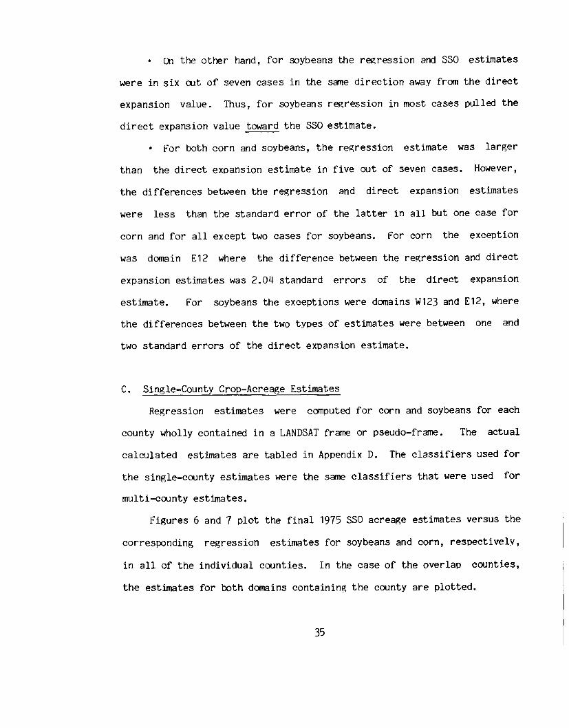
C. Single-County Crop-Acreage EstimatesRegression estimates were computed for corn and soybeans for each
county wholly contained in a LANDSAT frame or pseudo-frame. The actualcalculated estimates are tabled in Appendix D. The classifiers used forthe single-county estimates were the same classifiers that were used formulti-county estimates.
Figures 6 and 7 plot the final 1975 SSO acreage estimates versus thecorresponding regression estimates for soybeans and corn, respectively,in all of the individual counties. In the case of the overlap counties,the estimates for both domains containing the county are plotted.
35


t5
5 56.•
I
.;.I
1000,
symbol domaint 1 \H23
t 2 CIA3 CU
I 4 C33+5 E126 E23
6
3000 3
i 5
2
C0RN 5
S 2000 2S 30
x = REGRES5101~ l';STUIATE (X 1000 ACRES)'{ = S$O ESTnIAT.~ (X 1000 ACRES)
4000350030002500200015001000
o
4000
COHN REGRESSION ESTIHAT~
Figure 7. Comparison of regression and SSG county estimates for corn.
37

For the county soybean estimates in Fi~ure 6, it appears that in amajority of the counties the regression estimate exceeds the SSG value.Moreover, the frequency of the regression over-estimation varies withdomain. For example, in domain C33+ nearly all of the regression countyestimates for soybean acreages exceed the corresponding SSG countyestimates.
In Appendix D it can be seen that if a county is quite dissimilar inland use from its containing domain, then the county regression estimatebased on that domain deviates markedly from the county SSG estimate. Anexample of this is Dupage county which is in domains C12 and E12. Dupageis essentially a suburb of Chicago. Thus, with regards to land use it ismore like domain E12 than like domain C12. As can be seen in Figure 6,in Dupage county the soybean re~ression estimate based on domain E12 iscloser to the SSG estimate than is the regression estimate based ondomain C12. In fact, in domain E12 it appears that the soybeanregression estimates deviate very little from the SSG values in urbancounties such as Cook, Dupage, and Champaign, but in highly agriculturalcounties, such as Ford, Vermillion, and Iroquios, there are quite largedifferences between the regression and SSG values. This effect is aresult of the the highly heterogeneous land-use pattern of domain E12.
Though Figures 6 and 7 have different scales, it is apparent thatthere is better agreement between the regression and SSG estimates forcorn in Figure 7 than for soybeans in Figure 6. This is furtherevidenced by the correlations between the two estimates. For the entirestate the correlation between r~ression and SSG estimates is .96 for
38

corn and .91 for soybeans. In danain E12 the correlation between
estimates is .95 for corn and .85 for soybeans. In Figure 7 it appears
that for corn, unlike soybeans, the nunber of positive differences
between regression and SSG estimates is nearly equal to the number of
negative differences. However, several of the domain effects observed
for soybean regression estimates persist for the corn regression
estimates. For example, the r~ression estimate for corn acre~es are
less than the SSGestimates in the agricultural counties of danain E12,
as was also the case for soybeans. ~reover, in domain C33+ the
differences between regression and SSGestimates for corn are all in the
same direction. For corn the regression estimator consistently
overestimates in C33+, wherea s for soybeans it cons i sten tl y
underestimates there.
The coefficients of variation* for the com and soybeans
regression estimates are mapped in Figures 8 and 9, respectively. In the
case of the overlap counties, the lower C.V. is used. The distributions
of the C.V. 's are indicated in the figure legends.
As can be seen in Figures 8 and 9, many large C.V.'s for county
regression estimates for corn and soybeans occurred--41% of the C.V.'s of
county regression estimates for corn acre~es exceeded 30%. Similarly,
for soybeans 47%of the C.V.IS exceeded 30%. Somemoderately small C.V. 's
were obtained, however, in domain C1A, for example, all of the county
regression C.V.'s for com were between 10.0 and 12.0%.
-As is explained more fully in Appendix B, the variances, and hencecoefficients of variation, of the single-county regression estimatesgiven in this report are possibly overstated.
39

C.V. (%) Frequency,.. 10.0 19.9 29r~'m...........:.:.:.:.:.:.:.:. :. 20.0 - 29.9 30~.:~~~......1 ... "' ~~I.......... 30.0 39.9.............. - 20...............• .• .• .. . .• ..
I 1 40.0+ 211DTAL 100
Figure 8. Distribution of Coefficients of Variation (c. V. '5) of CountyRegression btimatcs for Corn

..~..~ .
••• ~ •• i~ •• _
, ..
_0...-.-0
.-
~"'i~'.. ...'.117"'1'
..~:
I~_.~--.. . . . . . .. .. . ... .. . . . . . .. . . . . . . .~ ...,..,. .
,,""'-
c. v. (%)10.0 19.9 2120.O~ 29.9 3230.0 - 39.9 2840.0+ 19
TOTAL 100
Figure 9. Distribution of Coefficients of Variation (C.V. IS) of CmmtyRegression Estimatcs [or Soyhc3Ils
Lfl

In Figure 8 it can be seen that the C.V. 's of county r~gressionestllnates for corn are lowest in northern Illinois and hi~hest in thesouthern part of the state. Fi~ure 9 shows that the opposite is true forsoybeans--high C.V.'s in northern Illinois and low C.V.IS in the southernpart of the state.
The magnitl~es of the regression estimate C.V. IS are partiallyexplained by the very magnitudes of the regression estimates themselves.Figures 10 and 11 show that many of lar~e C.V. 's were for re~ressionestllnateswhich were small in magnitude, and conversely many of the smallC.V.'s were for regression estimates which were large in magnitude.Large C.V.'s also occurred in areas where th~re was considerable spectralconfusion. For corn, large C.V. 's occurred in the southern part ofIllinois, where considerable spectral confusion between corn and treesoccurred. For soybeans, large C.V.'S occurred in the northern part ofthe state where considerable confusion between soybeans and cornoccurred.
Tables 11 and 12 present the regression estimates for th~ sixteenoverlap counties. Because each overlap county is contained in twodomains, each tabled county has two regression estimates for each crop.The difference between these two regression estimates, referred to as theoverlap difference, was compared in each overlap county to the larger ofthe standard errors of the two regression estimates, denoted S2.
For corn, six of the sixte~n overlap differences exceeded thecorresponding S2's. This occurred in the four counties overlapped byC33+ (July 16) and W123 (August 4) and in the two counties overl~p')ed by
42

100 X • REGRESSION ESTIMATE (X 1000 ACRES)Y • COEFFICIENT OF VARIATION OF REGRESSION ESTIHATE (%)
44
6 6C0RN 6
80.0 ~ domainC 1 Wl230 2 ClAE 4 3 C12F 6 4 C33+F S El2I 3 6 £23CIE 4N 60.0 tT
t 6 50 4F t 6V t 4 64 4A t 6 3R 6 6 4I t 6\A 40.0 +T t 6 66I ;. 6 4 60 :.. 1 61.,N A 6 6 66 5•• 5 6 6 664 6 4
3 66 4A 5 5 5 1~ 3 133 5... 5 6 3 3 3 1 3 53 5J20.0 + 1 1 3 31 3 5t 3 1 131 1 1 1 1 1 3 3'!> 1 1..~..... 2 2 2 2,j 2 2 2
0.0 t , , , , , ~0 500 1000 1500 2000 2500 3000 3500 4000
CORN REGRESSION ESTIMATE
fiRure 10. Coefficient of variation of regression estimates as afunction of the regression estimates for corn in individualcounties.
43

100 t x - REGRESSION ESTIHATE (X 1000 ACRES)Y - COEFFICIENT OF VARIATION OF REGRESSION ESTIMATE (%)
:;. 5~ 1
S ~0 1yB tE .. 5 symbol dOllla1D.'A 80.0 + 1 Wl23N
...2 CIA:.. 3 Cl2
C 4 C3l+-0 :.. 5 E12E :.. 6 E23FF :..
I :.. 1C :..
I 60.0 +EN :.. 6 5T :..
:.. 120 :.. 1 2F ;. 1 5. 5
•• 2 5V ~
i
A ••IR 40.0 t 2
I+
3 1 1A 6 3 1 1 3 5T .•. 3 3 2 1 3 5I ... 3 11 31 335 23 3 30 6 6 6 4 2N ::.. 1 4 1 ·3 4 3 5 3 3.. 14534 31 4 4,
'i" 6 4 3 46 4 441- 6 6 6
20.0 i 6 6 4 1 66 6.•. 6 6 6 6 464 6,j 5 6 6 66 6t 6 6 6; 6~
i0.0 1.
6
, I0 500 1000 1500 2000 2500
SOYBEAN REGRESSION ESTIMATE
figure 11. Coefficient of variation of regressionfunction of the regression estimatesindividual counties.
44
estimates asfor soybeans
ain

UlCIJ~Uell
'1;jCIJ~lilE..-l~UlCIJ
lHo~oUl..-l~ellp..
6u
» ::l ell CIl »~ ell ..-l ~ ~ ~ CIJ
§ <Il I-l 0 ~ <Il III
I-l 0 CIl 0 CIl I~0, ::l CIlI~
U ,~u, ~ p..
ItS

CMIo
NI
N.-lI
.-l
.-l-lC
oLJ"\
Jo.-lokok

C12 (August 21) and E12 (September 7). In the latter two counties theoverlap differences were between 1.0 and 1.5 times S2, and in the fourC33+/W123 counties the overlap differences were from 1.5 to 2.0 times S2.
For soybeans, four overlap differences exceeded the correspondin~ S2values. Of these four, three were between 1.0 and 1.5 times S2--Stark,Mason, and Moultrie, where the corn overlap differences were all lessthan corn S2's--and one was between 1.5 and 2.0 times S2, namely Dupage,where the corn overlap difference was also greater than its correspondingS2 value.
Even thoogh many of the overlap differences were less than or onlyslightly larger than S2, a number of the overlap differences werenevertheless fairly large because S2's were large. For example, forcorn, in Dupage county the regression estimate based on domain C12 wasmore than 300% above the regression estimate based on domain E12. Thiswas caused by the different land-use distributions in the two domains andby the different strata poolings used for county estimates in E12 andC12. (The same strata pooling is used for all county estimates in thesame danain, ho..lever.) The E12 estimates were made using a "swisscheese" estimator for pooled stratun 30; i.e., in domain E12, regressionestimates were computed for strata 11, 12, and 20 and a direct expansionestimate was computed for stratum 30. This eliminated a comrrdssion-errorbias in the regression estimate which would have occurred had stratum 30been used for regression. In danain C12, ho..lever,stratum 30 was pooledwith strata 12 and 20. For the corn regression estimator based on domainC12, the stratum estimates for corn in Dupage county were the following:
47

Strata11
(12,20,30)TOT AI...
Estimate188943106155961
StandardDeviation
45563199538267
C.V.(%)
24.1102.568.4
Note that the contribution of pOoled stratum (12,20,30) was 61% ofthe total estimate. If instead a "swiss cheese" estimate had been used,the contritution of oooled strata (12,20,30) would have been considerablyless.
V. ConclusionsIt was found that classifier Performance was influenced by a number
of temporal, methodological, and geograPhical factors*.were obtained when corn was tasselled and near dough
Best resultsstage of
development. Dates earlier or later in the growing season produced poorresults. However, the effects of atmosphere on the results obtainedcannot be independently measured or completely separated from the effectsdue to the maturity stage of the crops. Also, poor classifier performancewas observed in areas where considerable SPectral confusion was present.This s~gests that multi-temooral LANDSAT data should be investiRated asa means to decrease spectral confusion between crops.
-Another factor affecting classifier Performance is average field size.The magnitude of this effect is being assessed by comparing the resultsof the Illinois Crop Acreage Experiment to results from similar studiesin other states. These comparisons will be presented in future repOrts.Average field sizes in acres in Illinois by crop type were woods - 21.1,corn - 29.1, oats - 14.2, winter wheat - 17 .9, sorf1,hum- 14.6, soybeans -28.9, alfalfa - 14.4, clover - 12.0, and permanent pasture - 11.0.
48

Resubstitution was found to be an acceptable method of classifiertraining and testi~ for a classification domain which contained 84segrrents. Equal priors proved to be the best type of "priorprobabilities" to use for estimating; corn acreap;es. However, forsoybeans, the best type of priors varied by domain. Minor crops couldnot be distinquished with any dep;reeof consistency or accuracy and it isfelt that the project methodolg;ywill not improve minor crop acreageestimates.
For major crops, however,estimates for counties and g;roups
increases in precision of acreageof counties can be achieved using;
LANDSAT data with the methodolog;ydeveloped in this project. However,the large coefficients of variation make the majority of the countyestimates unsuitable for operational use with the present area-samplesize. Nevertheless, estimates for groups of counties appear quiteencouraging when sufficient spectral separability is present in theLANDSAT data. The reported variances of the single-county regressionestimates may be overstated but are, nevertheless, a function of spectralseparability and re~ression-domain homop;eneity.
In order to perform the developed rrethodolo~, LANDSAT frames had tobe joined top;ether in several cases to provide sufficient data fordesigning the classifier and for estimating;strata rep;ressionparameters.It is felt that when an adequate number of segments for classifiertraining and testing is available that only 8 to 14 counties shoulddefine a regression domain. These counties should be spatiallycontiguous and the resulting domain should be as homogeneous as possiblewith regards to intensity of cultivation.
49

Finally, even though the ability of LANDSAT data to imorove acreageestimates varied widely across the data sets analyzed, it is felt thatwhen improved sensor technology is realized or possibly in geographicalareas with larger field sizes that the developed methodology may providecounty acreage estimates for major crops with precisions suitable foroperational use.
VI. References1. Ray, Robert M., III and Huddleson, Harold F., "Illinois Crop-Acreage
Estimation Experiment", Proceedings of the 1976 Symposium on MachineProcessing of Remotely Sensed Data, Purdue University, WestLafayette, Indiana.
2. Cook, Paul, ""ProceciJresfor Boundary Location in LANDSAT MSS DigitalData", Statistical Reporting Service, United States Department ofAgriculture, Washington, D.C., in progress.
3. Donovan, Walter E.; Ou;a, Martin; and Ray, Robert M.; "Compilationand Geometric Registration of ERTS Multitemporal Imagery," CACTechnical Memo No. 52, Center for Advanced Computation, U~iversity ofIllinois at Urbana-Champaign, Urbana, Illinois, May 1975.
4. Donovan, Walter E., I·Oblique Transformation of ERTS Images toApproximate North-South Orientation," CAC Technical Memo No. 38,Center for Advanced Computation, University of Illinois atUrbana-Champaign, Illinois, November 1974.
5. Ozga, Martin; Donovan, Walter E.; and Gleason, Chaoman P., "AnInteractive System for Agricultural Acreage Estimates Using LANDSATData," Proceedings of the 1977 Symposium on Machine Processing ofRemotely Sensed Data, Purdue University, West Lafayette, Indiana.
6. Startuck, Robert R., "Overview and Examples of the EDITOR System forProcessing LANDSAT Data", Statistical Reporting Service, UnitedStates Department of Agriculture, Washington, D.C., March 1977.
7. Sigman, Richard R.; Gleason, Chapman P.; Hanuschak, George A.; andStartuck, Robert A.; "Stratified Acreage Experiments in the IllinoisCrop-Acreage Experiment", Proceedings of the 1977 Symposium onMachine Processi~ of Remotely Sensed Data, Purdue University, WestLafayette, Indian~
50

8. Huddleston, Harold f., and Ray, Robert M. III, II A New Approach toSmall Area Crop-Acreage Estimation", Annual Meeting of the AmericanAgricultural Economics Association, Pennsylvania State University,State College, PennsYlvania, August 1976.
9. Wigton, Willian H., '·Use of LANDSAT Technology bv StatisticalReporting Service'·, Proceedings of the 1976 Symposium on MachineProcessing of Remotely Sensed Data, Purdue University, WestLafayette, Indiana.
10. Toussaint, Godfried T. , "Bibliop.;raohy on Estimation ofMissclassification", IEEE Transactions on Information Theory. Vol.IT-20, No.4, (July, 1974), pages 472-79.
11. "Illinois Weekly i\leatherand Croo Bulletin", Illinois CooperativeCrop Reporting Service, Springfield, Illinois, 1975.
Remote SensingNASA, Lyndon B.
12. "Crop Identification Technology Assessment for(CITARS), Volume X, Interpretation of Results",Johnson Space Center, Houston, Texas, December, 1975.
13. Von Steen, Donald H. and Wigton, William H., "Crop Identification andAcreage Measurement Utilizing LANDSAT Imagery", Statistical ReportingService, United States Department of Agriculture, Washington, D.C.,March 1976.
VII. CONTRIBUTIONS BY AUTHORS
Chapman Gleason: Project Coordinator; Analysis of W123, E2+, E3+; systemsdevelopment; statistical methodology; ground data collection coordinator;project write-up.
Robert Starbuck: Analysis of W123 jackknifing, El, E2; systems development;statistical methodology.
Richard Sigman: Analysis of Wl, Cl+, C2, C3, C3+; systems development;statistical methodology; project write-up.
George Hanuschak: Analysis of W2, Cl+, C2; ground datastatistical methodology.
Michael E. Craig: Analysis of C1A.Paul W. Cook: Registration of C2, C3, C4, E2, E3, E4.
collection;
Richard D. Allen: Coordination and management of the ground data collectionin Illinois.
51

•• A6
•••••••••• AS
• • • • • • • • • • A4
Appendix A
Supplementary Survey Questionnairesfor 1975 Illinois Crop
Acreage ExperiMent
Questionnaires:
·JES Satellite Crop Information Supplement •••••••••• A2·~IDnthlyupdate questionnaires:
-Printed questionnaire (July visit) •••••••••••• A1-Computer-generated questionnaire
(August and September visits) •-Discrepancy Correction Form
Instructions .
Al

---
I
I-
-
IT
I l I
I
III
I
1
II II I~.•dc::-.~u:.o
c:c: 0OU....•..-- .0-Zll..
II.•\ I IIfL

I';I••••L
!
· il ~
l-XW:IiW.Ja.a.::>'"
'1"1 •..• ~IE r:
• ".~ '.~.5:) '" ..
....e •.u "t"1 00
• Dt-~li
• .. ;' ,.7"; ,..
.~ Q •...- ..0::1 ........ ; Y
.,....ON",U:U.!
.~
..eu• :;~_(}\O
"":s
••••_-" ..• E-"""%
..~!1:! ...,I-U~
·~" ".-"E E N
"'''~%
. ::.- .. ..•DD_0 >
A3
"". ~.
• ! .
". ,"
! ,:_~, . "

....•c<c'V>~""
I I I. . .I I II I I. . .I I I
A " A" A AA A AA A AA A AA A A A A,.
A A AIII III IIIWO WO ILl0>-Z >-2 >-z
I J~
"1 1
A A AA , A , A •A~ AID AID" ... A_ 10_, , . ,IIIA IIIA 11110WO WO ILl0>-Z >-Z >-Z
III III II) 1ft.., .., .., IIIl- I- l- t-0 0 0 az Z z z...•--- N---
CL0'O:~v,
•a: .- • • • •w ,III a a a ar ------- ..1--- ..1--- ..1--- ..J::> • III III III IIIZ ••• ..• ..• ..• ..•• to. to. to. to.
-----------0..lOW ,wa:o ~-co -• IL.VV ,
• -----------••• a• w >-W• a 11..111• zw ••.• ::> •• Will V ...• 1-::> W -• z a.. ,• •... III••• -----------• ,• .0
01&...LLt-4UW ••..•t- ,•.... -----------III... ..,> III >-w::> 1&.:1:t- o: _e IZ 00 VZ 11\W Z W -0: 0.« 0. ,0: 0..1 III::> a:v v• -----------• ,• ..• OIL. •••-vw-• ,• -----------• I• ><• Q. ., .• 0 ><l'l I• Z 0: >e-• - v >< ,•• w• co• « J• 11.1 a ><• z .... .,• v .., >eN I• .. - ><-• II.. >< ,-------- A0>-1'- A..10: 0 ..,0: Awe.., ..10 A-a:!! v , AI&.ZZ ct'V)_ •..• A A:>e •........,0 ...• "1Il0::J: U>-Z , III«!DV WO::J: >-Z-------------
••• •••• co• c• w z• a: - a• v ..I ••.• w ••.· -,• •••.-----------•t--lit 11.1•.• r ,:> III c.o
a: III Z'II) 0 ::>::>o CL a•.•0 Z:> a: cIII V..I w,a: 1011\CL 0 ,
v.-----------••.0• ..I...,.-••••••
• •••• •~
• •• •• •• t- •• z •• o.W •• ox 0• O:W •• V.J • >-• Q. • C• ..,0. • a• t-::> • ,• •••111 • 0• ..I • X• .JZ •• WO •• t- •.• • l-• «l- • -• 11)« • III• X • - 0:• a: • > 0• "'0 • t-• r-IL. • ... e• ~z • 0 a:• - • W• • III X.. • t- ::>• • .. Z• • • ••• 0 III
'""'V>01-V> __r- •...•V) '".~0 •...•..
IIIcr..,..,·rm •.•0:1:0.W::> ><>z..,ocr • .Jn.lXl«« >•0xxcr0: a..o .n.11.0«

AS
•...o•..nI•...
I I I I
a..•nI•...•0-)(
iii IIIQj
'U •..a 0nI Z
..\I:uG.l.cl)I
'UG.l:>....•0toG.lll;
0
-Z
IIIQj
><1
'UQj
:>•....•0IIIQj
ll;
G.l.D
0•..to
SQj•...•.00•...a.nI•..nICl
'U.....•Qj..•~
1•..a
Qj Qj •..§ E u
- ..nIOIl •...a Qj
f-4iii II)

INSTRUCTIONS FOR COMPLETING 1975 SATELLITE CROP INFORMATION SUPPLEMENT
I. PURPOSE:
Research is being conducted this crop year in Kansas, Illinois. andT~xss to investigate the potential operational use of satellite datato improve crop acreage estimates at the State and County level. Cropor land use information collected in the June Enumerative Survey (JES)along with followup visits to the segments will be used to aid incomputer identification of different crops.
You will be either conducting an interview with the tract operator orobserving each agricultural field in agricultural tracts and recordingits crop or land use. If the crop or land use has changed since thelast time the field was visited, the current crop or land use is to berecorded. and the date of harvest or land use change is to be acquiredfrom the tract operator.
If. nF.FINITIONS:
A. All JES definitions hold including:
Field - a continuous area of land inside a tract devoted to one cropor land use.
R. For this survey. some additional clarification of crop or land use isas follows:
Crop - record the crop name for an field seeded to one agriculturalproduct. such as winter wheat.
Land use - record a specific use for a field not in any planted crop.
Examples are permanent pasture (note type of graBlJ grown). summer fallowand idle crppland. NOTE: Alfalfa hay is a crop use and not a ~use.
Change in Crop or Land Use from Previous Visit - a crop chauge refersto any change from tbe previously reported crop planted (winterwheat to soybeans. etc.) or crop appearanc~ (winter wheat nowharvested to idle cropland or alfalfa just cut for hay). Aland use change refers to any cbange in 1anlSutilization suchas cropland pasture now plowed up or sUIIIIIlecfallow now plantedto winter wheat.

- 2 -
111. PROCEDURJo:FOR INTER.VIEW OR OBSERVATION
A. PRIOR TO VISITING SEGMENT (At /tome. be.6olLe enumeJla.uon)
1. ColuD~s 2, 3, 6, 7, and 8: For the July visit, complete thesecolumns by copying the crop/land use from Line 2 of the JEStract questionnaire and acreage field data from the JES Sec-tion A - Acreage of Fields and Crops in Tract. Copy infor-mation for all tracts with agricultural field data reportedin Section A of JES Part A questionnaire. You do not have torecord or observe any field which farmstead, roads, ditches,woods, etc. (Any JES Line 5 field).
2. Column 4 (Followup field number): This column must be used whena .IES field is subdivided and different crop or land use is madeof any part of a field since the time of the previous visit.
). Identify tracts where the operator will have to be contacted.These tracts can be identified since theywere selected for a.July Update or Objective Yield interview or because there iso likelihood of a crop or land use change for a field since thelast time the segment/tract was visited. Examples of fieldslikely to have changes are: winter wheat, any hay crop, inten-tions to plant a spring sown crop or harvest of a spring sowncrop such as soybeans. Contact the operators of these tracts andobtain the field information for the satellite supplement withoutobserving fields.
Try to observe the fields in tracts not to b~ contacted. Ifnecessary, contact the tract op~rator to obt~in the satellitesupplement information.
8. VISITING THE SEGMENT
1. Tract operators requiring an interview - For all operatorsr~quiring a visit, obtain satellite supplemer.t information foreach agricultural field in the tract. Interview the tractoperator if this is possible. If operator is not available,obtain survey data from a reliable source, such as wife, hiredman, etc. Follow the instructions as given on. the supplementfor the interview.
2. Tract operators not requirinR an interview - Observing crop/landuse and field appearance instructions are as follows:
A7

Task 1:
Task 2:Task 3:
Taak 4:
Ta!'lk 5:
TaAk 6:
Task 7:
- 3 -
Locate the tract and record the starting time (Military)when you started to observe fields. Record ID informa-tion in upper right hand corner.Enter date of visit in Column 1, example (July 24 - 07/24).Verify the pre-entered tract and field data for the tractin Columns 2 through 8.Complete the field observation and verification. Observeeach field in the tract by driving past the field andidentifying the field's current crop or land UAe. If noportion of the field has changed land use from the previousvisit, check a "no" (Column 9) and enter the field appearancecode (Col~ 18). Then complete any notes on this particularfield in Column 19. When the crop or land use has changed,follow the Flow Diagram for Task 4 to record the changes.Verify the pre-entered tract and field data (Columns 2, 3,6, 7, & 8) for another tract in the segment and continueuntil all tracts are covered.Contact tract operator(s) for field9 that have crop orland use changes since the previous visit. (Yes, checkedin Colu.n 9), and complete two or ~re linea for eachfield with a crop or land use chang~. (See TaAk 6 in the~low cLi4g1UJlft) •Record ending time when you leave segment.
c. AFTER VISITING THE SEGMENT
1. For the August and Septeaber visits: Copy the previous visitsfield data into Colu.as 2 through 8. Pre-enter data in Column4 only when a JES field has been subdivided into two or morefields on a previous visit.
2. Mail the completed Satellite Supplement for the visit just com-pleted to the State Office in the envelope pl'cwided.
A8

Appendix BEstimation Methods and Classifier Desi~n
Procedures Used in the Illinois Crop AcreaRe Experiment-
I. STATISTICAL THEORY AND METHODOLOGYA. DIRECT EXPANSION ESTIMATION (GROUND DATA ONLY)
Aerial photo~raphy obtained from the Agricultural Stabilization andConservation Service is photo-interpreted using the percent ofcultivated land to define broad land-use strata. (See Table 81.)Within each stratum, the total area is divided into Nh area frame units.This collection of area frame units for all strata is called an areasampling frame. A simple random sample of nh units is drawn within eachstratum. The Statistical Reporting Service then conducts a survey inlate May, known as the June Enumerative Survey (JES). In this generalpurpose survey, acres devoted to each crop or land use are recorded foreach field in the sampled area frame units. Intensive training of fieldstatisticians and inteviewers is conducted providing rigid controls tominimize non-sampling errors.
The scope of information collected on this survey is much broaderthan crop acreage alone. Items estimated from this survey include crooacres by intended utilization, grain storage on farms, livestockinventory by various weight categories, and agricultural labor and farmeconomic data.
Let h = 1,2, ..., L be the L land-use strata. Eor a specific crop(corn, for example) the estimate of total crop acreage for all purposesand the estimated variance of the total are as follows:Let Y = Total corn acres for a state (Illinois, for example).
Y = Estimated total of corn acres for a state.Yh' = Total corn acres in jth sample unit in the hth stratum.Then J
LY = L
h=1(1)
*Excerpted from Sigman, Richard R.; Gleason, Chaoman P.; Hanuschak,George A.; and Starwck, Robert A.; "Stratified Acreage Experiments inthe Illinois Crop-Acreage Experiment", Proceedings of the 1977 Symposiumon Machine Processing of Remotely SensediData, Purdue University, WestLafayette, Indiana.
81

The estimated variance of the total is:L N2 Nh - nh
nh - )2v(y) Lh
L (Yh" -= (n - 1) Nh Vhh=l nh h j=l JNote that we have not
classified LANDSAT pixels.direct expansion estimate,
As an example, forexpansion estimates were:
vet made use of an auxiliary v3riable such asThe estimator in (1) is commonly called a
and we will denote this by yDE
the state of Illinois in 1975, the direct
~orn YDF.= 11,408,070 Acreselative Samplin~ Error = 2.4% =
Soybeans YDE = 8,569,209 ~Relative Samplin~ Error = 2.9% = Iv(¥) I Y
B. REGRESSION ESTIMATION (GROUND DATAAND CLASSIFIED LANDSAT DATA)
The rEgression estimator utilizes both ~round data and classifiedLANDSAT pixels. The estimate of the total Y using this estimator is:
whereYh(reg) = Yh + bh (Xh - Xh)
regression coefficient forregressin~ ~round-reported~ sample units.
the aver~h corn acres per samplefor the h land-use stratum
nh= L YhJ"I nhj=l
the estimatedstratU1l whenpixels for thenhL (Xh· -~) (YhJ"- Yh)
j=l J=-----------nh - 2.L (xhj - xh)
J=l
B2
Imit from the ~round survey
ththe h land-useacres on classified

the average number of Pt~els of corn per frame unit for allframe units in the h land-use stratum. Thus whole LANDSATframes must be classified to calculate Xh. Note that this isthe mean for the population and not the sample.
Nh= . L ~/Nh
1=1
the aver<¥!;enLlnberland-use stratunnhL xhJ,/nh.j=1
=
~i = number of pixthS classified as corn in the ith area frameunit of the h strata.
of pixels of corn per sample unit in the hth
Xhj = number of pixthS classified as corn in the jth sampleunit in the h strata.
21 - rhnh - 2
The estimated (large sample) variance for the regression estimatoris
2L Nh Nh - nhv(YR) = L --- Nh=1 nh h
where 2rh = sample coefficient of determin8tion bet~~en reported corn
acres and classified corn pixels in the h land-use stratum.
=
Note that,L nh - 1 2 ~= L -----~ (1 - rh) v(Y)h=1 nh - c.
(2)
and so lim v(YR) = a as r~ + 1 for fixed nh. Thus a gain in lowervariance properties is substantial if the coefficient of determinationis large for most strata.
The relative efficiency of the regression estimator compared to thpdirect expansion estimator will be defined as the ratio of therespective variances:
B3

.-R • E. = v( Y DE) / v( Y R ) ( 3 )
W1en LANDSAT oasses do not cover the entire state on one date, itis necessary to 1.-.Grkwith analysis districts (danains) which are whollycontained within a LANffiATscene or pass. In this stillythe analysisdistricts \-.erecollections of counties wholly contained in a LANffiATpass. The regression estimate for the ith analysis district is
L·YRi =h~~ Nhi Yhi(re~)
where
When analysis districts are used, degrees of freedom for leastsquares regression by strata can become small. Under thesecircumstances it t~S necessary to pool strata, and the re~ressionestimate for the i analysis district becomes:
L"YR1" = 1:;1N- y.k=l ki ki(reg)'
where L- = total number of pooled strata for the ith analysis domain,
for k = 1, 2, , Li, and Nki, X~i' x~", yr;" are adjusted forvarying sizes of the sample units 1n eacft stratum. (Thus, h indexesindividual stratum; whereas, k indexes pooled stratum. Consequently,the - notation is redundant and will not be used in the next section.)
C. COUNTY ESTIMATES USING A REGRESSION ESTIMATORLet Nk ,c = total number of area frame units
strata for a set of C counties.in the kth pooled
~ = total number of oixels in tHe set of C counties,c classified as corn for the k pooled stratum divided
by Nk C',Then an estimate based on the regression estimator of the total cornacreage for the C counties is:
L
YREG,c = K:1Nk,c(Yk + bk (~,c - xk»
B4
(4)

L 2= r Nk=1 k,c
- )2- xk
whereI(C) = 1 if O(C) < total number of counties wholly contained
in the analysis district= 0 otherwise
O(C) is the cardinality of the set C.S~,y = variance for the corn reported acreage for the kth
pooled stratllTlnk 2
=.r (YkJ' - Yk) / (nk - 1)J=1Note that when I(C) = 1, the variance formula contains a term which
is not present when I(C) = O. This extra term occurs because thestatistical treatments of these two cases are quite different. When Cis the entire regression domain [I(C) = 0], the problem is one ofestllnatingthe oopulation total for the regression domain. On the otherhand, when C is a subset of the regression domain [I(C) = 1], theproblem is one of predicting a sub-population total using the stratumregression equations developed for~sample from the entire population.
In this latter case, the variance formula given above is derived bytreating the part of C contained in stratum k as a single (fictitous)segment in which the number of pixels classified as the crop of interestis Xk . This is equivalent to assuming that there is no variation atall ~ong the "errors"--Le., reported acres minus regression-predictedacres for the crop of interest--for the (actual) segments in C. Ifthere is such variation, and preliminary investigation suggest thatthere is, then the stated variance formula is conservative andoverstates the variability of the county regression estimates. Attemptsto more accurately model the structure of the regression-error arecurrently being pursued and if successful will be described in a futurereport.
II. DESIGNING A QASSlfIERThe pixel classifier is a set of discriminant functions
corresponding one-to-one with a set of classification categories. Eachdiscriminant function consists of the category's likelihood orobability
85

for the caselikelihood functionsand covariances ofcategory discriminantmeans and covariances
multiplied by the category's prior probability. If the priorprobabilities used are cgrrect for the population of pixels beingclassified, then the resulting Bayes classifier minimizes the posteriorprobability of misclassifying a oixel for a 0-1 loss function.
In crop-acreage estimation, however, the objective is to minimizethe variance of resulting acreage estimates. Since minimizing theposterior probability of misclassification does not necessarily achievethis objective, optimum acreage estimation may require the use of priorprobabilities different than the optimum Bayes set.
of multivariate normal signatures, the cate~oryare completely specified by the population means
the category signatures. Thus, the calculation offunctions involves the estimation of signatureand category prior probabilities.
Designing the classifier for this experiment consisted of thefll~ing steps:
1. Identification of classification categories.2. Calculation of signature means and covariances and category
prior probabilities from a training set of labeled pixels (called"training the classifierll
).
3. Measlrement of classifier performance on a test set of labeledpixels (called "testing the classifier").
4. Heuristic optimization of the classifier by repeating steps 1through 3 for different numbers of categories and/or different priorprobabilities, and then proceeding to step 5 for the 1I0ptimized"classifier.
5. Estimation of classifier performance in classifying the entirepixel population.
Because of the availability of ground data, which supplied thelocation and cover type of agricultural fields, supervisedidentification of classification categories was possible. Aclassification category was created for each cover type in which thenumber of training pixels exceeded a specified threshold, usually 100pixels. In addition, a classification category for surface water wascreated usi~ pixels from rivers, lakes, and ponds.
A classifier was heuristically optimized through aclassification trials using field-interior pixels to trainsegment-interior pixels to test. The various trials usedcombinations of the number of categories and the method ofprior probabilities.
B6
series ofand all
differentcomputing

Table 81. Stratum numbers and definitions
:non-:agricul tural
( 30)range landproposed waterwater /
10
stratundescription
intensiveagrirnl ture
sub-stratundescription
75~+ cultIvated50% - 75% cultivated
20 15% - 49% cultivated31\ \32 :urban33/406162
87

PER
FLDS EP
---.----Train! I Priors-'~~.~:.-~_..t----~-··NB I EP
i1 PER
Appendix C: Results of Individual Classification Trials
TableCl. Summary of Corn Classification trials for data set WI.
% Correct I Str;;ta POD] ing ---rl-- Rj/ I I:El TRE2-I I
541--0----:--.83 - F~~~~I 10-50 I .80,.36 3.95 3.78j 11-12-20-30 .86,.62,.09,1.0 4.25
88 0 .64 2.74 i 1.4610-50 .56, .50 2.15 . i 2.06
11-12-20-30 1'.65,.60,.06,.95 12.4657 0 .84 5.97 i 3.18
10-50 .82,.31 4.20 I' 4.0211-12-20-30 /'.89,.57,.15,1.0 4.58
84 I 0 .70 3.26 11. 74
I10-50 ! .62,.51 112.44 2.33
_ 11-12-20-30 !.72,.56,.07,.97 12.77-----'-------'-- I ---------, __ L-_
Table C2. Summary of Soybean Classification trials for data set WI.
T~ain/ 'I' P=iors I % Correct iJest i-~~--r-~--t-~
PER 74 III
FLDS EP 71 II
PER 74 III
Strata Pooling
o10-50
11-12-20-30o
10-5011-12-20-30
o10-50
11-12-20-30o
10-5011-12-20-30
C1
.81.82,.83
, .82,. 70, .98, .98
I.82
.83,.83i .83, .72, .98, .98
.81.82,.84
.82,.75,.99,.98
I .82.82, .84I .82,.72,.97,.98
,
5.255.26
5.425.43
5.205.25
5.415.42
RE2
4.734.815.564.894.975.764.694.815.624.874.965.74

Table C3. Summary of Corn for Classification trials for data set W2.
Tr:'lin/i hiors ; >( Cormt;Test I i I-----~-----,
----rRE1?
o .63 2.6611.6110-50 .66,.19 1.68 1.76
11-12-20-30 .66,.71,.06,.28 1.27o .41 1.65 1.0010-50 .55,.15 1.47 1.54
11-12-20-30 .72,.48,.25,.00 1.15o I .69 3.16 1.91
10-50 I .74,.30 2.03 2.13
_--'- -'-- -'- 1_1-_1_2-_2_0-_3_0_--,1_·82•• 58•• 12. ~_--..J-_1_' 6_7
PER 85
NB
FLDS
EP
EP
51
54
Strai:a Pooling
687437731
Table C4. Summary of Soybean Classification trials for data set W2.
Train/-~ ..
I Pooling II Priors I % Correct Strata ~2 REl I RE2Test I iI I
NB EP 65 0 .62 2.53 2.210-50 .60,.49 2.10 2.1
I11-12-20-30 .73,.31,.63,.55 1.9
PER 63 0 .63 2.63 2.3I
I 10-50 I .62,.49 2.15 2.2I I
11-12-20-30 .73,.38,.58,.55 1.9FLDS EP 65 0 .63 2.60 1.6
I10-50 .61,.51 2.16 2.1
11-12-20-30 .73,.34,.63,.02 1.9
I
C2

REI EE2
3.34 1.732.23 2.00 *
2.232.08 1.071.74 1.56
1.813.90 2.022.54 2.28
2.482.32 1.201.86 1.67
1.91
40*2521831297
Table C5. Summary of Corn Classification trials for data set W123.
Tr;,inrT-r;riOr~ -;- /0 r:(/-rr~-CLi-S-trata Poo ling I - R,;-
-~~;~~~--j--------t----__._._~_. -L. ._ll ~
NB EP I 52 I 0 ! .70I 10-50 I .72,.21I 11-12-20-30 .78,.54,.00,.58
PER Ii 86 10~50 II . 56~:1811-12-20-30 .67,.57,.00,.20
FLDS EP 48 0' .7510-50 .77,.27
11-12-20-30 .86,.47,.01,.70PER 84 0 .57
I10-50 I .59,.21
11-12--20-30 1.71,.54,.01,.23____ ~ ..L- L .1-,. -"- __ ---1.. _
*C1assifier used for crop-acreage estimates.
Table C6. Summary of Soybean Classification trials for data set W123.
.._-I --
% Correct TSttata IITrain/ l'r iors Pooling Ib2 REI RE2
Te.3t II +-
NB EP 63 0 I .67 2.99 2.810-50 .69,.49 2.56 2.6
11-12-20-30 .77,.44,.57,.56 2.5PER 67 0 .74 3.32 3.1
I 10-50 .74,.50 2.78 2.811-12-20-30 .78,.62, .55,.66 2.9
I
FLDS EP I 47 0 .62 2.61 2.410-50 •64,•47 2.29 2.3
I 11-12-20-30 .68,.50,.56,.55 2.3PER 66 0 .71 3.39 3.2
10-50 .74,.52 2.84 2.8
I 11-12-20-30 .78,.64,.56,.66 2.9i
*C1assifier used for crop-acreage estimates.
C3

Test :I INB EP 41 0 .71 3.30 1.71
10-50 .70,.59 3.15 3.0811-12-30 .84,.77,.59 5.39
PER 87 0 .71 3.30 1.14I 10-50 I .37,.78 1.53 1.49I 11-12-30 .53,.61,.78 2.01FLDS EP 44 0 I .77 4.24 2.19
10-50 I .75,.66 3.81 3.7211-12-30 1.86,.79,.66 6.30PER 87 0 I .59 2.34 1.21I
10-50 .41,.75 1.64 1.6011-12-30 .58,.60,.75 2.20
:
Table C7. Summary of Corn Classification trials for data set CLA.
Train/ i I'riors I-/" correc?rata Pooling I
*C1assifier used for crop-acreage estimates.
REi fRE2I
*
*
Table C8. Summary of Soybean Classification trials for data set CLA.
I , --.-Train/ I Priors % Correct Strata Pooling I Rh2 I REI , RE2ITest I ,I I
NB EP 61 0 .66 2.88 2.6210-50 .62,.96 2.59 2.39
11-12-30 .61,.24,.96 2.38PER 68 0 .66 2.88 3.5310-50 .71,.96
13•46 3.19
11-12-30 .72, .12,.96 3.11FLDS EP 62 0 .71 I 3.34 3.0510-50 .67,.98 I 3.03 2.79
11-12-30 .66,.30,.98 2.76PER 68 0 .77 4.20 3.8310-50 .74,.98 3.78 3.48
11-12-30 .74,.15,.98 3.39
*C1assifier used for crop-acrea~e estimates.
C4

Table C9. Summary of Corn Classification trials for data set C12.
Train/ Priors Categories % Strata Pooling R2Test Correct h REI RE2
NB EP 26/HCPC & PC 51 11-12-20-30 .17, .42, .15, .00 1.09nDS 10/HCPC & PC 64 11-(l2,20)-3r) .20,.20, .00 1.12NB PER 6/SCPC & PC 89 (11,12,2v) .07 1.06
89 11-(12,20)-3r) .33, .07, .00' 1.20EP 50 11- (12,20,30) .02, .02 .98PER 5/SCPC & PC 90 11-12-20 .29,.09,.01 1.16EP 4/SCPC & PC 88 (11,12,20) .05 1.04
11-(12,20) .33, .05 1.2711-12-20 .33,.09,.02 1.21
*C1assifier used for crop-acreage estinates.
TableCIO. Summary of Soybean Classification trials for data set C12.
Train/ Priors Categories % Strata Pooling~
REI RE2Test Correct
NB EP 26/MCPC & PC 76 11-12-20 .35,.61,.79 1.68FLDS 10/MCPC & PC 56 11-(12,20,30) .25,.79,.56 1.59NB PER 6/SCPC & PC 70 (11,12,20) .44 1.77
70 11-(12,20)-30 .33,.82,.66 1.78EP 67 (11,12,20) .40 1.64
67 11-(12,20) .29,.81 1.6167 11-(12,20,30) .29,.79 1.83
PER 5/SCPC & PC 72 11-12-20 •34, •84 ,.83 1.72EP 4/SCPC & PC 76 11-12-20 .36, .79, .80 1.74 *
*C1assifier used for crop-acreage estimates.
cs

Table C1l. Summary of Corn C1assi~iction trials ror data set C33+,train/test on NB.
Prior
EP
PER
a' I ,10
S Cater,ories Correct Strata PC101ir.g R 2 REI RE2I 11rI
9/SCPC & PC 62 11-12-20-30 .26,.47,.38,.12 1.44 1.4410/SCPC & PC 48 0 .58 2.36 1.53
10-50 .46,.52 1.86 1.74*! 11-12-20-30 .30,.52,.47,.22 1.60 1.60
12/MCPC & PC 21 0 .47 1.87 1.2110-50 .39, .40 1.60 1.4911-12-20-30 .28,.61,.51,.01 1.67 1.67
14/SCPC & PC 09 11-12-20-30 .01, .02, .34, .02 1.08 1.0816/MCPC & PC 07 11-12-20-30 .00, .05, .52,.11 1.17 1.1717/SCPC 08 11-12-20-30 .01, .02, .33, .02 1.07 1.0719/MCPC 07 11-12-20-30 .00, •06 ,.47,•11 1.15 1.15
9/SCPC & PC 87 11-12-20-30 .49, .14, .00, .00 1.21 1.2110/SCPC & PC 86 11-12-20-30 .52, .15, .00, .00 1.22 1.2214/SCPC & PC 86 11-12-20-30 .52, •15, .00, .00 1.22 1.2216/SCP.C & PC 58 0 .03 1.01 .66
10-50 .33, .04 1.29 1.2111-12-20-30 .70, .03, .17, .02 1.42 1.42
17/SCPC 87 11-12-20-30 .56, .11, .00, .00 1.24 1.2419/MCPC 58 11-12-20-30 .70, .06, .07, .02 1.36 1.36
1 I*C1assifer used for crop-acreage estimates.
C6

Table C:i =:. Sunnnaryof Soybean Classification trials for data set C33+,train/test on NB.
%Priors Categories Correct Strata Pooling ~2 RE1 RE2
EP 9jSCPC & PC 42 0 .37 1.56 1.1610-50 .27,.54 1.55 1.5511-12-20-30 . 10, •75, . 57, . 5C 1.97 1.97
10/SCPC & PC 29 0 .48 1.90 1.4110-50 .40, .52 1. 76 1. 7611-12-20-30 .22,.79, .58,.71 2.23 2.23*
12/MCPC& PC 70 11-12-20-30 .09,.70, .08, .2_ 1.38 1.3814jSCPC & PC 19 11-12-20-30 .13, .68, .55, .62 1.87 1.8716jMCPC & PC 38 11-12-20-30 .20, .63, .46, .81 1. 79 1. 7917jsCPC 19 11-12-20-30 .14, .67, .55,.7 1.89 1.8919jMCPC 38 11-12-20-30 .21, .62, .46, .8 1.80 1.80
PER 9/SCPC & PC 57 11-12-20-30 .14, .67, .52, .5( 1.81 1.8110jSCPC & PC 48 0 .38 1.58 1.17
10-50 .37,.50 1.68 1.6811-12-20-30 .19,.75, .55, .3' 1.98 1.98
14/SCPC & PC 48 0 .38 1.58 1.1710-50 .37,.50 1.68 1.6811-12-20-30 .19,.75,.55,.3 1.98 1.98
16jMCPC & PI 80 11-12-20-30 .16,.78,.12,.1 1.50 1.5017/SCPC 63 11-12-20-30 .15, .67, .49,.5 1. 79 1. 7919/MCPC 80 11-12-20-30 .15,.78,.12,.1 1.49 1.49
*C1assifier used for crop-acreage estinates.
C7

Table C13. Summary of Corn and Soybean Classifications trials for data setE12, train/test on NB.
-Cov~~-'Tj~~-io~-f;l-~~'CO-;:-~";;~t-~ISt7;l:t-~~-,~;f~~- --Rj;------Tii1 I LEX
~=rn- -~~;-1--~---:(11,12,~o~- --~ ~i---------1-;: ~~i~:~~PER I 79 0 .34 1.48 .54
I (11,12,20) 1.63 2.65 1.86'
o I .44 1.75 .79(11,12,20) .39 1.60 .97
o .58 2.38 1.06*(11,12,20) .42 1.68 1.01
I II I_n --'- '-- ._ ...l.. ._~~ ---1. ~ __ •
SOYbeJ. EP
PER
46
64
*C1assifer used for crop-acreage estimates.
C8

Table C14. Summary of Corn Classification for data set E23+, train/teston NB.
%Priors Categories Correct Strata Pooling ~2 REI RE2
EP 18/MCPC 44 0 .38 1. 59 .9610-50 .31,.25 1.36 1. 1511-12-50 .19,.48,.25 1. 38 1.2711-12-20-30 · 19, .48, .37, .09 1.44
PER 68 0 .46 1.84 1.1110-50 · 32 , .44 1. 51 1.2711-12-50 .27, .27 , .44 1.42 1. 3111-12-20-30 .27, . 27 , .82, .29 1.65
EP 28/MCPC 43 0 .53 2.08 1.2610-50 .43,.53 1. 79 1. 5111- 12- 50 .29, . 52 , .53 1. 74 1. 6111-12-20-30 · 30 , . 52 , . 74 , . 2: 1.92
PER 63 0 .50 1. 97 1. 1910-50 .37, . 51 1.65 1.3811-12-50 .29,.35,.51 1.55 1.4311-12-20-30 .29, . 35, .78, . 1( 1.72
*Classifier used for crop-acreage estimates.
C9
*

Tab1eClS. Summary of Soybean Classification trials for data set E23+,train/test on NB.
%Priors Categories Correct Strata Pooling ~2 REI RE2
EP 18/MCPC 44 0 .68 3.08 1. 3310-50 .61,.75 2.78 1.6811-12-50 .62, .65, . 75 2.94 2.2111-12-20-30 .62, .65, .44, .48 2.38 '
PER 70 0 .66 2.86 1.2310-50 · 60, . 64 2.48 1. 5011-12-50 .63, .60, .64 2.52 1.9011-12-20-30 .63, .60, .23, . 11 2.11
EP 28/MCPC 27 0 .53 2.09 .9010-50 · 44 , . 65 1. 95 1. 1811-12-50 .45,.36,.65 1.89 1.4311-12-20-30 .45, .36, .23, . 77 1.56
PER 71 0 .64 2.73 1.1810-50 .57, .64 2.38 1.4411-12-50 · 60 , •58, •64 2.43 1.8311-12-20-30 60, . 58, . 22 , . 18 2.02
*Classifier used for crop-acreage estiQates.
CIO

Abbreviation
CREGES(SBREGE)
CORNCV(SBCV)
COR.~SS(SBSSO)
Appendix D
Regression Estimates for Corn
and Soybean Acreages in
Individual Illinois Counties
..
Meaning
Regression estimatefor corn (soybeans)acreage [hundreds of acres]
Coefficient of variationof corn (soybeans)regression estimate [%]
SSO estimate for corn(soybean) acreage[hundreds of acres]
Dl

0U)U)mU)
:>uellU)
W(!lWCt:
C") 0:.IIli C1l-::a
U)U)za0u
>uzz a.... 0< u~00a- U)0 1&.1II. (!)
1&.1en Ct:w UI-<~....I- 7"en >-w U)
~>- -'t- a..z;:)0u z-<t
%00
>-t-'Z::;:)CU
~-~.~~~NOOC")-~~.~NO~N_~O~~~OC~N-~~O~~N.~N~~~N __ ~N~OO~NN~~~~-C")- -~~~NC")~C") ~~~.~~~~N~C").-~~N- - -C")~.~~~~~N.~ON~~~.~N~~~N~_~NCO•••••••••••••••••••••••••••••~O~~~~~.~~~~._~~~O.N~N~~N_N~~C")~~~NN~N~C").N~C")NN.N~~~~.N~~~.~
~C")~~N-.C~_.~_~-~~~~C")~~~~~~-.~C").O~~.-~.~~~~~~N~~-~~~~-OO.N~~~-~~~~~~~~.N~~~.~~~~N~C").C")~~N...•
O~.COOOOC~COOC~CNCCCCCOCCNCCCO~C~O."".~N~C")~.~~~_~~~~N~CCN~C")C")~~~~¢~C~~.~~~-.~ __ NM¢~.C~~NC- N •..•- •..••..•N •..•-- •..•-N __ --_N_
O.~-~~CN~C")N~-~C").~~OO~~C~N~~N~•••••••••••••••••••••••••••••.C")~~~C~~~~~_.~-~~~~.~~~~~~~~-NC")-N-NN----N~_N NN-N- N
~~o~~~-~rc~~~-_~«NOC-CC_C_~¢~~~.~~-N~C.~~«,.~N~~~.C~._NN_N_~~~~N~~C")~C~~O~N~~.NN~C~~~~~.N- N - ----N ------N --N-
...• ----------------------------
D2
~N•:z

o ••.._oN..,o_••..1I1en c_o ••.•• o_N ••..eI) ..,••.•- ••.•P)oDNCXi r-l ••••••••eI)
> CIlN••.•o_NNClCU •••••••ar _oo.Noe-en .P)p)P)."'1Il
W<!:l ._oCCIHCN..,lL O'NacO"llC'C"':ex- ~..,a....•..,C"':a •..• -CI)
c Plo_o_o_~.P)Pl.CIl.o_«CIlNc_oIll.OCI) O_CIl.,.oe • .,..N ••..NoDo_OC")1Il0N ••...•CIl CIl-••.._o_oNIIlC")C")lIlo_"'._o_oeN.~~~ NN-- N -CI)
> •...NO ••.•••...••..._O••..CIlP).~e.N~_O~ •••.•U ••••••••••••••••••••CXi ••...C")N~IIl-C") ••...••..•••...oD-~ •••.•N ••...- ••.•CI) NNP)C")C")C")P)NNC")NNC")NC")C")C")C")C")C")
W(!) "'fW'l••• CIlN_~.-N.""P)CIlIll~"".W Pl~ • 0 "'. 111••..c·Co. CIl'••..•••..C")~ .•••.•ex- CIl~""o_lI'-N.C")"' ••.•~.""~o_NII1-'"m ft~~- - • -CIl
cr•••• CI)U VI
Zex-oU
2~cr~ >o Uo zex-ex- 0o UlL
enW~ encr W~ 0•..•W~ a:-en u1&.1>-~Z ~=> >-o enu ~
-'Q.
z-cr~oo
>-~Z
='CU
lIl.ceooe••..C ••.•c ••..ClCP)•...~c •..•N ••.•eNNN ••.•N ••.•
.CCll ••.•.,.O..,• • • • • • •NNNNc_e----_ ...• ~
o_oCl)OoD.C_oNN.,..,.••...Pl••...C")CI!OfW'l-NN-N •..•N-
NN(\lN(\lNN
o(!)
>- <l~Cl' a a;WCI...J 2 1&.1ZWcr WI&.IZ
oex-~w:r-'zc ~ iLl 1&.' U <!:l ••.alXC.J~03
•...H'Z
N-u enCIlZex-oU
z~CI >r uC 2o «
oa UolL
enw VI~ WCI C)~ W•.•• a:-~ uCI)iLl
>~ xz >-~ eno ~U ...J
a
z•....CI%oo
>-•••z;:)cu
D3
OIllOIllCCCOOOIl1I11c:II1CCt\lOOC-o.,.e••..N~ePl«O'NIIl~CIl-oIl1I11C ••..c_-' ••.•NO"OOo_II10- ••....,o_N•• C~oD_ ••.•_ PlPl_ ••.•••.•••.•Pl ••.•••.•••.•--
N.~CIl • .,.O.,..II1CCIlC ••...CIl"'••..C")~N••••••••••••••••••••NCIl_fW'lCllo_eo_oN •• CIl_~CIl""'''''N_N-oNN_ ••.•••.•_NNNN_N._Nr-lNN
COIl1.CIl •••.•o_•••...•o_~IIl_"' ••..••..•N1I1~~~IIlCllN ••..•II1N~II1I11••.•PlCll-oC")••.•o~_P).,._C")~lI'oC") ••..."'CI)N..,P)O"~ •- -- PlP)---- P) ••.•- --
zo••. ...J la. ...JC...Jla..CIl...J ••. ...Ja••.1&.1> ...J...J~ CI ozex-cr % 1&.10••.0C CI-'zzz:rzex-Cl ••.•..•~CI~~lL~ClZwOCl •..•ClOCllOcrW-'a:-~Za:-wo~Q.~ZZCIl>0UaCl)Z-';:)ccr~ClNO&a.: ~ c:r <rlL: CI.•..•0 CI'ClIClW U 01&.1•...•= ~ICI CCO~~~-'-'Jrrr'~~Q.QQ.CI) ••.~
C>N•"2

aenen~CI)
>UCDen
•..•C\JOC\lo_Mc_ .••.oo ••..ano .••.O'CO.••.C\JO'COI")MO'-M ••..ON- .••.an'OO'.o.oMM-MM ••..•'OI")---- - --••..-'OO'O ••..'O••..-'O.N ••..an.co••••••••••••••••anan• .o.an'O •.MO'.O' ••..••..r--CCNNNNNNNNNNN-NN- •..•
cCIlCIla:CIl
>o([;CIJ
M,ooO'O'lI'l .••.anancc..rw'l,ccoco•..•ltloO'an.anMNCO-_C\J.N_O ••..•..•N --C\:- __ •..•
NMr--NoN.oan-.oNCO• • • • • • • • • • • •~lI'lC\Jan••...or--CIO-co.oan,..,NMO'M- •• C:ONan.
WC>laJa:-Il)en
I")NanClO•..•NCD'O'O-'O-OMOOcrJMoC.ol")lnanln.NI")C\roO'O'OO'C\JO'eIlanM•..•'ONcCDO'.P')P').•. - ..• - .... - .•. N-laJ
.cr;o.oC:Oll'lr--ano.ooNC:OO''O••..NCr--crlO'P')OI")lI'lO'NNMC:OO ••..•N.RI ..,. •••••••• _ ••••••
+I")M enU V!zexo
u
z•...~ >1 Uo Zo ex
oa:- UolL
IIII.IJ CIl•..W~ Cl1 W- a:~ UU'JW
~•...%Z >-:;:) eno •...U ...J
Q.
z•...~2:oo
>-I-Z:;:)oo
cananooocoanoolnCOOON •..•M.-C"l"'OanN_O'."'CIOlCanClOCIOOC"lan"'O',..,._C\rll'l•••..••..- - --• ..ol\.-....-NO•• O.o..oC"l."'C:O••••••••••••••••eIl••..Mo.an_ ••..__ ••..C\:.NM ••...M .••.MO'MM.".'OMNO' ••..P')an.
o •.CI)N.anO'O''O ••..OP')MMCOO.00.or--0'00ClOo_.,.., ••..OCN.'OCOCONan •••..MMoNM.'O'O- .......•
>- Zex a:-OZ W Z-I-ZlaJ Z •..•Z 1 0.. <~
Ol-laJO>-Q.OlaJOZ ..J ..JZI- I- Z III 1&.;:;:) CIl 0 C!) ~ >- 0 I- U ••.•
OZlaJlaJ~eno •..•cx~C!)a:CI- ZZ->-lLUexooZZa:-azo -en0",)'< ex.CI 'I.: ~ er CO elL: CI.(.; •... CIU' U lL Cl , c ,. r 7" ,. ,. Q. 0: UHf) ::r
.0...••:2D4
CIlCIlZ0:oU
>uZZ 0:•..•0
~ uxooa: CIlo laJ~ Cl
WU1 ex1&.1 uI-~%•...••..%U1 >-1&.1 U1
I->- ...J~ a.Z:;:)oU
Z•...CI~oo
>-I-Z~CU
oanoll';ooooOOOO-«'0' 0'an••...00""'an-II"·CIl-crl•..•'OP'lNCIlN._.".N - __ crl_ -N •..•
.00-No ••..LtlN>DCIOanO••••••••••••N-an o ••..an0'''''.0 an•..•.••.
NNNMNan-NNNMN
-anO' ••..CIlanOCl)O'••..•.O'.oc:oc:o••..an•• an-o •.•..ananNO'-Man • .o.o.o.cN - M- ---
_NM .••.an'O••..COO'~rro
ZZ 0Cl U'laJ""•••• (II ••.• lL ..J~ ~1aJ O~ ..JQ. ..JC>O: ~~ 1- ••.•2: ~ 0 ~ ~ C CI ~ l&J.1- % ..J~o~ Q. oex oz ~ era:...Jroo·=ccaCl~""lL""UUOO1&.llL ••.•y..JO>:J:
N-It'2

cenen~en
:>uCDV)
~~wexII[;V)
+('I)
N~ cncn2ex
0u
2•...~ >% U0 20 a:
0ex u0ILcnLLJ cn~ LLJc:r ~:I: LLJ•... ex~ ucnLLJ>-~ %Z >-~ cn0 ~U ...JCL
Z•..•<%00
('I)('I)O._~~O~~N~~('I)~.~~~O~M('I)O~~C~~~M~~('I)~N~~~~N~NO ~~~~~~~~M.~~~~~N~('I)NN~~e~~M~-~~o ~-~ .~-~N. ~MM-~N~-- - - - - -N~N.NON~M~M~_~MOMMM~~~~~~~M~~O.~••••••••••••••••••••••••••••••••N~~.~~_~~N~~ •• ~_~"~~~('I)~~~~~~M~O~---NN_N __ N NMN--N __ ~ N_NN
MO~~.~M~~~.O~~~~~M('I)~--~~~~('I)M~-~~~~~~.oNo.~~('I)('I)('I)M--~~N~~~.-NN~o~('I)N.~~~~~('I)~M~~~ ~OON~O.~.~-~~~ ••• O('l)- ..- .. .." ....•.
~~OOOO~o~~o~~~eo~~o~~o~e~ocee~e~O~.O~MO~('I)('I).~~~~oo~~~~O~('I)-~o.~~~-_~.('I)~~.~~~~.N~~N~~N~-N~~~~-~~~-" -
~~~O('l)~~~_~.~~N_~~~._OO •• ~~.~O~~M••••••••••••••••••••••••••••••••_~~N~~O_N_~~~('I)~~~"OM~M~N~~~~N.~N.MN('I)M('I)('I)('I)('I)~('I).~.N.~N('I).N.('I)~N('I)N~M('I)('I)~
~MMo~~~~~~._oo~N~NN_~_ON~~O~_.M~~N.~NO~~('I).~e('l)N~.~M~oOON~N~~o~~~~_~~~~.N~~N('I) •• ~~ ~~N~N. ~('I)NNM~~--
o 2ex Z % Z 0W 0< c:r 222 0 w ~ 0 ~C a:...JcnXLLJ~-O 2 vzu ~ •..• Z 1>- Z oexo~~...J~~ZOa:a:OZZUa:~ <~> r <~ ~~ cnlL~a:Z~~~...J""v)WLLJv)WOc:r~cn>- ...JZ~zcn~W""Z xex>-W~m~""W2...J""O~CLlLza~cn...Jc:ra:WI""...JO~2~...J N~ W<c:r...J<:I:~IL><~%a:Uv.lLr3a:v.~...Ja:CLU...JW""m>-""...J ('I)o ...J...J...Joa:=olL<ac:rc:r<c<wCc:r<c:ro~wc •..•c:rrzc:r~x~ "U c:rUUCUULLJWILIL~rr~~~~J:I:~:l:CLnCLa:cncn=~3~~ 2
n5