the art of the science: climate forecasts for wildfire management in the southeastern united states
TRANSCRIPT

LETTER
The art of the science: climate forecasts for wildfiremanagement in the southeastern United States
Carla Roncoli & Norman Breuer & David Zierden &
Clyde Fraisse & Kenneth Broad & Gerrit Hoogenboom
Received: 19 March 2012 /Accepted: 10 June 2012 /Published online: 27 June 2012# Springer Science+Business Media B.V. 2012
Abstract This article illustrates how a wildfire risk forecast evolved iteratively based onstakeholder consultations. An assessment based on phone interviews indicates that suchforecasts can assist fire management decisions, such as deployment of human, financial, andmaterial resources and management of forest, timber, and habitats, and public safety. Butcareful attention to communication, collaboration, and capacity building is key to realizingthis potential.
Climatic Change (2012) 113:1113–1121DOI 10.1007/s10584-012-0526-1
Electronic supplementary material The online version of this article (doi:10.1007/s10584-012-0526-1)contains supplementary material, which is available to authorized users.
C. Roncoli (*)Department of Anthropology, Emory University, Atlanta, GA 30322, USAe-mail: [email protected]
N. Breuer :K. BroadRosenstiel School of Marine and Atmospheric Science, University of Miami, Miami, FL 33149, USA
N. Breuere-mail: [email protected]
K. Broade-mail: [email protected]
D. ZierdenCenter for Ocean‐Atmospheric Prediction Studies, Florida State University, Tallahassee, FL 32306, USAe-mail: [email protected]
C. FraisseDepartment of Agricultural and Biological Engineering, University of Florida, Gainsville, FL 32611, USAe-mail: [email protected]
G. HoogenboomAgWeatherNet, Washington State University, Prosser, WA 99350, USAe-mail: [email protected]
1 Introduction
Recent advances in climate predictions can help reduce hazards and increase preparedness.But for this potential to be realized, forecast content, format, and delivery must be congruentwith decision-makers’ information needs, habits, and skills (Cash et al. 2006). Stakeholderinvolvement is, therefore, essential to the production of “usable science” (Dilling and Lemos2011; Feldman and Ingram 2009). This approach is exemplified by the development of awildfire risk forecast for Florida and Georgia.
This article contributes to two bodies of literature, focused respectively on wildfiremanagement and climate forecasts. First, while fire management in the southwestern UShas been widely studied (Austin and Wolf 2001; Garfin and Morehouse 2005), less is knownabout conditions in the Southeast, where most forestlands are under private—rather thanfederal—ownership. Second, though stakeholder involvement is recognized as essential toproducing relevant and credible decision support tools, there are few examples in the climateapplication literature of how a tool evolves iteratively based on stakeholder consultation.
2 Fire management in the southeastern US
Forestlands are very important to the southeastern US, providing timber products, employ-ment, recreation, and ecosystem services. Georgia currently ranks third in the U.S. for totalforestland and first in the U.S. for privately owned forestland—estimated at 22 million acres.Florida ranks tenth among southern states for forestland (Johnson et al. 2006), with forestryand related activities yielding substantial revenues in the northern part of the state(Hodges et al. 2005).
Though fire is part of natural ecological processes of forestlands and grasslands, in certainclimatic conditions it can cause catastrophic losses, affecting the forestry industry, airquality, road safety, and recreational activities. Georgia and Florida experience respectively8,000 and 5,720 wildfires per year, which burn 50,000 to 100,000 acres in each state (Butryet al. 2001). Most wildfires in the region occur from January to May, with April and Mayaccounting for the largest numbers of acres in Florida (Goodrick and Hanley 2009).Persisting droughts in Southeast, however, may cause fire activity to continue during thesummer. For example, in June and July 1998, 2,255 fires occurred in Florida, causing 80,000people to be evacuated, $390 million worth of timber to be lost, and $133 million to be spentfor fire suppression (Butry et al. 2001). The ability to identify fire-prone areas and predictwildfire risk is thus crucial for preventing such damages and costs.
The two main actors in fire management in the study area are the Florida Division ofForestry (DOF) and the Georgia Forestry Commission (GFC), state agencies mandated withfire management responsibilities on private and most public lands. These agencies have in-house meteorologists who issue forecasts using data from the National Centers for Environ-mental Prediction (NCEP). Fire weather forecasts include seven-day forecasts as well asthree-day and daily forecasts (also considering relative humidity, dispersion levels, and fuelcondition). The DOF and GFC produce daily maps of KBDI values and outlooks for theforest sector (http://www.gfc.state.ga.us/; http://www.fl-dof.com/).
Among federal agencies, the Forest Service (FS) of the United States Department ofAgriculture (USDA) manages a total of 1.2 million acres of national forests in Florida. InGeorgia, the Fish and Wildlife Service of the Department of the Interior overseas theOkefenokee National Wildlife Refuge. At the regional level, the Southern Area CoordinationCenter (SACC)—one of several units of the National Interagency Coordination Center—
1114 Climatic Change (2012) 113:1113–1121

coordinates the mobilization of federal and state resources to manage wildfire and naturaldisasters. SACC Predictive Services issues several forecast products using data from theNCEP (http://gacc.nifc.gov/sacc/predictive/outlooks/outlooks.htm).
Private sector actors include trade organizations such as the Georgia Forestry Association(GFA) and the Florida Forestry Association (FFA). Private sector coalitions covering bothstates are the Greater Okefenokee Association of Landowners (GOAL), the Quail Unlimitedand the Wild Turkey Federation, which use fire to control invasive species and preservewildlife habitat. Georgia and Florida also have Prescribed Fire Councils, composed ofconservation organizations, private landowners, and public agencies devoted to restoringthe use of fire for ecosystem management.
Homeowners, insurance companies, business owners, healthcare professionals, transpor-tation managers have also stakes in fire management. However, this study focused oninstitutional actors, who can incorporate the wildfire risk forecasts into planning and whocan help convey the information to clients and citizens. Many of these actors participate inannual workshops held in the southeastern US since 2004, following the successful NationalFire Climate Workshop series initiated by CLIMAS and University of Arizona in 2000(Garfin et al. 2003). These pre-season events bring together fire managers, applied research-ers, and climatologists to develop predictions for the upcoming fire season, addressingregionally-specific fire management concerns. Specific conditions for the southeasternUS include a bimodal fire season, propensity for short-term, multi-day, dry episodes,and a strong connection with El Niño-Southern Oscillation (ENSO) in the southern partof the region. Workshops recommendations have pointed to the need for innovativemanagement solutions that fit with the region’s unique climatology and land usesystems (Garfin et al. 2004).
3 Materials and methods
The wildfire risk forecast was developed by the Southeast Climate Consortium (SECC), oneof several Regional Integrated Sciences and Assessment (RISA) programs funded by theNational Oceanic and Atmospheric Administration (NOAA). The SECC is mandated withproducing and disseminating climate forecasts for agriculture and natural resource manage-ment for the southeastern US is and characterized by a stakeholder-driven research agenda(Breuer et al. 2008). The initial impetus for the wildfire risk forecast stemmed from aninquiry by a Florida fireworks company, which was interested in predicting wildfire out-breaks because bans on burning during high fire activity periods negatively affected itsbusiness. In response, SECC scientists developed a seasonal climate forecast (Brolley et al.2007) that integrates the mean monthly values of the Keetch-Byram Drought Index (KBDI),a continuous reference scale for dryness of soil and duff layers (Keetch and Byram 1968).The KBDI forecast was then presented at the National Fire Climate workshop for thesoutheastern US to elicit expert feedback.
Weather data from hundreds of National Weather Service observer sites allow for county-scale KBDI forecasts. The original version of the forecast consisted of four color coded maps(SOM1), each showing the probabilities of KBDI values being in one of four categoriesrepresenting actionable thresholds determined through stakeholder interaction (Goodrickand Brenner 2000): abnormally dry (≥450), moderately dry (≤500), severely dry (≥550), andextremely dry (≥650). Since the KBDI is driven by daily weather and can change drasticallybased on rainfall events, these categories relate to the probability of exceeding the threatlevel at least 7 days during the month, rather than the month as a whole.
Climatic Change (2012) 113:1113–1121 1115

The forecast is based on both initial conditions (current KBDI values) and expected ENSOpatterns (Dixon et al. 2008; Jones et al. 1999). Studies have shown a connection between ENSOand wildfire activity in peninsular Florida and the coastal plains of Georgia and Alabama(Winsberg et al. 2003). Wildfire activity is normally heightened during La Niña events anddecreases during El Niño phases (Brenner 1991). However the late spring/early summer seasonfollowing an El Niño often turns drier than normal, leading to increased wildfire outbreaks forearly summer, as occurred in Florida in 1998 (Brzuszek et al. 2010). An evaluation of the KBDIforecast for Florida found high skill from January to March, when ENSO effects are strongest(Brolley et al. 2007), while from April to June, forecast skill was weaker. The skill generallydecreases as lead time increases and also varies for each ENSO phase depending on month andlocation. Therefore, both KBDI forecast and the real-time monitoring of KBDI values areneeded, the former being more suited for medium- and long-term preparation, while the lattercan inform short-term responses.
In late 2005 the first KBDI forecast was posted on the SECCwebsite (www.AgroClimate.org).In June 2006, phone interviews were conducted with 23 stakeholders in Georgia andFlorida. Another phone survey was carried out in June 2008 with 18 respondents of which14 had been interviewed in 2006 (others had retired or moved on). Interviews werestructured in two segments. The first part focused on understanding wildfire managementin the study area, eliciting contextual information until saturation (Glaser and Strauss 1967).In the second part respondents provided comments on the KBDI forecast, which they wereasked to look at prior or during the interview. Following a severe fire season, the 2008interviews also explored whether respondents had used any predictive information, such asthe KBDI forecasts.
Study participants included representatives of public agencies, extension, private sector,and environmental organizations, who were recruited through purposive and snowballsampling. This approach, widely used in qualitative research on fire management (Canton-Thompson et al. 2008; McCaffrey et al. 2011), is appropriate when particular characteristicsor specialized knowledge of participants matter more than representativeness. Though thenon-random, small size sample limits generalization of results, this sampling strategy wasinstrumental to generating textured accounts of decision processes and detailed feedback onthe forecast, which resulted in substantial product improvements.
4 Assessment results
4.1 Stakeholder feedback
The assessment indicated that both representation and content of the forecast are importantaspects of information delivery. Since fire professionals must absorb information and actpromptly, the ability to convey messages clearly and concisely is essential in time-sensitive,high-pressure situations (Taylor et al. 2006). Therefore, most respondents expressed appre-ciation for the following features of the KBDI forecast:
& Visual representation of the forecast (rather than in graphs, formulae, or text), whichallows the forecast to be “grasped at a glance”
& Monthly updates of the forecast, which can be used in tracking trends, an importantfactor in estimating danger levels
& Expression of the forecast in terms of threshold levels that are relevant to operationaldecisions (e.g. the DOF stops issuing burn permits when KBDI levels are above 450).
1116 Climatic Change (2012) 113:1113–1121

At the same time, respondents offered suggestions for improvements, focused particularlyon improving the transparency and the spatial and temporal scale of the information. This ledto the following modifications of the KBDI forecast:
& Included links to additional technical and methodological information on KBDI andENSO
& Synthesized information into one interactive map rather than four static ones (Fig. 1)& Provided both cartographic and satellite versions& Spatial scale expanded to include the Carolinas& Offered options to view KBDI values for the entire region or a single county& Extended timeframe from January-May—the busiest fire season in the region—to
include June and July when wildlands are vulnerable to fires triggered by summerthunderstorms
& Mouse-over pop-up window added, indicating location of rainfall stations where datawere derived from, probability levels, and other parameters (e.g. elevation) that enablestakeholders to assess relevance and reliability of information (SOM2)
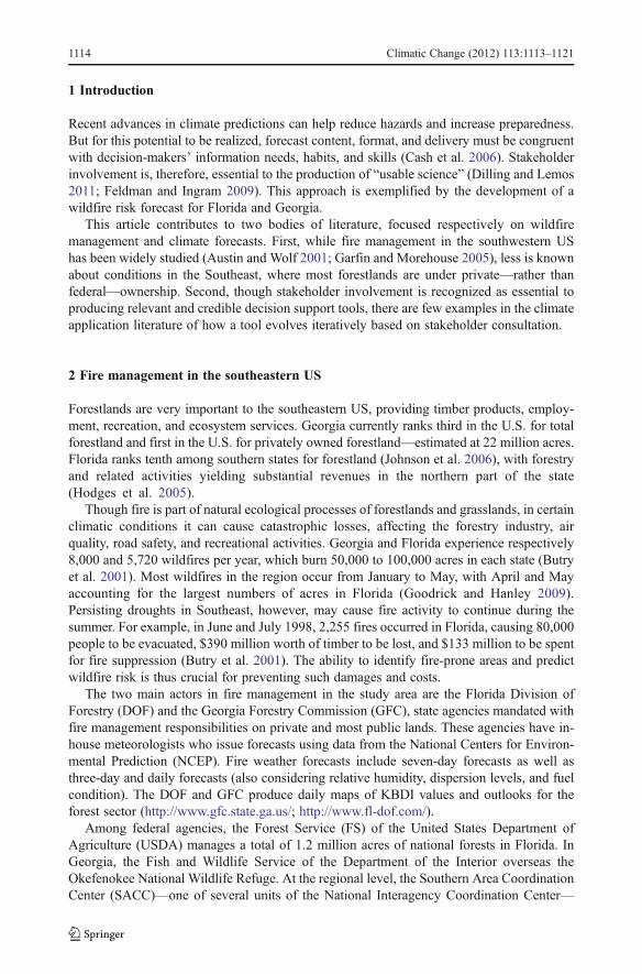
Fig. 1 Example of wildfire risk forecast available on the AgroClimate website in July 2011, indicatingprobabilities of abnormally dry conditions for the Southeast region
Climatic Change (2012) 113:1113–1121 1117

4.2 Potential applications
Stakeholders interviewed reported awareness and use of climate forecasts from differentsources, including NOAA, CNN, the Weather Channel, and—especially—local TV chan-nels. DOF and GFS personnel reported seeking such information to triangulate forecastsreceived from their own agencies. At the same time, they stressed the importance ofcontextualizing scientific forecasts in terms of their own practical, place-based experience.For example, since the most dangerous fires in Florida occur when winds blow from thesoutheast, a veteran fire manager would react differently to fire outbreaks according to winddirection.
Prior to being contacted for the interview, most (86.9 %) of the 2006 respondents had notseen the KBDI forecast, since it had been launched on the SECC website only a few monthsearlier. Having explored the forecast prior to or during the interview, the majority (78.3 %) ofstakeholders identified potential applications, including fire and forest management, timbermarketing, transportation safety, and education efforts (see more details in SOM3).Stakeholders expressed the belief that forecasts could help scheduling prescribedburns, organizing time and resources at high risk times, negotiating advance timbersales, and booking contractors. Private operators appreciated the extra ‘edge’ that theforecast offers in making their businesses more competitive. However, respondentsalso emphasized that many risk factors (e.g. fuel availability, human intervention, andenvironmental conditions) affect wildfire outbreaks (Slocum et al. 2010) and thatoperational decisions are never based on a single piece of information.
4.3 Persisting challenges
While the assessment indicated that the KBDI forecast can inform fire management, none ofthe respondents reported using it in making actual decisions. Some of the constraintsidentified during interviews are “intrinsic” to the information itself (e.g. scale, skill, etc.)while others are “contextual”, being related to the decision environment wherein forecastsare introduced (e.g. information flows, human capacity, decision processes, etc.), as outlinedbelow.
The discrepancy between the temporal and spatial scales of the KBDI forecasts and firemanagement decisions was mentioned as one of the most significant barriers to application(Corringham et al. 2008). Given to the volatility of wildfire and the high cost of movinghuman and material resources, action is generally based on real-time information and short-term outlooks. District rangers also pointed to micro-variation in topographical and ecolog-ical conditions as a hindrance to using county-wide information.
Another important constraint relates to the probabilistic nature of the KBDI forecast.Given the high stakes and costs involved in fire management, stakeholders are reluctant toact upon forecasts without a clear measure of its reliability (Corringham et al. 2008) Thoughevidence of forecast skill is available in scholarly journals (Brolley et al. 2007), translatingsuch information in accessible and actionable terms remains a challenge. The spatiallyvariable skill of ENSO-based forecasts—stronger in southern Georgia and peninsularFlorida, weaker in the fire-prone Piedmont—added to the uncertainty. Understanding ofENSO, on which the forecast is based, was unevenly distributed among stakeholdersinterviewed in 2008. Thought most (88.9 %) of them reported having “heard about ENSO”,only about one third (35.7 %) of them was able to correctly identify the ENSO phase (LaNiña) prevailing at the time of the interview and its implications for climate patterns in theregion.
1118 Climatic Change (2012) 113:1113–1121

Contextual challenges relate to institutional and policy processes. Though district rangersregularly consult different sites for climate information, at the height of the fire season—when they are very busy and must act quickly—they mostly rely on “in-house” informationrather taking time to explore and compare outlooks from multiple sources. This is becausethe hazardous nature of the business and the potential for financial, legal, and politicalrepercussions make decision makers weary of acting upon information that is not vetted byagency experts, particularly in centralized institutional settings (Morehouse 2000). Thoughnumbers are too small for statistical analysis, Florida respondents were more hesitant thantheir Georgia counterparts to consider using KBDI forecasts. This may be explained bydifferences in the authority structures and decision making processes of the two stateagencies, which have evolved out of regionally-specific vulnerabilities. The greater fuelload, amounts of public land, rural–urban interface and population density in Florida meanthat the DOF is endowed with a much greater budget and staff than the GFC and is morecentralized and dependent on cutting-edge technology and formally trained personnel. TheGFC, on the other hand, is more decentralized and reliant on district rangers’ field experi-ence. This allows the agency to be relatively flexible and responsive to local-level con-ditions, but it may hinder coordination, as it occurred in 2007, when smoke from multipleprescribed fires in southern Georgia affected air quality in urban Atlanta (GFC 2007).
Non-fire management forces, such as public opinion, economic interests, and politicalagendas also shape the broader context of fire management decisions and, by extension,of forecast responses (Prater and Lindell 2000). Policies such as the Clean Air Act,Clean Water Act, the Endangered Species Act, and the National Environmental PolicyAct create a regulatory environment that decision makers must engage with as theystrive to reduce wildfire risk. For example, if particulates levels during wildland firesexceed standards, prescribed burns are constrained regardless of predicted or actualKBDI levels (Cleaves et al. 2000).
Finally, while support from federal agencies and land-grand universities has enabledSECC scientists to develop the KBDI forecast and other successful products, their ability toaddress stakeholders’ demands is sometimes restricted by contractual and institutionalconditions. For example, the regional coordination agency (SACC) representatives stressedthat their operational decisions are often based on what is happening in multiple contiguousstates rather than within one state. Thus, the KBDI forecast would be more useful to them ifit covered the entire southern US, but such expansion is impeded by the fact that the SECC isfunded to work in specific states. Furthermore, being based at land-grant universities theSECC has a productive partnership with cooperative agricultural extension services, how-ever outreach and capacity building directed to forest and fire managers are not equallysupported.
5 Discussion and conclusion
Fire management is characterized by considerable complexities and liabilities and by amultiplicity of stakeholders. Though reliance on internal information may be the beststrategy in emergency situations, the ability to integrate external information is key toproactive planning (Brown and Squirrel 2010). Seasonal fire climate outlooks are not meantto be used in isolation from information of different origin or scale, but can be one additionalelement contributing to planning and preparedness.
However, persistent efforts will be required for the KBDI forecast to be accepted andintegrated into the information management habits of fire managers, as demonstrated by the
Climatic Change (2012) 113:1113–1121 1119

experience with other innovative tools developed by RISA programs. It is well recognizedthat fire professionals’ abilities to use climate outlooks and other decision support tools mustbe improved (Corringham et al. 2008; Kobziar et al. 2009). Certification programs andsector events offer opportunities for information dissemination and stakeholder training.
Reaching diverse actors calls for pluralistic approaches infused with an understanding ofwhat works best in various institutional contexts. For example, in more decentralizedcontexts, outreach may directly target intermediate and local level managers, while in morehierarchical settings, relationships must be first established with central-level, in-houseexperts who can legitimize and transmit information to on-the-ground personnel. Privateoperators may be more motivated and better positioned than state agency officials to useexternal scientific forecasts, but also have less time for searching and synthesizing suchinformation.
Yet, addressing intrinsic and contextual challenges to forecast application entails morethan targeted dissemination strategies. It requires that stakeholders be co-producers ratherthan mere receivers of scientific information (Cash et al. 2006), being involved in iterativeconsultations such as those that generated the KDBI forecast. But this kind of scientist-stakeholder engagement is contingent upon an environment of institutional incentives andfunding that supports long-term programs, flexible research agendas, sustained partnerships,and investments in outreach and training. In sum, effective decision support systems for firemanagement hinge on the “arts” of communication, collaboration, and capacity building aswell as on the “science” of climate, fuel, and fire interactions.
Acknowledgments This studywas supported byUSDA andNOAA through the Southeast Climate Consortium.We appreciate comments by Alan Dozier, Carrie Furman, Gregg Garfin, and Keith Ingram, and graphic work byShenandoah Evans and Oxana Uryasev.
References
Austin D, Wolf B (2001) Fire in Indian country: two case studies in the southwestern United States. Institutefor the Study of Planet Earth, University of Arizona, Tuscon, AZ. CLIMAS Report Series CL1-01
Brenner J (1991) Southern oscillation anomalies and their relationship to wildfire activity in Florida. Int JWildland Fire 1:73–78
Breuer N, Cabrera V, Ingram K, Broad K, Hildebrand P (2008) AgClimate: a case study in participatorydecision support system development. Clim Chang 87:385–403
Brolley J, O’Brien J, Schoof J, Zierden D (2007) Experimental drought threat forecast for Florida. Agric ForMeteorol 145:84–96
Brown G, Squirrel T (2010) Organizational learning and the fate of adaptive management in the US ForestService. J Forest 108:379–388
Brzuszek R, Walker J, Schauwecker T, Campany C, Foster M, Grado S (2010) Planning strategies forcommunity wildfire defense design in Florida. J Forest 108:250–257
Butry D, Mercer E, Prestemon J, Pye J, Holmes T (2001) What is the price of catastrophic wildfire? J Forest99:9–17
Canton-Thompson J, Gebert K, Thompson B, Jones G, Calkin D, Donovan G (2008) External human factorsin incident management team decision-making and their effect on large fire suppression costs. J Forest106:416–424
Cash D, Borck J, Patt A (2006) Countering the loading-dock approach to linking science and decision making:comparative analysis of El Niño-Southern Oscillation (ENSO) forecasting systems. Sci Technol HumValues 31:465–494
Cleaves D, Martinez J, Haines T (2000) Influences on prescribed burning activity and costs in the nationalforest system. Technical Report SRS-37. Southern Research Station, US Forest Service
Corringham T, Westerling A, Morehouse B (2008) Exploring use of climate information in wildfire manage-ment: a decision calendar study. J Forest 106:71–77
1120 Climatic Change (2012) 113:1113–1121

Dilling L, Lemos MC (2011) Creating usable science: opportunities and constraints for climate knowledge useand their implications for science policy. Glob Environ Chang 21:680–689
Dixon P, Goodrich G, Cooke W (2008) Using teleconnections to predict wildfires in Mississippi. MonWeather Rev 136:2804–2811
Feldman D, Ingram H (2009) Making science useful to decision makers: climate forecasts, water management,and knowledge networks. Weather Clim Soc 1:9–21
Garfin G, Morehouse B (2005) Fire in the West. Workshop Proceedings. March 5–6, 2002, Tuscon, AZ,CLIMAS and The Institute for the Study of Planet Earth, Available at: http://www.climas.arizona.edu/files/climas/pubs/2002fireproceedings-draft.pdf
Garfin G, Owen G, Morehouse B, Lenart M, Brown T (2003) National seasonal assessment workshops for firepotential. Available at: http://www.climas.arizona.edu/projects/national-seasonal-assessment-workshops-fire-potential
Garfin G, Brown T, Ochoa R, Hockenberry H (2004) National seasonal assessment workshop final report:Eastern and Southern States January 27–29, 2004. Shepherdstown, WV. CLIMAS, Institute for the Studyof Planet Earth. The University of Arizona Tucson, AZ
Georgia Forestry Commission (2007) The Historic 2007 Georgia wildfire: learning from the past—planningfor the future, Available at: http://www.wildfirelessons.net/documents/Historic_2007_GA_Wildfires.pdf
Glaser B, Strauss A (1967) The discovery of grounded theory: strategies for qualitative research. AcademicPress, New York
Goodrick S, Brenner J (2000) Climate’s influences on wildfires in Florida. In: Morehouse B (ed) Theimplications of La Niña and El Niño for fire management. Workshop Proceedings, February 23–24,2000, CLIMAS, The Institute of Planet Earth, The University of Arizona, Tuscon, AZ, pp 18–20
Goodrick S, Hanley D (2009) Florida wildfire activity and atmospheric teleconnections. Int J Wildland Fire18:476–482
Hodges A, Mulkey D, Alavalapati J, Carter D, Kiker C (2005) Economic impacts of the forest industry inFlorida. Final Report to the Florida Forestry Association. University of Florida, Institute of Food &Agricultural Sciences, Gainesville, FL
Jones C, Shriver J, O’Brien J (1999) The effects of El Niño on rainfall and fire in Florida. Fla Geogr 30:55–69Johnson T, Bentley G, James W, Howell M (2006) The South’s timber industry: an assessment of timber
product output and use, 2003. U.S. Department of Agriculture Forest Service, Southeastern ExperimentResearch Station. Resour. Bull. SRS–11, Asheville, NC
Keetch J, Byram D (1968) A drought index for forest fire control. U.S. Department of Agriculture ForestService, Southeastern Experiment Research Station. Research Paper S E-38. Asheville, NC. Available at:http://www.fl-dof.com/fire_weather/information/se038_keetchbyram_di.pdf
Kobziar L, Rocca M, Dicus C, Hoffman C, Sugihara N, Thode A, Morgan Varner A, Morgan P (2009)Challenges to educating the next generation of wildfire fire professionals in the United States. J Forest107:339–345
McCaffrey S, Stidham M, Toman E, Shindler B (2011) Outreach programs, peer pressure, and common sense:what motivates homeowners to mitigate wildfire risk? Environ Manage 48:475–488
Prater C, Lindell M (2000) Politics of hazard mitigation. Nat Hazards Rev 1(2):73–82Slocum M, Platt W, Beckage B, Orzell S, Taylor W (2010) Accurate quantification of seasonal rainfall and
associated climate-wildfire relationships. J Appl Meteorol Clim 49:2559–2573Taylor J, Gillette S, Hodgson R, Downing J, Burns M, Chavez D, Hogan J (2006) Informing the network:
improving communication with interface communities during wildland fire. Hum Ecol Rev 14:198–211Winsberg M, O’Brien J, Zierden D, Griffin M (2003) Florida weather. University of Florida Press, Gainesville
Climatic Change (2012) 113:1113–1121 1121