the american community survey -...
TRANSCRIPT
The American Community Survey An Esri® White Paper June 2016

Copyright © 2016 Esri All rights reserved. Printed in the United States of America. The information contained in this document is the exclusive property of Esri. This work is protected under United States copyright law and other international copyright treaties and conventions. No part of this work may be reproduced or transmitted in any form or by any means, electronic or mechanical, including photocopying and recording, or by any information storage or retrieval system, except as expressly permitted in writing by Esri. All requests should be sent to Attention: Contracts and Legal Services Manager, Esri, 380 New York Street, Redlands, CA 92373-8100 USA. The information contained in this document is subject to change without notice. Esri, the Esri globe logo, esri.com, and @esri.com are trademarks, service marks, or registered marks of Esri in the United States, the European Community, or certain other jurisdictions. Other companies and products or services mentioned herein may be trademarks, service marks, or registered marks of their respective mark owners.

J10020
The American Community Survey
An Esri White Paper Contents Page
Introduction ........................................................................................... 1
ACS versus Census 2000: What's the Difference? ............................... 1 Data Collection/Methodology ......................................................... 2 Time Frame ..................................................................................... 2 Sample Size ..................................................................................... 3
Margin of Error ..................................................................................... 3
Geography ............................................................................................. 4
Esri and ACS......................................................................................... 4 Medians and Averages .................................................................... 5 Summary Profiles/Mapping: Reliability of ACS Data ................... 5
Summary ............................................................................................... 6
Glossary ................................................................................................ 7
Esri's Data Development Team ............................................................. 8
Esri White Paper i

J10020
The American Community Survey
Introduction The American Community Survey (ACS) is the de facto replacement for sample data from the decennial census. The 2010 Census eliminated the long form. Those who want data on income and poverty status, school enrollment, journey to work, household type and relationships, languages spoken, migration, citizenship, disability, health insurance, ancestry, military service, or housing characteristics must turn to the American Community Survey.1 The US Census Bureau was testing this replacement before Census 2000; however, the full rollout of the ACS did not happen until 2005. The first release of ACS data for all counties, plus tracts and block groups (BG), was in December 2010. Earlier releases of ACS data (2006 through 2009) were only available for larger geographic areas. Now the full effects of this replacement for census sample data can be seen and assessed. The 2010–2014 data from the American Community Survey is now available from Esri. Esri provides reports, thematic mapping, and online help to explain the data. The reports include two summary profiles (Population and Housing). Esri's reports/maps are designed to simplify the data and enhance its usability.
ACS versus Census 2000: What's the
Difference?
The first thing that you notice on an ACS report or map is the additional number shown for the margin of error (MOE). The margin of error represents the confidence interval for an ACS estimate. There were no margins of error reported for Census 2000 sample data. The MOE epitomizes the main difference between Census 2000 and ACS data—the precision of the estimates. The subjects included in the ACS are similar to the Census 2000 sample; however, the method of collecting the data is very different, which introduces conspicuous differences in the results. The Census 2000 sample represented approximately 1 in 6 households at one point in time, April 1, 2000. The ACS represents approximately 1 in 50 households and continuous measurement of demographic characteristics through monthly surveys. Releases for all areas down to block groups represent averages over 60 months, or five years (2010–2014, inclusive). There are important distinctions between sample data provided in conjunction with a census and sample data collected throughout the year, every year. The differences are summarized here, with references to additional documentation for the curious data user. There are three key differences between Census 2000 sample data and ACS estimates: ■ Data collection: Ongoing monthly surveys (ACS) vs. single survey (Census 2000) ■ Time frame: Period estimates (ACS) vs. point estimates (Census 2000) ■ Sample size: 1 in 50 households (ACS) vs. 1 in 6 households (Census 2000)
1 General information about the American Community Survey is summarized here. However, this is the Census Bureau's data. More information is available from the ACS handbooks at https://www.census.gov/ programs-surveys/acs/guidance/handbooks.html.
Esri White Paper

The American Community Survey
J10020
These differences in methodology can affect comparisons of the data over and above the demographic change that occurred between 2000 and the latter half of the decade.
Data Collection/ Methodology
The continuous data collection of the ACS necessitates changes in variable definitions, sample weighting, and sizes: ■ Residency rules are different. The ACS defines a resident by a two-month rule. The
census rule is "usual place of residence" or wherever a person spends most of the year. ACS data may include seasonal populations in addition to year-round residents.
■ Date-specific variables, like employment, represent monthly averages, including
seasonal variations. ■ Since income is also collected over the course of the previous 12 months, it must be
adjusted by the Consumer Price Index to represent a calendar year. ■ Migration is now measured from one year ago, not five years ago. ■ Survey samples must be weighted by estimates for states, counties, or places, not
census counts for states, counties, tracts, and block groups. (Estimates are subject to error.)
■ Sample sizes are smaller than previous decennial census samples, since the data is
collected from continuous surveys of the population, not once every 10 years.
Time Frame Small monthly samples must be pooled to provide suitable estimates for the smallest areas. Areas with populations fewer than 20,000, including tracts and block groups, require 60 months of surveys. Even one-year ACS data (for areas with populations greater than 65,000) requires a 12-month sample. ACS estimates are all period estimates representing an interval of time, not a single date like April 1, 2010. Interpreting the change between April 1, 2000, and a five-year average for 2010–2014 may be difficult. ■ An average of 2010–2014 includes the aftermath of the Great Recession and slow
recovery from 2010 through 2014. Annual change will not be discernible from the severe economic downturn and subsequent recovery.
■ Annual rates of change cannot be calculated, precluding comparison to any other
periods in time. ■ In the future, overlapping multiyear periods are likely to challenge data users who try
to calculate change between periods.
June 2016 2
The American Community Survey
J10020
Sample Size The much smaller sample sizes of the ACS (1 in 50 compared to 1 in 6 in 2000) affect data reporting and produce much larger sampling errors. ■ Smaller sample sizes require less detail in the data reported. For example, age by
income in 2000 was reported for seven different age groups (10-year intervals, such as 25–34 years). ACS age by income is reported for four age groups (15–24, 25–44, 45–64, and 65+ years).
■ Some values for medians, per capita income, and the aggregates used to determine
averages are missing from the ACS database, especially at the block group level. ■ Sampling errors must be reported as margins of error, because the variability of the
estimates is increased with smaller sample sizes. In some cases, the sampling error can exceed the estimate.
ACS data looks like Census 2000 sample data, but the resemblance is superficial. Continuous measurement and significantly smaller sample sizes yield less precise measures of common variables than Census 2000 sample data. All survey-based estimates are subject to sampling error and uncertainty. Any sample will differ from the total population because it represents just a fraction of the total. Census 2000 sample data represented a larger share of the population, and sampling errors were not reported. However, the Census Bureau deems it necessary to report measures of sampling error with all ACS estimates.
Margin of Error The margin of error enables data users to measure the range of uncertainty around each estimate. This range can be calculated with 90 percent confidence by taking the estimate +/- the MOE. For example, if the ACS reports an estimate of 100 +/- 20, then there is a 90 percent chance that the value for the total population falls between 80 and 120. The larger the MOE, the lower the precision of the estimate and the less confidence one should have that the estimate is close to the true population value. The MOE measures the variability of an estimate due to sampling error. Simply, sampling error occurs when only part of the population is surveyed to estimate the total population. There will always be differences between the sample and the total. Statistically, sampling error measures the differences between multiple samples of the same population and differences within a sample of the population. Sampling error is directly related to sample size. The larger the sample size, the smaller the sampling error. Different areas are sampled at different rates to make the sample representative of the total population. Due to these complex sampling techniques, estimates in some areas have more sampling error than estimates in other areas. All MOEs are approximations of the true sampling error in an area and should not be considered exact. In addition, MOEs do not account for nonsampling error in the data and therefore should be thought of as a lower bound of the total error in a survey estimate. The ACS reports MOEs with estimates for most standard census geographies. ACS estimates of total population and collapsed age, sex, and Hispanic origin estimates are controlled to annual estimates from the census' Population Estimates Program (PEP) for counties or groups of less populous counties. Since these estimates are directly controlled to independent estimates, there is no sampling error, and MOEs are zero. However,
Esri White Paper 3
The American Community Survey
J10020
controlling a period estimate to the average of five point estimates imparts additional errors in the data that are not measured by MOEs. In some areas, missing values are prevalent for medians and the aggregate estimates used to calculate averages. When estimates are zero, the Census Bureau models the MOE calculation by comparing ACS estimates to the most recent census counts and deriving average weights for states and the country.2 At the state, county, tract, or block group level, state-specific MOEs for zero estimates will be the same regardless of the base of the table.
Geography Most ACS geography corresponds to boundaries as of January 1, 2014. ACS geography is generally consistent with 2010 geography and the areas available with Esri's 2016 updates; however, there are differences. The inventory of county subdivisions has changed since 2010, which is included in ACS but not in Esri's updates. ACS data for congressional districts represents the boundaries from the 114th Congress. ACS data for Core Based Statistical Areas (CBSAs) reflects definitions from the Office of Management and Budget from February 2013. Additionally, Esri has made ACS data available for designated market areas (DMAs), ZIP codes, and user-defined polygons. ACS data for ZIP codes is not provided by the Census Bureau, but Esri has created ZIP code data by aggregating the block group level ACS data using a block-to-block group apportionment methodology. ZIP code boundaries are current as of Q3 2015, and the source is HERE (Nokia). Esri produces ACS data for DMAs, representing the 2015–2016 definitions from Nielsen; this data is not provided by the Census Bureau either.
Esri and ACS Clearly, ACS data differs from the familiar census sample data. To help data users understand the inconsistencies, Esri is providing reports, thematic mapping, and online help. All products include the display of MOEs for the estimates. The reports include two summaries (Population and Housing). Esri's reports/maps are designed to simplify the data and enhance its usability including the following: ■ Enhanced geographic coverage: User-defined polygons and ZIP codes ■ Reliability thresholds to simplify interpretation of MOEs in summary profiles and
mapping Esri offers the ability to query ACS data for the most popular geographies—user-defined polygons and ZIP codes. Since these areas are not available from the Census Bureau, there are no tabulated MOEs. Estimating data for these custom areas requires aggregation of ACS estimates and recalculation of MOEs. Esri has developed algorithms to calculate MOEs using guidelines from the Census Bureau. These algorithms account for full and partial areas within the custom area.
2 US Census Bureau, "Variance Estimation," Design and Methodology American Community Survey (Washington, DC: US Government Printing Office, 2010), 12-4–12-5.
June 2016 4

The American Community Survey
J10020
There are several considerations to note when viewing MOEs for custom areas. As the number of estimates involved in the sum of a derived estimate increases, the approximate MOE becomes increasingly different from the MOE that would be derived directly from ACS microdata. The direction of this difference (positive or negative) is based on the correlation and covariance of the estimates. In addition, MOEs are not scalable. MOEs at smaller geographic levels do not add up to MOEs at larger levels. Therefore, analyses should always make use of the largest standard geographic unit possible. For example, if your area of interest includes 90 percent of a county, the MOE for the total county will be more accurate than the MOE derived from county parts.
Medians and Averages
A median represents the middle of a distribution. A number of variables are reported as distributions with median values such as household income, home value, contract rent, or year structure built. The Census Bureau estimates medians from standard distributions that are not released to the public.3 Therefore, the bureau's estimated medians will differ from medians that are calculated from the reported tables. For standard geographic areas, Esri displays the medians that are reported by the Census Bureau with its calculations of MOEs. Note that there are missing medians in the Census Bureau's tables, primarily for smaller areas like tracts and block groups. It is possible to find a distribution reported for a given variable, even if the median is missing. If the median is not reported by the Census Bureau for a standard geographic area, then Esri reports display N/A, or not available. Medians are shown for nonstandard areas like ZIP codes and polygons, which are not available from the Census Bureau. For these areas, Esri calculates the medians from the reported distributions. However, MOEs are not available. Averages are commonly calculated from the aggregate value of a variable, such as the sum of all reported incomes by household or the total number of vehicles reported, divided by the total number of cases (e.g., households). Aggregates may also be tabulated as missing by the Census Bureau, even if a distribution is reported for the area. If an aggregate value is missing, then an average cannot be determined and will be displayed as N/A whether for standard or nonstandard areas.
Summary Profiles/Mapping: Reliability of ACS
Data
The summary reports display MOEs for the estimates plus an additional column that Esri has included to help data users interpret the MOEs relative to the estimates. Decisions about the quality of an estimate based on the MOE alone can be difficult. A reliability symbol is displayed on the reports to give the user some perspective on the MOE. The symbol is based on an estimate's coefficient of variation (CV) and is meant to be used as a quick reference to gauge the usability of an ACS estimate. The CV is a measure of relative error in the estimate. It measures the amount of sampling error in the estimate relative to the size of the estimate itself. A large amount of sampling error in a small estimate will generally discount the usefulness of the estimate; however, a small amount of sampling error in a large estimate shows that the estimate is reliable.
3 For more information on the standard distributions, see the Census Bureau's documentation at http://www2.census.gov/programs-surveys/acs/tech_docs/subject_definitions/ 2014_ACSSubjectDefinitions.pdf, appendix A.
Esri White Paper 5

The American Community Survey
J10020
The reliability is based on thresholds that Esri has established based on the usability of the estimates. Users should be aware that these are generalized thresholds: ■ High Reliability: Small CVs (less than or equal to 12 percent) are flagged green
to indicate that the sampling error is small relative to the estimate, and the estimate is reasonably reliable.4
■ Medium Reliability: Estimates with CVs between 12 and 40 are flagged yellow—
use with caution. ■ Low Reliability: Large CVs (over 40 percent) are flagged red to indicate that the
sampling error is large relative to the estimate. The estimate is considered very unreliable.
■ Some estimates do not indicate reliability. In these cases, either the estimate or MOE
is missing, or the estimate is zero. The amount of acceptable error in an estimate is subjective to the analysis at hand. Data users can compute a CV directly from the MOE; the CV is calculated as the ratio of the standard error to the estimate itself. To get the standard error, divide the MOE by 1.645 (for a 90 percent confidence interval). To calculate a CV, use the following equation:
1006451 ×
=ESTIMATE
.MOE
CV
The CV is commonly expressed as a percentage. For example, if you have an estimate of 80 +/- 20, the CV for the estimate is 15.2 percent. This estimate should be used with caution, since the sampling error represents more than 15 percent of the estimate.
Summary The American Community Survey is a product of its design. Data users (including vendors) cannot fix the differences that ensue from continuous measurement of the population in lieu of a decennial sample survey. Data users will have to balance the benefits of timely data with the drawbacks of estimate quality. To do this effectively, data users will have to make use of new tools to evaluate the quality of ACS data, such as MOEs, CVs, and tests for significant differences between samples. In addition to statistical tools, the data user can employ larger areas of analysis or collapse some of the distributions if the reliability of the estimates is a problem. When comparing areas, the Census Bureau recommends focusing on percentages of distributions rather than estimate values. Changes to the sample size, time frame, data collection, and survey methodology make ACS data something completely different from the sample data previously collected from
4 National Research Council, Using the American Community Survey: Benefits and Challenges (Washington, DC: The National Academies Press, 2007).
June 2016 6

The American Community Survey
J10020
the decennial census. When the Census Bureau reports sampling error with the survey estimates, it's time to pay attention to the differences.
Glossary ACS estimate: The ACS replaces census sample data. Esri is releasing the 2010-2014 ACS estimates, five-year period data collected monthly from January 1, 2010, through December 31, 2014. Although the ACS includes many of the subjects previously covered by the decennial census sample, there are significant differences between the two surveys including fundamental differences in survey design and residency rules. Coefficient of variation (CV): The CV measures the amount of sampling error relative to the size of the estimate, expressed as a percentage. A large amount of sampling error in a small estimate will generally discount the usefulness of the estimate; however, a small amount of sampling error in a large estimate shows that the estimate is reliable. Confidence interval: The confidence interval is another way to measure the uncertainty of an estimate. The upper bound is the estimate plus the margin of error; the lower bound is the estimate minus the margin of error. (If the lower bound is negative, then zero is assumed for the lower bound.) Confidence intervals for ACS estimates represent a 90 percent certainty that the interval around the estimate includes the true population value. Margin of error (MOE): The MOE is a measure of the variability of the estimate due to sampling error. MOEs enable the data user to measure the range of uncertainty for each estimate with 90 percent confidence. The range of uncertainty is called the confidence interval, and it is calculated by taking the estimate +/- the MOE. For example, if the ACS reports an estimate of 100 with an MOE of +/- 20, then you can be 90 percent certain the value for the estimate falls between 80 and 120. Nonsampling error: All other survey errors that are not sampling errors are collectively classified as nonsampling error. This type of error includes errors from interviewers, respondents, coverage, nonresponse, imputation, and processing. Nonsampling error also includes unchecked methodological errors from controlling ACS estimates to independent population estimates. Period estimates: These are estimates based on data collected over a period of time. ACS five-year data is collected monthly over 60 months and is sometimes referred to as a "rolling survey." Point estimates: Point estimates are based on data collected at a single point in time. The decennial census refers to April 1 and captures a snapshot of the population at that time.
Esri White Paper 7
The American Community Survey
J10020
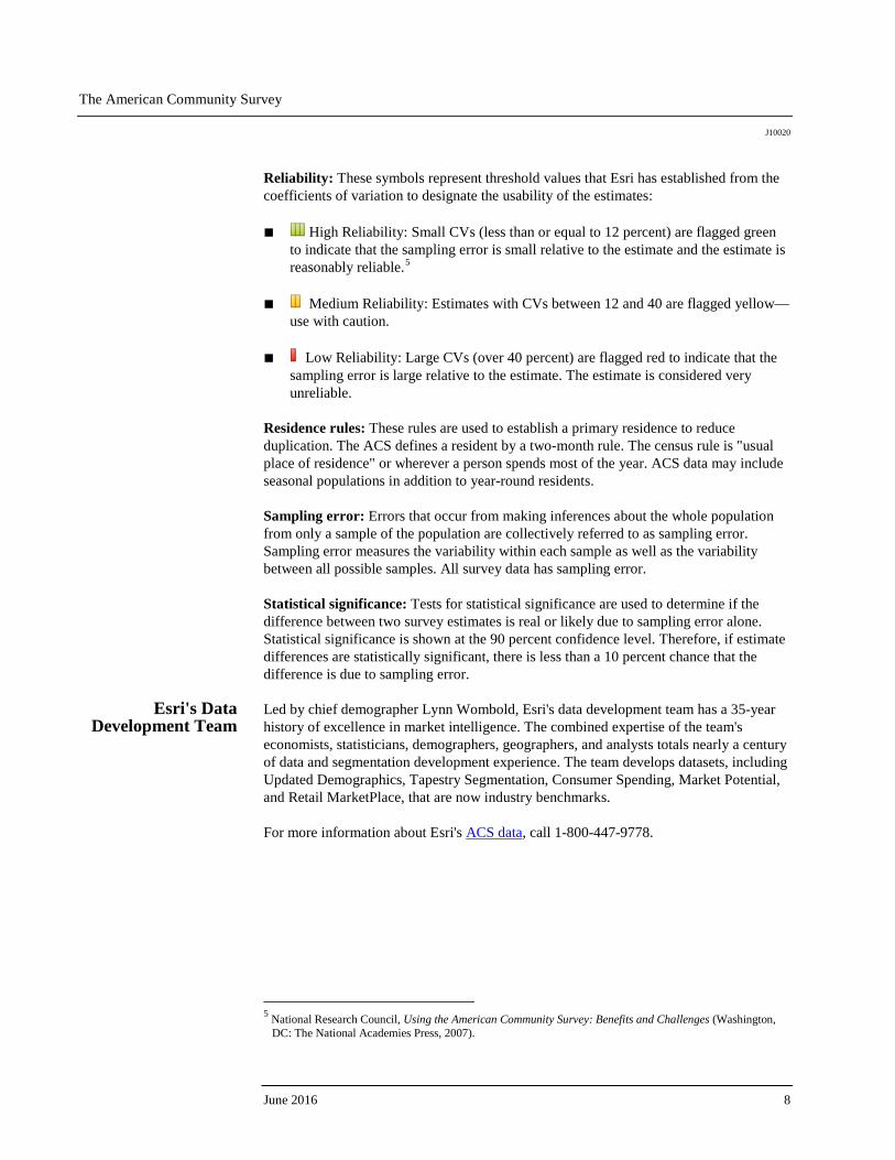
Reliability: These symbols represent threshold values that Esri has established from the coefficients of variation to designate the usability of the estimates: ■ High Reliability: Small CVs (less than or equal to 12 percent) are flagged green
to indicate that the sampling error is small relative to the estimate and the estimate is reasonably reliable.5
■ Medium Reliability: Estimates with CVs between 12 and 40 are flagged yellow—
use with caution. ■ Low Reliability: Large CVs (over 40 percent) are flagged red to indicate that the
sampling error is large relative to the estimate. The estimate is considered very unreliable.
Residence rules: These rules are used to establish a primary residence to reduce duplication. The ACS defines a resident by a two-month rule. The census rule is "usual place of residence" or wherever a person spends most of the year. ACS data may include seasonal populations in addition to year-round residents. Sampling error: Errors that occur from making inferences about the whole population from only a sample of the population are collectively referred to as sampling error. Sampling error measures the variability within each sample as well as the variability between all possible samples. All survey data has sampling error. Statistical significance: Tests for statistical significance are used to determine if the difference between two survey estimates is real or likely due to sampling error alone. Statistical significance is shown at the 90 percent confidence level. Therefore, if estimate differences are statistically significant, there is less than a 10 percent chance that the difference is due to sampling error.
Esri's Data Development Team
Led by chief demographer Lynn Wombold, Esri's data development team has a 35-year history of excellence in market intelligence. The combined expertise of the team's economists, statisticians, demographers, geographers, and analysts totals nearly a century of data and segmentation development experience. The team develops datasets, including Updated Demographics, Tapestry Segmentation, Consumer Spending, Market Potential, and Retail MarketPlace, that are now industry benchmarks. For more information about Esri's ACS data, call 1-800-447-9778.
5 National Research Council, Using the American Community Survey: Benefits and Challenges (Washington, DC: The National Academies Press, 2007).
June 2016 8

Printed in USA
Contact Esri
380 New York Street Redlands, California 92373-8100 usa
1 800 447 9778 t 909 793 2853 f 909 793 5953 [email protected] esri.com
Offices worldwide esri.com/locations
Esri inspires and enables people to positively impact their future through a deeper, geographic understanding of the changing world around them.
Governments, industry leaders, academics, and nongovernmental
organizations trust us to connect them with the analytic knowledge
they need to make the critical decisions that shape the planet. For
more than 40 years, Esri has cultivated collaborative relationships
with partners who share our commitment to solving earth’s most
pressing challenges with geographic expertise and rational resolve.
Today, we believe that geography is at the heart of a more resilient
and sustainable future. Creating responsible products and solutions
drives our passion for improving quality of life everywhere.