sustainability and heritage conservation: notes from the malaprabha river valley
TRANSCRIPT

JUL-
SE
P 2
016
Circular Economy and Sustainability
Delta Cities and Resilience
Greening Chandigarh
Bhutan’s Gross National Happiness
Urbanisation in Myanmar
Smart Tech for Sustainability
FOCUS ON
SustainableCities
ISSN 2455-2380
€ 15/$ 15INTERNATIONAL EDITION
cover-10final.indd 2 25/06/16 10:54 am
08 | MY LIVEABLE CITY • Jul-Sep 2016
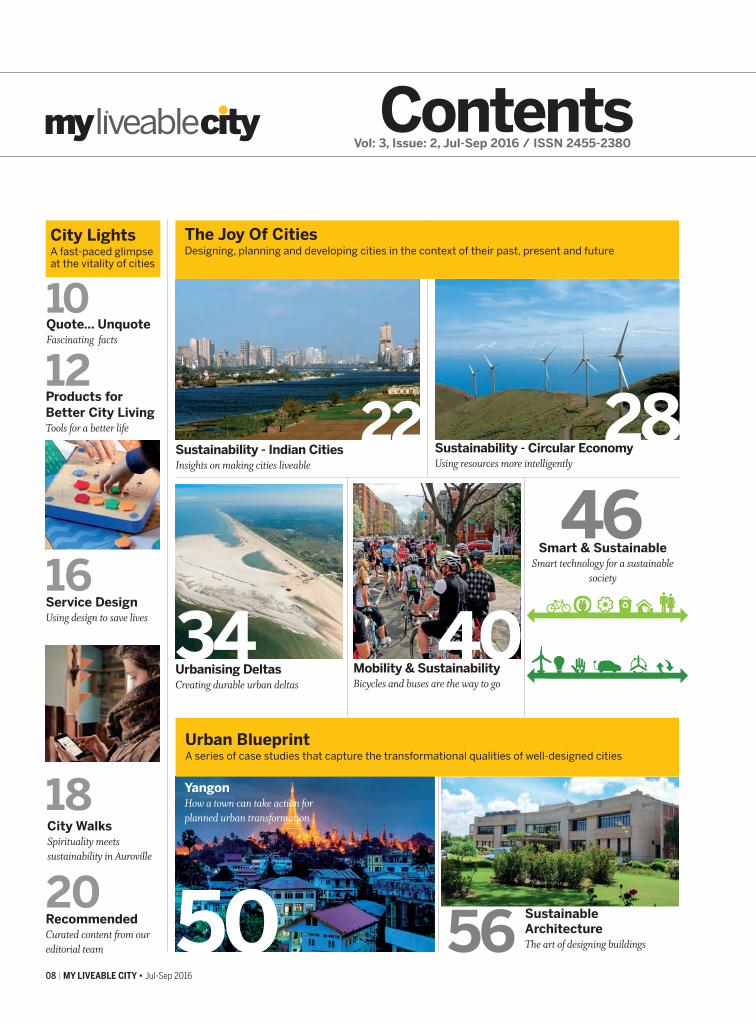
Contents
Sustainability - Indian CitiesInsights on making cities liveable
22
The Joy Of CitiesDesigning, planning and developing cities in the context of their past, present and future
City Walks Spirituality meets sustainability in Auroville
12 Products for Better City LivingTools for a better life
City LightsA fast-paced glimpse at the vitality of cities
Urban BlueprintA series of case studies that capture the transformational qualities of well-designed cities
18
20Recommended Curated content from our editorial team
16Service Design Using design to save lives
10 Quote... Unquote Fascinating facts
Sustainability - Circular EconomyUsing resources more intelligently
Urbanising Deltas Creating durable urban deltas
Yangon How a town can take action for planned urban transformation
28
Sustainable ArchitectureThe art of designing buildings50
Vol: 3, Issue: 2, Jul-Sep 2016 / ISSN 2455-2380
Mobility & Sustainability Bicycles and buses are the way to go
Smart & SustainableSmart technology for a sustainable
society
46
34 40
56
contents.indd 8 25/06/16 12:26 pm

Jul-Sep 2016 • MY LIVEABLE CITY | 09
InterviewSanjay Prakash merges art and eco-friendly design
Community ParticipationLighting up lives
Change Agents
92
Cities We Likewww.myliveablecity.com @CitiesWeLike
122 Urban DelightResearch Pavilion, University of Stuttgart
118 Photo EssayHow different cities adapt differently
114 Knowledge Tour MyLiveableCity’s mini-travelogue in the Netherlands
ProvocateurA hard-nosed look at what makes cities liveable or unliveable!
106
104 Sustainable CitiesJustice and sustainability
110Smart
SustainabilityEvery little bit counts in making a more liveable city
Bhutan Happiness leads to sustainability
100Chandigarh How it became one of India’s most liveable cities
84
60
78
64
72
Fukushima Using technology to resurrect disaster-laden environments
Case study of the historic town of Badami
InterviewAseem Inam on how cities are similar yet different
96
Environmental UrbanismBalancing architecture and the environment for sustainability
Nature In CitiesIf nature can adapt then so should we
68
Sustainability and Heritage Conservation
Culture CornerVisual wonders from across the world
Pherols of the Rawai Valley Balancing environmental resilience with ecological harmony
Meeting up with city lovers and organisations who are making a difference
contents.indd 9 25/06/16 12:26 pm

The historic town of Badami in the Malaprabha River Valley of Karnataka, India, is being developed under HRIDAY
(Heritage City Development and Augmentation Yojana), a national scheme that aims to preserve and revitalise a heritage city while reflecting its unique character.
However, the ancient village of Pattadakal and its World Heritage Site (WHS), the historic town of Aihole and many other sacred precincts nearby have not been integrated in this initiative. The agrarian habitat of the valley and its interdependence with resident agrarian communities has also been blatantly ignored. The Local Planning Area boundary suitably eliminates the natural setting: a complex web of water network systems, surrounding hill forest land, sacred groves and concentration of sacred living precincts in the valley. The proposed master
78 | MY LIVEABLE CITY • Jul-Sep 2016
Gitanjali Rao elaborates on the ongoing struggles to integrate sustainability practices with heritage conservation in the historic town of Badami
URBAN BLUEPRINT>India
SUSTAINABILITY AND HERITAGE CONSERVATION
Notes from the Malaprabha River Valley
plan for Badami lacks integration and there is a complete absence of addressing unprotected living shrines in the core area, the traditional skills and everyday life experience of the community set in the vernacular fabric.
This essay is a re-examination of the natural, cultural, sacred and heritage values of the Malaprabha River Valley and the threats and challenges to its integrity and authenticity. In the absence of any regional policy, tourism activity in the last few years, both domestic and foreign, though a means to economic revitalisation have shown signs of negative impact, leading to disruption and dereliction of the traditional habitat, built heritage, natural, cultural and social values.
CONTEXTThe Malaprabha River, revered as one of the sacred rivers in North Karnataka, finds its origin
North Easterly flowing Malaprbaha River close to the WHS of Pattadkal
The proposed master plan for Badami lacks integration and there is a complete absence of addressing unprotected living shrines
UB-badami.indd 78 25/06/16 2:40 pm

Jul-Sep 2016 • MY LIVEABLE CITY | 79
at Kanakunmbi – a small hamlet in the Western Ghats - and meets another sacred river, Krishna, at Koodalasangama, an important pilgrim site of the Veerashaivas (followers of the Hindu God Shiva). The confluence of rivers (sangama) is believed to be sacred in Hindu culture. Saint Basaveshwara’s (Adishthana) resting place, situated in this sacred space, has a frequent stream of pilgrims visiting the site for myriad social, cultural and religious activities. A sacred trail passing through the valley was once active with pilgrims treading the route in groups, singing and dancing in praise of God along the way, stopping for shelter and food at various living shrines and villages along the valley.
Flowing eastward from an altitude of 792.48 kms, 306 kms long, branching out into three more tributaries, the river forms one of the four principle tributaries of the River Krishna, an interstate river in Southern India, with a catchment of 2 lakh sq kms. A portion of 13,271 sq. kms spreads across Karnataka State, feeding vast tracts of agricultural land, tilled to this date by traditional methods. There are a few exceptions, closer to the towns, where the technology, water intensive monoculture and large scale production of cash crops have taken over in the last few decades. These guzzle
Recommended delineation of Local Planning Area encompassing a coherent interdependent system of natural, cultural, sacred sites, built heritage and agrarian habitat of the Malaprabha River Valley
tons of water, pumped illegally from the fast depleting river.
Human habitation along the Malaprabha Valley dates back to the 2nd millennium BC, confirmed by large findings of antiquities of stone, copper, bronze and iron. Several subsurface archaeological potential patches in private farmland and hamlets abutting the river await delineation, protection and scientific excavation. The living, east flowing river basin once inhabited by wild animals and semi-nomadic tribes engaged in hunting, fishing and growing food – thousands of years before the existence of the Chalukyan Empire – is today dotted with more than 40 villages and a few fast-growing towns in an otherwise predominantly agricultural rural landscape. Untouched by fast urban development, the area stands a greater chance to plan for timely holistic sustainable development of the river valley.
The Malaprabha River Valley was once the headquarters of the powerful Chalukya Kings, who governed much of Peninsular India for more than 200 years, from the middle of the 6th century to the middle of the 8th century. Conceived and built in stages, it epitomises the valour of the Chalukyas, bringing complete unification of the Deccan region from the mid-6th
DR
AW
ING
: KS
RS
AC
, GIT
AN
JALI
RA
O
A sacred trail passing through the valley was once active with pilgrims treading the route in groups, singing and dancing in praise of God
UB-badami.indd 79 25/06/16 2:40 pm

80 | MY LIVEABLE CITY • Jul-Sep 2016
URBAN BLUEPRINT>India
both sides by one of the finest red sandstone, encompassing the three cultural magnets uniquely representing the Chalukyan capital cities. They are the ancient city of Vatapi (present Badami), the capital, at one end of the valley which witnessed two interrelated phases of Hindu monuments: earlier rock cut and later structural temples. The ancient Aivalli, which is now the present village of Aihole, at the other end of the valley, served as a vigorous commercial centre and cultural metropolis and was the cradle of Indian temple art, architecture and iconography covering a time span of 800 years under various dynasties. Midway between Badami and Aihole, situated on the bank of the northeasterly flowing river, was the ancient royal commemorative centre: Pattdakal (Kisuvulal), a sacred city of crown rubies, the seat of coronation of Chalukyan kings. It represented the high point of eclectic art during the 7th and 9th centuries. It was designated as a UNESCO World Heritage Site in 1987.
The group of monuments at Pattadakal, Badami and Aihole are a collective testament to an Indian Royal Dynasty, the early Chalukyas (c.543-757), who in their two centuries of power dominated the Deccan, Kalinga (Orissa) and Southern Gujarat. The diverse typology of cultural resources is an array of defense, royal, natural and sacred systems constituting fort walls plugged into the natural defense of the Kaladgi Hill range, a series of gateways, citadels, cenotaphs of the royals, rock cut cave shrines, structural temples, water network systems, pushkarnis and cultural routes.
Besides the concentration of protected heritage monuments in the three historic towns of Badami, Aihole and Pattadakal, many unprotected sacred ancient living precincts of regional importance in the surrounding agrarian hamlets, dedicated to Hindu Gods and Goddess, are strewn across the valley in Mahakuta, Chikkamahakuta, Siddhnakolla, Shivayogi Mandir Banashankari and BN Jalihal. These are connected via cultural routes penetrating deep into sacred groves, close to a network of natural springs, river banks, on the hill top and embedded in hills, validating the principle of site selection in ancient manuals on temple buildings.
The continued religious, social and spiritual practices have witnessed a sharp rise in the number of domestic pilgrims visiting the area compared to those at the heritage sites of national importance. This represents strong links with the associated community and stresses the continuity of use, cultural expression and care coupled with increased pressure on these sites.
These living shrines have an uninterrupted string of assorted activities throughout the year like darshan on ordinary days, celebration of every stage
Traditional land use of the present Aivalli Village is a unique condition composed of 50% of the land as heritage property, 30% as habitat and the rest as agricultural farmlands and hills
century showcasing their ingenuity in building an empire occupying a distinct political and cultural niche in the history of ancient India. The earliest reference to it: ‘Karnata’, is mentioned in the Great Indian Epic, the Mahabharata.
HERITAGEThe most visible, concentrated and tangible
recorded cultural remains are confined to a 35-kilometre stretch and five kilometre-wide river valley measuring 1550 ha., contained on
MA
P: G
ITA
NJA
LI R
AO
, RA
DH
IKA
, AS
HW
INI
UB-badami.indd 80 25/06/16 2:41 pm

Jul-Sep 2016 • MY LIVEABLE CITY | 81
of food production on their ancestral land, offering of the first crop, religious ceremonies, consecration of birth, marriages and sanyasa (sainthood), annual processions of Gods, month-long fairs and traditional performing arts, attracting a large number of devotees from the region for social, cultural and economic transactions. All activities, mundane and important, associated with their lands, river, forests, sacred groves, living shrines and monasteries display the continuity of original functions.
Insensitive new developments within the sacred precinct of Banashankari and Mahakoota, catering to the increased number of pilgrims, have marred the integrity of the site. The month-long annual fair exerts pressure on the already inadequate urban infrastructure causing water shortages, road blocks, poor sanitation, inadequate and/or absence of private and public toilets resulting in open defecation in the surrounding pristine natural setting. The ongoing unscientific conservation initiatives at Chikkamahakuta have cleared the very sacred grove disrupting the interrelationship of the built and natural heritage.
While the National Monument Authority ensures preservation of monuments and sites through management and protection of the prohibited and regulated areas around the centrally protected monuments in Badami, Aihole, Pattadakal and Nagarhal, the State Archaeology, Heritage and Museums Department is responsible for the protected properties at Chikkamahakuta and Badami. However, the area beyond its jurisdiction, which forms an integral part of the ancient capital is bereft of any protection. For example,
unprotected, important ancient living temples managed by the community, ancient quarry sites, burial sites, traditional agrarian dependent settlements, forests, sacred groves, agricultural land, river and complex web of water system. In the absence of any timely protection and management, these assets will succumb to varied pressures: environmental, developmental, tourism and natural calamities. The Badami HRIDAY initiative, acting beyond its mandate, can emerge as a promising initial laboratory and observatory to demonstrate heritage-based sustainable development with a long-term promise to increase intrinsic values for the community.
BALANCING SUSTAINABILITY AND HERITAGE CONSERVATIONThe Badami HRIDAY initiative has already propelled the revision and preparation of the heritage sensitive master plan under the Town and Country Planning Act. At the Local Planning Authority level, the master plan under the Karnataka Town and Country Planning Act (KTCP), will undertake the preparation of the land use plan, zoning regulations and areas of special control falling in the buffer zone laying special development regulations for protecting the Outstanding Universal Value. The Local Planning Area, which is confined to Badami city, needs a revision to incorporate the valley in its entirety.
By designating the delineated river valley as a Local Planning Area, it can be regulated by one single overarching regulatory body with equitable representations of government stakeholders, local communities, researchers and experts from various fields. The management of the buffer zone can be done by
Left: Downward northern view of Aihole. Clusters of temples of Mallikarjauna and Jyotirlinga, trapped in single storey vernacular fabric and surrounded by vast expanses of farm land Right: Historic core of Badami confined to ancient moat on the west, set in a picturesque setting of hills defining the east, south and northern edge and manmade water tank Agastya in the centre
PH
OTO
: YO
H K
AW
AN
O
MA
P: G
ITA
NJA
LI R
AO
, UD
ST
UD
IO 2
015
BA
TCH
, KLE
TEC
H U
NIV
ER
SIT
Y
UB-badami.indd 81 25/06/16 2:41 pm

82 | MY LIVEABLE CITY • Jul-Sep 2016
URBAN BLUEPRINT>India
the Local Planning Authority and the regulations implemented at different levels: Panchayat, District and Local Planning Area. At the district level, all the departments will follow the rules and regulations of the Local Planning Authority while planning and implementing their respective mandates in the areas falling under the buffer zone.
There have been innumerable failed attempts in the past to integrate the natural and cultural heritage management in both developed and developing countries. They have ended up
being addressed independent of each other. With the delineation of the Local Planning Area, a regional river basin plan of Malaprabha would guarantee Integrated Water Resource protection, management and a guided development of waterscape, water regime and watershed area. Active and continued community involvement in the protection and sustainable usage of shared natural resources and cultural assets would instill a sense of belonging and responsibility. The ongoing afforestation scheme can help increase the tree canopy lost to developmental
Top: Distant southern hills with embedded rock cut cave shrine and Tatkoti village encircling Agastya Lake, viewed from the pilgrim trail via forest valley to Mahakuta Bottom: A living temple square of the local Goddess in the historic town of Badami. A traditional ancient congregation space of timeless quality will be lost with the road widening initiative underway
UB-badami.indd 82 25/06/16 2:42 pm

Jul-Sep 2016 • MY LIVEABLE CITY | 83
activities and the timber mafia. Focus should be on forest land, along the river edge, around the water reservoirs, sacred trails and sacred groves. Active participation can be sought from local residents, youth and tourists.
By availing existing attractive government incentives and knowhow to practice organic farming, floriculture and less water intensive cropping cycle within the special planning area and by allowing tourists and youth of the region to participate in different stages of operation, the traditional techniques of agricultural
practices can be revived and passed on to the next generation. Alternate avenues for improved quality of life of the resident community may also be achieved through mapping of crafts and practicing craftsmen for gainful employment in the areas of conservation works, focusing on traditional construction activities in the region, encouraging homestays in the historic towns and villages, promotion of agro-based, craft and textile-based industries along with training and capacity building for conservation, preservation, promotion and presentation of heritage and sacred sites.
A value based inclusive, integrated and sustainable development of the valley will ensure safeguarding, protection and management of its rich natural, cultural, tangible and intangible heritage, keeping the resident community at the heart of the development. This is possible through a continued and active participation of the community in the heritage-based development process thereby safeguarding the rights of the community on land and water as well as on cultural, social, religious values and traditional skills. The challenge ahead is establishing a sustained machinery to integrate the otherwise isolated efforts of the community and the local, state and central government agencies in achieving the desired long-term goals.
Piligrim site of Mahakuta set in a sacred grove is a unique example of socially- produced cultural expression, interconnected underground water sytem and an ensemble of temple styles
PH
OTO
S: G
ITA
NJA
LI R
AO
UB-badami.indd 83 25/06/16 2:43 pm