surveyors (surveyor-general) practice directions 2021 (no. 1)
TRANSCRIPT

Authorised by the ACT Parliamentary Counsel—also accessible at www.legislation.act.gov.au
Australian Capital Territory
Surveyors (Surveyor-General) Practice Directions 2021 (No. 1)
Disallowable Instrument DI2021-51
made under the
Surveyors Act 2007, section 55 (Surveyor-General Practice Directions)
1 Name of instrument
This instrument is the Surveyors (Surveyor-General) Practice Directions 2021 (No. 1).
2 Commencement
This instrument commences on the day after its notification day.
3 Surveyor-General practice directions
I issue the surveyor-general practice directions in the Schedule.
4 Revocation
This instrument revokes the Surveyors (Surveyor-General) Practice Directions 2013 (No. 1) DI2013-217.
Jeffrey Brown
Surveyor-General
31 March 2021
Surveyors (Surveyor-General) Practice Directions 2020 (No. 1) - Page 2 of 44
Authorised by the ACT Parliamentary Counsel—also accessible at www.legislation.act.gov.au
Table of Contents Definitions ...................................................................................................... 4
Division 1 – General Duties of a Surveyor ................................................... 8
Directions 6 – 14 ................................................................................................... 8
Division 2 – Adoption of Datum .................................................................. 11
Directions 15 – 16 ............................................................................................... 11
Division 3 – Measurement and Calculations ............................................. 12
Subdivision A – Use of Equipment 12
Directions 17 – 20 ............................................................................................... 12
Subdivision B – Partial Surveys and Easements 13
Directions 21 – 22 ............................................................................................... 13
Subdivision C – Re-determination of Boundaries 14
Directions 23 – 28 ............................................................................................... 14
Subdivision D – Calculations and Accuracy of Field Measurements 16
Directions 29 – 32 ............................................................................................... 16
Division 4 – Survey Marks and Monuments .............................................. 17
Subdivision A – Description of Marks 17
Directions 33 – 36 ............................................................................................... 17
Subdivision B – Marking of Surveys 20
Directions 37 – 45 ............................................................................................... 20
Division 5 – Boundaries Formed by Tidal and Non-Tidal Waters and other Natural Features ................................................................................. 26
Directions 46 – 51 ............................................................................................... 26
Division 6 – Field notes ............................................................................... 30
Directions 52 – 58 ............................................................................................... 30
Division 7 – Survey Plans ........................................................................... 32
Directions 59 – 65 ............................................................................................... 32
Division 8 – Stratum Surveys ...................................................................... 35
Direction 66 ........................................................................................................ 35
Division 9 – Community Title ...................................................................... 36
Direction 67 ........................................................................................................ 36
Division 10 – Unit Title ................................................................................. 37
Direction 68 ........................................................................................................ 37
Schedule 1 - Forms ...................................................................................... 38
Form 1 (Direction 7) ............................................................................................ 38
Form 2 (Direction 10) .......................................................................................... 38
Surveyors (Surveyor-General) Practice Directions 2020 (No. 1) - Page 3 of 44
Authorised by the ACT Parliamentary Counsel—also accessible at www.legislation.act.gov.au
Form 3 (Direction 65) .......................................................................................... 38
Schedule 2 – Datums and Mapping Projections ....................................... 39
Australian Capital Territory Standard Grid Coordinates (SGC) ............................ 39
Schedule 3 – Supervision of Persons by Registered Surveyors ............. 40
S3-1 Background ................................................................................................ 40
S3-2 Objectives of supervision of persons by Registered Surveyors................... 40
S3-3 Definitions .................................................................................................. 41
S3-4 Levels of Supervision – ‘Immediate’ and ‘General’ ..................................... 42
S3-5 Supervision in the Office and in the Field ................................................... 43
S3-6 Power of entry ............................................................................................ 43
S3-7 Supervision in relation to NSW Board Examinations .................................. 44

Surveyors (Surveyor-General) Practice Directions 2020 (No. 1) - Page 4 of 44
Authorised by the ACT Parliamentary Counsel—also accessible at www.legislation.act.gov.au
Definitions
Definitions 5. In these directions, unless the contrary intention appears:
‘The Act’ means the Surveyors Act 2007.
‘Adjustment Report’ means the document that shows the results of the adjustment of the survey observation network, be it a horizontal, vertical or combined adjustment.
‘AHD’ means Australian Height Datum as defined in the National Mapping Council (now ANZLIC) Special Publication 10 (NMC SP10) published in May 1971.
‘Appropriate accuracy’ means such accuracy as is reasonably possible of attainment in any particular survey.
‘Approved Survey Plan’ means any plan as defined by Guideline No. 7.
‘Calculation Sheet’ means the document showing survey calculations as determined by the surveyor, and the boundary definition to be shown on the Deposited Plan.
‘Control Survey’ means a high-accuracy geodetic survey or a breakdown of a high-accuracy geodetic survey established for the purpose of setting out any other survey or to which any existing survey can be related, shown on a plan signed by a registered surveyor and available from a government authority.
‘Control Mark’ means a survey mark of a durable nature and maintained as part of a horizontal or vertical control survey network.
Co-ordinated Reference Mark’ or ‘CRM’ means a reference mark of a kind referred to in Direction 35 and Direction 36, registered by a government authority, which has been or will be connected to a control survey such that co-ordinates derived from that control survey have been or will be attributed to the mark.

Surveyors (Surveyor-General) Practice Directions 2020 (No. 1) - Page 5 of 44
Authorised by the ACT Parliamentary Counsel—also accessible at www.legislation.act.gov.au
‘Corner’ means a point at which two boundary lines and/or arcs meet.
‘Established Survey Control Mark’ Means a control mark with a horizontal accuracy of Class C or better or a vertical accuracy of Class LC or better as described in Guideline No. 2.
‘Estate Development Plan’ means a plan as defined in the Planning and Development Act 2007, Section 94.
‘GNSS’ means Global Navigation Satellite Systems
‘Greenfield Survey' means a survey of land, in an urban area, that is subject to an Estate Development Plan and may or may not be comprised within a Holding Lease.
‘Guideline’ means a guideline for surveyors authorised by the Surveyor-General, or his predecessors, and available on the OSGLI website.
‘Identification Survey’ means a survey of a previously measured parcel of land made for the purpose of re-identification of the boundaries of that land and of their location in relation to relevant improvements and interests. An identification survey cannot be used to create new boundaries.
‘Infill Survey’ means a survey in an existing urban area of previously surveyed parcels.
‘Monument’ means a natural or artificial object, or a point thereon, that is shown on an existing survey plan held by a public authority which is used for the purpose of locating or relocating a boundary or point in a survey.
‘Mean High Water Mark’ means the line of mean high tide between the ordinary high-water spring and ordinary high-water neap tides.
‘Plan’ means any drawing or record, signed by a registered surveyor, of either a partial or complete survey of land.

Surveyors (Surveyor-General) Practice Directions 2020 (No. 1) - Page 6 of 44
Authorised by the ACT Parliamentary Counsel—also accessible at www.legislation.act.gov.au
‘Reduced Level’ means the vertical distance in metres as determined between a surveyed point and the AHD.
‘Reference Mark’ means a durable survey mark of the kind referred to in Direction 34 (a) and connected by measurement to a corner, angle, line mark or tangent point of any survey.
‘Road’ means a public access way as defined by the Public Roads Act 1902.
‘Rural Survey’ means a survey, as defined by the Act, other than an urban survey, of land within the Territory.
‘Spline’ means a continuous curve that:
(a) is constructed so as to pass through a given set of
points, and,
(b) has continuous first and second derivatives.
‘SP1’ means the publication titled Standards and Practices for Control Surveys (SP1) Version 1.7 as published by the Inter-Governmental Committee on Surveying and Mapping in 2007.
‘Stratum’ means any parcel of land consisting of a space of any shape below, on or above the surface of the land or partly below and partly above the surface of the land, some or all of the vertical dimensions being limited.
‘Survey Certificate’ under the Planning Development Act 2007, Section 139 means a detail survey plan pursuant to Guideline No. 15.
‘Survey/Land Survey’ is defined in the Act.
‘Surveyor’ and ‘Registered Surveyor’ have the same meaning in these Directions and in any attached schedule, as in the Act.
‘Survey Mark’ means any mark placed in accordance with these Directions or shown on a plan of a survey.

Surveyors (Surveyor-General) Practice Directions 2020 (No. 1) - Page 7 of 44
Authorised by the ACT Parliamentary Counsel—also accessible at www.legislation.act.gov.au
‘Surveyor-General’ means the person occupying the position of Surveyor-General pursuant to part 5 of the Surveyors Act 2007.
‘Urban Survey’ means a survey, as defined by the Act, of land within the Territory for urban development, as comprised in section 6 subsection (1) (a) and (1) (b) of the Districts Act 2002.

Surveyors (Surveyor-General) Practice Directions 2020 (No. 1) - Page 8 of 44
Authorised by the ACT Parliamentary Counsel—also accessible at www.legislation.act.gov.au
Division 1 – General Duties of a Surveyor
Directions 6 – 14
General provisions for undertaking a survey
6. When undertaking a survey in accordance with these
Directions the surveyor shall:
(a) during the course of the survey locate or relocate
with appropriate accuracy the boundaries of the land
surveyed;
(b) place or if required replace such survey marks as are
required by that survey considering the purpose of
the survey;
(c) determine with appropriate accuracy the position of
all monuments relevant to the survey; and
(d) make complete field notes of the survey in
accordance with Division 6 of these Directions; and
(e) if so required prepare a plan of the land surveyed
and if necessary a report on the survey.
Power of entry 7. A written notice of intention to enter upon land given under
section 45 of the Act shall be in or to the effect of Form 1 in
Schedule 1 to these Directions.
Survey search information
8. A surveyor shall procure all information necessary to:
(a) locate or relocate the boundaries of any land
surveyed; and
(b) connect the survey to control marks where required by
these Directions.
Requisitions 9. (a) A surveyor must promptly address and respond to all
requisitions from the Surveyor-General or Registrar
General.
(b) After certification of the plan by the Surveyor-General,
where amendments are required the surveyor shall
submit a revised plan containing the correct
information.
(c) After registration, amendments to a plan may be made
by the Surveyor-General in accordance with Guideline
No. 16 ‘Amendments to Deposited Plans and Units
Plans’.

Surveyors (Surveyor-General) Practice Directions 2020 (No. 1) - Page 9 of 44
Authorised by the ACT Parliamentary Counsel—also accessible at www.legislation.act.gov.au
Surveys not requiring strict accuracy
10. (a) A surveyor may make a survey for a purpose not
requiring strict accuracy under arrangement made
between the surveyor and the surveyor’s client and in
such a manner and with such marking as may be
agreed upon between them.
(b) A plan made in accordance with this Direction shall
show monuments as approximately located.
(c) Where a survey is made in accordance with this
Direction the surveyor shall endorse on the plan a
certificate in or to the effect of Form 2 in Schedule 1 to
these Directions.
Identification surveys or re-marking
11. (a) A surveyor may make:
(i) an Identification Survey in such a manner as may
be required by the nature of such survey; and
(ii) a survey requiring for the re-marking of a
previously surveyed parcel of land in such a
manner and with such marks in such positions as
may be specially required by the client. Such a
survey shall not include a survey required in
connection with any disposition of land or of any
interest in land.
(b) Where such a survey is made in accordance with this
Direction, the provision of Directions 6, 7, 8, 12, 13,
14, 17, 22 (b), 29 to 33 and 52 to 58 both inclusive
(but no other provision of these Directions) shall apply
in respect thereof.
(c) Surveys made in accordance with this Direction are
not surveys of lesser accuracy as described in
Direction 10.

Surveyors (Surveyor-General) Practice Directions 2020 (No. 1) - Page 10 of 44
Authorised by the ACT Parliamentary Counsel—also accessible at www.legislation.act.gov.au
Lodging of plans and survey information
12. (a) Plans prepared in association with surveys made under Directions 10 and 11 may be lodged with the Surveyor-General who shall keep a record of all such plans.
(b) Plans of Identification Surveys required under the provision of Section 34 of the Building (General) Regulation 2008, must be lodged with the Surveyor-General.
(c) Survey Certificates that are required to accompany a development application under the provisions of the Planning and Development Act 2007, Section 139 may be lodged with the Surveyor-General.
(d) The surveyor shall lodge the coordinate values of the CRMs derived in accordance with Direction 39 and Guideline No. 2 in a manner or a form prescribed by the Surveyor-General.
(e) The surveyor shall lodge the coordinate values of the reference marks found, placed, re-referenced, or gone as part of the survey, in a manner or a form prescribed by the Surveyor-General.
(f) The surveyor shall lodge the adjustment report for the survey control network upon request by the Surveyor-General.
(g) The Surveyor shall lodge the calculation sheet upon request by the Surveyor-General.
Requirements for supervision
13. Surveys made pursuant to these Directions shall be made only by a surveyor or by a person supervised by a surveyor in accordance with Schedule 3.
Supervision 14. (a) A surveyor:
(i) Is solely responsible for surveys carried out under
his or her supervision; and
(ii) Should exercise a standard of supervision that
will ensure the survey reflects his or her
professional responsibilities and complies with all
relevant statutes including these Directions.
(b) Supervision shall be carried out in accordance with
Schedule 3 of these Directions

Surveyors (Surveyor-General) Practice Directions 2020 (No. 1) - Page 11 of 44
Authorised by the ACT Parliamentary Counsel—also accessible at www.legislation.act.gov.au
Division 2 – Adoption of Datum
Directions 15 – 16
Datum line for orientation
15. (a) Before adopting a line as the datum for orientation of a
survey, a surveyor shall determine and confirm the
marks defining such line are in the correct position
and undisturbed.
Method(s) for determining datum line bearing
(b) The bearing used for the orientation of the survey
shall:
Greenfields Survey.
(i) be calculated from co-ordinate values of
Established Survey Control Marks, one of which
shall be a Trigonometric Station; or
(ii) where (i) is not possible, be calculated from co-
ordinate values of an Established Survey Control
Mark to another Established Survey Control
Mark; or
Infill surveys (iii) be taken either directly or by calculation from
stated dimensions between the survey reference
marks contained within registered or approved
survey plans;
(c) The coordinates used in subclauses (b); (i) and (ii) shall be obtained from the Survey Control Mark Register within 3 months before the completion of the survey. The bearing shall be verified by angular connection, and if practicable, distance connection to another Established Survey Control Mark.
(d) Whenever possible the survey reference marks adopted in accordance with subclause (b) (iii) above shall be contained within a single registered or approved survey plan. The bearing shall be verified by angular connection and distance connection to at least one other reference mark.
Vertical datum 16. Reduced levels should be obtained, and control marks should be placed, in accordance with Guideline No. 2 and Direction 35.

Surveyors (Surveyor-General) Practice Directions 2020 (No. 1) - Page 12 of 44
Authorised by the ACT Parliamentary Counsel—also accessible at www.legislation.act.gov.au
Division 3 – Measurement and Calculations
Subdivision A – Use of Equipment
Directions 17 – 20
Standardisation and calibration of equipment
17. (a) In making a survey, the surveyor shall ensure that all equipment used in the survey is in accurate adjustment, standardised and properly calibrated.
(b) Electronic distance measuring equipment must be calibrated at least once every 12 months and immediately after repairs or any change or upgrade of software, on a certified baseline established by or acceptable to the Surveyor-General.
(c) GNSS equipment must be verified at least once every 12 months, and immediately after repairs or any change or upgrade of software, on a geodetic network approved by the Surveyor-General, in accordance with Guideline No. 9.
(d) Details and results of a calibration or verification of equipment used for making a survey are to be lodged with the Surveyor-General, when completed or on request.
Surveys using GNSS
18. (a) When making a survey of other than an irregular natural boundary using GNSS equipment, a surveyor must use an approved GNSS surveying technique in accordance with Guideline No. 10 that will achieve an accuracy as required by Direction 31.
(b) When making a survey of an irregular natural boundary using GNSS equipment, a surveyor must use an approved GNSS surveying technique in accordance with Guideline No. 10 so that each change of course or direction of the boundary is determined with appropriate accuracy.
(c) The procedures and techniques used when operating GNSS must be in accordance with Guideline No. 10 and the details and results of the observation reductions are to be supplied to the Surveyor-General on request.
Use of direct measurements
19. A surveyor shall measure all boundaries and lines by the most direct method that is reasonable and practicable.
Use of remote sensing or photogram-metric methods
20. Notwithstanding the provisions of Direction 19, the Surveyor-General may authorise the determination of boundaries by photogrammetric methods, or by a remote-sensing method approved by the Surveyor-General.

Surveyors (Surveyor-General) Practice Directions 2020 (No. 1) - Page 13 of 44
Authorised by the ACT Parliamentary Counsel—also accessible at www.legislation.act.gov.au
Subdivision B – Partial Surveys and Easements
Directions 21 – 22
Partial surveys 21. (a) If surveying part of the land in a document of title, the
surveyor shall connect such part by actual
measurement to monuments or points having a known
relation to a corner of the land in the title.
(b) Partial surveys shall be made in accordance with
Guideline No. 1.
Location of easements or proposed easements
22. (a) For any easement over a service the surveyor shall verify that the relevant services are wholly within the limits of the easement.
(b) Where the land being surveyed is subject to or it is proposed that it be subject to any form of easement the surveyor shall connect such easement or proposed easement by measurement to essential relevant monuments and where practical to corners of the parcel in which the easement is or is to be located.
(c) The surveyor shall show on the plan the essential dimensions of the easement or proposed easement as appropriate, provided that the essential dimensions need not be determined by measurement unless the circumstances so require.
(d) The essential dimensions referred to in subclause (c) above must be sufficient to allow a check closure of such dimensions.
Surveyors (Surveyor-General) Practice Directions 2020 (No. 1) - Page 14 of 44
Authorised by the ACT Parliamentary Counsel—also accessible at www.legislation.act.gov.au
Subdivision C – Re-determination of Boundaries
Directions 23 – 28
Adoption of original survey marks
23. In the absence of evidence to the contrary, where a surveyor makes a resurvey of land in a Crown Grant or Crown Lease or part thereof the boundaries as originally marked on the ground shall be adopted as the true boundaries, even though the bearings and lengths appearing in a relevant plan or document do not agree with those between the corresponding monuments.
(a) All boundaries shall be re-determined in accordance
with Guideline No. 22.
Location of irregular boundaries
24. (a) Where an occupation must be used to define a boundary a surveyor shall traverse it and place the angle points of the boundary in such a way that the boundary shall follow the material of the fence, wall or structure at the surface of the ground.
(b) Unless it is impractical to do so, angle points in the irregular fence, wall or other structure shall be substantially marked by the surveyor and the nature of the marks shown on the plan.
(c) The surveyor shall indicate on the survey plan the age, nature, construction material, and where practicable, height of the structure, as at the date of survey. Where the construction material is a paling fence, the construction material need not be specified.
Variation from original dimensions to be shown
25. Where a corner peg and reference mark or control mark are found a surveyor shall determine the bearing and distance between them. If a difference from the original reference is determined, the surveyor shall decide from other evidence which of the monuments to adopt and shall note details of such evidence and difference on the plan.
Practice to be adopted where original marks are missing or disturbed
26. Where monuments of an original survey are missing or disturbed the surveyor shall determine the boundaries and corners of the subject land by measurement in correct relation to boundaries of adjacent parcels of land and parcels of land on opposite sides of roads, and to occupations and to such other evidence of correct location as may be found after full investigation and inquiry.

Surveyors (Surveyor-General) Practice Directions 2020 (No. 1) - Page 15 of 44
Authorised by the ACT Parliamentary Counsel—also accessible at www.legislation.act.gov.au
Disclosure of excess or shortage
27. (a) Where a measurement discloses a boundary of land
surveyed to be longer or shorter than is indicated in
the document of title to such land a surveyor shall
verify the length of such boundary and record
appropriate entries in field notes, and show in such
notes and on any plan of the survey the monuments
adopted.
(b) In the absence of monuments defining the land
surveyed a surveyor shall indicate whether there is
sufficient land available to permit the adoption of such
measurement without causing any encroachment
upon or hiatus with any road, street or lane or upon
any adjoining or adjacent parcel of land.
Reference to old marks to be shown on field notes and plans
28. (a) A surveyor shall indicate in field notes and in any plan
of survey the nature and position, or non-existence of
all monuments relevant to the survey.
(b) A monument that is important for the definition of the
land must be shown in the surveyor’s field notes, and
on the survey plan, with the annotation “found”,
“gone”, “disturbed” or “inaccessible” as appropriate.
(c) A monument must not be recorded as “gone” unless a thorough search for it has been made and the measurements of its probable site recorded on the surveyor’s field notes.
(d) Where a surveyor ascertains during the making of any
survey that control marks or co-ordinated reference
marks are missing, disturbed or likely to be disturbed
the surveyor shall report the fact to the Surveyor-
General.

Surveyors (Surveyor-General) Practice Directions 2020 (No. 1) - Page 16 of 44
Authorised by the ACT Parliamentary Counsel—also accessible at www.legislation.act.gov.au
Subdivision D – Calculations and Accuracy of Field Measurements
Directions 29 – 32
Angular checks 29. A surveyor who makes a survey which exceeds a length of 10 kilometres shall check the angular measurements by GNSS observations, by a complete angular close or by comparison against Established Survey Control Marks and shall not, for this purpose, interpolate any angular measurement made by another surveyor.
Angular closure 30. Wherever practical a complete angular close shall be obtained. The observed angular misclose shall not exceed 10 seconds plus 10√n seconds where ‘n’ is the number of traverse angular stations either for the whole surround or between and including established survey control marks, or GNSS observations for orientation have been made; provided always that any misclose shall not exceed 1 minute.
Accuracy of measured distances
31. (a) A length measurement must be verified, either directly by means of a second measurement of that length or indirectly by calculation of that length from the measurements of other lengths and angles.
(b) When making an urban survey, a surveyor must measure all lengths to an accuracy of 6 mm + 30 ppm or better at a confidence level of 95%.
(c) When making a rural survey, a surveyor must measure all lengths to an accuracy of 10 mm + 50 ppm or better at a confidence level of 95%.
Closure of surround traverse.
32. (a) A surveyor shall check all measurements and where the nature of the survey permits, the check shall be by the mathematical closure of the lines in all surrounds in the survey.
(b) The closure of any survey must be such that the length of the misclose vector must not exceed 15 mm + 20 ppm of the perimeter.
(c) The length of the misclose vector may be determined as √(a2+b2) where ‘a’ is the misclose in eastings and ‘b’ is the misclose in northings.
(d) All computations and transformations to be used in the preparation of a survey plan must be checked for accuracy.
(e) Areas must be computed to an appropriate accuracy.
Surveyors (Surveyor-General) Practice Directions 2020 (No. 1) - Page 17 of 44
Authorised by the ACT Parliamentary Counsel—also accessible at www.legislation.act.gov.au
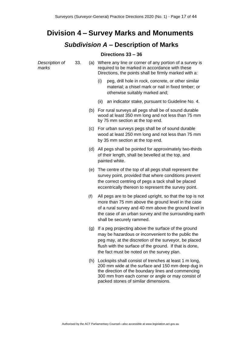
Division 4 – Survey Marks and Monuments
Subdivision A – Description of Marks
Directions 33 – 36
Description of marks
33. (a) Where any line or corner of any portion of a survey is required to be marked in accordance with these Directions, the points shall be firmly marked with a:
(i) peg, drill hole in rock, concrete, or other similar
material; a chisel mark or nail in fixed timber; or
otherwise suitably marked and;
(ii) an indicator stake, pursuant to Guideline No. 4.
(b) For rural surveys all pegs shall be of sound durable wood at least 350 mm long and not less than 75 mm by 75 mm section at the top end.
(c) For urban surveys pegs shall be of sound durable
wood at least 250 mm long and not less than 75 mm
by 35 mm section at the top end.
(d) All pegs shall be pointed for approximately two-thirds
of their length, shall be bevelled at the top, and
painted white.
(e) The centre of the top of all pegs shall represent the
survey point, provided that where conditions prevent
the correct centring of pegs a tack shall be placed
eccentrically thereon to represent the survey point.
(f) All pegs are to be placed upright, so that the top is not
more than 75 mm above the ground level in the case
of a rural survey and 40 mm above the ground level in
the case of an urban survey and the surrounding earth
shall be securely rammed.
(g) If a peg projecting above the surface of the ground
may be hazardous or inconvenient to the public the
peg may, at the discretion of the surveyor, be placed
flush with the surface of the ground. If that is done,
the fact must be noted on the survey plan.
(h) Lockspits shall consist of trenches at least 1 m long, 200 mm wide at the surface and 150 mm deep dug in the direction of the boundary lines and commencing 300 mm from each corner or angle or may consist of packed stones of similar dimensions.

Surveyors (Surveyor-General) Practice Directions 2020 (No. 1) - Page 18 of 44
Authorised by the ACT Parliamentary Counsel—also accessible at www.legislation.act.gov.au
Description of marks
(i) Where any corner, angle or other point is marked other than with a peg, where practicable wings shall be cut in solid rock, concrete or fixed timber, 75 mm long 20 mm wide and 10 mm deep commencing 20 mm from the corner or where the surface renders this impracticable, lines may be painted at least 300 mm long and 20 mm wide.
(j) Where practicable, a corner or angle may be marked using a boundary mark token securely attached to timber, post, fence or other surface using a non-corrodible nail, spike, rivet or screw. The boundary mark token shall be at least 32 mm diameter and 1.5 mm thick, with “Boundary Mark” permanently stamped or etched on the upper surface.
Description of reference marks
34. (a) Where a surveyor is required to place reference marks
in accordance with these Directions - they shall
consist of:
(i) a galvanised iron pipe at least 300 mm long and
internal diameter not less than 10 mm with a wall
thickness of not less than 3 mm;
(ii) a solid non-corrodible metal spike at least 300
mm long and having a diameter of at least 20
mm;
(iii) a galvanised iron spike at least 100 mm long
driven into fixed timber with a wing 75 mm long
cut into the timber and directed to the galvanised
iron spike;
(iv) a galvanised iron star picket at least 300 mm long
with a drill hole or punch mark on its upper end.
(v) a drill hole cut into a kerb or other substantial
structure at least 5 mm in diameter and 10 mm
deep with a wing at least 75 mm long, 20 mm
wide and 10 mm deep at the base, and the point
directed thereto;
(vi) a drill hole at least 10 mm in diameter and 25 mm
deep cut into bedrock with a wing 75 mm long
and directed thereto where such bedrock exists
within 300 mm of the natural surface of the
ground;
(vii) an appropriate chisel mark cut into the sound
wood of a suitable tree; or
(viii) a mark of a durable character or a specific point
on a permanent or substantial structure.

Surveyors (Surveyor-General) Practice Directions 2020 (No. 1) - Page 19 of 44
Authorised by the ACT Parliamentary Counsel—also accessible at www.legislation.act.gov.au
Description of reference marks
(b) Where a surveyor has placed or has found a
subsurface reference mark or a control mark more
than 0.4 m below the existing surface of the ground,
the depth shall be indicated on the plan.
(c) Where a surveyor has placed a reference mark
referred to in either sub-clause (a); (i), (ii), or (iii) of
this Direction it must be placed vertically at least 80
mm below the surface of the ground, or deeper if it is
likely to be disturbed.
Description of CRMs
35. A CRM shall be:
(a) a non-corrodible metal plaque set in a concrete kerb as specified by ACT Government Survey Office plan Misc. 825; or
(b) a non-corrodible metal plaque set in the top of a concrete block as specified by ACT Government Survey Office plan Misc. 825; or
(c) a deep driven stainless-steel rod; as specified by ACT Government Survey Office plan Misc. 827; or
(d) a galvanised iron star picket as specified in ACT Government Survey Office Plan Misc. 824; or
(e) a drill hole and wings cut into a kerb or other substantial structure, as specified by ACT Government Survey Office plan Misc. 826.
Other marks 36 The Surveyor-General may approve the use of other marks of a durable character as a substitute for marks described in Directions 33 to 35.

Surveyors (Surveyor-General) Practice Directions 2020 (No. 1) - Page 20 of 44
Authorised by the ACT Parliamentary Counsel—also accessible at www.legislation.act.gov.au
Subdivision B – Marking of Surveys
Directions 37 – 45
Urban
Marking urban surveys
37. (a) Where a surveyor makes an urban survey the
surveyor shall, whenever possible, firmly mark each
corner thereof (including corners of each parcel of
land in a subdivision) with a peg or mark of a nature
as prescribed in Direction 33.
(b) Where it is not possible or practical to mark a corner,
the surveyor shall:
(i) place a reference mark in accordance with
Direction 43 (a), and
(ii) note on the plan that the corner was not marked
and show the connection from the reference
mark to the corner.
(c) Where a surveyor makes an urban survey, the
surveyor shall place line marks pursuant to Direction
33 on all unfenced boundaries at intervals of not
more than 200 metres, with the position shown on
the plan.
(d) Marking of urban surveys shall not be completed
until land servicing has reached a stage where all
CRMs, reference marks and corner marking will be
durable and stable.

Surveyors (Surveyor-General) Practice Directions 2020 (No. 1) - Page 21 of 44
Authorised by the ACT Parliamentary Counsel—also accessible at www.legislation.act.gov.au
Placement of reference marks and CRMs for urban surveys
38. Where a surveyor makes an urban survey for any purpose and the land surveyed:
(a) abuts a road or street in which, within the limits of the
frontage of the land surveyed:
(i) reference marks have not been placed, are gone or are inaccessible, the surveyor shall place a reference mark near each extremity of the boundary of the subject land where it abuts the road or street, including at road intersections and;
(ii) within a Greenfields survey, reference marks
and CRMs have not been placed, are gone or
are inaccessible, the surveyor shall place CRMs
at intervals of not more than 200 metres
throughout the length of the frontage of the land
surveyed.
(iii) reference marks or CRMs have been
demonstrably disturbed the surveyor shall make
new connections from the said marks to the
subject land and shall note details of such
evidence and difference on the survey plan.
(b) abuts territory land, the surveyor shall place sufficient reference marks suitable for the redefinition of the rear boundaries of the land surveyed.
(c) does not abut a road or street, the surveyor shall
place at least two reference marks suitable for
redefinition of the survey.
(d) The requirement of subclause (a) (i) is subject to the
condition that a reference mark need not be placed
with 25 metres of another reference mark or CRM.
Connections to CRMs in greenfield surveys
39. In a greenfield survey, the surveyor shall connect all
CRMs placed, in accordance with Direction 38 (a) (ii),
to the subject land in accordance with Guideline No.
2 by a closed traverse, which includes the CRMs
placed and Established Survey Control Marks.

Surveyors (Surveyor-General) Practice Directions 2020 (No. 1) - Page 22 of 44
Authorised by the ACT Parliamentary Counsel—also accessible at www.legislation.act.gov.au
Rural
Marking rural surveys
40. (a) Where a surveyor makes a rural survey the surveyor
shall mark distinctly and durably all lines which form
or are to form the boundaries between parcels and
road frontages:
(i) with a mark as prescribed in Direction 33
together with lockspits cut in the direction of
each unfenced boundary from each corner and;
(ii) on unfenced boundaries with marks and
lockspits as prescribed in Direction 33 placed at
intervals of not more than 200 metres where
one mark cannot be seen from the next or;
(iii) not more than 500 metres, where one mark can
be seen from the next and;
(iv) show the position of such marks on the plan.
(b) Where it is not possible or practical to mark a corner,
the surveyor shall:
(i) place a reference mark in accordance with
Direction 43 (a), and
(ii) note on the plan that the corner was not marked
and show the connection from the reference
mark to the corner.
Reference marks for rural surveys
41. Reference marks shall be placed or connected to on rural surveys in accordance with the following:
(a) where the land surveyed is not being subdivided - at
least two reference marks suitable for redefinition of
the survey.
(b) where the land surveyed is being subdivided - at
least two reference marks in respect of each parcel.
(c) where a boundary other than a road frontage
exceeds 2,400 metres - additional reference marks
at intervals of not more than 1,500 metres; and
(d) where a boundary required to be marked in
accordance with the Directions is a road frontage -
pairs of reference marks suitable for orientation so
that the interval between any two successive
reference marks does not exceed 1,000 metres, and
one reference mark at each extremity thereof.

Surveyors (Surveyor-General) Practice Directions 2020 (No. 1) - Page 23 of 44
Authorised by the ACT Parliamentary Counsel—also accessible at www.legislation.act.gov.au
Surveys of rural or reserved roads
42. When making a survey of a rural or reserved road a surveyor shall:
(a) measure and mark distinctly and durably all lines which form or are to form the boundary of one side of the road with marks and lockspits pursuant to Direction 33;
(b) place marks, pursuant to Direction 33, at each corner along the surveyed boundary. Where the distance between corners is in excess of 200 metres marks are to be placed at intervals of not more than 200 metres except where corner marks are intervisible. Where marks are intervisible the distance between them should not exceed 500 metres;
(c) place marks, pursuant to Direction 33, at each corner of the unsurveyed boundary; and
(d) place pairs of reference marks suitable for survey orientation so that the interval between any two successive reference marks does not exceed 1,000 metres, and one reference mark at each extremity thereof.
Surveyors (Surveyor-General) Practice Directions 2020 (No. 1) - Page 24 of 44
Authorised by the ACT Parliamentary Counsel—also accessible at www.legislation.act.gov.au
Urban and Rural
Placement of reference marks and CRMs
43. (a) Where these Directions require a surveyor to place
CRMs, of the type described in Direction 35, and
reference marks the surveyor shall place them
adjacent to the corner or line mark, in positions such
as to minimise disturbance and be:
(i) not more than 30 metres from the corner, or line
mark to which it refers,
(ii) clear of all in-ground services,
(iii) at least 1 metre behind the kerb in speed zones
greater than 60 km/h.
(b) CRMs of a type described in Direction 35 (b), or (c)
or (d) are required to be placed at a ratio of at least 2
such CRMs per 100 blocks of land or part thereof,
provided always that 1 shall be of the type described
in Direction 35 (c).
(c) Where a CRM is installed in such a position that it
has, or the surveyor may have reason to consider
that it may have in future, clear line of sight only to
one other CRM then the surveyor shall place nearby
a reference mark and shall connect the CRM to it by
closed traverse.
(d) Where these Directions require a surveyor to place a
CRM of the type described in Direction 35, the
surveyor shall determine the AHD reduced level of
the CRM in accordance with Direction 16 and
provide the results to the Surveyor-General prior to
practical completion.
Connections to be shown
44. Where a surveyor is required to place a reference mark, the requirement shall include the connection by direct measurement from the mark to the survey made by the surveyor
Surveyors (Surveyor-General) Practice Directions 2020 (No. 1) - Page 25 of 44
Authorised by the ACT Parliamentary Counsel—also accessible at www.legislation.act.gov.au
Connection to control marks for infill and rural surveys
45. For infill and rural surveys:
(a) If the land being surveyed is not connected by
survey to a control survey, a surveyor shall connect
the survey to the nearest Established Survey Control
Marks if within 300 metres of the survey in an urban
area and 1,000 metres of the survey in a rural area.
Such connections should comply with Guideline No.
2 and Guideline No. 10.
(b) Measurements between all control marks found or
placed, and connections to the survey, must be
proved by closed traverse and the connections
shown on the survey plan.
(c) If GNSS equipment is used in the making of a
survey, the surveyor shall connect to at least three
Established Survey Control Marks.

Surveyors (Surveyor-General) Practice Directions 2020 (No. 1) - Page 26 of 44
Authorised by the ACT Parliamentary Counsel—also accessible at www.legislation.act.gov.au
Division 5 – Boundaries Formed by Tidal and Non-Tidal Waters and other Natural Features
Directions 46 – 51
Definitions 46. In this Division:
‘Bed’, in relation to a lake or stream, includes any portion of the lake or stream:
(a) that is alternately covered and left bare with an increase or diminution in the supply of water, and
(b) that is adequate to contain the lake or stream at its average or mean stage without reference to extraordinary freshets in time of flood or to extreme droughts.
‘Lake’ includes any permanent or temporary lagoon or a similar collection of water not contained in an artificial work, but does not include tidal waters.
‘Natural feature’ includes any cliff face or ridgeline, but does not include any tidal or non-tidal waters.
‘Stream’ includes any non-tidal waters that are not a lake.
Surveys where boundary includes tidal or non-tidal or other natural features
47. (a) A boundary formed by tidal waters, or by a lake,
stream or natural feature, must be surveyed so that
each change of course or direction of the boundary is
determined with appropriate accuracy.
(b) If the actual position of the mean high-water mark of
tidal waters, the bank of the lake or stream or the
natural feature is substantially different to the
adopted position of the boundary, both the actual
position and the adopted position are to be shown on
the survey plan.
(c) If:
(i) the middle line of a stream is the boundary of
land and has not previously been defined by
survey, or
(ii) the middle line of a stream is otherwise required
to be determined,
both banks of the stream must be surveyed and
shown on the survey plan together with the
determination of the middle line.
(d) The middle line of a stream need not be marked
unless the purpose for which the survey is made so
requires.

Surveyors (Surveyor-General) Practice Directions 2020 (No. 1) - Page 27 of 44
Authorised by the ACT Parliamentary Counsel—also accessible at www.legislation.act.gov.au
Changes in boundaries formed by tidal waters
48. (a) If, since the date of a previous survey, there has
been a change in the position of the mean high-water
mark of tidal waters forming a boundary of land to be
surveyed:
(i) if the change arose from natural, gradual and
imperceptible accretion or erosion—the position
of the mean high-water mark as it is as the
result of the change is to be adopted, or
(ii) if the change arose otherwise than from natural,
gradual and imperceptible accretion or
erosion—the position of the mean high-water
mark as it was before the change is to be
adopted.
(b) The first survey of a mean-high water mark
boundary, or approval to the adoption of a changed
position referred to in subclause (a) (i) must be
obtained from the Surveyor-General
(c) When seeking approval to a determination under
subclause (b), a surveyor must provide the Surveyor-
General with a comprehensive report regarding the
surveyor’s determination.
(d) A comprehensive report under this clause must
include:
(i) the basis and method of determining the
position of the mean high-water mark, and
(ii) the surveyor’s opinion as to the reason for any
change in that position and the process by
which the change has taken place, and
(iii) such photographs, documents or other
information relevant to the position of the mean
high-water mark as is reasonably required by
the person to whom the report is to be provided.
Surveyors (Surveyor-General) Practice Directions 2020 (No. 1) - Page 28 of 44
Authorised by the ACT Parliamentary Counsel—also accessible at www.legislation.act.gov.au
Changes in boundaries formed by lakes, streams and natural features
49. (a) If, since the date of a previous survey, there has been a change in the position of the bank of a lake forming a boundary of land to be surveyed, then, in any subsequent survey, the position of the bank, as it was before the change, must be adopted.
(b) If, since the date of a previous survey, there has been a change in the position of the bank of a stream, or of some other natural feature, forming a boundary of land to be surveyed, then, in any subsequent survey:
(i) for any change arising from natural, gradual and imperceptible accretion or erosion, the position of the bank or natural feature, as it is as a result of the change, must be adopted, or
(ii) for any change arising otherwise than from natural, gradual and imperceptible accretion or erosion, the position of the bank or natural feature, as it was before the change, must be adopted.
(c) A surveyor who determines a new position for the
bank of a stream, or for a natural feature, in
connection with a survey carried out for the purposes
of lodging a survey plan with a public authority, must
lodge, together with the survey plan, a
comprehensive report regarding the surveyor’s
interpretation of the new position. The report is to
include:
(i) the basis and method of determining the
position of the bank of stream or natural feature,
and
(ii) the surveyor’s opinion as to the reason for any
change in that position and the process by
which the change has taken place, and
(iii) such photographs, documents or other
information relevant to the position of the bank
of stream or natural feature as is reasonably
required by the person to whom the report is to
be provided.
Surveyors (Surveyor-General) Practice Directions 2020 (No. 1) - Page 29 of 44
Authorised by the ACT Parliamentary Counsel—also accessible at www.legislation.act.gov.au
References to high water mark, tidal waters, lakes streams and other natural features in previous surveys
50. For the purposes of preparing a survey, in any previous survey plan or other description of land:
(a) a reference to high-water mark is taken to be a reference to mean high-water mark, and
(b) a reference to, or description of, a boundary that abuts tidal waters is taken to be a reference to, or description of, a boundary that abuts mean high-water mark, and
(c) a reference to a bank of a lake or stream is taken to be a reference to the limit of the bed of the lake or stream, and
(d) a reference to, or description of, a boundary that abuts a lake or stream is taken to be a reference to, or a description of, a boundary that abuts the limit of the bed of the lake or stream, unless a contrary intention appears.
Method of showing natural features boundaries on plans
51. A survey plan that shows a natural feature boundary:
(a) must describe the natural feature, and
(b) must indicate the boundary by a spline curve that generally follows the position of the boundary, and
(c) must include a table of sequential bearings and distances that accurately locates each change in direction of the natural feature, and
(d) must show the connection between terminals of the natural feature for each parcel.

Surveyors (Surveyor-General) Practice Directions 2020 (No. 1) - Page 30 of 44
Authorised by the ACT Parliamentary Counsel—also accessible at www.legislation.act.gov.au
Division 6 – Field notes
Directions 52 – 58
Field Notes
52. (a) A surveyor shall make neat, precise, complete and
readily intelligible field notes of every survey.
(b) Facts, readings and observations must be recorded
immediately after they are ascertained.
(c) A surveyor must keep an archive of:
(i) all field notes made by the surveyor, with
indexes and cross-references set out in a
manner that facilitates the preparation of a
complete and accurate survey plan, and
(ii) all other information and documentation relevant
to those field notes.
(d) A surveyor’s field notes must include:
(i) the nature and position of any survey mark
found by the surveyor, and
(ii) the nature of any survey mark (other than a peg)
placed by the surveyor.
(iii) All other information relevant to the survey.
(e) No erasures shall be made and all amendments shall
be initialled by the surveyor.
Surveyor to retain electronic records
53. (a) If a survey has been recorded in whole or in part by electronic methods other than GNSS methods:
(i) an electronic copy of all recorded data, and
(ii) a copy of the reduced data or positional results,
must be retained in a form that facilitates the preparation of a complete and accurate survey plan.
(b) If a survey has been recorded in whole or in part by GNSS methods:
(i) an electronic copy of all recorded data, and
(ii) a copy of the reduced baseline or positional results,
must be retained in a form that facilitates the preparation of a complete and accurate survey plan.
Disclosure of difficulties
54. A surveyor shall disclose any doubt, discrepancy or difficulty suggested by or encountered in a survey in the field notes.

Surveyors (Surveyor-General) Practice Directions 2020 (No. 1) - Page 31 of 44
Authorised by the ACT Parliamentary Counsel—also accessible at www.legislation.act.gov.au
Datum line to be recorded
55. A surveyor must clearly indicate in the surveyor’s field notes the datum line of the survey and the origin of the orientation adopted.
Landmarks to be recorded
56. A surveyor should record the names of estates, houses, roads, rivers, creeks, lakes and the like, and house numbers, as far as they are material to the survey and ascertainable by the surveyor.
Surveyor to sign and date field notes
57. (a) In the case of a survey that has been performed by a surveyor personally or under the surveyor’s supervision, the surveyor must personally sign, date and retain each page or sheet of the field notes and (in the case of a survey recorded by electronic means) each page or sheet of the reduced and formatted data.
(b) Before signing each page or sheet, the surveyor must be satisfied that the notes are accurate and that the date the work was performed is recorded.
Recording angles, bearings and distances
58. (a) All angles and bearings must be observed and
recorded in degrees, minutes and seconds, and
expressed clockwise from zero through to 360
degrees.
(b) All distances must be measured and recorded in
metres.

Surveyors (Surveyor-General) Practice Directions 2020 (No. 1) - Page 32 of 44
Authorised by the ACT Parliamentary Counsel—also accessible at www.legislation.act.gov.au
Division 7 – Survey Plans
Directions 59 – 65
Plans to be lodged promptly
59. (a) Plans of survey must be lodged with the Surveyor-
General no later than 12 months after completion of
the survey.
(b) All marking as required in Division 4 of these
Directions must be completed prior to lodgement
unless an exemption is granted by the Surveyor-
General.
(c) All distances on the plan shall be shown as horizontal ground distances, expressed in metres.
Standards for plans
60. (d) Guideline No. 6, “Deposited Plans, Standards and Procedures” may be reviewed by the Surveyor-General, and promulgated as a notifiable instrument.
(e) Plans may be rejected for examination in accordance with Guideline No. 6.
Datum to be shown
61. A surveyor shall show the datum line of the orientation of a survey in the plan by distinguishing letters ‘A’ and ‘B’ placed at the terminals thereof and the nature of the marks defining the datum line shall be noted therein.
Description of marks and connections to be shown
62. A surveyor shall indicate on the plan:
(a) the nature of any corner or line mark placed which is not a peg;
(b) the nature of any reference mark placed together with the relevant connections;
(c) the nature of any reference mark or CRM found and connected to, together with the relevant connections; and
(d) closed connections between control marks.

Surveyors (Surveyor-General) Practice Directions 2020 (No. 1) - Page 33 of 44
Authorised by the ACT Parliamentary Counsel—also accessible at www.legislation.act.gov.au
Information to be shown on Plan
63. A surveyor shall show in a plan of survey:
(a) the nature of all boundaries at the time of the survey,
irrespective of how they are marked or defined; and
(i) if a wall is on a boundary, the boundary shall be
described in the plan as ‘face of wall’ or ‘passing
through wall’, or otherwise, as appropriate: A wall
shall not be described as a ‘party wall’ except in
accordance with Section 32 of the City Area
Leases Ordinance 1936, as applied and modified
by Section 5 of the National Lands Ordinance
1989 for National Land, and/or Sections 27 and 28
of the Common Boundaries Act 1981 for Territory
Land;
(b) the description, width and where practicable, height of all walls used in common and the position of the boundary therein;
(c) the location and description (including the age, nature, construction material, and if practicable, height) and the relationship to the boundary of any permanent structure (including any fence):
(i) that is within one metre of the boundary of the land surveyed, or
(ii) that is otherwise relevant to the boundary
(d) A surveyor shall disclose any doubt, discrepancy or difficulty suggested by or encountered in a survey in the plan thereof or in an annexure thereto or in an accompanying report.
(e) Where boundaries have been wholly or partly compiled or computed, a notation to that effect shall be shown on the plan.
GNSS and remote sensing derived lines to be indicated
64. A survey plan that includes lines derived from GNSS observations, from photogrammetric or remote sensing means, must indicate which of those lines have been so derived.

Surveyors (Surveyor-General) Practice Directions 2020 (No. 1) - Page 34 of 44
Authorised by the ACT Parliamentary Counsel—also accessible at www.legislation.act.gov.au
Certification 65. (a) Where a surveyor is required to furnish a plan of survey for lodgement at the Registrar-General’s Office the surveyor shall endorse thereon a certificate in or to the effect of Form 3 in Schedule 1 to these Directions.
(b) Such certification must be an original electronic certificate made by the surveyor’s signature that has been registered/lodged with the Surveyor-General
(c) Such certificate may be incorporated in any certificate required by any law to be endorsed on such plan.
(d) Unless prior written approval is obtained from the Surveyor-General, such certification must not be issued until all survey marks required to be placed in connection with the survey have been duly placed.

Surveyors (Surveyor-General) Practice Directions 2020 (No. 1) - Page 35 of 44
Authorised by the ACT Parliamentary Counsel—also accessible at www.legislation.act.gov.au
Division 8 – Stratum Surveys
Direction 66
Requirements for stratum surveys
66. Where a plan of survey of a stratum is required the surveyor shall:
(a) mark at ground level the projection of the extremities of the stratum block and relate it to existing boundaries and occupations or, pursuant to Direction 34, place reference marks adjacent to the stratum block which will be stable, durable and accessible;
(b) complete the survey, once building construction has reached a stage where all relevant structures have been constructed and are suitable for boundary re-definition purposes.
(c) define the stratum by dimensions of regular, or description of irregular surfaces;
(d) delineate on the plan the extent of any easement and fully describe its purpose and limits;
(e) show on the plan elevations and sections sufficient to delineate the stratum blocks using reduced levels based on the AHD;
(f) verify AHD reduced levels by closed height difference between three control marks, the AHD reduced levels of which have been obtained from the ACT Government Survey Control Mark Register within 3 months before completion of the survey and are to an accuracy of Class LC or better, as specified in SP1;
(g) show on the plan the position and reduced level of at least two reference marks or survey control marks adjacent to the subject land; and
(h) determine all reduced levels to an accuracy of Class LC or better, as specified in SP1.

Surveyors (Surveyor-General) Practice Directions 2020 (No. 1) - Page 36 of 44
Authorised by the ACT Parliamentary Counsel—also accessible at www.legislation.act.gov.au
Division 9 – Community Title
Direction 67
Survey and plan requirements
67. References to roads in these Directions include private roads, or easements for access within a community title, unless the Surveyor-General has provided written advice to the contrary.

Surveyors (Surveyor-General) Practice Directions 2020 (No. 1) - Page 37 of 44
Authorised by the ACT Parliamentary Counsel—also accessible at www.legislation.act.gov.au
Division 10 – Unit Title
Direction 68
Legislative requirements
Related legislation and directions
68. (a) Directions within this Division and Guideline No. 17 are supplementary to the requirements of the Unit Titles Act 2001 and associated regulations. In the event of an inconsistency between the Act or regulation and these Directions, the former take precedence.
(b) In carrying out a survey for the preparation of a Units Plan within the meaning of the Unit Titles Act 2001, a surveyor shall undertake the survey in accordance with this Division. The provision of Directions 6, 7, 8, 14, 17, 22 (b), and 52 to 58 both inclusive (but no other provision of these Directions) shall apply in respect thereof.

Surveyors (Surveyor-General) Practice Directions 2020 (No. 1) - Page 38 of 44
Authorised by the ACT Parliamentary Counsel—also accessible at www.legislation.act.gov.au
Schedule 1 - Forms
Form 1 (Direction 7)
Surveyors Practice Directions
Surveyors Act 2007
To the owner of..............................................................................................................
(insert reference to land proposed to be entered)
In pursuance of Section 45 of the Surveyors Act 2007 notice is hereby given that I, the undersigned registered Surveyor, intend to enter the above mentioned land on ....................................................................for the purpose of making a survey.
(insert dates of proposed entry)
Dated this .................................... day of .............................................. 20 ..........
(Name)......................................................
(Signature).........................................................
Registered Surveyor
(Address) .........................................................
Form 2 (Direction 10)
Surveyors Practice Directions
Surveyors Act 2007
I ....................................................................... of .......................................................................
a surveyor registered under the Surveyors Act 2007 hereby certify that the survey represented in this plan, being a survey which does not require strict accuracy was made in accordance with Direction 10 of the Surveyors Practice Directions.
(Signature).........................................................
(Date).........................................................
Form 3 (Direction 65)
Surveyors Practice Directions
Surveyors Act 2007
I ....................................................................... of...........................................................
a surveyor registered under the Surveyors Act 2007 hereby certify that the survey represented on this plan is accurate and has been made in accordance with the Surveyors Practice Directions and was completed on ...............................................
(Signature).........................................................
(Date).........................................................

Surveyors (Surveyor-General) Practice Directions 2020 (No. 1) - Page 39 of 44
Authorised by the ACT Parliamentary Counsel—also accessible at www.legislation.act.gov.au
Schedule 2 – Datums and Mapping Projections
Australian Capital Territory Standard Grid Coordinates (SGC)
Horizontal Datum: The Australian Capital Territory Standard Grid Coordinates (SGC) system is based upon the Australian Geodetic Datum as proclaimed in the Commonwealth Gazette No. 84 of 6 October 1966 (AGD66). This datum is described fully in the National Mapping Council of Australia (now the Intergovernmental Committee on Surveying and Mapping (ICSM)) Special Publication No. 10 (SP10) titled ‘The Australian Geodetic Datum Technical Manual’. Projection: Standard Grid Coordinates are derived from a Transverse Mercator projection of latitudes and longitudes on the AGD66. This grid has the following parameters:
Coordinates are in metres;
Central Meridian
149 degrees 00 minutes 33.46139 seconds east of Greenwich (Stromlo Trigonometrical Station);
False Origin
Based on Stromlo Trigonometrical Station having:
• Latitude: 35 degrees 19 minutes 03.85060 seconds south of the equator
• Longitude: 149 degrees 00 minutes 33.46139 seconds east of Greenwich
• Grid coordinates of E 200 000.000 metres
N 600,000.000 metres
• The Scale Factor at the Central Meridian is 1.000 086
Vertical Datum:
The Australian Height Datum (AHD) is the official height datum in the Australian Capital Territory, as defined in the GDA2020 Technical Manual.
For further information on SGC see:
Wellspring, K. H., Some aspects of the conversion from imperial to metric coordinates in the Australian Capital Territory, Technical papers of the 16th Australian Survey Congress, Canberra, Australia, 1973.
Surveyors (Surveyor-General) Practice Directions 2020 (No. 1) - Page 40 of 44
Authorised by the ACT Parliamentary Counsel—also accessible at www.legislation.act.gov.au
Schedule 3 – Supervision of Persons by Registered Surveyors
S3-1 Background
‘Supervision’ may be defined as the act, process or function of overseeing, directing or managing work, workers or a project.
The supervising surveyor has an important role in guiding the training of future professionals and also has certain obligations in undertaking the preparation and instruction of a supervised person.
A supervising surveyor must provide appropriate direction to employed persons and should provide guidance and direction in relation to the preparation of a person for relevant NSW Board of Surveying and Spatial Information (the Board) examinations. Supervision may be through the exercise of general supervision and/or immediate supervision in both field and office environments.
This document (Schedule 3) provides guidance to surveyors regarding their role and responsibilities regarding professional supervision of their employees.
S3-2 Objectives of supervision of persons by Registered Surveyors
The supervising surveyor is responsible for ensuring that the supervised person is aware of the importance of the surveyor’s role in:
• maintaining the integrity of the cadastre and the high quality of surveys;
• providing professional and high quality services to the public;
• producing high quality survey outcomes in accordance with legislative requirements;
• ensuring that work is undertaken in a safe and responsible manner (WHS) and in accordance with other relevant legislation; and
• a continuing professional responsibility to the wider surveying profession.

Surveyors (Surveyor-General) Practice Directions 2020 (No. 1) - Page 41 of 44
Authorised by the ACT Parliamentary Counsel—also accessible at www.legislation.act.gov.au
S3-3 Definitions
A ‘supervising surveyor’ means a person who either:
(a) supervises the activities of others in order to fulfil legal and professional responsibilities and obligations; or
(b) has agreed to supervise a graduate
or both, and is a registered surveyor.
A supervised person may include:
• an unqualified person who acts under the registered surveyor’s direction and assists the registered surveyor in the performance of the registered surveyor’s legal and professional responsibilities;
• a surveyor’s assistant;
• a graduate of surveying;
• a student of surveying;
• a person holding a recognised qualification as determined by the Board;
• a candidate for examination or;
• other such person as the Surveyor-General may determine from time to time.
Surveyors (Surveyor-General) Practice Directions 2020 (No. 1) - Page 42 of 44
Authorised by the ACT Parliamentary Counsel—also accessible at www.legislation.act.gov.au
S3-4 Levels of Supervision – ‘Immediate’ and ‘General’
A supervising surveyor:
• is solely responsible for surveys carried out under the surveyor’s supervision, and
• is responsible for the health and safety at work of the supervised person in accordance with relevant ACT and Commonwealth legislation.
• should exercise a standard of supervision that will ensure the survey reflects the surveyor’s professional responsibilities and complies with relevant statutes.
It is a matter for the supervising surveyor in the circumstances relating to each individually supervised person as to the level of oversight required and to ensure that the supervised person is capable of carrying out their role at their level of ability. In relation to survey graduates and students of surveying, this involves an exposure to a broad range of surveys and experience to appropriately prepare them for their future role as professional surveyors.
The extent of supervision required will vary according to the experience, skills and ethics of the supervised person.
The following information is provided for guidance only and is not intended to be an exhaustive list of matters which may be considered by a supervising surveyor in the exercise of the role.
Regarding immediate supervision, the supervising surveyor is expected to have a significant level of involvement with the supervised person. This includes but is not necessarily restricted to:
• briefing the supervised person on the purpose and details of their required duties before the supervised person commences involvement with the survey and associated tasks;
• accompanying the supervised person on site at the early stage of the supervised person’s training;
• being present on sufficient occasions to ensure that the supervised person’s questions and issues are able to be addressed expeditiously;
• inspecting the marking and physical aspects of the survey and associated tasks, including but not limited to field notes, closes, etc., upon completion and effecting checks and verification of the supervised person’s work such as to be confident of the quality and accuracy of the work produced. Again it is noted that the supervising surveyor is solely responsible for the correctness of the surveys undertaken by a supervised person under their supervision and direction;
• discussing all aspects of the survey at the completion of the work.
The supervising surveyor should consider when the level or frequency of ‘immediate’ supervision could be reduced. Such a decision should consider the demonstrated ability of the supervised person to plan and implement a work program, and assume a leadership role in undertaking surveys.
In relation to general supervision, the supervising surveyor continues to be wholly responsible for the work of the supervised person. However, the level of oversight and review is reduced as compared to immediate supervision. This reflects the confidence that the supervising surveyor has in the knowledge, skill and competency of the supervised person.

Surveyors (Surveyor-General) Practice Directions 2020 (No. 1) - Page 43 of 44
Authorised by the ACT Parliamentary Counsel—also accessible at www.legislation.act.gov.au
General supervision may apply, for example, to a supervised person who has had some level of recognised technical qualification and has attained an appropriate level of experience. General supervision would normally only apply to a student of surveying, or a surveyor’s assistant.
General supervision may involve:
• instruction on the requirements for any unusual or difficult aspects of the survey and associated tasks and possible methods of approach, especially if new procedures are involved;
• progress checks upon any unusual or complex features of the survey task;
• a detailed and comprehensive review of the assignment on completion.
Regardless of the level of supervision exercised, the supervising surveyor should be aware of any risks or circumstances which may not be evident from office examination and deliberations. This may require the supervising surveyor to visit the site.
S3-5 Supervision in the Office and in the Field
Whether the supervised person is working in the office or the field it is the role of the supervising surveyor to ensure that the supervised person is appropriately supervised. Any deficiencies in skills, quality of work product, and professionalism (particularly in relation to clients) should be addressed and rectified. The supervising surveyor takes full responsibility for the work of the supervised person undertaken in the course of their employment.
During the course of their employment, and while under direct supervision, supervised persons should be exposed to a variety of surveys including complex and challenging situations through which they can gain a wide range of experience.
In addition a supervising surveyor should impress upon the supervised person the importance of:
• professional presentation and ethical conduct, through both example and instruction, and
• adherence to and maintenance of safe work methods, practices and procedures in both field and office environments.
S3-6 Power of entry
Section 45 of the Surveyors Act 2007 (the Act) provides a registered surveyor with power of entry onto land under the conditions of this section.
However, section 45(4) of the Act does not provide an assistant (including unaccompanied supervised person) with such power, unless accompanied by the registered surveyor or having the owner’s written permission.

Surveyors (Surveyor-General) Practice Directions 2020 (No. 1) - Page 44 of 44
Authorised by the ACT Parliamentary Counsel—also accessible at www.legislation.act.gov.au
S3-7 Supervision in relation to NSW Board Examinations
The supervision of candidates for land surveying qualification is a fundamental responsibility of a surveying professional.
The Board recognises the importance of academic qualifications, examinations and the granting of certificates of competency as key elements in preparing supervised persons for their future professional roles.
However, it is the role of the supervising surveyor to assist the supervised person for both the examination of the candidate’s competency and to prepare the supervised person for work as a surveying professional. Poorly-presented candidates reflect on the reputation of the supervising surveyor.
The supervising surveyor is best placed to assess the character, level of knowledge and preparedness of the supervised person to undertake the examination process.
At the completion of the supervision period, the supervised person should have attained a broad range of training and experience.