supporting risk-informed planning, budgeting and resource
TRANSCRIPT

KEBIJAKAN INOVATIFPERCEPATAN PEMBANGUNAN BERBASIS DESA
DI PROVINSI NUSA TENGGARA TIMUR
Supporting risk-informed planning,budgeting and resource allocationin East Nusa Tenggara Province
Syaiful Anwar, Ministry of Environment and ForestryI Wayan Darmawa, Provincial Development & Planning Body

OUT LINE
1. CHARACTERISTICS OF EAST NUSATENGGARA PROVINCE
2. CLIMATE CHANGE ADAPTATIONPLANNING (VULNERABILITY ANDCLIMATE RISK)
3. INTEGRATING ADAPTATION OPTIONSINTO SUB-NATIONAL DEVELOPMENTPLANNING IN EAST NUSA TENGGARAPROVINCE (SPARC)

CHARACTERISTICS OF EAST NUSATENGGARA PROVINCE

Climate: 8 months (dry / dry) and 4 months (rain / wet)
Total Size Region Mainland region ± 47.349,9 km2
Ocean territory ± 200.000 km2
only 432 islands have name
only 44 Island Inhabited
Geographical location :8 0-120 LS dan 1180-1250 BT
1,192 islands (small and large)
CHARACTERISTICS EAST NUSA TENGGARA
Administrative regions:
District : 21 and 1 city Sub district town: 306 units Village : 3,270 units

No Main Source of Income The Total (%)1 Agriculture 3,129 95.69
•Crops 2,311 70.67
•plantation 650 19.88•Livestock 17 0.52•Fishing 69 2.11•Aquaculture 26 0.80•Horticulture 52 1.59•Other 4 0.12
2 Processing industry 11 0.343 Wholesale / Retail Small 43 1.314 service 84 2.575 More 3 0.09
The Total 100.00
Main source of income Year 2015

Rural communities in East Nusa Tenggara (NTT) Province arehighly dependent on the climate for their subsistenceagricultural production and water resources. Ensuring foodand water security is already a major challenge.
Provincial government conducting climate vulnerabilitymapping at village level and climate risk (both historical andprojection from 2011 to 2040).
Assisted by GEF/UNDP through SPARC (Strategic Planning andAction to Strengthen Climate Resilience of Rural Community)Project, in cooperation with Ministry of Environment andForestry:
SPARC is implemented in Manggarai, East Sumba & Sabu Raijuadistrict.

Strengthen resilience and adaptive capacity toclimate-related hazards and natural disasters inall countries
• This cross cutting issue can be as an entry point into otherSDGs targets achievement, such as poverty, land degradation,and water.
• This achieved targets also provide co-benefit to other sectors,such as food, energy, health.
• Even to other conventions targets:such as UNCCD, CBD

CC ADAPTATION PLANNING PROCESSbased on Ministerial Decree No. 33/2016
IdentifyTargets(Adm
boundary orEcosystem)
Climateimpact
formula-tion
Vulnerabi-lity
assessmntand
ClimateRisk
CCAdaptation
options
PrioritizingCC
AdaptationOptions
Integrationof CC
Adaptationinto DevPlanning

VULNARABILITY MAP

EXTREME WET2011-2040

EXTREME DRY2011-2040
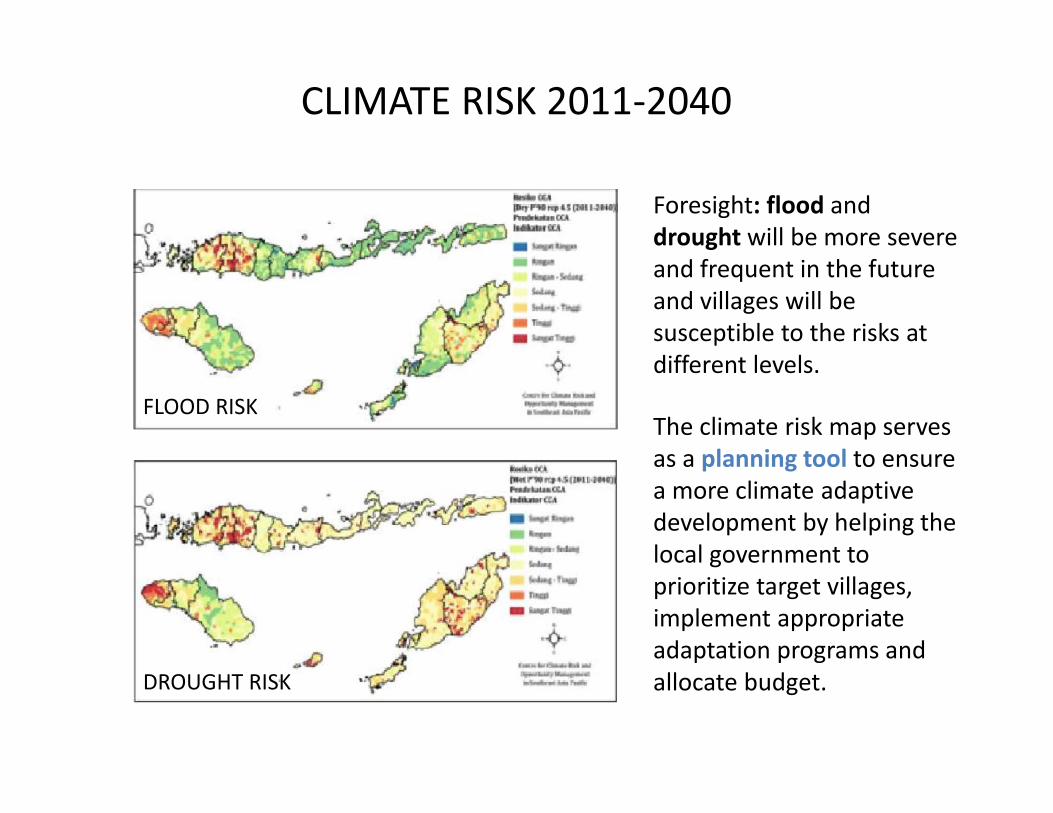
DROUGHT RISK
FLOOD RISK
Foresight: flood anddrought will be more severeand frequent in the futureand villages will besusceptible to the risks atdifferent levels.
The climate risk map servesas a planning tool to ensurea more climate adaptivedevelopment by helping thelocal government toprioritize target villages,implement appropriateadaptation programs andallocate budget.
CLIMATE RISK 2011-2040

ADAPTATION OPTIONS BASED ONCLIMATE RISK SCENARIOS
(as a set of Menu for dev. Planning)
• Water infrastructure development (Agriculture & clean water)• Cultivation of Vegetable enhancement (carrot, String-bean,
eggplant, tomato).• Mattress production made from Kapok tree , carried out by group
of woman.• Maintenance/development of irrigation network for paddy and
vegetable.• Regreening surroundings embung (water resource)• Solar pump development and its installation• Infiltration well as water conservation.• Etc.
It seems like common actions but this is not business as usual. Thiscould avoid mal adaptation in the future.
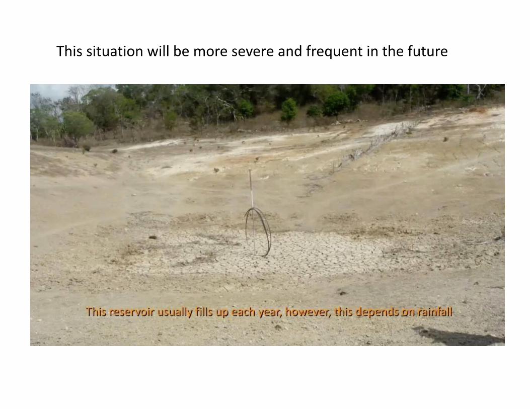
This situation will be more severe and frequent in the future

Before:abandoned land
After:vegetable planting area


Climate Change Adaptation mainstreamed:Integrated into the Development Planning for
Budget/Resource allocation
CC Adaptation Plan are integrated in theprovincial and districts medium-termdevelopment planning (RPJMDs)
CC Adaptation actions are integrated into thevillage medium-term development planning(RPJMDes)
Enhancing East Nusatenggara ONE DATA system
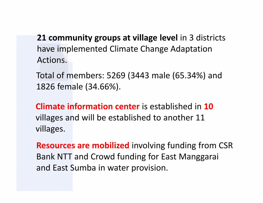
Climate information center is established in 10villages and will be established to another 11villages.
Total of members: 5269 (3443 male (65.34%) and1826 female (34.66%).
Resources are mobilized involving funding from CSRBank NTT and Crowd funding for East Manggaraiand East Sumba in water provision.
21 community groups at village level in 3 districtshave implemented Climate Change AdaptationActions.

THANK YOU
SUSTAINABLE DEVELOMENT WILL BE PROMOTED