support services for commercial space transportation - faa: home
TRANSCRIPT

HQ-0
9687
.indd
Support Services for Commercial Space Transportation
October 2008
AdministrationFederal Aviation
About the Office of Commercial Space Transportation
The Federal Aviation Administration, Office of Commercial Space Transportation, licenses and regulates U.S. commercial space launch and reentry activity as well as the operation of nonfederal launch and reentry sites as authorized by Executive Order 12465 and Title 49 United States Code, Subtitle IX, Chapter 701 (formerly the Commercial Space Launch Act). The Office’s mission is to ensure public health and safety and the safety of property while protecting the national security and foreign policy
interests of the United States during commercial launch and reentry operations. In addition, the Office is directed to encourage, promote, and facilitate commercial space launches and reentries. Additional
information concerning commercial space transportation can be found at http://ast.faa.gov.
NOTICE
Use of trade names, services, or images associated with corporate entities in this document does not constitute official endorsement of such products, services, or corporate entities,
either expressed or implied, by the Federal Aviation Administration.
Available from
Federal Aviation AdministrationAssociate Administrator for Commercial Space Transportation
800 Independence Avenue, S.W., Rm. 331Washington, D.C. 20591
http://ast.faa.gov
• i •
Support Services for Commercial Space Transportation
Table of Contents
Introduction ..........................................................................................1
Why Undertake This Study? ................................................................1AWARENESS ..............................................................................................................................1
PLANNING ................................................................................................................................2
How is this Study Organized?..............................................................2
What Support Services are Available and What Services are Needed? ..........................................................................................3
COMMUNICATIONS................................................................................................................3
SURVEILLANCE ..........................................................................................................................3
SPACE TRAFFIC CONTROL ..................................................................................................4
NAVIGATION ............................................................................................................................5
METEOROLOGY........................................................................................................................5
SPACE WEATHER ......................................................................................................................6
ORBITAL SERVICING................................................................................................................7
IN-ORBIT CREW RESCUE......................................................................................................8
TECHNICIAN TRAINING ......................................................................................................9
Summary of Services Providers........................................................10
Communications Profiles ................................................................11NASA TRACKING AND DATA RELAY SATELLITE SYSTEM (TDRSS)......................11
NASA DEEP SPACE NETWORK (DSN)............................................................................13
IRIDIUM SATELLITE LLC ......................................................................................................14
ORBCOMM ..............................................................................................................................16
GLOBALSTAR ..........................................................................................................................17
Surveillance Profiles ..........................................................................19SPACE SURVEILLANCE NETWORK (SSN) ......................................................................19
OTHER INTERNATIONAL SPACE SURVEILLANCE PROGRAMS ............................21
Space Traffic Control Profiles ..........................................................22 FAA OFFICE OF COMMERCIAL SPACE TRANSPORTATION ..................................22
FEDERAL COMMUNICATIONS COMMISSION ............................................................23
INTERNATIONAL TELECOMMUNICATION UNION ................................................24
NATIONAL TELECOMMUNICATIONS AND INFORMATION
ADMINISTRATION ................................................................................................................25
Navigation Profiles ............................................................................26GLOBAL POSITIONING SYSTEM ......................................................................................26
OTHER INTERNATIONAL NAVIGATION PROGRAMS..............................................27
Meteorology Profiles ..........................................................................28NOAA NWS SPACEFLIGHT METEOROLOGY GROUP..............................................28
Space Weather Profiles ......................................................................30NOAA SPACE WEATHER PREDICTION CENTER (SWPC) ......................................30
EUROPEAN SPACE AGENCY - SPACE ENVIRONMENTS AND EFFECTS
SECTION....................................................................................................................................32
THE INTERNATIONAL SPACE ENVIRONMENT SERVICE (ISES) ............................33
Crew Rescue Profiles ........................................................................34RUSSIAN FEDERAL SPACE AGENCY (ROSCOSMOS) ................................................34
NATIONAL AERONAUTICS AND SPACE ADMINISTRATION (NASA) ................35
Technician Training Profiles ..............................................................36SPACETEC..................................................................................................................................36
• ii •
Federal Aviation Administration / Commercial Space Transportation
Support Services for Commercial Space Transportation
• 1 •
IntroductionSpace transportation operators interact with a range of organizations that provideservices to enable safe and successful transportation activities. New spacetransportation markets, such as re-supply of space stations and commercial humanspaceflight, could drive demand for improved or new support services. This studyprovides a review of organizations that supply space services in an attempt tounderstand what services are available in a number of specific categories. Interviewswith a number of but not all commercial orbital and suborbital transportationoperators help identify any new or improved services that are needed. This study isonly a snapshot and is not intended to include all space transportation supportservice categories or providers. The study focuses primarily on U.S. based serviceproviders but also includes a few notable international providers.
The categories of support services examined within this study include:
• Communications• Surveillance• Space Traffic Control• Navigation• Meteorology• Space Weather• Orbital Servicing• Crew Rescue• Technician Training
Other essential support services discussed in separate FAA/AST reports including :
• Human Spaceflight Training• Spaceports
The “Commercial Human Spaceflight Training Survey” released by FAA/AST inFebruary 2008 discusses available human spaceflight training support services.AST’s annual “2008 U.S. Commercial Space Transportation Developments andConcepts: Vehicles, Technologies, and Spaceports.”
Why Undertake This Study?
AWARENESS
A large number of government and commercial organizations provide supportservices critical to the commercial space transportation industry within the UnitedStates. As demand for space transportation services increases it is important toidentify the support services necessary to enable the growth of a healthycommercial space transportation industry. Government and public awareness ofthe role that these organizations play will help foster increased support for thesesupport services.

Federal Aviation Administration / Commercial Space Transportation
• 2 •
PLANNING
Space transportation operators and government users need to understand whatservices are available in order to develop and field space transportation systems.The user community can also employ this study and the resulting discussions tovoice feedback about support services. In addition, service providers can use thisstudy to understand more thoroughly the needs of the user community and as aresult improve their service offerings.
How is this Study Organized?This study was generated through primary research with the support serviceproviders and interviews with select suborbital and orbital space transportationoperators.
The first section of the study consists of an introductory discussion of the servicesavailable and the services needed for each of the support service categories. Somesections also include feedback from commercial space transportation operators.
The second section consists of more detailed profiles of the support serviceproviders. Each profile examines the following questions:
• Contact information– How can the reader access more information about the service provider?
• Summary of services– What high level services does this organization provide?
• Background and development plans– What is the basic background of this organization?– What facilities and equipment does the organization own or have
access to? – Does the organization have plans to further develop the services offered?
(e.g., deploy new infrastructure, offer new services, etc.) • Accessibility
– Are the services available to commercial operators? – How can commercial operators access the services? – Are there access fees associated with the services?
Although the profiles contain a large amount of information, readers shouldcontact the organizations for full details about the services. In addition, servicesprovided by spaceports vary and should be contacted individually.

Support Services for Commercial Space Transportation
• 3 •
What Support Services are Available and What Services are Needed?
COMMUNICATIONS
A number of methods exist for providing communications betweenspace transportation vehicles and ground systems and controllers.Suborbital space transportation operators, especially those wholaunch and land at the same facilities, should be able to use in-houseor local ground-based systems to provide communication services.Orbital transportation systems circle the globe every hour and a half and require multiple communication access points fortransportation vehicles to remain in continuous contact with theground. During the beginning of the space age the Soviet Union and the United States deployed large and costly land- and sea-based communication networks around the planet in order tocommunicate with launch vehicles and spacecraft. Today’s orbitalspace transportation operators have a number of terrestrial- andspace-based options including private and public land-basedfacilities, national space-based systems, such as the Tracking andData Relay Satellite System (TDRSS), and commercial space-based networks such as ORBCOMM, Iridium, and Globalstar.
Most land-based systems focus on providing communicationservices to satellites and other spacecraft that operate in a givenorbit for a long duration of time and are not optimized for therelatively short duration of most space transportation activities. However, someground systems that support spaceports and associated national ranges providelimited communications support during launch to facilitate range safety.
TDRSS is the premier civil government space-based communications system thatis used to provide the majority of communication services to government spacetransportation systems. Commercial space-based networks that exist primarily to serve terrestrial communications needs can also be used by commercial space transportation operators. Low Earth orbit (LEO) systems, includingORBCOMM, Iridium, and Globalstar, can provide useful service at affordable rates with limited bandwidth. Geosynchronous Earth orbit (GEO)-basedcommunications satellites may be able to offer greater bandwidth but require larger transceivers to be carried on the transportation vehicle.
SURVEILLANCE
Space surveillance refers to the ability to detect, track, and identify objects inspace. Space Surveillance services in use by space transportation operators includecalculation of debris-clear launch trajectories and in-orbit debris tracking and
Communications Services Needed
Space transportation operatorfeedback indicated that TDRSS is very useful but it wasn’t developedfor commercial use and the cost ofusing TDRSS services is relativelyexpensive. Land-based communicationsnetworks are available but are alsorather expensive. LEO networks areaffordable but offer limitedbandwidth. GEO satellitecommunications systems offer greaterbandwidth but require bulkytransceiver equipment. An affordable,high-bandwidth space-basedcommunications capability wasidentified as a very useful service that is not currently provided.
collision warnings. Space surveillance systems use various types of sensorsincluding electro-optical, conventional and phased-array radars. The primarysupplier of space surveillance capability within the United States is the SpaceSurveillance Network, which consists of a world-wide network 29 sensors thatprovide data on 24,500 cataloged objects inspace. The Joint Space Operations Center( JSpOC) within the U.S. StrategicCommand provides collision avoidanceanalysis for the Space Shuttle and Inter-national Space Station. During NASAmissions the JSpOC computes possible closeapproaches of other orbiting objects with theSpace Shuttle or ISS. JSpOC also conductsre-entry assessments for objects includingprediction of time, location of atmosphericreentry, and potential ground impact.
A program was begun by the DoD in 2003 called the Commercial & ForeignEntities Support Pilot Program (CFE). The CFE program transferred surveillancedata sharing responsibilities from NASA to the DoD. CFE implemented an onlinedatabase dubbed “Space Track” that allows approved and registered entities toaccess surveillance data free of charge. The CFE program currently offers analyticalsupport including basic conjunction (conflicting orbital trajectories) services. Inthe future, CFE may offer more advanced analytical services including pre-launchsafety screenings and end of life/reentry support. A number of separate spacesurveillance capabilities, operated by foreign governments, exist throughout theworld. The provider profiles offer more detailed information about spacesurveillance systems.
SPACE TRAFFIC CONTROL
Space traffic control services within the United States consist ofan assortment of decentralized processes. A variety oforganizations exert control over specific space activities. A spacetransportation operator needs to coordinate the development andlaunch of a space transportation system with the FAA. Radiospectrum usage will need to be coordinated with the FCC, who will also share info with the ITU. U.S. federal governmentoperators will coordinate radio spectrum usage with the NationalTelecommunications and Information Administration (NTIA).
Spaceports provide launch support services including access toairspace within which to conduct a space launch. Commercialspace transportation systems passing through the national airspacesystem must coordinate and receive approval with the controllingauthority, which may include the FAA and the U.S. Departmentof Defense. Spaceport profiles are not included in this section but
• 4 •
Federal Aviation Administration / Commercial Space Transportation
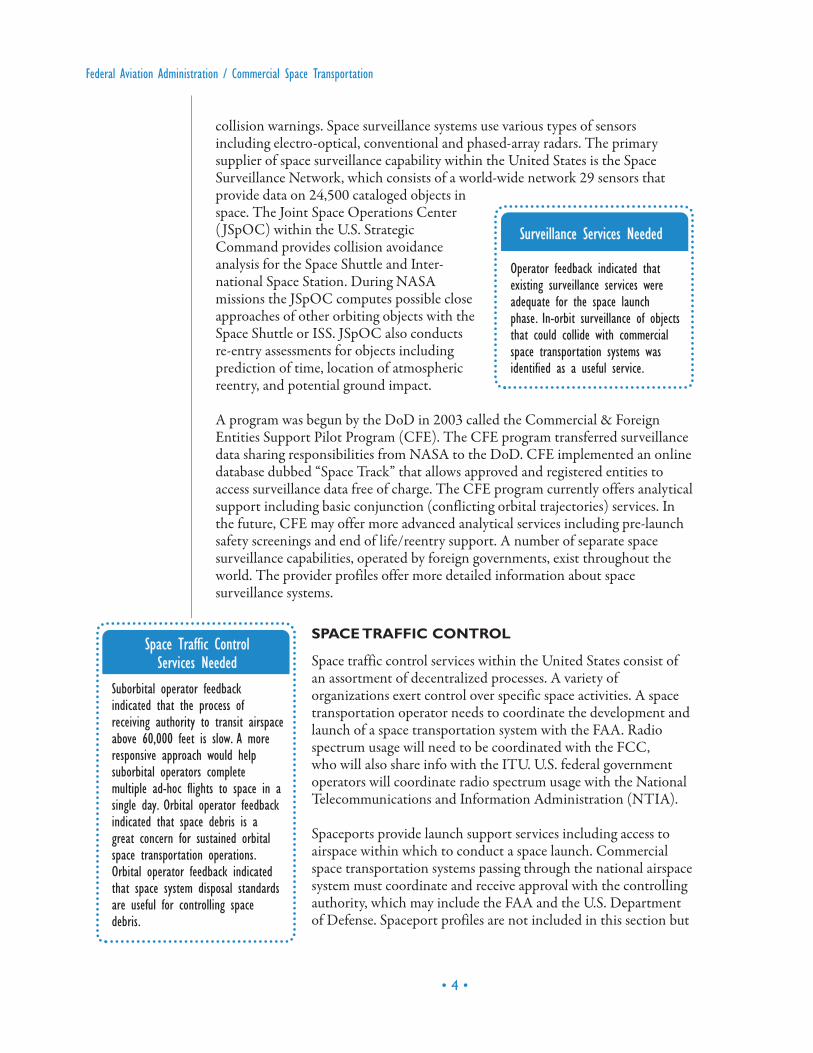
Surveillance Services Needed
Operator feedback indicated thatexisting surveillance services wereadequate for the space launchphase. In-orbit surveillance of objectsthat could collide with commercialspace transportation systems wasidentified as a useful service.
Space Traffic Control Services Needed
Suborbital operator feedbackindicated that the process ofreceiving authority to transit airspaceabove 60,000 feet is slow. A moreresponsive approach would helpsuborbital operators completemultiple ad-hoc flights to space in asingle day. Orbital operator feedbackindicated that space debris is agreat concern for sustained orbitalspace transportation operations.Orbital operator feedback indicatedthat space system disposal standardsare useful for controlling spacedebris.
spaceports, especially those located within national ranges, may exert controlduring the space launch phase. Once in orbit, rendezvous with space stations orsatellites requires coordination with the controlling entity. For example,rendezvous with the International Space Station (ISS) would require coordinationwith ISS mission control. Reentry at the end of the mission requires coordinationwith the FAA. A number of standards exist that aim to reduce orbital debris byspecifying how space systems should be disposed of at the end of useful life.
NAVIGATION
Space transportation operators may utilize navigation services provided by anumber of space-based navigation systems. Space based navigation systems arecurrently used primarily to navigate spacecraft in orbit, however, space basednavigation systems can also be used to track launch vehicle position during ascentinto space. Global Positioning System (GPS)-based launch range systems havebeen tested successfully and could reduce the need for radars andother expensive launch range infrastructure.
Most space vehicles using space-based navigation systems use theGlobal Positioning System (GPS). GPS is a U.S.-built and -operatedspace-based radio-positioning system that provides users withworldwide positioning, navigation, and timing services. It consists of a constellation of between 24 and 32 satellites in medium Earth orbit.
The Russian GLONASS system is the next most well developedpositioning system that consists of approximately 19-24 operationalsatellites. China is planning to deploy the Compass positioningsystem but has only deployed four satellites so far. Europeancountries are funding the development of the Galileo positioningsystem. Two test satellites have been launched and the system isscheduled to be operational in 2013.
METEOROLOGY
Space launch and reentry require accurate forecasting and real-time monitoring ofweather conditions. Scheduling and preparation for a space transportation launchcan be impacted by forecasted weather conditions. The launch itself may berestricted by factors such as temperature, visibility, and high altitude winds. Oncespace transportation systems are safely in orbit, the operations of ground-basedsupport systems such as communications relays, radars, or other mission criticalsystems can experience interference with by weather. For transportation systemsthat return to Earth, weather must also be considered when planning andexecuting reentry and landing procedures. Space transportation operators and thespaceports that support them may have varying requirements regarding the typeand accuracy of atmospheric weather information; however, weather services play a critical role in supporting commercial space transportation.
Support Services for Commercial Space Transportation
• 5 •
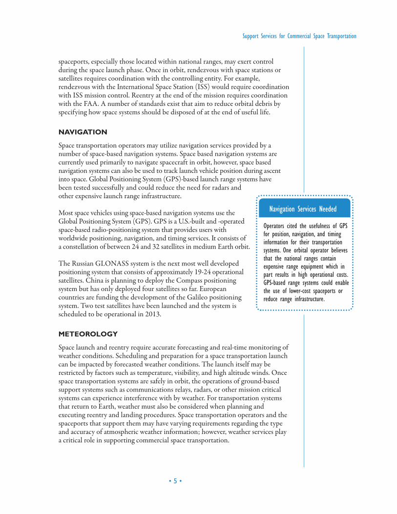
Navigation Services Needed
Operators cited the usefulness of GPSfor position, navigation, and timinginformation for their transportationsystems. One orbital operator believesthat the national ranges containexpensive range equipment which inpart results in high operational costs.GPS-based range systems could enablethe use of lower-cost spaceports orreduce range infrastructure.
The National Weather Service (NWS) within the United States collects anddisseminates weather data and products through a number of sources including theInternet. Current NWS and privately-generated aviation weather services may beadequate for some space transportation operators. However, specialized weatherservices are available at a number of launch ranges within the United States. AtCape Canaveral, a number of meteorological entities exist within the USAF,NASA, NWS, and private contractors. The United States Air Force operatesspecialized weather squadrons, the 45th at Patrick Air Force Base and the 30th at
Vandenberg Air Force Base, in support of space launch. Spacetransportation companies launching from federal ranges rely on therange to provide meteorology information. The Eastern and westernranges rely on customized weather monitoring systems to supportspace launch activities. The Eastern range uses the Eastern RangeDispersion Assessment System and the Western range uses theMeteorological Interactive Data Display System-Vandenberg. Forspecific information about range capabilities contact VAFB at(805)605-7206 and CCAFS at (321)494-4803.
The NOAA National Weather Services Spaceflight Meteorology Group supportsNASA’s human spaceflight program with meteorology and weather forecastingservices that support human spaceflight. The Applied Meteorology Unit at CapeCanaveral tests advanced weather prediction and monitoring technologies andserves as a bridge between meteorological researchers and the operationalforecasters within the USAF, NASA, and the NWS.
SPACE WEATHER
Space weather describes the short-term impact on the Earth’s magnetosphere fromthe Sun’s photons, solar wind particles, and the interplanetary magnetic field. The impacts of concern are the adverse affects on technological systems, such astelecommunications, power distribution, and navigation. The health of humans inspace may also be impacted by severe space weather events. The primarycomponents of space weather are solar flares, sunspots, solar winds, and coronalmass ejections (CMEs).
Space weather information is collected and analyzed by a variety of academic andgovernment programs. Some of these organizations study space weather as part of amission to advance scientific knowledge or to support tools used for educatingstudents about the space environment. Such services are provided by the entitieslike the High Altitude Observatory (HAO) or the Center for Space EnvironmentModeling (CSEM). However, several organizations serve as focal points for moretimely distribution of space weather data and products that can be used by spacetransportation operators to support their operations.
Within the United States, the Space Weather Prediction Center (SWPC), jointlyoperated by NOAA and the USAF, is the country’s official source for space
• 6 •
Federal Aviation Administration / Commercial Space Transportation
Meteorology Services Needed
No weather servicedeficiencies were identifiedby the spaceflight operatorsinterviewed.
weather information. SWPC information is accessible via a number of sourcesincluding the Internet. The SWPC continually monitors and forecasts Earth’sspace environment, provides solar-terrestrial information, conducts and leadsresearch and development programs to understand the enviro-nment and toimprove services, and advises policy makers and planners.
Within Europe, the Space Environments and Effects Section is theEuropean Space Agency’s (ESA’s) focal point for analyses of thephysical environment in space and its effects on space systems andastronauts. The Section is also the driving force behind the ESASpace Weather applications initiative, which has led to the onlinetool called The Space Weather European Network (SWENET), a series of applications, services, and data products that enableregistered users access to data and services on space weather andenvironment and its effects. SWENET collects data through several external sources, including the SWPC, and makes it available through a common database.
On a more global scale, the International Space EnvironmentService (ISES), is a service group operating under the support of the International Union of Radio Science. ISES is one of twelvesuch service groups, created by the Federation of Astronomical andGeophysical Data Analysis Services, which are dedicated to thestudy of astronomy, geophysics and related sciences. The specificmission of ISES is to facilitate near-real-time internationalmonitoring and prediction of the space environment. They are able to accomplish this using a network of eleven Regional WarningCenters throughout the world, which collectively monitor andpredict solar-terrestrial activity. They also assist users who wish tomitigate the impact of space weather on activities that could besensitive to solar-terrestrial conditions.
ORBITAL SERVICING
In-orbit servicing is a forward-looking support service that could includeresupplying, refueling, and repairing space transportation systems in orbit. Like crew rescue, servicing services could be provided by the space transportation
organizations and used by them as well. For example,the NASA Commercial Orbital TransportationServices (COTS) program is funding thedevelopment of a limited commercial in-orbitservicing capability. Future space transportationarchitectures that extend to geostationary orbits, andon to the Moon and Mars, may include fuel depotsthat transportation providers may service and be
Support Services for Commercial Space Transportation
• 7 •
Space Weather ServicesNeeded
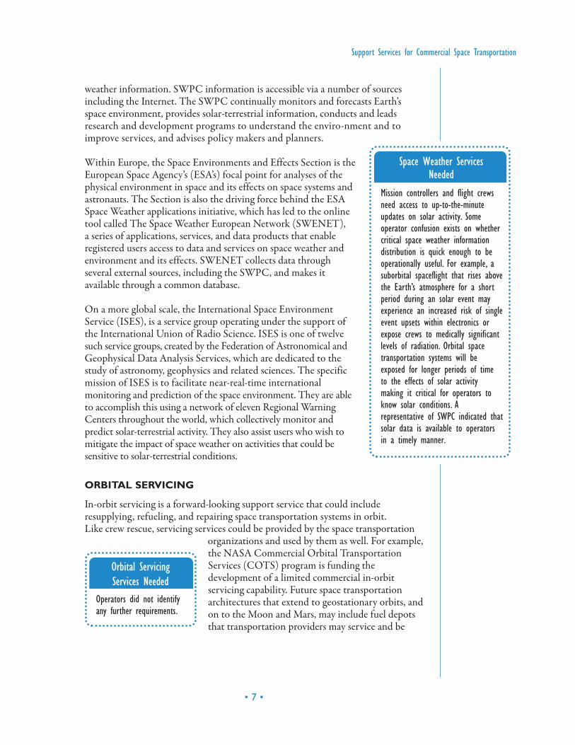
Mission controllers and flight crewsneed access to up-to-the-minuteupdates on solar activity. Someoperator confusion exists on whethercritical space weather informationdistribution is quick enough to beoperationally useful. For example, asuborbital spaceflight that rises abovethe Earth’s atmosphere for a shortperiod during an solar event mayexperience an increased risk of singleevent upsets within electronics orexpose crews to medically significantlevels of radiation. Orbital spacetransportation systems will beexposed for longer periods of timeto the effects of solar activitymaking it critical for operators toknow solar conditions. Arepresentative of SWPC indicated thatsolar data is available to operatorsin a timely manner.
Orbital ServicingServices Needed
Operators did not identifyany further requirements.
serviced by. Repair or upgrading of satellites or damaged transportationinfrastructure could be accomplished by such a service.
A number of in-orbit servicing systems have existed for awhile now. For example,the Space Shuttle was initially conceived as a system that would not only carryastronauts into space but also rendezvous and repair, refuel, and generally servicethe United States space infrastructure. Indeed, the Space Shuttle has been used in this capacity a number of times, most notably to repair the Hubble SpaceTelescope. Russia’s Progress spacecraft has supplied Russian space stations and the International Space Station for a long time. Most recently the European Space Agency-developed Automated Transfer Vehicle (ATV) has successfullydemonstrated a large capacity servicing mission to the International Space Station.
Advanced servicing technologies and capabilities have been developed and testedin programs such as Orbital Express. In this mission, a prototype servicing satelliterendezvoused with another test satellite and exchanged fuel and equipmentthrough the use of robotic interfaces. Complimentary research includes the Front-end Robotics Enabling Near-term Demonstration (FREND), a DARPA sponsoredtechnology risk reduction program. FREND is a ground-based demonstration ofrobotic technologies that could be used to accomplish autonomous rendezvousand grapple with a variety of interfaces.
A number of commercial organizations have proposed space servicing conceptsincluding fuel depots. However, no operational services, beyond those nationalsystems identified earlier, yet exist. No detailed profiles were developed as a result.
IN-ORBIT CREW RESCUE
In-orbit crew rescue is a forward-looking support service that commercial spacetransportation operators may themselves offer. In the future it may be efficient forone organization, perhaps government funded, to have a rescue vehicle on-call thatcould support the majority of manned space activity at the time.
Today, emergency rescue plans for space flight crews and participantsare specific to the particular space vehicles and space programs inoperation. As a result, there is no “generic” rescue vehicle or programthat can be called upon to rendezvous and dock with a newcommercial spacecraft. Unless multiple issues are resolved (such asstandardization of docking mechanisms and hatches), a commercialspace operator may need to consider appropriate redundancies and
docking capabilities within their own fleet so as to conduct their ownrescue missions should the need occur. The only current in-orbit crew rescuesystems are operated by government agencies involved with ISS, Soyuz, and SpaceShuttle activity. Current strategies include “lifeboat” Soyuz vehicles attached to the ISS, backup Space Shuttle launches, and compatible interface mechanisms.
• 8 •
Federal Aviation Administration / Commercial Space Transportation
In-orbit Crew RescueServices Needed
Operators did not identifyany further requirements.

TECHNICIAN TRAINING
Training of technical personnel to support the space transportationindustry has occurred primarily by the space transportationcompanies themselves. Each organization developed its owntraining curricula tailored to its needs. No national certificationsimilar to what the FAA offers for aircraft maintenance personnelexisted until recently. The National Science Foundation funded the development of a standardized process for training aerospacetechnicians. When hiring new personnel, organizations can betterunderstand the knowledge and skills of candidates with thecertification. SpaceTEC is the organizing force behind thecertification and as a result a number of colleges and otherorganizations are offering this new aerospace techniciancertification.
Support Services for Commercial Space Transportation
• 9 •
Technician TrainingServices Needed
Space transportation operatorfeedback indicated that spaceflighttechnician training is specializedbecause space transportation systemsemploy differing technologies andarchitectures. Therefore an FAA-mandated technician certification,similar to aviation technician, doesnot make sense.
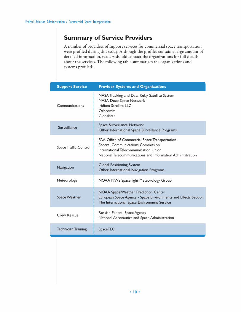
Summary of Service ProvidersA number of providers of support services for commercial space transportationwere profiled during this study. Although the profiles contain a large amount ofdetailed information, readers should contact the organizations for full detailsabout the services. The following table summarizes the organizations andsystems profiled:
• 10 •
Federal Aviation Administration / Commercial Space Transportation
Support Service Provider Systems and Organizations
Communications
NASA Tracking and Data Relay Satellite System
NASA Deep Space Network
Iridium Satellite LLC
Orbcomm
Globalstar
SurveillanceSpace Surveillance Network
Other International Space Surveillance Programs
Space Traffic Control
FAA Office of Commercial Space Transportation
Federal Communications Commission
International Telecommunication Union
National Telecommunications and Information Administration
NavigationGlobal Positioning System
Other International Navigation Programs
Meteorology NOAA NWS Spaceflight Meteorology Group
Space Weather
NOAA Space Weather Prediction Center
European Space Agency - Space Environments and Effects Section
The International Space Environment Service
Crew RescueRussian Federal Space Agency
National Aeronautics and Space Administration
Technician Training SpaceTEC

Support Services for Commercial Space Transportation
• 11 •
Communications Profiles
SUMMARY OF SERVICES
TDRSS operates as a bent pipe relay system between customer space platformsand customer ground facilities and offers the following services:
• Telecommunications• Tracking
– Tracking and data acquisition services between low Earth orbiting (LEO)spacecraft and NASA/customer control and/or data processing
– Tracking and clock calibration services provide the following measurementsfor multiple access service (MA), S-Band Single Access Service (SSA), andKu-band Single Access (KuSA), as well as SSA/MA cross-supportcustomers:· Range · Doppler · Customer Time · Return Channel Time Delay (RCTD)
• Testing• Analysis• Data Distribution/Processing Services
BACKGROUND AND DEVELOPMENT PLANS
TDRSS is part of NASA’s Space Network (SN), which was established in the early1980s to replace NASA’s network of ground tracking stations that had supportedall of NASA’s manned flight missions. It consists of nine on-orbit satellites locatedin geosynchronous (GEO) orbit and ground stations used for spacecommunications. The system’s goal is to increase the time spacecraft are incommunications with the ground network and to increase the amount of databeing transferred. The operation of the SN is managed by the Goddard SpaceFlight Center under direction from the NASA Headquarters Space OperationsManagement Directorate.
The TDRSS space segment consists of six first-generation operational satellites inGEO orbit, which carry functionally identical payloads, and
NASA TRACKING AND DATA RELAY SATELLITE SYSTEM (TDRSS)
Contact Information:Networks Integration Management OfficeNASA Goddard Space Flight CenterGreenbelt, MD 20771Email: [email protected]
three second-generation satellites, which also have identical payloads. The system’sground segments are located near Las Cruces, New Mexico, and consisting of twofunctionally identical ground terminals known as the White Sands Complex andthe Guam Remote Ground Terminal.
Between 2005 and 2007, NASA worked on developing the low-cost TDRSStransceiver (LCT2) for use by launch vehicles to relay telemetry through TDRSSto the ground. The goal of the LCT2 development was to cut the transceiver costin half, to about US$75,000 per unit. LCT2 would also eliminate the expense ofhaving multiple ground stations downrange tracking the launch. At the end ofdevelopment, NASA planned to transfer the technology over to the industry,particularly to commercial rockets and inexpensive sounding rockets such as thosethat fly routinely at Wallops Flight Facility in Virginia. In March 2007, LCT2launched aboard an orbital piggy-back payload on a Minotaur 1 rocket.
ACCESSIBILITY OF SERVICES
Services on TDRSS are being managed by the Space Communications andNavigation Program Office at NASA Headquarters. The Space Network Project atGSFC, handles day-to-day operations of TDRSS and SN. Customer interface andrequirements development are handled by the Network Integration ManagementOffice (NIMO) at GSFC. TDRSS services may be available to both commercialand civilian customers on a reimbursable basis for missions in which NASA has aparticular interest by providing forward service command data to payloads andreturn service data to scientists and operations personnel. TDRSS customersinclude:
• ATV space tug • International Space Station (ISS)• Space Shuttle• Hubble Space Telescope (HST)• Landsat 7• Sea Launch• South Pole TDRSS Relay (SPTR)• NASA's Earth Observing System EOS: TERRA, AQUA, AURA• Tropical Rainfall Measuring Mission (TRMM) • The Rossi X-ray Timing Explorer (RXTE)
• 12 •
Federal Aviation Administration / Commercial Space Transportation
Support Services for Commercial Space Transportation
• 13 •
SUMMARY OF SERVICES
The DSN provides the following services through its network of antennas andtwo-way communications link:
• Transmit commands to distant spacecraft• Receive telemetry data from spacecraft• Track the position and speed of spacecraft• Receive science data from spacecraft• Measure variations in radio waves for radio science experiments• Perform very-long-baseline interferometry observations• Monitor and control the performance of network
BACKGROUND AND DEVELOPMENT PLANS
The DSN was established in 1958 after the first U.S. satellite, Explorer 1, waslaunched and when the operations of its designer and builder, Jet PropulsionLaboratory ( JPL), were transferred from the U.S. Army to NASA. It was createdback then to track Explorer 1 in space and to provide communications for all deepspace missions. The DSN is an international network of antennas that supportsinterplanetary spacecraft missions, radio and radar astronomy observations forexploration of the solar system and the universe, and selected Earth-orbitingmissions. The Interplanetary Network Directorate (IND) is the branch withinNASA JPL that manages the DSN program.
The DSN consists of three deep space communications complexes situated insemi-mountainous, bowl-shaped terrain and are located approximately 120 degreesof longitude apart in the following areas:
• Goldstone, in California’s Mojave Desert • Near Madrid, Spain • Near Canberra, Australia
Each complex has at least four receiving and transmitting stations equipped withultra-sensitive receivers and large parabolic dish antennas that are steerable andhigh-gain.
• Stations are operated remotely from a central signal processing center at each site.
NASA DEEP SPACE NETWORK (DSN)
Contact Information:NASA Jet Propulsion Laboratory ( JPL)4800 Oak Grove DrivePasadena, CA 91109http://deepspace.jpl.nasa.gov/dsn/index.html
• Central signal processing centers have electronic systems that point andcontrol the antennas, receive and process telemetry data, transmit commands,and generate spacecraft navigation data.
The DSN’s future depends on NASA’s continuous exploration of the solar systemand beyond with both robotic and human-piloted spacecraft, which may requireexpanded and high data rate deep space communications. An array of new smallerDSN antennas with combined collecting area ten times larger than the existing 70-meter antennas is one of the possibilities. Using laser light to communicate isanother possibility, as well as having optical communications terminals on Earth orin orbit to improve data collection.
ACCESSIBILITY OF SERVICES
The coordination for the use of the DSN facilities is arranged with theTelecommunications and Mission Operations Directorate within JPL. There havebeen no reports of DSN providing services to the commercial sector. Most of itsmissions are commissioned by NASA. DSN supports an average of 35 to 40 deepspace missions each year. As a mission is being developed, a representative from theDSN program works with the mission team to establish the amount of coveragethe mission will need from DSN assets during its lifetime. This coverage includesthe amount of time per day for routine communications and also critical coverageof major mission events. Once the amount of coverage time is established andmajor mission events are scheduled, DSN commits to providing coverage for 95 percent of the time agreed to with its mission customers, while the remainingfive percent allows for unexpected disruptions during that coverage.
SUMMARY OF SERVICES
Iridium provides satellite voice and data communications services throughdedicated handsets and installed communications systems onboard ships, aircraft,land-based handsets and value added voice and data products.
• Maritime– Ship Safety and Alert System (SSAS)– Crew Calling– In Network – Iridium phones installed on vessels and headquarters– Long Range Identification and Tracking (LRIT) Transceiver– The Iridium Fax Service
• 14 •
Federal Aviation Administration / Commercial Space Transportation
IRIDIUM SATELLITE LLC
Contact Information:6707 Democracy Boulevard, Suite 300Bethesda, MD 20817(301)571-6200 Fax: (301)571-6250www.iridium.com

– Vessel Monitoring System (VMS)– Man Overboard– Broadband Mobile Data (New Service)
• Aviation– Cockpit -Flight communications, tracking, monitoring, alerts and alarm– Flight Tracking– Rotary Wing Aircraft solutions– Air Safety Services
• Land/Mobile– Prepaid/Postpaid Solutions– Asset Tracking– Fleet Management– Oil and Gas Telemetry– Disaster Emergency/rescue operations
• DoD– Over-the Horizon– Netted– Blue Force Tracking– Unattended Sensors
BACKGROUND AND DEVELOPMENT PLANS
The company started out as Iridium Inc. in 1991 and began its commercialoperations in 1998. It then filed Chapter 11 bankruptcy in 1999. In December2000, a group of private investors led by Dan Colussy acquired the operating assetsof the bankrupt Iridium, and formed Iridium Satellite LLC. The acquired assetsincluded the satellite constellation, the terrestrial network, Iridium real property,and intellectual capital.
Iridium provides satellite voice and data communications via its constellation of 66LEO satellites. The company has operations centers in Tempe, Arizona andLeesburg, Virginia, and a gateway in Hawaii for DoD services. The company isplanning major investments for launching its Iridium NEXT system, a nextgeneration 66-satellite constellation, which will be fully operational by 2016.
In 2002, Iridium participated in a joint project with Kennedy Space Center (KSC)and Wallops Flight Facility (WFF) to investigate the feasibility of using theIridium satellite system through its Flight Modem to provide low-rate full duplextwo-way communications (GPS tracking data and commands). The Flight Modemsystem consists of a GPS receiver, an on-board computer, and a standardcommercial satellite modem, and antenna. The target applications for this projectwere manned and unmanned aircraft tracking and commanding and two-waybackup communications system for rockets.
Support Services for Commercial Space Transportation
• 15 •
ACCESSIBILITY OF SERVICES
Iridium’s customers come from industries, such as maritime, aviation, U.S.government/military, emergency/humanitarian services, mining, forestry, oil andgas, heavy equipment, transportation, utilities, and other foreign civil andgovernment agencies. The company designs, builds, and sells its products,solutions, and services through its network of more than 150 distribution partners.
Contact Iridium for pricing information.
SUMMARY OF SERVICES
ORBCOMM provides the following machine-to-machine (M2M) services formobile and fixed site data applications:
• Monitoring and controlling assets at remote sites for oil and gas extraction,pipeline operations, storage, custody transfer, and electric power generationand distribution
• Tracking and managing construction equipment, locomotives, rail cars, trucks,trailers, shipping containers, marine vessels, aircraft, and locating andrecovering stolen vehicles and cargo
• Messaging for truck fleets, owner operators, and remote workers• Weather data for general aviation and marine vessels
BACKGROUND AND DEVELOPMENT PLANS
ORBCOMM was founded in 1993 by Orbital Sciences and Teleglobe. InNovember 2006, ORBCOMM issued a public offering of stock and sold 9.23million shares of common stock. As of December 2007, ORBCOMM had 96 full-time employees, 27 located in its Fort Lee, New Jersey headquarters and 69 in itsDulles, Virginia network control center and offices.
Its ground segment consists of the following:
• Gateway Earth Stations (GES) in Argentina, Arizona, Australia, Brazil,Curacao, Italy, Japan, Kazakhstan, Korea, Malaysia, Morocco, New York, andWashington
• 16 •
Federal Aviation Administration / Commercial Space Transportation
ORBCOMM
Contact Information:2115 Linwood Avenue, Suite 100Fort Lee, NJ 070241.800.ORBCOMM (703)433-6300 Fax: (703)433-6400www.orbcomm.com/
• Gateway Control Centers (GCC) in Brazil, Italy, Japan, Korea, Malaysia, andUnited States
• Network Control Center (NCC) in Dulles, Virginia
In May 2008, ORBCOMM signed a $117-million contract with Sierra NevadaCorporation for the design, manufacture, and delivery of 18 new satellites, with anoption to purchase as many as 30 more. ORBCOMM plans to launch the 18satellites in three separate missions of six satellites each between 2010 and 2011.
In June 2008, ORBCOMM launched six new satellites, one Coast Guarddemonstration satellite and five QuickLaunch satellites to replenish existingsatellites and to expand the messaging capacity. These satellites are equipped withAutomatic Identification System (AIS) payloads to receive and report AIStransmissions to be used for ship tracking and other navigational activities.ORBCOMM works with the U.S. Coast Guard on the AIS project, and alsointends to market AIS data to other U.S. and international government agencies, aswell as to companies whose businesses require such information.
ACCESSIBILITY OF SERVICES
ORBCOMM serves commercial and government customers through its networkof 145 value added resellers (VARs) that provide whole product solutions andcustomer support to end-users. Service costs are based on quantity of data sent andfrequency of messaging. Contact ORBCOMM for pricing information.
SUMMARY OF SERVICES
Globalstar offers the following satellite services designed to work with mobilephones, data terminals and accessories designed by QUALCOMM, Axonn LLCand other manufacturers:
• Mobile voice and data satellite communications • Fixed voice and data satellite communications in rural villages, remote
industrial, commercial and residential sites, and on ships• Satellite data modem duplex and simplex services• Personal asset tracking and remote monitoring – sending data from assets in
remote locations to a central monitoring station
Support Services for Commercial Space Transportation
• 17 •
GLOBALSTAR
Contact Information:461 So. Milpitas Blvd., Suite 2Milpitas, CA 95035(408)933-4000 Fax: (408)933-4100www.globalstar.com

BACKGROUND AND DEVELOPMENT PLANS
Globalstar was formed in 1991 by a technology partnership between Loral Spaceand Communications and Qualcomm Inc. (QUALCOMM). On February 2002,Globalstar and three of its subsidiaries filed for Chapter 11 protection. The firststage of a two-step Globalstar’s acquisition by Thermo Capital Partners LLC wascompleted on December 5, 2003 and the second stage was completed on April 14,2004. On November 1, 2006, Globalstar once again became a publicly-tradedcompany on the NASDAQ market. As of September 30, 2008, Globalstar hadapproximately 400 full-time employees in the U.S. and overseas .
Globalstar’s satellite network includes 48 in-orbit operational LEO satellites, plusin-orbit spares. Its ground infrastructure includes two Satellite Operations ControlCenters (SOCC), a Ground Operations Control Center (GOCC), a GlobalstarData Network (GDN), and a network of 25 gateways located in North America,Europe, Central America, South America and Asia. Twelve of the gateways areowned by Globalstar’s subsidiaries and the rest by unaffiliated independentgateway operators.
Globalstar worked in 2001 with Wallops Flight Facility to develop a FlightModem that will use Globalstar’s satellite communications system to enablerockets or any flight vehicle to communicate with ground controllers. This space-bound Globalstar modem was a modified version of the Supervisory Control andData Acquisition (SCADA) modem offered by Globalstar for industrial dataapplications such as wireless remote asset tracking and relaying telemetryinformation from remote sites. The Flight Modem, located aboard the rocket, actslike a Globalstar phone and places calls through the Globalstar orbiting satellites tothe ground controllers. The modem can provide rocket position and may alsoprovide information on the performance and health of the vehicle and its payload.
Globalstar has undergone the following developments pertaining to its plannedsecond-generation satellite constellation:
• On November 30, 2006, Globalstar contracted with Thales Alenia Space toconstruct 48 low Earth orbit satellites.
• In March 2007, Globalstar contracted with Thales Alenia Space for theconstruction of the Satellite Operations Control Centers, TelemetryCommand Units and In Orbit Test Equipment.
• On September 5, 2007, Globalstar contracted with Arianespace to launch itssecond-generation satellites. Arianespace will initially perform four Soyuzlaunches of six satellites each. Globalstar holds an option for four additionallaunches. The first launch is scheduled for September 2009.
• On May 19, 2008, Globalstar contracted with Hughes Network systems todevelop a proprietary satellite air interface and manufacture the next-generation ground network equipment and software upgrades for Globalstar’sgateways. Hughes will also design and manufacture ASICs for the nextgeneration of Globalstar phones.
• 18 •
Federal Aviation Administration / Commercial Space Transportation
ACCESSIBILITY OF SERVICES
Globalstar sells its telephone products and services globally through a network ofagents and resellers. It sells its data products through value added resellers in itsNorth American, Central and South American and Western European markets Its10 independent gateway operators distribute directly or through agents andresellers in their markets. In November 2007 Globalstar introduced its SPoTSatellite Personal Tracker which combines a GPS receiver with a Globalstarsimplex transmitter. SPoT is sold on the Internet and through retail distributors ofoutdoor and electronic products. The company’s largest market segments are thegovernment (including federal, state, and local agencies), public safety and disasterrelief, recreation and personal, and maritime and fishing. Globalstar also servescustomers from telecommunications, oil and gas, natural resources (mining andforestry), and construction and utilities sectors.
Contact Globalstar for pricing information.
Surveillance Profiles
SUMMARY OF SERVICES
The SSN provides the following services:
• Analyze new space launches and evaluate orbital insertion• Detect new man-made objects in space• Chart present position of space objects and plot their anticipated orbital paths• Produce and maintain current orbital data of man-made space objects in a
space catalog• Inform NASA and other government entities if objects may interfere with the
orbits of the Space Shuttle, the International Space Station, and operationalsatellite platforms
• Predict when and where a decaying space object will re-enter the Earth’satmosphere
• Generate and disseminate a report on decaying debris so the event is notmistaken/misinterpreted as an attack
• Determine which country owns a re-entering space object
Support Services for Commercial Space Transportation
• 19 •
SPACE SURVEILLANCE NETWORK (SSN)
Contact Information:U.S. Strategic CommandJoint Functional Component Command for Space ( JFCC-SPACE)901 SAC BLVD STE 1A1OFFUTT AFB, NE 68113-6020 (402) 294-4130 (DSN prefix 271) Fax: (402) 294-4892E-mail: [email protected]

• Predict surface impacts of re-entering objects and notify the FederalEmergency Management Agency and Public Safety Canada if an object maymake landfall in North America or Hawaii
BACKGROUND AND DEVELOPMENT PLANS
The Space Surveillance Network (SSN) has been tracking space objects since 1957and was previously under the direction of the United States Space Command(USSPACECOM). USSPACECOM was formed to institutionalize the use ofouter space by the United States. However, n October 2002, the DoD mergedUSSPACECOM with the United States Strategic Command (USSTRATCOM)and responsibility of the space surveillance mission fell to the newly definedUSSTRATCOM mission.
The SSN consists of 29 electro-optical and radar sensors (both military andcivilian) that detect, track, and identify Earth orbiting objects. Identified objectsand their orbits are maintained in the Space Catalog, a comprehensive listing ofthe numbers, types, and orbits of about 24,500 objects in space. The 614th Air andSpace Operations Center (AOC) located at Vandenberg AFB, CA is theprocessing facility for the SSNs flow of information. The 614 AOC employs largecomputers to process SSN information for various space surveillance and spacecontrol missions.
A major component of the SSN is the Space Fence, a multi-static VHF-band radarsystem that detects orbital objects passing over the US in Low Earth Orbit (LEO)and Medium Earth Orbit (MEO). The Space Fence is comprised of nine facilities:
• Three transmitter sites located in Lake Kickapoo, Texas; Gila River, Arizona;and Jordan Lake, Alabama
• Six receiving stations in San Diego, California; Elephant Butte, New Mexico;Red River, Arkansas; Silver Lake, Mississippi; Hawkinsville, Georgia; andTattnall, Georgia
In April 2007, the U.S. Air Force tasked its Electronic Systems Center (ESC) atHanscom Air Force Base to upgrade the Space Fence system by switching its radarsfrom using VHF-band frequency to S-band. This will enable the Space Fence todetect much smaller objects in LEO and MEO to meet warfighter requirementsfor space situational awareness. A Request for Information (RFI) was released inMay 2007 to gain industry feedback and suggestions that would improve the SpaceFence’s performance requirements in the areas of object detection, fence integrity,and radar coverage. Initial Operating Capability is expected in 2015. Thecontract award is set for January 9, 2009.
The Space Based Space Surveillance (SBSS) program plans to deploy opticalsensing satellites to search, detect, and track small objects in orbit, particularlywithin geostationary orbit. The SBSS Block 10 will be launched in 2009.Subsequent SBSS efforts may be able to provide surveillance of even smallerobjects.
• 20 •
Federal Aviation Administration / Commercial Space Transportation
ACCESSIBILITY OF SERVICES
USSTRATCOM provides space surveillance services primarily to the US military,NASA, International Space Station, other US government agencies such as FEMA,and international government agencies such as Public Safety Canada. In 2003,Public Law 108-136 transferred the responsibility for space surveillance support ofcommercial and foreign entities to AFSPC from NASA.
OTHER INTERNATIONAL SPACE SURVEILLANCE PROGRAMS
A number of foreign countries operate space surveillance programs. Known spacesurveillance capabilities are in development or operation in Russia, Germany,France, and Canada. Russia’s space surveillance system is controlled by the MilitarySpace Forces (VKS), which is a branch of the Armed Forces of the RussianFederation responsible for military space operations. VKS maintains a significantspace surveillance capability independent of its Ballistic Missile Early Warning(BMEW) assets.
Germany’s Forschungsgesellschaft für Angewandte Naturwissenschaften (FGAN –Research Establishment for Applied Science) Institute for High Frequency Physicsand Radar Techniques controls the world’s largest radome with a diameter of 49meters. It houses the space observation radar Tracking and Imaging Radar (TIRA).The TIRA system serves as the central facility for developing and investigatingradar techniques for the detection and reconnaissance of objects in space and air targets.
The French Armament Procurement Agency/ Systems Evaluation and TestDirectorate (DGA/DCE) of the French Ministry of Defense operates the Armorradar sensor. ARMOR is located on the tracking ship Monge, which mainlysupports French ballistic missile tests. ARMOR tracking data and orbitdeterminations have similar application as Germany’s TIRA radar, that supportsrisk object re-entry and conjunction event predictions.
Established in the 1990s, the Grande Reseau Adapte a la Veille Spatial (GRAVES)experimental surveillance system is owned by the France’s Department of Defenseand is operated by the Office National d’Etudes et Recherches Aérospatiales(ONERA), the French Aerospace lab. The system has tracked and recorded a totalof 2,500 space objects found in LEO orbits. The GRAVES system is based onVHF transmitters with planar phased-array antennas, which are located in Dijon.
In 2006, the Canadian Forces’ Surveillance of Space (SofS) project was establishedto foster bilateral defense agreements with the US. The CF SofS ConceptDemonstrator (CD), a ground-based space surveillance sensor, would contributedata to the US Space Surveillance Network (SSN).
Support Services for Commercial Space Transportation
• 21 •

Space Traffic Control Profiles
SUMMARY OF SERVICES
• License spaceports• License commercial space launch• License commercial space reentry• Issue safety approvals• Issue experimental permits• Provide requirements and guidelines for commercial human spaceflight crew
and spaceflight participants• Encourage, facilitate, and promote U.S. commercial space transportation
BACKGROUND AND DEVELOPMENT PLANS
The Federal Aviation Administration’s Office of Commercial SpaceTransportation (AST) has the authority to regulate and promote the United Statescommercial space transportation industry. The office was established in 1984 as astandalone entity within the Department of Transportation but was eventuallytransferred under the authority of the FAA in 1995. As a regulatory entity, ASTensures that commercial space transportation does not harm public health andsafety, safety of property, and national security and foreign policy interests of theUnited States. AST’s website contains a large number of reports and analysis of thepast, current, and the developing commercial space transportation industry.
AST’s approximately 60 employees are based primarily at the FAA headquartersbuilding in Washington DC. AST has access to FAA equipment and personnel ata number of locations including the Volpe National Transportation Systems Centerin Massachusetts and the Civil Aerospace Medical Institute in Oklahoma.
AST is working in coordination with other FAA offices to develop the Space andAir Traffic Management (SATM). SATM is not conceived as a system separatefrom the current National Airspace System (NAS). Instead SATM is a concept thatintegrates space vehicles into NAS operations while equitably sharing the airspacewith conventional air traffic.
• 22 •
Federal Aviation Administration / Commercial Space Transportation
FEDERAL AVIATION ADMINISTRATION
Contact Information:The Federal Aviation Administration’s Office of Commercial Space Transportation(FAA/AST)800 Independence Avenue, SWWashington, DC 20591(202) 267-7793 www.faa.gov/about/office_org/headquarters_offices/ast/

Support Services for Commercial Space Transportation
• 23 •
ACCESSIBILITY OF SERVICES
There are no fees to obtain an FAA/AST license or permit.
SUMMARY OF RELEVANT SERVICES
• Regulate spectrum use of the U.S. commercial space industry• Coordinate spectrum use of U.S. commercial space industry with national and
international organizations
BACKGROUND AND DEVELOPMENT PLANS
The Federal Communications Commission (FCC), headquartered in Washington,D.C., was created in 1934 as an independent U.S. government agency empoweredto regulate interstate and international communications by cable, satellite, wire,television, and radio. The FCC’s authority covers the 50 U.S. states, the District ofColumbia, and U.S. possessions. The FCC International Bureau (IB) is responsiblefor regulating spectrum usage by U.S. commercial spacecraft. The IB also sharesexpertise about the commercial satellite industry in the domestic spectrummanagement process and advocates U.S. satellite radio communication interest ininternational coordination and negotiations. In 2007, the FCC processed 232 newspace and Earth station authorizations. The FCC’s website also contains a numberof databases and reports on spectrum usage by the U.S. commercial space industry.
The FCC does not have specific plans developing new services related to spectrumuse by space transportation organizations.
ACCESSIBILITY OF SERVICES
Coordination of spectrum use by commercial spacecraft is handled by the FCC’sInternational Bureau Filing System located on its website. Basic registrationservices are free of charge. Advanced services such as the registration of commercialcommunications satellites require bonds to ensure spectrum utilization.
FEDERAL COMMUNICATIONS COMMISSION
Contact Information:Federal Communications Commission (FCC)445 12th Street SWWashington, DC 205541-888-CALL-FCC (1-888-225-5322)[email protected]/
• 24 •
Federal Aviation Administration / Commercial Space Transportation
SUMMARY OF SERVICES
• Manages the Master International Frequency Register for Equipment andFacilities
• Manages the procedures for spectrum assignment or allotment plans
BACKGROUND AND DEVELOPMENT PLANS
The International Telecommunication Union (ITU) is a United Nations agencyfocused on helping governments and the private sector provide information andcommunication technologies. The ITU is based in Geneva, Switzerland, and itsmembership includes 191 member countries and more than 700 private sectormembers and associates. The ITU Space Services Department is responsible forcoordinating and recording procedures for space systems and earth stations. TheITU coordinates the deployment of space-based systems (satellites) that emitelectromagnetic signals to minimize interference. The ITU coordinates use ofspectrum of all nations or “administrations.” The space services departmentmanages the Master International Frequency Register that includes theresponsibility of capturing, processing and publishing of data and examination offrequency assignment notices submitted by nation states. The space servicesdepartment also assists nations to comply with ITU procedures and manages theprocedures for space related assignment or allotment plans.
ACCESSIBILITY OF SERVICES
ITU space system databases are available for access at their website. ITU willprovide assistance to countries to coordinate their spectrum use.
INTERNATIONAL TELECOMMUNICATION UNION
Contact Information:International Telecommunication Union (ITU)Place des Nations1211 Geneva 20Switzerland+41 22 730 5111www.itu.int

SUMMARY OF SERVICES
• Manages the spectrum use of the U.S. Federal government• Coordinates the registration of Federal government satellite networks• Allows commercial access to the Institute for Telecommunications Sciences
(ITS) a research and engineering laboratory
BACKGROUND AND DEVELOPMENT PLANS
The U.S. National Telecommunications and Information Administration (NTIA),created in 1978, advises the President on telecommunications and informationpolicy issues. The NTIA represents the Executive Branch in domestic andinternational telecommunications and information policy activities. The NTIAalso manages the U.S. Federal government’s use of spectrum and conducts researchand engineering to solve technical telecommunications issues for the Federalgovernment and private sector. The NTIA manages the infrastructure and publictelecommunications facilities grants. The Office of Spectrum Managementdevelops and implements plans and policies that establish use of the spectrumnationally and internationally. The OSM coordinates the registration of Federalgovernment satellite networks and allocates spectrum to satisfy the needs ofFederal agencies.
The NTIA has offices in Washington D.C. and operates the Institute forTelecommunication Sciences (ITS), a research and engineering laboratory inBoulder, Colorado.
The NTIA may begin to collect fees in 2008 for the license of hybrid terrestrial-satellite mobile communications. Currently the licenses are granted free of charge.The NTIA also proposes legislation to competitively auction all domestic satelliteservices. Direct Broadcast Satellite and Satellite Digital Audio Radio Services wereassigned by auction prior to a 2005 court decision. New legislation could restorethe competitive bidding process.
Support Services for Commercial Space Transportation
• 25 •
NATIONAL TELECOMMUNICATIONS & INFORMATION ADMINISTRATION
Contact Information:NTIAHerbert C. Hoover Building (HCHB)U.S. Department of Commerce / NTIA 1401 Constitution Avenue, N.W. Washington, D.C. 20230www.ntia.doc.gov

ACCESSIBILITY OF SERVICES
The NTIA primarily provides services to other federal government entities.However, the ITS can be used for research that aids the private sector via theFederal Technology Transfer Act of 1986. The Act legally allows for commercialuse of government facilities and resources to aid in development of advancedtelecommunications technologies. Regarding access fees, a number of contractingvehicles are available for commercial access to the ITS.
Space Navigation Profiles
SUMMARY OF SERVICES
• Navigation information – allows users on the ground and in air to locate anypoint on Earth
• Space travel navigation information– Rendezvous maneuvers: Space resupply systems can use GPS for navigation
during rendezvous maneuvers with the International Space Station.– Constellation control: provides orbit maintenance of large numbers of space
vehicles.• Accurate, three-dimensional location and position information (latitude,
longitude, and altitude)• Precise and accurate time information, used by multiple systems for
verification and other time sensitive applications• Velocity• Worldwide common grid
BACKGROUND AND HISTORY
The Global Positioning System (GPS) is a U.S.-built and -operated space-basedradio-navigation system that provides users with worldwide positioning,navigation, and timing services. It consists of a constellation of between 24 and 32MEO satellites that orbit the Earth at an altitude of approximately 11,000 milesand a network of ground stations used for monitoring and control.
GPS, initiated in 1973, was developed by the United States Department of
• 26 •
Federal Aviation Administration / Commercial Space Transportation
GLOBAL POSITIONING SYSTEM
Contact Information:Air Force Space CommandPublic Affairs Office 150 Vandenberg, Suite 1105 Peterson AFB, CO 80914(719) 554-3731
U.S. Coast Guard Navigation Center7323 Telegraph RoadAlexandria, VA 22315(703) 313-5900www.navcen.uscg.gov
Defense. It was previously known as the Navstar Global Position System. Thesystem was not made available for civilian use until 1983. The GPS consists ofthree parts: the satellites in orbit, the monitor and control earth stations, and theGPS receivers owned by users. The space and control segments are operated by theUnited States Air Force. The master control station is located at Falcon Air ForceBase in Colorado Springs, Colorado. There are six monitor stations located atFalcon Air Force Base; Cape Canaveral, Florida; Hawaii; Ascension Island in theAtlantic Ocean; Diego Garcia in the Indian Ocean; and Kwajalein Island in theSouth Pacific Ocean. The monitor stations are responsible for routine checks andanalyses of the orbiting satellites.
The United States is currently working on upgrades and advancements to GPS.The new developments will be introduced in three separate stages: Block IIIA,IIIB, and IIIC. Block IIIA is scheduled for launch beginning in late 2013. ThisGPS III system anticipates having new and multiple frequencies and 500 timesgreater transmitter power. The new developments will improve GPS usability,accessibility, and resistance to jamming to both military and civilian users. Inaddition, the European Galileo navigation system under development will improvethe proposed GPS III system as they plan to be inter-operable.
Another developing service under consideration involves the Moon and the planetMars. NASA is developing a plan to create a GPS-like network of satellites thatorbit the Moon and Mars. This network could provide a navigation andcommunication network to aid in Lunar and Martian exploration and landing.
ACCESSIBILITY
GPS satellites provide service to civilian and military users. The civilian service isavailable to users worldwide. The military service is available to U.S. and alliedarmed forces as well as approved Government agencies. GPS is a service thatprovides users with instantaneous access. There are no fees from the U.S.government to use the GPS satellites for consumer products.
The current GPS system has Selective Availability (SA) which can, in effect, “shutdown” the GPS system for civilian users, such as during times of war. However, thenew GPS III satellites will not support SA, allowing for greater accuracy andreliability for GPS users.
OTHER INTERNATIONAL SPACE NAVIGATION PROGRAMS
A number of foreign countries are developing and operating global space basednavigation systems. These countries include Russia, Europe, and China. Japan andIndia are developing smaller, regional systems not detailed in this report.
Development of Russia’s GLONASS navigation system began in 1976 and aconstellation was complete in 1995. However, the subsequent decline of theRussian economy reduced investment in GLONASS. Plans to revitalize theGLONASS system are under way in Russia and in early 2001 the Russian
Support Services for Commercial Space Transportation
• 27 •
government set a goal to add six satellites in 2009 and enhance the program to fullglobal coverage by 2011. GLONASS expects to become a constellation of 24satellites, as of September 2008, 19 satellites were estimated to be operational. Thesystem transmits two types of signals: standard precision and obfuscated highprecision. Russian president Vladimir Putin made GLONASS an open-accessservice. It is a civil service to Russian and foreign users free of charge.
Galileo is a global navigation satellite system that is under development in Europe.In 2002, the European Union decided to fund the project to develop the Galileonavigation system. On December 28, 2005, the first demonstrator spacecraft in theGalileo project was launched. A second spacecraft launched in April 2008. Galileois similar to the United States’ Global Positioning System (GPS) and is scheduledto be ready in 2013. The system plans to use a constellation of 30 satellites inMEO. Both the United States and Europe will benefit from the development ofGalileo because there has been an agreement to make the two GPS and Galileocompatible and interoperable. Receivers will be able to connect with satellites ineither constellation.
Compass is a global navigation satellite system under development by China.Compass is projected to use a 35-satellite constellation, with 5 in GEO and theremaining 30 in MEO. Compass-M1, the first experimental satellite for Compass,was launched in 2007. Compass plans to be an expansion of China’s currentBeidou system, developed by China Academy of Space Technology (CAST) underthe China Aerospace Science and Technology Corporation. Compass plans to be apublic service available globally to general users. There will also be a licensedservice that provides greater accuracy restricted to use by authorized and militaryusers. The system will initially cover China and its neighboring countries only butwill eventually extend into a global navigation satellite network.
Meteorology Profiles
SUMMARY OF SERVICES
• Weather analysis and forecasts• Weather advice• Monitor and evaluate weather at Space Shuttle landing sites• Advice to the NASA flight director, flight control team, and mission manage-
ment team during landings (meteorological support during manned spaceflight)
• 28 •
Federal Aviation Administration / Commercial Space Transportation
NOAA NWS SPACEFLIGHT METEOROLOGY GROUP
Contact Information:National Weather ServiceSpaceflight Meteorology GroupJohnson Space Center / WS8Houston, TX 77058
• Recommendations of appropriate landing scenario based on latest forecast• Evaluates the Space Shuttle Weather Flight Rules• Weather forecasts include: descriptions of clouds, visibilities, precipitation,
winds, turbulence, temperature, altimeter setting, and density altitude• Weather briefings include: synoptic explanations, the forecast rationale, and
alternate weather scenarios• Technique Development Unit (TDU) that customizes the Spaceflight
Meteorology Group’s (SMG’s) Meteorological Data and Display System(MIDDS) for weather support
BACKGROUND AND DEVELOPMENT PLANS
The NOAA National Weather Service’s (NWS) Spaceflight Meteorology Group(SMG) has been providing meteorology and weather forecasting support to thehuman spaceflight program at the Johnson Space Center since 1965. SMG waspreviously known as the Weather Bureau prior to 1970. In the late 1970s, theAutomation of Field and Services (ATOS) division of the NWS was added to SMG’soperation. Meteorological Data and Display System (MIDDS) has been providingsatellite data and imagery to the SMG since 1988.
The Spaceflight Meteorology Group consists of eight NOAA/NWSmeteorologists and one Consolidated Space Operations Contract (CSOC)meteorologist. MIDDS and WSR-88D Principal User Process (PUP) are the twosystems of SMG that provide the analysis and forecasts.
The SMG is located at the Johnson Space Center in Houston, Texas. SMG also hasfacilities at the Kennedy Space Center (KSC) in Florida and the Edwards AirForce Base in California. SMG uses two facsimile machines to obtain maps fromthe National Meteorological Center, a Continental Meteorological Data System(COMEDS) terminal, Unifax satellite receivers, and a Closed Circuit Television(CCTV) system.
SMG is making future developments in manned spaceflight support for use oncethe next-generation Orion spacecraft enters operation. In addition, SMG hasimproved current human spaceflight missions by implementing new weather-focused space shuttle mission’s simulations.
ACCESSIBILITY
SMG provides pre-mission and post-mission summaries for each Space Shuttlemission. The pre-missions summary is available three or four weeks before theexpected launch. The summary includes the STS mission number, the predictedlaunch date, the orbiter name, the predicted landing date, crew information, payloaddescriptions, and the Transoceanic Abort Landing (TAL) locations. Any alterationsto the weather flight rules are also included in the pre-mission summary. The post-mission summary, published three weeks after landing, include a description of thelaunch, the TAL, and the landing weather. The post-mission and pre-missionsummaries are all accessible on NWS’s SMG website free of charge.
Support Services for Commercial Space Transportation
• 29 •
• 30 •
Federal Aviation Administration / Commercial Space Transportation
Space Weather Profiles
SUMMARY OF SERVICES
• Alerts and forecasts of solar and geophysical events (daily, weekly, monthly)• Reports and summaries (solar images, text reports, data lists, and data plots)• Space weather models • Solar and geomagnetic indices• Instrument Measurements
BACKGROUND AND DEVELOPMENT PLANS
The SWPC, jointly operated by NOAA and the U.S. Air Force, is the nation’sofficial source of space weather alerts and warnings. It continually monitors andforecasts Earth’s space environment, provides solar-terrestrial information,conducts and leads research and development programs to understand theenvironment and to improve services, and advises policy makers and planners.
Organizational Structure :
National Oceanic and Atmospheric Administration National Weather Service
National Centers for Environmental Prediction Space Weather Prediction Center
The SWPC uses a number of assets including:
The Geostationary Operational Environmental Satellite (GOES) network. Inaddition to monitoring and predicting atmospheric weather, this multi-satelliteobserving system is also the foundation for many space weather forecasts, alerts,and warnings, using its onboard Space Environment Monitor (SEM) instruments(magnetometer, X-ray sensor, high energy proton and alpha detector, and energeticparticles sensor).
NOAA SPACE WEATHER PREDICTION CENTER (SWPC)
Contact Information:NOAA/ National Weather ServiceNational Centers for Environmental PredictionSpace Weather Prediction Center, W/NP9325 Broadway, Boulder CO 80305Phone: (303)497-7348www.swpc.noaa.gov

The Polar Orbiting Operational Environmental Satellite (POES) network.POES monitors the particle radiation environment (just above Earth’satmosphere), which potentially can impact radio communication and navigation,satellite operations, and the well being of personnel traveling on high-altitudeaircraft.
The Advanced Composition Explorer (ACE) Real Time Solar WindApplication. NOAA also has access to the ACE spacecraft, a NASA Explorermission, which studies the solar winds from a point approximately 1.5 millionkilometers above the Earth. The spacecraft also studies interplanetary magneticfields and higher energy particles accelerated by the Sun, as well as particlesaccelerated in the heliosphere and the galactic regions beyond. NOAA partneredwith the ACE project and setup the ACE Real Time Solar Wind (RTSW)monitoring capability, which can provide up to one hour's warning of CMEs thatcan cause geomagnetic storms on Earth.
Future development plans include:
• GOES-O launch: late 2008 or early 2009 • GOES-P launch: as early as December 2009 • GOES-R launch: 2015, with additional instrumentation, including Space
Environment In-Situ Suite (SEISS), Extreme Ultraviolet Sensor/X-Ray SensorIrradiance Sensors (EXIS), and Solar Ultraviolet Imager (SUVI)
• The National Polar-orbiting Operational Environmental Satellite System(NPOESS) launch: 2013, allowing forecasters to predict Earth’s atmosphericand near-space environment weather patterns with greater speed and accuracy
• The ACE spacecraft reached the end of its design life in 2003. There are nocurrent plans to replace it, however, a fuel-use strategy has been implementedthat will allow continued operations through 2024.
ACCESSIBILITY
All services are open to the public via their website at no charge. Their “SpaceWeather Now” site, accessible at www.swpc.noaa.gov/SWN, provides a near real-time snapshot of space weather conditions such as solar wind activity, latestimagery, solar activity forecasts, and geomagnetic field activity.
The SWPC offers email alerts and forecasts via free subscription service, accessibleat www.swpc.noaa.gov/alerts/index.html.
The ACE RTSW monitoring site is available at sec.noaa.gov/ace/index.html
Support Services for Commercial Space Transportation
• 31 •
• 32 •
Federal Aviation Administration / Commercial Space Transportation
SUMMARY OF SERVICES
• Space-weather Operational Airline Risks Service (SOARS)– Predictions of the radiation risk to humans onboard aircraft; onboard
avionics for given routes– Forecasts of the impact of space weather effects on HF communications
• “Auroras Now!” site– General information about auroras and space weather – Current magnetic activity level and near real-time images
• Multiple indices and forecasting tools for – Geomagnetic and Geomagnetically-Induced Current (GIC) Activities– Potential Impact on Radio Communications– Potential Impact on Satellite Navigation Systems– Satellite Anomalies and Operational Support
• Email Alerts
BACKGROUND AND DEVELOPMENT PLANS
The Space Environments and Effects Section is the ESA’s focal point for analyses ofthe physical environment in space and its effects on space systems and astronauts.The Section is also the driving force behind the ESA Space Weather applicationsinitiative, which has led to the online tool called The Space Weather EuropeanNetwork (SWENET), a series of applications, services, and data products thatenable registered users access to data and services on space weather and environmentand its effects. SWENET collects data through several external sources includingthe NOAA SWPC and makes it available through a common database.
Development plans include:
• Partner websites/databases linked to the SWENET portal• Website is continually upgraded with user friendly services such as email alerts
and interface enhancements. Animated images are now being generated.
EUROPEAN SPACE AGENCY - SPACE ENVIRONMENTS ANDEFFECTS SECTIONContact Information:Space Environments and Effects Section ESTEC/TEC-EES Keplerlaan 1 - 2200 AG Noordwijk The Netherlands Fax: +31-71-56 [email protected]

ACCESSIBILITY
SWENET data are accessible via their website at www.esa-spaceweather.net/swenet/index.html, (free registration is required). Alerts can also be sent via email.
The Solar Heliospheric Observatory (SOHO) website is free and open atsohowww.nascom.nasa.gov, and provides near real-time solar images and space-weather conditions. The SOHO spacecraft was launched in 1996 as part of a jointproject between ESA and NASA. It is in a similar orbit to the ACE spacecraft, andstudies the Sun and the solar wind.
SUMMARY OF SERVICES
• Space weather forecasts• Warnings of disturbances to the solar-terrestrial environment• Facilitation of scientific study and experimentation• Monthly bulletins on satellite activity, including launches and predicted orbit
decay• Organized workshops focused on improving forecasting capabilities
BACKGROUND AND DEVELOPMENT PLANS
ISES is a permanent service of the European-based Federations of Astronomical andGeophysical Data Analysis Services (FAGS), and is administered primarily theInternational Union of Radio Science (URSI) in association with the InternationalAstronomical Union (IAU) and the International Union of Geodesy andGeophysics (IUGG). ISES coordinates the exchange of data amongst 12 RegionalWarning Centers (RWCs) around the world. The RWC supporting the UnitedStates is the NOAA’s aforementioned Space Weather Prediction Center. The RWCs’primary function is to provide their solar-terrestrial forecasting services to usercommunities within their own region. Such users include high frequency (HF) radiocommunicators, power line and pipeline authorities, and satellite operators. TheRWCs also benefit the entire ISES community by collecting and share data fromtheir region with the other centers through the ISES network.
Support Services for Commercial Space Transportation
• 33 •
THE INTERNATIONAL SPACE ENVIRONMENT SERVICE (ISES)
Contact Information:Geological Survey of CanadaGeomagnetic Laboratory7 Observatory CrescentOttawa, OntarioCanada, K1A 0Y3(613) 837-4241 FAX: (613) 824-9803http://www.ises-spaceweather.org

• 34 •
Federal Aviation Administration / Commercial Space Transportation
ACCESSIBILITY
ISES has developed a comprehensive space weather website (www.spaceweather.org).It serves as a gateway to a variety of information about space weather topics,provides information on current space weather conditions in the Solar system, anddetails historic and forecasted space weather conditions. The site also providesdirect links to the eleven RWCs and their products and services such as alerts,forecasts, and predictive models.
Generally, the accessibility of information from these RWCs is open and available viaseveral electronically delivered methods. Their websites are regularly updated, andalerts can be given via email, SMS, or via anonymous FTP servers. At times, access tothese services may require registration with the site.
Crew Rescue Profiles
SUMMARY OF SERVICES: SOYUZ-TMA SPACECRAFT
• Crew and supply transport to the International Space Station (ISS)• Space tourism vehicle• Fixed emergency lifeboat vehicle on ISS
BACKGROUND AND DEVELOPMENT PLANS
The Soyuz-TMA (Transport-Modified-Anthropometric) design is the most recentrevision of the Russian Soyuz vehicle, and is the world’s longest-serving and one ofthe most reliable manned spacecraft. It can carry up to three crew members andsupplies to the ISS, and remains attached to the ISS for up to six months as a“lifeboat” and return vehicle in the unlikely event of in-orbit emergency thatrequires evacuation from the station. The TMA is also the vehicle used by thespace tourism company Space Adventures Ltd. for private flights to the ISS.
There are proposals to replace the Soyuz with alternate vehicles including theAdvanced Crew and Transportation System.
RUSSIAN FEDERAL SPACE AGENCY (ROSCOSMOS)
Contact Information:St. Schepkina 42, Moscow, Russia, GSP-6, 107996+7-495-631-9768www.roscosmos.ru
ACCESSIBILITY OF SERVICES
This program-specific contingency plan should not be considered as accessible tothe commercial space industry. It is intended to provide some basic background incase a partnership with Roscosmos is being considered for rescue services.
SUMMARY OF SERVICES: SPACE SHUTTLE
• Crew and supply transport to the International Space Station (ISS)• Contingency Shuttle Crew Support (CSCS)
BACKGROUND AND DEVELOPMENT PLANS
NASA is the U.S. agency that is responsible for the nation’s public space programand aerospace research. NASA’s Space Shuttle – officially called the SpaceTransportation System (STS) – has flown more than 100 missions since its initiallaunch in 1981.
The Contingency Shuttle Crew Support (CSCS) plan would be implemented tosustain a stranded shuttle crew on-board the ISS while a second shuttle rescuemission is prepared and launched. The ISS serves as an “on-orbit safe haven”,capable of supporting up to six additional crew members (above normal crewcontingent of three persons) for a limited time. NASA aims for any rescue missionto be able to launch within 35 days of request, and return as many as sevenadditional crew members from the ISS.
The shuttle is scheduled to be retired in 2010, with no replacement expected until2015 when the new Orion spacecraft and the Ares I launch vehicle becomeoperational. Lockheed Martin is contracted to design and build Orion, whichwould continue the STS crew rescue role.
ACCESSIBILITY OF SERVICES
This program-specific contingency plan should not be considered as accessible tothe commercial space industry. It is intended to provide some basic background incase a partnership with NASA is being considered for rescue services.
Support Services for Commercial Space Transportation
• 35 •
NATIONAL AERONAUTICS AND SPACE ADMINISTRATION (NASA)
Contact Information:Public Communications OfficeNASA HeadquartersSuite 5K39Washington, DC 20546(202) 358-0001 Fax: (202) 358-3469www.nasa.gov

NASA has not yet elected to pursue a commercial crew transportation services underCommercial Orbital Transportation System.
Technician Training Profiles
SUMMARY OF SERVICES
• Develops and coordinates administration of the exams for Certified AerospaceTechnician
• Subjects covered within the Core certification include: Introduction toAerospace, Applied Mechanics, Basic Electricity, Test & Measurements, Materialsand Processes and Aerospace Safety
BACKGROUND AND DEVELOPMENT PLANS
SpaceTEC was established in 2002 after the National Science Foundation awarded athree-year grant to the Community Colleges for Innovative Technology Transfer.SpaceTEC’s mission is to create and implement an industry-driven, government-endorsed, technical education process for aerospace technicians that can be sharedwith other educational venues. SpaceTEC draws upon an advisory committee withrepresentatives from the Florida Aviation & Aerospace Alliance, a large number ofNASA centers and commercial companies. SpaceTEC has developed written, oral,and practical tests that lead to the Certified Aerospace Technician certification. Thetests are administered at partner facilities by authorized SpaceTEC Examiners.
SpaceTEC’s home offices reside in Florida and its partner organizations are locatedaround the country.
SpaceTEC continues to identify and partner with organizations who want to offeraerospace technician certification. New services that SpaceTEC is planning to rollout inlate 2008 include concentrations in vehicle processing, manufacturing, and composites.
ACCESSIBILITY OF SERVICES
SpaceTEC certification is open to all qualified applicants. Specific qualifications andpartnering institution are identified on SpaceTEC’s website. Practice exams andinstructional materials are available on the website.
• 36 •
Federal Aviation Administration / Commercial Space Transportation
SPACETEC
Contact Information:SpaceTECMail Code SpaceTECKennedy Space Center, FL 32899(321) 730-1020www.spacetec.org