subject final report of findings building 30, former
TRANSCRIPT
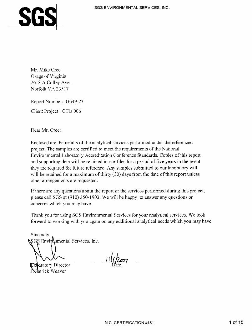
2618A COLLEY AVENUE ♦ NORFOLK, VIRGINIA 23517-1132 PHONE: 757.440.0400 ♦ FAX: 757.440.0411 December 13, 2007 NAVFAC Mid-Atlantic Marine Corps North Carolina IPT Environmental Business Line Code: OPNCEV Attn: Mr. Dan Oros, P.G. 6506 Hampton Boulevard Building C, Room 3016 Norfolk, VA 23508-1278 SUBJECT: FINAL Report of Findings Building 30, Former Underground Storage Tank (UST) 30-1
Marine Corps Base (MCB) Camp Lejeune, North Carolina Navy Contract No. N40085-06-D-7006
CTO No. 0004 Dear Mr. Oros: Osage of Virginia Inc. (Osage) is pleased to submit this Report of Findings for soil sampling work performed at the above referenced site. This letter report documents field activities, as well as provides findings and recommendations with respect to the soil samples collected along the underground piping associated with the former UST. Background and Purpose Building 30 is located in the vicinity of Gottschalk Marina aboard Marine Corps Base (MCB) Camp Lejeune, North Carolina. The site location is shown on Figure 1. Building 30 is currently a bathroom facility, with one washer and dryer unit for use by Marina residents. Former UST 30-1 was located approximately 50 feet to the South-Southeast of Building 30. It supplied fuel via underground piping to a dispenser located on the Marina pier, which extends approximately 200 feet from the shore line into the water. The 1,000-gallon steel gasoline tank was closed by removal on July 29, 1993 by Jones & Frank (J&F). Two soil samples from the tank basin were collected and analyzed for Total Petroleum Hydrocarbons (TPH) Gasoline Range Organics (GRO) and Diesel Range Organics (DRO). Laboratory analysis of the soil samples indicated results were below the laboratory method detection limits. The September 3, 1993 tank closure report stated that the product delivery lines were excavated and removed from the subgrade or rendered non-usable.
December 13, 2007 Page 2 of 3
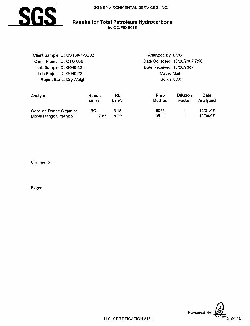
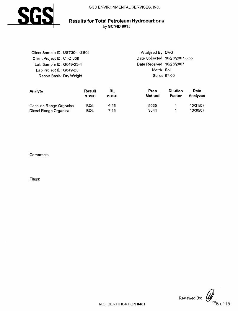
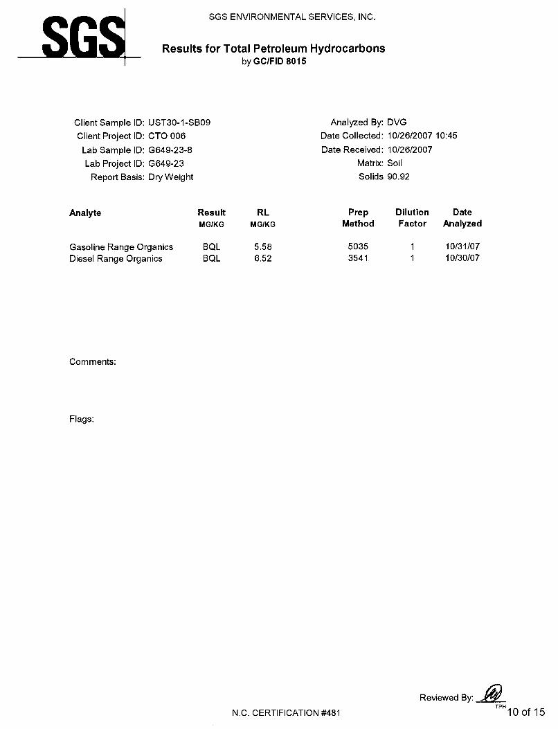
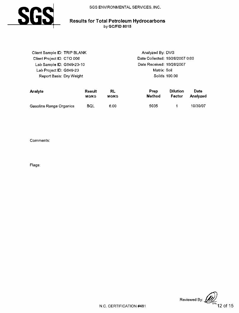
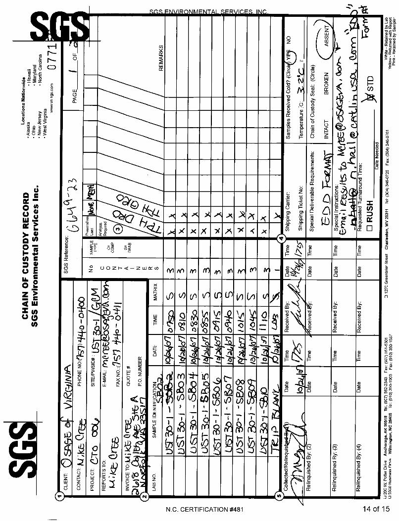
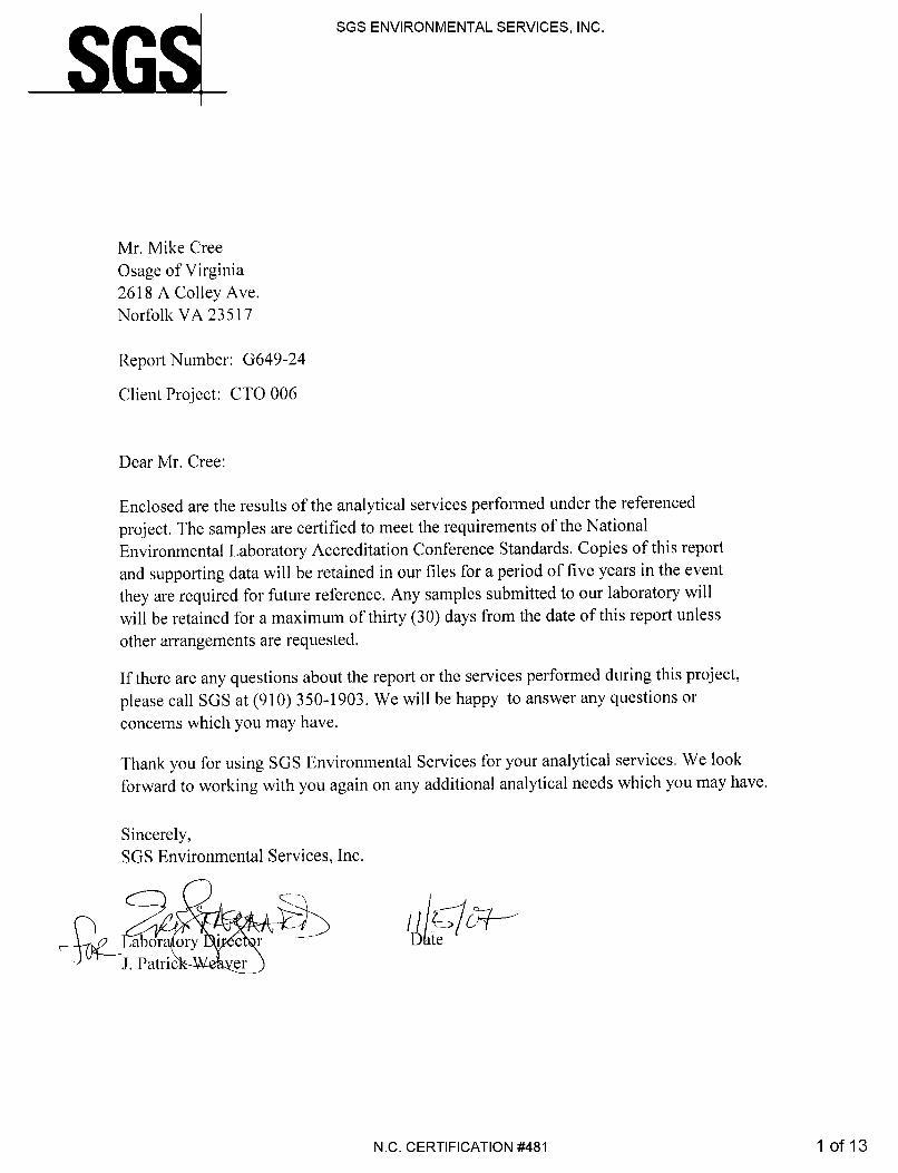
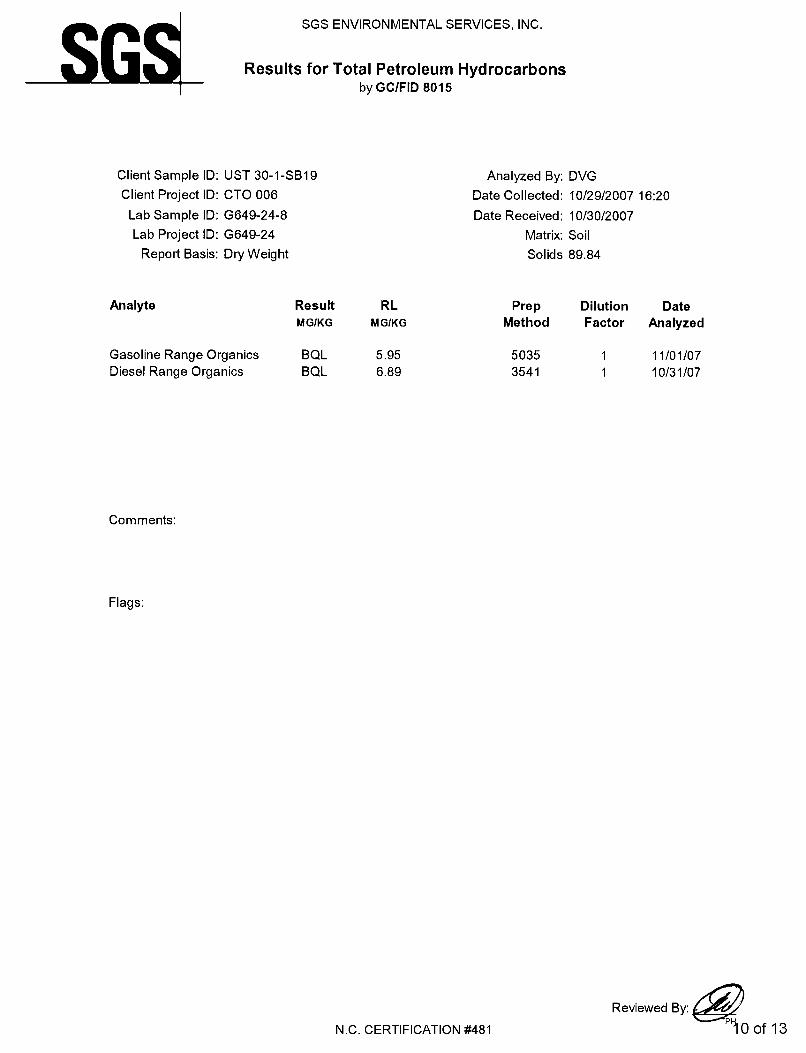
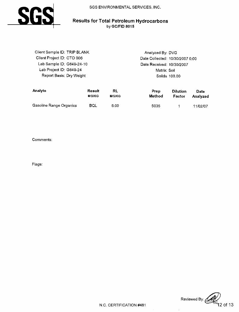
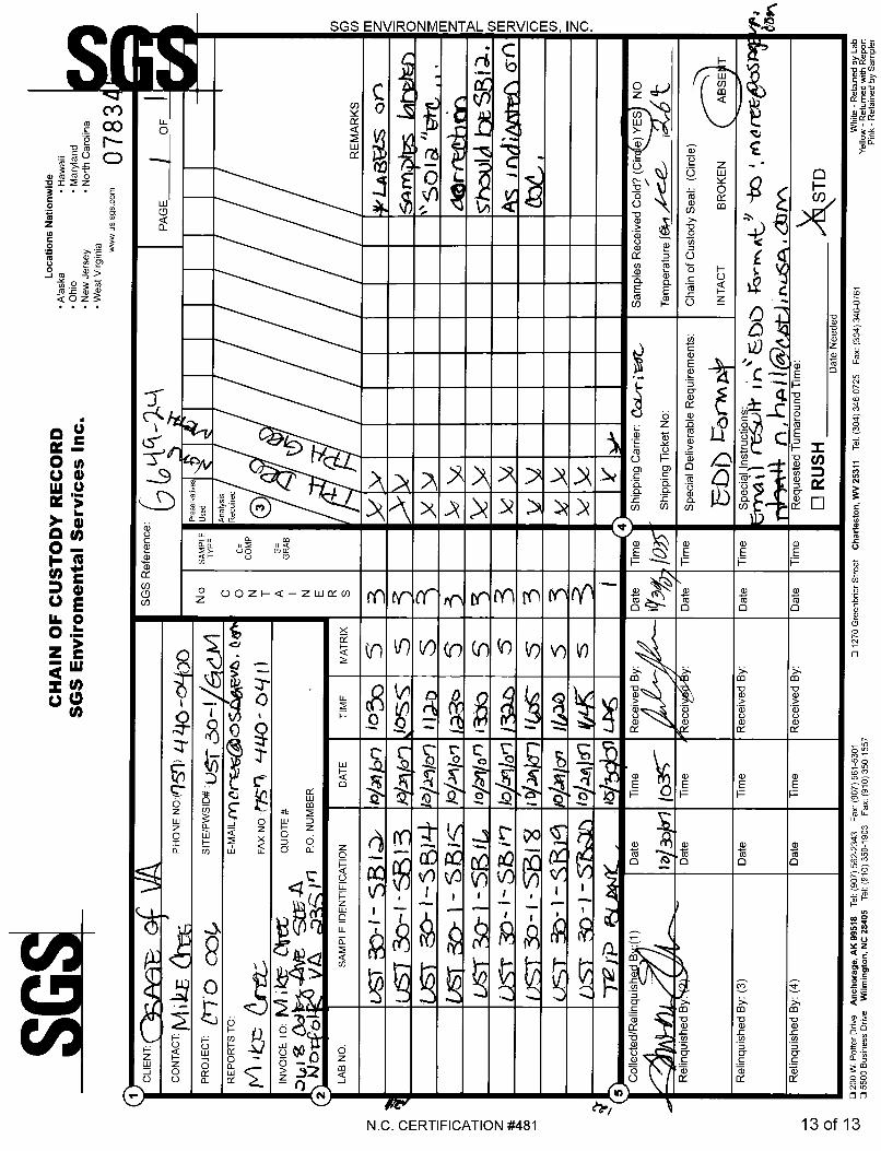
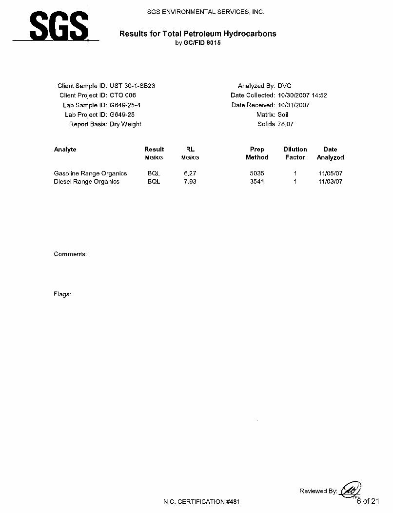
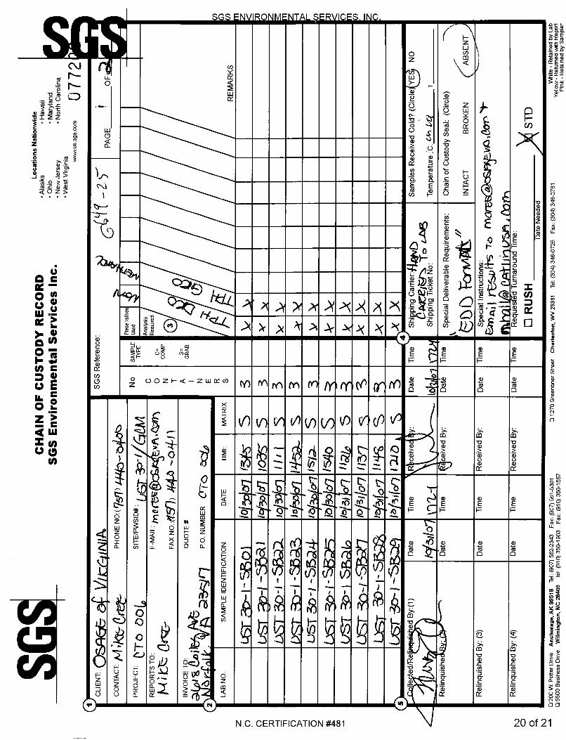
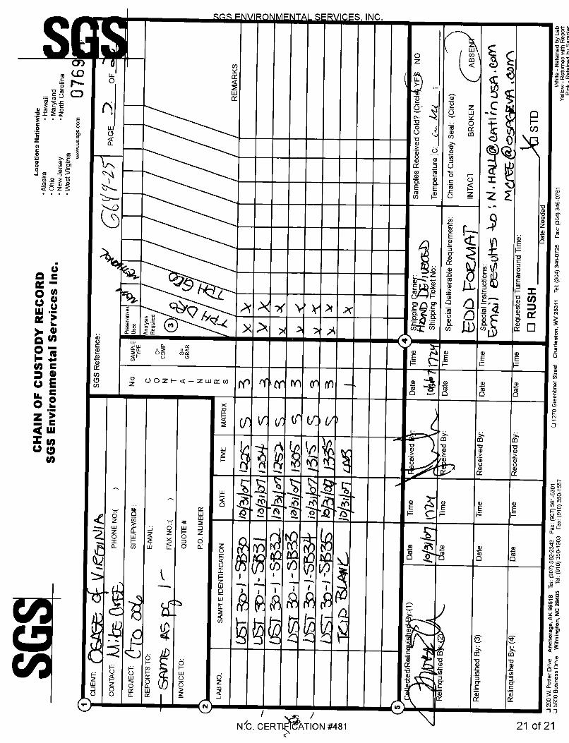
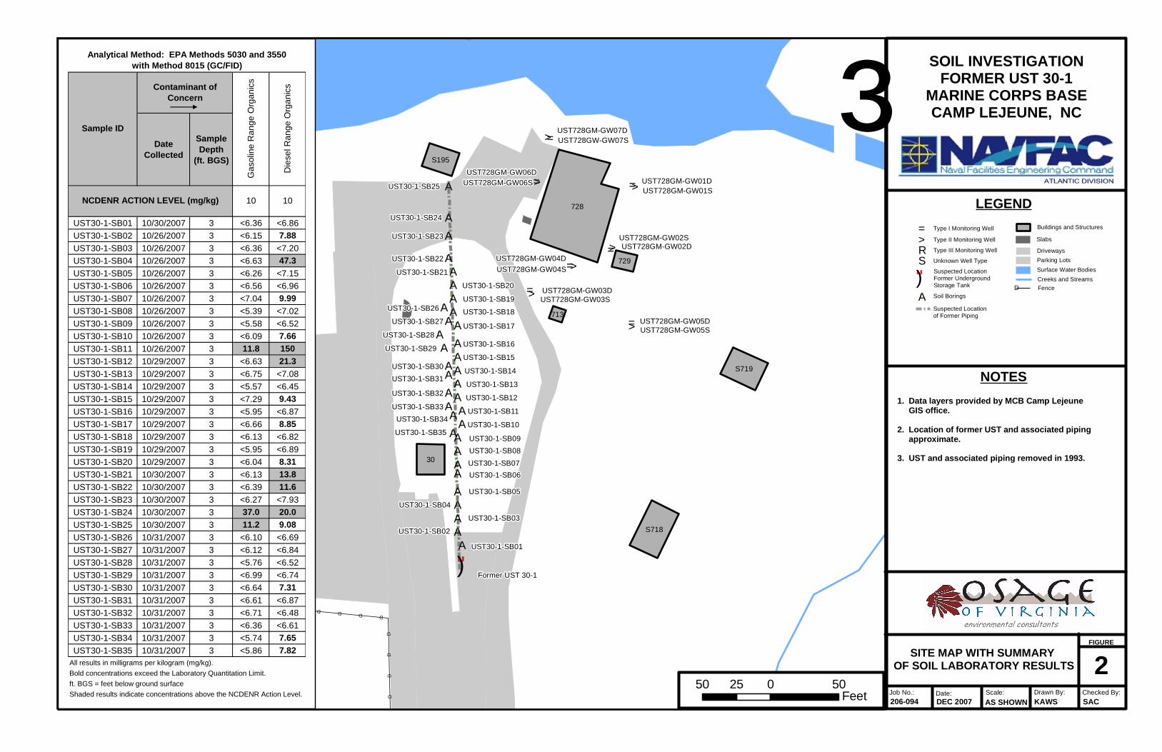
Upon recent review of the report by the North Carolina Department of Environment and Natural Resources (NCDENR), they requested that MCB Camp Lejeune collect soil samples along the transfer piping and dispenser locations associated with the UST. As part of this investigation, soil samples were collected from the requested areas. Methods Osage personnel conducted soil sampling activities along the suspected location of the underground piping associated with UST 30-1 on October 26 and October 29-31, 2007. Samples were collected along the line from the former tank area northward to where the line attached to the Marina pier. Utility location of the area did not identify any remaining fuel piping. Soil samples from the dispenser area were not collected, as the dispenser was located over water on the pier. The soil investigation involved the advancement of 35 hand augers for collection of soil samples (UST30-1-SB01 through UST30-1-SB35). Samples were visually examined for evidence of a release and screened using a Photo Ionization Detector (PID). One vadose zone soil sample was collected for laboratory analyses from a depth of three feet Below Ground Surface (BGS) at each hand auger boring. The soil samples were placed in laboratory glassware, labeled, placed immediately on ice in a cooler, and transported under proper Chain-of-Custody (COC) protocol to SGS Environmental Services, Inc. (NC Certification #481) of Wilmington, North Carolina. Samples were analyzed for TPH-GRO and TPH-DRO via EPA Methods 5030 and 3550, respectively. Sampling Results Analytical results for the soil samples are summarized in Table 1 and discussed below. The complete laboratory analytical report and COC documentation are included in Appendix A.
EPA Method 5030 As shown in Table 1, analytical results from three of the 35 soil samples revealed noncompliant TPH-GRO concentrations. Soil samples UST30-1-SB11, UST30-1-SB 24, and UST30-1-SB25 contained gasoline range organics at concentrations of 11.8 mg/kg, 37.0 mg/kg, and 11.2 mg/kg, respectively. All other soil sample results were reported as below laboratory quantitation limits (BQL) for TPH-GRO. EPA Method 3550 Laboratory analysis detected TPH-DRO concentrations in 16 of the 35 soil samples. Only six of those 16, however, exhibited noncompliant concentrations. Soil samples UST30-1-SB04, UST30-1-SB11, UST30-1-SB12, UST30-1-SB21, UST30-1-SB22, and UST30-1-SB24 contained diesel range organics above the NCDENR Action Limit of 10 mg/kg. Soil sample UST30-1-SB04 had a TPH-DRO concentration of 47.3 mg/kg, while sample UST30-1-SB11 exhibited the highest concentration of 150 mg/kg. TPH-DRO
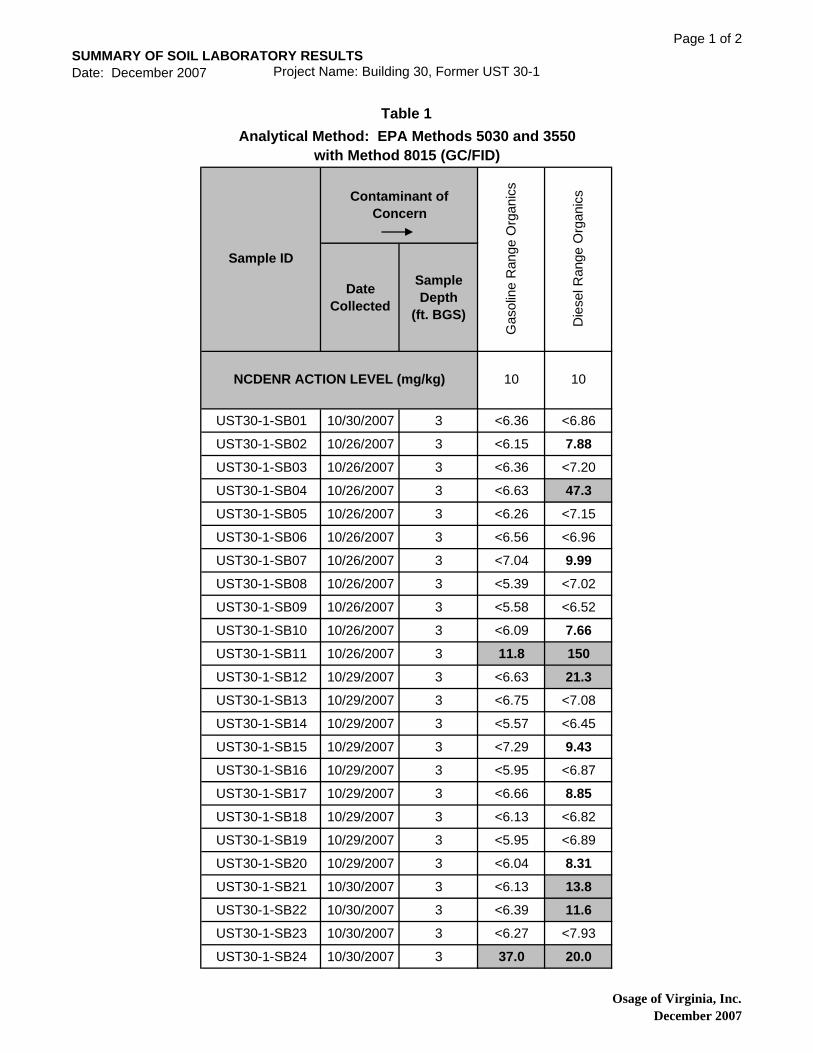
SUMMARY OF SOIL LABORATORY RESULTSDate: December 2007 Project Name: Building 30, Former UST 30-1
Page 1 of 2
Date Collected
Sample Depth
(ft. BGS)
UST30-1-SB01 10/30/2007 3 <6.36 <6.86
UST30-1-SB02 10/26/2007 3 <6.15 7.88
UST30-1-SB03 10/26/2007 3 <6.36 <7.20
UST30-1-SB04 10/26/2007 3 <6.63 47.3
UST30-1-SB05 10/26/2007 3 <6.26 <7.15
UST30-1-SB06 10/26/2007 3 <6.56 <6.96
UST30-1-SB07 10/26/2007 3 <7.04 9.99
UST30-1-SB08 10/26/2007 3 <5.39 <7.02
UST30-1-SB09 10/26/2007 3 <5.58 <6.52
UST30-1-SB10 10/26/2007 3 <6.09 7.66
UST30-1-SB11 10/26/2007 3 11.8 150
UST30-1-SB12 10/29/2007 3 <6.63 21.3
UST30-1-SB13 10/29/2007 3 <6.75 <7.08
UST30-1-SB14 10/29/2007 3 <5.57 <6.45
UST30-1-SB15 10/29/2007 3 <7.29 9.43
UST30-1-SB16 10/29/2007 3 <5.95 <6.87
UST30-1-SB17 10/29/2007 3 <6.66 8.85
UST30-1-SB18 10/29/2007 3 <6.13 <6.82
UST30-1-SB19 10/29/2007 3 <5.95 <6.89
UST30-1-SB20 10/29/2007 3 <6.04 8.31
UST30-1-SB21 10/30/2007 3 <6.13 13.8
UST30-1-SB22 10/30/2007 3 <6.39 11.6
UST30-1-SB23 10/30/2007 3 <6.27 <7.93
UST30-1-SB24 10/30/2007 3 37.0 20.0
Table 1Analytical Method: EPA Methods 5030 and 3550
with Method 8015 (GC/FID)
Sample ID
Contaminant of Concern
Gas
olin
e R
ange
Org
anic
s
Die
sel R
ange
Org
anic
s
NCDENR ACTION LEVEL (mg/kg) 10 10
Osage of Virginia, Inc.December 2007

SUMMARY OF SOIL LABORATORY RESULTSDate: December 2007 Project Name: Building 30, Former UST 30-1
Page 2 of 2
Date Collected
Sample Depth
(ft. BGS)
Table 1Analytical Method: EPA Methods 5030 and 3550
with Method 8015 (GC/FID)
Sample ID
Contaminant of Concern
Gas
olin
e R
ange
Org
anic
s
Die
sel R
ange
Org
anic
s
NCDENR ACTION LEVEL (mg/kg) 10 10
UST30-1-SB25 10/30/2007 3 11.2 9.08
UST30-1-SB26 10/31/2007 3 <6.10 <6.69
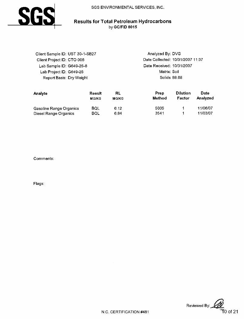
UST30-1-SB27 10/31/2007 3 <6.12 <6.84
UST30-1-SB28 10/31/2007 3 <5.76 <6.52
UST30-1-SB29 10/31/2007 3 <6.99 <6.74
UST30-1-SB30 10/31/2007 3 <6.64 7.31
UST30-1-SB31 10/31/2007 3 <6.61 <6.87
UST30-1-SB32 10/31/2007 3 <6.71 <6.48
UST30-1-SB33 10/31/2007 3 <6.36 <6.61
UST30-1-SB34 10/31/2007 3 <5.74 7.65
UST30-1-SB35 10/31/2007 3 <5.86 7.82All results in milligrams per kilogram (mg/kg).
Bold concentrations exceed the Laboratory Quantitation Limit.
ft. BGS = feet below ground surface
Shaded results indicate concentrations above the NCDENR Action Level.
Osage of Virginia, Inc.December 2007

WALLACE CREEK
NEW RIVER
JULIAN C. SMITH
A STREET
C STREET
D STREET
McHUGH BOULEVARD
CROSS STREET
ON
SLOW
DR
IVE
CUTLER STREET
SETH WILLIAM
S BOULEVARD
EDEN STREET
PEND
ER STR
EET
BEVIN STREET
F STREET
TIMM
ERMAN AVENUE
1,000 0 1,000500 Feet
SCALEData Sources: Data Layers provided by MCB Camp Lejeune GIS Office.
³
FIGUREPROJECT TITLE
JOB NO. DATE SCALE DRAWN BY CHECKED BY1
SOIL INVESTIGATIONFORMER UST 30-1
MARINE CORPS BASECAMP LEJEUNE, NC
SITE LOCATION MAP
206-094 NOV 2007 AS SHOWN SAC MEM
Site Location
LegendWater Supply Wells
Roads
Railroads
Playgrounds
Athletic Fields and Courts
Parking Lots and Driveways
Surface Water
Buildings and Structures
1,500 Foot Radius
=>
=>
=>
=>
=>
=>
=>
")
!A
!A
!A
!A
!A
!A!A
!A
!A!A
!A!A
!A!A
!A!A
!A!A
!A!A
!A!A
!A!A
!A!A!A
!A!A
!A
!A
!A
!A
!A
!A
D
DDDDDDDDDDDDDDDD
DD
D
D
D
D
D
D
D
D
D
D
D
D
D
D
DD
D
D
D
D
D
D
D
D
D
DDDD
DD
DD
DD
DD
D
D D D D D D DD
DD
DD
D
UST728GM-GW05SUST728GM-GW05D
UST728GM-GW03SUST728GM-GW03D
UST728GM-GW04SUST728GM-GW04D
UST728GM-GW02DUST728GM-GW02S
UST728GM-GW01SUST728GM-GW01D
UST728GM-GW07DUST728GW-GW07S
UST728GM-GW06S
UST728GM-GW06D
UST30-1-SB01
UST30-1-SB02
UST30-1-SB03
UST30-1-SB04
UST30-1-SB05
UST30-1-SB06UST30-1-SB07UST30-1-SB08UST30-1-SB09
UST30-1-SB10
UST30-1-SB11
UST30-1-SB12
UST30-1-SB13
UST30-1-SB14
UST30-1-SB15
UST30-1-SB16UST30-1-SB16
UST30-1-SB17
UST30-1-SB18
UST30-1-SB19
UST30-1-SB20
UST30-1-SB24
UST30-1-SB23
UST30-1-SB22
UST30-1-SB21
UST30-1-SB26
UST30-1-SB27
UST30-1-SB28
UST30-1-SB29
UST30-1-SB30UST30-1-SB31
UST30-1-SB32
UST30-1-SB33UST30-1-SB34
UST30-1-SB35
Former UST 30-1
UST30-1-SB25
728
30
S718
S719
S195
729
713
³
Scale:AS SHOWN
SOIL INVESTIGATIONFORMER UST 30-1
MARINE CORPS BASECAMP LEJEUNE, NC
NOTES
Job No.: Date:DEC 2007
Drawn By:KAWS
Checked By:SAC
FIGURE
2206-094
SITE MAP WITH SUMMARY OF SOIL LABORATORY RESULTS
1. Data layers provided by MCB Camp Lejeune GIS office.
2. Location of former UST and associated piping approximate.
3. UST and associated piping removed in 1993.
Date Collected
Sample Depth
(ft. BGS)
UST30-1-SB01 10/30/2007 3 <6.36 <6.86UST30-1-SB02 10/26/2007 3 <6.15 7.88UST30-1-SB03 10/26/2007 3 <6.36 <7.20UST30-1-SB04 10/26/2007 3 <6.63 47.3UST30-1-SB05 10/26/2007 3 <6.26 <7.15UST30-1-SB06 10/26/2007 3 <6.56 <6.96UST30-1-SB07 10/26/2007 3 <7.04 9.99UST30-1-SB08 10/26/2007 3 <5.39 <7.02UST30-1-SB09 10/26/2007 3 <5.58 <6.52UST30-1-SB10 10/26/2007 3 <6.09 7.66UST30-1-SB11 10/26/2007 3 11.8 150UST30-1-SB12 10/29/2007 3 <6.63 21.3UST30-1-SB13 10/29/2007 3 <6.75 <7.08UST30-1-SB14 10/29/2007 3 <5.57 <6.45UST30-1-SB15 10/29/2007 3 <7.29 9.43UST30-1-SB16 10/29/2007 3 <5.95 <6.87UST30-1-SB17 10/29/2007 3 <6.66 8.85UST30-1-SB18 10/29/2007 3 <6.13 <6.82UST30-1-SB19 10/29/2007 3 <5.95 <6.89UST30-1-SB20 10/29/2007 3 <6.04 8.31UST30-1-SB21 10/30/2007 3 <6.13 13.8UST30-1-SB22 10/30/2007 3 <6.39 11.6UST30-1-SB23 10/30/2007 3 <6.27 <7.93UST30-1-SB24 10/30/2007 3 37.0 20.0UST30-1-SB25 10/30/2007 3 11.2 9.08UST30-1-SB26 10/31/2007 3 <6.10 <6.69UST30-1-SB27 10/31/2007 3 <6.12 <6.84UST30-1-SB28 10/31/2007 3 <5.76 <6.52UST30-1-SB29 10/31/2007 3 <6.99 <6.74UST30-1-SB30 10/31/2007 3 <6.64 7.31UST30-1-SB31 10/31/2007 3 <6.61 <6.87UST30-1-SB32 10/31/2007 3 <6.71 <6.48UST30-1-SB33 10/31/2007 3 <6.36 <6.61UST30-1-SB34 10/31/2007 3 <5.74 7.65UST30-1-SB35 10/31/2007 3 <5.86 7.82
All results in milligrams per kilogram (mg/kg).Bold concentrations exceed the Laboratory Quantitation Limit.ft. BGS = feet below ground surfaceShaded results indicate concentrations above the NCDENR Action Level.
Analytical Method: EPA Methods 5030 and 3550 with Method 8015 (GC/FID)
Sample ID
Contaminant of Concern
Gas
olin
e R
ange
Org
anic
s
Die
sel R
ange
Org
anic
s
NCDENR ACTION LEVEL (mg/kg) 10 10 LEGEND
50 0 5025Feet
Parking Lots
Slabs
Creeks and Streams")Suspected LocationFormer Underground Storage Tank
S Unknown Well Type
Soil Borings!A
= Type I Monitoring Well
> Type II Monitoring Well
R Type III Monitoring Well
Buildings and Structures
Driveways
Surface Water Bodies
D Fence
Suspected Locationof Former Piping
APPENDIX A
LABORATORY REPORTS AND CHAIN-OF-CUSTODY DOCUMENTATION