statement of qualifications for professional civil
TRANSCRIPT

Statement of Qualifications for Professional Civil
Engineers Registered in The State of California
July 2018
Prepared for:
Santa Clara Valley Urban Runoff Pollution Prevention Program

This page is left intentionally blank.

www.balancehydro.com Santa Clara Valley Urban Runoff Pollution Prevention Program –
Civil Engineers List i
Table of Contents
FIRM INFORMATION 1
INTRODUCTION 1 BACKGROUND 1 STORMWATER AND HYDROMODIFICATION EXPERIENCE 1 SANTA CLARA COUNTY EXPERIENCE 2 AGENCY AND REGULATORY RELATIONSHIPS 2
STATEMENTS OF QUALIFICATION 2
STATEMENT OF THE FIRM’S UNDERSTANDING OF URBAN STORM WATER MANAGEMENT PRACTICES, ISSUES, AND REQUIREMENTS, INCLUDING LID REQUIREMENTS 2 STATEMENT OF THE FIRM’S UNDERSTANDING OF CONTINUOUS SIMULATION HYDROLOGIC MODELS AND ANALYSIS OF OUTPUT DATA FOR USE IN DESIGN OF HYDROMODIFICATION CONTROL MEASURES 3 STATEMENT OF THE FIRM’S UNDERSTANDING OF ON-SITE THIRD-PARTY INSPECTIONS OF INSTALLED STORMWATER TREATMENT MEASURES 3 PROJECT EXPERIENCE 4 TABLE 1: RECENT (LAST 5 YEARS) SANTA CLARA COUNTY PROJECT IN THE DESIGN OF STORMWATER TREATMENT AND FLOW CONTROL MEASURES (INCLUDING LID MEASURES) 4
PROJECT STAFF BIOS 8
APPENDIX A: TRAINING CERTIFICATE 10
APPENDIX B: FEE SCHEDULE 11
APPENDIX C: RESUMES 12

This page is left intentionally blank.

www.balancehydro.com Santa Clara Valley Urban Runoff Pollution Prevention Program –
Civil Engineers List 1
Firm Information Name: Balance Hydrologics
Business Address: 800 Bancroft Way Suite 101 Berkeley, California 94710
Phone: (510) 704-1000
Year Established: 1988
Primary Contacts:
Principal-in-Charge, Edward Ballman, (510) 704-1000 ext.203
Project Manager, Teresa Garrison, (510) 704-1000 ext. 241
Introduction Balance Hydrologics is interested, available and committed to produce HMP planning and design work for Santa Clara Valley Urban Runoff Pollution Prevention Program. We would greatly appreciate the opportunity to be included in SCVURPPP’s List of Civil Engineers.
Background
Balance Hydrologics (Balance) is a full service site‐specific hydrology consulting firm located in Berkeley, California, established in 1988. The firm is comprised of over 30 professional staff with a broad array of experience throughout California with most having an advanced graduate degree in the fields of hydrology, geology or engineering. One of our principal goals is providing planners, engineers, biologists, and land managers with rigorous analyses quantifying significant watershed processes. Balance’s emphasis is on intensive field study coupled with application of cutting‐edge modeling platforms, generally structured to meet the specific needs of the habitat or watershed manager.
Most investigations are designed to measure, simulate and plan to control the effects of specific land uses on aquatic, riparian, or estuarine habitat conditions. Our projects cover the full spectrum of services, from studies to establish baseline hydrologic, hydraulic, geologic, and water quality conditions to developing mitigation or restoration designs, providing construction‐phase support, and post‐project monitoring.
Stormwater and Hydromodification Experience
Balance Hydrologics has been at the forefront of innovative stormwater management planning having consulted on hundreds of stormwater projects. Our expertise includes site level stormwater management planning, construction level facility design, and assistance in regulatory requirement program development. Balance also develops innovative infiltration-management programs, such as implementing rain-catchment programs to replace lost recharge with roof runoff.
Our problem-solving strategy is based on a balanced technical approach, utilizing our team of hydrologic professionals with diverse backgrounds in hydraulics, hydrogeology, engineering, geomorphology, geohydrolo-gy, geochemistry, natural resource management, sedi-mentation and sediment management. Explicitly unique academic and professional staff backgrounds allows us to consider and integrate multiple technical stormwater issues, including:
Stormwater designs
BMP design and monitoring
Hydromodification management
Stormwater design third-party reviews

2 www.balancehydro.com
On-site third-party inspections of installed stormwater treatment measures
Stormwater master planning
Channel stability and flood hydrology of perennial and intermittent streams
TMDL evaluations and recommendations
Surface- and groundwater hydrology, and their interactions
Advanced water and sediment quality questions
Hydraulics and sediment transport in natural channels
Estuary, lagoon, lake, pond, and reservoir management
Wetland protection and restoration
Hydrologic and water-quality aspects of reclamation and restoration plans
Santa Clara County Experience Balance established our project tenure in Santa Clara County 30 years ago, bringing the essential experience to meet the needs of this on-call contract under SCVURPPP, including proven experience in addressing hydromodification, hydrological analysis, restoration planning and design from urban to natural settings; our team has addressed hydromodification management requirements, designed stormwater facilities, in addition to designing and constructing wetland, floodplain, creek, and habitat restoration projects throughout Santa Clara County and beyond. Our hydromodification studies, stormwater designs, stormwater master plan development, watershed and hydrologic assessment, restoration planning, and post-restoration monitoring efforts have included restoration projects for the following Santa Clara County and neighboring agencies:
Agency and Regulatory Relationships
Strong relationships with key agencies throughout Santa Clara County has been a key element of their project success. They regularly work directly with a wide-range of regulatory agencies, California Department of Fish and Game, San Francisco Bay Regional Water Quality Control Board, U.S. Army Corps of Engineers, U.S. Fish and Wildlife Service, National Marine Fisheries, Alameda County Zone 7 Flood Control, California Department of Health Services. Our clear understanding
of environmental regulations including environmental impact analyses (NEPA and CEQA), wetlands, water rights, Division of Safety of Dams (DSOD), Federal Energy Regulatory Commission, FEMA and FIA regulations, and Clean Water Act and/or Porter-Cologne standards directly benefits VTA.
Statements of Qualification Statement of the firm’s understanding of urban storm water management practices, issues, and requirements, including LID requirements
Our stormwater management practice focuses on the reestablishment of structure and function within the full gamut of aquatic ecosystems that characterize California’s diverse hydrography, with the goal of preserving and enhancing these ecosystems in a manner compatible with each setting, be it natural open space or at the interface with the built environment. We apply a green infrastructure approach to urban runoff; water management that protects and restores the natural water cycle in both an urban and natural setting. A restored stream, floodplain, or wetland, or vernal pool can provide benefits of flood risk reduction, improvement of water quality, additional habitat for fish and wildlife, and erosion and sediment control. Our approach is founded on a long track record of field work and monitoring that, coupled with state-of-the-art modeling platforms, allow us to characterize and quantify the spatial and temporal nature of water fluxes that reflect the underlying interaction of geology, biology, and climate. Our design goals are focused on:
Slowing flood waters by allowing water to flow onto floodplain surfaces, thereby reducing flood depth and velocities as well as bank erosion.
Restoring and improving water supply and water quality, both of which naturally improve when rainfall and runoff are percolated and recharged into the local groundwater quality.
Restoration and enhancement of aquatic and terrestrial habitats, increasing habitat area for plants, animals, fish, and all biotic as well as abiotic elements.
Safeguard people and property by lessening flood hazards; offer health and ecological benefits for citizens with additional outdoor space.
We partner with agencies, resource conservation districts, habitat agencies, watershed councils, and land trusts to maintain or restore hydrologic cycle components to
www.balancehydro.com Santa Clara Valley Urban Runoff Pollution Prevention Program –
Civil Engineers List 3
maximize functions and values. We are adept at applying geomorphic, hydrologic, and hydraulic principles in settings from constrained urbanized areas to preserving open spaces at all levels of a watershed (from source to sea).
Statement of the firm’s understanding of continuous simulation hydrologic models and analysis of output data for use in design of hydromodification control measures
We utilize rainfall-runoff (H&H) modeling platforms, including HEC-HMS, BAHM, XPSTORM, MIKE-URBAN, Hydraflow (Civil 3D), to size and design stormwater facilities for peak flow attenuation, water-quality treatment, and hydromodification control. Our team of engineers and scientists are adept at developing long term continuous simulation models to design complex hydromodification control facilities and demonstrate the ability of low impact development to maintain on site water balance.
Statement of the firm’s understanding of on-site third-party inspections of installed stormwater treatment measures
Balance engineers regularly provide third-party reviews, which include parameterizing and running the Bay Area Hydrology Model (BAHM) for a proposed development area to assess bioretention facility sizes and required pump capacity and to show compliance with the C.3 requirements for water-quality treatment and hydromodification management. Typical peer review activities included review of hydrologic analyses and
modeling related to potential changes in peak stormwater flows and the configuration of detention basins. Balance engineers were also called upon to review hydraulic modeling for proposed storm drain systems, including consideration of sediment transport and maintenance issues. In special cases, the reviews included subsurface drainage as well, particularly with respect to impacts on local, shallow groundwater tables.
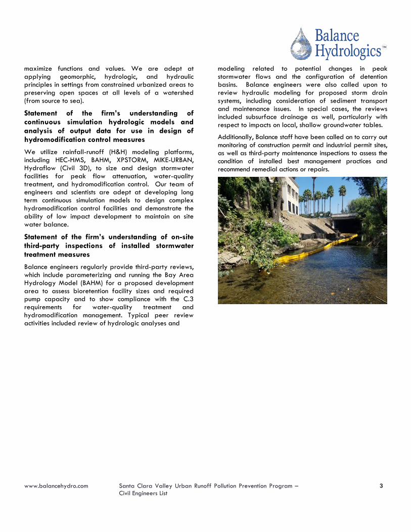
Additionally, Balance staff have been called on to carry out monitoring of construction permit and industrial permit sites, as well as third-party maintenance inspections to assess the condition of installed best management practices and recommend remedial actions or repairs.

4 www.balancehydro.com
Project Experience Table 1: Recent (last 5 years) Santa Clara County Project in the Design of Stormwater Treatment and Flow Control Measures (including LID measures)
Project Description of Work
Corvin Drive, Santa Clara, Calabazas Creek, S Santa Clara County, California
FEMA Letter of Map Amendment, Hydrologic Calculations and Modeling
APLA Construction, SJ Behavioral Health Stormwater, San Jose, Coyote Creek, Santa Clara County, California
Hydrologic Calculations and Modeling for Stormwater Design
Morgan Hill School Stormwater, Morgan Hill, Santa Clara County, California
LEED Compliance for Stormwater Management, assess floodplain management impacts
Belmont Stormwater, San Jose, Santa Clara County, California
Data collection, Stormwater Quality and Hydromodification Sizing, Hydrologic Calculations and Modeling for Stormwater Design, Hydromodification Control Compliance, BAHM Model
Los Gatos (Sahadi Property) Stormwater, HMH Engineers, Los Gatos, Santa Clara County, California
Hydrologic Calculations and Modeling for Stormwater Design, Hydromodification Control Compliance, BAHM Model
Almendra Creek Peer Review, Santa Clara, Monte Sereno, Guadalupe River, Santa Clara County, California
Peer review of the proposed Almendra Creek restoration plan
Walker Driver Stormwater, Mountain Veiw, Stevens Creek, Santa Clara County, California
Hydrologic Calculations and Modeling for Stormwater Design, Hydromodification Control Compliance, BAHM Model
South King Hydromod Design, San Jose, Santa Clara County, California
Hydromodification Control Design Services
Southern Wine and Spirits Stormwater inspections, Southern Wine and Spirits, Union City, Alameda County, California
Monitoring of and coordinates maintenance for stormwater treatment infrastructure
Evergreen Hydromod Feasability, San Jose, Santa Clara County, California
Hydrologic Calculations and Modeling for Stormwater Design, Hydromodification Control Compliance, BAHM Model
Calle Artis Stormwater Management, San Jose, Santa Clara County, California
Hydrologic Calculations and Modeling for Stormwater Design, C.3 Facility Sizing, Detention Sizing
Piercy Road Hydromod, San Jose, Santa Clara County, California
Hydrologic Calculations and Modeling for Stormwater Design, Hydromodification Control Compliance, BAHM Model
HMH, South King Road Stormwater Management, San Jose, Santa Clara County, California
Hydrologic Calculations and Modeling for Stormwater Design, Hydromodification Control Compliance, BAHM Model

www.balancehydro.com Santa Clara Valley Urban Runoff Pollution Prevention Program –
Civil Engineers List 5
SCVWD, On-call High-Flow Discharge and Sediment, Santa Clara, California
High flow sediment monitoring
Los Gatos Stormwater, Los Gatos, Santa Clara County, California
Hydrologic Calculations and Modeling for Stormwater Design, Hydromodification Control Compliance, BAHM Model
Samaritan Court Hydromod Assistance, San Jose, Santa Clara County, California
Hydrologic Calculations and Modeling for Stormwater Design, Hydromodification Control Compliance, BAHM Model
Nieman-Telford Hydromod Plan, San Jose, Santa Clara County, California
Hydrologic Calculations and Modeling for Stormwater Design, Hydromodification Control Compliance, BAHM Model
City of Sunnyvale, Butchers Corner PRC, Santa Clara, California
Hydrologic Calculations and Modeling for Stormwater Design, XPStorm model
City of Cupertino, Cupertino GC Clubhouse Flood Planning, Santa Clara, Stevens Creek
Floodplain management assistance related to City Golf Course improvements
Ponderosa Homes via HMH Engineers, Edenvale Avenue Stormwater, San Jose, Santa Clara County, California
Data collection, Stormwater Quality and Hydromodification Sizing, Hydrologic Calculations and Modeling for Stormwater Design, Hydromodification Control Compliance, BAHM Model
Sunnyvale PS Hydraulic Modeling, Sunnyvale, Santa Clara County, California
Stormwater System Modeling supporting Water Pollution Control Plant Primary Treatment Design
Milpitas Storage SWCP Review, Santa Clara County, California
Peer review services related to the Stormwater Control Plan
Laurel Wood Road SWCP Review, Santa Clara County, California
Peer review services related to the Stormwater Control Plan
Standard Pacific Homes, Parkside Trails Stormwater Management, Santa Clara, Santa Clara County, California
Hydrologic Calculations and Modeling for Stormwater Design, Hydromodification Control Compliance, BAHM Model
Surrey Farm Stormwater, Santa Clara, Santa Clara County, California
Hydrologic Calculations and Modeling for Stormwater Design, Hydromodification Control Compliance, BAHM Model, Flood control modeling
Sares Regis, Colonnade SWMP Peer Review, Santa Clara County, California
Peer review services related to the Stormwater Control Plan

6 www.balancehydro.com
Southern Wine and Spirits Stormwater inspections, Southern Wine and Spirits, Union City, Alameda County, California
Balance Hydrologics conducts monitoring of and coordinates maintenance for stormwater treatment infrastructure located at the distribution facility for Southern Glazer’s Wine and Spirits (Formerly, Southern Wine and Spirits at 1555 Atlantic Street, Union City, California (1555 Atlantic, hereafter). The basis for the monitoring and maintenance of the stormwater treatment measures implemented at 1555 Atlantic are presented in the Operation and Maintenance Manual (OMM) written by Kier and Wright Civil Engineers and Surveys, and approved by Union City. The following bio-retention systems are inspected for hydrologic conditions and performance monthly, before and after the wet-season, and after large storm events:
One (1) stormwater media-filter vault, located under the northwest corner of the parking lot
One (1) flow-through planter box, located along the southern edge of the warehouse
Five (5) bio-retention areas, located at various locations throughout the parking lot.
Balance Hydrologics inspects hydrologic conditions and performance of each bio-retention system at Southern Wines and Spirits distribution center, and reports the findings to the City of Union City.
Sunnyvale Wastewater and Stormwater Master Plan, Santa Clara County, California Balance Hydrologics is contracted with the City of Sunnyvale, as a subcontractor to IEC Corporation, to update the stormwater master plan for the City. Balance is developed a fundamental understanding of the stormwater conveyance system to guide maintenance and infrastructure planning programs. Work products will have included: hydrologic and hydraulic models of the City’s storm drain system; simulation results showing the effects of alternative improvements to the “trunk” lines within the storm drain network; a simulation platform which can be modified and operated to predict the effects of future changes to the stormwater system; and guidance regarding system inadequacies and needed upgrades.
Tasks included: field gauging (monitoring) of flows in a limited set of locations within the storm drain system;
development and operation of an XPStorm based numerical model of the stormwater system; simulation using the model of existing operating conditions for the design event; hydraulic evaluation of upgrades to the system to meet design standards; and writing of the stormwater sections of the master plan.
Belmont Stormwater, Santa Clara County, California Balance Hydrologics (Balance) was tasked with the planning and design of stormwater management infrastructure for the high-density in-fill Belmont Project (previously named Edenvale Avenue project) in the City of San Jose. The project is subject to hydromodification management requirements, as well as the water quality standards set forth in the Santa Clara C.3 Stormwater Handbook. Using the Bay Area Hydrology Model (BAHM) Balance engineers conducted compliance modeling.
Working closely with the client, Balance optimized the design from a performance and costs perspective. The final design consists of a storage vault and 2-pump system, that meters the captured runoff to a biofiltration facility. The vault storage allows storm peaks to be held and pumped out in a regulated manner, which allows for a controlled release to meet the flow-duration standards. After coordination with HMH and the pump engineers, a large and small pump were selected based on the pump flow rates and the start/stop elevations were modified to best fit the scenario.
Los Gatos (Sahadi Property) Stormwater, HMH Engineers, Los Gatos, Santa Clara County, California Balance Hydrologics was tasked with determining appropriate stormwater management facilities that would effectively treat stormwater runoff for hydromodification concerns for the Sahadi Property development. This project is proposing to construct four home lot areas and an access roadway in the hills of the Town of Los Gatos. Using the Bay Area Hydrology Model (BAHM), Balance performed a preliminary model run to size stormwater infrastructure for hydromodification and water quality treatment standards. The topography and geology of the site pose a particular challenge for installing a storm drain system, as well as finding suitable locations to place bio-retention planting areas. Thus, multiple model iterations and coordination with the HMH staff were needed to determine the most appropriate configuration of infiltration trenches.

www.balancehydro.com Santa Clara Valley Urban Runoff Pollution Prevention Program –
Civil Engineers List 7
Conceptual Stormwater Control Plan for the Proposed Salinas Regional Soccer Complex, City of Salinas, Monterey County, California
Balance engineers developed a conceptual Stormwater Control Plan (SWCP) for the Salinas Regional Soccer Complex project located in the City of Salinas, California. The purpose of this document was to define the basis for the preliminarily proposed stormwater infrastructure at the Soccer Complex and describe post-construction Best Management Practices (BMPs) that will be used to manage stormwater runoff at the site. For this site BMPs are the various site design elements and controls incorporated into a project to enhance stormwater quality and control runoff rates and volumes. The stormwater management approaches developed by Balance are intended to mitigate potential adverse impacts to off-site receiving waters associated with the project, and to meet or exceed current City of Salinas design guidelines and requirements.
Balance engineers analyzed and redesigned the proposed infiltration facilities to retain and infiltrate the 100-year 72-hour storm event imbedded within a 1-year rainfall record. We completed runoff and flow routing calculations inside of the Bay Area Hydrology Model (BAHM) adapted for climate conditions in the City of Salinas. This analysis was integrated into a preliminary Stormwater Control Plan meeting the City of Salinas Stormwater Development Standards.
Santa Clara Valley Water District Hydromodification Plan, Santa Clara County, California Balance Hydrologics worked as part of a multidisciplinary team to evaluate existing hydrologic and geomorphic responses and predict future responses related to growing urbanization in Santa Clara County. The team was also charged with recommending regional and on-site solutions to reduce urban stormwater runoff.
Three watersheds were evaluated as test cases to create a basin-wide hydromodification plan (or HMP). The three test watersheds included Thompson Creek, Ross Creek, and San Tomas Creek. A set of methods was established and applied to each watershed to explore how the “urban-modified” frequency and duration of channel-forming flows shifted the balance of channel-bank and bed stability within a watershed.
Balance led the team’s field investigation program, which consisted of conducting an overall watershed reconnaissance, surveying channel cross sections and collecting information on bank and bed characteristics that form the basis for both the hydrologic modeling and the channel-stability assessment. Data collected at cross-sections were used as input parameters for stability assessment calculations, and were also used to interpret and evaluate the feasibility of the stability assessment

8 www.balancehydro.com
and provide a field-based understanding of the studied subwatersheds.
In a complementary ongoing study, Balance Hydrologics measured sediment discharge and streamflow at 6 sites within the Thompson Creek subwatershed of the Coyote Creek watershed, in eastern Santa Clara County. The study compared sediment transport rates between upper and lower reaches within the watershed to evaluate the effects of urbanization on sediment loads. The results of this project were used to evaluate the effects of hydromodification on sediment-discharge rates, sediment production and deposition, and stream stability.
Balance staff installed 6 monitoring stations, four with continuous-recording stream gages, in the watershed in January 2003. The stations were located on the main stem of Thompson Creek and two tributaries, Yerba Buena and Evergreen Creeks. The upper watershed stations represented less-developed conditions without significant channel disturbance, while the lower reaches represented more development and greater channel disturbance. Samples of suspended sediment and bedload were collected at all stations to determine flow/sediment discharge rates. In conjunction with the flow record, these data were used to estimate the volume and size distribution of sediment entering and passing through the watershed, to evaluate bank stability related to sediment transport findings, to calibrate HEC-6 sedimentation models, and to relate sediment transport in Thompson Creek to findings from other streams throughout the region.
Update of the Canyon Del Rey Master Drainage Plan, Monterey County, California Balance Hydrologics was contracted through the Monterey Peninsula Water Management District to provide an update of the Canyon Del Rey Master Drainage Plan. This study served to guide future watershed management decisions including drainage infrastructure improvements, sediment management issues, and land use planning.
A characterization and evaluation of the watershed was completed to quantify runoff rates across a range of storm events, assess the conveyance capacity of key drainage infrastructure, and evaluate erosion and sedimentation rates within the watershed. The results of the watershed characterization and evaluation was used to identify deficient drainage infrastructure and to inform recommended solutions. These findings were summarized
in an update to the 1977 Canyon Del Rey Master Drainage Plan last prepared in 1977. This update utilized refined analytical tools to evaluate the existing conditions, and address the evolving regulatory standards that impact future management with respect to drainage and sediment control. The primary objective for this study was to prepare an implementable document that can effectively be utilized to guide future activities in the Canyon Del Rey watershed.
Project Staff Bios Edward Ballman, P.E., principal engineer, is a registered civil engineer (California #64095) specializing in hydraulics and hydrology. He has more than 36 years of experience on a diverse array of projects including flood inundation and water supply investigations, hydrology and drainage modeling, floodplain studies, including floodplain design concepts, flood control plans, stormwater management plans, hydromodification studies, general planning studies, and peer reviews for FEMA map revisions. Mr. Ballman regularly works with multiple-stakeholders on both flood related and restoration projects, he is known for successfully navigating permitting needs and facilitating collaboration amongst stakeholders. He leads the technical direction of Balance’s 1D and 2D hydrologic and hydraulics modeling efforts for fluvial and floodplain restoration projects, this work may include alternative analysis, modeling shear stresses, fish passage, depth analysis – relative to habitat needs, flooding, sediment studies, and water quality.
• Registered Professional Engineer: California #C64095
• Certified Professional in Stormwater Quality: CPSWQ #0379
Teresa Garrison, P.E., Staff Engineer, will serve as project manager. Teresa is a professional civil engineer with a focus on water resources, water quality, and restoration. Her stormwater work focuses hydrologic, hydraulic modeling, water quality, and treatment through LID, BMPs and green infrastructure to meet agency requirements. Teresa is well versed in stormwater treatment to meet MS4 requirements for peak flow and hydromodification design and is a certified QSD/QSP for stormwater pollution prevention. Her passion for water quality fuels her work with meadows, marshes, ponds and wetland for restoring or constructing natural treatment systems.

www.balancehydro.com Santa Clara Valley Urban Runoff Pollution Prevention Program –
Civil Engineers List 9
• Registered Professional Engineer: California #84034
• Qualified Stormwater Developer and Practitioner QSD/QSP: California # 26493
Dr. Zan Rubin worked with Balance from 2005-2008 and again since 2015. For more than 15 years, he has designed and implemented, both locally and internationally, investigations of complex hydrogeologic, geomorphic, bed-sedimentation, water-quality, and sediment-quality questions in streams, lakes, lagoon, and wetlands in the working landscapes of the California. Dr. Rubin’s dissertation, “Metrics and Approaches for Quantifying Ecosystem Impacts and Restoration Success,” addressed the need for stream restoration projects to be scientifically assessed through development of appropriate Restoration Effectiveness Monitoring programs. He proposed innovative methods of evaluating riparian restoration effectiveness on the lower Colorado River and forecasting the cumulative impacts of planned dams in the Mekong River basin. Dr. Rubin has conducted several water quality studies in Santa Clara and San Mateo Counties, including studies for SCVURPPP and SMCWPPP Storm Water Quality Monitoring.
Montana Marshall, MS, EIT, will provide project support. A graduate of the Stanford Environmental Fluid Mechanics and Hydrology program within the Civil and Environmental Engineering department, she is experienced with hydrologic analysis as well as the design and development of plansets. She regularly runs the modeling of C.3 compliance for the stormwater management infrastructure throughout Santa Clara County. She has participated and contributed to a variety of projects involving field data collection, geomorphic assessment, and modeling. For this project, she will aid with field inspections and with BAHM and HEC-RAS modeling if deemed necessary.
Chelsea Neill will serve as a project hydrologist and geomorphologist. Ms. Neill specializes in field hydrology and geomorphology, principally in support of habitat management and channel repair projects. Ms. Neill is experienced modeling surface water with an emphasis on groundwater interactions. She is proficient at collecting and analyzing streamflow and hydrologic data including, water-quality and suspended-sediment samples. She is skilled in auto-level and total-station surveying, as well as hydrologic modeling. During previous work with the CA DFW, Ms. Neill assisted in planning and monitoring
stream restoration projects throughout Central and Northern California.
Jonathan Owens has been conducting hydrologic field studies in diverse settings since 1993. He uses his background in engineering, geology, and geomorphology to model hydrologic systems and perform field studies. Mr. Owens has been managing streamflow and sediment gaging on Wildcat Creek since 2005 when Balance reoccupied the USGS gaging station at Vale Road. Jonathan is a regular member of the Wildcat and San Pablo Creeks Watershed Council. He has directed and participated on watershed-scale sediment-source studies and stream restorations, including designing bank stability, using biotechnical approaches. Jonathan served for four years as the channel stability expert for the Corps of Engineers’/Contra Costa County flood-control channel on Wildcat Creek, in Richmond.
Katherine Ridolfi is an aquatic ecologist with many years of consulting experience. Her principal interest and expertise is in assessing and managing contaminated aquatic ecosystems. She has worked extensively to provide strategic and technical support at RCRA/CERCLA sites, and to develop Total Maximum Daily Loads (TMDLs) and a range of water quality monitoring plans and programs. She’s spent considerable time in the field sampling water, tissue and sediment, and overseeing the processing of samples, laboratory analysis and data assessment for technical reports. She has managed a wide range of projects for industrial, government and NGO clients throughout the U.S. Before coming to Balance, she worked in Washington, D.C. for the Michigan-based firm LimnoTech and for the San Francisco Estuary Institute. Her work for SFEI included wet weather sampling to determine stormwater loads; monitoring of biosentinel prey fish to assess risk to wildlife from mercury and PCBs; developing TMDLs for sediment, mercury, nutrients, pathogens, and PCBs; developing indicators for assessing watershed health in the Bay Area; and facilitating large stakeholder meetings on a variety of technical topics.

6 www.balancehydro.com
Appendix A: Training Certificate

Teresa Garrison
Oct 11, 2017 - Oct 11, 2019
Certificate # 26493

www.balancehydro.com Santa Clara Valley Urban Runoff Pollution Prevention Program –
Civil Engineers List 7
Appendix B: Fee Schedule

306
304A 17-18 Fee Schedule 091717
*PROFESSIONAL FEE SCHEDULE, 2017-2018 BALANCE HYDROLOGICS, INC. (Effective September 17, 2017)
Scientific and Engineering Staff† Hourly Rate Senior Principal $245 Principal $210 Senior Specialist $195 Senior Professional $190 Project Professional $175 Senior Staff Professional $160 Staff Professional $135 Assistant Professional $125 Junior Professional $115 Support Staff GIS Senior Analyst $125 GIS/CADD Analyst $115 GIS/CADD Assistant Analyst $105 Senior Project Administrator $105 Senior Report Specialist $90 Report Specialist $85 Hydrologic Technician $85 Mileage will be charged at $0.60 mile (2WD) and $0.63/mile (4WD, if 4WD needed). Rental vehicles will be charged at cost + 10%. Nominal use charges are applied for certain field and analytical instruments; fees vary with the nature, duration, and
frequency of use. Rate schedule available on request. Per diem rates will be charged according to those rates set by the General Services Administration (www.gsa.gov) based on
location, or nearest location to project site. Project-related expenses will be billed at cost plus 10%, including work by outside consultants and analytical or testing
laboratories. Certain surcharges and minimums apply to courtroom or hearing testimony; particulars available upon request.
* Reimbursable charges for mileage are subject to change based upon prevailing IRS rates. † Includes environmental scientists and engineers practicing in hydrology, geology, soil and watershed sciences, and civil and erosion-control engineering.

8 www.balancehydro.com
Appendix C: Resumes

Edward D. Ballman, P.E. Principal Engineer Page 1
Summary of Experience
Mr. Ballman is a leader in applying innovated solutions modeling the movement of water – in streams, rivers, and wetlands – relative to ecological function. Mr. Ballman regularly works with multiple-stakeholders on restoration projects and is known for successfully navigating permitting needs and facilitating collaboration amongst stakeholders. He leads the technical direction of Balance’s 1D and 2D modeling efforts for fluvial and floodplain restoration projects, this work may include alternative analysis, modeling shear stresses, fish passage, depth analysis – relative to habitat needs, sediment studies, and water quality. Additionally, Mr. Ballman leads Balance’s model calibration program – integrating real-time flow and sediment measurements for model calibration and verification. He also directs the development of complex plansets for stream, floodplain, and wetland restoration design including structural and biotechnical approaches. Lastly, he prepares floodplain analyses including LOMRS, CLOMRs and related documents supporting wetland and habitat restoration permitting.
Responsible for the development and application of computer models to all levels of water resource problems. Directs Balance’s efforts in the fields of urban stormwater management including mitigating impacts related to both quantity and quality, and carries out statistical analyses of hydrologic data to support current design work. Prepares floodplain analyses including LOMRS, CLOMRs and related documents supporting wetland and habitat restoration or permitting. Assists in channel-stability and stream restoration efforts. Supports stream gaging, well-monitoring and other hydrographic functions performed by Balance.
Relevant Experience
Sunnyvale Wastewater and Stormwater Master Plan, Santa Clara County, California. Mr. Ballman was the Principal-in-Charge for Balance’s role as a subconsultant to IEC for the City of Sunnyvale. Mr. Ballman provided the technical direction in developing the fundamental understanding of the stormwater conveyance system to guide maintenance and infrastructure planning programs. Balance’s effort includes monitoring of flows for model calibration, development and operation of an XPStorm based numerical model of the stormwater system; model simulation of existing operating conditions for the design event; hydraulic evaluation of upgrades to the system to meet design standards; and writing of the stormwater sections of the master plan.
Stormwater Management and Flood Control Planning Assistance for Alameda Point, City of Alameda, Alameda County, California. Mr. Ballman was the project manager for Balance’s role for this project. Efforts included C.3 compliance, stormwater strategy, flood control and sea level rise. The site presented challenges due to project location and the impact of high tides, causing localized flooding, Balance provided an innovative stormwater management approach. In addition, Balance addressed FEMA requirements.
EDWARD D. BALLMAN, P.E.
Principal Engineer
Education:
M.E. Environmental Water Resources,
Department of Civil and
Environmental Engineering,
University of California at Berkeley,
1998
B.Ch.E. University of Minnesota,
1982
Registered Professional Engineer:
California #64095
Certified Professional in
Stormwater Quality: CPSWQ
#0379
Professional Affiliations:
Floodplain Management Association
American Society of Civil Engineers

Edward D. Ballman, P.E. Principal Engineer Page 2
Cypress Grove Stormwater Management Plan, CLOMR/LOMR for Levee Improvement, City of Oakley, Contra Costa County, California. As Principal-in-Charge, oversaw the development of the stormwater management plan (SWMP) for this 200-acre residential development in the City of Oakley to support preparation of CEQA documents and initial civil engineering design. Hydrologic modeling was combined with water quality control guidelines so that the pond can function both as a water quality treatment measure and a flood control facility. Conditional Letter of Map Revision (CLOMR), followed by a request for a Letter of Map Revision (LOMR) for levee improvement work along Marsh Creek associated with the Cypress Grove development.
University Villages Stormwater Infrastructure Design, City of Marina, Monterey County, California. Mr. Ballman was the Principal-in-Charge for this effort, which included a hydrologic model of the proposed infiltration system that was a key component of the value engineering that was applied to reduce the overall cost of the infrastructure, while still meeting all requirements of the Fort Ord Reuse Authority. University Villages is one of the important redevelopment projects associated with the conversion of the Fort Ord military base to civilian uses. Balance Hydrologics was originally brought into this project by the developer to provide peer review services for stormwater planning. The scope of work eventually included working with the lead project civil engineer to design underground stormwater facilities capable of detaining and infiltrating runoff from storms up to the calculated 100-year recurrence interval event.
Conceptual Stormwater Control Plan for the Proposed Salinas Regional Soccer Complex, City of Salinas, Monterey County, California. Mr. Ballman, Principal-in-Charge, with the project team developed a conceptual Stormwater Control Plan (SWCP) for the Salinas Regional Soccer Complex project located in the City of Salinas, California. The document defined the basis for the proposed stormwater infrastructure at the Soccer Complex and described post-construction Best Management Practices (BMPs) that will be used to manage stormwater runoff at the site. For this site, BMPs are the various site design elements and controls incorporated into a project to enhance stormwater quality and control runoff rates and volumes. The stormwater management approaches developed by Balance are intended to mitigate potential adverse impacts to off-site receiving waters associated with the project, and to meet or exceed current City of Salinas design guidelines and requirements.
Dublin Ranch Stormwater Management Plan, City of Dublin, Alameda County, California. As Project Manager, Mr. Ballman, lead Balance’s efforts in the Dublin Ranch project, a 220-acre project encompassed a wide range of land uses including high-density housing, single-family homes, office sites, and commercial retail. Mr. Ballman led hydrologic and hydraulic analyses to evaluate alternative basin configurations and features that increased their effectiveness in enhancing water quality while reducing overall maintenance costs. Balance evaluated the opportunities and constraints throughout the project to identify the appropriate best management practices (BMPs) for the specific conditions. The resulting hierarchical approach included a suite of site design, source control and treatment BMPs that complemented the new regional water quality basin at the southern end of the project.
Silver Creek Park Linear Park Master Plan Update, City of San Jose, Santa Clara County, California. Mr. Ballman was the Principal-in-Charge for the geomorphic, hydrologic and hydraulic analyses of the Silver Creek Park in support of a master plan for the park. The plan update added wetland areas to the park site, redesigned park facilities, access and paths, and improved floodwater conveyance through the site. The team evaluate existing hydraulic conditions, riparian vegetation, and channel morphology and recommended conceptual designs for the areas which would convey flood flows. The updated design concept was then analyzed using HEC-RAS (one-dimensional) and CCHE2D (two-dimensional) models to predict hydraulic behavior of the reach during 10- and 100-year flood events. A bypass swale with energy dissipation structure was designed to carry flood flows with minimal damage to park areas and minimal access restrictions.
Upper Penitencia Creek, Santa Clara County, California. Principal Engineer on complete construction documents to provide habitat enhancements, enhancements included widening a channel and adding wetlands and extensive floodplains. Project provided mitigation and restoration of the Creek at the future site of the Berryessa BART station and campus. Provided technical guidance for the two-dimensional hydraulic model in CCHE2D and a complimentary sediment transport model in HEC-GeoRAS and HEC-RAS of the existing and proposed conditions on the Creek.

Teresa Garrison, PE, M.S Civil Engineer & Hydrologist Page 1
Summary of Experience
Teresa Garrison is a professional civil engineer and hydrologist specializing in stormwater, water resources, water quality, and restoration. Her stormwater work focuses hydrologic, hydraulic modeling, water quality, and treatment through LID, BMPs and green infrastructure to meet agency requirements. Teresa is well versed in stormwater treatment to meet MS4 requirements for peak flow and hydromodification design and is a certified QSD/QSP for stormwater pollution prevention. Her passion for water quality fuels her work with meadows, marshes, ponds and wetland for restoring or constructing natural treatment systems.
Her previous work in the water resources field include onsite water treatment systems (waste, grey, and drinking water), Teresa’s restoration projects including stream stabilization for architectural remains and habitat enhancement for the California Red Legged Frog. Civil site development and infrastructure skills include site development of roads, parking lots, and utility infrastructure, complete with AutoCAD plans and specifications.
Teresa has vast experience with water quality testing, and assisted with water quality lectures and labs at Humboldt State University. She has work with Arcata Wastewater Treatment Facility, as part of the Arcata Marsh Research Institute. She developed technical reports and management strategies for improving the water quality and treatment efficiency of natural treatment systems.
Teresa’s work experience along with her continued education has given her a scientific background to understand water quality and natural treatment systems. She has a passion to learn new things, and apply her experience and expertise to provide innovative solutions to engineering design problems.
Relevant Experience
Truckee River Revitalization Assessment, Town of Truckee, Nevada County, California. A sediment source assessment for the Town of Truckee river corridor. The Truckee River is under TMDL for suspended-sediment and this project for the Truckee River Watershed Council looked to assess and identify areas of sediment to the Truckee River. Additionally, the results of the sediment sources were evaluated to identify restoration location where implementation of stormwater BMPS or restoration techniques could be utilized to reduce sediment loads to the Truckee River.
Stormwater Drainage Modeling and Stormwater Drainage Report, Joerger Ranch Development, Town of Truckee, California. Working with the projects main civil engineers on the stormwater systems and evaluating/modeling the design for local, regional and state requirements. Water quality were modeled through the Town of Truckee’s LID Calculator and peak flows for flood control and hydromodification were modeled with the US Army Corps of Engineers HEC-HMS model. The design provided stormwater treatment and storage through bioretention areas and with underground infiltration chambers. The results of the modeling and calculations were presented in a Stormwater Drainage Report.
Teresa Garrison, P.E.
Civil Engineer & Hydrologist
Education:
M.S. Environmental Systems,
Humboldt State University,
California, 2011
B.A. Environmental Resources
Engineering, Humboldt State
University, 2009
Registered Professional Engineer:
California #84034
Qualified Stormwater Developer
and Practitioner QSD/QSP:
California # 26493
Professional Affiliations:
Society of Wetland Scientist
California Stormwater Quality
Association
American Society of Civil Engineers
Certifications:
Certified Wetland Hydrologist

Teresa Garrison, PE, M.S Civil Engineer & Hydrologist Page 2
Operations and Maintenance Manual for the Barrington DA52C Detention Basin, City of Brentwood. Write and work with Flood Control on the O&M Manual for the stormwater detention basin as part flood reduction strategies and general maintenance of stormwater infrastructure.
Stormwater Planning, Placer County Government Center Master Plan Update, Placer County, California. Area wide stormwater modeling with XP Strom computer software to evaluate existing conditions and identify areas for improvements that could be addressed in the Place County Government Center Master Plan. The project modeled improvement alternatives to evaluate the stormwater storage requirements for the master plan updates and presented feasible solutions that incoming development could use to meet the current stormwater regulations.
Stormwater Management, Cowan Ranch Development, Antioch, Contra Costa County, California. Conducted the stormwater drainage analysis and modeling for the proposed Cowell Ranch Development. The development requires water quality treatment, hydromodification and flood control, which was modeled to meet the current regional and state requirements. Specifically, the San Francisco Bay regional C.3 requirements under the California implemented State General Permit (NODES permits). The stormwater management system was designed using a progressive split basin approach which provided the required stormwater storage with a smaller bioretention area footprint.
Stormwater Drainage Modeling and Stormwater Management Plan, Roberts Ranch Development, Castro Valley, California. Working with the projects main civil engineers on the stormwater systems and evaluating/modeling the design for regional and state requirements. Water quality and hydromodification were modeled through the Bay Area Hydrology Model and peak flows for flood control were models with the US Army Corps of Engineers HEC-HMS model. The design provided stormwater treatment through bioretention areas and storage with underground pipes. As part of the project a Stormwater Management Plan was prepared.
Stormwater Drainage Modeling, Cowell Ranch, City of Brentwood, California. Hydrologic and hydraulic modeling of the flow-duration control performance of the stormwater infrastructure at the proposed development. Provided hydrologic modeling support to assist in sizing the proposed stormwater facilities that will provide control of runoff quality and quantity to meet the prevailing requirements in the Municipal Regional Stormwater Permit and assess whether those facilities can control peak runoff rates using design storm events from the Contra Costa County Flood Control and Water Conservation District.
Stormwater Drainage Modeling, Warm Springs East, City of Freemont, California. Hydrologic and hydraulic modeling of the flow-duration control performance of the stormwater infrastructure at the proposed development. Working with the main civil engineers to evaluate the stormwater infrastructure and present feasible solutions for sizing the stormwater detention and treatment components of the stormwater infrastructure to meet the current local and Municipal Regional Stormwater Permit requirements.
Stormwater Drainage Peer Review, Sierra Drive Residential Development, Town of Truckee, Nevada County, California. Conducted a peer review of the stormwater drainage design for hydrologic and hydraulic components for a proposed development site. The peer review evaluated the proposed design for accuracy and the designs ability to meet the town and Lahontan Regional Water Quality Control Board stormwater requirements for water quality and flow-duration control.
Stormwater Detention and Wetland Treatment System, Rangiora, New Zealand. Working with the City Council and land developer to design a stormwater wet pond and treatment wetland for a subdivision as part of the Land Use Regional Plan requirements.
Inland Port Water and Wastewater System, Rolleston, New Zealand. Design and modeling of the reticulated water supply system under both temporary, restricted, supply and for full project build out. Design of the wastewater collection and conveyance system, including stormwater first flush capture for pollution control.

Zan Rubin., PhD, Senior Geomorphologist/Hydrologist Page 1
Summary of Experience
Dr. Rubin worked with Balance from 2005-2008 and again since 2015. For more than 15 years, he has designed and implemented investigations of complex hydrogeologic, geomorphic, bed-sedimentation, water-quality, and sediment-quality questions in streams, lakes, and wetlands in the working landscapes of the California and throughout the world. Dr. Rubin has conducted many of the firm’s water quality studies, including multi-year TMDL sediment-transport and bed-condition investigations on San Francisquito Creek and other channels near Stanford University, and throughout Santa Cruz, San Mateo, and Santa Clara Counties. He has also led countywide investigations of water quality in San Mateo and Santa Clara Counties. For the Callippe Preserve Golf Course he designed and implemented a water quality and ‘nuisance flow’ management strategy. On the lower Colorado River, Dr. Rubin investigated restoration potential in areas of limited water quality, habitat quality, and riparian areas with elevated soil salinity. Internationally, Dr. Rubin has been part of a team supporting the national governments of Cambodia and Laos to model sediment trapping from future hydropower development, to identify projects with the greatest impacts, and to propose dams with alternative sites, designs, and management strategies to minimize sediment trapping, barriers to fish migration, and flood risk.
Relevant Experience
Palos Colorados Site Characterization and Channel Stabilization, City of Moraga, Contra Costa County, California. Working with the project biologists, Dr. Rubin assessed bed and bank conditions in over 15,000 feet of headwaters channels, the main stems of Coyote Gulch and Laguna Creek, prioritizing sites for channel repair and enhancement using low-impact bioengineering and restoration planting approaches. Results of the stream assessment were also used to develop the project stormwater management plan, including design of detention measures to prevent hydromodification impacts and maintain the hydrologic regime within Coyote Gulch. In the winter of 2016 three small ravines flowing into Coyote Gulch began to actively incise and channel stabilization strategies were developed. The stabilization approach included traditional methods of bio-engineering and grade control in combination with diversion and infiltration structures to reduce surface runoff into the incising ravines.
SMCWPPP Storm Water Quality Monitoring, SMCWPPP, Santa Clara & San Mateo Counties, California. Dr. Rubin was the project manager for this effort for SMCWRPPP represented by EOA requested Balance to implement the updated SMCWRPP Workplan to comply with the reissued NPDES MRP. Balance provided site reconnaissance to identify sites that were both accessible during wet weather and would maximize the number of sites sampled per storm events. Balance conducted storm event sampling and coordinated with laboratories for sample deliveries and QA/QC. Weekend and holiday storm events were included, for
ZAN RUBIN, PhD
Senior Geomorphologist/Hydrologist
Education:
PhD., Environmental Planning,
University of California, Berkeley,
2015
M.S. Geosciences, Colorado State
University, 2010
B.A. Geology/Religious Studies,
Bowdoin College, 2002
Professional Affiliations:
American Geophysical Union
Society of Freshwater Sciences
Salmonid Restoration Federation

Zan Rubin., PhD, Senior Geomorphologist/Hydrologist Page 2
Water Years 2017 and 2018. Balance conducted individual event data verification reports, per the Project QAPP.
GCRCD Pond Hydroperiod Study LAG Grant, Santa Clara County, California. Dr. Rubin is the lead geomorphologist for this study to understand seasonal variation in pond hydroperiod, combined with potential climate change effects, threatens to further reduce and fragment habitat for pond-dependent species. The project goal is to identify ponds most susceptible to climate change that warrant focused management and/or restoration in the early stages of NCCP implementation. He has overseen the bathymetric and topographic surveys and is assisting with the development of a hydroperiod dataset and assessment tool that can be used by other land managers, open space authorities, park districts, and agencies.
Multiple Pond Improvements and Repairs at Joseph D. Grant County Park, Santa Clara County Parks, Santa Clara County, California. Dr. Rubin is the technical director for the hydrologic study to evaluate pond habitats in Joseph D. Grant Park. Working with biologists to understand sensitive pond habitats for CRLF, CTS and WPT dependent on water bodies for breeding and rearing habitat in otherwise dry grasslands and woodlands. In the Mediterranean climate of the Bay Area, the persistence of pools in streams, ponds, and artificial impoundments through the long dry season is a key determinant of habitat availability. Changes in the annual hydroperiod and increase in the magnitude and duration of droughts expected due to changes in climate threatens to further reduce and fragment available habitat through the reduction or elimination of key individual breeding and rearing pools and ponds.
Pollutant of Concern Monitoring on the Guadalupe River, City of San Jose, Santa Clara County, California. Dr. Rubin was a project team member for SCVWD-funded wet-weather monitoring program in the lower Guadalupe River to support development and implementation of Total Maximum Daily Loads (TMDLs) programs by the San Francisco Bay office of the Regional Board. The monitoring program incorporated an intricate sampling protocol and a comprehensive QA/QC program to collect data on concentrations of key pollutants of concern (POC) in storm runoff, including suspended sediment, mercury, PCBs, PBDEs, PAHs, pesticides, trace metals, nutrients and toxicity. As one of only 6 watersheds in the POC monitoring program, coordinated through BASMAA, the data for these particle-borne and dissolved pollutants are being compared to predicted loadings for the Guadalupe River, and used to develop loadings estimates for other, unmonitored watersheds with similar characteristics in the south and east Bay.
Lower Colorado River Restoration Planning and Evaluation of Ecosystem Function in Restored Sites. Dr. Rubin evaluated restoration potential of aquatic and riparian sites along lower Colorado River where water quality, temperature, and soil salinity present considerable challenges. He also evaluated effectiveness of ongoing riparian restoration on the lower Colorado River under the Lower Colorado River Multi Species Conservation Program using insect traps to quantify the aquatic-to-terrestrial subsidy of energy from the Colorado River and the availability of suitable prey for species of concern in riparian restoration sites. His research highlighted important shortcomings in ongoing restoration approaches and proposed alternatives better suited to the highly modified river corridor and nearby agricultural lands. A peer reviewed article was published in the journal Restoration Ecology: Rubin and others 2018- https://onlinelibrary.wiley.com/doi/full/10.1111/rec.12829
The Nature Conservancy: Ecosystem Restoration of the Middle Sacramento River, California. Before this study, monitoring information from California’s middle Sacramento River had not been synthesized, despite restoration having been ongoing since 1989. Dr. Rubin’s assessment quantified changes in flow regime of Sacramento River and the implications of those changes on frequency, duration, and magnitude of geomorphic processes including bed-mobility, floodplain inundation, and side-channel connectivity. Dr. Rubin was part of a team coordinated by The Nature Conservancy which included more than a dozen experts, and was based on the development and application of quantitative ecological indicators. These indicators were used to characterize the status of terrestrial and floodplain resources, channel dynamics, and flow regime. The synthesis demonstrated good progress in the restoration of riparian habitats, birds, and other wildlife, but not in restoration of streamflows and geomorphic processes. A peer reviewed publication in the journal San Francisco Estuary and Watershed Science describes the research in detail: Golet and others 2013- http://escholarship.org/uc/item/0db0t6j1

Chelsea Neill, Geomorphologist/Hydrologist Page 1
Summary of Experience
Ms. Neill specializes in fluvial and coastal hydrology and geomorphology. She collects and analyzes streamflow and hydrologic data, including water quality and sediment samples. Ms. Neill manages projects related to sediment transport and groundwater/surface water interactions. She has extensive experience collecting and analyzing hydrologic, topographic, and bathymetric data. In graduate school, she both led and worked as part of a graduate student team on projects related to water quality in agricultural areas and modeling stormwater run-off with an emphasis on groundwater interactions. She is experienced in spatial and temporal analysis and remote-sensing through GIS platforms, as well as analysis through hydrologic modeling. Ms. Neill has conducted a variety of field investigations related to salmonid fisheries and assists in planning and monitoring stream restoration projects.
Relevant Experience
Watson Ranch Stormwater, American Canyon, California. Ms. Neill provided field support for this project to address downstream flood conveyance issues that are an immediate concern in the Rio del Mar and North Slough drainages. The effort includes hydrologic and hydraulic modeling to define stormwater detention requirements, extensive work to characterize the hydrology and water quality of the existing quarry pond, and completion of a Stormwater Management Plan.
Stormwater Characterization for Reduction and Reuse: Presidio of Monterey, Monterey County, California. Ms. Neill worked as part of a graduate student team to evaluate the stormwater run-off conditions within the Presidio of Monterey. The goals of this project were to model the existing stormwater conditions, identify potential Low Impact Development Structures (LIDs) and sites, and to determine the amount of stormwater run-off that could be decreased through LID implementation. Within this project, Ms. Neill specifically evaluated the underlying geology of the Presidio of Monterey through historic bore log analysis to determine the feasibility and physical constraints for LID implementation.
Study of Santa Clara County Steelhead Streams to Identify Priority Locations for Gravel Augmentation and Large Woody Debris Placement Project, Santa Clara Valley Water District, Santa Clara County, California. Ms. Neill is part of a team of geomorphologists, engineers, biologist and District staff developing a programmatic guidance document for large wood and gravel augmentation for streams throughout the District, to provide habitat to restore threatened Central California Coast Steelhead habitat as well as geomorphic function, which can improve riparian health, water quality, and prevent damage to infrastructure.
Bear Creek Redwoods Pond Assessment, Santa Clara County, California. Ms. Neill assisted in the bathymetric and topographic survey of three ponds using an Acoustic Doppler Current Profiler (ADCP) and a total station. These data will be used to develop a stage-storage relationship, which will inform management decisions regarding aquatic habitat, as well as for fire suppression.
CHELSEA NEILL
Geomorphologist/Hydrologist
Education:
M.S., Watershed Science, Applied
Marine and Watershed Science
Program, California State
University- Monterey Bay, 2015
B.S. Geosciences, Denison University,
2009
Professional Affiliations:
American Geophysical Union
Geological Society of America

Chelsea Neill, Geomorphologist/Hydrologist Page 2
GCRCD Pond Hydroperiod Study LAG Grant, Santa Clara County, California. Ms. Neill assisted in this study to understand seasonal variation in pond hydroperiod, combined with potential climate change effects, threatens to further reduce and fragment habitat for pond-dependent species. The project goal is to identify ponds most susceptible to climate change that warrant focused management and/or restoration in the early stages of NCCP implementation. Ms. Neill has conducted the bathymetric and topographic surveys and is assisting with the development of a hydroperiod dataset and assessment tool that can be used by other land managers, open space authorities, park districts, and agencies.
Santa Clara Valley Water District High-Flow Sediment Sampling, Santa Clara County, California. Ms. Neill sampled suspended and bedload sediment, and water flow during high-flow events at twenty-one different locations within Santa Clara County. Results from the sampling were used to aid SCVWD in understanding sediment transport during high flow conditions in streams throughout the County.
Multiple Pond Improvements and Repairs at Joseph D. Grant County Park, Santa Clara County Parks, Santa Clara County, California. Ms. Neill conducted topographic surveys and monitoring to develop and implement a hydrologic study to evaluate pond habitats in Joseph D. Grant Park. Working with biologists to understand sensitive pond habitats for CRLF, CTS and WPT dependent on water bodies for breeding and rearing habitat in otherwise dry grasslands and woodlands. In the Mediterranean climate of the Bay Area, the persistence of pools in streams, ponds, and artificial impoundments through the long dry season is a key determinant of habitat availability. Changes in the annual hydroperiod and increase in the magnitude and duration of droughts expected due to changes in climate threatens to further reduce and fragment available habitat through the reduction or elimination of key individual breeding and rearing pools and ponds.
San Francisquito Creek Early Flood Warning System, Santa Clara and San Mateo Counties, California. Ms. Neill installed two new ALERT rainfall stations in the upper portion of the watershed and a radio receiver at Palo Alto City Hall that collects data from these and other nearby existing ALERT stations for transfer to an on-line database. The database provides near-real-time viewing of the data streams, and alarms to alert staff of potential flood conditions.
Alum Rock, Upper Penitencia Creek 5-Year Monitoring Plan, VTA On-call, City of San Jose, Santa Clara County, California. Ms. Neill assists in the 5-year monitoring program of two completed mitigation projects on Upper Penitencia Creek in Alum Rock Park. The geomorphic monitoring includes a newly-constructed floodplain and a 300-foot fish passage improvement project. Monitoring components include installation of a datalogger, staff plate, sedimentation plates on the floodplain, detailed total station surveyed cross-sections and a longitudinal profile section at selected locations along the fish passage project, winter storm observations, and photo documentation.
Silveira Lake Wetland Marsh Creation and Channel Restoration, Baseline Hydrologic Monitoring, Santa Clara County, California. Ms. Neill assists in the baseline hydrologic monitoring of Lake Silveria, including the inlet stream, lake level, and monitoring wells adjoining the lake. She also is responsible for the associated data analysis. The baseline monitoring information will be used to inform the marsh creation and channel restoration project.
Large Streamwood Design, Stevens Creek at Clear Creek Court, Santa Clara County, California. Ms. Neill summarized FAHCE objectives, developed cross-sections, and assisted with the final report working closely with project manager Mr. Donaldson on this pilot project to design large streamwood structures in Stevens Creek to provide habitat for threatened Central California Coast Steelhead.
Stanford University, San Mateo County, California. Ms. Neill is currently providing field support and data analysis for several on-going projects for Stanford University, including streamflow and sediment monitoring at several locations, and hydraulic modeling of short sections of channel.

Montana Marshall, Engineer/Hydrologist Page 1
Summary of Experience
Montana is experienced with hydrologic analysis, design and development of plan sets, and simulation of hydrologic conditions and quantitative field assessment of streams, wetlands, and urban systems. She collects and analyzes streamflow, hydrologic, water quality and sediment data and participates in a range of analyses and engineering projects directed at habitat protection and enhancement, and maintaining conformance with flood, water quality, hydromodification and other flood-protection regulations.
Relevant Experience
Various Stormwater Management and Design Projects, Contra Costa, San Francisco, San Mateo, Sacramento, and Santa Clara Counties, California. Ms. Marshall participates in several projects aimed at designing stormwater management and detention in urban locations to maintain conformance with existing infrastructure, floods, water quality, hydromodification and other hazard-protection regulations. These projects include the use of HEC-HMS, CCHM, IMP, XPSTORM and other modeling software to analyze, design and report viable and efficient solutions.
Stormwater BMP Inspections and Monitoring for Southern Glazer’s Wine and Spirits, Alameda County, California. Ms. Marshall is the project manager for a multi-year project to inspect and monitor stormwater best management practices for a large distribution center in Union City. This role includes monthly site visits, documentation of observations, and reporting results to both the client and the City of Union city in order to illustrate conformance to BMP regulations.
Santa Clara Trails Master Planning, Santa Clara, California.
Ms. Marshall performs hydrologic and hydraulic (H&H) modeling for both existing and proposed conditions as part of a project team that is designing a trails master plan for the City of Santa Clara. This effort involves experts in planning, hydraulic engineering, traffic engineering, and landscape architecture in order to restore sections of Calabazas Creek to be more pedestrian friendly, while reducing flood risk and enhancing the creek’s functions.
Yerba Buena Creek Bridge Site Selection Study, Santa Clara County, California. Ms. Marshall performed an evaluation the stability of the existing creek banks and general recommendations for abutment setback design and location on Yerba Buena Creek in the Evergreen neighborhood of San Jose. This evaluation included site visits, measurements and observations, analysis of nearby historical hydrologic and rainfall data, and an assessment of collected survey data in the project reach. The design considerations and conclusions of this evaluation were presented to community members and the City of San Jose.
Lake Almaden Water Budget, Santa Clara County, California. Ms. Marshall contributed to the analysis of available surface water, groundwater, evapotranspiration and lake level data to calculate a physical water budget for the
MONTANA MARSHALL
Engineer/Hydrologist
Education:
M.S. Civil and Environmental
Engineering, Environmental Fluid
Mechanics and Hydrology, Stanford
University, 2016
B.S. Civil and Environmental
Engineering, Water Resources and
Hydrology, UCLA, 2014
State Registrations:
Engineer-In-Training,
California #154246
LEED Green Associate,
California #10927367
Wilderness First Responder
(includes First Aid and CPR)
Professional Affiliations:
American Society of Civil Engineers

Montana Marshall, Engineer/Hydrologist Page 2
lake, then correlated water input data to available water quality data to a necessary volume of flow to divert into the lake during the summer dry season to avoid lake closures due to water quality issues.
Guadalupe Railroad Crossing Existing Conditions Assessment, Santa Clara County, California. Balance staff have been involved in a Caltrain crossing on the Guadalupe River to provide assistance with bank erosion, floodplain restoration, and geomorphic assessment. Ms. Marshall was on the geomorphic survey team which collected topographic information and geomorphic characteristics, and provided construction management during an emergency bank repair.
Santa Clara Valley Water District High-Flow Sediment Sampling, Santa Clara County, California. Ms. Marshall samples suspended and bedload sediment, and water flow during high-flow events at several different locations within Santa Clara County. Results from the sampling are used to aid SCVWD in understanding sediment transport during high flow conditions in streams throughout the County.
SMCWPPP Storm Water Quality Monitoring, SMCWPPP, Santa Clara & San Mateo Counties, California. Ms. Marshall assisted in this effort for SMCWRPPP represented by EOA requested Balance to implement the updated SMCWRPP Workplan to comply with the reissued NPDES MRP. Balance provided site reconnaissance to identify sites that were both accessible during wet weather and would maximize the number of sites sampled per storm events. Balance conducted storm event sampling and coordinated with laboratories for sample deliveries and QA/QC. Ms. Marshall sampled water quality constituents in manholes, channels, and outfalls during high-flow events at several different urban locations, which included weekend and holiday storm events.
Stanford University, San Mateo County, California. Ms. Marshall is currently providing field support and data analysis for several on-going projects for Stanford University, including streamflow and sediment monitoring at several locations, and hydraulic modeling of short sections of channel.
Alum Rock, Upper Penitencia Creek 5-Year Monitoring Plan, VTA On-call, City of San Jose, Santa Clara County, California. Ms. Marshall assists in the 5-year monitoring program of two completed mitigation projects on Upper Penitencia Creek in Alum Rock Park. The geomorphic monitoring includes a newly-constructed floodplain and a 300-foot fish passage improvement project. Monitoring components include installation of a datalogger, staff plate, sedimentation plates on the floodplain, detailed total station surveyed cross-sections and a longitudinal profile section at selected locations along the fish passage project, winter storm observations, and photo documentation.
Streamflow Gaging within San Francisquito Creek Watershed, San Mateo County, California. Ms. Marshall collects hydrologic and water quality data at a number of sites throughout the San Francisquito Creek Watershed. She is responsible for analyzing hydrologic, water quality, and suspended sediment data and preparing the associated analysis and reports.
Stanford University, Comparison of Satellite and Rain Gauge Data for use in Groundwater Models, Central Valley, California. Ms. Marshall was a research assistant for a project aimed at modeling groundwater in the Central Valley using remote sensing. She was involved the collection, processing, analysis and comparison of rain gage and GPM/TRMM satellite precipitation data to determine feasibility of these data sources for use in groundwater models.
US Department of Fish and Wildlife, Mobility and Scour Analysis, Mill Creek, CA. Ms. Marshall conducted a mobility and scour study that included field data collection, HEC-RAS modeling and data analysis in order to determine the cause of and solution for a cobble bar upstream of a fish ladder installed on Ward Dam in Mill Creek.
Stanford University, Impacts on Sediment Transport in an Embayment, Sediment Transport Modeling. Ms. Marshall completed a capstone project for a Stanford course during her master’s degree that examined the impacts of embayment geometry, viscosity, and settling velocity on sediment transport in and out of an embayment. In particular, she observed and analyzed the formation of eddies and used this assess the effects that these variables have on the sediment flux through the entrance to the embayment.

Jonathan A. Owens Senior Hydrologist/Engineer Page 1
Summary of Experience
Mr. Owens has been conducting hydrologic field studies in diverse settings since 1993. He uses his background in engineering, geology, and geomorphology to model hydrologic systems and perform field studies. He has experience designing, implementing, and directing integrated hydrologic investigations and long-term monitoring projects. His research focused both on fluvial and subsurface systems. Mr. Owens manages projects involving flow hydraulics, riparian roughness, channel morphology, sediment-transport and hydrologic effects of proposed land use changes. Responsible for many streamflow, constituent-transport, and recharge simulations. Evaluates historic flow records and identifies hydrologic patterns. Models stream network discharges and temporal requirements for targeted biological species to establish water availability for consumptive uses. Coordinates Balance’s stream gaging program. Is in charge of storm monitoring to collect field data used to calibrate the model runs. Performs field investigations and modeling to assess flood levels in both natural streams and vegetated, urban, flood-control channels.
Relevant Experience
Hydrologic Data Acquisition and Management, Alameda County Public Works Agency, California. Mr. Owens serves as technical director for this urban streamflow monitoring network within Zone 12 of the Alameda County Flood Control and Water Conservation District. Balance is maintaining, operating, and monitoring 10 streams and 10 rain gages for the District in the Oakland area, and the work includes developing and maintaining rating curves for each of the monitoring sites and QA/QC of the monitoring records. Data from these stations is streamed to an on-line database, available for viewing in near-real-time, and will feed upcoming calibration efforts for flood control and stormwater master planning efforts.
SMCWPPP Storm Water Quality Monitoring, SMCWPPP, Santa Clara & San Mateo Counties, California. Mr. Owens is the principal-in-charge for this effort for SMCWRPPP. Balance implemented the updated SMCWRPP Workplan to comply with the reissued NPDES MRP. Balance provided site reconnaissance to identify sites that were both accessible during wet weather and would maximize the number of sites sampled per storm events. Balance conducted storm event sampling and coordinated with laboratories for sample deliveries and QA/QC. Weekend and holiday storm events were included, for Water Year 2017. Balance will continue this effort for WY18.
Los Gatos Creek Trail Reach 5B/C, City of San Jose, Santa Clara County, California. Mr. Owens was a geomorphic team member for the draft design basis report, which provided context and initial design concepts to accommodate a new creek trail to be closely aligned with the Los Gatos Creek. Design plans and hydraulic analyses addressed issues such as flood control, bank protection and stability, and habitat suitability for steelhead fish.
JONATHAN A. OWENS
Principal Hydrologist/Engineer
Education:
M.S., Civil Engineering, University of
California, Berkeley, 1993
B.S. Engineering Sciences, Dartmouth
College, 1990

Jonathan A. Owens Senior Hydrologist/Engineer Page 2
Santa Clara Valley Water District High-Flow Sediment Sampling, Santa Clara County, California. Mr. Owens is the principal-in-charge and project manager for this effort where Balance conducted high-flow sediment sampling at multiple sites for the District during water year 2016. The effort includes the installation of staff plates, measuring flow and sampling for bedload-sediment, suspended-sediment during storm events.
Santa Clara Valley Water District Reservoir Inflow Mercury Load Sampling, Santa Clara County, California. Mr. Owens is the principal-in-charge and project manager for this effort where Balance conducted reconnaissance mercury sampling at 11 inflow sites at Almaden and Guadalupe reservoirs for the District during the spring of water year 2016. The effort included sampling for Total Hg, Dissolved Hg, Methyl Hg, and suspended-sediment, as well as measuring flow to calculate loading rates.
Geomorphic Assessment to Support Bridge Design, Los Gatos Creek, CalTrain Diridon Station, City of San Jose, Santa Clara County, California. Mr. Owens served as Balance’s Project Manager, leading efforts which included a geomorphic assessment, data collection for model calibration, integrated geomorphic constraints into the bridge design. He led our team in reviewing many alternatives for pier spacing and span width to balance constructability, cost, geomorphic compatibility and habitat values. His team identified two important channel dimensions to use as the basis for design within the incised creek reach, due to the release regimes of multiple upstream reservoirs combined with a significant area of urban runoff. Geomorphic considerations that we incorporated into the bridge design focused on improving bankfull-channel integrity, maximizing aquatic habitat, and providing flexibility for the channel to adjust to the evolving hydrology of this reach.
San Francisquito Creek Watershed Long-Term Water Quality Monitoring and Assessment Program, 1999–Present, San Mateo and Santa Clara Counties, California. As Project Manager, Mr. Owens co-leads this ongoing project for Stanford University, which entails monitoring flows and water quality in the San Francisquito Creek watershed, key habitat for federally-listed steelhead trout. From 1999-2002, eight sites on three headwaters streams were monitored for flow and water samples were collected under a full range of storm runoff and low-flow conditions for analysis of nutrients, trace metals, pesticides, salinity, and suspended sediment. From 2001 to 2007, Balance managed automated (Isco) sampling stations at three lower watershed sites and collected composite water quality samples for these same pollutants. Since 2008, monitoring has focused on gaging flows, measuring salinity and characterizing suspended sediment transport.
Stevens Creek Blackberry Farm Stream Restoration City of Cupertino Department of Public Works, Santa Clara County, California. Mr. Owens was Balance’s primary Construction-Observation Geomorphologist for this project. Balance Hydrologics cooperatively led the development of a stream corridor restoration plan for Stevens Creek at Blackberry Farm. The stream corridor designs were rooted within a set of robust fluvial geomorphic, hydrologic, sediment transport, and fishery habitat analyses, each of which were peer reviewed by scientists and engineers at the Santa Clara Valley Water District. The primary focus of the project was to replace four steelhead trout migration barriers with stable, self-sustaining channel forms providing geomorphic, hydraulic and ecological functionality.
San Francisquito Creek Early Flood Warning System, Santa Clara/San Mateo Counties, California. Mr. Owens provided technical oversight to establish two new ALERT rainfall stations in the upper portion of the watershed and a radio receiver at Palo Alto City Hall that collects data from these and other nearby existing ALERT stations for transfer to an on-line database.
Geologic and Hydrologic Constraints for Trail Planning, Calero County Park, Santa Clara County, California. Mr. Owens was the Project Manager for Balance’s contribution to a local planning firm, for the Trails Master Plan update for Calero County Park in western Santa Clara County. Mr. Owens used readily-available soils and geology maps and information to identify regions within the park with conditions that are poorly- or better-suited for trail construction. Of particular concern within Calero were areas of serpentine soils and landslide-prone areas, though most of the geologic units within the park were not poorly suited for trail construction. These findings, combined with canvassing of field conditions by experienced Balance staff, were used to develop several GIS layers that were used (in combination with other layers) by the landscape architecture firm and the County to assess the feasibility and potential constraints associated with several different proposed trail alignment schemes.
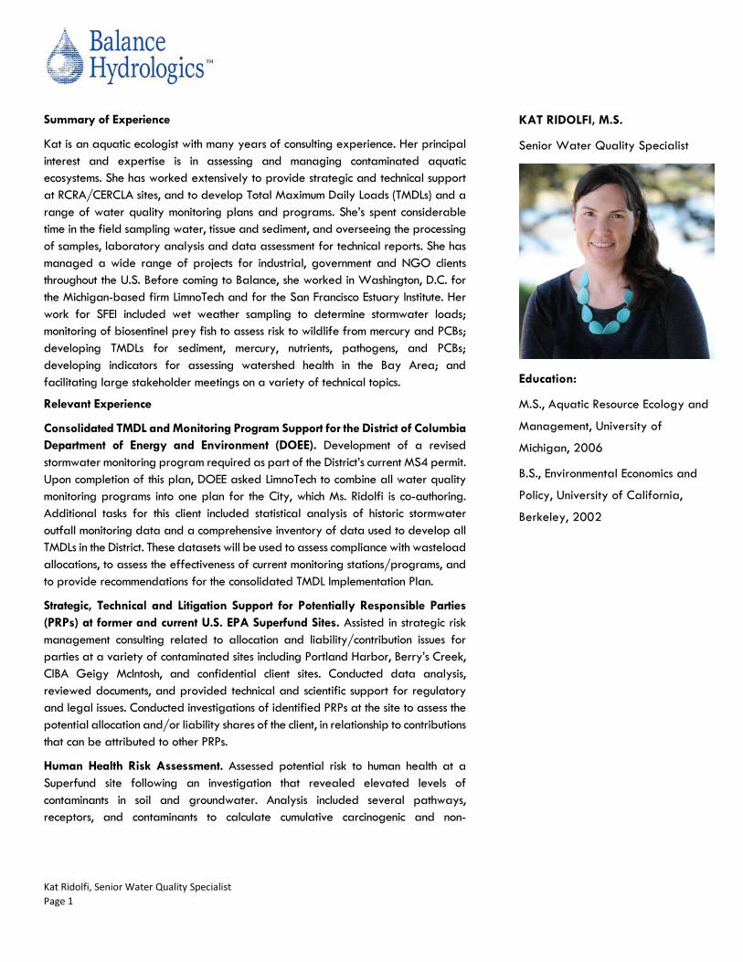
Kat Ridolfi, Senior Water Quality Specialist Page 1
Summary of Experience
Kat is an aquatic ecologist with many years of consulting experience. Her principal interest and expertise is in assessing and managing contaminated aquatic ecosystems. She has worked extensively to provide strategic and technical support at RCRA/CERCLA sites, and to develop Total Maximum Daily Loads (TMDLs) and a range of water quality monitoring plans and programs. She’s spent considerable time in the field sampling water, tissue and sediment, and overseeing the processing of samples, laboratory analysis and data assessment for technical reports. She has managed a wide range of projects for industrial, government and NGO clients throughout the U.S. Before coming to Balance, she worked in Washington, D.C. for the Michigan-based firm LimnoTech and for the San Francisco Estuary Institute. Her work for SFEI included wet weather sampling to determine stormwater loads; monitoring of biosentinel prey fish to assess risk to wildlife from mercury and PCBs; developing TMDLs for sediment, mercury, nutrients, pathogens, and PCBs; developing indicators for assessing watershed health in the Bay Area; and facilitating large stakeholder meetings on a variety of technical topics.
Relevant Experience
Consolidated TMDL and Monitoring Program Support for the District of Columbia Department of Energy and Environment (DOEE). Development of a revised stormwater monitoring program required as part of the District’s current MS4 permit. Upon completion of this plan, DOEE asked LimnoTech to combine all water quality monitoring programs into one plan for the City, which Ms. Ridolfi is co-authoring. Additional tasks for this client included statistical analysis of historic stormwater outfall monitoring data and a comprehensive inventory of data used to develop all TMDLs in the District. These datasets will be used to assess compliance with wasteload allocations, to assess the effectiveness of current monitoring stations/programs, and to provide recommendations for the consolidated TMDL Implementation Plan.
Strategic, Technical and Litigation Support for Potentially Responsible Parties (PRPs) at former and current U.S. EPA Superfund Sites. Assisted in strategic risk management consulting related to allocation and liability/contribution issues for parties at a variety of contaminated sites including Portland Harbor, Berry’s Creek, CIBA Geigy McIntosh, and confidential client sites. Conducted data analysis, reviewed documents, and provided technical and scientific support for regulatory and legal issues. Conducted investigations of identified PRPs at the site to assess the potential allocation and/or liability shares of the client, in relationship to contributions that can be attributed to other PRPs.
Human Health Risk Assessment. Assessed potential risk to human health at a Superfund site following an investigation that revealed elevated levels of contaminants in soil and groundwater. Analysis included several pathways, receptors, and contaminants to calculate cumulative carcinogenic and non-
KAT RIDOLFI, M.S.
Senior Water Quality Specialist
Education:
M.S., Aquatic Resource Ecology and
Management, University of
Michigan, 2006
B.S., Environmental Economics and
Policy, University of California,
Berkeley, 2002

Kat Ridolfi, Senior Water Quality Specialist Page 2
carcinogenic risk for the property. Risk-based target levels because cumulative target risk was exceeded for some pathways.
Technical Support for RCRA Regulatory Requirements. Assisted in completing/submitting RCRA permit application and materials for visual site inspection for industrial site under RCRA management.
Mercury and PCBs TMDLs. Collaborated with state and federal regulatory agencies to develop statewide TMDLs for the State of Michigan, the nearshore segment of Lake Michigan (IL), Tomales Bay (CA), and implementation plans for the entire San Francisco Bay (CA). Specific tasks included extensive collaboration/coordination over multiple years with regulatory agencies, co-authorship of TMDL documents in addition to compiling and analyzing databases, developing source analysis, and GIS mapping.
Comprehensive Plan to Reduce PCBs in the Spokane River. Developed source assessment, conceptual model, and inventory of BMP options for PCBs impacting the Spokane River. Work involved compiling data from a variety of state and local agencies, conducting gap analysis, identifying potential sources within the watershed, and developing conceptual model of fate, transport, and pathways of PCBs. With input from a large variety of stakeholders, completed an inventory of BMPs to reduce PCB loads to the River. Analysis of the BMP options included cost effectiveness and prioritizing the BMPs appropriate for the watershed.
Analysis of Cadmium Dynamics in a Massachusetts Reservoir. Led data analysis and investigation into why surface water and sediment concentrations of cadmium in the Neponset Reservoir (MA) were showing inconsistent patterns over time. Developed several lines of evidence supported by analysis on fate and transport of cadmium in the water column and sediments.
Environmental Assessment and NEPA/NHPA Review for Springhouse Run Restoration. Developed Environmental Assessment for restoration of a stream in the National Arboretum (Washington, DC). Work required extensive consultation with the State Historic Preservation Office and oversight of two comprehensive archaeological surveys to determine presence of archaeological artifacts in the site.
Watershed Restoration and Action Plan Template for the State of Minnesota. Developed template for local governments and watershed groups to write a watershed restoration and action plan. Plans will be used to prioritize implementation planning at a site-specific level within a watershed to protect aquatic habitat and recreation on streams and lakes. Co-wrote pilot report for the Pomme de Terre watershed as an example to be used by other watersheds.
Review of 316(b) Rule as it Relates to Fish Entrainment. Analyzed draft EPA regulations concerning cooling water intake systems and potential effects on fish communities for a nuclear power plant on Lake Michigan. Evaluated a range of methods to reduce entrainment and impingement of fish and compiled data needs for 316(b) permit application.
Watershed Assessments for Several Watersheds in Anne Arundel County, Maryland. Detailed habitat and geomorphic analysis of streams and other water management infrastructure throughout the county.
PCB Source Tracking for City of Camden, NJ. Sampled sediment from storm drains (dry and wet weather) in Camden in order to track source of PCB contamination.
DC Bacteria Translator. Developed a translator to convert bacteria TMDLs from fecal coliform to E. coli as mandated by new water quality standards. Work included review of other state translator methods, analysis of paired bacteria data collected in DC, evaluation of ability of DC monitoring strategy to support new water quality guidelines, and recommendation of translator to use in DC.
Green Infrastructure Site Selection. Identified criteria and metrics for DC Water to use in selecting sites for green infrastructure pilot projects.