special climate statement 44 – extreme rainfall and … also continued heavy falls along the...
TRANSCRIPT
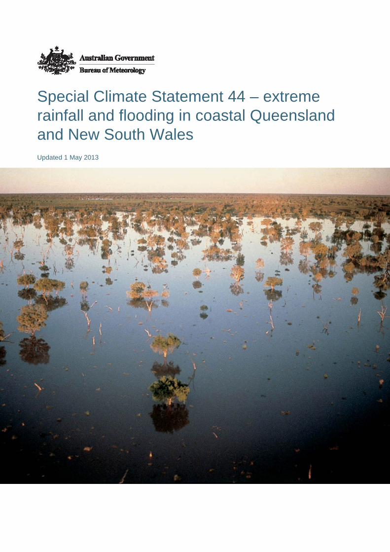
Special Climate Statement 44 – extreme rainfall and flooding in coastal Queensland and New South Wales Updated 1 May 2013

Special Climate Statement 44 – extreme rainfall and flooding in coastal Queensland and New South Wales
Published by the Bureau of Meteorology 2013
© Commonwealth of Australia 2013 This work is copyright. Apart from any use as permitted under the Copyright Act 1968, no part may be reproduced without prior written permission from the Bureau of Meteorology. Requests and inquiries concerning reproduction and rights should be addressed to the Publishing Unit, Bureau of Meteorology, GPO Box 1289, Melbourne 3001. Requests for reproduction of material from the Bureau website should be addressed to AMDISS, Bureau of Meteorology, at the same address.

Special Climate Statement 44 – extreme rainfall and flooding in coastal Queensland and New South Wales
i
Contents
1 Introduction......................................................................................................................1
2 Detailed assessment of the event ...................................................................................2
2.1 Rainfall during the event ......................................................................................2 2.2 Extreme single and multi-day rainfalls during the event ......................................3 2.3 Notable flooding arising from the rain event ........................................................4
Notes and contacts.................................................................................................................14

Special Climate Statement 44 – extreme rainfall and flooding in coastal Queensland and New South Wales
ii
List of Tables
Table 1. Daily rainfalls in excess of 400 millimetres recorded during the event. ........................9
Table 2. Selected long-term stations which have set daily rainfall records for January.. ...........10
Table 3. Highest catchment-averaged rainfalls during the event. ..............................................12
Table 4. Record flood heights reached during the event............................................................13
List of Figures
Figure 1. Rainfall for the period 22–29 January 2013. ...............................................................5
Figure 2. Areas with highest January daily rainfall on record on 27 and 28 January .................6
Figure 3. Queensland rainfall for January 2013, showing areas which have had their wettest January on record. .....................................................................................................................7
Figure 4. Highest flood classification reached in period 22–30 January 2013. ..........................8

Special Climate Statement 44 – extreme rainfall and flooding in coastal Queensland and New South Wales
1
Most of the east coast of Queensland, and the coast of New South Wales from the Illawarra northwards, experienced very heavy rainfall during the period from 22 to 29 January 2013, as a result of the former tropical cyclone Oswald tracking southwards along a track just inland from the Queensland coast. This rainfall resulted in severe flooding in many areas within 200 kilometres of the east coast, most notably in the Burnett catchment in Queensland and the Clarence catchment in northern New South Wales, both of which reached record flood peaks.
Oswald formed in the Gulf of Carpentaria on 21 January, and made landfall that night near Kowanyama, on the west coast of the Cape York Peninsula, as a category 1 system. It rapidly weakened after landfall and was downgraded to a tropical low on the morning of 22 January. The low moved near the east coast, being centred off Cooktown on 23 January and then tracked slowly to the south-southeast just inland from the coast. It was centred near Townsville on the 24th, became slow-moving in the St. Lawrence-Rockhampton area on the 25th and 26th, and then resumed a southwards track to be centred near Dalby on the 28th. It then accelerated southwards and moved offshore near Sydney on the 29th before moving out to sea.
Throughout its lifespan, the system brought heavy rainfall, especially in moist easterly to northeasterly flow on its southern flank. The system was also associated with strong winds, with numerous sites experiencing gusts in excess of 100 km/h, and coastal storm surges and high waves, as well as a number of tornadoes, particularly in the Bundaberg area. A storm surge of around 0.5 metres above normal tide levels was observed at several points along the Queensland and New South Wales coast, with 0.59 metres above normal tide levels observed at Tweed Heads, while offshore waves exceeding 12 metres were observed off Coffs Harbour. Significant coastal erosion and some inundation of foreshore areas were experienced.
There are few close precedents in the last 50 years for the track of Oswald. While a number of former tropical cyclones have moved far enough south to have significant impacts on New South Wales, most such systems have either originated over the Coral Sea and not approached the Queensland coast until south of the Tropic of Capricorn (e.g. Zoe 1974, Nancy 1990), or moved south from the Gulf of Carpentaria and tracked through western Queensland (e.g. Audrey 1964).
This statement describes notable extreme rainfalls and associated flooding. A detailed account of severe weather associated with the event, such as high winds and tornadoes, will be produced at a later date.
1 Introduction

Special Climate Statement 44 – extreme rainfall and flooding in coastal Queensland and New South Wales
2
2.1 Rainfall during the event
The first heavy rains directly associated with the system occurred on 22 January. Merluna, south-east of Weipa, received 202.4 millimetres in the 24 hours to 9 a.m. on the 22nd, with Kowanyama receiving 158.8 millimetres and Weipa 132.8. An easterly flow not directly associated with the core of Oswald also brought heavy rain on parts of the east coast, especially around Tully, where Menavale received 292.0 millimetres.
Extreme rainfalls continued in both areas on the 23rd. On the west coast of the Cape York Peninsula, RAAF Scherger received 366.8 millimetres, the heaviest daily rainfall in the region since 1985, while Weipa had 327.8 millimetres, a site record. Heavy rain also continued on the east coast with 280.4 millimetres at Tully.
The focus of extreme rainfalls then moved progressively southwards along, and in the area immediately inland from, the east coast. On the 24th peak rainfalls were between Cardwell and Mackay, including 405 millimetres at Paluma. The next day, the most extreme rainfalls were in the Rockhampton area. A number of sites within 40 kilometres of Rockhampton exceeded 400 millimetres, including 587 millimetres at Upper Dee (near Mount Morgan) and 556.6 millimetres at Pacific Heights, while Rockhampton itself received 349 millimetres.
On the 26th and 27th, the heaviest rainfalls were along and inland from the coast between Gladstone and Bundaberg. Boolaroo Tops, about 60 kilometres south-southwest of Gladstone, had 497 millimetres on the 26th and 468 millimetres on the 27th, for a two-day total of 965 millimetres, whilst other exceptional totals on the 27th, both in the area west of Childers, included 549 millimetres at Mount Rawdon and 480 millimetres at Walla.
The heaviest rain moved south on the 28th and was centred over southeast Queensland and the far northeast of New South Wales. The most extreme daily falls of the event occurred this day, centred on two areas; the Gold Coast hinterland and New South Wales border ranges, and parts of the Scenic Rim area on the southwestern edge of the Brisbane River catchment. Both areas had sites with 24-hour totals in excess of 700 millimetres, with Upper Springbrook, in the Gold Coast hinterland, receiving 744 millimetres and Mount Castle, on the Main Range north of Cunninghams Gap, 709 millimetres. Numerous sites in the Gold Coast hinterland exceeded 400 millimetres. In New South Wales, the highest total was 539 millimetres at Upper Rous River.
The last major day of the event was the 29th, with most of the New South Wales coast, and parts of the northern inland, receiving at least 50 millimetres in the 24 hours to 9 a.m. These falls also extended into the far east of Victoria. Heavier falls were widespread, with totals in the 100–200 millimetres range common in the Sydney region and the Illawarra, as well as scattered locations further north along the coast. There were also continued heavy falls along the Queensland–New South Wales border with
2 Detailed assessment of the event

Special Climate Statement 44 – extreme rainfall and flooding in coastal Queensland and New South Wales
3
another 377 millimetres at Upper Springbrook. Next day the rain moved out to sea with only light falls (mostly less than 10 millimetres) recorded.
Total rainfall for the 22–29 January period is shown in Figure 1. Almost all of the east coast from the Hunter north to Cape York received at least 200 millimetres, with totals in excess of 400 millimetres common on the Queensland coast from St. Lawrence south to the New South Wales border, as well as between Townsville and Cairns and on the west coast of the Cape York Peninsula. Much higher totals occurred in topographically favoured locations, with eight-day totals of 1496 millimetres at Upper Springbrook and 1426 millimetres at Boolaroo Tops. The highest total in New South Wales was 1046 millimetres at Upper Rous River. The rain was largely confined to areas within 300 kilometres of the coast, with most areas west of an Albury–Dubbo–Mitchell–Hughenden line receiving little or no rain from the event.
The event took place against a background of relatively dry antecedent conditions. Except for localised heavy falls on the Darling Downs and tropical regions north of Townsville, most of the region affected by the event had had less than 50 millimetres in the first three weeks of January, following a dry finish to 2012 in which rainfall for September–December was mostly at least 40 per cent below normal.
2.2 Extreme single and multi-day rainfalls during the event
Table 1 lists the highest daily rainfalls observed during the event. Upper Springbrook’s 744 millimetres on 28 January is the highest one-day rainfall in Australia since 772 millimetres fell at Coops Corner, on the Sunshine Coast, in August 2007.
Most of the sites where daily totals in excess of 400 millimetres occurred have relatively short data sets. A number of long-term sites set records, either for any month or for January (Table 2), with the most significant record-breaking taking place on 27 January (Figure 2) in the area inland from the southern Queensland coast, which is a region with limited historical experience of extreme daily rainfalls. Rockhampton (349.0 millimetres on 25 January) and Gladstone (254.4 millimetres on 25 January) both set all-time records for their current sites, and Bundaberg (252.0 millimetres on 27 January) a January record, but in all three cases there have been higher daily rainfalls at former sites in those towns. Gladstone did set records (all sites combined) for its highest 3-day (657.8 millimetres) and 4-day (819.8 millimetres) rainfalls – the latter total exceeded Gladstone’s previous record for a whole calendar month, and was more than the site received for the full year in either 2011 or 2012. In total, 26 sites with 80 years or more of data set all-time daily rainfall records, and another 28 set January records (Table 2).
A major feature of the event was the extent of the heavy rain through the coastal and near-coastal catchments, as indicated by catchment rainfall averages (Table 3). Most exceptionally, the catchment average of 206.8 millimetres for the Burnett catchment on 27 January exceeded the previous record (123.6 millimetres) by nearly 70 per cent.

Special Climate Statement 44 – extreme rainfall and flooding in coastal Queensland and New South Wales
4
The Burnett catchment also set records by large margins for highest 2-, 3- and 4-day timescales. Catchment records for daily rainfalls were also set for the Mary, Logan–Albert, Kolan and Burrum catchments, and numerous records were set at the 2-, 3- and 4-day timescales.
Over the Brisbane catchment, the highest 1-day rainfall ranked as the sixth-highest since 1900, with the 2-, 3- and 4-day rainfalls ranking second. Catchment total rainfall was slightly above that of the 2011 event for all time periods. In the Bremer sub-catchment the 2013 event ranks second behind 1974 (and ahead of 2011) for all time periods. The only significant record set for a large catchment in New South Wales was for a 3-day period for the Clarence catchment.
Despite the dry first three weeks of the month, the event was of sufficient magnitude for some parts of Queensland to have their wettest January on record, especially in a region extending from Gladstone south to Gayndah (Figure 3).
2.3 Notable flooding arising from the rain event
The heavy rains resulted in major flooding in many catchments along the coasts and adjacent inland of Queensland and far northern New South Wales, as well as in the headwaters of some inland-draining rivers (Figure 4).
The most severely-affected catchments were the Burnett, Burrum and Clarence catchments. All rivers, and various tributaries, reached record levels at numerous locations, including the major centres of Bundaberg and Grafton (Table 4). Conditions were particularly extreme in the upper Burnett catchment, where flood peaks exceeded previous records by several metres at some locations (the largest margin being 5.86 metres at Eidsvold). Most other rivers peaked below their highest levels of 2010–11, although the majority of southeast Queensland rivers reached major flood levels, with the Logan reaching its highest level since 1974 at Waterford Bridge.

Special Climate Statement 44 – extreme rainfall and flooding in coastal Queensland and New South Wales
5
Figure 1. Rainfall for the period 22–29 January 2013.

Special Climate Statement 44 – extreme rainfall and flooding in coastal Queensland and New South Wales
6
Figure 2. Areas with highest January daily rainfall on record (dark blue) on 27 January (top) and 28 January (bottom). Areas with daily rainfall above the 99th and 97th percentile are also shown.

Special Climate Statement 44 – extreme rainfall and flooding in coastal Queensland and New South Wales
7
Figure 3. Queensland rainfall for January 2013, showing areas which have had their wettest January on record.

Special Climate Statement 44 – extreme rainfall and flooding in coastal Queensland and New South Wales
8
Figure 4. Highest flood classification reached in period 22–30 January 2013.

Special Climate Statement 44 – extreme rainfall and flooding in coastal Queensland and New South Wales
9
Table 1. Daily rainfalls in excess of 400 millimetres recorded during the event. Date Rainfall (mm) Station number Station name 24 January 405.0 32064 Paluma 25 January 587.0
556.6 538.2 478.0 459.0 451.0 427.0 414.0
539053 33077 39067 39242 39043
539054 33008 39351
Upper Dee TM Pacific Heights Moonmera Broadmeadows Glenlands Besch’s Hill TM Byfield Upper Ulam Road
26 January 497.0 539122 Boolaroo Tops TM 27 January 549.0
480.0 468.0 422.0 407.0
539094 39313
539122 39068
539021
Mount Rawdon TM Walla TM Boolaroo Tops TM Mount Larcom Fig Tree TM
28 January 744.0 709.0 653.0 570.0 539.0 523.0 515.0 501.0 496.0 482.0 482.0 481.0 480.0 459.0 451.0 447.0 444.0 435.0 435.0 430.0 429.5 429.0 429.0 425.0 415.0 413.0 408.0 407.0 407.0 406.0 406.0 404.0 401.0
540400 540171 40550
540581 558080 40937 40534
540573 540438 540437 41134 40930 40882
540582 540290 540520 58036
540584 558032 40607
558049 540054 540612 41046 40845
540207 540519 40042 40197 40147
540138 540169 40335
Upper Springbrook Alert Mount Castle Alert Numinbah Springbrook TM Upper Rouse River Benobble Alert Wunburra Stony Creek Road TM Numinbah Valley Alert Numinbah Valley TM Top Plains Laheys Lookout Alert Numinbah Alert Bryn Euryn TM Canungra Army Alert Mount Nebo Alert Chillingham (Limpinwood) Illinbah TM Limpinwood Springbrook Road Huonbrook Little Nerang Dam Alert Little Nerang Dam HW TM The Head Binna Burra Alert Wilsons Peak Alert Upper Tenthill Alert Canungra Mount Tamborine Mount Nebo Mount Glorious Alert Thornton Alert Mount Tamborine Alert

Special Climate Statement 44 – extreme rainfall and flooding in coastal Queensland and New South Wales
10
Table 2. Selected long-term stations which have set daily rainfall records for January. All-time records are shown as bold with the previous all-time record shown below the previous January record, where applicable. Where two station numbers are shown combined records have been used.
Station number
Station name State Rainfall amount
(mm)
Date Previous record Years of
data 27000 28000 33008 33076 33077 35026 39004 39009 39019 39020 39043 39048 39049 39054 39057 39066/39039 39067 39068 39070 39073 39083/39082 39096 39104/39330 40013 40020 40021 40042 40060
Aurukun Laura Byfield Yaamba Pacific Heights Duaringa Baralaba Boona-Choppa Callemondah Calliope Station Glenlands Goovigen Gracemere Jambin Kalpowar Gayndah Moonmera Mount Larcom Mount Perry Mundubbera Rockhampton Wateranga Monto Bauple Blackbutt Biggenden Canungra Cooyar
QLD QLD QLD QLD QLD QLD
QLD QLD
QLD
QLD QLD QLD QLD QLD QLD QLD QLD
QLD QLD QLD QLD QLD QLD
QLD QLD
QLD
QLD
QLD
332.6 172.8 427.0 314.2 556.6 256.8
151.0 315.8
346.0
294.0 459.0 204.0 384.0 160.0 223.0 282.8 538.2
269.6 345.0 314.9 349.0 243.6 185.1
258.6 194.8
295.8
407.0
180.0
23/1 23/1 25/1 25/1 25/1 25/1
25/1 27/1
26/1
25/1 25/1 25/1 25/1 25/1 26/1 27/1 25/1
25/1 27/1 27/1 25/1 27/1 27/1
27/1 27/1
27/1
28/1
27/1
232.4 (11/1/1964) 132.1 (21/1/1907) 323.9 (11/1/1951) 253.5 (22/1/1918) 509.3 (31/1/1893) 154.9 (22/1/1918) 219.2 (20/12/1973)
104.5 (9/1/1996) 229.6 (28/1/1974) 253.5 (5/2/1931)
224.8 (22/1/1956) 330.2 (12/2/1947) 243.4 (31/1/1978) 262.4 (23/1/1955) 145.0 (31/1/1978) 215.1 (22/1/1956) 152.0 (31/1/1978) 170.2 (13/1/1968) 185.4 (20/1/1929) 208.3 (23/1/1918) 381.0 (21/2/1929) 252.2 (31/1/1978) 339.1 (23/1/1890) 178.6 (20/1/1929) 267.5 (29/1/1896) 164.1 (16/1/1913) 141.2 (22/1/1956) 152.1 (10/2/1942) 225.2 (8/1/2011)
149.2 (10/1/2011) 181.0 (9/2/1999) 161.0 (9/1/1968)
246.4 (13/7/1954) 250.0 (27/1/1974) 305.0 (7/2/2010)
179.6 (12/1/1910)
96 110 82
111 120 123
85 85
80
100 81 80
109 84 80
143 107
98
122 100 142 80 83
104 97
113
93
107

Special Climate Statement 44 – extreme rainfall and flooding in coastal Queensland and New South Wales
11
40093 40096 40113 40126 40135 40151 40198 40199 40200 40255 40400 40550 40922/40112 41108 55046 55047 55062 56023 57024 57103 60013 61082 61100 84002 84014
Gympie Helidon Kumbia Maryborough Moogerah Dam Mungar Junction Tarome Tarong Theebine Wooroolin Moorang Numinbah Kingaroy Beau Maison Pine Ridge Valais Werris Creek Old Koreelah Woodenbong Kookabookra Forster-Tuncurry Wyee Broke Bonang Dellicknora
QLD QLD QLD
QLD QLD
QLD QLD QLD QLD QLD QLD QLD QLD
QLD
NSW
NSW NSW NSW
NSW NSW NSW NSW NSW VIC VIC
239.2 156.4 203.0
258.8 293.0
231.0 297.6 177.0 360.0 210.0 321.0 653.0 234.0
154.2
131.0
127.0 109.4 205.0
215.2 102.4 181.0 171.8 85.0 117.0 136.0
27/1 28/1 27/1
27/1 28/1
27/1 28/1 27/1 27/1 27/1 28/1 28/1 27/1
20/1
29/1
29/1 29/1 28/1
28/1 28/1 28/1 29/1 29/1 29/1 29/1
176.0 (10/1/1898) 127.0 (27/1/1974) 113.4 (23/1/1996) 146.1 (28/12/1921) 250.7 (31/1/1893) 217.7 (24/1/1947) 243.4 (8/2/1991)
201.0 (10/1/1996) 247.0 (27/1/1974) 139.7 (20/1/1929) 283.2 (8/1/2011)
142.5 (20/1/1929) 243.0 (27/1/1974) 525.3 (24/1/1947) 129.4 (4/1/1996) 169.0 (8/2/1981)
124.5 (21/1/1956) 136.1 (5/11/1938) 106.0 (23/1/1991) 114.8 (24/2/1955) 126.2 (30/1/1984) 104.2 (8/1/1974) 143.0 (5/1/2008)
176.8 (19/2/1961) 136.7 (20/1/1938) 97.8 (13/1/1968)
142.7 (13/1/1911) 148.6 (15/1/1948) 83.0 (17/1/1988) 77.2 (8/1/1934)
127.0 (28/1/1920)
125 118 93
125 88
118 99 90
106 95 84 84
108
94
81
130 121 100
80 82
115 113 94
121 96

Special Climate Statement 44 – extreme rainfall and flooding in coastal Queensland and New South Wales
12
Table 3. Highest catchment-averaged rainfalls during the event. Values shown in bold are the highest on record for that catchment/period. Catchments marked (*) are sub-catchments of the Brisbane River system. Catchment Number
of days Highest
rainfall (mm) Period ending
Record in 1900-2012 period (mm)
Boyne 1 2 3 4
280.79 508.07 731.86 804.72
26/1 26/1 27/1 27/1
361.65 (12/2/1947) 414.48 (11-12/2/1947) 463.20 (11-13/2/1947) 473.56 (11-14/2/1947)
Bremer* 1 2 3 4
197.91 278.62 311.35 329.03
28/1 28/1 28/1 29/1
215.36 (27/1/1974) 371.57 (26-27/1/1974) 427.79 (25-27/1/1974) 469.19 (25-28/1/1974)
Brisbane 1 2 3 4
133.86 263.15 302.02 316.17
28/1 28/1 28/1 28/1
170.69 (27/1/1974) 279.24 (26-27/1/1974) 348.51 (25-27/1/1974) 397.44 (25-28/1/1974)
Burnett 1 2 3 4
206.82 255.07 304.63 326.72
27/1 27/1 27/1 28/1
123.61 (20/1/1929) 175.60 (20-21/1/1929) 190.43 (19-21/1/1929) 212.33 (11-14/7/1954)
Burrum 1 2 3 4
263.71 348.48 430.88 442.52
27/1 27/1 27/1 27/1
255.45 (21/2/1992) 419.11 (16-17/1/1913) 498.89 (15-17/1/1913) 517.99 (14-17/1/1913)
Clarence 1 2 3 4
145.44 213.72 278.37 290.62
28/1 28/1 29/1 29/1
186.60 (21/2/1954) 229.72 (9-10/3/2001) 266.51 (9-11/3/2001) 296.47 (10-13/3/1974)
Fitzroy 1 2 3 4
93.16 142.64 171.68 199.35
25/1 26/1 26/1 27/1
97.44 (17/2/1959) 165.97 (22-23/1/1918) 203.49 (20-22/4/1928) 217.06 (19-22/4/1928)
Kolan 1 2 3 4
280.21 448.77 578.22 614.72
27/1 27/1 27/1 27/1
251.38 (16/1/1913) 412.43 (16-17/1/1913) 512.08 (15-17/1/1913) 565.12 (15-18/1/1913)
Lockyer* 1 2 3 4
139.29 236.95 276.49 296.37
28/1 28/1 28/1 29/1
155.15 (27/1/1974) 247.39 (26-27/1/1974) 294.33 (26-28/1/1974) 337.73 (25-28/1/1974)
Logan-Albert 1 2 3 4
208.84 272.63 309.31 333.67
28/1 28/1 29/1 29/1
184.58 (26/1/1974) 352.76 (26-27/1/1974) 420.49 (25-27/1/1974) 451.33 (25-28/1/1974)

Special Climate Statement 44 – extreme rainfall and flooding in coastal Queensland and New South Wales
13
Mary 1 2 3 4
250.67 317.65 384.69 451.67
27/1 28/1 27/1 28/1
229.55 (28/3/1955) 348.65 (27-28/3/1955) 362.95 (26-28/3/1955) 388.72 (8-11/1/1968)
Richmond 1 2 3 4
140.50 199.60 256.08 269.53
28/1 28/1 29/1 29/1
235.24 (21/2/1954) 338.29 (20-21/2/1954) 374.85 (10-12/3/1974) 437.90 (10-13/3/1974)
Tweed 1 2 3 4
276.52 416.57 502.90 539.46
28/1 29/1 29/1 29/1
325.05 (6/2/1931) 441.05 (5-6/2/1931) 566.41 (4-6/2/1931) 625.43 (4-7/2/1931)
Table 4. Record flood heights reached during the event at sites with 40 years or more of data.
River Location Peak flood height (m)
Date Previous record (m)
Clarence Clarence Burnett Burnett Burnett Burnett Burnett Burnett Burnett Burnett Burnett Boyne Boyne Baffle Boonara Creek Lockyer Creek Bremer Burrum Burrum Barambah Ck Kolan Kolan Don Don Condamine Weir
Grafton Ulmarra Abercorn TM Yarrol Ceratodus Wuruma Dam Eidsvold Mt. Lawless Walla Woongarra Bundaberg Proston Gayndah Flume Mimdale Ettiewyn Mulgowie Kalbar Bruce Highway Burrum Highway Ban Ban Springfield Gin Gin Creek Goovigen Rannes Emu Vale Ballymena
8.09 6.08 11.15 12.45 19.93 3.74 22.06 17.98 23.25 17.55 9.53 12.42 17.48 22.33 11.39 9.27 11.00 14.29 13.60 14.00 14.35 16.00 11.03 14.05 8.89 11.22
29/1 29/1 27/1 26/1 27/1 27/1 27/1 28/1 28/1 29/1 29/1 27/1 28/1 27/1 27/1 28/1 28/1 27/1 27/1 27/1 26/1 27/1 27/1 26/1 28/1 30/1
7.89 (Mar 1890) 6.08 (Mar 1890) 8.5 (Jan 1996) 10.98 (Mar 1992) 15.8 (1893) 3.38 (Dec 2010) 16.20 (Dec 2010) 17.18 (Feb 1942) 23.11 (Jan 1890) 17.03 (Jan 1890) 9.04 (Jan 1890) 9.56 (Jan 2011) 16.34 (Dec 2010) 20.12 (Feb 1971) 10.33 (Jan 2011) 9.14 (Jan 1976) 10.95 (Feb 1991) 13.84 (Jan 1996) 12.17 (Mar 1992) 10.15 (Feb 1971) 12.27 (Mar 1992) 12.66 (Mar 1992) 10.82 (Feb 1978) 12.60 (Dec 1973) 7.59 (May 1996) 11.14 (Dec 2010)
Special Climate Statement 44 – extreme rainfall and flooding in coastal Queensland and New South Wales
14
Values in this statement are current as of 24 April 2013, and subject to the Bureau’s normal quality control processes. Rainfall data from telemetry gauges (those with ALERT, AL (Alert) or TM (Telemetered) in their names) may be from non-Bureau owned stations and includes real-time operational data from automated systems and has not been checked.
The data set from which area averages and other spatial analyses are drawn commences in 1900.
The following climatologists may be contacted for further information about this event:
Dr Blair Trewin (03) 9669 4623 (national)
Dr Aaron Coutts-Smith (02) 9296 1525 (NSW)
Dr Jeff Sabburg (07) 3239 8660 (Queensland)
Notes and contacts