space weather – learn from the meteorologists
TRANSCRIPT
CCMC Workshop 2005Clearwater Florida
Space Weather – Learn from the Meteorologists
Dr. Robert McCoy321 SP
Office of Naval Research(703) 696-8699
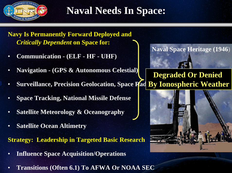
Naval Needs In Space:
Navy Is Permanently Forward Deployed and Critically Dependent on Space for:
• Communication - (ELF - HF - UHF)
• Navigation - (GPS & Autonomous Celestial)
• Surveillance, Precision Geolocation, Space Radar
• Space Tracking, National Missile Defense
• Satellite Meteorology & Oceanography
• Satellite Ocean Altimetry
Strategy: Leadership in Targeted Basic Research
• Influence Space Acquisition/Operations
• Transitions (Often 6.1) To AFWA Or NOAA SEC
Naval Space Heritage (1946)
Degraded Or Denied By Ionospheric Weather
Outline
• Motivation for Improved Ionospheric Specification & Forecast
• Ultraviolet Remote Sensing of the Thermosphere & Ionosphere
– RAIDS, HIRAAS, GIMI, SSULI Operational Sensors on DMSP
– RF Satellite Instruments (GPS Occultation, CIT)
• Global Assimilation of Ionospheric Measurements (GAIM)
• Ionospheric Scintillation & Imaging from Geosynchronous Orbit (IMAGER)
• Ocean to Space Seamless Models

Precision Geolocation of RF Emitters
HF
Ionosphere
Geolocation Error Ellipse
HigherFrequencies
Naval Information Warfare Activity (NIWA)
Ionospheric & Scintillation Effects on
Naval Systems
Forward Element
93 km
UHF Controller
5-10 Min. Message Delays
TLAM
Range Errors
15-100 m Errors;Loss of Lock
TMDGPS
20-50 min Message Delays at Solar Maximum
Fire Control
NAV
Message Updates During Loiter Phase
Theater Ionospheric Imaging DRI/BE
Scintillation
RefractionTime DelaysPhase Shifts
Faraday RotationDispersion
UFOFLTSATCOM
GPS
HF Comm.OTH Radar
Reflection
Ionospheric EffectsIonospheric Effects
GFOAltimetry
Selective Availability Ionosphere Troposphere
Orbit & Clock
Multipath
Noise
GPS Navigation Error Budget
Largest single source of error

Difficulties for Ionospheric Models
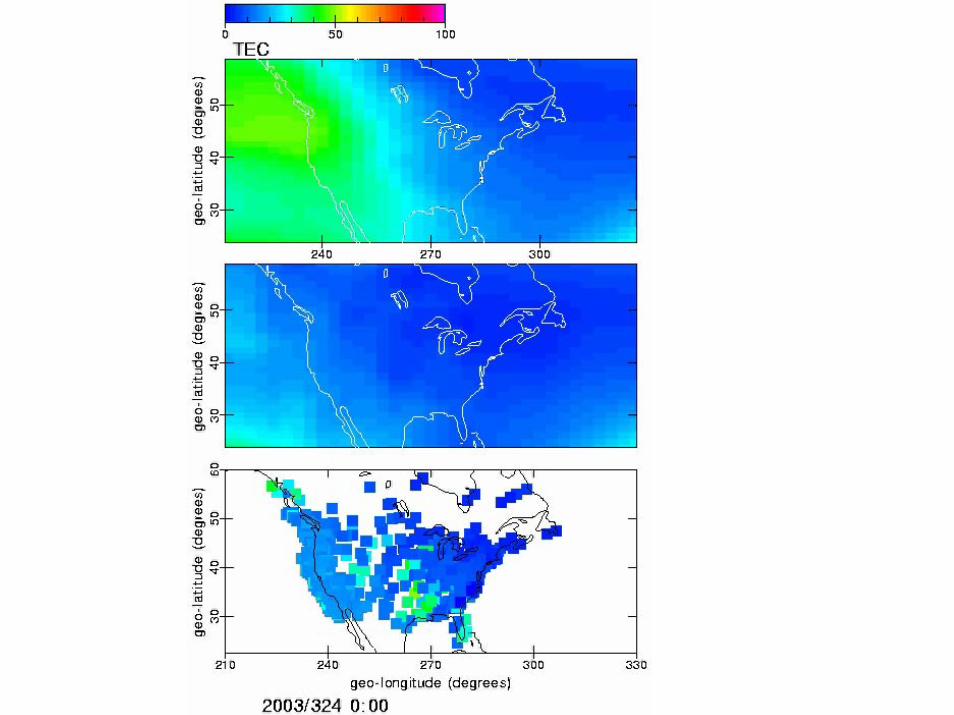
Apr 2002
Feb 2002
TE
C e
cm
-2
Daily Measured Values
Variability: Daily, Seasonal, Solar Cycle
Forcing: Solar EUV, X-ray, Solar Wind, Winds, Fields,
Tides, Convection, Dynamics
“Weather”

Regional Observations: Atmosphere
Over 3000 aircraft provide reports of pressure, winds and temperature during flight.
From a network of roughly 900 upper-air stations, radiosondes, attached to free-rising balloons, make measurements of pressure, wind velocity, temperature and humidity from just above ground to heights of up to 30km
158 Operational sites, providing humidity, reflectivity information, in a 250 mile radius around each site
Observ ations: Global Satellite Systems
Winds from fiv e geos are b eing p rocessed every six hours to prod uce vect ors of c ompa rable accuracy ( hi winds com pare within 7 m /s of raobs); GOES and M eteosat winds ar e being produce d every thre e hou rs on most d ays
Regional Observations: Surface and Hydrological
The backbone of the surface-based sub-system continues to be about 10,000 stations on land making observations of meteorological parameters such as atmospheric pressure, wind speed and direction, air temperature and relative humidity.
Automated Surface Observing Systemprovides weather observations which include: temperature, dew point, wind, altimeter setting, visibility, sky condition, and precipitation up to approx 10,000 ft. 569 FAA-sponsored and 313 NWS-sponsored ASOSs are installed at airports throughout the country
Cooperative Observer Network: 11,400 volunteer observers provide 24 hr max/min weather observations which include: temperature, precip, snow, and hydrology at non-airport locations
Surface
BalloonsBuoys
Aircraft
DMSP, POES
GOES
Rocketsondes
>5.5 MillionObservations/Day
Meteorological Weather Specification & ForecastBasic Physics Algorithms + Continuous Observations
Naval Operational Global Atmospheric Prediction System (NOGAPS)
Courtesy Marie Colton

Data Sources For Assimilating Ionospheric Model
DMSP
GPS
IonosphericTomography
In-Situ
Digisonde Network
SSIES
Occultation (COSMIC)
UV
Limb
Nadi
r
SSULISSUSI

New Optical Data Sources
ARGOS23 Feb, 1999
HIRAAS
Electron Density
29 Mar 31 Mar 01 Apr 03 Apr
F10.7: 261 Ap: 9
F10.7: 245 Ap: 48
F10.7: 257 Ap: 39
F10.7: 223 Ap: 9
1 2
3 4
5 6
7
8
RAIDS

6 Satellites In 3 Orbital Planes; 700 km;3000 Occultations/Day
Constellation Observing System for Meteorology, Ionosphere & Climate (COSMIC) (UCAR )
GPS Occultation ReceiverNadir UV Photometer
3-Frequency Beacon (TRANSIT)
Profiles of Ionospheric Electron Density Lower Atmospheric Refractivity (Temp, Pressure & Water Vapor)
Sponsors:
Taiwan NSPO ($80M) + U.S. Consortium($16M): NSF, NOAA, NASA, STP, USAF, ONR
1
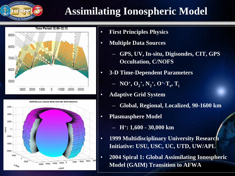
Assimilating Ionospheric Model
• First Principles Physics
• Multiple Data Sources
– GPS, UV, In-situ, Digisondes, CIT, GPS Occultation, C/NOFS
• 3-D Time-Dependent Parameters
– NO+, O2+, N2
+, O+, Te, Ti
• Adaptive Grid System
– Global, Regional, Localized, 90-1600 km
• Plasmasphere Model
– H+: 1,600 - 30,000 km
• 1999 Multidisciplinary University Research Initiative: USU, USC, UC, UTD, UW/APL
• 2004 Spiral 1: Global Assimilating Ionospheric Model (GAIM) Transition to AFWA

Utah State NRL AFWA
NOAA SEC
CCMC
AFRL
NSF SPAWARMDA DTRA
Customer
NASA
NG
Transition Path
Sponsors
GAIM TransitionGlobal Assimilation of Ionospheric Measurements
CCMC: Community Coordinated Modeling CenterSMC: Space & Missile System CenterNG: Northrop GrummanAFWA: Air Force Weather AgencySEC: Space Environment Center ?
Customer
Gauss-Markov Kalman Filter
Full PhysicsKalman Filter
3/06
7/07
V&V
V&V
Spiral Development

Halloween Storm Oct 2003
1915 UT 2025 UT 2215 UT
• Storm Enhanced Density (SED) Plumes– Illustrated by Total Electron Content (TEC) from 900+ GPS Receivers & TOPEX (Southern Hemisphere)– Penetration of Magnetospheric Electric Fields into MidlatitudeIonosphere– Shut Down $4.5B FAA WAAS System for 30+ hours
Basu - B. U.
1915 UT 2025 UT 2215 UT

Radar Echoes over Jicamarca Peru
Ionospheric Bubbles & Scintillation
NRL Model Simulation of the Development Of
An Ionospheric Bubble Leading to Ionospheric Scintillation
Ionospheric Irregularities & Scintillation

High Space/Time Resolution Ionospheric Imaging
Low Latitudes (Diego Garcia)
Mid Latitudes (Puerto Rico)

Extreme and Far-Ultraviolet Camera•1000 km by 1000 km field of view•10 km by 10 km spatial resolution•100 second temporal resolution
1000 km x 1000 km
Ionospheric Mapping
and Geocoronal Experiment (IMAGER)

Assimilating Model Grid Sizes
GlobalGrid
RegionalGrid
SynopticGrid

New Modeling Initiative: Ocean to SpaceDefense Threat Reduction Agency (DTRA)
Ocean
Troposphere
Mesosphere
Thermosphere
Stratosphere
Exosphere
Whole Atmosphere Community
Climate Model (WACCM)
NCAR
NOGAPS- ALPANRL
ρv2Ionosphere