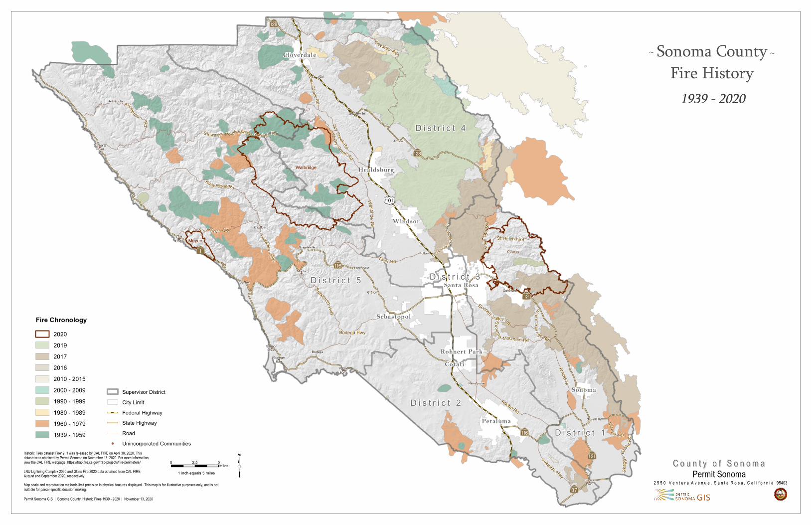
sonoma county fire history
TRANSCRIPT
Walbridge
MeyersGlassMark We st
Sprin
gsRd
Aç
AÜ
?̀
Aà
?Ý
Aç
AÜ
KÍ
?Ô
D i s t r i c t 5
D i s t r i c t 2
D i s t r i c t 4
D i s t r i c t 1
D i s t r i c t 3
Annapolis
Asti
BodegaBodega
Bay
Cazadero
FortRoss
Fulton
Geyserville
Graton
Guerneville
Jenner
Jimtown
Oakmont
Penngrove
SalmonCreek
Schellville
SearsPoint
ForestvilleMonte
Rio
StewartsPoint
ValleyFord
Ram
al Rd
CazaderoHwy
St Helena Rd
Lakeville Hwy
Sonoma Mountain Rd
Adobe Rd
WDry Creek Rd
Dry Creek Rd
Bennett Valley Rd
Fo rtRo s s R d
Annapo lis Rd
River Rd
King Ridge Rd
Stewarts Point Skaggs Springs Rd
Arnold Dr
Warm
Spri ngs Rd
DutcherCreek Rd
Skag
gsIsla
ndRd
Calist
oga R
dBohemian Hwy
Westside
Rd
Geysers Rd
Bodega Hwy
Cotati
Sonoma
Windsor
Healdsburg
Sebastopol
Rohnert Park
Santa Rosa
Cloverdale
Petaluma
1939 - 2020
Historic Fires dataset Fire19_1 was released by CAL FIRE on April 30, 2020. This dataset was obtained by Permit Sonoma on November 13, 2020. For more information view the CAL FIRE webpage: https://frap.fire.ca.gov/frap-projects/fire-perimeters/LNU Lightning Complex 2020 and Glass Fire 2020 data obtained from CAL FIRE August and September 2020, respectively.
Permit Sonoma GIS | Sonoma County, Historic Fires 1939 - 2020 | November 13, 2020
Map scale and reproduction methods limit precision in physical features displayed. This map is for illustrative purposes only, and is notsuitable for parcel-specific decision making.
t0 52.5 Miles1 inch equals 5 miles
2 5 5 0 V e n t u r a A v e n u e , S a n t a R o s a , C a l i f o r n i a 95403Permit Sonoma
C o u n t y o f S o n o m aC o u n t y o f S o n o m a
Supervisor DistrictCity LimitFederal HighwayState HighwayRoad
! Unincorporated Communities
Fire Chronology20202019201720162010 - 20152000 - 20091990 - 19991980 - 19891960 - 19791939 - 1959
~ Sonoma CountyFire History
~