soil chemistry analysis as an effective cultural resource
TRANSCRIPT

W&M ScholarWorks W&M ScholarWorks
Dissertations, Theses, and Masters Projects Theses, Dissertations, & Master Projects
2007
Soil Chemistry Analysis as an Effective Cultural Resource Soil Chemistry Analysis as an Effective Cultural Resource
Management Tool: A Magical Mystery Tour Management Tool: A Magical Mystery Tour
Nathan David Lawrence College of William & Mary - Arts & Sciences
Follow this and additional works at: https://scholarworks.wm.edu/etd
Part of the Biological and Physical Anthropology Commons, and the Cultural Resource Management
and Policy Analysis Commons
Recommended Citation Recommended Citation Lawrence, Nathan David, "Soil Chemistry Analysis as an Effective Cultural Resource Management Tool: A Magical Mystery Tour" (2007). Dissertations, Theses, and Masters Projects. Paper 1539626532. https://dx.doi.org/doi:10.21220/s2-327s-w122
This Thesis is brought to you for free and open access by the Theses, Dissertations, & Master Projects at W&M ScholarWorks. It has been accepted for inclusion in Dissertations, Theses, and Masters Projects by an authorized administrator of W&M ScholarWorks. For more information, please contact [email protected].

Soil Chemistry Analysis a s an Effective Cultural R esource M anagem entTool: A Magical Mystery Tour
Nathan David Lawrence
Williamsburg, Virginia
Bachelor of Arts, Franklin and Marshall College, 2003
A Thesis presented to the G raduate Faculty of the College of William and Mary in Candidacy for the Degree of
M aster of Arts
Departm ent of Anthropology
The College of William and Mary May, 2007

APPROVAL PAGE
This Thesis is submitted in partial fulfillment of the requirements for the degree of
Master of Arts
Nathan David Lawrence
, 2007Approved Jaw ie Committe
Committee Chair Assistant Professor Martin Gallivan, Anthropology
The College of William and Mary
Assistant Professdr Frederick H. Smith, Anthropology The College of Willianruand Mary
/ f Dr. Gkwett-Fesler mes Riiver Institute for Archaeology, Inc.

ABSTRACT PAGE
In my thesis I highlight the strengths and weaknesses of soil chemistry analysis in the context of cultural resource management (CRM). Cultural resource management is the “for-profit” sector of the archaeological discipline, arising as a result of the National Environmental Protection Act of 1966. While the history of soil chemistry is well documented and its applications broad and diverse in academia, cultural resource archaeologists have been slow integrate this manner of testing into their fieldwork. One of the common reasons for this is the belief that soil chemistry is too expensive, time consuming and the results do not justify the methods. However, this is not the case. Soil chemistry, especially the phosphate spot test, can be a quick and cost-effective method of gathering archaeological data, especially when sources such as the artifact record are lacking. While it is true that extensive chemical analysis can be a complicated process, it is these basic methods that are of greatest use to the archaeologist in the field.
These types of testing are of great use in specific contexts such as plowzone studies and determining activity use areas. In addition, soil chemical analysis strengthens the case for practice theory as an appropriate theoretical framework for explaining the various uses of social and physical space. How and why cultures manipulate the environment is closely tied to the manner in which individuals in the culture’s past engaged in the same activities. This reliance on the past is used in the present and carried forward to shape the future.
It is my hope that this thesis demonstrates the value of soil chemistry analysis in the context of CRM and supports the argument for its increased use. It has been proven that this method of study has the potential to yield significant results and therefore should be integrated into the methodological framework of CRM in general and utilized whenever possible.
TABLE OF CONTENTS
With a Little Help From My Friends: Acknowledgements...............................................ii
Revolution: Introduction................................... 1
Come Together: The Divides in Archaeology...................................................................6
Get Back: Theoretical Background ............................................. 13
The Long and Winding Road: A History of Soil Chemistry Analysis........................... 22
Hello, Goodbye: The Bridgeway Site (44SK406)...........................................................31
We Can Work it Out: Analysis ........ 41
Good Night: Conclusions......................................................................................... 58
In My Life: Closing........................................................................................................62
Works Cited............................... 64
Vita..................................................................... 70
i

WITH A LITTLE HELP FROM MY FRIENDS: ACKNOWLEDGEMENTS
This thesis would not have been completed without the support of numerous
individuals. First I must thank Anthony W. Smith and the rest of the crew who
completed work on the Bridge way Site after I was forced to leave the project due to
injury. I was given regular reports and when I began writing this work the data I was
provided were second to none. It is because of their hard work that I am able to present
what follows.
Secondly I am indebted to the other members of JRIA for their assistance through
this process. From the gathering of references to providing the hardware and software
necessary to complete analysis, the company could not have been more accommodating.
I would also like to thank the members of my committee, Martin Gallivan,
committee chair, Frederick H. Smith, and Garrett Fesler, who have taken the time to
ensure that I produced a quality paper.
Finally I would like to thank all my family and friends who have encouraged,
forcefully when necessary, me in completing this endeavor. Their support has helped me
complete what has been, in many ways, one of the most trying years of my life and I will
be forever grateful.
REVOLUTIONS INTRODUCTION
There is no shortage of questions we can ask of the archaeological record.
However, our ability to answer these questions, in addition to answering them in a
manner that withstands scrutiny, is often called into question, both by our peers and the
public at large. An archaeologist must formulate answers which not only attempt to
accurately interpret the past, but are appropriate given the strategies we employ. The
proven methods of locating sites, be they through historical research and/or field survey,
then subsequently excavating their artifacts and features provides a wealth of data, but it
is often useful to pursue other methods, what one might term as falling outside the norm,
as well. While these possibly unorthodox approaches must be employed when more
traditional methods of gathering information cannot be utilized, it can also be beneficial
to supplement tried and true methods with additional data sets. The challenge is to
understand what these different methods can and cannot tell us and subsequently use
them to augment one another rather than simply rely on one or even worse, use them in a
contradictory fashion. One of these areas is soil chemistry studies.
One of the keystones of archaeological research in a cultural resource
management (CRM) setting is the shovel test pit. This is simply a hole the archaeologist
digs to subsoil, screens the excavated soil, and collects any artifacts that are present. The
presence or absence of artifacts and their type determine if in fact a site is present and
possibly an inference into the manner, for example prehistoric or small farmstead, of the
area in question. If the collection of a soil sample is added to this scenario, then the
avenues of study become more diverse. Often the information gained from soil chemistry
1

analysis can serve to strengthen the data found in the artifact record or shed light a part of
the past that was previously unavailable.
By analyzing the chemical make-up of the soil from an archaeological site, it is
possible to assess the types of activities the area might have been used for in the past.
This is an especially appealing avenue of research when there is little or no mention of
the site in the documentary record and/or the site contains few, if any, features and also
has a low artifact density. House areas of enslaved Africans are one example of this and
such sites will be discussed later. But the question still remains: why is soil chemistry, in
my opinion, underutilized? There seems to be an overlying belief in the archaeological
community, especially in the field of CRM, that analysis of this type often does not return
on the investment put into it. While it is true that soil chemistry is slowly gaining
acceptance, my hope is that this thesis will help to speed up this process, especially with
regards to cultural resource management. The question becomes: of what value is soil
chemistry analysis to this context of archaeological testing? I hope to prove that it can
become a vital part of contract archaeology, given its potential for determining area usage
in the past. I feel that soil chemistry is a method for determining how a past culture
ordered the physical space in which it existed. This is valuable information for any
archaeological excavation and the fact that soil chemistry analysis achieves this goal in a
rapid and cost-effective manner strengthens the argument. These are issues I will explore
in this thesis.
The lack of soil chemistry use in CRM is symptomatic of a larger problem in
archaeology, namely the need to break down the barriers that separate us such as
academics vs. non-academics, “public” vs. “scientific” writing and the ever changing
2
theoretical perspectives with which we align ourselves. Once we approach these divides
from a cooperative, rather than antagonistic, perspective progress can be made that will
be beneficial to both sides. After ail examination of these barriers I will turn more
specifically to soil chemistry and its application. The first area that requires discussion is
theory. Soil chemistry analysis is based upon the assumption that past cultures engaged
in specific activities in a repetitive and constant nature in space. Practice theory provides
us with the proper framework to draw these conclusions. Individuals engage in repetitive
acts based on their interpretation of the past and how this past shapes their present and
future. In this way events of the past exert a force on the future long after they have
ceased to occur.
Next, a discussion of the development of soil chemistry as an analytical science
applicable to historical archaeology is necessary. Soil chemistry analysis has been in
practice for almost a century and it in necessary to understand this past if one is to make
use of the various chemical tests available in the present. By employing soil chemistry
analysis on a test site, I shall demonstrate its effectiveness as an archaeological tool in a
CRM context. An example of soil chemistry being used as a supplemental testing
strategy in a CRM project is the Bridgeway Site, 44SK406, in Suffolk, Virginia. Given
the amount of disturbance the site had endured and its environmental conditions, soil
chemistry analysis was an ideal choice for testing. The analysis of the data gathered,
which consisted of studying levels of the elements phosphorous, calcium, potassium, and
magnesium, help to determine the manner in which the past residents of the Bridgeway
Site ordered and utilized their physical space, namely designating specific spaces for
specific purposes. Soil chemistry aided in determining that areas of 44SK406 were used
3

primarily for waste disposal while the burial ground, even though it was in close
proximity to dwellings, was void of human activity. This analysis was particularly
insightful given the lack of artifacts found on the site; however the most complete picture
of the past was obtained when the artifact and feature record was utilized in conjunction
with the soil chemistry data. Questions that could not have been answered by one single
data set were made clearer when the evidence was looked at in summation. In addition to
the methods employed at the Bridgeway Site, my research exposed me to other methods
of soil chemistry analysis. One in particular, the Eidt spot test, serves as an example of
how chemical analysis can be a quick, easy, and inexpensive way of gathering data.
These three requirements are especially valuable in the context of CRM.
Most historical archaeologists are familiar with the standard methods of
excavation (i.e. shovels, trowels, and screens used to collect artifacts), but soil chemistry
testing yields a different data set, one that is not so visible but no less valuable. Once it is
clear exactly what soil chemistry can and cannot tell archaeologists, it is possible to
integrate these methods into the already present framework of CRM archaeology and
form a more complete picture of the site in question. Sometimes soil chemistry analysis
will correlate with other forms of data and sometimes it will not, it is the j ob of
archaeologists to determine why these inconsistencies exist. It helps to put in perspective
my belief that soil chemistry has a valuable place in the greater arena of archaeological
research, as long as we clearly define what it is and is not capable of accomplishing.
Once its strengths and weaknesses are revealed we are able to see that soil chemistry
studies are a means of determining cultural activity in physical space. I feel the evidence
4

demonstrates that data gathered from soil chemistry analysis accurately reflects site usage
in the past and with regards to CRM, this data is gathered in an efficient manner.
When one looks at the traditional methods of archaeological research in a CRM
context, namely shovel testing and test units, one finds that while effective, they are time
consuming and therefore expensive, especially in today’s “get it done yesterday” business
climate. If it is possible for soil chemistry testing to provide us with reliable data quickly
and inexpensively for a site that can be integrated with more traditional data sets, then the
results for the CRM community can only be positive. While the field of CRM is not what
the majority of theses at present focus on, I feel that this needs to change. Statistics from
a 2005 study conducted by Association Research Inc. for the Society for American
Archaeology in association with the Society for Historical Archaeology indicate that only
one third of archaeologists consider themselves members of the academic community and
more than half are employed in CRM, local, state, and/or federal governments, or another
closely related field (ARI, 2005: 6). These figures demonstrate that the majority of
archaeology that is being conducted falls outside the grouping of what one might
consider “pure research.” As the majority of my personal experience in archaeology falls
within the parameters of CRM, I thought it best to explore this field in my thesis.
The following chapters demonstrate the value of soil chemistry analysis, both in
regards to efficiency and data recovery, in a cultural resource management setting and the
importance of its increased utilization in the future.
5

COME TOGETHER: THE DIVIDES IN ARCHAEOLOGY
While the main topic of this thesis is soil chemistry analysis and its use in a CRM
context, this study also attempts to expose larger issues. Problems of miscommunication
and confusion are common among the subdisciplines of archaeology. This is the
overarching theme of Social Theory in Anthropology, in which the contributors seek to
bring together sometimes opposing viewpoints and ideas in order to further the discipline
of archaeology at large. Michael Schiffer defines social theory as boiling down to the
attempt to answer the how and why of questions about human behavior and society
(Schiffer, 2000: 1). How societies function, be it at the individual, local, national, or
global level and why they function in such a manner are the basic issues that archaeology
and anthropology attempt to engage. However, conflict often arises on the best methods
of answering these questions and large amounts of energy have been expended on which
theories, practices, etc. should take precedence over others. Schiffer argues that it is
incorrect to argue that one theory is “better” than another. He states (Schiffer, 2000: 1):
There are countless kinds of specific phenomena for social theories to
explain: from small-group interactions to the use of mediated
communication in industrial societies, from diet choice among hunter-
gatherers to the operation of multinational corporate networks that trade
foodstuffs around the globe, and from the design of a flint knife to the
functioning of an interconnected power grid on half a continent. It is my
contention that to explain these diverse human phenomena, numerous
theories are required, varying in level of generality, degree of abstraction,
6

and empirical content. No single social theory can serve all explanatory
needs in archaeology.
The type of theory necessary to solve a particular problem is dependent on the question
that is being asked. Rather than attempt to derive a solution from a pre-determined
structure, one must find, or create if necessary, a theory appropriate to the issues at hand.
This sentiment is echoed by Giddens as he describes structuration theory
(Giddens, 1984: xxii):
.. .1 have not been reluctant to draw upon ideas from quite divergent
sources. To some this may appear an unacceptable eclecticism, but I have
never been able to see this type of objection. There is an undeniable
comfort in working within established traditions of thought - the more so,
perhaps, given the very diversity of approaches that currently confronts
anyone who is outside any single tradition. The comfort of established
views can, however, easily be a cover for intellectual sloth. If ideas are
important and illuminating, what matters much more than their origin is to
be able to sharpen them so as to demonstrate their usefulness, even if
within a framework which might which might be quite different from that
which helped engender them.
It is has often been stated that one of archaeology’s strengths is the struggle
between its various theoretical perspectives (Moss, 2005: 582-583, Knauft, 1996: 2).
When differing opinions are brought together, most likely the individuals who formulate
them come to the table with one of two goals in mind: collaboration or antagonism.
Either they hope to use the different opinions in a productive way or take the opportunity
7

to “prove” that their opinion is right by discrediting the others. It needs to be the goal of
archaeologists that the former occurs and not the latter. I agree with Hegmon, who warns
against the dangers of “theory wars” (Hegmon, 2005: 589), situations where different
theoretical perspectives clash with the only outcome being the participants obtaining
notoriety for their conflict (Hegmon, 2005: 589). Yelling draws attention to the loudest
voice but does not guarantee that what is being said has any more value than an idea
presented in a whisper. The key is to keep differences of opinion as differences of
opinion and not allow them to degrade into personal attacks. As is often the case, clear
lines of communication are necessary for advancements to be made. This is true when
communicating within the archaeological community and outside of it as well.
Another area of concern within the archaeological community is our discursive
practices and the ways they are perceived by various groups, both within and outside of
the discipline. Contrary to popular belief, archaeologists devote a large amount of time to
writing. These range from academic works, such as this thesis, to the often talked about
“gray literature” of CRM, to work for general consumption by the public (Stahl, et al,
2004: 88). Each of these writing genres is written in accordance with a particular
structure to achieve a predetermined outcome. But is it possible to break out of these
molds? For example, can a work present the archaeological evidence in a form easily
accessible to the layperson while still retaining a high level of scholarship and
thoroughness? I believe it can be done and should be done whenever possible. An
excellent example of this is the book Uncommon Ground by Leland Ferguson (1992).
This work is accessible to the non-archaeologist, in addition to containing a wealth of
information for the professional. Ideas are presented in a clear manner with minimal use

of jargon and any terms which might be confusing to the reader are explained. While this
model might not be appropriate for all archaeological literature, more of it would
certainly benefit the discipline. One of my goals as an archaeologist is to reach as broad
an audience as possible with my writing, I hope to produce works that present the
evidence as well as engage the reader, allowing for more than just the simple
transmission of information. As authors we must be aware that the accounts of the past
that we produce must clearly reflect the conditions in which they were created. The
making of the account must be a part of the account itself (Stahl, et al, 2004: 93).
Archaeologists must be aware of how the documents they produce serve to shape
the past and are used in the present. As we are all aware, it often common for a work to
be interpreted or engaged in a manner other than its author intended. This can be traced
back to the early twentieth century and even farther, with individuals such as E.E. Evans-
Pritchard (1940: vii) whose subsidized research was used for less than ethical purposes
by the funding government. It is critical that we interpret the documents we produce as
more than simply a collection of data and its analysis. The setting that produced the
document is just as important. In order to foster collaboration between archaeologists,
the anthropological community at large, and other groups such as historians and the
public, we need to be able to explain ourselves in addition to the writings we produce.
A segment of archaeology that is often a source of conflict is its relationship to
the public. As Barbara Little (2002:3) states, archaeological sites and artifacts can be
used “for such purposes as education, community cohesion, entertainment, and economic
development.” It is important for archaeologists to realize that their research can, and
should, be adapted for a larger audience than just their colleagues. The reason this is not
9

often the case is the nature of archaeological research. With highly technical methods
and a vocabulary that would confound most laypersons, archaeology has the potential to
alienate rather than educate. It has often been argued that archaeology has become
undecipherable to the everyday individual. It is the science of a small group of women
and men who conduct their research for their own reasons, and the public is best left out
of it. Paul Shackel uses the example of a sign he recovered from an archaeological dig at
Harper’s Ferry, West Virginia in the 1970’s. It read - “Yes-we are archaeologists. Yes-
we are doing archaeology. Please do not disturb us.” (2002: 157). He reasons that the
tone of the sign is a result of the New Archaeology in the 196Q’s and 70’s. At this time,
archaeologists became increasingly focused on using scientific methods to find the “true
objective past,” a concept that archaeology in its purest form was too complex for the
general public to understand. Another reason for the widening gap between
archaeologists and the public during this time was the creation of a highly technical
vocabulary that could only be understood by other specialists in the field (Shackel, 2002:
157-158). Shackel quotes Jacquetta Hawkes’ 1968 critique of New Archaeology as such:
“[Some discussions of archaeology] have seemed to me so esoteric, so
overburdened with unhelpful jargon, so grossly inflated in relation to the
significance of the matter involved, that they might emanate from a secret
society, an introverted group of specialists enjoying their often rather
squalid intellectual spells and rituals at the expense of an outside world to
which they will contribute nothing that is enjoyable, generally interesting
or of historical importance.” (2002: 158).
However, in the past few years there has been a movement to alter these views.
10

William Lipe (2002: 20) states two reasons that archaeology is important to the
general public. First, it allows individuals to confront actual, physical evidence from the
past, such as structures and artifacts. Second, it provides credible accounts of what
occurred in the past. Archaeology seeks to provide an unbiased, or at least a fairly
balanced, view of the past. Archaeology can help to fill in the information gaps that can
occur in written and oral tradition. In archaeology, the physical evidence is present; we
can only hope that it is interpreted to the best of our abilities. It is after this interpretation
occurs that it becomes our duty to distribute this knowledge to the public. It is clear that
the general public is interested in archaeology and finds it valuable (Little, 2002: 4).
Given this fact archaeologists need to include the public in the archaeological process,
rather than shield them from it.
One example of successful public archaeology is “Archaeology in Public,” which
is part of the Archaeology in Annapolis program in Annapolis, Maryland. This plan was
implemented soon after the start of Archaeology in Annapolis in 1981 (Logan, 1998: 70).
“Archaeology in Public” centered around three goals. The first was to identify the
evidence used to support historical interpretations. Second was to recognize how
interpretations are created based on that evidence. And finally, third was to question and
challenge interpretations, especially interpretations which are presented as undisputable
fact (Logan, 1998: 70). It was hoped that by accomplishing these goals the public would
gain a better understanding of not only how archaeology is conducted but also how the
past is interpreted. It is important for individuals to form their own conclusions, or at
least approach the conclusions of others with a critical eye.
11

In my opinion, the work done at the Bridgeway Site is an excellent example of
ways that the divides in archaeology can be reached. First, while the work done at
44SK406 most definitely falls into the realm of CRM, the manner in which it was
conducted, analyzed and reported displays an integrated approach. While the traditional
methods of excavation, namely shovel tests and the excavation of features, were
employed, other avenues were pursued as well. Soil chemistry is the focus of this thesis
but skeletal analysis and architectural studies were also utilized. In addition, the final
report on the Bridgeway Site was written in a manner that I would term as “more
accessible” to the reader than the average CRM report. By stating specific research
questions, exposing the methods used to answer them, and explaining the conclusions and
how they were created, the work gives a more complete picture of the process of
archaeology than the standard report which usually states what was found and if the site
meets certain governmental standards for preservation. The Bridgeway excavations and
the document they produced strive to be accessible to the broadest audience possible, a
goal that I feel archaeologists need to embrace as well. The dissemination of information
is one of the best ways to ensure that more barriers are not erected in archaeology and
those that already exist begin to come down.
12

GET BACKs THEORETICAL BACKGROUND
While archaeology in a CRM context is not often deeply embedded in a
theoretical framework, the success of soil chemistry analysis as a form of testing is rooted
in establishing the manner in which cultures in general interact with the space around
them. As Kent states, “An understanding of how past and present people use space is
vital to our knowledge of many important aspects of the past with which archaeologists
are grappling55 (1987: 1). As archaeologists we are, in a sense, participating in reverse
engineering. Given an end product, we must deduce how it was discarded, used, and
created, in addition to determining how outside forces might have affected it during its
interment. We are trying to reason our way back to the thought process of the individual,
or group, which created the artifact. First we must strip away any environmental factors
that might have altered the material, then deduce what the object was used for and why at
some point it no longer was able to perform this function. Finally, what can this artifact
tell us about the producer as an individual and as a member of a larger cultural group?
The majority of artifacts in the archaeological record were created for a specific purpose
based on a set of cultural values that the individual(s) that produced it possessed. As
archaeologists it is our job to shed light on these values.
Geology, biology, and further cultural interaction are part of the process of what
happens to objects after they are discarded but at present we are concerned with how
archaeological context is comprised of function, discard behavior, and taphonomy.
Fortunately for archaeologists, humans, while capable of random acts, often operate
within a set frame or context; in short we are often defined by our habits. Kent continues
13

“Humans are creatures of patterns — our cultural material is patterned, our behavior is
patterned, our culture is patterned, and the interrelationship among cultural material,
behavior, and culture is patterned. Most importantly... our use of space is patterned”
(1987:3). These patterns leave their mark on the environment in which they occur and it
is these marks that we are searching for with soil chemistry analysis. However in reality
it is not that simple. As Newton’s Third Law of Motion states, every action has an equal
and opposite reaction. Just as cultural patterns and their physical manifestations effect
the environment in which they exist, this same environment shapes the patterns.
While the subj ect of this thesis places decidedly more emphasis on method than
theory, the basis for these techniques can trace their theoretical roots to individuals such
as Bourdieu. Through his theory of practice, an argument is made for why cultures
engage in repetitive tasks. He states that (Bourdieu, 1977: 72):
In order to escape the realism of the structure, which hypostatizes systems
of objective relations by converting them into totalities already constituted
outside of individual history and group history, it is necessary to pass from
the opus operatum to the modus operandi, from statistical regularity or
algebraic structure to the principle of the production of this observed
order, and to construct the theory of practice, or, more precisely, the
theory of the mode of generation of practices, which is the precondition
for establishing an experimental science of the dialectic of the
internalization of externality and the extemalization of intemality, or,
more simply, of incorporation and objectification.
14

The essence of this statement can be distilled down to the belief that if one wishes to
determine the how and why of a practice, then one needs to examine the practice itself.
An overarching structure is not necessary to explain the act, meaning can be determined
from the act itself.
Bourdieu’s concept of the habitus, improvised acts which have a basis in history
(Bourdieu, 1977: 78), provides an explanation for why seemingly random acts are
conducted in uniform order by so many individuals in a society. It is the culture’s
collective past, what he refers to as its “unconscious” (Bourdieu, 1977: 78) that forms its
present. Cultures are a product of their history although they often don’t realize it.
Because all members of a culture share this collective history, certain acts are perpetrated
in a similar manner by every individual. This homogeneity reinforces the habitus.
Individuals are choosing to engage in these acts of their own free will, but they are being
guided in their choices by the past shared experiences of their culture (Bourdieu, 1977:
80).
Habitus, a product of history, helps to form the present, and as the present
becomes the past, habitus also helps to produce history and in doing so drives the entire
process forward (Bourdieu, 1977: 82). Bourdieu likens this to a train which travels
forward, carrying along its own rails (Bourdieu, 1997: 79). Thus habitus, while a factor
in shaping culture, is also culture itself, there is no one influencing the other but rather
one single entity.
But if we are products and creators of that same culture, how is it that we
experience such wide variation between individuals but still belong to the group?
Bourdieu demonstrates that it is these variations that in fact help to define the norm
15

(Bourdieu, 1977: 86). For example, if one was to make a list of the traits that a “typical”
CRM archaeologist possesses, a fair number of statements could be created which
describe that person. A Bachelor’s Degree in Anthropology, field experience, not
wearing a suit to work, would all be examples of appropriate characteristics and for
argument’s sake let us assume that the list becomes quite extensive. However, the
challenge is to find an archaeologist that possesses all these traits, or conversely, find one
trait that all CRM archaeologists possess. While there would be many traits that
numerous archaeologists would possess, neither of the above challenges would be able to
be met. This is how the individual defines culture and is defined by culture at the same
time (Bourdieu, 1977: 86).
The collective singular traits of all the individual members characterize a culture
and an individual draws the maj ority of his or her traits from this pool as well. Language
is a good example of this; consider a dictionary. The majority of words that we as
speakers of English use can be found here, however we each choose to utilize these
words in a different manner, expressing our own personal style. Music is another
illustration. Sheet music possesses a rigid structure and on paper looks the same to all
musicians, however every musician interprets the music in his or her own unique way
and I would venture to say that no musician has ever performed the same piece of music
in the exact same way twice! Culture exists more as a set of guidelines, rather than rules.
How we employ those guidelines while interacting with the world around us is a matter
of personal choice.
The interaction of culture and environment is constant, unending and all-
permeating; one could even make the argument that rather than the existence of a cultural
16

system interacting with an environmental system, there is really only one system. Given
that we are in this system, it is difficult for us to comprehend it at times, much like
Plato’s allegory of the Cave, we often grow accustomed to one world view and so
working past it can be a challenge. This demonstrates that the issues prevalent in
archaeology can be tied to much broader theoretical and philosophical questions. In
order for soil chemistry to become integrated into the larger framework of CRM,
archaeologists in the subdiscipline must be open to the belief that their current methods,
while effective, can be improved upon.
At its base level, soil chemistry works because, as previously stated, humans are
creatures of habit. When doing the same activity over and over again, we tend to do it in
the same way in the same place. For example, while taking seminar classes at William
and Mary, the students, myself included, were not seated at desks but rather around large
tables. From the first class on, we almost always sat in the same order, if not the same
seat, for the following classes. Deviations were usually the result of an absence, change
in class structure (i.e. student presentations) or someone making a conscious effort to “be
different”. This last cause definitely shows that a change in seating position constituted a
divergence from the norm. We had subconsciously arranged ourselves in space and a
shift in that arrangement caused a conscious reaction, we became aware of the pattern
only when it was altered.
Is this phenomenon social or cultural? One could argue that if he or she were like
me, their main source of social interaction during their formative years was school.
Beginning in elementary and continuing through high school, assigned seats, complete
with nameplates in the early years, were the norm. Someone subjected to those
17

conditions for that length of time would grow accustomed to it and continue such
practices even after they were no longer required, a sort of Pavlovian training. However,
I would argue for something much more basic. As people we are comfortable with what
we know and avoid change simply for change’s sake. We do in the present what we have
done in the past and this familiarity makes us feel better.
This example follows Bourdieu’s idea of the habitus. During our formative years
of education in childhood, while in an academic setting, we were given assigned seats.
This had been the case for generations of students before us but at the time we were not
aware of it. This is the “unconscious history” to which Bourdieu was referring, A
regulated seating arrangement became enmeshed with our notion of an academic setting
and so we continued to engage in the practice even when it was no longer required.
Freewill was occurring but our choices were shaped by our past experiences as
individuals and the past shared experiences of our culture.
So the question becomes how do human patterns manifest themselves in the
archaeological record? Do people in the past have a “seating arrangement” culture? To
answer this question we must first address the properties of space and time by examining
the current thinking on discard culture. Some historical archaeologists have begun to
recognize different cultural discard patterns. For example, while Anglo-Americans of the
colonial era tended to dispose of their trash directly out of doors and windows, letting it
accumulate in close proximity to the dwelling, enslaved Africans tended to keep their
yards swept, with refuse areas located on the peripheries of their properties (Fesler 2005).
One hypothesis for these differences is that while Anglo-European home life was
centered around and in the home, enslaved Africans spent the maj ority of their time
n

outdoors (Armstrong 1999: 179). This differentiation continues into the present day with
the work of Gundaker and Me Willie demonstrating how many African Americans
participate in an elaborate practice of ornamenting their physical space with material
objects (Gundaker and McWillie, 2005). Material objects and their placement in space
serve as one of the main tools we as anthropologists use to study people both in the past
and present.
Even though enslaved Africans did not own the land on which they lived, the
physical space was still considered in their possession. Delle notes records from Radnor
Plantation in Jamaica, which state that the enslaved were “cultivating their provision
grounds.” The importance lies in the fact that the grounds are referred to as belonging to
the enslaved Africans, not their owner, which designates some measure of possession
(Delle, 1998: 152).
These are clear examples of differing uses of space. While the same activity,
disposal of waste, is being undertaken by both cultural groups, the areas in which they are
choosing to practice them differ. Some variables, such as climate and topography, would
be shared by both cultural groups in a given area. But in this case culture is an additional
factor which produces different responses to the same action, namely removal of waste.
The goal of archaeology is to not only identify the factors responsible for a given cultural
action in the past, but which factors take precedence over others. In this example climate,
available resources, and cultural groups were all factors in determining how waste was
disposed of, however the cause of the differing responses between Anglo-European and
enslaved African was cultural. Given a different set of circumstances, one of the other
variables might have proved to be the deciding factor. When these various types of
19

spatial uses are found on archaeological sites, they can serve as one of the ways to
distinguish which cultural group was present in the past. Simply put, we can interpret
human spatial patterns based on how artifacts, features, etc. exist in physical space.
The property of time in an archaeological context is slightly more complicated
than the spatial contexts. While spatial patterns may tell us who was in a particular area
and what they were doing, they do not necessarily tell us when, or for how long, they
were doing it. While the documentary record is helpful in these instances, often
chronological data are unavailable and so we must make assumptions based on the
archaeological data alone. While Steno5s law of superposition allows us to relatively date
sites with (usually) little problem (Thomas, 1998: 205), achieving specific dates is often
more difficult. While the repetitious nature of humans does not give direct clues as to
when a site was occupied, it can aid us in determining the duration. Let us again return to
the trash example, specifically food remains.
When refuse is found it is usually obvious that it is the remnants of more than one
meal, meaning that the area was used more than once as a place of disposal. Again we
see evidence of the habitual nature of humans as the refuse from these separate
occurrences are all deposited in the same space. The accumulation of these remains over
time shows that patterns are evident temporally as well as spatially. In general, the rule is
the larger the deposit the longer the site was occupied. It is due to the fact that this
repetition and placement occurs that makes soil chemistry analysis possible.
Since it has been demonstrated that soil chemistry analysis is a valid form of
testing from a theoretical standpoint, it is time to turn to questions of methodology. This
manner of testing, like many in archaeology, was not an initial product of archaeological
20

research but rather brought to the discipline from another area of study, in this case
agriculture. The development of soil chemistry analysis through the 20th century into the
21st is the subject of the next chapter.
21
THE LONG AND WINDING ROAD;
A HISTORY OF SOIL CHEMISTRY ANAL YSIS
Before we can delve into the discipline of soil chemistry, we much first examine
soil itself. Soil is “the result of the complex interaction of a variety of physical, chemical,
and biological processes acting on rock or sediment over time” (Holliday, 1992: 102).
Soils are the result of weathering processes at the surface of the earth that involve
sediments and rock, in addition to the factors of climate, flora, fauna, landscape position
and time which result in the most common medium for plant growth (Holliday, 1992:
102). While soil formation is generally considered a natural process and no soils are
considered “man-made” or synthetic, there is no doubt that humans, both intentionally
and indirectly, play a role in the process.
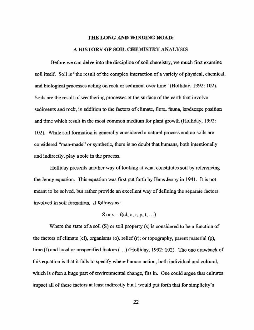
Holliday presents another way of looking at what constitutes soil by referencing
the Jenny equation. This equation was first put forth by Hans Jenny in 1941. It is not
meant to be solved, but rather provide an excellent way of defining the separate factors
involved in soil formation. It follows as:
S or s = f(cl, o, r, p, t , ...)
Where the state of a soil (S) or soil property (s) is considered to be a function of
the factors of climate (cl), organisms (o), relief (r); or topography, parent material (p),
time (t) and local or unspecified factors (...) (Holliday, 1992: 102). The one drawback of
this equation is that it fails to specify where human action, both individual and cultural,
which is often a huge part of environmental change, fits in. One could argue that cultures
impact all of these factors at least indirectly but I would put forth that for simplicity’s
22

sake we group change as a result of human activities under local or unspecified factors.
Something as simple as the creation of a walking trail in the woods or as complex as a
strip mining operation both impact soil formation but differ greatly in scale. For the
purposes of this study, we shall focus on a very specific aspect of soil formation: how the
materials people leave behind, either on or in the soil, alter that soil’s chemical makeup
and leave traces of their presence (or absence) even after the parent material has been
removed, decomposed, etc. It Is the analysis of these changes that the study of soil
chemistry is founded on.
As a discipline, soil chemistry analysis began in the last century as a means for
locating prehistoric sites and those of similar age. One of the pioneering individuals in
the field was Olof Arrhenius, a Swedish agronomist examining soils for use in the
growing of sugar beets. During these surveys he found that areas that had been the site of
human habitation in the past possessed accumulations of phosphorous in the present
(Arrhenius 1963: 124). This led him to conclude that elevated phosphorous levels
relative to surrounding soils could indicate settlement patterns when no other evidence
was present. One of his most interesting studies was an attempt to determine if a
mountain in Sweden was in fact the site of three witch burnings as local history supposed.
Not only was he able to prove this to be true but Arrhenius was also able to determine,
based on phosphate levels, from which three villages the witches had been brought (1963:
126). During these early tests, Arrhenius used a laboratory based method of analysis
which, while accurate, took over two days to complete due to the need for 48 hours of
agitation in a citric acid solution and 6 hours of storage at 55 degrees C (Arrhenius, 1963:
135-136).
23.

In 1951 Lutz published another study involving phosphate analysis, this one based
on native village sites in Alaska (Lutz, 1951: 925). He notes that Hrdlicka was one of the
first anthropologists to notice that the vegetation found on village sites usually differed in
floristic composition and color from adjacent undisturbed vegetation. Plants were fuller
and a darker green, presumably the effect of a relatively high level of soil fertility. He
hypothesized that the chemical conditions in the soils of the village sites had been altered
by human activities (Lutz, 1951: 925). Following these assumptions Lutz measured the
phosphorous levels of these sites and did indeed find them to be elevated, evidence that
the “more prosperous” vegetation was a direct result of human habitation (Lutz, 1951:
927-928). On the negative side, Cruxent used phosphate analysis to demonstrate that an
absence of elevated phosphate levels can be interpreted as an absence of past habitation.
As with other researchers, he states that soil chemistry analysis is a useful adjunct to
standard archeological methods since phosphate deposition due to cultural forces occurs
over a wide range of climates (Cruxent, 1962: 90).
The work of Cook and Heizer (1965) did much to establish that soil chemistry
analysis, particularly those which employ phosphorous, are indeed a valid form of
testing. Based on accumulation rates, they prove that the amount of phosphorous added
to the soil by both human and domesticated animal habitation is abundant enough to
significantly alter the already present levels and so be detectable even after a long period
of time (Cook and Heizer, 1965: 96).
Perhaps the greatest advance in soil chemistry analysis during the early 1970’s
was Eidt’s development of a rapid field test, often called the spot test, for the presence of
phosphorous (1973). This test has been proven valid in more recent studies (Bjelajac,
24

1996). During the second half of the 1970’s progress was made, specifically in Europe,
towards creating a correlation between specific phosphate levels and human occupation.
The goal became to what extent an exact reading of phosphorous levels could tell about
human activity in the past as opposed to a comparative analysis of one area having
relatively more or less phosphorous than another area (Proudfoot, 1976). In his work,
Proudfoot demonstrates the difficulty in using specific phosphate levels as opposed to
relative ones. A multitude of factors, for example types of phosphate found, such as
inorganic and organic, the soil in which it is found, and other elements present add to the
complexity of the test. As such, the methodology and analysis becomes more complex as
the number of variables increase. This type of testing requires not only laboratory
facilities but individuals with an extensive background in chemistry to undertake them.
While this research is most definitely advancing the study of soil chemistry analysis, its
methods and results are more exacting than my study required. Soil chemistry testing has
become sufficiently advanced that archaeologists have choices as to the methods they
will employ. One must determine which method is appropriate for the study it will be a
part of.
When developing conclusions, the context in which those conclusions are created
is of extreme importance. The work of Christopher Carr demonstrates the importance of
taking much more than the element levels present into account. While deposition of
elements by humans and livestock no doubt affect the soil, there are numerous other
factors that must be considered. The decomposition rates of the elements involved and
how these rates change due to soil composition, moisture content, etc must be noted in
addition to the possibility that soils were enriched by multiple periods of habitation. In
25.

summation, when using soil chemistry to compare archaeological sites, especially ones in
differing environments, how specific elements react in these unique settings must be well
understood (Carr, 1982).
Philip Bethell and Ian Mate pointed out some of the shortcomings of phosphate
analysis in a 1989 article. Using examples from Great Britain they pointed out that
phosphate levels on a site may have been elevated prior to settlement due to natural
processes or after abandonment because of modem practices (1989: 19). In addition,
variations in phosphate levels must be accounted for on the vertical axis as well as the
horizontal. Changes occur depending on where in the soil column the sample was taken
and so the profile becomes just as important as the surface location (1989: 20). Soil
samples taken from various depths ensure accuracy. Finally they caution against the
dangers of sampling a multi-phase site, as the earlier periods of occupation may be
obscured by the later ones (1989:20). However, even with these potential risks, Bethell
and Mate still endorse soil chemistry analysis as a valid form of testing, especially Eidt’s
spot test (1989: 20). They state “it can be regarded as the "trowel’ of archaeological
chemistry” with two of its greatest attributes being that it is “cheap and immediate”
(1989: 20), two words that also carry great weight in the realm of CRM. While its
history demonstrates that soil chemistry analysis has its drawbacks, if archaeologists are
aware of these shortcomings and account for them in their analyses then the testing
becomes a valuable part of archaeological method.
A small group of historical archaeologists have begun to employ the methods of
soil chemistry analysis on a series of Chesapeake sites. Soil chemistry analysis has been
extensively employed at sites such as Poplar Forest (Heath, 1999; Fischer, 2001; Stroud,
26

1999), King’s Reach (Pogue, 1988 a, b, 1990,1997), Utopia (Fesler, 2004), and Rich
Neck Plantation (Sullivan and Kealhofer, 2004). In all these cases soil chemistry was
employed to answer questions that the documentary record and other types of excavations
were not able to address. For example, in the case of Utopia soil chemistry analysis was
able to demonstrate that waste and debris was deposited to the fringes of the site and the
yard area was kept clean, rather than simply tossed out of doors or windows of the
dwelling. This pattern is indicative of enslaved African spatial arrangement, a conclusion
which was borne out by further excavation (Fesler, 2005).
The Chesapeake researchers have found that soil chemistry analysis has been
most useful at enslaved African contexts, in addition to historic sites that have produced
only a small amount of artifacts or features. These areas can benefit greatly from this
type of sampling given that often these varieties of sites yield low artifact densities and
their presence in the historical record is sparse at best. In addition, above it was stated
that enslaved Africans arranged their physical space in a manner different from
Europeans, an excellent example of this is the swept yard. Soil chemistry analysis is
particularly well suited to identify these types of spatial differences.
One of the greatest impediments to soil chemistry analysis is its effectiveness in
plowzone contexts. The plowzone layer consists of soils that were utilized for agriculture
while the site was occupied. It possesses little or no stratigraphy given that it was
significantly altered due to the action of the plow. The concern has been that given the
fact that plowzone soils are highly disturbed due to multiple seasons of agriculture, this
action could result in element levels that do not represent what occurred when the site
was occupied. However, given the work at Poplar Forest and Utopia (Fischer, 2001;
27

Fesler, 2003, 2004), soil chemistry analysis has been shown to be successful in plowzone
contexts as well. While some testing has occurred on North American sites, a greater
amount of research has occurred in Europe. Farrington notes a particular study where
phosphate analysis was used along side aerial photography and magnetometry in the
context of plowzone at several sites in eastern England. The method demonstrated that
the phosphate levels in the plowzone accurately reflected those in subsurface features and
the usefulness of the plowzone in an archaeological context was still intact (Farrington,
1983: 121). Entwistle et al also use chemical analysis in the interpretation of Scottish
historical sites (Entwistle et al, 1998). In the United States, the combined use of
phosphate analysis and magnetic survey at the sites of Fort Kaskaskia and Fort De
Chartres Number 1 in Illinois were able to locate the boundaries of the forts and their
internal structures (Weymouth, 1982: 13-14). As these and other studies have
demonstrated, even after extended amounts of plowing, chemicals deposited as a result of
human habitation still remain in the same place where they originated.
At present, the most common element analyzed in soil chemistry by historical
archaeologists is phosphorous. It has been demonstrated that the soils of habitation sites
may possess as much as fifty times the proportion of phosphorus as non-inhabited sites
(Solecki, 1951: 255). Studies have shown that phosphate is the most common chemical
element introduced by humans into the soil. This is due mainly to two factors: it is a
common element found in soil and it is not greatly affected by surface geological
processes. Phosphate is a main component of biological molecules; it is part of the
nucleic acids that compose genetic material and participates in the process of storing and
releasing energy at the cellular level (Lambert, 1997: 34). Due to these facts, phosphate
28

is found in biological waste, both in humans and domestic livestock. Not only is it
present in these materials but the waste itself has been deposited in the soil in large
enough amounts in the past to alter the soil’s chemistry (Cook and Heizer, 1965: 4-9).
One of the greatest concerns of soil chemistry analysis is what happens to the soil once it
ceases to be acted upon by cultural agents and is primarily affected by environmental
factors. These factors, such as erosion, rainfall, plant growth, and bioturbation can alter
the amount of a given chemical in the soil and so if a sample is taken it might not
accurately reflect what was occurring at the time of cultural deposition. Fortunately,
once dissolved, phosphates become fixed in the soil and further dissolution by rainwater
is a very slow process. The element forms highly insoluble compounds with iron,
aluminum, and manganese, which are also very common in soils. These compounds
remain in soil for long periods of time which means that they can serve as markers of
human activity (Lambert, 1997: 34). In other words, the amount of phosphate that is
present in the soil at the time of deposition is very near to the amount that is present at the
time of soil sampling (Dietz, 1957: 409).
While soil chemistry analysis has been used with success in numerous
archaeological investigations, its practice has not become widespread in the cultural
resource management community. There are several reasons for this. One, sampling
strategies are not uniform across a wide range of sites (Fischer, 2001: 68). Two, to
undertake such sampling and analysis is often seen as cost prohibitive.
With regards to the second issue, I believe it is possible to make the argument for
implementing soil chemistry analysis as part of numerous cultural resource projects. As
is widely known, cultural resource management is a highly competitive business. With
29

many projects being won as a result of a bidding process, the incentive to cut costs is
high. As anyone in the field can tell you, finding ways to keep expenses down is always
a priority. Unfortunately, this has the potential for archaeology, in a CRM setting, to
become complacent. Experimentation is often viewed as an unnecessary expense. Once
a method has been proven to work, often the belief becomes that it is the only method
that will work. As present, at least on the East Coast, the basic progression of contract
archaeology proceeds as Phase I shovel testing, Phase II close interval testing and test
units, and finally Phase III excavation of features. The belief is that methods such as
these provide the greatest amount of data in return for the time, money, and labor
invested. While this sequence has been proven effective on countless sites, there are
times when other methods might be useful in addition to, or instead of, these practices.
Soil chemistry analysis is one example of this. The main argument for not employing it
is often that the testing would be excessive, merely repeating data that could have been
gathered from other methods of survey, demonstrating that the expense would not be
justified. The Bridgeway project, which was undertaken in the fall and winter of 2005-
2006 by the James River Institute for Archaeology is a study that stands contrary to this
notion. The excavations and testing that occurred demonstrated that soil chemistry
analysis can be a valuable addition to CRM work both from data collection and cost-
benefit standpoints.
30.

HELLO, GOODBYE: THE BRIDGEWAY SITE (44SK4D6)
The Bridgeway Site is located in the northern section of the City of Suffolk,
Virginia in the southeastern portion of the state. The project area lays in the Bridgeway
Commerce Park, hence its name, a tract which has undergone and continues to undergo
large-scale commercial, light industrial and residential development. With regards to
present landmarks, the site is about 100 yards to the east of Harbour View Boulevard and
% of a mile north of Town Point Drive. To the west lies the remnants of the former State
Road 624, abandoned Skeet Road, and to the north is the altered tributary, i.e. drainage
ditch, of Streeter Creek. The site drains into a modified second-order tributary to Streeter
Creek which itself drains directly into Hampton Roads Harbor. Interstate 664 is Va mile
to the east (See Figure 1).
31

:teiyjnsxny(>i/ ►
PROJECT AREA
■w ,,
Figure 1: Project Area Location on Newport News South Quadrangle (USGS 1986). Image courtesy of JRIA.
This site is located within the Atlantic Coastal Plain physiographic province. This
is a relatively flat plain with low topography. It essentially encompasses the east coast of
the United States, as its name implies, with the exception of northern New England.
Within the Atlantic Coastal Plain the site is located on the Churchland Flat, a geologic
formation which possesses a gradual slope to the east. The flat lies north of the Dismal
Swamp and southeast of the Suffolk Scarp. Various phases of transgression and
regression have resulted in the Churchland Flat, one of many terraces and scarps along
the present coastline resulting from the rising and falling of sea level (Coch and Oaks,
32

1973: 23-24). The geologic formation most prevalent in the area is the Sand Bridge
Formation which is primarily medium sand with 15-20% silt content. At the Bridgeway
site, the Sand Bridge Formation is approximately 8 feet thick and is found over the
Norfolk Formation, silty sand deposited in brackish marine conditions. This second
formation can be found on the surface along a tributary to Streeter Creek (Coch, 1971:
13-14). In the fall of 2005 current elevations at the site were 15-25 feet above mean sea
level. In addition the area possessed a relatively flat topography which sloped at a low
angle to the north and then dropped sharply into Streeter Creek. As of January 2007 the
aforementioned topography is no longer in existence as development had begun on the
property and 44SK406 is no longer in existence.
The historical record as it relates to the Bridgeway Site is somewhat sparse;
however some conclusions can be drawn. Prior to its incorporation into the City of
Suffolk in 1974, the site was part of Nansemond County. However, given that the public
records for this county were destroyed in three separate public fires in 1734, 1779, and
1866 documents are understandably few. For this reason it was possible to narrow down
the site to existing on one of three possible tracts of land, but no further. The first was a
52-acre parcel owned by Edward Lewelling In 1804. Second is a 26-arce parcel
attributed to Eley Campbell in 1811 and third is an area of unknown size, 55-65 acres that
was owned by James Wright in 1820. All three of these parcels were acquired by Levi
Ames between 1851 and 1860 (Smith et al, 2006: 11-16). While at present it is not
known exactly who lived at the Bridgeway Site, all three of the above properties shared
the same characteristics. All were farms of extremely modest means and so the
inhabitants were likely from one of three groups. The first possibility was that the
33

residents were the small freeholders themselves, namely Lewelling, Campbell, or Wright.
Another possibility is that the site was rented to tenant farmers by one of the
aforementioned three. Finally the residents might have been enslaved Africans belonging
to the landholders or farmers. However, this last scenario seems unlikely given that the
landowners were o f extremely modest means and numerous slaves were a luxury that
they probably could not afford (Smith, et al, 2006: 14-15). No matter the case, the
archaeological evidence came to support these conclusions as it demonstrated that who
ever lived on the property had very little in the way of material goods.
Excavations were first undertaken at the site in 1990 by Espy, Huston, and
Associates Inc. who performed a Phase I survey. Shovel tests were dug at 25 meter
intervals and areas with high artifact concentrations were subjected to further testing at 5
meter intervals. It was concluded that the property might contain a tenant/slave-
associated domestic site and was potentially eligible for inclusion in the National Register
of Historic Places under Criterion D (“Capable of yielding important information about
the past.”). It was recommended that any adverse effects to the site in the future be
preceded by a Phase II significance evaluation (Shea et al, 1990: 44)
The James River Institute for Archaeology (JRIA) conducted the Phase II portion
of the investigation in 1993 to refine the site’s boundaries and assess its potential for
eligibility on the National Register of Historic Places. After a datum was established in
relation to the Phase I grid, shovel test pits (STPs) were dug at 20 foot intervals with a
total of 167 STPs dug, 66 of which were positive (Figure 2). The assemblage suggested a
period of occupation from the late 18 th century through the middle of the 19th century.
The site was found to be approximately 240 feet running north/south and 220 feet
34

running east/west with a smaller area of dense artifact concentration in the northwest
comer measuring approximately 160 by 160 feet. Five trenches were then mechanically
excavated in this northwest comer in the hopes of finding the remains of intact subsurface
features (Figure 2). One feature, a possible subsurface storage pit, was found and a 2’X2’
test unit in its southwest comer confirmed this hypothesis. Given the artifacts recovered
and the historical research associated with the site, it was believed that the possible root
cellar was evidence of a dwelling and that this structure was likely a tenant or
emancipated African-American domestic site. At the conclusion of the proj ect a Phase
III Data Recovery was recommended if adverse affects to the property could not be
avoided in the future. (McDonald and Luccketti, 1993).
35

I* / }t * f h ft / m /
/ h f r {1 ( ' L
/ J i s ''*'»T
BRlL f-Yv A V SU'foH. Virginia
44SK406PHASE Ji
,<AMS5 ftv'iH Ihfi- irui= FD" ADCi W IulM Y 3awstr. 1923
7 K
> j ... *c
/ /% // ----------f i f i i y y v s -
/ / / / / / £ W i t s *** Jnri/ -7 <7/
/ / &/ / / /
5a
/ /- ^ « V/# ./f.f / r in * 4«nr| j f>«/ f j y // </ ur h t f * */ /Vi/ tf f t f A A afi,
,r /f 7 /; r> j / « o #r jgr / # i rn mu trm
' J 'A
•ft*
■ 3 *
♦Hi*
ifp i"iE-"
X11* «**»*
i i - .'i .W I
JSfKi • i iA uA >«W
— I>« fcr .i tf»y
&
JSf-5 A
^ A
^ £•
^ A
.Sl& ,5,
*s»
i^r A
,$« A
*£m ■ITtSi »»»lS , . ■_«S» .-I
. . - 2 “ l'-«»
t—1 1— sV ■*>'£»'
«AV «pI
• t e i iarm t*"1 hpww < sris
M VWill *P«2i }|TJ| JT»«4
ii «Sj
, a .IZia «--«* ■*•;*
lift*
C! !< *11.
.A.
\ 0ar**! i mi
_ iA . J *3 M
fo / Abl ii1 rtvk
t0
/ "t< A .
f
p C
\♦ft**
A . »i5m
C
FIGURE 2: Phase II Shovel Test and Test Trench Map (McDonald and Luccketti, p21). Image courtesy o f JRIA.
Prior to the excavations at the Bridgeway Site, 44SK406 the site and surrounding
area had been under cultivation (most often soybeans, com, or wheat) and bordered by
bmsh and woods at creeks, roads, and upland swamps. As my involvement in the project
commenced, the site was in the process o f being prepared for eminent construction. The
majority o f the area had been cleared, most likely within the past few years, and the only
36

vegetation consisted of grasses and other small plants. The only trees were part of a
small stand in the south-central portion of the site and these also were evidence of recent
activity, as they were less than two decades old. With regards to topography, some
sections had been stripped of topsoil and plowzone while others had been filled in to
create a more level area, again done in preparation for the impending construction.
The Phase III excavation of 44SK406 began in the fall of 2005, when JRIA was
again contracted to commence investigations, due to further development of the area.
Upon arrival at the site it was evident that since the excavations in 1993, the area had
seen considerable activity. Large portions had been stripped by heavy machinery of any
plowzone that might have existed at some point in the past. The only relatively
undisturbed area of the site was the aforementioned small stand of trees, located in the
south central portion of the site, which was scheduled to be cleared as well once
investigations were concluded. Given that there was little hope of recovering a vast
amount of artifacts and the likelihood that the alterations to the site had erased most of
the features, soil chemistry seemed a good candidate for a method of recovering what
little data the site still held. With that said, normal procedure was followed and the first
step was to establish a grid on 10 foot centers in relation to the Phase II grid.
Once the grid had been laid, close interval shovel tests were dug to determine if
any artifact concentrations were present and to further refine the site boundaries (Figure
3). After this was accomplished the site was mechanically stripped and the grid
reestablished in the hopes that surviving features would be exposed.
37

[*3=Wjl
•
• o
• »
• *
© © ©
Q • • o
o • ©
9 9 • ©
m o • ©
o © © ©
9 O 9 •
©&>* • © ©
• • © ©
© • Q •
O • • ©
• * O ©
• 1 ”• • ©
H F S ID S S V W m A S S it ^C.CriE'lHTER'A&t St-OVsL TE ST ?sO & _FET J?S1TS
• • •
• 9 9 • • fHUKl 9
© • 3 o 9 © • M 'i : ?W:1"J• 9 ©
* * • 9 • • • • Q •
• © • O • • • • 9 *
• • • 9 • • • • 9 •
• • * 9 • o 9 • 9 *
• • £3 w 9 • • rw • 9 •
© 9 9 9 9 • • © 9 •
© 9 9 © O • © • 9 ©
© 9 9 9 © • © • 9 •
o 9 9 Q © o © • 9 ©
m JOiffi 9 • 9
• j * 9 9 •
of 9 9 O o © © O 9 ©
-id s&aa 4G riLT
FO
o
o
©
* •
• o• • • •
•52#9 ©
• # *
Go
o
oo*
o o o •
• 9
• * • •
*? *g 2 U rfCNCHC5.:sU5H P ,€S. !»«i,SM
m
©
©©
O
•
cMoo©
G
©#?^ f iK P T r ^ B - c a . t l .
qkE£WI a SKJ-.ii TES'i
m FOB i’A <-H:.KtL U i i w QiS -JHBED fiEA wS ES.i = _:
q *.2C* ttvt SlOvfci.' fc&l li A Sf-Svtl '§?.'• fi>W jla . I< W M ? **» > *• i t . & ..<Ks
Figure 3: Phase HI Close-Interval Shovel Testing and Test Units. Image courtesy ofJRIA.
38

Another reason that soil chemistry analysis was a logical choice for the
Bridgeway Site was the fact that due to environmental conditions, a traditional Phase III
excavation was not possible. The soils present at the site, primarily the Weston,
Nansemond, and Dragston fine sandy loams, all become highly saturated with water
when it is present. The aforementioned soil types, in addition to being soft permitted the
water table in the project area to rise to an unusually high level, and the large amounts of
rain during excavations only added to the problem (Figures 4 and 5). It was found that in
some test units and trenches the water table was less than two feet below the ground
surface.
Figure 4: Feature 502 Filling with Water at Base of Excavation, Note Lack of Damage to Feature Edges, Water is Rising from Below. Photo courtesy of JRIA
Figure 5: Southern Trench Still Flooded Two Days After Rain. Photo courtesy of JRIA.
39

Soil sampling began after the site had been mechanically stripped and the extent
of features determined (Figure 6). Once this had been accomplished a ten foot grid was
established and samples were taken from the surface of the exposed subsoil. Given the
extremely disturbed nature of the site archaeologists had their doubts that soil chemistry
analysis would yield meaningful results. However, once analysis commenced the testing
was determined to be a success.
/
LTRENCH 3
/ TRENCH 4 L -
/
N/I
0 10 70 30F=
i ~
- 1 C 7 7
TRENCH 1
1 TRENCH 2
O'
O
o
I I1 'ir'
0 o c7>CD °4=S
TRENCH 5
2 ] TRENCH 6
JTRENCH
Figure 6: Mechanically Excavated Trenches and Open Area, Showing IdentifiedFeatures. Image courtesy of JRIA.
40

WE CAN WORK IT OUT: ANALYSIS
Archaeologists located and excavated several significant features at 44SK406. It
was the excavation of these features teamed with the results of the soil chemistry analysis
that provided the richest account of past life at the Bridgeway Site. The features can be
divided into two groups, the first being two root cellars, features 501 and 502, located in
the western half of the site and the second a grouping of ten burials located to the east.
The finds of the soil chemistry analysis demonstrate site usage in reference to these
features. The hypothesis was that this type of testing would serve as an excellent
compliment to the feature and artifact analysis, both from data collection and cost-benefit
standpoints, a hypothesis that was found to be true. These features represent two very
different, one could argue almost polarized, types of spatial utilization. To begin, root
cellars are shallow pits ranging in depth from several inches to a few feet. They would
have been dug within a dwelling, most likely after it was constructed. Root cellars served
as storage areas for goods, such as produce, that required a more regulated environment
with regards to temperature, moisture, sunlight, etc., than that of the exposed nature of
the dwelling space above ground. These features might also have been used as a hiding
place for goods that the residents of the dwelling would not want other individuals to
find. This is often the case with root cellars found in an enslaved African context (Kelso,
1984). The root cellars are indicative of habitation, most likely they existed beneath
dwellings and so are evidence of daily usage. The cellars and the space around them
would have experienced a great amount o f activity through out the day and night. This is
in contrast to the second group of features, the burials.
41

Burials would represent a sacred space, one which was to be avoided except
during interment or ceremonial use. In regards to daily activity, presence of such action
in this area would be at a minimum. With these parameters in mind, one would expect
the chemical traces of human activity to be relatively high around the dwelling and
relatively low around the burials.
The chemical analysis done at the Bridgeway Site focused on four primary
elements. Each is associated with a certain type of human or animal activity and
accumulates in the soil in sufficiently significant amounts to be suitable for sampling.
Their presence or absence can be indicative of what people in the past were doing and
where they were doing it. The first of these elements is phosphorous, which is the most
widely studied of the four as was evidenced in the background chapter. Methods of
analyzing this substance have been used and refined for almost a century (Fischer, 2001:
19). Phosphorous is ideal for detecting both human and animal activity as it is present in
all organic material. Since much of human activity revolves around producing, moving,
or depositing phosphorous-rich materials, elevated levels in the soil can indicate the
presence of past peoples. Activities such as food preparation, disposal of human and
animal waste, and waste disposal in general are all possibilities for past spatial use when
high phosphorous levels are detected in the present.
Since phosphorous is often found in the context of waste disposal, it is likely that
if elevated levels of this element occur on a site they will be located in areas of probable
waste disposal, i.e. away from dwellings and along possible boundaries such as fence
lines. At the Bridgeway Site the phosphorous footprint fits this model, with the highest
42

concentration in the northeast comer, well away from both the dwelling and burial areas
(Figure 7).
1 50 140 1 30 1 20 110 100 00
00 70 50 50 40 30 20 10 0
600-
590
580
560’
540
480 490 500 510 520 530 540 550 560
Figure 7. Phosphorus distribution of the Bridgeway Site. Image courtesy of JRIA.
Magnesium is the second element that was analyzed. While not as popular a
subject of study as the other three elements in this report, it can still be a valid indicator
of cultural activity, although what exactly it indicates it still debated. The most agreed
upon cause of its presence, especially in historic sites, is burning. This can be interpreted
in several ways. The first is that if magnesium is found in an area then it was a site of
43

some maimer of fire. The most likely activity that would entail the creation of a fire is
cooking. Therefore, magnesium can be a sign of food preparation areas (Fischer, 2001:
57-58). Secondly, magnesium may indicate a secondary site, where the remains of fires,
i.e. ashes, were deposited due to clearing. In this way the element could serve as a
marker of waste-disposal practices.
Magnesium levels were highest in the southwestern quadrant of the Bridgeway
Site, just south of feature 501. Other spikes occurred in the vicinity of feature 502 and to
the east and south of the burials. Root cellars are often dug in front of hearths, and so the
elevated magnesium levels adjacent to feature 502 could be indicative of such an
alignment. As is often the case with soil chemistry, low levels of an element can be just
as telling as increased ones. This was true with magnesium and the other elements
examined, very low readings occurred in the vicinity of the burials and between the burial
area and the dwelling area (Figure 8). This allows us to hypothesize that these areas were
either kept free of debris or avoided all together, scenarios which will be discussed later.
44

Figure 8. Magnesium distribution of the Bridgeway Site. Image courtesy of JRIA.
Potassium is another element studied at the Bridgeway Site. Given its prominent
presence in plant matter as a factor in protein synthesis, carbohydrate translocation and
enzyme activation (Ankerman and Large, n.d.: 120), potassium is an indicator of wood
and other plant material. It can be a marker o f where wood has burned or decomposed,
ash has been dumped, etc. For this reason elevated levels of this element can indicate

hearths, depositional areas such as along fencelines or just outside of doorways, or
kitchen areas.
While relatively low levels of potassium occur over the majority of the Bridge way
Site, there is one notable exception. Just to the north of feature 502 is a high
concentration which could indicate the location of a possible door or window of the
dwelling through which waste might have been thrown outside. As was seen with
magnesium, the lowest levels of potassium occur within the burial area and between this
area and the dwellings (Figure 9).
590
5S0
56tf
550]
T T480 490 500 510 520 530 540 550 560
Figure 9. Potassium distribution of the Bridgeway Site. Image courtesy of JRIA.
46

The final element for consideration in this project is calcium. While calcium
levels are easy to detect, given that the element can be tied to many human activities, it
may serve as a marker of cultural action but which action is often not clear. Calcium is
extremely prevalent in bone and is also found in organic waste and therefore might
indicate disposal areas such as trash middens, privies and burials. Oyster shell and marl
was, and is, a common paving material and it has been shown that the presence of
calcium can indicate this type of activity as well. In addition to paving, calcium is a
component of lime and so is present in the soil when this substance has been added in the
past to aid crop growth. Finally, as lime and marl are often found in mortar, high levels
of calcium can indicate the presence of this material or the existence of a hearth (Fischer
2001: 55-56). As one can see from the above data, while high calcium levels can indicate
cultural activity, it can be difficult to discern exactly what that activity was. In many
instances, including this study, corroborating the chemical analysis with artifact and
feature data is the most effective means to determine site usage.
In the case of 44SK406, calcium levels, when examined in relation to the other
elements studied, served to reinforce our hypothesis of the existence of two root cellars
and a burial area. High levels registered directly next to Feature 502, to the south of
Feature 501, and east of the burials. Again we see low levels of the element between the
two features and in the vicinity and directly west of the burials. As before, this pattern
points to high levels of activity in relation to the dwellings and relative avoidance of the
burial ground (Figure 10).
47

160140
1 o o s i o r — — — i------------- i — -------j— ,---------- r — _ — f—>— —.... *r-----------1—80 480 490 500 510 520 530 540 560 560
Figure 10. Calcium Distribution of the Bridgeway Site. Image courtesy of JRIA.
So what does the chemical analysis done at the Bridgeway Site tell us about how
its space was utilized in the past? By integrating the soil chemistry data with the
excavation results we can create the strongest picture of the Bridgeway Site that is
possible. As one can see, all o f the chemical profiles share similar characteristics. High
concentrations occur to the north and south of Features 501 and 502 and to the east of the
burial ground. Low concentrations are found between the features and the burial ground,
between the features themselves, and in the vicinity of the burials (Figure 11).
48

70
60
50
40
30
20
Figure 11. Probable area usage for the Bridgeway Site. Image courtesy of JRIA.
These results reinforce the hypothesis that Features 501 and 502 represent a
dwelling area and the burial ground was treated, if not as a sacred space in a religious
sense, as burials are today, then at least an area that was not used for daily activities and
was left relatively undisturbed by the inhabitants, with the exception of the graves. These
assumptions are based on relative chemical amounts as a measure of activity. The higher
the reading, the greater the amount of element deposited. Therefore, more burning
occurred there, waste was deposited, or food preparation occurred. Conversely,
49
extremely low elemental levels point to a conscious effort to avoid an area. The burial
ground is a perfect example of this. Based on the evidence it appears that the bodies were
interred and times of burial notwithstanding, the area was then considered off limits. No
additional activities occurred there and in fact steps may have been taken to keep the area
in a static state.
The work done at 44SK406 is an excellent case study of soil chemistry analysis in
action, due to the fact that it highlights both the strengths and weaknesses of the testing
method. While chemical analysis was not able to provide answers to all the questions
asked of the archaeological record, it served as a supplement to historical research and
artifact and feature analysis. This was especially true of one of the most important
questions: why where the burials placed so close to the dwellings? In fact given the
proximity, did later inhabitants of the area even know the graves were there? While it is
uncommon for burials to be placed this close to a dwelling, it is not unheard of.
Armstrong and Fleischman conducted a study of the Seville Plantation in Jamaica where
four burials were found in extreme proximity to the house structures (Armstrong and
Fleischman, 2003). The chemical evidence, or more appropriately lack thereof, shows
that activity in the burial area was minimal, therefore the inhabitants most likely knew of
their existence, which brings us to the question of placement. Given the poor quality of
the soil and the meager means of the residents, it was likely that any available ground
would have been used for agriculture. A plot of land for interring the dead far from the
domestic site was a luxury that could not be afforded. By utilizing the several methods
mentioned above, archaeologists were able to reach this conclusion which would not
have been possible had only a single approach been employed.
50

Was soil chemistry cost effective at the site? In terms of processing, which was
conducted by A&L Eastern Laboratories, Inc. in Richmond, the samples were delivered,
analyzed, and the results retuned to JRIA in less than a month with a cost of less than
$1,000. When one compares this cost to the expense of full excavations in the context of
a large project, the data produced proves that undertaking this testing was a sound
investment. While this scenario has proved successful, it is by no means the only manner
of conducting soil chemistry analysis.
Using the work done at the Bridgeway Site as a staring point, I have explored
other methods of soil chemistry analysis. While they focus on the same four elements:
phosphorous, magnesium, potassium and calcium, the method by which they are
accomplished differs. While conventional testing usually involves the collecting of
samples and their subsequent analysis by an outside lab, I believe that “in-house” or “on
site” methods can be just as effective for less cost with quicker results.
The rapid chemical field test as outlined in Eidt (1973) is ideal for being
integrated into a Phase II close-interval shovel-testing strategy. Its simplicity is a key
factor, allowing quick results at a low cost. Prior to conducting field work it is necessary
to make some laboratory preparations in order to ensure proper chemical management.
While these preparations might seem complex, they allow the actual testing in the field to
proceed smoothly. By taking these steps ahead of time efficiency in the field is greatly
increased. Also, several of these steps are necessary to prevent contamination to the
sample. The testing process requires two reagents, A and B. The first is a solution of 30
mL of hydrochloric acid and 5 g ammonium molybdate dissolved in 100 mL of distilled
water. This reagent is used to extract the phosphate from the soil sample. Reagent B, the
51

reducing agent, is prepared by dissolving 1 g of ascorbic acid in 200 mL of distilled
water. While reagent A has a shelf life of approximately one month, reagent B must be
formulated daily and so Eidt recommends keeping premeasured amounts of 1 g ascorbic
acid to streamline the process. After the reagents have been created, they must be readied
for the field. At this point it is important to stress the necessity of clean equipment as
contamination will skew the results of the samples. All materials should be cleaned with
a solution of HC1 and water and then rinsed several times with distilled water. This is
necessary for both lab and field tools. The reagents should be placed in plastic dropper
bottles for sampling purposes and again it is crucial that the tips do not become
contaminated. Once transported to the field with the other necessary equipment the
actual testing process can commence.
The procedure for conducting the spot test is very simple. First the soil sample
must be obtained. Eidt recommends using a soil auger but his testing was not conducted
in the context of a shovel testing scenario. I prefer to collect the soil from the side o f an
excavated shovel test, provided the necessary precautions are taken to ensure purity, the
soil should never be touched. Once the soil is obtained approximately 50 mg, about the
amount that will fit on the tip of a knife, should be placed on a piece of filter paper, just
enough to be moistened by two drops of reagent. The paper and soil should then be
placed on a laboratory tripod and two drops of reagent A should be added, followed by
two drops of reagent B thirty seconds later. The presence of phosphate will be evident by
dark blue lines radiating out from the center o f the sample. The faster they appear and
the greater their density shows a higher level of phosphate. The table below summarizes
these values.
52

Phosphate Value Length of Radiating Lines (mm)
Time of Appearance of Lines (min)
Percent Ring Around Sample
None 0 0 0Weak < or = to 1 2 Variable
Regular 2 1-2 50Good 3-5 V2-l 75Strong 8 1/2 100
While these values are admittedly simplistic, they do provide a picture of relative
phosphate values over a site which can be used to either supplement other data gathered
during excavations or provide guidance as to where further testing should occur.
The materials necessary to conduct the above testing are relatively easy and
inexpensive to acquire. An internet search can quickly locate the materials needed to
perform the testing and obtain pricing information. These are not the only materials that
can be used for this testing but they serve as examples of the types of equipment required
and the costs that would be incurred for starting up such an operation. The bottles
necessary for transporting the reagents to the field are 4 oz. in size, have a dropper cap,
and are manufactured by Nalgene, they can be found at us.plastic.com for S3.95 each. A
tripod, 8’ high and 5” in diameter, is available at espchemicals.com for $55.54. Eidt
recommends using filter paper 9” in diameter and a box of 100 sheets of Grade #1 filter
paper cost $8.95 at vwrlabsshop.com. While I find it unnecessary, if one desires to use a
soil auger as suggested by Eidt, an AMS Regular Auger can be found at
53

cspoutdoors.stores.yahoo.net/amsregaug.html for $107.95. The final piece of equipment,
a knife, should already be a part of any archaeologist’s tool kit.
In addition to the equipment necessary for the spot tests, the chemicals needed are
also easy to obtain: 500 mL of hydrochloric acid was available for $46.00, 125 g of
ammonium molybdate cost $66.00, and 100 g of ascorbic acid was priced at $36.00.
Distilled water can be purchased at a local grocery store for pennies on the gallon. The
above amounts of materials should be sufficient for several months, if not years, of
testing, with the exception of the filter paper, 100 sheets could easily be used in one day
and so I would recommend a bulk purchase of this item if possible. As I previously
stated, the above sources and amounts are only meant as examples of how to obtain them
and more than likely a CRM company can procure resources elsewhere, the chemistry
department of the nearest college, university, or high school would be my
recommendation. However, if one were to obtain the items from the above sources, the
total cost would be approximately $330.00. If the archaeologist opted to forgo the auger
then the cost would be approximately $220.00 dollars. When taken in the context of a
project budget, the material cost for soil chemistry testing is small. But the cost of labor
still remains, and I believe that this extra expense can also be justified.
A typical way of conducting close interval shovel testing is that each person in a
crew is placed on a transect and proceeds to excavate the shovel tests. While all
individuals are participating in the same activity, each is acting as an independent unit.
Integrating soil chemical analysis into this scheme is relatively simple and can be
accomplished one of two ways. The first is to have every archaeologist sample the
54

shovel tests as they dig them and the second is to appoint an individual specifically to
carry out the testing.
Having all archaeologists carry out soil collection is the preferred method if
samples are being taken for laboratory analysis. However, if one wishes to employ the
type of field test as outlined by Eidt, it is better to have an individual on the crew
dedicated to this procedure rather than sharing the responsibility as it cuts down on the
amount of equipment and supplies needed and simplifies the process. As shovel testing
progresses, the archaeologist simply samples the units that have been completed and then
compiles the results. In either case, the added time and effort required is minimal.
If all crew members are participating in sampling for laboratory analysis then,
speaking from personal experience, on average an additional 2 lA to 5 minutes is required
to gather the sample after the shovel test has been excavated. 2 cups of soil,
approximately the amount that will fit in a 6”X6” resealable plastic bag, is sufficient for
testing. Given a hypothetical area of lOO’XlOO’ sampled at ten foot intervals, 121
samples would need to be collected. At four minutes per sample, 8 hours would be
needed to collect them. If one uses the average of 8 hours to sample a lOO’XlOO’ area
then for this unit, one “person day” is needed. When factored into the larger project
budgets of time and finances, this amount is relatively small, especially when measured
against the potential return on the data.
An example of methods similar to the Eidt spot test can be found in a study of a
site which contained both prehistoric and historic components located in the Sunol Valley
of Alameda County, California (Bejelajac, et al, 1996). In this instance, the spot test was
subjected to statistical analysis as well as a “real world” application with positive results.
55

First the values for the samples were assigned based on characteristics such as color
designation and time it took for color to appear (Bejelajac, et al, 1996: 245). These
values were then determined to be “on-site” or “off-site” due to comparison with prior
surface survey and mechanical excavations (Bejelajac, et al, 1996: 246). When complete
it was found that the phosphate sampling had an accuracy rate well above 90% and
therefore had been found statistically valid (Bejelajac, et al, 1996: 246-247). Again we
are reminded of how by itself soil chemistry analysis can not completely identify all sites,
but when used in conjunction with other methods it becomes a valuable asset. Bejelajac,
et al state (1996: 248):
The modified technique presented here is intended as a supplement to
thorough archaeological investigation of sites. Phosphate analysis by
itself will not identify residues or cultural debris from all types of human
activity and is best used as an additional evaluation technique that can be
incorporated in any archaeologist’s tool kit.
Soil chemistry analysis is but one of many methods that can and should be employed on
as many sites as possible. As is often the case in archaeology, the more varied and
thorough the testing that is undertaken, the more complete the results will be.
In addition to methodological advances, the study of the Bridge way Site
strengthens the case of practice theory, particularly in the case of absence of evidence. I
found the lack of activity within the burial area interesting. While the argument could be
made that the apparent lack of activity that was displayed in this area was a result of
simply nothing occurring on the site as opposed to intentional avoidance, the presence of
the burials when taken in conjunction with the common practice of designating grave
56

sites as a specific type of social space outweighs it. Again we see the definition of space
changing over time and how events in the past serve to shape the physical present. At
some point the burial ground was seen as a proper place for the internment o f bodies,
however once the bodies were placed there its context shifted from one of available
physical space to one that was now “off limits”. This definition persisted after the
physical act of burial and the space remained set apart. The use originated in the past and
was followed in the present, thus perpetuating itself into the future. As is often the case
in archaeology and anthropology in general, what is not present often holds as much
value as what is.
57

GOOD NIGHT: CONCLUSIONS
As previously stated, soil chemistry analysis can be a valuable part of many
excavations; however it is not necessary in every case. It is my belief that such testing is
not necessary in most Phase I settings as most jobs of this nature consist of large project
areas where the majority of the property tested will most likely be negative. In addition,
since the purpose of Phase I excavations are to often determine the presence or absence
o f sites, shovel testing is much more effective from the stand points of time, cost, and
accuracy. With that said, to say that soil chemistry analysis should never be implemented
in a Phase I testing strategy is a dangerous precedent to set. The need for a data recovery
plan of this sort might arise out of several scenarios. For example, there may be strong
documentary evidence that a project area at one time in the past was used for human
occupation, however, if surface inspection and shovel testing come up negative and the
search area is of a manageable size, then soil chemistry from the previously dug shovel
tests are an option. This could help to pinpoint features or areas likely to contain
features. As is common knowledge, shovel testing on a 50 by 50 foot (or 15 by 15 meter)
grid, while often effective, has its limitations.
Soil chemistry analysis is of greatest use on a Phase II survey, but it can also be a
valuable component of Phase III excavations as well. The main purpose of Phase II
CRM work is to define the limits of a site and determine if it is eligible to be listed on the
National Register of Historic Places. A common way to accomplish this is to undertake
close interval shovel testing. Setting up a grid on 10 or 20 foot spacing will likely
determine if the scatter of artifacts from the Phase I testing was just that, a scatter, or
58

evidence of an actual site. Since this process is similar to the preferred collection method
of soil chemistry samples, I feel integrating the two procedures would, be of great value.
Taking a soil sample from the sidewall of an STP that was just excavated is quick and
easy, with the resulting analysis either reinforcing the data that the rest of the Phase II
excavation will produce or filling in gaps that otherwise would have been left empty.
One of the best, and also simplest, examples of this is the site map. A map of the site
with potential and/or confirmed features overlain with soil chemistry data demonstrates
the relationship between material culture and its effect on the environment.
In science it is often the goal to continuously refine and sharpen techniques.
However, in the case of soil chemistry analysis the methods for rapid field analysis are
available and need no more adjustments. This is a case where no matter how much better
the mouse trap is no path will be beaten to your door. To quote Cook and Heizer (1965:
20):
In any study that attempts to assess the value of quantitative chemical
methods for detecting and appraising human habitation areas the primary
point of view must be comparative. Consequently as many numerical
procedures as possible must be developed for expressing differences and
similarities within a group of such areas, or between them on the one hand
and culturally sterile, or control, regions on the other. Most of these
procedures may be very simple mathematically and statistically and
indeed there is no reason for seeldng ultrarefinement or sophistication
(emphasis added). All that is needed is a series of indices or indicators
capable o f distinguishing between types o f soil or site matrices.
59

While I’m not saying that a comparison, for example, of phosphate levels between
Tidewater Virginia and Northern California would not be useful at some level, the need
for it in a CRM context is highly unlikely. Given the fact that the majority of CRM
projects are only concerned with what went on inside the project area and the immediate
vicinity, such broad connections are unnecessary. This is echoed by Dietz (1957: 403)
who states:
For archaeological purposes exact tests are not too important; comparative
tests are. To leam how to make these tests the archaeologist would have
to spend a day in a soils laboratory, or have a soils man show him how to
do them. The reagents are inexpensive.
The above quote shows that soil chemistry analysis fits three of the largest goals of CRM;
make it quick, cheap, and easy. The extra time required to perform chemical testing in
the field only adds on a few minutes at best to each shovel test dug, the materials required
for such testing are low cost and easy to obtain, and the skills needed to perform the
testing are minimal.
As in often the case in CRM archaeology, there is just as much pressure to create
a cost and time effective methodology as producing a quality product. Obviously more
time and greater precision would be ideal but the need is often to achieve acceptable
results in as short a time as possible. This is where the spot test developed by Eidt
becomes valuable. As he states, “The significance of the spot test is not in its precision,
but in the simplicity and rapidity of which anthropic soils can be identified in the field. It
is therefore a most useful technique for making rapid site surveys (1973).” Based on this
and the other findings presented in this thesis, it has been proven that soil chemistry
60

analysis utilized within the framework of a CRM setting can yield significant results and
in the future archaeologists who specialize in the cultural resource management
subdiscipline need to take such methods into account when developing their research
designs.
Soil chemistry analysis is also of value when interpreting archaeology to the
public. During the process of writing this work, my conversations with individuals who
are not archaeologists demonstrated that this type of testing is of interest to the public. I
often found myself explaining the process and how soils, while not displaying any visual
information, can often tell us a great deal. The explanation of how element levels in
present soils can be affected by the activities of people in the past and these differences
can be measured by archaeologists and used to interpret cultural activity was easily
understood by non-archaeologists in addition to individuals displaying interest in the
subject. Just as much as methods, the results, such as the element maps in this document,
serve to show what we as archaeologists try to accomplish in an easily accessible manner.
These conversations served to spark interest in archaeology and make the discipline more
accessible to the public, goals which all archaeologists should hope to accomplish.
61

IN MY LIFE: CLOSING
In general it seems that trends in anthropology swing as if on a pendulum,
between particularistic and broad, the individual and society, freewill and control.
Proponents of one of these sides are always arguing that the other is wrong, and for no
matter how brief a moment it may be, the majority always lies to one side or the other,
followed by the inevitable swing back in the other direction. The idea of habitus and the
supposition that a culture draws on its past to create its present and drive it forward into
the future supports the belief that chemicals in the soil can serve as markers of how
physical space was utilized over time. Practice theory establishes continuity, a necessity
for the success of soil chemistry analysis. At present it served my purposes but if during
further research new information comes to light which causes me to contradict the pages I
have set forth in this work I have no qualms about doing so. It was not until I began my
time at William and Mary that I realized the most important part of this process was not
figuring out which arc of the pendulum swing you were on but using the motion to drive
the discipline forward, no matter which direction it came from. Sides of a debate are not
the lifeblood of anthropology; it is the debate itself that sustains the field (Knauft, 1996:
2). Again we are reminded of Bourdieu’s concept of the habitus (Bourdieu, 1977: 78).
We, as a culture of anthropologists, are using our past experiences to influence our
present and in doing so shaping our future. Staying firmly rooted to one school of
thought denies us the ability to alter our theories and methods as the discipline advances.
Clinging to the comfortable paths that have been paved by those who came before us will
cause study to stagnate, simply answering the same old questions in different way that in
62

all reality isn’t all that different from what someone else has already said. This has been
known for quite some time, as even Thoreau stated in Walden: “It’s remarkable how easy
and insensibly we fall into a particular route, and make a beaten path for ourselves”
(Thoreau, 1995: 314).
Am I making the argument that soil chemistry analysis can answer all of
archaeology’s questions and so must be used to the fullest degree possible in every CRM
project? Certainly not. However, at present I do feel that it is an underutilized technique
that would benefit many if it were further employed. In my opinion the discipline of
archaeology is at a crossroads and the status of soil chemistry analysis is an example of a
shift that is occurring. As more and more archaeology occurs outside of an academic
context, the emphasis is placed on not only producing results, but producing them in a
cost-effective and timely matter. In order for this to take place we as archaeologists must
keep abreast o f new developments in the field as well as realize that much of an
archaeologist’s work has little to do with archaeology. Possessing a solid background in
finance, personnel management, and business practices are fast becoming just as
important parts of the archaeologist’s “toolkit” as excavation techniques, knowledge of
past material culture, and theory. It is my hope that academic institutions recognize this
shift and embrace it, rather than view it as a passing phase. If the goal o f the majority of
academic institutions in this country is to continue enforcing a curriculum of primarily
research-based archaeology, then I feel they are doing their students a disservice and not
preparing them for the real world.
63

WORKS CITED
Ankerman, Don and Richard Large, eds.n.d. S o il a n d P la n t A n a ly s is A g ro n o m y H a n d b o o k . A&L Agricultural Laboratories,
np.
Armstrong, Douglas V.1999 “Archaeology and Ethnohistory of the Caribbean Plantation.” In “I Too, A m
A m e r ic a A rc h a e o lo g ic a l S tu d ie s o f A fr ic a n -A m e r ic a n L ife . Theresa A. Singleton, ed. 173-192. University Press of Virginia, Charlottesville.
Armstrong, Douglas V. and Mark L. Fleischman2003 House-Yard Burials of Enslaved Laborers in Eighteenth-Century Jamaica.”
International Journal o f Historical Archaeology. 7: 33-65.
Arrhenius, Olaf.1963 “Investigations of Soil from Old Indian Sites.” Ethnos. 2-4:122-136.
Association Research Inc.2005 2 0 0 5 S a la ry S u rvey .
Bethell, Philip and Ian Mate1989 “The Use of Soil Phosphate Analysis in Archaeology: A Critique.” In S c ie n tific
A n a ly s is in A rc h a e o lo g y . Julian Henderson, ed. 1-29. Institute of Archaeology, Archaeological Research Tools no. 5. University of Califomia-Los Angeles, Los Angeles
Bourdieu, Pierre1977 O utline o f a T h eo ry o f P ra c tice . Cambridge University Press, Cambridge,
England.
Bjelajac, Victor, Edward M. Luby, and Rose Ray1996 “A Validation Test of a Field-Based Phosphate Analysis Technique.” Journal of
Archaeological Science. 23: 243-248.
Carr, Christopher1982 H a n d b o o k on S o il R e s is tiv ity S urvey ing . Center for American Archaeology Press,
Evanston, Illinois.
Coch, Nicholas K.1971 G eo lo g y o f the N e w p o r t N e w s S o u th a n d B o w e r ’s H ill Q uadrang les, V irginia .
Virginia Division of Mineral Resources, Charlottesville, Virginia.
64

Coch, Nicholas K., and Robert Q. Oaks1973 P o st-M io c e n e S tra tig ra p h y a n d M orpho logy, S o u th ea s te rn V irginia .
Commonwealth of Virginia, Division of Mineral Resources, Charlottesville, Virginia.
Cook, S.F. and R.F. Heizer.1965 “Studies on the Chemical Analysis of Archaeological Sites.” Publications in
Anthropology. 2:1-102. University of California, Berkeley.
Craxent, J.M.1962 “Phosphorous Content o f the Texas Street Hearths.” American Antiquity. 28: 90-
91.
Delle, James A.1998 A n A rc h a e o lo g y o f S o c ia l Space: A n a ly z in g C o ffee P la n ta tio n s in J a m a ic a ’s B lu e
M ounta ins. Plenum Press, New York.
Dietz, Eugene F.1957 “Phosphorous Accumulation in Soil of an Indian Habitation Site.” American
Antiquity. 22(4): 405-409.
Eidt, R.C.1973 “A Rapid Chemical Field Test for Archaeological Site Surveying.” American
Antiquity. 38: 206-210.
Entwistle, Jane A., Peter W. Abrahams, Robert A. Dodgshon1998 “Multi-Element Analysis of Soils from Scottish Historical Sites. Interpreting
Land-Use History Through the Physical and Geochemical Analysis of Soil.” Journal of Archaeological Science. 25: 53-68.
Evans-Pritchard, E.E.1940 The N u er: A D e sc r ip tio n o f the M o d es o f L iv e lih o o d a n d P o litic a l In stitu tio n s o f a
N ilo tic P eo p le . Oxford University Press, New York.
Ferguson, Leland1992 U ncom m on G round : A rc h a e o lo g y a n d E a r ly A fr ic a n A m erica , 1650-1800.
Smithsonian Institution Press, Washington.
Fesler, Garrett R.2003 In the Zone. Paper presented at the annual Jamestown Conference, Williamsburg,
Virginia
2004 From Houses to Homes: An Archaeological Case Study of Household Formation at the Utopia Slave Quarter, ca. 1675 to 1775. Ph.D. dissertation. Ms. courtesy of the author. On file James River Institute for Archaeology, Inc., Williamsburg.
65

2005 Sweeping the Yard, Keeping the Faith: Archaeological Evidence of Swept Yards at the Utopia Slave Quarter and the Larger Chesapeake. Paper presented at the annual meeting of the Society for Historical Archaeology, York, England.
Fischer, Lisa A.2001 Recovering Elements in Historical Archaeology: The Use of Soil Chemical
Analysis for Overcoming the Effects of Post-Depositional Plowing. M.A. Thesis, Department of Anthropology, College of William and Mary, Williamsburg.
Giddens, Anthony.1984 The C o n s titu tio n o f S oc ie ty: O u tlin e o f the T h eo ry o f S tru c tu ra tio n . University of
California Press, Los Angeles.
Gundaker, Grey and Judith McWillie2005 N o S p a ce H id d en : The S p ir it o f A fr ic a n A m e r ic a n Y a rd Work. University of
Tennessee Press, Knoxville
Heath, Barbara J.1999 H id d e n L ives: The A rc h a e o lo g y o f S la ve L ife a t T hom as J e f fe r s o n ’s P o p la r
F o rest. University Press of Virginia, Charlottesville.
Hegmon, Michelle2005 “No More Theory Wars: A Response to Moss.” American Antiquity. 70: 588-
590.
Holliday, Vance T.1992 “Soil Formation, Time, and Archaeology.” In S o ils In A rch a eo lo g y : L a n d sc a p e
E v o lu tio n a n d H u m a n O cc u p a tio n , Vance T. Holliday, ed. 101-117. Smithsonian Institution Press, Washington.
Kelso, William M.1984 K in g sm ill P la n ta tio n s , 1619 -1800 : A rc h a e o lo g y o f C o u n try L ife in C o lo n ia l
V irginia. Studies in Historical Archaeology Series. Academic Press, New York
Kent, Susan1987 “Understanding the Use of Space: An Ethnoarchaeological Approach.” In M e th o d
a n d T h eo ry f o r A c tiv ity A re a R esea rch : A n E th n o a rch a e o lo g ic a l A p p ro a c h , Susan Kent, ed. 1-60. Columbia University Press, New York.
Knauft, Bruce M.1996 G en ea lo g ie s f o r the P re sen t in C u ltu ra l A n th ro p o lo g y . Routledge, New York.
66

Lambert, Joseph B.1997 T races o f the P ast: U n ra ve lin g the S ecre ts o f A rc h a e o lo g y T hrough C h e m is tiy .
Helix Books, Addison Wesley, Reading, Massachusetts
Lipe, William D.2002 “Public Benefits of Archaeological Research.” In P u b lic B en e fits o f A rc h a e o lo g y ,
Barbara J. Little, ed. University Press of Florida, Gainesville.
Little, Barbara J.2002 “Archaeology as a Shared Vision.” In P u b lic B e n e fits o f A rch a e o lo g y , Barbara J.
Little, ed. University Press of Florida, Gainesville.
Logan, George C.1998 “Archaeologists, Residents, and Visitors.” In A n n a p o lis P asts. Paul A. Shackel,
Paul R. Mullins, and Mark S. Warner, eds. University of Tennessee Press, Knoxville.
Lutz, H.J.1951 “The Concentration of Certain Chemical Elements in the Soils of Alaskan
Archaeological Sites.” American Journal of Science. 249: 925-928.
McDonald, Bradley and Nicholas M. Luccketti1993 Phase II Significance Evaluation of 44SK406 and 44SK407, at the Proposed
Bridgeway Commerce Park, Suffolk, Virginia. Report on file at James River Institute for Archaeology, Williamsburg, Virginia.
Moss, Madonna L.2005 “Rifts in the Theoretical Landscape of Archaeology in the United States: A
Comment on Hegmon and Watkins.” American Antiquity. 70. 581-587.
Parrington, Michael.1983 “Remote Sensing.” Annual Review of Anthropology. 12. 105-124.
Pogue, Dennis J.1988a Anthrosols and the Analysis of Archaeological Sites in a Plowed Context: The
King’s Reach Site. Northeast Historical Archaeology 17:1-15.
1988b Spatial Analysis of the King’s Reach Plantation Homelot, ca. 1690-1715.Historical Archaeology 22(2):40-56.
1990 K in g ’s R e a c h a n d 1 7th C en tu ry P la n ta tio n L ife . Maryland Historical and Cultural Publications, Annapolis.
1997 Culture Change Along the Tobacco Coast: 1670-1720. Ph.D. dissertation, Department of Anthropology, American University, Washington, D.C.
67

Proudfoot, B.1976 “The Analysis and Interpretation of Soil Phosphorous in Archaeological
Contexts.” In G eo a rch a eo lo g y: E a rth S c ience a n d the P ast. D.A. Davidson and M. L. Shackley, eds. 93-113. Westview Press, Inc., Boulder.
Schiffer, Michael Brian.2000 “Social Theory in Archaeology: Building Bridges.” In S o c ia l T h eo ry in
A rc h a e o lo g y , Brian Schiffer, ed. 1-13. The University of Utah Press, Salt Lake City.
Shackel, Paul A.2002 “Broadening the Investigations of the Past at Harpers Ferry National Park.” In
P u b lic B en e fits o f A rc h a e o lo g y , Barbara J. Little, ed. University Press of Florida, Gainesville.
Shea, William G. and Alain C. Outlaw1990 A Phase I Archaeological Survey at Pig Point, Suffolk, Virginia. Report on file at
Virginia Department o f Historic Resources, Richmond.
Smith, Anthony W., Garrett R. Fesler, Matthew R. Laird, and Ashley McKeown2006 Marginal Ground: Archaeological Excavations at 44SK406, a ca. 1790-1830
Small Farm. Report on file at James River Institute for Archaeology, Williamsburg.
Solecki, Ralph S.1951 “Notes on Soil Analysis and Archaeology.” American Antiquity. 16(3): 254-256.
Stahl, Ann, Rob Mann, and Diana DiPaolo Loren2004 “Writing for Many: Interdisciplinary Communication, Constructionism, and the
Practices of Writing.” Historical Archaeology. 38(2): 83-102.
Stroud, Sarah1999 An Analysis of the Soil Chemistry at the North Hill, Thomas Jefferson’s Poplar
Forest. Paper presented at the annual meeting of the Virginia Academy of Science, Norfolk, Virginia
Sullivan, Karen A. and Lisa Kealhofer2004 “Identifying Activity Areas in Archaeological Soils from a Colonial Virginia
House Lot Using Phytolith Analysis and Soil Chemistry.” Journal of Archaeological Science. 31: 1659-1673.
Thomas, David Hurst1998 A rc h a e o lo g y . Harcourt Brace College Publishers, New York.
68

Thoreau, Henry David1995 W a l d e n : A n A n n o t a t e d E d i t i o n . Houghton Mifflin, Boston.
Weymouth, John W.1982 Final Report on Magnetic Surveys over the Sites of Fort Kaskaskia and Fort De
Chartres Number 1, Illinois. Nebraska Center for Archaeophysical Research, University o f Nebraska, Lincoln.
69
VITA
Nathan David Lawrence
Nathan David Lawrence was bom on January 13, 1981 in Sunbury, Pennsylvania.
He graduated from Selinsgrove Area High School in 1999 and received his B.A. in
Anthropology with a minor in Geosciences from Franklin and Marshall College in
Lancaster, Pennsylvania in 2003. His honors thesis was entitled “Historical Archaeology
of the Maclay-Wolverton House: Analyzing the Past While Informing the Present” and
his field schools consisted of work at 19th century coffee plantation of Marshall’s Pen,
Jamaica (Franklin and Marshall College).
He entered the M.A. program in the Anthropology Department, College of
William and Mary in Williamsburg, Virginia in 2004. In the past Nathan has been
employed by the Northumberland County Historical Society, the Lancaster County
Historic Tmst, and the Hermitage in Nashville, Tennessee. Presently he lives in
Williamsburg, Virginia where the James River Institute has employed him for
Archaeology since 2002. In addition to archaeology, Nathan serves a coach and teacher
in the local public and private school systems, as well as training competitively for
marathons.
70