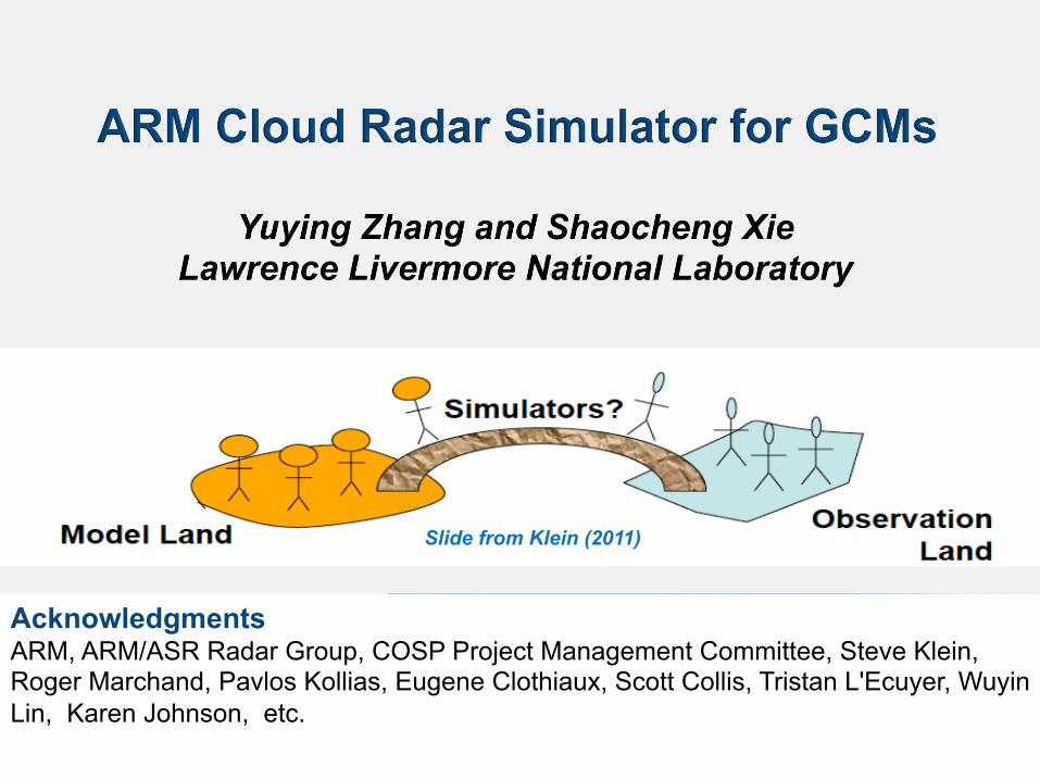
slide from klein (2011) - atmospheric system research · arm, arm/asr radar group, cosp project...
TRANSCRIPT
Lawrence Livermore National Laboratory LLNL-PRES-571334 1
This work was performed under the auspices of the U.S. Department of Energy by Lawrence Livermore National Laboratory under contract DE-AC52-07NA27344. Lawrence Livermore National Security, LLC
LLNL-PRES-647364
Acknowledgments ARM, ARM/ASR Radar Group, COSP Project Management Committee, Steve Klein, Roger Marchand, Pavlos Kollias, Eugene Clothiaux, Scott Collis, Tristan L'Ecuyer, Wuyin Lin, Karen Johnson, etc.
Slide from Klein (2011)

Lawrence Livermore National Laboratory LLNL-PRES-571334 2
ARM simulators
• Take the advantage of COSP, the CFMIP Observation Simulator Package, by inverting the COSP CloudSat simulator for view from the ground and run at a different wavelength for the ARM ground-based remote sensors
• Make it as part of COSP for a broad use by the climate modeling community
Ideas on the ARM Radar Simulator
Lawrence Livermore National Laboratory LLNL-PRES-571334 3
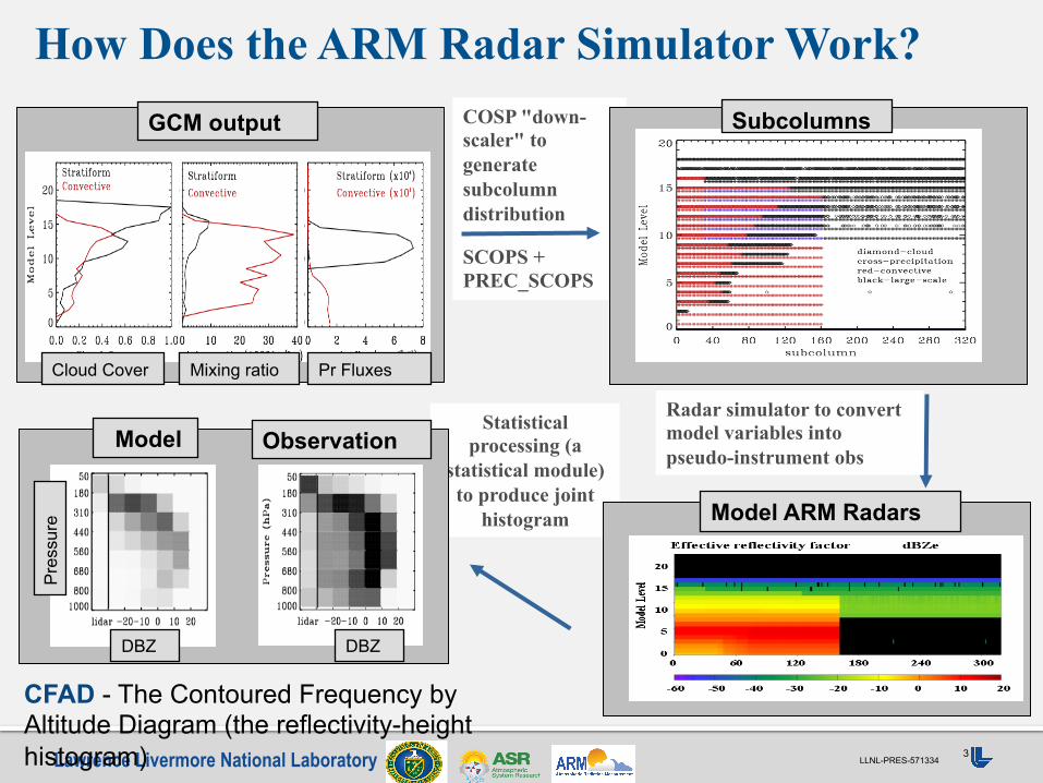
COSP "down-scaler" to generate subcolumn distribution
SCOPS + PREC_SCOPS
How Does the ARM Radar Simulator Work?
Radar simulator to convert model variables into pseudo-instrument obs
Statistical processing (a
statistical module) to produce joint
histogram Model ARM Radars
Subcolumns
Model Observation
GCM output
Cloud Cover Mixing ratio Pr Fluxes
DBZ DBZ
Pre
ssur
e
CFAD - The Contoured Frequency by Altitude Diagram (the reflectivity-height histogram)

Current Status and Future Plan
• The ARM cloud radar simulator has been created based on the COSP CloudSat radar simulator and tested with ACME
• Additional ARM instrument limitations such as the minimum and maximum detectable signals are considered in the ARM simulator
• Multi-year ARM GCM-oriented cloud radar data (CFAD) at ARM permanent sites and AMF sites are being created.
• 2006 -2010 at SGP (done) (working on other sites) • Will extend to the most recent years once the KAZR-ARSCL data are available
• Working with COSP PMC and ARM for code release • Documentation, user guide, and distribution
• Refine and improve the ARM radar simulator • Add the non-attenuated, Rayleigh-scattering only, radar reflectivity CFAD to the
simulator output and refine the code structure to make it more flexible for future modification
• Develop ideas to create an ARM lidar simulator
Lawrence Livermore National Laboratory LLNL-PRES-571334 5
• Retrievals: comparing retrieved geophysical parameters (LWC/IWC) can easily link model problems to particular physical processes, but uncertainty from the instrument limitations
• Simulator: bypass some difficulties to compare with retrieved parameters, but difficult to interpreting results in terms of physical processes because the comparison variables are not trivially related to any single geophysical quantity
Slide from Klein (2011) (modified by Xie)