slide 1 – yarmouth st to mass ave.swcpc.org/documents/swc_cyclemap - markup 1.pdf · slide 1 –...
TRANSCRIPT
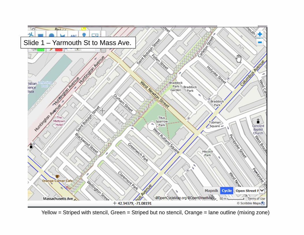
Slide 1 – Yarmouth St to Mass Ave.
Yellow = Striped with stencil, Green = Striped but no stencil, Orange = lane outline (mixing zone)
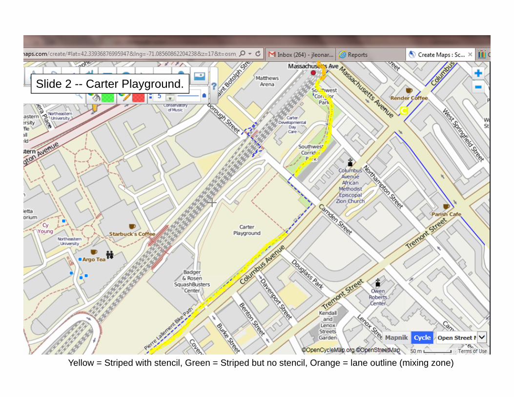
Slide 2 -- Carter Playground.
Yellow = Striped with stencil, Green = Striped but no stencil, Orange = lane outline (mixing zone)

Slide 3 – Ruggles Station
Yellow = Striped with stencil, Green = Striped but no stencil, Orange = lane outline (mixing zone)
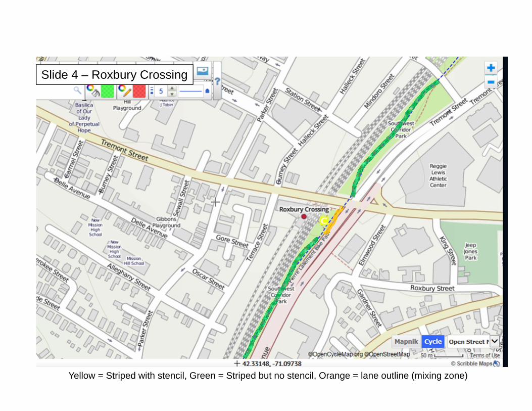
Slide 4 – Roxbury Crossing
Yellow = Striped with stencil, Green = Striped but no stencil, Orange = lane outline (mixing zone)
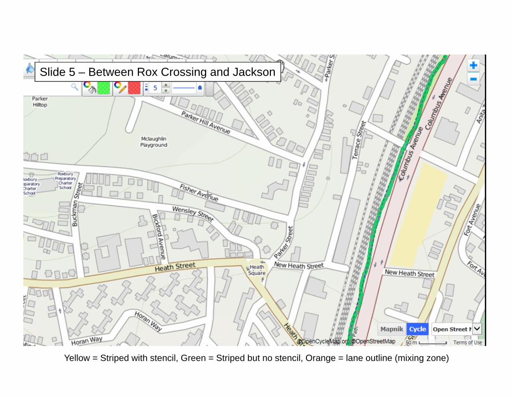
Slide 5 – Between Rox Crossing and Jackson
Yellow = Striped with stencil, Green = Striped but no stencil, Orange = lane outline (mixing zone)
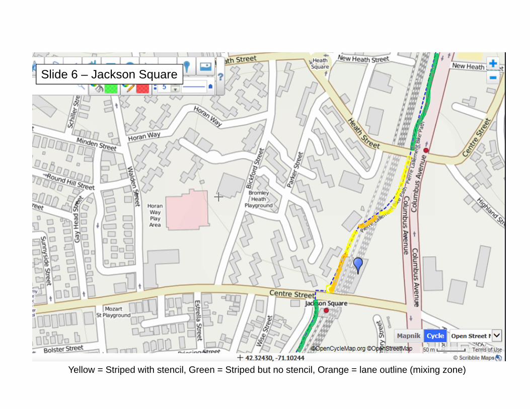
Slide 6 – Jackson Square
Yellow = Striped with stencil, Green = Striped but no stencil, Orange = lane outline (mixing zone)
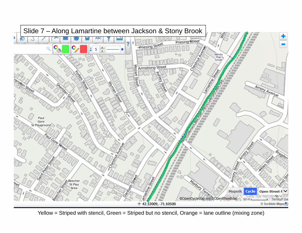
Slide 7 – Along Lamartine between Jackson & Stony Brook
Yellow = Striped with stencil, Green = Striped but no stencil, Orange = lane outline (mixing zone)

Slide 8 – Stony Brook
Yellow = Striped with stencil, Green = Striped but no stencil, Orange = lane outline (mixing zone)
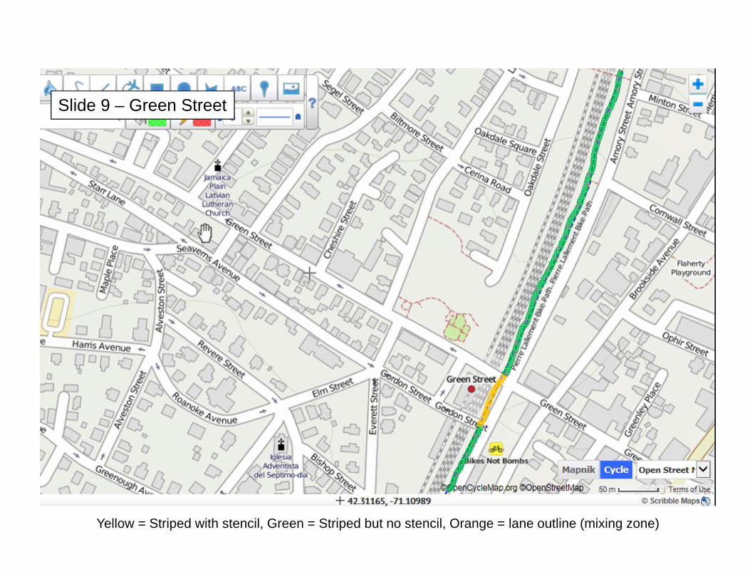
Slide 9 – Green Street
Yellow = Striped with stencil, Green = Striped but no stencil, Orange = lane outline (mixing zone)
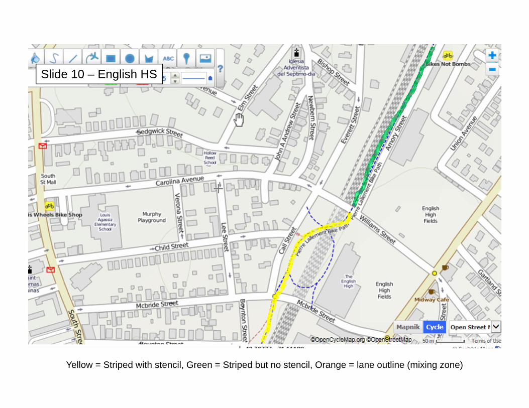
Slide 10 – English HS
Yellow = Striped with stencil, Green = Striped but no stencil, Orange = lane outline (mixing zone)
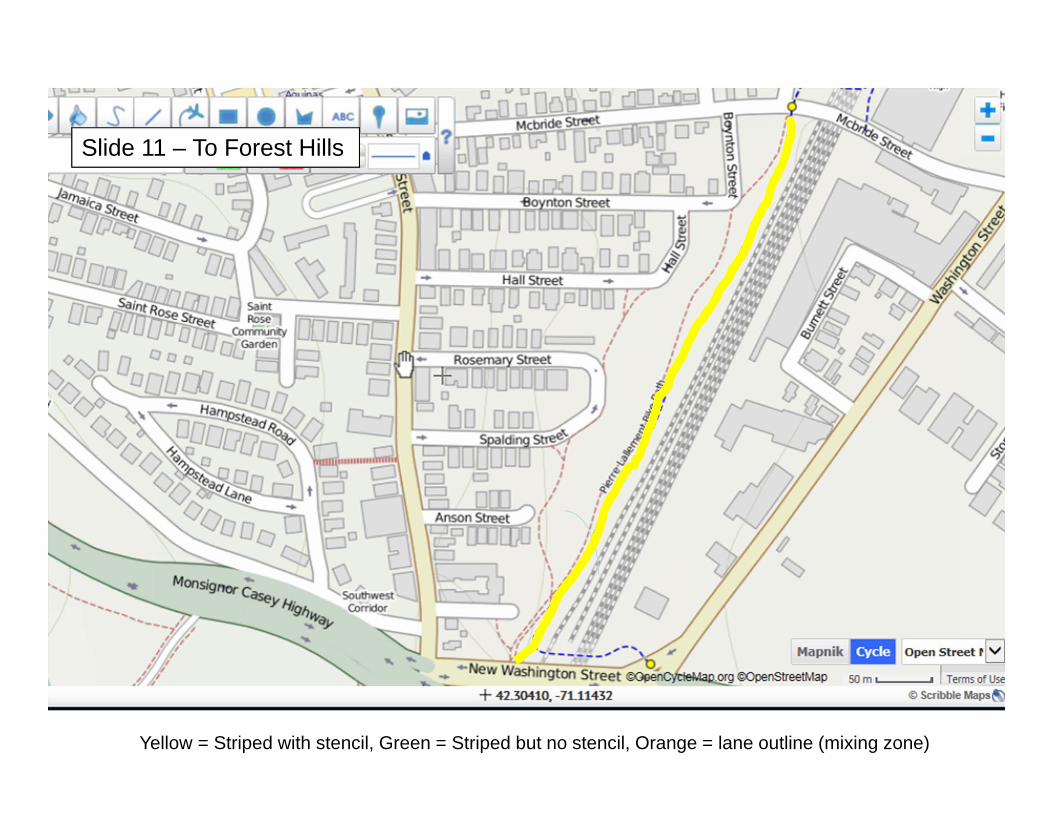
Slide 11 – To Forest Hills
Yellow = Striped with stencil, Green = Striped but no stencil, Orange = lane outline (mixing zone)