site assessment – desk study, field survey, soil structure dan doody senior engineer (retired)...
Post on 21-Dec-2015
214 views
TRANSCRIPT

Site Assessment – Desk Study, Field Survey, Soil Structure
Dan DoodySenior Engineer (Retired)Monaghan County Council

Site Assessment – Key Issues
Environmental Function of ICW – Natural treatment processes. Minimum ‘hard engineering’. Low/zero energy requirements.
Social Considerations – Existing land use. Stakeholder interests in site and linked land and water resources.
Landscape fit – Integration into the environment - Detailed land survey.
Biodiversity – Complement local ecology. (Wetland plants, diverse habitats).

Site Assessment
Baseline information:Can ICW be safely constructed?Any negative impacts on
environment/receiving waters?Site data for appropriate design. Info to regulators – planning/discharge
licenses. Info to contractors – Include ground
conditions to allow cost estimate.

Site Assessment - General
Location of ICW If in (or discharging to) a SAC, SPA, NHA –
An Appropriate Assessment (Art 6 of Habitats Directive) will be required.
Otherwise - field visit to describe habitats in accordance with the Heritage Council’s guide to habitats in Ireland.
Generally favour sites with low current biodiversity value.

Site Assessment - General
Risk Based Approach: Hazard-Pathway-Receptor.Hazard: water vectored pollutants,
construction/operation of ICW.Pathway: significant linkage (e.g. field
drains, gravel seams, karst) between hazard and receptor.
Receptor: Surface Water, Groundwater, Natural/built heritage.

Site Assessment - General
‘Absolute Protection is not possible’.Mitigate risk by;
Low velocity/high residence time – wetland configuration of adequate functional area.
Subsoil of sufficient depth and of the required impermeability.

Site Assessment - General
ICWs afford additional protection:High impedances to infiltration by biofilms,
humus and organic matter.Biological feedback mechanisms secure
water retention.Wetland soils provide an effective
processing medium (e.g. for denitrification of nitrate-N and ammonium-N).

Site Assessment - General
Terrestrial Soils v. Wetlands Soils

Typical ICW Influent - Farmyards

Typical ICW influent - Wastewater
Domestic ICW Influent

Ammonium-N concentration
Sustained influent concentrations exceeding 100mg/l and flux concentrations in excess of 280mg/l may cause vegetation die-off.

Typical Discharges - Farmyards

Typical Discharges - Wastewater

Precipitation/Evapotranspiration
Rain related inflow may be many orders of magnitude greater than that originating from direct sources.
Conversely there are likely to be drought periods when there will be no surface water discharges.

Restrictions
ICWs should not be considered for sites: Within 60m up-gradient of a potable well. Within the inner protection zone of a public
groundwater supply (300m up-gradient where protection zone not identified).
Within 25m of dwelling. Under mature trees. Where there is a risk of collapse (swallow
holes/karst features). Of Natural Heritage value (without an appropriate
assessment).

Restrictions (contd.)
ICWs should not be considered for sites:Where ICW may negatively impact Cultural
Heritage value.Where adequate land area not available.Close to watercourses (10m from ponds
1&2, 5m from subsequent ponds).Liable to flooding.Where neither surface discharge nor
exfiltration is possible (additional wet-woodland bunded area??)

Surface Water Protection
ICW should be of sufficient size and/or receiving water should have sufficient assimilative capacity (see below)

Groundwater Protection
500mm thickness of subsoil under ponds with a max permeability of 1x10⁻⁸m/s underlain by a further 500mm of subsoil.
On a regionally important aquifer where the groundwater vulnerability is high/extreme, 750mm of soil enhanced to 1x10⁻⁸m/s underlain by a further 250mm.
On highly permeable sand/gravel/fractured rock in hydraulic contact with the water table – 750mm of low permeability subsoil with upper 500mm enhanced to provide a permeability of 1x10⁻⁸m/s.

Groundwater Protection (contd.)
Where a risk exists of catastrophic leakage (karst geology/mined areas) increase depth of subsoil to 1500mm – or reject the site.
Geomembrane-lined ponds to be underlain by 100mm of subsoil & 50mm of protective fine sand and overlain by 200mm of low to moderate permeability subsoil.

Competency of Assessor
To collect and interpret recorded and field info. To make a visual assessment (Is a specialist
needed?). To assess the impact on aquatic receptors and
site values. To design the wetland (including
understanding terrestrial and wetland soil ecology and their bio-geochemical processes).

Site Assessment - Practical
Desk Study & collation of information Visual Assessment:
Characterisation of wastewater (farmyard inventory/PE and volumetric range).
Evaluate receptor sensitivity and location.
Site Tests: Trial holes. Soil characteristics and particle size analysis.
Decision Process/Recommendations.
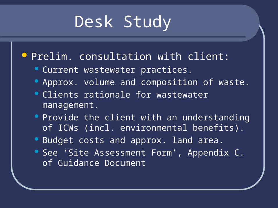
Desk Study
Prelim. consultation with client: Current wastewater practices. Approx. volume and composition of waste. Clients rationale for wastewater management. Provide the client with an understanding of ICWs
(incl. environmental benefits). Budget costs and approx. land area. See ‘Site Assessment Form’, Appendix C. of
Guidance Document

Data Collation
Site Information.Targets at risk?Site Restrictions? – NPWS.Location options?Topography – OSI maps.Weather/Climate data (www.met.ie)

Surface water receptors
Flow and quality data from EPA, OPW LA, otherwise calculate flow by: Empirical formula orCAD model.Direct flow measurements.

Discharge from ICW
Discharge (m3/yr) = (A+B+C) – (D+E) where, A = initial volume for treatment (m3/yr). B = Intercepting (paved/roof) area (m2) x annual
rainfall (m). C = ICW area (m2) x annual rainfall (m). D =ICW area (m2) x annual evapo-transpiration &
interception (m). E = ICW area (m2) x annual infiltration rate (to
ground) (m).

Receiving Water Quality data
BOD,MRP,SS, Ammonium-N, Nitrate-N, Nitrite-N, (+ if available, Q-rating & WFD river body status).
May be available from EPA or LA – if not:Min 3 sets of samples over 3 months (incl.
July – Sept)

Mixing of discharge with river water
Cds = (Qu x Cu) + (Qd x Cd)
(Qu + Qd) Qu = river flow u/s. Cu = pollutant concentration in river u/s. Qd = discharge flow. Cd = pollutant concentration in discharge. Cds = pollutant concentration in river d/s.
Average flows (ICW discharge prop. to rainfall) S.I. No.272 of 2009 surface water and S.I. No.9
of 2010 groundwater.

Groundwater
Limiting parameter – Ammonium-N EPA and GSI – Aquifers & Vulnerability maps
– groundwater protection zones. National aquifer maps (GSI).
If Vulnerability maps not available check: Relevant River Basin District project. Soil & subsoil maps (Teagasc). Outcropping bedrock & karst (GSI).
Groundwater Response Matrix – Appedix A (Guidance Document).

If Surface Discharge not available:
Consider discharge to ground. If discharge less than 5m3/day detailed
assessment not required. If greater than 5m3/day – guidance on
detailed assessment to be published by EPA in 2011.

Natural & Cultural Heritage
Designated (and candidate) NHAs, SPAs, SACs, protected structures, archaeological sites – consult with:ClientLANPWSDECLG

Visual Site Assessment
If no insurmountable problems from desk study carry out visual assessment to:Verify (or amend) desk study.Assess on-site hazards.Evaluate surface/ground water receptors.Location options for ICW.

Visual Assessment - Wastewater
Site visits – client present (on wet days):Component sources of waste.Estimate total volume of waste.Discuss all water management activities
with client.Take Photographs.

Visual Assessment - Topography
Scope Topographical Survey to:Aid design.Examine discharge options.Assess landscape fit.
Wet sites have advantages but:Biodiversity impact/benefits?Additional inflow?
N.B. Check for field drains.

Visual Assessment - Surface Waters
Identify receiving waters:Channel width, depth, debris marks.Est. assimilative capacity.Water quality info – samples.
Other water features:Lakes, wetlands, streams, ditches and N.B.
land drains.Photographs.

Visual Assessment - Groundwater
Check existing wells/boreholes within 300m (incl. direction of flow).
Groundwater levels (trial holes).Any groundwater quality data?Karst features – swallow holes, ‘dolines’Road cuttings, open excavations, river
banks (ground conditions).Photos.

Utilities, Natural & Cultural Heritage
Verify (or amend) desk study:Archaeological input?
Trees, o/h lines, houses, schools, churches.
Set-back distances.Downwind receptors.Evidence of flooding.Can ICW be constructed?

Trial Holes/Trenches
Trial Holes – min 2-3m below bases of ponds (plus depth to rock & water table).
No. of trial holes: Area of ICW 0.5ha - min 3 0.5 – 1.0ha - min 4 1.0 – 1.5ha - min 5 1.5 – 2.0ha - min 6 More than 2.0 ha - min 7
Record soil data to BS 5930 (Ref. Appendix D, Guidance Document)

Soil Subsoil Characteristics

Particle Size Distribution Test
A PSDT indicates permeability:Clay content – lab test to BS 1377 (particles
greater than 20mm diameter removed)Clay content 13% or greater for 1x10⁻⁸m/s. If 10% - 13% clay content, enhance subsoil
to achieve permeability of 1x10⁻⁸m/s.No of PSDTs related to size of ICW (similar
to trial hole scenario).

Summary – ICW Decision Issues
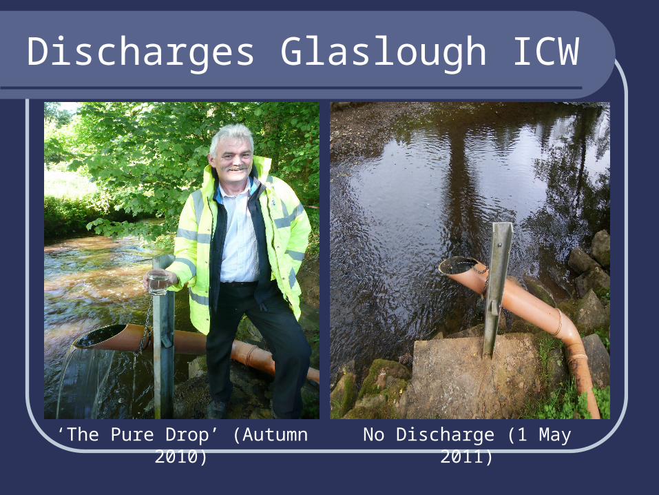
Discharges Glaslough ICW
‘The Pure Drop’ (Autumn 2010) No Discharge (1 May 2011)
