shellfish safety education activities
TRANSCRIPT
SHELLFISH SAFETY

A Guide to Activities for
The Joint Penelakut Tribe, Cowichan Tribes and
Hul’qumi’num Treaty Group
Shellfish Safety Project
Prepared as companion activities for:
The Shellfish Safety Resource Manual, Karen Fediuk, Mia Parker and Kristiann Allen, Ladysmith BC: 2007 Prepared by:
Linda Hiemstra, Mel Mor Science, Nanaimo, BC Tel: 250-751-4862 March 19, 2007
Shellfish Safety Project Penelakut Tribe, Cowichan Tribes and the Hul’qumi’num
Treaty Group
Materials List for Activities
1. Who is a Happy Clam? •• Activity Guide •• 2 – marine charts for Cowichan and Kuper Island areas (rolled up) •• Large laminated map (rolled up) •• Reusable stickers on sticker storage pages (front pouch of binder)
2. This is My Beach! •• Activity Guide •• 2 Laminated Enhanced Resource and Human Activity Maps (back pouch of
binder) •• Data Collection Sheets (extras in Activity Guide)
3. What is My Name? •• Activity Page for Participants to Complete (extras in Activity Guide) •• Activity Key (Activity Guide)
4. Is It Safe To Eat? •• Posters (rolled up) •• Poster Examples (Activity Guide)
5. General •• CD with files (Activity Guide)

Activity Guide for
This is My Beach
Prepared as a companion activity for:
The Shellfish Safety Resource Manual, Karen Fediuk, Mia Parker and Kristiann Allen, Ladysmith BC: 2007 Prepared by:
Linda Hiemstra, Mel Mor Science, Nanaimo, BC Tel: 250-751-4862 March 19, 2007
1
Shellfish Safety Project Penelakut Tribe, Cowichan Tribes and the Hul’qumi’num
Treaty Group
This is My Beach! – Activity Guide
Table of Contents Table of Contents ............................................................................................................ 1 Activity Goals................................................................................................................... 2 Activity Description .......................................................................................................... 2 Instructions ...................................................................................................................... 3
Organizing the Activity ................................................................................................. 3 Leading the Activity...................................................................................................... 3
Activity Materials.............................................................................................................. 4 Resource Maps ............................................................................................................... 5 Resource Information ...................................................................................................... 5
Tides ............................................................................................................................ 5 Beach or Intertidal Environment................................................................................... 5
Identification of Intertidal Species .................................................................................... 8 Potential Sources of Shellfish Contamination................................................................ 15
Human Sources ......................................................................................................... 15 Natural Sources ......................................................................................................... 15 Potential Pollution Sources for the Area..................................................................... 16
Topics for Discussion or Further Investigation............................................................... 17 Patterns...................................................................................................................... 17 Issues That Can Be Helped or Prevented.................................................................. 17
For More Information ..................................................................................................... 18 Data Record Sheet ........................................................................................................ 19

2
Shellfish Safety Project Penelakut Tribe, Cowichan Tribes and the Hul’qumi’num
Treaty Group
This is My Beach! – Activity Guide
Activity Goals The following are the goals of this activity.
• To make participants aware of the beaches in the reserve lands
• To provide information on the intertidal (beach) environment and the animals that inhabit this area
• To provide information on sanitary and biotoxin harvesting closures
• To make participants aware of human activities that cause harvesting closures
• To provide a safe and interesting learning environment for participants
Activity Description • This activity takes place on a beach at low tide.
• Onsite, participants are provided information on tides, beach zones and animals that inhabit the zones.
• Participants are divided into groups to locate and identify animals found in specific zones and enter the data on data reporting sheets.
• Participants then identify potential pollution sources as far as they can see and enter on the data reporting sheets.
• Participants discuss the shellfish harvesting status of the beach in relation to the season, the identified potential pollution issues and the other human activities.
• All animals and beach material is returned to the state in which it was prior to the beach activity.
3
Shellfish Safety Project Penelakut Tribe, Cowichan Tribes and the Hul’qumi’num
Treaty Group
This is My Beach! – Activity Guide
Instructions
Organizing the Activity 1. Choose the beach for the activity that has been or will be harvested for shellfish and
is relatively easy to access for a group. 2. Determine how long it will take to travel to the beach and how long you plan to spend
on the beach (1-2 hours). 3. Check the tides and schedule the beach activity so a .8m or a 2ft tide level or lower
occurs during the first hour on the beach. 4. Calculate the travel time and determine the departure and return schedule. 5. Using the land use maps and local knowledge determine the upland use around the
beach. 6. Using charts and local knowledge determine the marine activities in the beach area. 7. Call the Fisheries Officer and determine if the beach is open or closed to harvesting;
the harvest schedule for the past several months and for the next season and known contamination sources.
Leading the Activity 1. Enter the beach. At the high point of the beach, look towards the water and provide
a general description of tides move on the beach, intertidal zones and how specific animals inhabit each zone. Draw attention to obvious inhabitants of specific zones such as seaweed, barnacles, starfish, clam depressions etc. (10 minutes)
2. Find the high water line for the previous 24 hours. Locate and identify animals inhabiting this area and the area above which gets the least amount of seawater coverage. (15 minutes)
3. As you walk towards the water, identify general zone areas and surface animals in each area. Discuss how each animal needs the water for survival and food. (10 minutes)
4. As you move towards the water, dispatch groups of students to locate animals by turning over rocks and debris, digging etc to areas roughly equivalent to zones. Each group is to identify the animals and location and enter the information on the Data Record. Ask the question “Which beach area has the greatest diversity of species and the largest number of animals?” (25 minutes)
5. Congregate at the water’s edge and look towards the upland. Identify potential sources of shellfish contamination for the beach and surrounding area. Enter this information on the Data Record. Discuss what materials could be in the water from these sources and the problem these materials could cause to humans. (15 minutes)

4
Shellfish Safety Project Penelakut Tribe, Cowichan Tribes and the Hul’qumi’num
Treaty Group
This is My Beach! – Activity Guide
6. Facing the water, identify potential sources of shellfish contamination as far as you can see. Enter this information on the Data Record. Discuss what materials could be in the water from these sources and the problem these materials could cause to humans. HINT: Be sure to include the ocean as a source of biotoxins. (15 minutes)
7. Discuss if the beach is open or closed to harvesting and the impact of human activity on the beach. (10 minutes)
8. Instructor collects Data Records. (2 minutes) 9. Return all animals and beach materials to the state at which they were found initially.
(10 minutes) 10. Leave the beach.
Activity Materials 1. Activity Guide 2. Data Report Sheets – one for each group 3. Pencils 4. Resource Map Kuper Island and Cowichan area
NOTES
5
Shellfish Safety Project Penelakut Tribe, Cowichan Tribes and the Hul’qumi’num
Treaty Group
This is My Beach! – Activity Guide
Resource Maps The two resource maps are provided. These maps were modified from iMaps BC Land Resources Data Warehouse, URL: http://maps.gov.bc.ca/imf50/imf.jsp?site=imapbc. The maps are laminated versions for field use.
Resource Information
Tides • Tides are the alternating rise and fall of the ocean water on the land; produced by
the gravitational pull of the moon and the sun on the earth.
• The moon takes about 24 hours and 50 minutes to return to the same position in the sky from one day to the next; therefore tides of one day repeat about 50 minutes later on following day.
• The tidal pattern in the Strait of Georgia is called semi-diurnal - two high tides and
two low tides every 24 hours.
• The tides are not equal and one high tide is higher than the other and one low tide is lower than the other.
• Many factors affect the tides: the shape of the coastline, depth of the water,
contour of the ocean floor, and other influences.
• Being able to read tides is useful to plan harvesting times and will also indicate when a boat can access an area.
• It is critical to consult a tide table that represents the specific area you are
interested in. For Cowichan area and Kuper Island look up the tide table for Fulford Harbour at: http://www.niveauxdeau.gc.ca/english/Canada.shtml.
Beach or Intertidal Environment The beach or intertidal environment is between the land and the ocean. It is also called the littoral zone. The intertidal area is divided into sections or zones according to the influence of the tides or how often or how much water covers the area. See Figure 1 below.

6
Shellfish Safety Project Penelakut Tribe, Cowichan Tribes and the Hul’qumi’num
Treaty Group
This is My Beach! – Activity Guide
The intertidal area is in constant change and is therefore a very difficult place for animals and plants to survive. Despite the harshness, it remains one of the most productive aquatic regions - the water is rich in nutrients, has an abundant supply of oxygen and plankton, the tiny marine food for many shellfish, is brought in with each tide.
Figure 1 Intertidal Zones and the Animals that Inhabit Each Zone
Intertidal Zones
1. Spray Zone (Upper Littoral, Splash Zone or Barnacle Belt) is dry much of the time, but is sprayed with saltwater during high tides. It is flooded during storms and extremely high water.
• barnacles • lichens
• lice • limpets
• periwinkles • whelks
7
Shellfish Safety Project Penelakut Tribe, Cowichan Tribes and the Hul’qumi’num
Treaty Group
This is My Beach! – Activity Guide
2. High Tide Zone (Upper Mid-littoral Zone) is flooded only during high tide and has limited vegetation.
• anemones • barnacles • brittle stars • chitons
• crabs • green algae • limpets • mussels
• sea stars • snails • whelks
3. Middle Tide Zone (Lower Mid-littoral Zone) is a turbulent area covered and
uncovered twice a day with saltwater.
• anemones • barnacles • chitons • crabs • green algae
• limpets • mussels • sea lettuce • sea palms • sea stars
• snails • sponges • whelks • clams • oysters
4. Low Tide Zone (Lower Littoral Zone) area is usually under water and is only
exposed during very low tides. Organisms in this zone are not well adapted to long periods of dryness or to the extreme temperatures of the upper zones.
• abalone • anemones • brown seaweed • chitons • crabs • green algae • hydroids • limpets
• mussels • nudibranchs • sculpin • sea cucumber • sea lettuce • sea palms • sea stars • sea urchins
• shrimp • snails • sponges • surf grass • tube worms • whelks
NOTES

8
Shellfish Safety Project A Joint Penelakut and Cowichan Tribes Fisheries Project
This is My Beach! – Activity Guide
Identification of Intertidal Species Butter Clam, Saxidomus gigantea
Size: to 130mm (5 inches) Description: Butter clams have chalky-white shells with fine concentric rings and they lack the radiating ridges found on the Littleneck clam shells. The siphon can retract completely into the shell. They grow to approximately five inches in length and are common in the middle to lower intertidal areas. Habitat: Found in a variety of substrates but typically occur in areas with porous sand, broken shell or gravely mud. They are common in protected beaches in bays and estuaries along BC coast. They burrow to a maximum depth of 25 cm and adults remain in same burrow for life. Crabs and fishes prey on juveniles; moon snails, birds and sea stars prey on adults.
Littleneck Clam, Protothaca staminea Size: to 80mm (3 inches)
Description: Littleneck clams have oval shells with radiating ribs and concentric ridges with highly variable colouration. In the ocean and along the coast, the colour is often whitish with patterns of brown lines along the sides. In bays and estuaries, the colour is commonly grey or yellowish grey. Range: Common in protected beaches in bays and estuaries and near rocky outcrops on outer coastal areas. They are found from Baja California to the Aleutian Islands in Alaska. Habitat: Commonly found in firm, gravel beaches and are often found with Butter clams. They can burrow up to 15 cm, but are usually found 3-8 cm below surface. Adults remain in same burrow for life. They occur slightly above mid-intertidal to the subtidal up to 12 m. Crabs and fishes prey on juveniles and moon snails, birds, and sea stars prey on adult clams.

9
Shellfish Safety Project A Joint Penelakut and Cowichan Tribes Fisheries Project
This is My Beach! – Activity Guide
Manila Clam, Tapes philippinarum
Size: to 75mm (3 inches) Description: Manila clams have oval elongated shells with visible radial ribs; ribs stronger at posterior end. Shell colour is variable, gray to brown, often with streaked patterns and occasionally angular pattern similar to native littleneck. The siphon tip is split. Interior often has purple or yellow coloration; inside edge of the shell is smooth to the touch. Range: Manila clams are not native to BC. They have adapted well to BC intertidal areas and are now common in protected beaches, bays and estuaries in the Georgia Strait and west coast of Vancouver Island. There are also small isolated populations in Queen Charlotte Strait and around Bella Bella. Habitat: Preferred habitat is sand or gravel beaches, where they burrow to maximum depth of 10 cm. Adults remain in same location for life. Manila populations are found from the 1 m intertidal zone to well above mid-intertidal level. Manilas do not inhabit subtidal areas.
Find a Manila and a Littleneck clam and tell them apart by looking for the depression next to the points where the shells started growing (see arrow). Feel that the depression area is flat on a Manila clam and on the littleneck there is a ridge formed by the edges of the two shells.
Pacific Cockle, Clinocardium nuttallii Size: to 114mm (about 5 1/2 inches) Description: The Cockle shell is as high, or slightly higher, than it is long. It has 34-38 strong ribs with wavy lines at the margins. While buried, the short siphons shows at surface. Yellow-brown colour with a mottled russet and brown pattern is common. Range: Distribution is scattered on tidal flats along the coast, but is not abundant in any one location. Habitat: Preferred habitat is soft, sand-mud or eelgrass beds. Cockles are often associated with Butter and Littleneck clams.
10
Shellfish Safety Project A Joint Penelakut and Cowichan Tribes Fisheries Project
This is My Beach! – Activity Guide
They either create a shallow burrow or may be found on surface. They are able to move across beach and do not remain in same burrow. Cockles are most common in intertidal or shallow subtidal to 30 m depth. Cockles are easy prey because they occur on the surfaces of tidal flats and predators include sea stars, crabs, flatfish and birds.
Horse Clam (or Pacific Gaper), Tresus nuttallii Size: to 1750mm (about 7 inches) Description: A large, elongated shell with a length of approximately 1.5 times the height. The shells gape and are not able to contain the body and the large siphon. The siphon has leather-like plates at the tip. It has a smaller body and siphon compared to the Geoduck clam. Range: Widespread in sheltered coastal areas of BC, but less abundant in the north. Habitat: Horse clams prefer sandy substrates and eelgrass beds. They burrow to 1 m and adults remain in same burrow for life. They prefer the lower one third of intertidal zone to 20 m subtidal depth. Predators include birds, moon snails, sea stars, crabs, and various fishes.
Razor Clam, Siliqua patula Size: to 180mm (about 7 inches) Description: A long, thin, brittle shell is covered with a layer of shiny brown periostracum. Two white siphons extend from one end of the shell and a foot extends from the other. The shell is about 15 cm (6 inches) long and about 6.5 cm (2.5 inches) wide. Rrazor clams are rapid digger requiring specialized tools for harvesting. Range: Razors occur only on surf-swept beaches in Long Beach region on the west coast of Vancouver Island and on beaches east of Massett on the northeast coast of Graham Island in the Queen Charlotte Islands.

11
Shellfish Safety Project A Joint Penelakut and Cowichan Tribes Fisheries Project
This is My Beach! – Activity Guide
Habitat: Found in sandy, exposed beaches they usually burrow up to a depth of 25 cm. When disturbed, they can burrow to depths greater than 60 cm in less than a minute. They occur from mid-tide level to 20 m depth subtidally. Predators include gulls, ducks, crabs and fish.
Geoduck Clam, Panope abrupta Size: to 1950mm (7.5 inches or more) Description: Geoduck is the world's largest burrowing clam and can live for 140 to 160 years. Shells are chalky-white, may reach nine inches in length and do not completely close. The long siphon lacks the leather-like flaps of the horse clam. Range: Geoduck is widespread throughout BC, in sheltered to moderately exposed brackish water or outer coastal areas. Habitat: They prefer fine mud, sand or gravel and are sometimes abundant in eelgrass. Mostly occur subtidally, from 8 to 120 m in depth, but they may also be found in lower intertidal areas. Predators include sea stars, crabs, fishes, birds, and sea otters.
Pacific Oyster, Crassostrea gigas Size: to 12 inches in length Description: Oysters are variable in shape, from long and thin to round and deep. The shell is fluted; exterior grey-white with new growth often purple-black; smooth white interior. Lower (left) shell or valve is usually cupped; upper valve is flattened and smaller than other valve. Range: Oysters are found from Prince William Sound, Alaska south to Newport Bay, California. Habitat: Oysters attach permanently to surfaces and are most often found on structures or firm or rocky beaches. They inhabit intertidal areas to 20 feet (6m) depth.

12
Shellfish Safety Project A Joint Penelakut and Cowichan Tribes Fisheries Project
This is My Beach! – Activity Guide
Blue Mussel, Mytilus edulis
California Mussel, Mytilus californianus Size: Blue mussel to 4½ inches & California mussel to 10 inches Description: Smooth or lightly ridged dark blue shells, which are equal and are elongated. California mussels shells are thick and pointed at anterior and and are blue black. Mussels attach themselves to rocks, docks etc. by strong, thin threads called byssal threads, which are produced by a gland in the foot. Range: Mussels are very common and widely distributed along BC coast. Habitat: Mussels inhabit rocky shorelines on rocks, gravel, or compact mud. They are also common on floating or suspended surfaces. They occur intertidally and to 45 m depth subtidally. Dense colonies of mussels can be found between 1.5 to 3.7 m tide levels. Predators include diving ducks, sea stars, crabs, snails, and sea urchins.
Ochre Star, Pisaster ochraces Size: Arm radius to 7 inches Description: The Ochre Star has 5 arms (rays) with a very thick and very stiff body. It has shorter, thicker rays than Mottled Star. It ranges in colour from purple, orange, yellow to brown with a network of white spines. Range: Sitka, Alaska to Cedros Island, Baja California. Habitat: Often found in clusters, intertidally in mussel beds or on structures or rocks, to 87 m depth.
13
Shellfish Safety Project A Joint Penelakut and Cowichan Tribes Fisheries Project
This is My Beach! – Activity Guide
Lewis’ Moonsnail, Polinices lewisii Size: to 5 1/2 inches high Description: The Moonsnail has a large globular shell with a whitish exterior, a thin brown periostracum, wide and flaring aperture and a tan to brown horn operculum. The soft body is translucent brown with spots or blotches. Range: Southeastern Alaska to southern California. Habitat: Commonly found in sandy intertidal areas to 50m depth.
Green Sea Urchin, Strongylocentrotus droebachiensis Size: test (shell) diameter to about 3½ and to about 1½ inches high Description: Green sea urchins reach a maximum shell or "test" diameter of slightly greater than 100 mm on the Pacific coast. This urchin is a spiny oval shaped creature, greenish brown in color. Range: In the Pacific Ocean, the green urchin is found from the Aleutian Islands down the west coast of North America to Oregon. This urchin is also found on the east coast of Canada. Habitat: Green sea urchins are found at depths of 0 to 300 m, but are most common in the upper 50 m where kelp and other macroalgae are plentiful. The optimum environment is around 16°C and between 28 and 33 ppt salinity. Green sea urchins are found in abundance in BC waters and may be found in tide pools in the low intertidal zone, but are primarily found in the subtidal zone in areas with large gravel to rocky substrate.

14
Shellfish Safety Project A Joint Penelakut and Cowichan Tribes Fisheries Project
This is My Beach! – Activity Guide
Purple Shore Crab, Hemigrapsus nudus Size: carapace to 2¼ inches (5.5cm) wide Description: Purple Shore crabs have a square carapace with dark spots on claws. They may be olive or red-brown. The walking legs are not hairy. Range: Yakobi Island, Alaska to Mexico. Habitat: Purple shore crabs are found in the mid to lower intertidal areas, where they most commonly eat barnacles.
Keyhole Limpet, Whitecap Limpet, Shield Limpet, Ribbed Limpet, Plate Limpet
Size: Range 1 to 2 inches. Description: Limpets have a round, cone shaped shell with a single apex. Habitat: Limpets inhabit a variety of high intertidal to subtidal environments including rock crevices and areas in association with seaweeds and barnacles.
Clam Worm, Nereis vexillosa
Blood Worm, Glycera americana Size: Clam Worm 6 to 12 inches and Blood Worm to 13 inches Description: Worms are iridescent green-blue to grey or brown hues with many paddle-like feet. Blood worm’s rear and head is more tapered than the Clam worm. Habitat: Worms inhabit both the intertidal and subtidal areas, often in mussel beds, mudflats, and in the roots of eel grass.

15
Shellfish Safety Project A Joint Penelakut and Cowichan Tribes Fisheries Project
This is My Beach! – Activity Guide
Potential Sources of Shellfish Contamination
• The coast of British Columbia yields an abundance of clams, mussels, scallops and oysters for human consumption.
• Large areas of the coast are closed for the harvest of shellfish.
• Shellfish Closures are notices from government agencies that commercial harvesters and members of the public (recreational harvesters, tourists, First Nations) should not harvest shellfish in a specific area.
• Closures are due to sewage contamination or dangerous levels of toxins and pathogens, both human-produced and natural.
Human Sources Sanitary closures are assessed by counting fecal coliform bacteria: tiny animals that normally live in the guts of animals. Fecal coliform bacteria show if human or animal fecal wastes are likely present - and this indicates that other bacteria and viruses that do cause human and animal illness may also present.
Shellfish filter large volumes of water to extract suspended food particles and in this process can concentrate harmful substances. Harmful bacteria, viruses and toxic substances present in the water can be concentrated in shellfish.
Pollution sources, such as runoff from urban and agricultural areas, sewage discharges, faulty septic fields or drainage from wildlife areas, can negatively affects water quality causing sanitary closure for shellfish harvesting.
Multiple pollution sources account for the largest number of closures followed generally by agricultural/urban runoff, hinterland drainage, outfall sewage discharges and marine vessel discharges.
Natural Sources Marine toxins produced by naturally occurring plankton are called biotoxins. Shellfish concentrate biotoxins while feeding and the shellfish become harmful to eat. Shellfish can become toxic shellfish in BC at any time of the year.

16
Shellfish Safety Project A Joint Penelakut and Cowichan Tribes Fisheries Project
This is My Beach! – Activity Guide
Paralytic Shellfish Poisoning (PSP) is produced by plankton naturally occurring in our marine water and is concentrated by shellfish. Cooking does not destroy the toxin.
Amnesiac Shellfish Poisoning (ASP) is caused by domoic acid, a toxin also produced by natural plankton. Shellfish and crabs are tested for domoic acid.
Potential Pollution Sources for the Area
• Marinas and Anchored Boats • Wildlife • Seaplanes • Ferry Traffic • Agriculture
• Biotoxins • Urban Development • Garbage • Sewage Outfalls • Industry
NOTES

17
Shellfish Safety Project A Joint Penelakut and Cowichan Tribes Fisheries Project
This is My Beach! – Activity Guide
Topics for Discussion or Further Investigation
Patterns Seasonality
• Plankton grows faster and is more abundant in the summer time. • Summer brings more boats and people into the area.
Environmental Factors
• Many conditions change the amount of contaminants reaching shellfish intertidal areas: Rainfall – Temperature - Ocean Currents and Tides
Issues That Can Be Helped or Prevented Point Source Pollution means identifying the source of pollution and controlling contaminants so they do not flow into the ocean.
• This includes checking household septic tanks are in good shape and are not leaking.
• Through Regional District referral systems, Environment Canada assists municipal and regional planning departments by providing information on local shoreline sanitary conditions, shellfish resources and concerns about sewage disposal, storm water control and farm waste management practices.
• Ensuring that coastal facilities have proper waste disposal systems.
• Through referral systems for the federal Department of Transport, Navigable Waters Protection Act and the provincial Waste Management and Crown Lands Acts, Environment Canada provides input on siting and waste handling concerns with respect to shoreline installations and floating operations such as aquaculture facilities, logging and fishing camps.
Enforcing pollution regulations for boats on designated water bodies.
• Through the Pacific Shellfish Classification Committee recommendations are
made to the provincial Ministry of Environment, Lands and Parks for the designation of water bodies under the new Pleasure and Non-pleasure Craft Sewage Pollution Prevention Regulations in the Canada Shipping Act.
18
Shellfish Safety Project A Joint Penelakut and Cowichan Tribes Fisheries Project
This is My Beach! – Activity Guide
For More Information Fisheries and Oceans Canada – Tides Currents and Water Levels: http://www.niveauxdeau.gc.ca/english/Canada.shtml Fisheries and Oceans Canada – GIS Maps with Data Programs: http://www-heb.pac.dfo-mpo.gc.ca/maps/maps-data_e.htm Environment Canada Fact Sheet on shellfish and water quality: http://www.atl.ec.gc.ca/epb/factsheets/sfish_wq.htmlsurveys Environment Canada shellfish Water Quality Protection Program: http://www.pyr.ec.gc.ca/EN/shellfish/index.shtml http:www.keepersweb.org http:www.atl.ec.gc.ca/epb/factsheets/sfish_wq.html http:www.pyr.ec.gc.ca/EN/Shellfish/index.shtml
Fediuk, Karen, Parker, Mia and Allen, Kristiann. 2005. Shellfish Safety Resource Manual. A Joint Penelakut and Chemainus Fisheries Project. Ladysmith, BC.
Harbo, Rick M. 1997. Shells & Shellfish of the Pacific Northwest. A Field Guide. Harbour Publishing, Madeira Park BC, Canada.
Harbo, Rick M. 1999. Whelks to Whales. Coastal Marine Life of Oregon, Washington, British Columbia and Alaska. Harbour Publishing. Madeira Park BC, Canada.
NOTES

19
Shellfish Safety Project A Joint Penelakut and Cowichan Tribes Fisheries Project
This is My Beach! – Activity Guide
Data Record Sheet Beach Name(s) Date
Animals Intertidal Zone 1. 2. 3. 4. 5. 6. 7. 8. 9. 10. Uses of the Land that are Potential Sources
of Shellfish Contamination Location
1. 2. 3. 4. 5. 6. Uses of the Water that are Potential Sources
of Shellfish Contamination Location
1. 2. 3. 4. 5. 6.

CROFTON
Saltspring Island
CHEMAINUS
LADYSMITH
Kulleet Bay
Thetis Island
Galiano Island
BC Ferries
Trincomali Channel
Stuart Channel
BC Ferries
Sea Planes Industry Band Office Marina
Aquaculture Aquaculture
BC Ferries
Shoal Islands
Aquaculture
Strait of Georgia
Vesuvius
Vancouver Island
Ganges
Sewage Outfall

Cowichan Bay
Saltspring Island
CHEMAINUS
LADYSMITH
Thetis Island
Pender Island
BC Ferrries
Trincomali Channel
Stuart Channel
BC Ferrries
Sea Planes Industry Band Office Marina
BC Ferrries
Strait of Georgia
Vesuvius
Vancouver Island Ganges
Sewage Outfall
Satellite Channel
DUNCAN
Maple Bay
Mayne Island
Galiano Island
BC Ferries
Agriculture
Agriculture
Agriculture
BC Ferrries
BC Ferrries
Aquaculture
Fulford Harbour
AgricultureAgriculture


Posters for
Is It Safe to Eat?
Prepared as a companion activity for:
The Shellfish Safety Resource Manual, Karen Fediuk, Mia Parker and Kristiann Allen, Ladysmith BC: 2007 Prepared by:
Linda Hiemstra, Mel Mor Science, Nanaimo, BC Tel: 250-751-4862 March 19, 2007

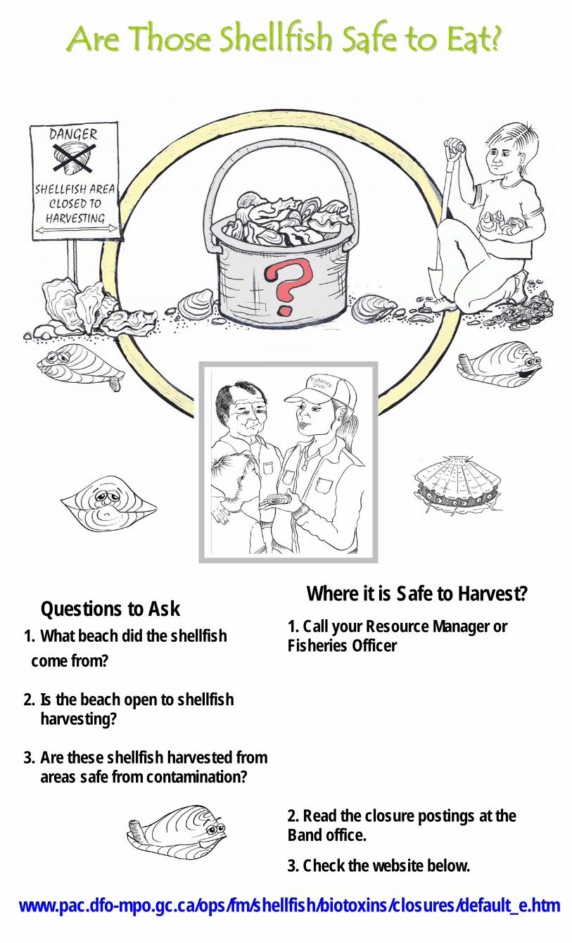
Questions to Ask 1. What beach did the shellfish come from? 2. Is the beach open to shellfish
harvesting? 3. Are these shellfish harvested from
areas safe from contamination?
Where it is Safe to Harvest? 1. Call your Resource Manager or Fisheries Officer.
Kuper Island: Loren James Tel: 246-2321 Extension 225 Cowichan Tribes: Wayne Paige Tel: 748-3196 Halalt Band: Bert Thomas Tel: 246-4736 Lyackson Band Tel: 246-5019 Chemainus Band: Kevin Frenchie Tel: 245-7155 Extension 247
www.pac.dfo-mpo.gc.ca/ops/fm/shellfish/biotoxins/closures/default_e.htm
AArree TThhoossee SShheellllffiisshh SSaaffee ttoo EEaatt??

Questions to Ask 1. What beach did the shellfish come from? 2. Is the beach open to shellfish
harvesting? 3. Are these shellfish harvested from
areas safe from contamination?
Where it is Safe to Harvest? 1. Call your Resource Manager or Fisheries Officer.
2. Read the closure postings at the Band office.
3. Check the website below.
www.pac.dfo-mpo.gc.ca/ops/fm/shellfish/biotoxins/closures/default_e.htm
AArree TThhoossee SShheellllffiisshh SSaaffee ttoo EEaatt??

Questions to Ask 1. What beach did the shellfish come from? 2. Is the beach open to shellfish
harvesting? 3. Are these shellfish harvested from
areas safe from contamination?
Where it is Safe to Harvest? 1. Call your Resource Manager or Fisheries Officer
Kuper Island: Loren James Tel: 246-2321 Extension 225 Cowichan Tribes: Wayne Paige Tel: 748-3196 Halalt Band: Bert Thomas Tel: 246-4736 Lyackson Band Tel: 246-5019 Chemainus Band: Kevin Frenchie Tel: 245-7155 Extension 247
www.pac.dfo-mpo.gc.ca/ops/fm/shellfish/biotoxins/closures/default_e.htm
AArree TThhoossee SShheellllffiisshh SSaaffee ttoo EEaatt??
Questions to Ask 1. What beach did the shellfish come from? 2. Is the beach open to shellfish
harvesting? 3. Are these shellfish harvested from
areas safe from contamination?
Where it is Safe to Harvest? 1. Call your Resource Manager or Fisheries Officer
2. Read the closure postings at the Band office.
3. Check the website below.
www.pac.dfo-mpo.gc.ca/ops/fm/shellfish/biotoxins/closures/default_e.htm
AArree TThhoossee SShheellllffiisshh SSaaffee ttoo EEaatt??
Activity Guide for
What is My Name?
Prepared as a companion activity for:
The Shellfish Safety Resource Manual, Karen Fediuk, Mia Parker and Kristiann Allen, Ladysmith BC: 2007 Prepared by:
Linda Hiemstra, Mel Mor Science, Nanaimo, BC Tel: 250-751-4862 March 19, 2007

1
Shellfish Safety Project Penelakut Tribe, Cowichan Tribes and the Hul’qumi’num
Treaty Group
What is My Name? – Activity Indicate the letter of the Hul'qumi'num name under the English name.
HUL'QUMI'NUM
a. sweem
b. lhew'qum'
c. 'ey'x
d. skw'lhey'
e. tl'uxwtl'uxw
f. stl'ula'um / st'ula'am
g. s'axwa' Let’s make a sentence! Say the Hul'q'umi'num' words for:
Dig clams
Gather oysters
Let’s go dig clams.
Let’s go gather oysters.
Figure 7. Manila Clam
Hul’qumi’num ___
Figure 2. Butter Clam
Hul’qumi’num ___
Figure 3. Horse Clam
Hul’qumi’num ___
Figure 4. Cockle
Hul’qumi’num ___
Figure 5. Oyster
Hul’qumi’num ___
Figure 6. Mussel
Hul’qumi’num ___
Figure 1. Dungeness Crab
Hul’qumi’num ___

2
Shellfish Safety Project Penelakut Tribe, Cowichan Tribes and the Hul’qumi’num
Treaty Group
What is My Name? – Activity Activity Key
Indicate the letter of the Hul'qumi'num name under the English name.
HUL'QUMI'NUM
a. sweem
b. lhew'qum'
c. 'ey'x
d. skw'lhey'
e. tl'uxwtl'uxw
f. stl'ula'um / st'ula'am
g. s'axwa' Let’s make a sentence! Say the island Hul'q'umi'num' words for:
Dig clams – t'hwaalh Gather oysters - tstl'uxwtl'uxw Let’s go dig clams. - 'ilhe nem' t'hwaalh Let’s go gather oysters. - 'ilhe nem' tstl'uxwtl'uxw
Figure 7. Manila Clam
Hul’qumi’num - d
Figure 2. Butter Clam
Hul’qumi’num - g
Figure 3. Horse Clam
Hul’qumi’num - a
Figure 4. Cockle
Hul’qumi’num - f
Figure 5. Oyster
Hul’qumi’num - e
Figure 6. Mussel
Hul’qumi’num - b
Figure 1. Dungeness Crab
Hul’qumi’num - c
Activity Guide for
Who is a Happy Clam?
Prepared as a companion activity for:
The Shellfish Safety Resource Manual, Karen Fediuk, Mia Parker and Kristiann Allen, Ladysmith BC: 2007 Prepared by:
Linda Hiemstra, Mel Mor Science, Nanaimo, BC Tel: 250-751-4862 March 19, 2007
1
Shellfish Safety Project Penelakut Tribe, Cowichan Tribes and the Hul’qumi’num
Treaty Group
Who is a Happy Clam? – Activity Guide
Table of Contents Table of Contents ............................................................................................................ 1 Activity Goals................................................................................................................... 2 Activity Description .......................................................................................................... 2 Instructions ...................................................................................................................... 3
Organizing the Activity ................................................................................................. 3 Leading the Activity...................................................................................................... 3
Activity Materials.............................................................................................................. 4 Resource Materials.......................................................................................................... 4
Harvesting Closure Information.................................................................................... 4 Maps ............................................................................................................................ 5 Reusable Map Labels .................................................................................................. 7
Potential Sources of Shellfish Contamination................................................................ 10 For More Information ..................................................................................................... 12 Template for Reusable Stickers..................................................................................... 13

2
Shellfish Safety Project Penelakut Tribe, Cowichan Tribes and the Hul’qumi’num
Treaty Group
Who is a Happy Clam? – Activity Guide Activity Goals The goals of this activity are as follows.
To provide information that will assist participants to read local marine charts and land maps and to identify land masses, landmarks and marine uses
To have participants use a map of the area to determine the location of communities and shellfish harvesting areas
To provide information and location of potential and existing pollution sources To have participants determine if an area is open or closed to shellfish harvesting To provide a positive, interactive learning experience for all participants
Activity Description This activity centres on a large poster size map of the local area. Using reusable stickers provided participants are asked to identify and label the
following: o gross features – islands, harbours, water masses; o marine and upland activities; and o shellfish harvesting areas.
Using the step by step instructions, participants are asked to determine if the shellfish harvesting areas are open or closed using the local fisheries officers, posted information, or the website
Closure information is added to the poster map in the appropriate location. Happy Clams are put on areas that are open to shellfish harvesting. Map is left in a conspicuous location with stickers in place. When activity is to be repeated, all stickers are removed prior to starting.
NOTES
3
Shellfish Safety Project Penelakut Tribe, Cowichan Tribes and the Hul’qumi’num
Treaty Group
Who is a Happy Clam? – Activity Guide
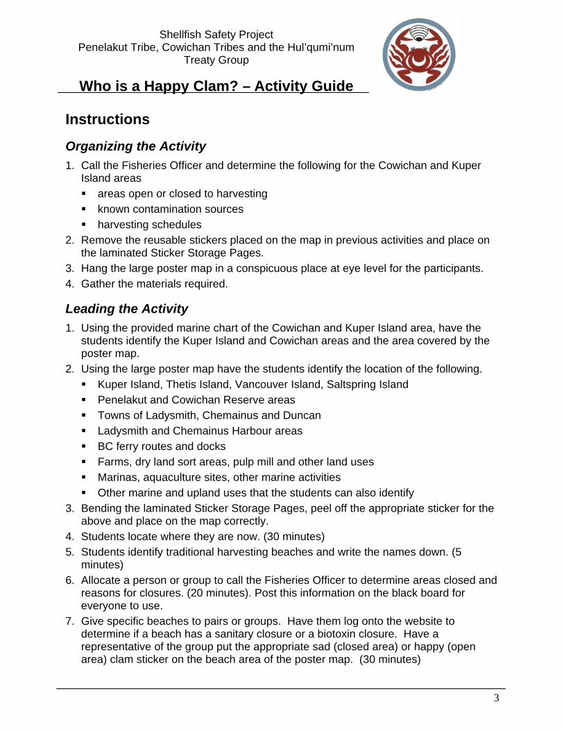
Instructions
Organizing the Activity 1. Call the Fisheries Officer and determine the following for the Cowichan and Kuper
Island areas areas open or closed to harvesting known contamination sources harvesting schedules
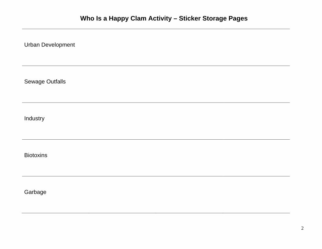
2. Remove the reusable stickers placed on the map in previous activities and place on the laminated Sticker Storage Pages.
3. Hang the large poster map in a conspicuous place at eye level for the participants. 4. Gather the materials required.
Leading the Activity 1. Using the provided marine chart of the Cowichan and Kuper Island area, have the
students identify the Kuper Island and Cowichan areas and the area covered by the poster map.
2. Using the large poster map have the students identify the location of the following. Kuper Island, Thetis Island, Vancouver Island, Saltspring Island Penelakut and Cowichan Reserve areas Towns of Ladysmith, Chemainus and Duncan Ladysmith and Chemainus Harbour areas BC ferry routes and docks Farms, dry land sort areas, pulp mill and other land uses Marinas, aquaculture sites, other marine activities Other marine and upland uses that the students can also identify
3. Bending the laminated Sticker Storage Pages, peel off the appropriate sticker for the above and place on the map correctly.
4. Students locate where they are now. (30 minutes) 5. Students identify traditional harvesting beaches and write the names down. (5
minutes) 6. Allocate a person or group to call the Fisheries Officer to determine areas closed and
reasons for closures. (20 minutes). Post this information on the black board for everyone to use.
7. Give specific beaches to pairs or groups. Have them log onto the website to determine if a beach has a sanitary closure or a biotoxin closure. Have a representative of the group put the appropriate sad (closed area) or happy (open area) clam sticker on the beach area of the poster map. (30 minutes)

4
Shellfish Safety Project Penelakut Tribe, Cowichan Tribes and the Hul’qumi’num
Treaty Group
Who is a Happy Clam? – Activity Guide 8. Have each group provide the shellfish harvesting information they determined to the
class. 9. Discuss the importance to human health of knowing if an area is open or closed (15
minutes) 10. Leave poster map in conspicuous place until next activity. (5 minutes)
Activity Materials 1. Activity Guide 2. Poster Map 3. Map Labels 4. Area Marine Chart
Resource Materials
Harvesting Closure Information
Checking for Shellfish Harvesting Closures on the Website 1. Log into Fisheries and Oceans Canada website: http://www.pac.dfo-mpo.gc.ca/ops/fm/shellfish/biotoxins/closures/default_e.htm 2. Click on PSP and Sanitary Contamination Closures. 3. Using maps on page 6-7 of this manual, determine the area of interest – either Area 17 or 18. Go to the correct area using scroll down box and press go. 4. Click on specific beaches for a larger map to determine if areas are closed. Harvesting is restricted in the red marked areas. 5. After checking a specific beach, click on Return to Area 17 Closures (or Area 18 Closures if you are using this area), to access the area map and check other beaches. 6. Once you are finished checking for sanitary closures, click on Shellfish Biotoxin Closures above the map. 7. Scroll down to find the area you are interested in and the appropriate closure information.
*Be sure to check for both PSP and Sanitary Contamination Closures if you plan on consuming any shellfish.
5
Shellfish Safety Project Penelakut Tribe, Cowichan Tribes and the Hul’qumi’num
Treaty Group
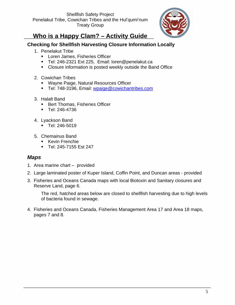
Who is a Happy Clam? – Activity Guide Checking for Shellfish Harvesting Closure Information Locally
1. Penelakut Tribe Loren James, Fisheries Officer Tel: 246-2321 Ext 225, Email: [email protected] Closure information is posted weekly outside the Band Office
2. Cowichan Tribes
Wayne Paige, Natural Resources Officer Tel: 748-3196, Email: [email protected]
3. Halalt Band
Bert Thomas, Fisheries Officer Tel: 246-4736
4. Lyackson Band
Tel: 246-5019
5. Chemainus Band Kevin Frenchie Tel: 245-7155 Est 247
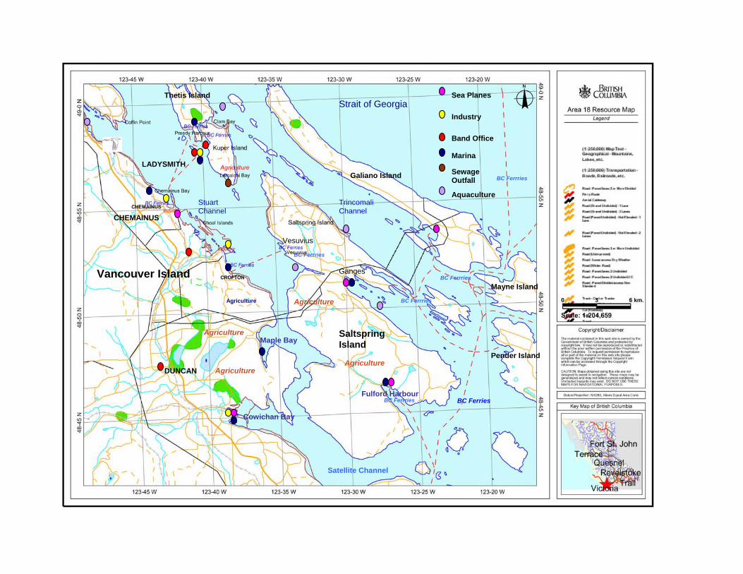
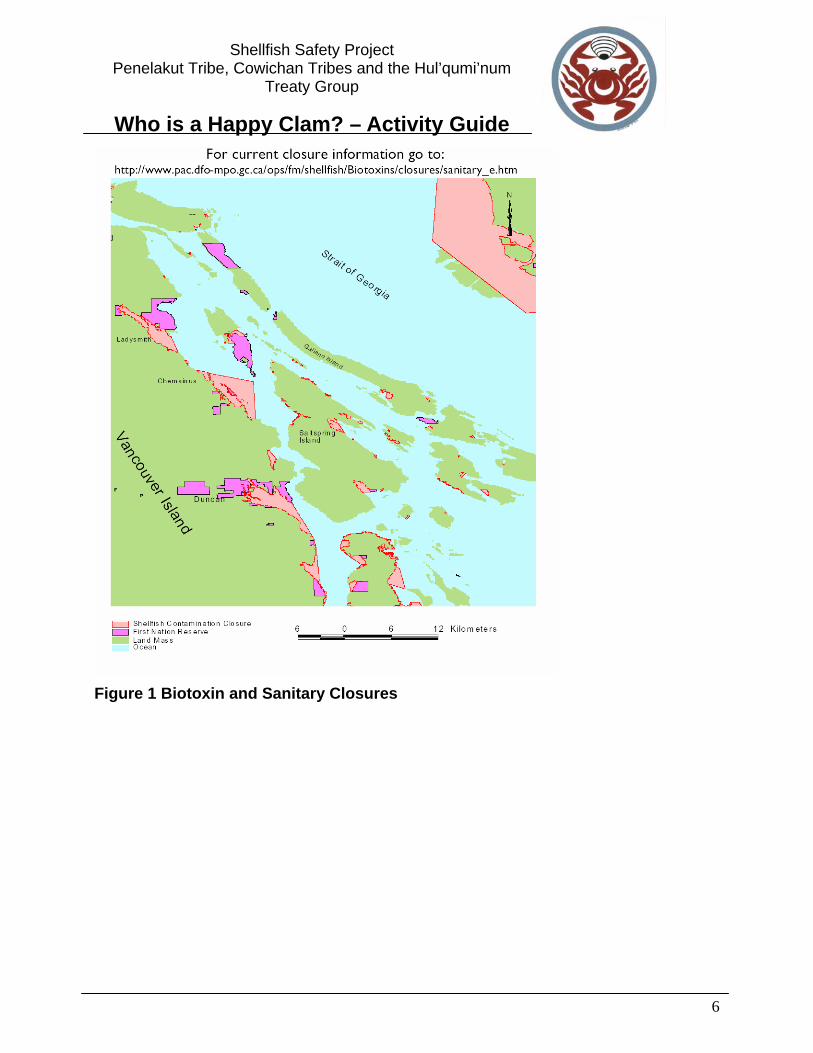
Maps 1. Area marine chart – provided 2. Large laminated poster of Kuper Island, Coffin Point, and Duncan areas - provided 3. Fisheries and Oceans Canada maps with local Biotoxin and Sanitary closures and
Reserve Land, page 6. The red, hatched areas below are closed to shellfish harvesting due to high levels of bacteria found in sewage.
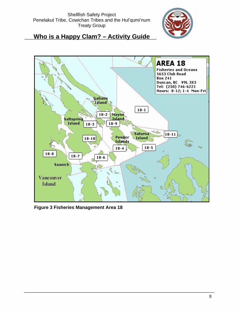
4. Fisheries and Oceans Canada, Fisheries Management Area 17 and Area 18 maps,
pages 7 and 8.
6
Shellfish Safety Project Penelakut Tribe, Cowichan Tribes and the Hul’qumi’num
Treaty Group
Who is a Happy Clam? – Activity Guide
Figure 1 Biotoxin and Sanitary Closures

7
Shellfish Safety Project Penelakut Tribe, Cowichan Tribes and the Hul’qumi’num
Treaty Group
Who is a Happy Clam? – Activity Guide
Figure 2 Fisheries Management Area 17
8
Shellfish Safety Project Penelakut Tribe, Cowichan Tribes and the Hul’qumi’num
Treaty Group
Who is a Happy Clam? – Activity Guide
Figure 3 Fisheries Management Area 18
9
Shellfish Safety Project Penelakut Tribe, Cowichan Tribes and the Hul’qumi’num
Treaty Group
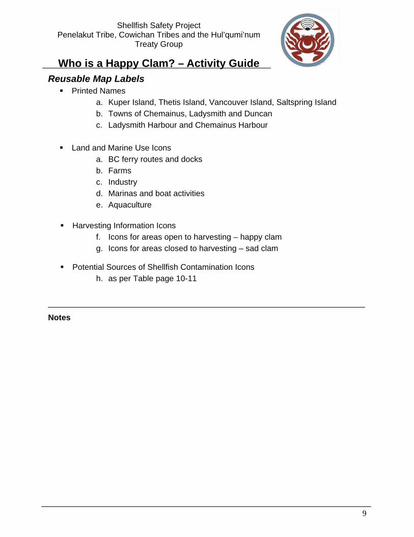
Who is a Happy Clam? – Activity Guide Reusable Map Labels
Printed Names a. Kuper Island, Thetis Island, Vancouver Island, Saltspring Island b. Towns of Chemainus, Ladysmith and Duncan c. Ladysmith Harbour and Chemainus Harbour
Land and Marine Use Icons
a. BC ferry routes and docks b. Farms c. Industry d. Marinas and boat activities e. Aquaculture
Harvesting Information Icons
f. Icons for areas open to harvesting – happy clam g. Icons for areas closed to harvesting – sad clam
Potential Sources of Shellfish Contamination Icons
h. as per Table page 10-11
Notes

10
Shellfish Safety Project Penelakut Tribe, Cowichan Tribes and the Hul’qumi’num
Treaty Group
Who is a Happy Clam? – Activity Guide
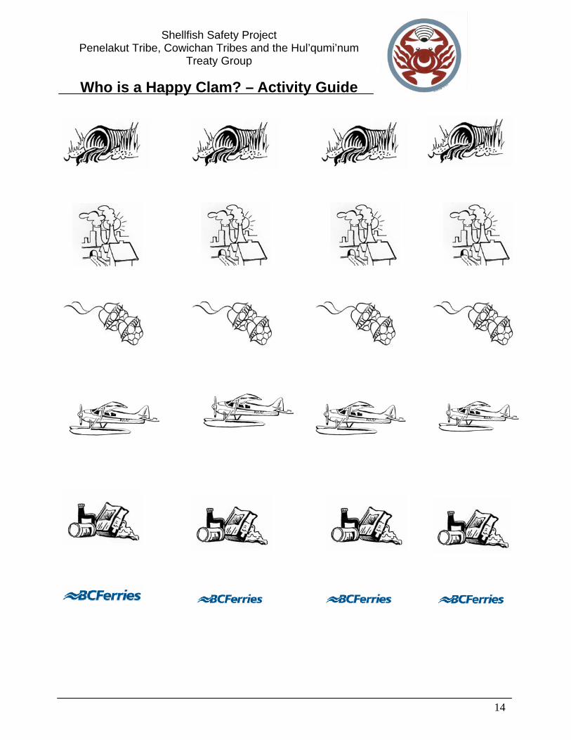
Potential Sources of Shellfish Contamination
Potential Pollutant/Issue Map Sticker Description
1.
Marinas And
Anchored Boats
Concentrated risk of oil, fuel and waste spilling. Only some waters are protected from dumping septic waste from recreational boats.
2.
Wildlife
Bacterial contamination from wildlife fecal waste and from dead carcasses.
3.
Seaplanes
This ocean travel method poses risk of possible fuel and waste spillage.
4.
Ferry Traffic
Increased risk of fuel and waste leakage on a larger scale.
5.
Agriculture
Agriculture and lawn care put more nitrogen in the ocean, encouraging Red Tide (Toxic Algae Blooms). The fertilizers containing the nitrogen go into the ocean by runoff of water after rains.
6.
Urban Development
Construction and other human activities may also increase the amount of runoff into the ocean. It also raises the risk of faulty septic containment and more wastes.
11
Shellfish Safety Project Penelakut Tribe, Cowichan Tribes and the Hul’qumi’num
Treaty Group
Who is a Happy Clam? – Activity Guide
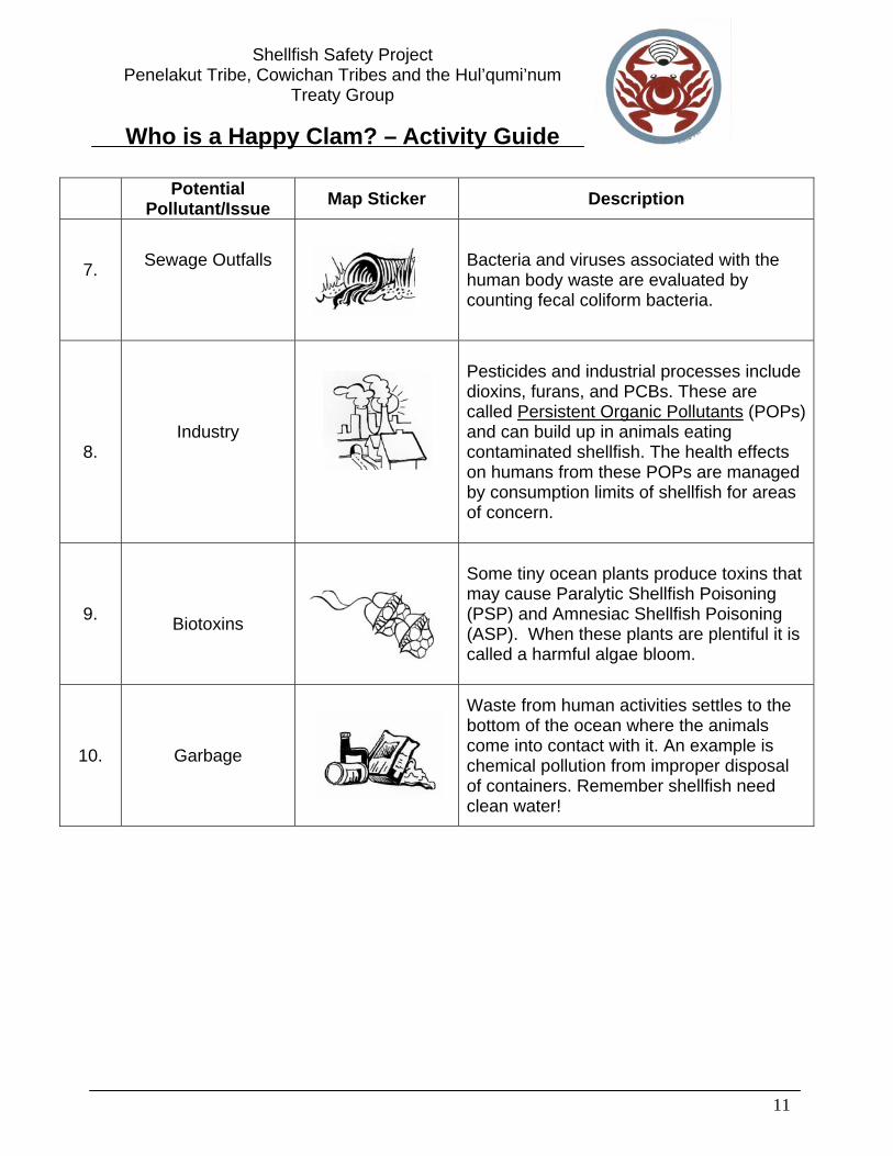
Potential Pollutant/Issue Map Sticker Description
7.
Sewage Outfalls
Bacteria and viruses associated with the human body waste are evaluated by counting fecal coliform bacteria.
8.
Industry
Pesticides and industrial processes include dioxins, furans, and PCBs. These are called Persistent Organic Pollutants (POPs) and can build up in animals eating contaminated shellfish. The health effects on humans from these POPs are managed by consumption limits of shellfish for areas of concern.
9.
Biotoxins
Some tiny ocean plants produce toxins that may cause Paralytic Shellfish Poisoning (PSP) and Amnesiac Shellfish Poisoning (ASP). When these plants are plentiful it is called a harmful algae bloom.
10.
Garbage
Waste from human activities settles to the bottom of the ocean where the animals come into contact with it. An example is chemical pollution from improper disposal of containers. Remember shellfish need clean water!

12
Shellfish Safety Project Penelakut Tribe, Cowichan Tribes and the Hul’qumi’num
Treaty Group
Who is a Happy Clam? – Activity Guide
For More Information Shellfish Water Quality Protection Program on the West Coast of Canada www.pyr.ec.gc.ca/EN/Shellfish/index.shtml Environment Canada Fact Sheet of shellfish and water quality http://www.ns.ec.gc.ca/epb/factsheets/sfish_wq.html Environment Canada Shellfish Water Quality Protection Program information http://www.pyr.ec.gc.ca/EN/Shellfish/index.shtml Canadian Shellfish Sanitation Program: http://www.ns.ec.gc.ca/epb/sfish/cssp.html Shellfish Contamination Closures http://www.pac.dfo-mpo.gc.ca/ops/fm/shllfish/biotoxins/closures/default_e.htm Shellfish Biotoxins http://www.pac.dfo-mpo.gc.ca/ops/fm/shellfish/Biotoxins/biotoxins_e.htm Shellfish Factsheet http:www.atl.ec.gc.ca/epb/factsheets/sfish_wq.html
Fediuk, Karen, Mia Parker and Kristiann Allen. 2005. Shellfish Safety Resource Manual. A Joint Penelakut and Cowichan Tribes Fisheries Project. Ladysmith, BC.
Notes
13
Shellfish Safety Project Penelakut Tribe, Cowichan Tribes and the Hul’qumi’num
Treaty Group
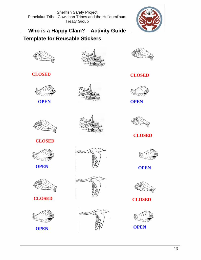
Who is a Happy Clam? – Activity Guide Template for Reusable Stickers
CLOSED
OPEN
CLOSED
CLOSED
CLOSED
CLOSED
OPEN
OPEN
OPEN
OPEN
OPEN
CLOSED
14
Shellfish Safety Project Penelakut Tribe, Cowichan Tribes and the Hul’qumi’num
Treaty Group
Who is a Happy Clam? – Activity Guide

15
Shellfish Safety Project Penelakut Tribe, Cowichan Tribes and the Hul’qumi’num
Treaty Group
Who is a Happy Clam? – Activity Guide
Kuper Island
Thetis Island
Saltspring
Island
Vancouver
Island
Chemainus
Bay
Preedy Harbour
Telegraph Harbour
Trincomali
Channel
Lamalchi
Bay
Stuart Channel
Clam Bay
Houston Passage
Kulleet Bay
Cowichan Bay
Chemainus
Ladysmith
Crofton
Shingle Point
Shoal Island
Aquaculture
Aquaculture
Aquaculture
Aquaculture
Aquaculture
Aquaculture
Aquaculture
Band Office
Band Office
Band Office

16
Shellfish Safety Project Penelakut Tribe, Cowichan Tribes and the Hul’qumi’num
Treaty Group
Who is a Happy Clam? – Activity Guide NOTES

Who Is a Happy Clam Activity – Sticker Storage Pages
1
Marinas and Anchored Boats
Wildlife
Seaplanes
Ferry Traffic
Agriculture
Who Is a Happy Clam Activity – Sticker Storage Pages
2
Urban Development
Sewage Outfalls
Industry
Biotoxins
Garbage

Who Is a Happy Clam Activity – Sticker Storage Pages
3
Towns and Harbours
Bays and Channels
Band Offices
Open to Harvesting
Closed to Harvesting