session 3 measuring latitude and longitude. we are located west of the prime meridian and north of...
TRANSCRIPT
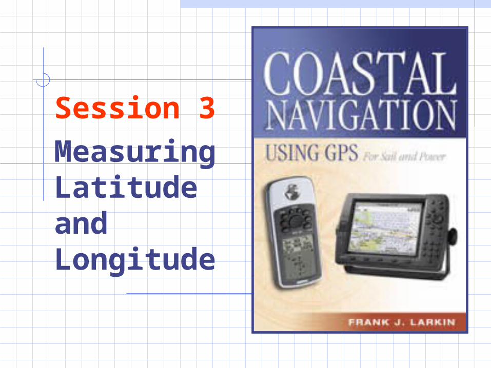
Session 3
Measuring Latitude and Longitude
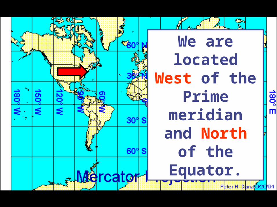
We are located West of the
Prime meridian and North of the
Equator.
LATITUDE
SCALE
The latitude scales are
found at the left and right margins of a
chart.
LATITUDE SCALE
One minute of latitude is equal to one nautical mile.
The latitude scales can be used to
measure distance.
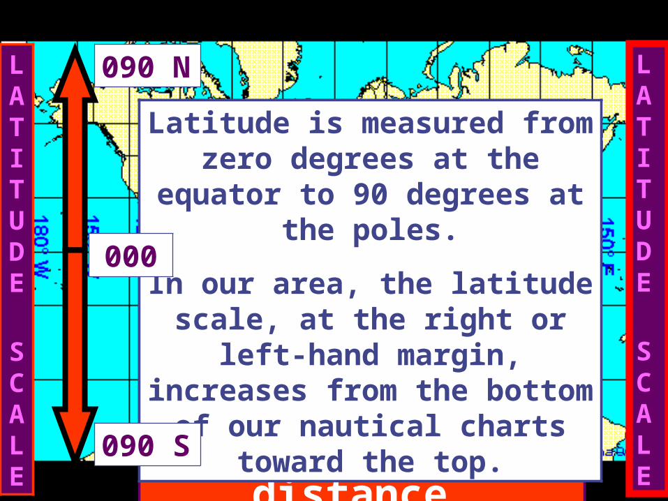
Latitude is measured from zero degrees at the equator to 90
degrees at the poles.
In our area, the latitude scale, at the right or left-hand margin, increases from the bottom of our nautical charts toward the
top.
090 N
090 S
000

The Longitude Scales are
located at the top and
bottom of a nautical chart..
LONGITUDE SCALE
LONGITUDE SCALE
Longitude is measured from zero at the prime meridian in
Greenwich, UK, east and west to a point in the Pacific Ocean.
In our area, the longitude scale, at the top or bottom margin, increases from right to left
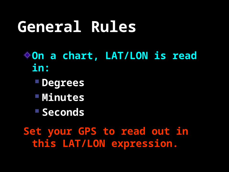
General Rules
On a chart, LAT/LON is read in: Degrees Minutes Seconds
Set your GPS to read out in this LAT/LON expression.
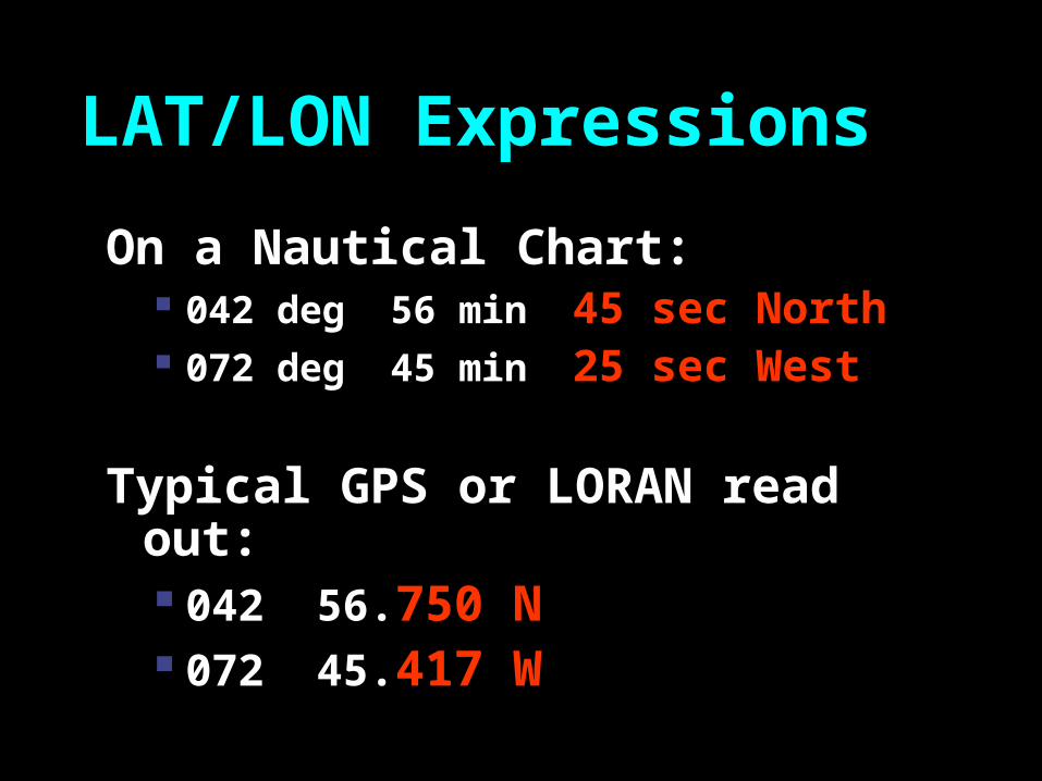
LAT/LON Expressions
On a Nautical Chart: 042 deg 56 min 45 sec North 072 deg 45 min 25 sec West
Typical GPS or LORAN read out: 042 56.750 N 072 45.417 W
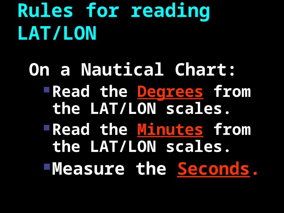
Rules for reading LAT/LON
On a Nautical Chart:Read the Degrees from the
LAT/LON scales.Read the Minutes from the
LAT/LON scales.Measure the Seconds.

Finding Your Latitude Position
Latitu
de S
cale
Longitude Scale
W Or ‘A’Fl 4sec BELL
SMALL SCALE CHART
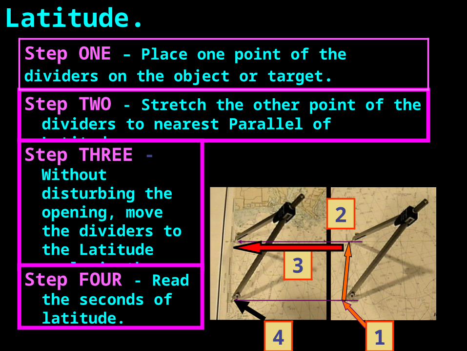
Measuring the Seconds of Latitude.
Step TWO - Stretch the other point of the dividers to nearest Parallel of Latitude.
Step THREE - Without disturbing the opening, move the dividers to the Latitude scale in the left or right margins.
Step FOUR - Read the seconds of latitude.
1
2
3
4
Step ONE – Place one point of the dividers on the
object or target.
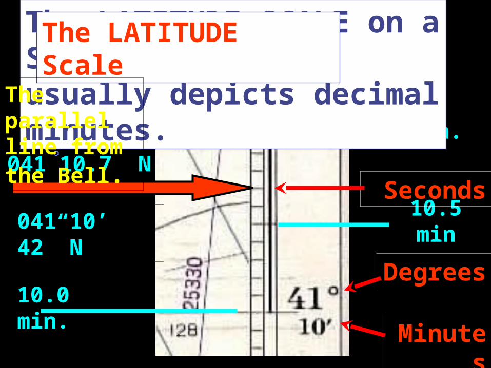
11.0 min.
10.5 min
041 10.7” N
The LATITUDE SCALE on a Small Scale Chart usually depicts decimal minutes.
Degrees
Minutes
Seconds
10.0 min.
041 10’ 42” N
The LATITUDE Scale
The parallel line from the Bell.
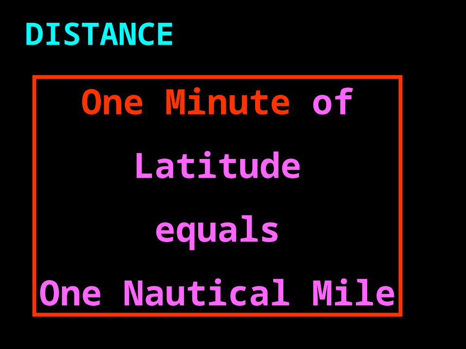
One Minute of
Latitude
equals
One Nautical Mile
DISTANCE
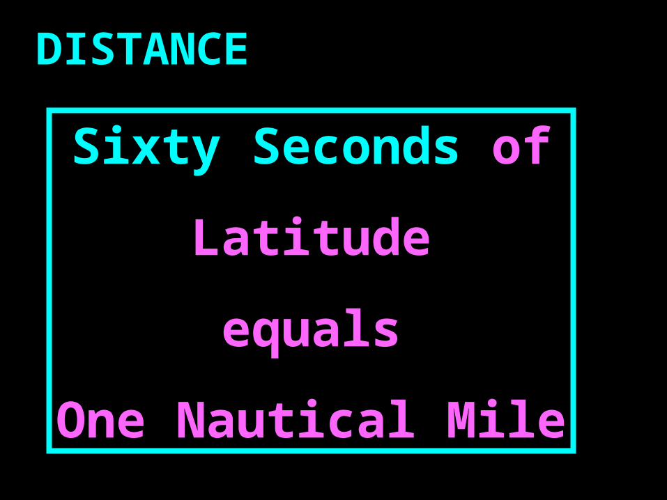
Sixty Seconds of
Latitude
equals
One Nautical Mile
DISTANCE
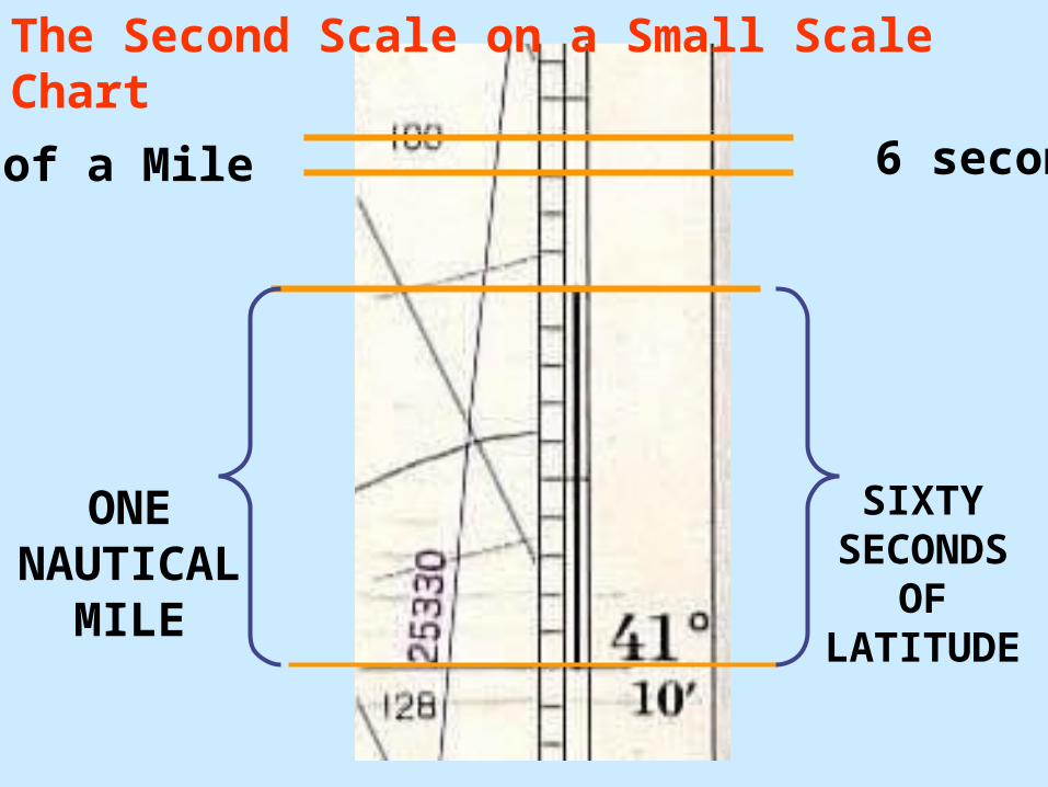
SIXTYSECONDS
OFLATITUDE
ONENAUTICAL
MILE
6 seconds1/10 of a Mile
The Second Scale on a Small Scale Chart
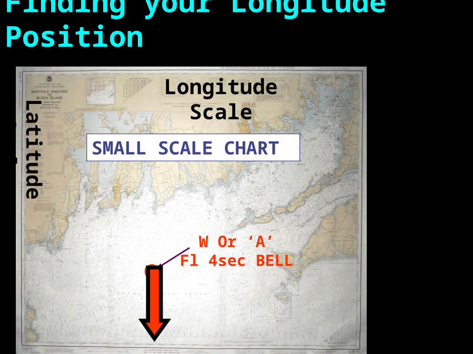
Finding your Longitude Position
Latitu
de S
cale
Longitude Scale
W Or ‘A’Fl 4sec BELL
SMALL SCALE CHART
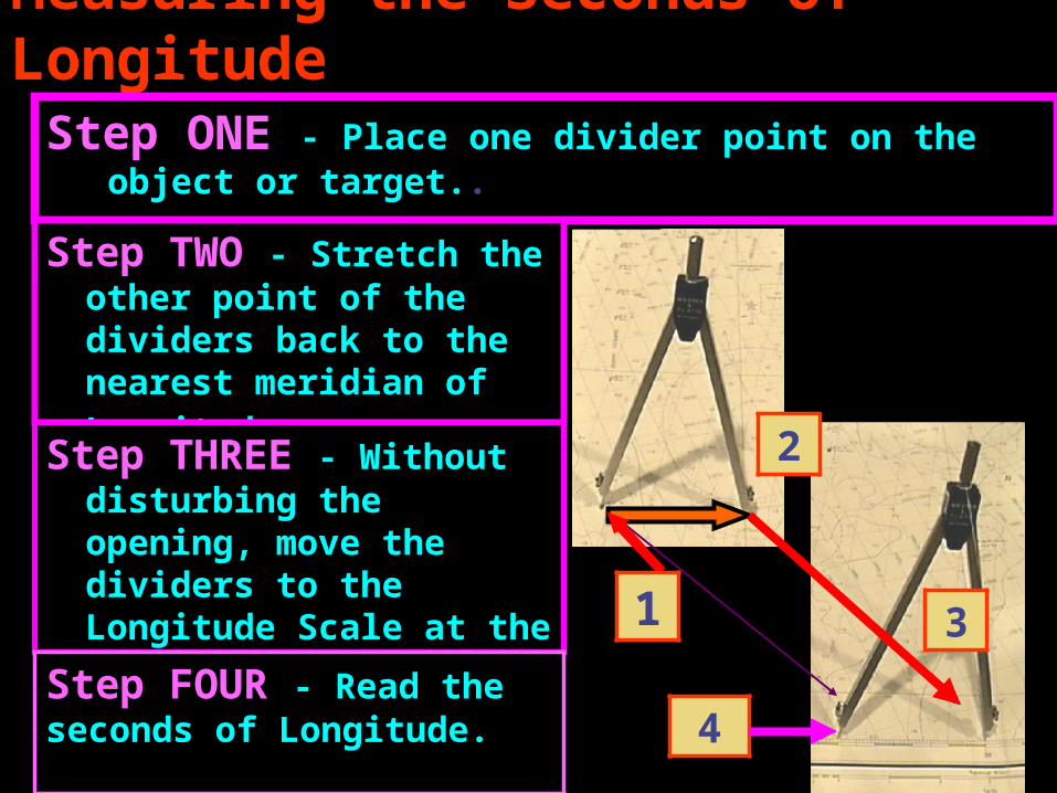
Measuring the Seconds of LongitudeStep ONE - Place one divider point on the object or
target..
Step TWO - Stretch the other point of the dividers back to the nearest meridian of Longitude.
Step THREE - Without disturbing the opening, move the dividers to the Longitude Scale at the top or bottom margin. 1
2
3
4Step FOUR - Read the seconds of Longitude.
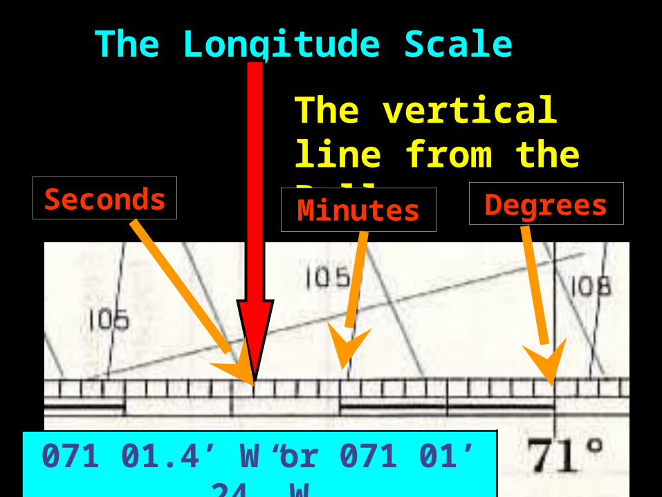
The Longitude Scale
The vertical line from the Bell.
DegreesMinutesSeconds
071 01.4’ W or 071 01’ 24” W
Any questions about how to read and plot Latitude and Longitude?