selected terrain studies for optimum hf station performance · selected terrain studies for optimum...
TRANSCRIPT
1
Selected Terrain Studies forOptimum HF Station
PerformanceA Presentation at
The Dayton Hamvention Antenna Forum
Friday, May 14, 2004Dayton, OH
by Dean Straw, N6BVSenior Assistant Technical Editor, ARRL
2
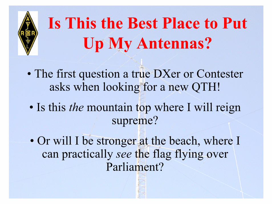
Is This the Best Place to PutUp My Antennas?
• The first question a true DXer or Contesterasks when looking for a new QTH!
• Is this the mountain top where I will reignsupreme?
• Or will I be stronger at the beach, where Ican practically see the flag flying over
Parliament?
3
What Terrain is Best?
•Team Vertical for a number of years has beenstressing the virtues of verticals over saltwater.
• There’s no question about it, especially on thelow bands: Verticals over saltwater rock androll!

4
Low Elevation Angles Are Critical,Especially on the Lower Bands.
A pair of verticals on the beach holds its own against a3-element 80-meter beam at 200 ft!
5
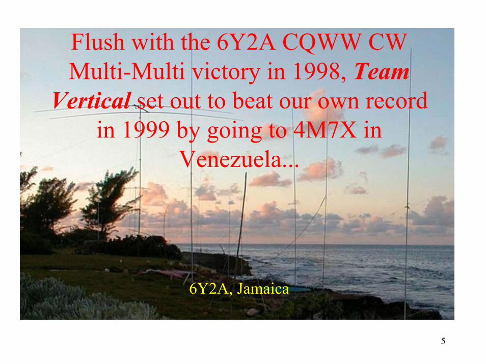
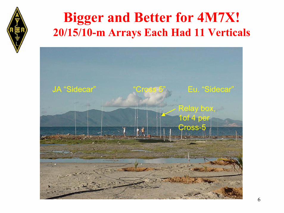
6Y2A, Jamaica
Flush with the 6Y2A CQWW CWMulti-Multi victory in 1998, TeamVertical set out to beat our own record
in 1999 by going to 4M7X inVenezuela...
6
Bigger and Better for 4M7X!20/15/10-m Arrays Each Had 11 Verticals
“Cross 5” Eu. “Sidecar”JA “Sidecar”
Relay box,1of 4 perCross-5
7
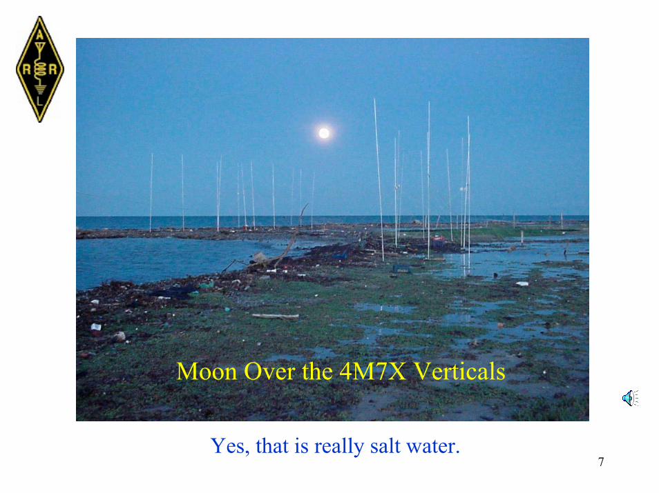
Moon Over the 4M7X Verticals
Yes, that is really salt water.
8
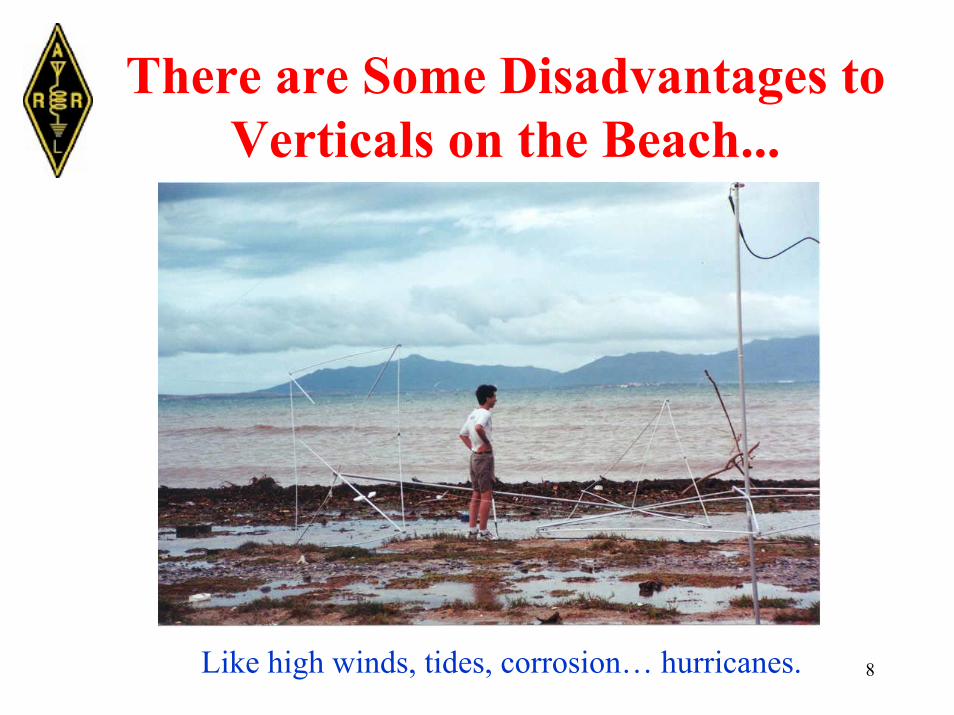
There are Some Disadvantages toVerticals on the Beach...
Like high winds, tides, corrosion… hurricanes.
9
Back to Dry Land
• OK, so not everyone can do the beach thingwith verticals.
• Horizontal antennas: Flat land is easy! Thingsare nice and predictable. (Saltwater is flat too.)
• What tools are available for assessing theeffect of real-world terrain on the launch of HFsignals?
10
The HFTA Program• HFTA stands for “High Frequency TerrainAssessment.”
• HFTA traces the path of rays over 2D terrain,taking into account reflections and diffractions.
• HFTA is bundled with the 20th Edition of TheARRL Antenna Book.
11
At $39.95: Somevery usefulsoftware -- with a900-page printedbook thrown infor free! But I’mbiased...
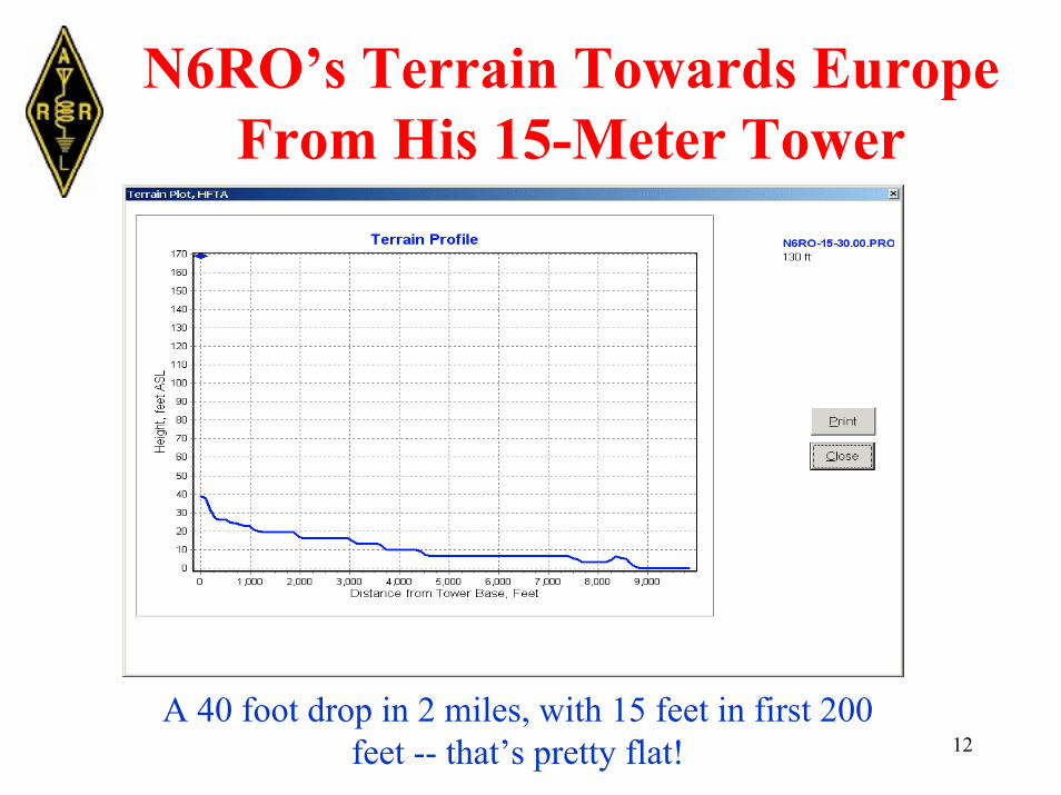
12
N6RO’s Terrain Towards EuropeFrom His 15-Meter Tower
A 40 foot drop in 2 miles, with 15 feet in first 200feet -- that’s pretty flat!

13
15 Meters to Europe at N6RO
Response is close to flat-land response.
Elevation-AngleStatistics
Figure of Merit
14
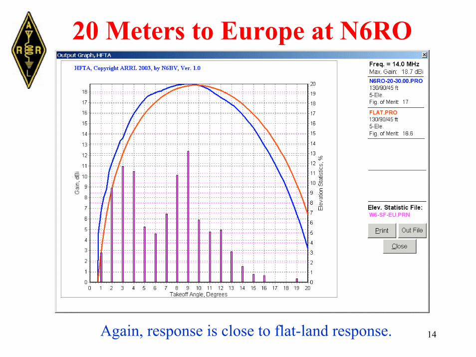
20 Meters to Europe at N6RO
Again, response is close to flat-land response.
15
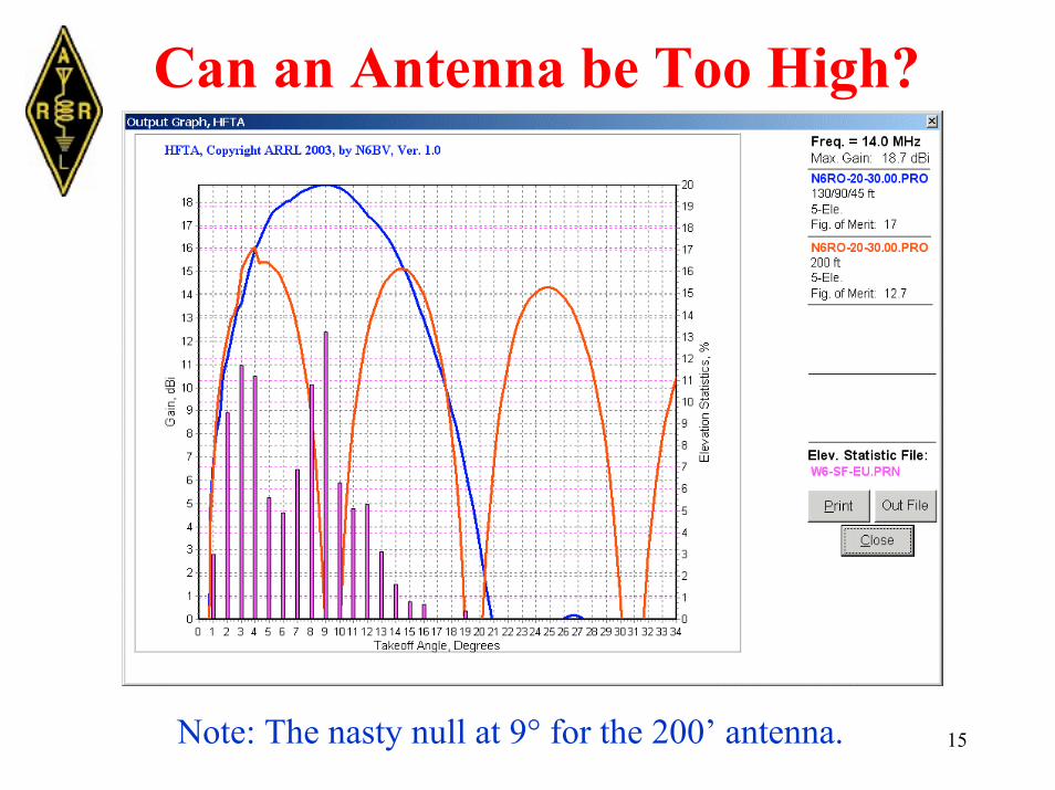
Can an Antenna be Too High?
Note: The nasty null at 9° for the 200’ antenna.
16
Getting Terrain Data for HFTA
• From paper topo maps -- excruciatinglypainful!
• “Seamless” USGS database -- easy to use.
• DEM (Digital Elevation Model) data -- mayrequire “merging” of several 7.5-minute maps tocover required area. Merging can be a pain.
(The HFTA manual details how to access eitherelectronic form of terrain data.)
17
Seamless USGS Database
The seamless USGS database is easiest to use.
Just specify area to be covered -- ±5 minutesNorth/South and ±5 minutes East/West,centered on latitude and longitude at tower base.

18
Seamless USGS Database
For ex., 37° 25’ 28” N and 121° 36’ 14” W
North37° 30’
West 121° 41’ 121° 31’ East 37° 20’
South
Note: You can neglect the seconds. This will give you a coveragecircle of at least 4400 meters around tower base.

19
MicroDEM & Seamless Data
The 4400-meter circle in5° steps shows theterrain data for HFTA
Note how circle isin central portion ofthe seamless map

20
MicroDEM & USGS DEM Data
Did I mention that it’sflat at N6RO? This mapdidn’t require merging ofDEMs, but just barely.
Terrain data for HFTA

21
40-m Stack, N6RO 10-m and 20-mStacks, N6RO
22
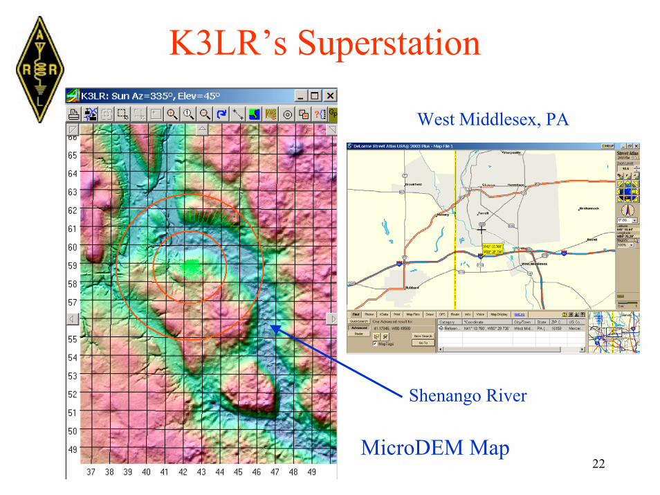
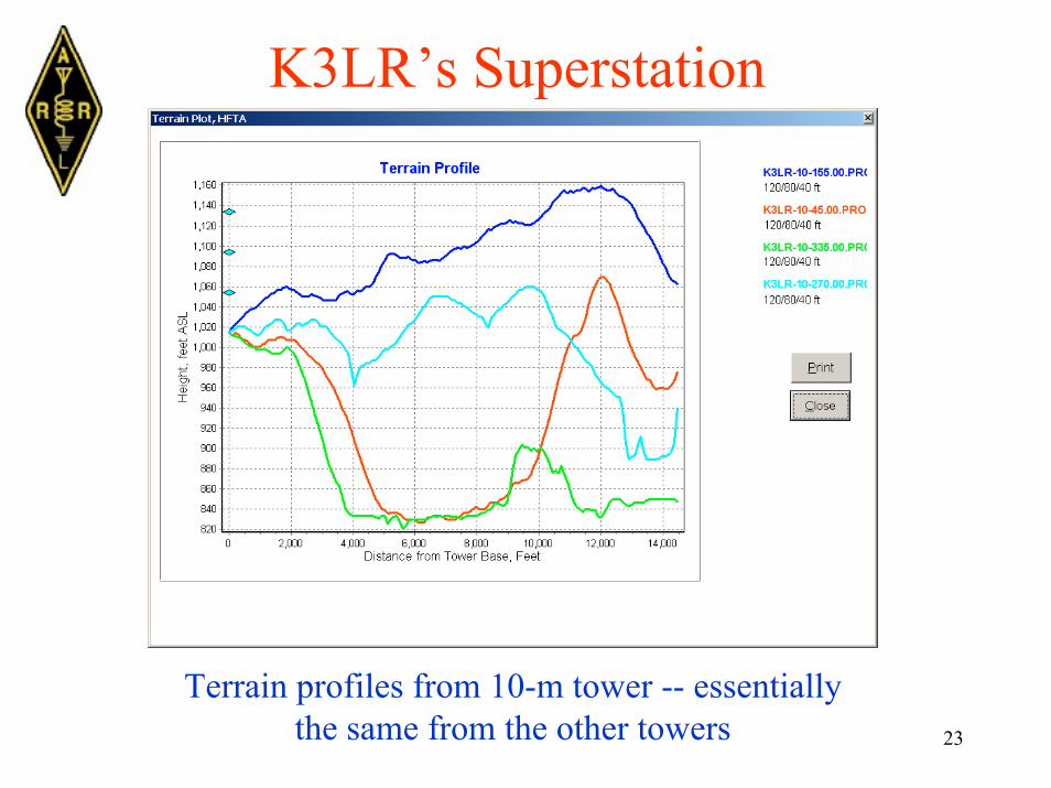
K3LR’s Superstation
West Middlesex, PA
Shenango River
MicroDEM Map
23
K3LR’s Superstation
Terrain profiles from 10-m tower -- essentiallythe same from the other towers
24
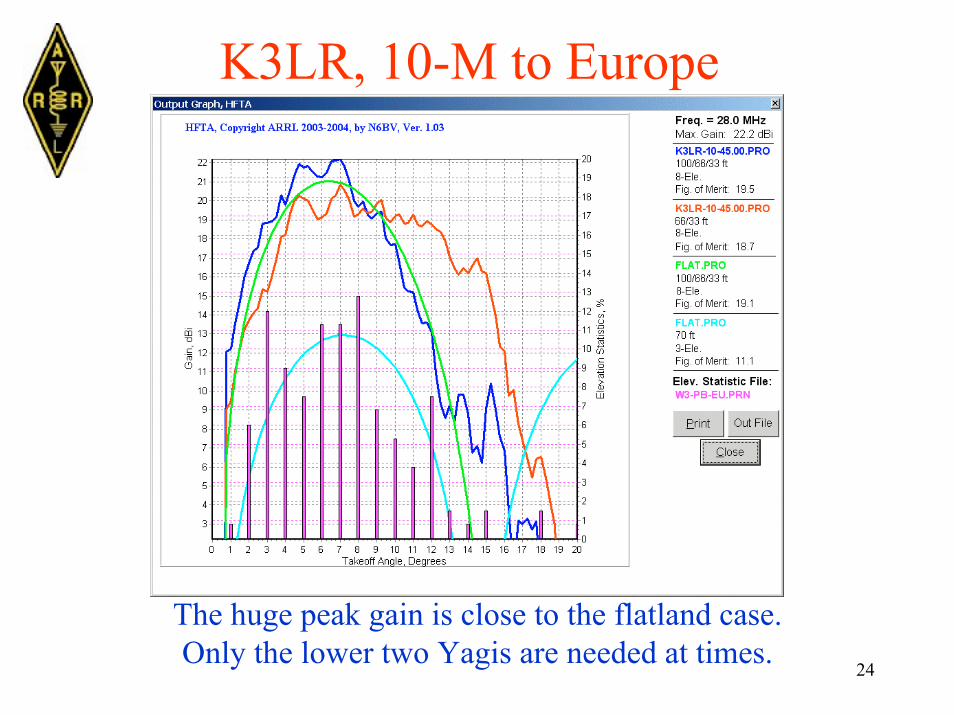
K3LR, 10-M to Europe
The huge peak gain is close to the flatland case.Only the lower two Yagis are needed at times.
25
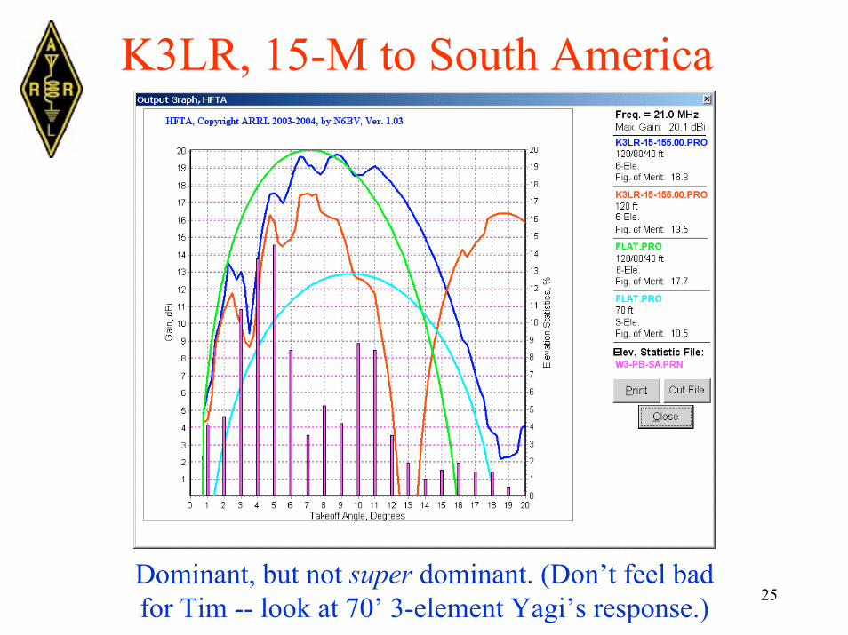
K3LR, 15-M to South America
Dominant, but not super dominant. (Don’t feel badfor Tim -- look at 70’ 3-element Yagi’s response.)
26
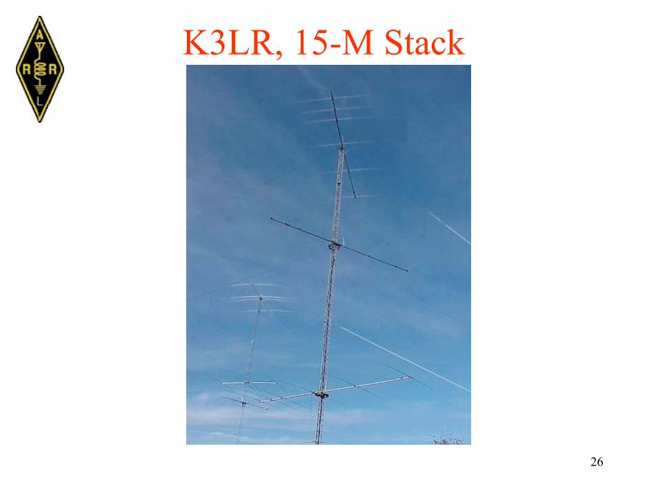
K3LR, 15-M Stack
27
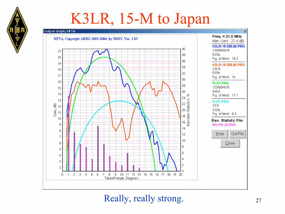
K3LR, 15-M to Japan
Really, really strong.
28
Seamless USGS Database For very complex terrains,the seamless database may betoo “smooth” -- for somemountaintops, for example.
For these cases, you shoulduse regular DEMs and mergethem when necessary.

29
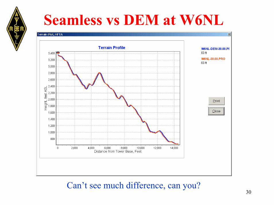
Seamless vs DEM at W6NL
• Dave Leeson, W6NL, lives on a mountaintopoverlooking Los Gatos, CA.
• The ground slopes away about −12°, verysteep indeed.
30
Seamless vs DEM at W6NL
Can’t see much difference, can you?
31
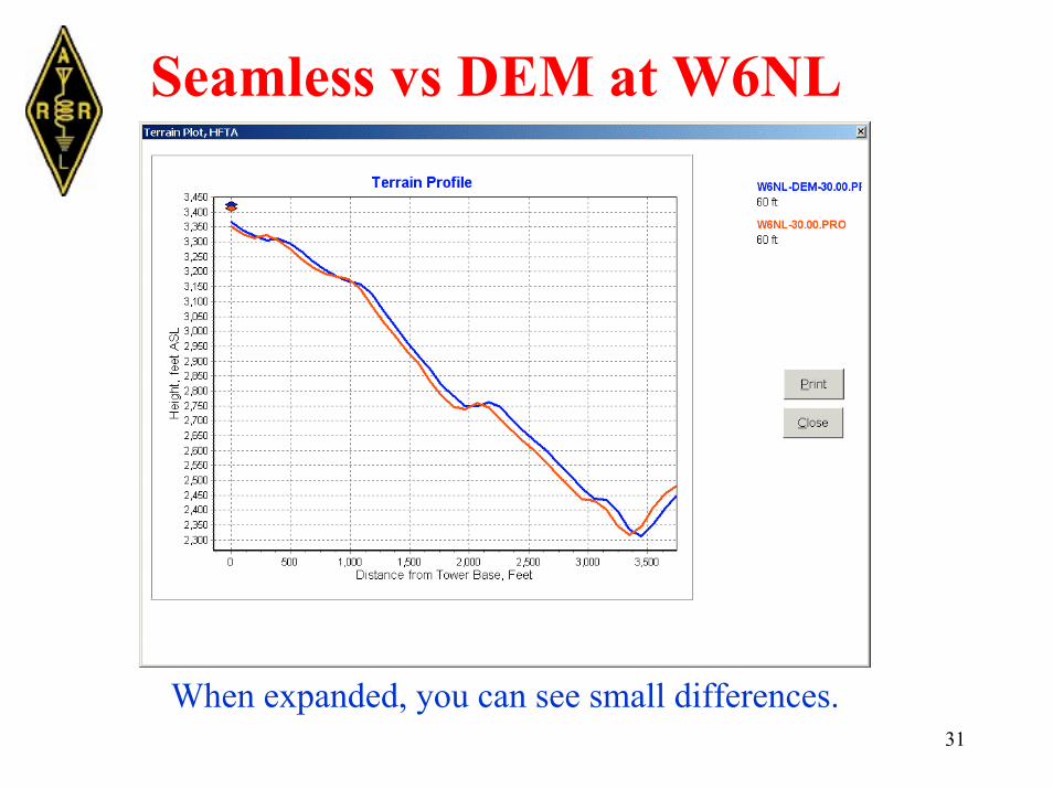
Seamless vs DEM at W6NL
When expanded, you can see small differences.

32
A Matter of Perspective
Now, even a −12° slope doesn’t look so steep.
33
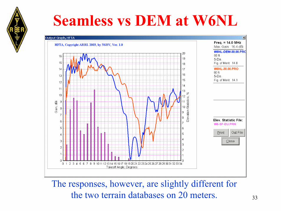
Seamless vs DEM at W6NL
The responses, however, are slightly different forthe two terrain databases on 20 meters.
34
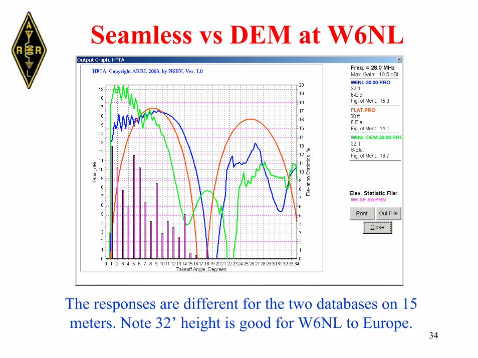
Seamless vs DEM at W6NL
The responses are different for the two databases on 15meters. Note 32’ height is good for W6NL to Europe.

35
Looking Around at W6NL
The ground slopes down in all directions. Still,the South American terrain looks weakest.
S.A.
OC.EU.
JA
36
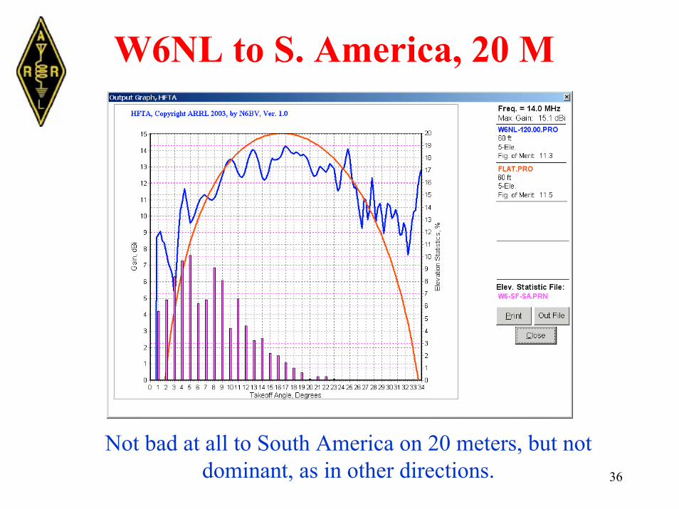
W6NL to S. America, 20 M
Not bad at all to South America on 20 meters, but notdominant, as in other directions.
37
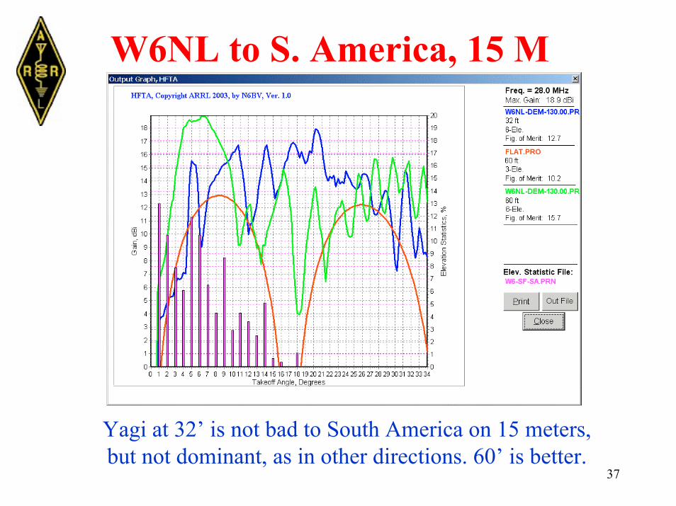
W6NL to S. America, 15 M
Yagi at 32’ is not bad to South America on 15 meters,but not dominant, as in other directions. 60’ is better.
38
Dropoffs
• As I said before, tower heights over flatterrain are easy to optimize -- whilemountaintops can be non-intuitive.

39
60’ Is Too High on 15 M to JA
The 32’ Yagi is better than the one at 60’. (Again,don’t feel bad for W6NL. See typical 3-elementflatland Yagi at 60’ for comparison to Japan!)
40
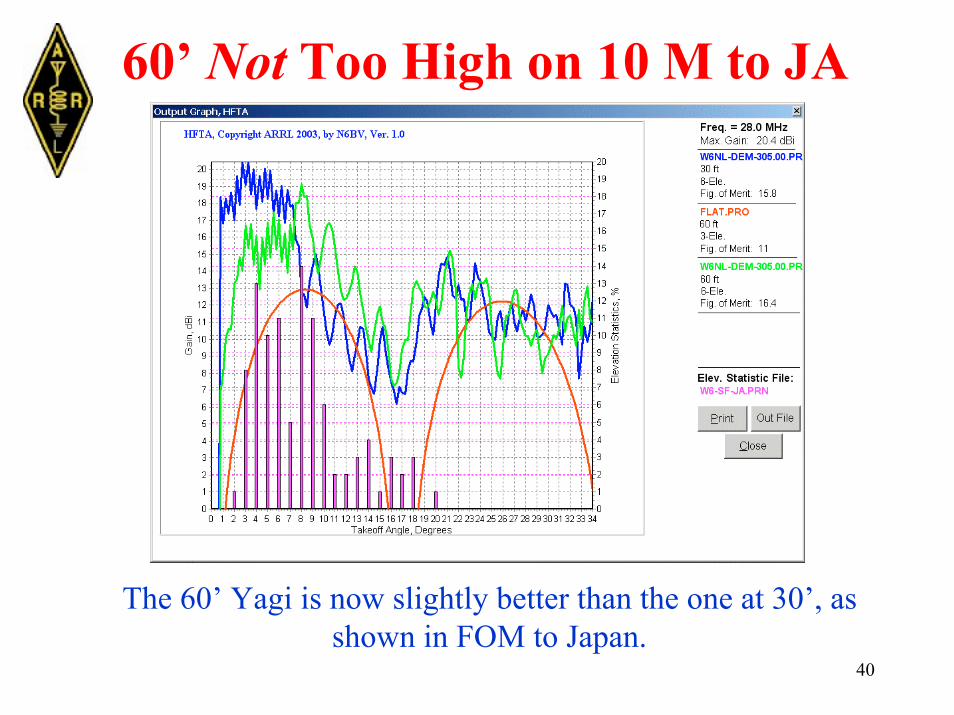
60’ Not Too High on 10 M to JA
The 60’ Yagi is now slightly better than the one at 30’, asshown in FOM to Japan.

41
Figure of Merit?
• Figure of Merit (FOM) is a convenient, butone-dimensional, look at system performance ata particular azimuth.
• FOMs vary with different target QTHs, at thesame antenna height.
42
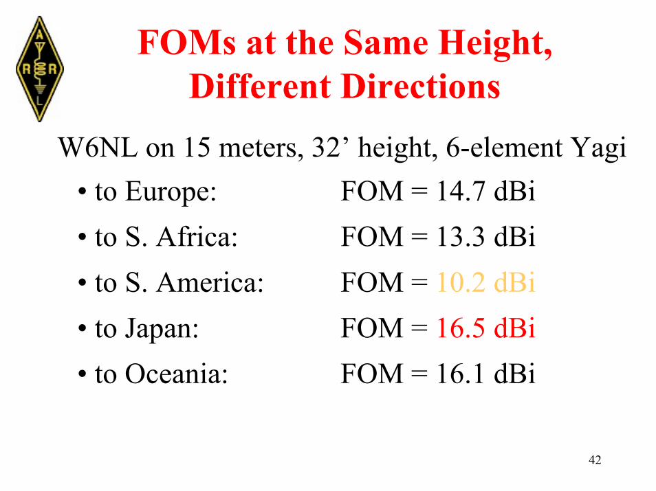
FOMs at the Same Height,Different Directions
W6NL on 15 meters, 32’ height, 6-element Yagi• to Europe: FOM = 14.7 dBi• to S. Africa: FOM = 13.3 dBi• to S. America: FOM = 10.2 dBi• to Japan: FOM = 16.5 dBi• to Oceania: FOM = 16.1 dBi
43
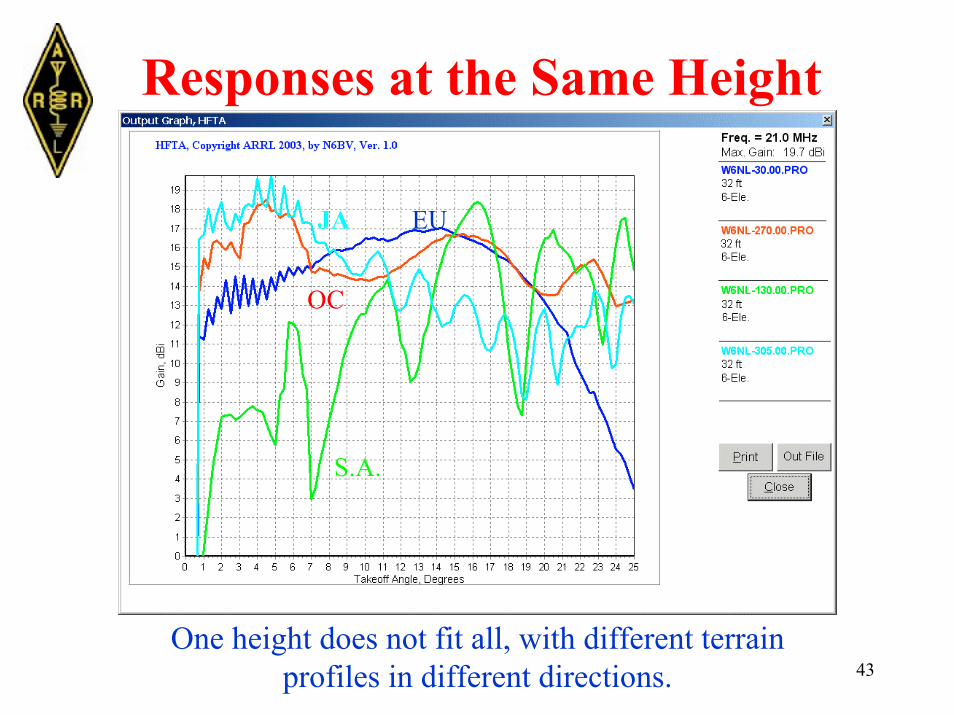
Responses at the Same Height
One height does not fit all, with different terrainprofiles in different directions.
JA
S.A.
EU
OC

44
What About Stacks at W6NL?
Yes, stacks would help some into Europe on 15 meters.Note N6RO 15-meter stack for comparison.
45
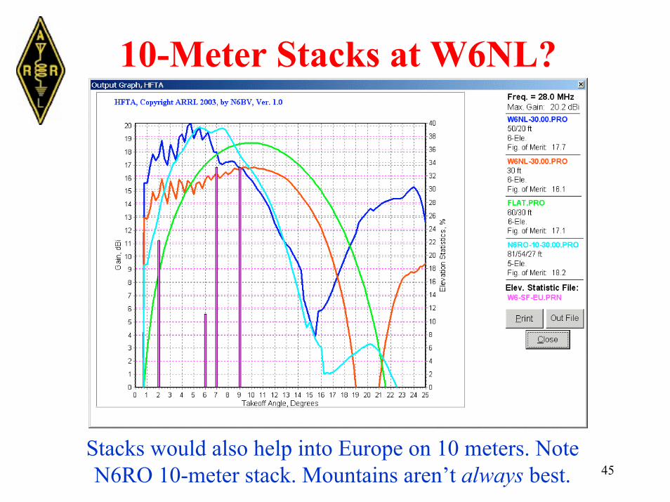
10-Meter Stacks at W6NL?
Stacks would also help into Europe on 10 meters. NoteN6RO 10-meter stack. Mountains aren’t always best.
46
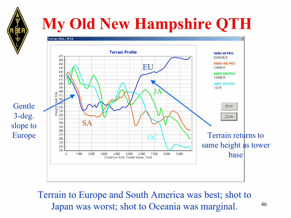
My Old New Hampshire QTH
Terrain to Europe and South America was best; shot toJapan was worst; shot to Oceania was marginal.
Gentle3-deg.
slope toEurope
EU
JA
SA
OC Terrain returns tosame height as tower
base

47
N6BV/1 on 15 Meters
Different antenna combinations for different directions.15 meters really played into Europe. FOMs for Europe.
48
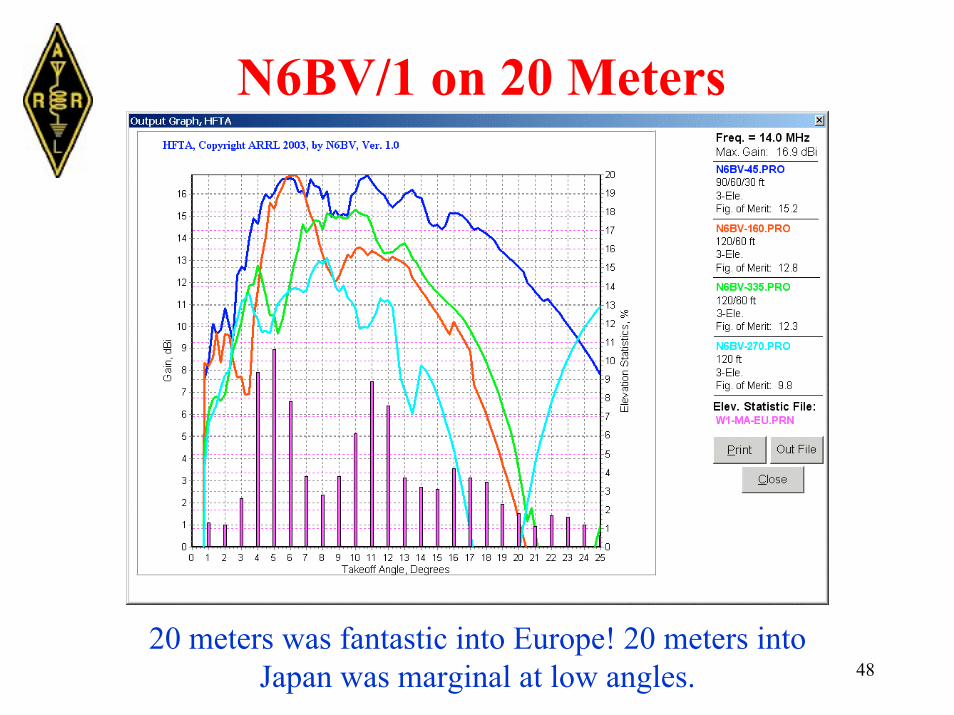
N6BV/1 on 20 Meters
20 meters was fantastic into Europe! 20 meters intoJapan was marginal at low angles.
49
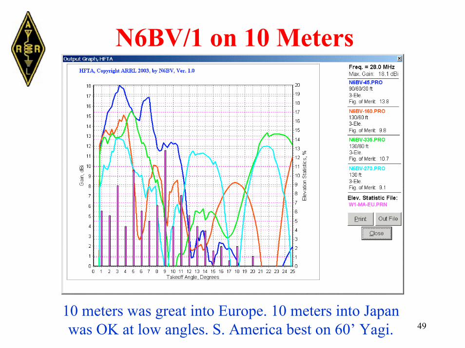
N6BV/1 on 10 Meters
10 meters was great into Europe. 10 meters into Japanwas OK at low angles. S. America best on 60’ Yagi.

50
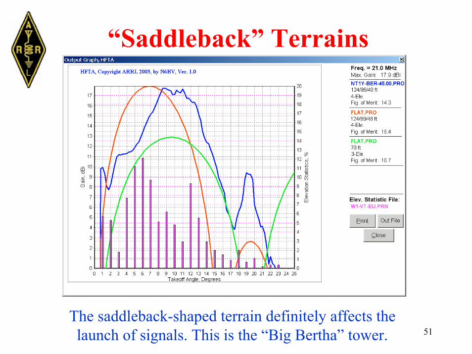
“Saddleback” Terrains
At about 1200’ the saddleback terrain configuration didn’tlook that bad, but it does affect the launch of signals.
“Saddleback” shapeat NT1Y from “BigBertha” tower
51
“Saddleback” Terrains
The saddleback-shaped terrain definitely affects thelaunch of signals. This is the “Big Bertha” tower.

52
Some Hints About Using HFTA• Make sure you check heights for “aliasing”glitches -- check in 1-foot increments.
• Be careful of relying solely on FOMs.
• Validate the terrain profiles (particularlywith “seamless” datasets) to the real-world.
• Mountain tops can be complicated!
• Watch out for common “saddleback”shapes in terrains.

53
“Best” Terrains -- Generalizations• Flat terrain is easy.
• Gently sloping terrain (eg, N6BV/1 toEurope) is good for stacking smaller Yagis(such as tribanders).
• Steep terrain doesn’t allow simple stackingon 15 and 10 meters -- it’s very easy to be toohigh. Watch out at different azimuths at sameantenna heights.
• Do model your tower height/antenna types,just to be sure!
54
The Wonder of HF Propagation The very fact that I can launch a small signalinto the ionosphere and communicate withsomeone halfway around the world is still trulywonderous to me -- after 45 years of being aham.
Despite the challenges -- or probably becauseof them -- I love operating HF radio! I hope thatBPL doesn’t happen for real...