section 1: continental drift - auburn high school 10...section 1: continental drift preview •...
TRANSCRIPT

Section 1: Section 1: Continental DriftContinental DriftPreviewPreview
•• ObjectivesObjectives
•• WegenerWegener’’s Hypothesiss Hypothesis
•• MidMid--Ocean RidgesOcean Ridges
•• SeaSea--Floor SpreadingFloor Spreading
•• PaleomagnetismPaleomagnetism
•• Wegener RedeemedWegener Redeemed
•• Continental Drift (Pangaea)Continental Drift (Pangaea)
ObjectivesObjectives
• Summarize Wegener’s hypothesis of continental drift.
• Describe the process of sea-floor spreading.
• Identify how paleomagnetism provides support for the idea of sea-floor spreading.
• Explain how sea-floor spreading provides a mechanism for continental drift.
WegenerWegener’’s Hypothesiss Hypothesis
• Continental drift-the hypothesis that states that the continents once formed a single landmass, broke up, and drifted to their present location.– First proposed by German scientist Alfred Wegener
in 1912.
– Used several different types of evidence to support his hypothesis.
Wegener’s Evidence
• Fossil Evidence: fossils of the same plants and animals could be found in areas of continents that had once been connected.
• Evidence from Rock Formations: ages and types of rocks in the coastal regions of widely separated areas matched closely.
• Climatic Evidence: changes in climatic patterns suggested the continents had not always been located where they are now.
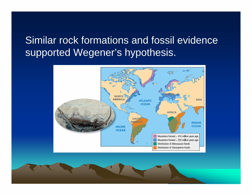
Similar rock formations and fossil evidence supported Wegener’s hypothesis.
Missing Mechanisms
• Wegener proposed that the continents moved by plowing through the rock of the ocean floor.– This idea was strongly opposed.
• Wegener’s mechanism was disproved by geologic evidence.
• Wegener spent the rest of his life searching for a mechanism for the movement of continents.
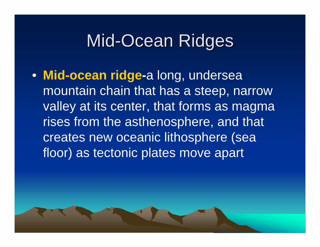
MidMid--Ocean RidgesOcean Ridges
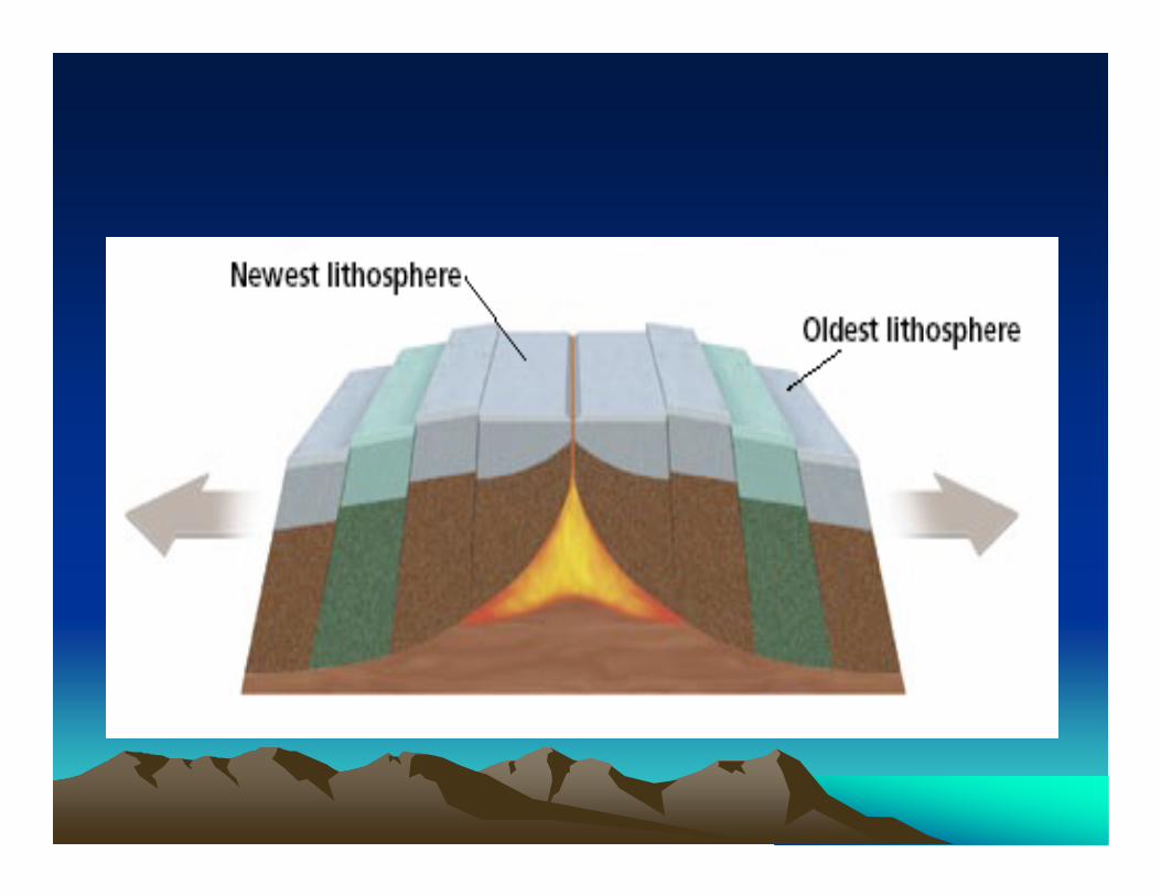
• Mid-ocean ridge-a long, undersea mountain chain that has a steep, narrow valley at its center, that forms as magma rises from the asthenosphere, and that creates new oceanic lithosphere (sea floor) as tectonic plates move apart
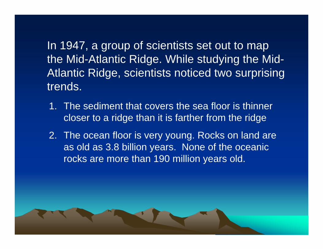
In 1947, a group of scientists set out to map the Mid-Atlantic Ridge. While studying the Mid-Atlantic Ridge, scientists noticed two surprising trends.1. The sediment that covers the sea floor is thinner
closer to a ridge than it is farther from the ridge
2. The ocean floor is very young. Rocks on land are as old as 3.8 billion years. None of the oceanic rocks are more than 190 million years old.
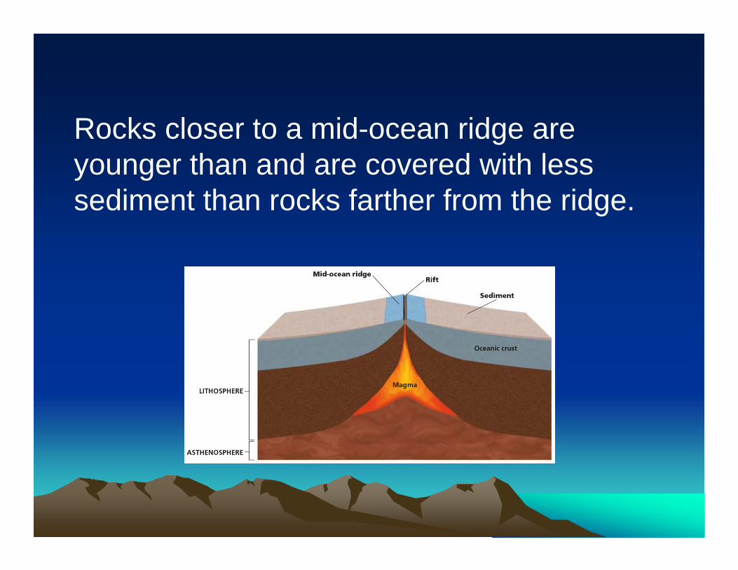
Rocks closer to a mid-ocean ridge are younger than and are covered with less sediment than rocks farther from the ridge.
• In the late 1950’s geologist Harry Hess proposed that the valley at the center of the mid-ocean ridge was a crack, or rift, in Earth’s crust.
• As the ocean floor moves away from the ridge, molten rock, or magma, rises to fill the crack.
• Hess suggested that if the sea floor is moving, the continents might be moving also.
• He suggested this might be the mechanism that Wegener was searching for.
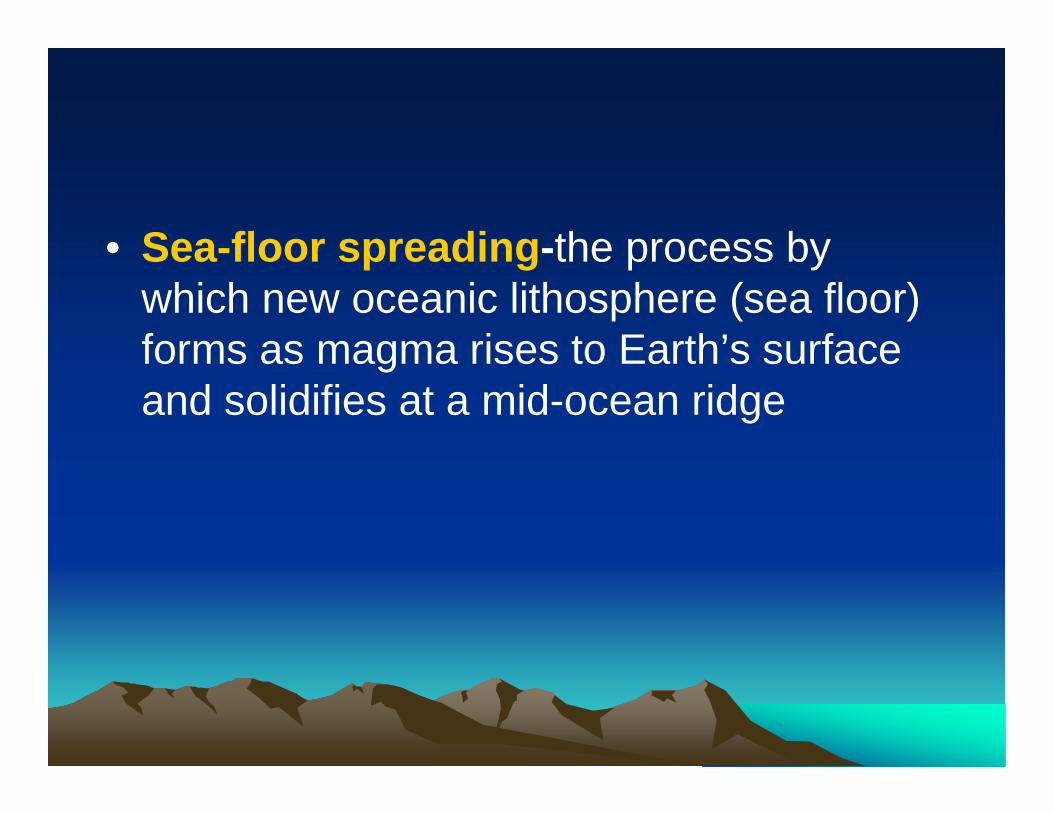
• Sea-floor spreading-the process by which new oceanic lithosphere (sea floor) forms as magma rises to Earth’s surface and solidifies at a mid-ocean ridge
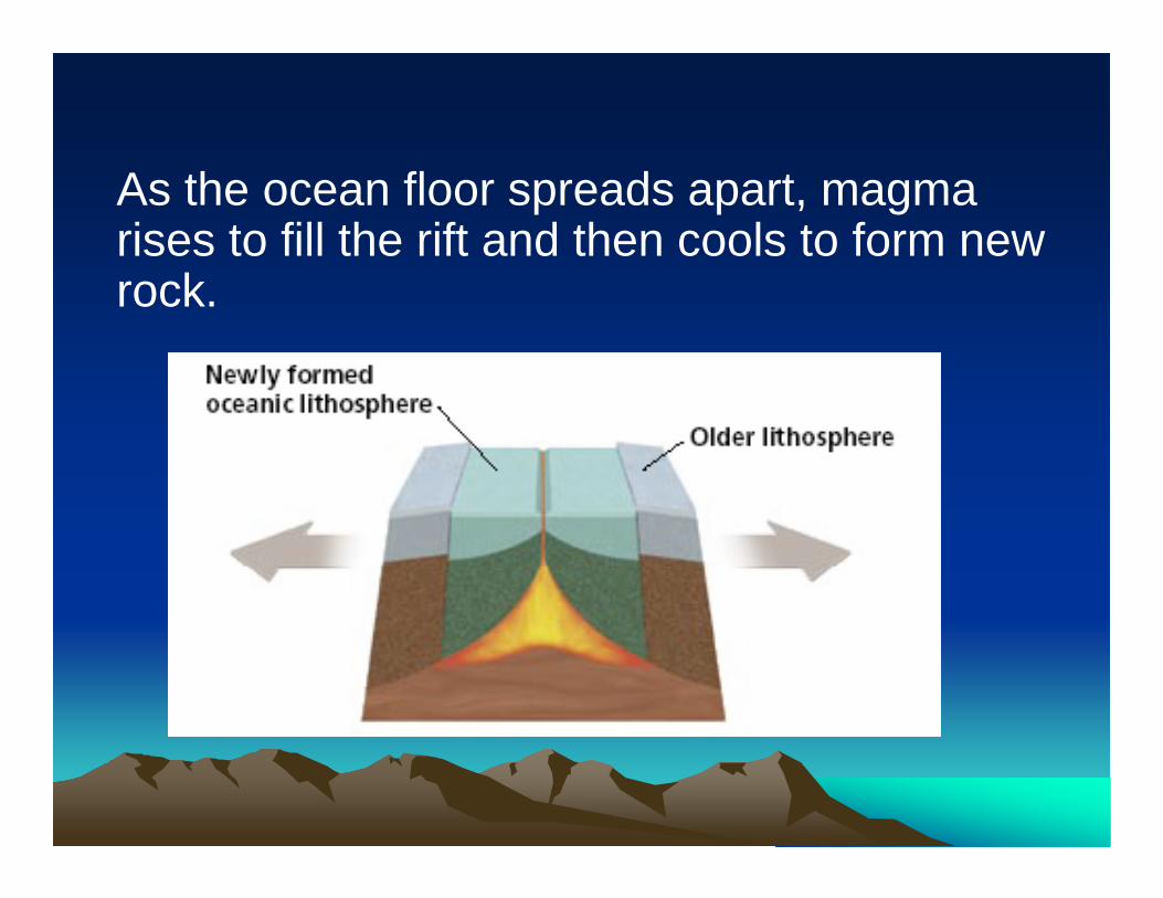
As the ocean floor spreads apart, magma rises to fill the rift and then cools to form new rock.
PaleomagnetismPaleomagnetism
• Paleomagnetism the study of the alignment of magnetic minerals in rock, specifically as it relates to the reversal of Earth’s magnetic poles; also the magnetic properties that rock acquires during formation
• As magma solidifies to form rock, iron-rich minerals in the magma align with Earth’s magnetic field. When the rock hardens, the magnetic orientation of the minerals becomes permanent.
Magnetic Reversals
•Scientists have discovered rocks whose magnetic orientations point opposite of Earth’s current magnetic field.
•Rocks with magnetic fields that point north (normal polarity) are all classified in the same time periods.
•Rocks with magnetic fields that point south (reversed polarity) also all fell into specific time periods.
Magnetic Reversals
• When scientists placed these periods of normal and reversed polarity in chronological order, they discovered a pattern of alternating normal and reversed polarity in the rocks.
• Scientists used this pattern to create the geomagnetic reversal time scale.
Magnetic Symmetry
• Scientists discovered a striped magnetic pattern on the ocean floor on each side of a mid-ocean ridge.
• The pattern on one side of the ridge is a mirror image of the pattern on the other side.
• When drawn on a map, these patterns match the geomagnetic reversal time scale.
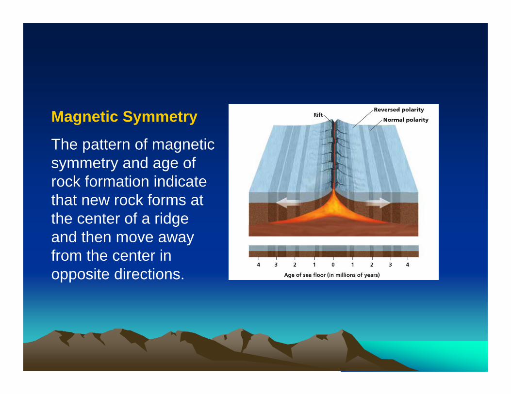
Magnetic Symmetry
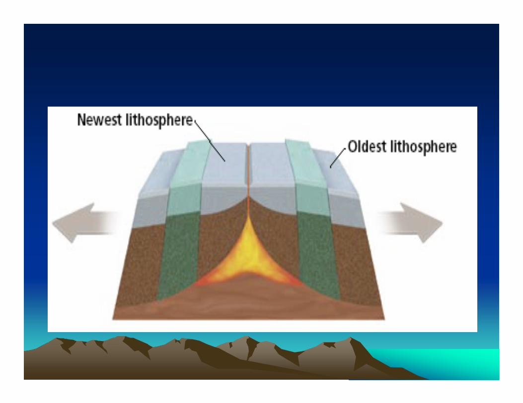
The pattern of magnetic symmetry and age of rock formation indicate that new rock forms at the center of a ridge and then move away from the center in opposite directions.
• Continental Drift Video
Wegener RedeemedWegener Redeemed• Reversal patterns on the sea floor could also be found on
land. The reversals in land rocks also matched the geomagnetic reversal time scale.
• Because the same pattern appears in rocks of the same ages on both land and the sea floor, scientists agreed that the magnetic patterns showed change over time.
• The idea of sea-floor spreading provides a way for the continents to move over the Earth’s surface.
• Sea-floor spreading was the mechanism that verified Wegener’s hypothesis of continental drift.
Section 2: Section 2: The Theory of The Theory of Plate TectonicsPlate TectonicsPreviewPreview
•• ObjectivesObjectives•• How Continents MoveHow Continents Move•• Tectonic PlatesTectonic Plates•• Types of Plate BoundariesTypes of Plate Boundaries•• Causes of Plate MotionCauses of Plate Motion•• Plate TectonicsPlate Tectonics
ObjectivesObjectives
• Summarize the theory of plate tectonics.• Identify and describe the three types of
plate boundaries.• List and describe three causes of plate
movement.
How Continents MoveHow Continents Move• plate tectonics the theory that explains how large pieces
of the lithosphere, called plates, move and change shape.
• lithosphere the solid, outer layer of Earth that consists of the crust and the rigid upper part of the mantle.
• asthenosphere the solid, plastic layer of the mantle beneath the lithosphere; made of mantle rock that flows very slowly, which allows tectonic plates to move on top of it.
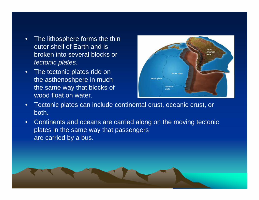
• The lithosphere forms the thinouter shell of Earth and isbroken into several blocks ortectonic plates.
• The tectonic plates ride onthe asthenoshpere in much the same way that blocks of wood float on water.
• Tectonic plates can include continental crust, oceanic crust, orboth.
• Continents and oceans are carried along on the moving tectonic plates in the same way that passengersare carried by a bus.
Tectonic PlatesTectonic Plates
• Scientists have identified about 15 major tectonic plates.
• Scientists identify plate boundaries primarily by studying data from earthquakes.
• The locations of volcanoes can also help identify the locations of plate boundaries.
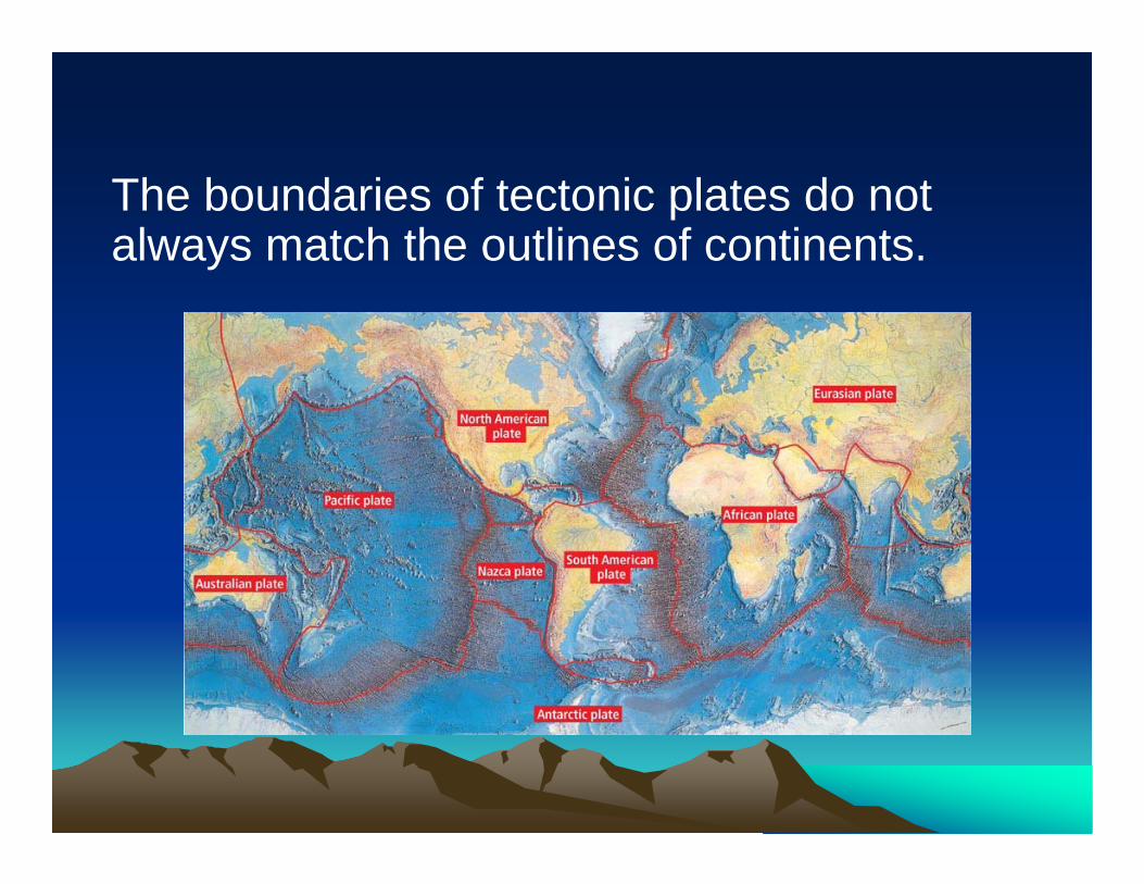
The boundaries of tectonic plates do not always match the outlines of continents.
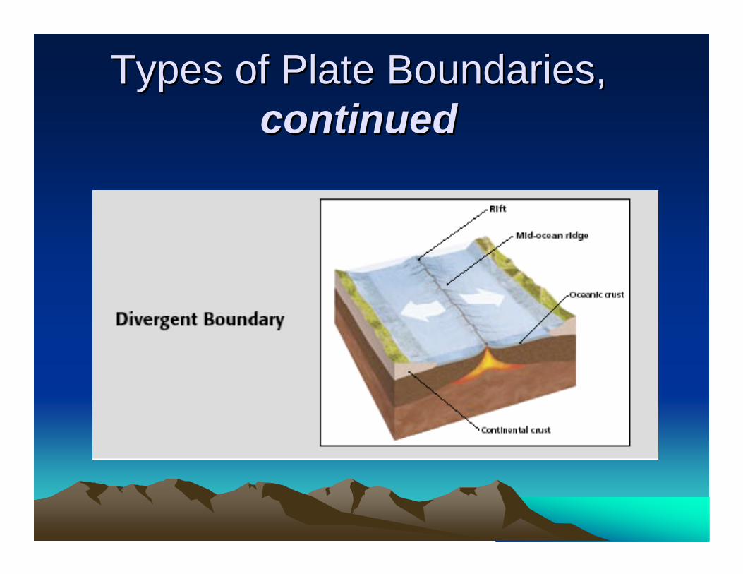
Types of Plate BoundariesTypes of Plate Boundaries• Tectonic plate boundaries may be in the middle
of the ocean floor, around the edges of continents, or even within continents.
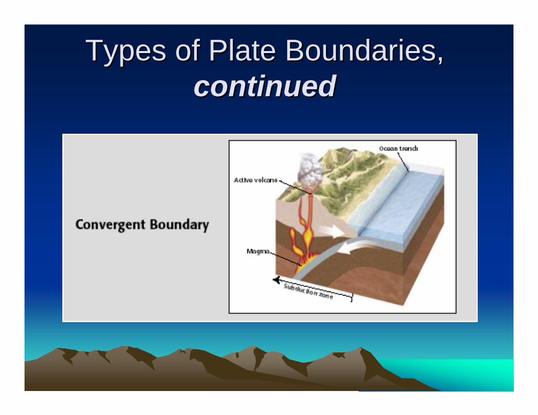
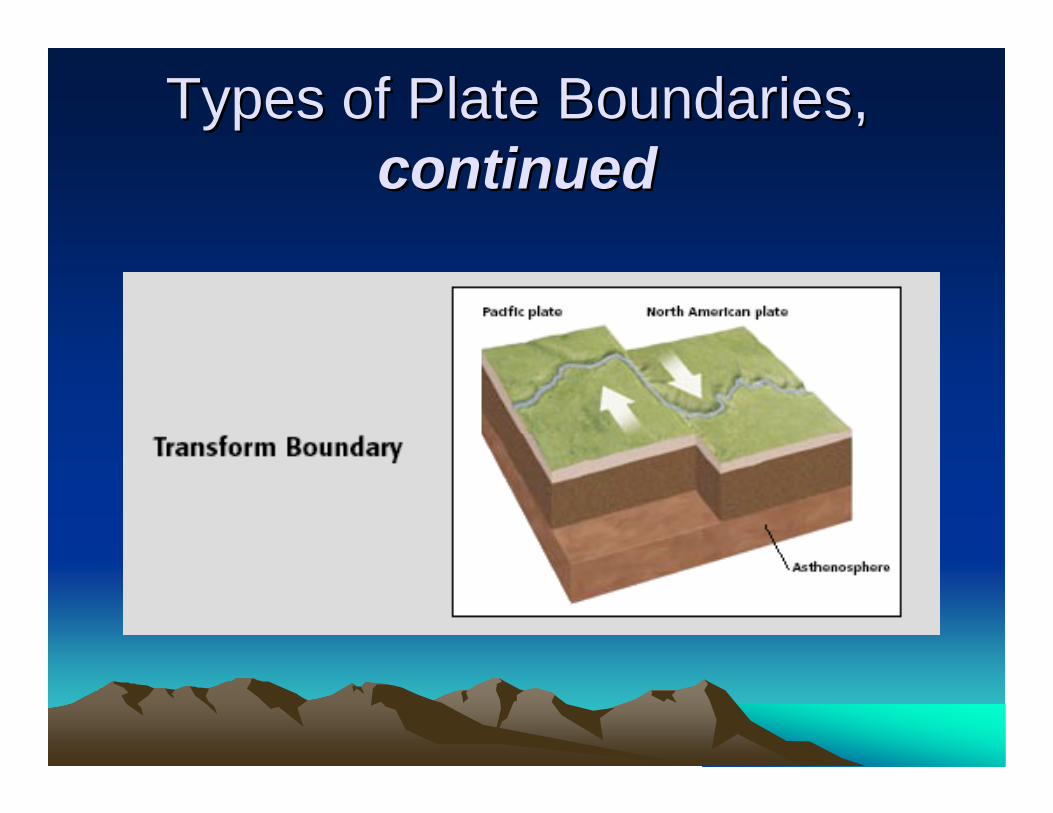
• The three types of plate boundaries are divergent boundaries, convergent boundaries, and transform boundaries.
• Each plate boundary is associated with a characteristic type of geologic activity.
Types of Plate Boundaries, Types of Plate Boundaries, continuedcontinued
Types of Plate Boundaries, Types of Plate Boundaries, continuedcontinued
Types of Plate Boundaries, Types of Plate Boundaries, continuedcontinued
Causes of Plate MotionCauses of Plate Motion
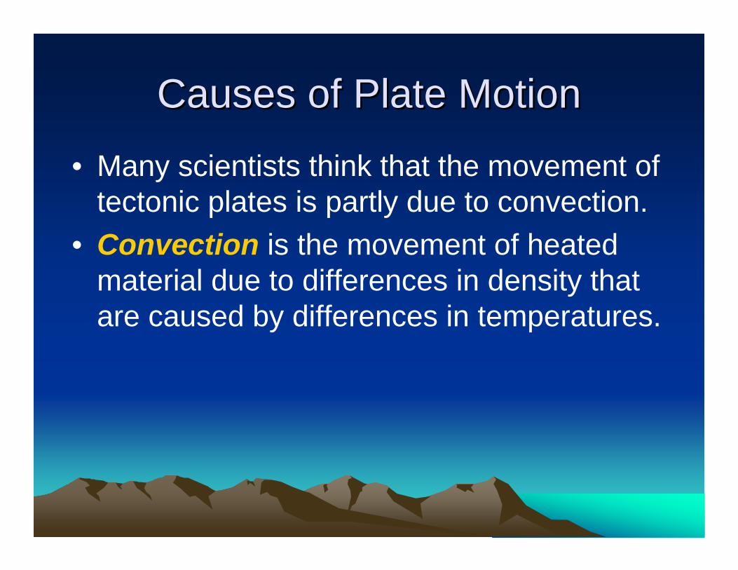
• Many scientists think that the movement of tectonic plates is partly due to convection.
• Convection is the movement of heated material due to differences in density that are caused by differences in temperatures.
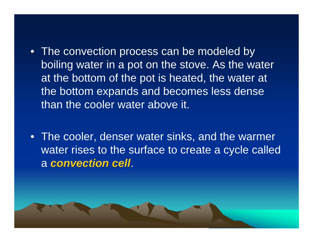
• The convection process can be modeled by boiling water in a pot on the stove. As the water at the bottom of the pot is heated, the water at the bottom expands and becomes less dense than the cooler water above it.
• The cooler, denser water sinks, and the warmer water rises to the surface to create a cycle called a convection cell.
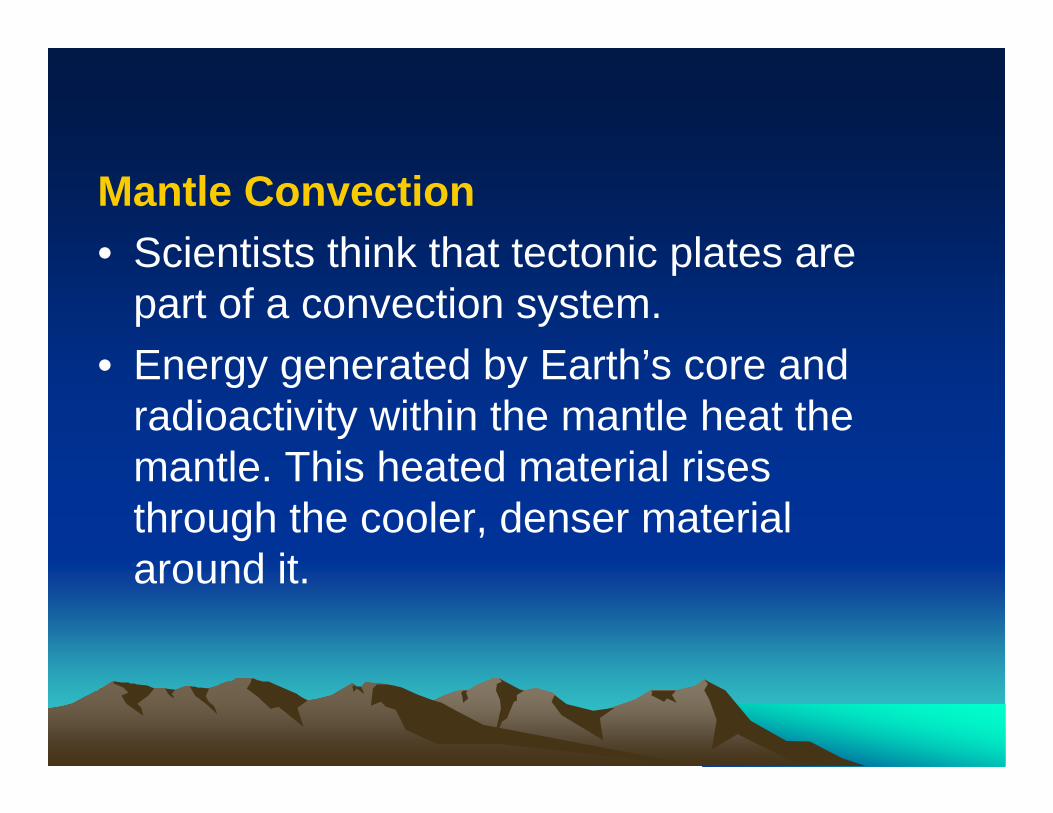
Mantle Convection• Scientists think that tectonic plates are
part of a convection system.• Energy generated by Earth’s core and
radioactivity within the mantle heat the mantle. This heated material rises through the cooler, denser material around it.
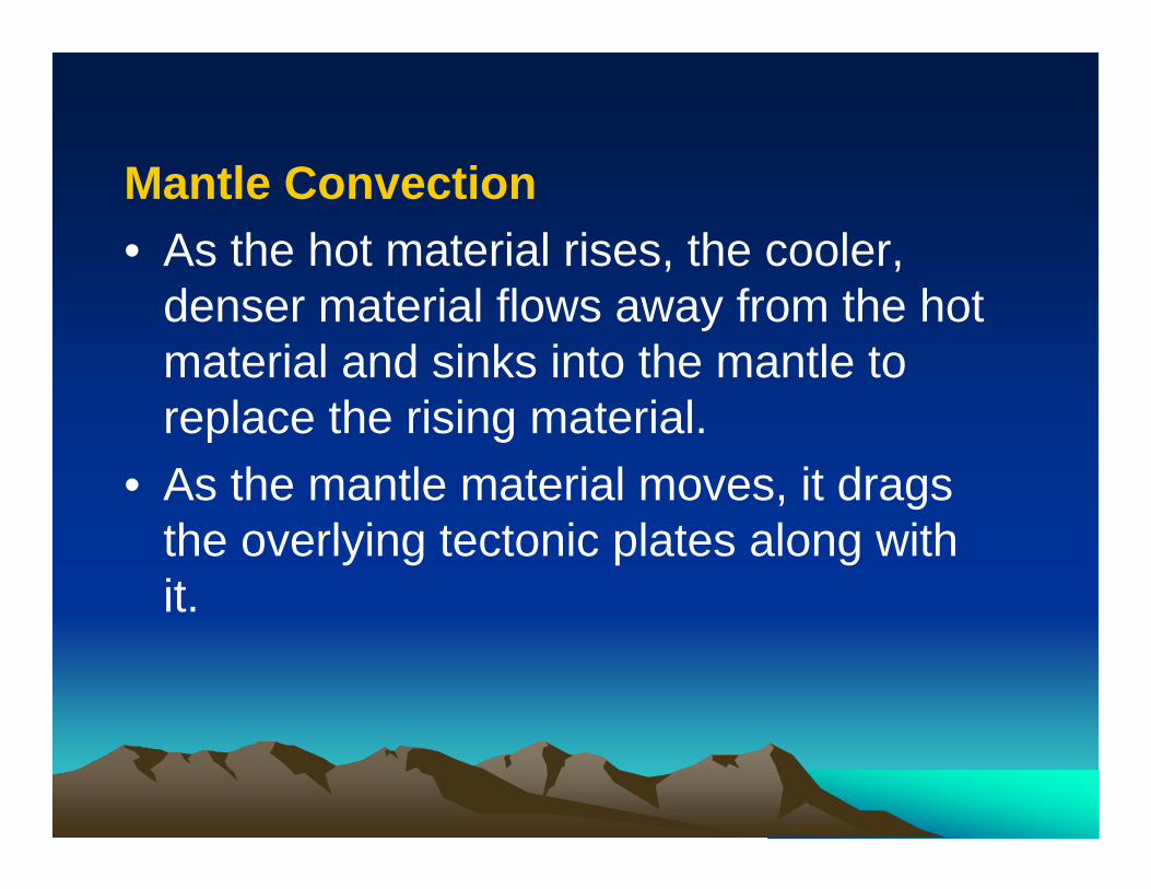
Mantle Convection• As the hot material rises, the cooler,
denser material flows away from the hot material and sinks into the mantle to replace the rising material.
• As the mantle material moves, it drags the overlying tectonic plates along with it.
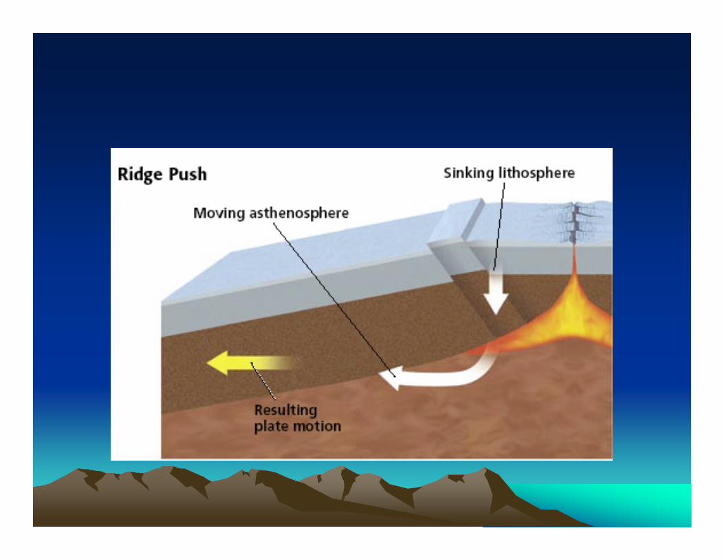
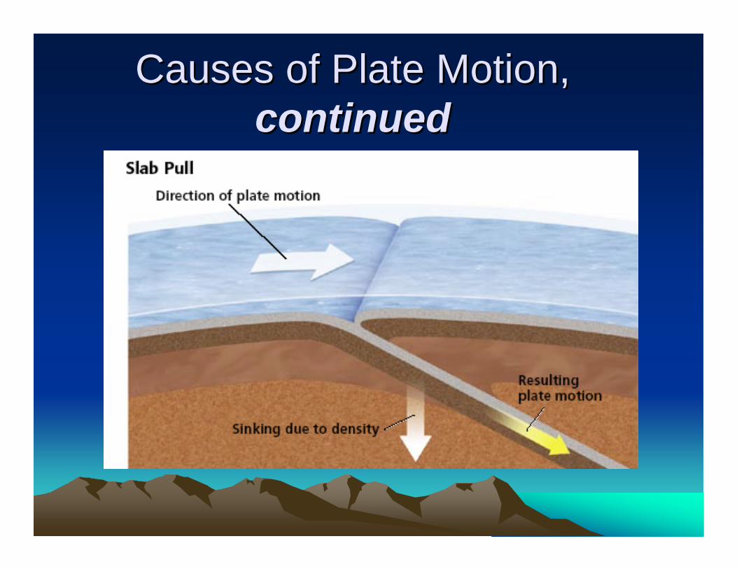
Causes of Plate Motion, Causes of Plate Motion, continuedcontinued
Section 3: Section 3: The Changing The Changing ContinentsContinentsPreviewPreview
•• ObjectivesObjectives
•• Reshaping EarthReshaping Earth’’s Crusts Crust
•• Effects of Continental ChangeEffects of Continental Change
•• The Supercontinent CycleThe Supercontinent Cycle
•• Maps in ActionMaps in Action
ObjectivesObjectives
• Identify how movements of tectonic plates change Earth’s surface.
• Summarize how movements of tectonic plates have influenced climates and life on Earth.
• Describe the supercontinent cycle.
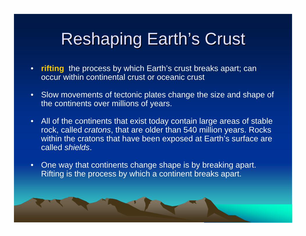
Reshaping EarthReshaping Earth’’s Crusts Crust• rifting the process by which Earth’s crust breaks apart; can
occur within continental crust or oceanic crust
• Slow movements of tectonic plates change the size and shape of the continents over millions of years.
• All of the continents that exist today contain large areas of stable rock, called cratons, that are older than 540 million years. Rocks within the cratons that have been exposed at Earth’s surface are called shields.
• One way that continents change shape is by breaking apart. Rifting is the process by which a continent breaks apart.
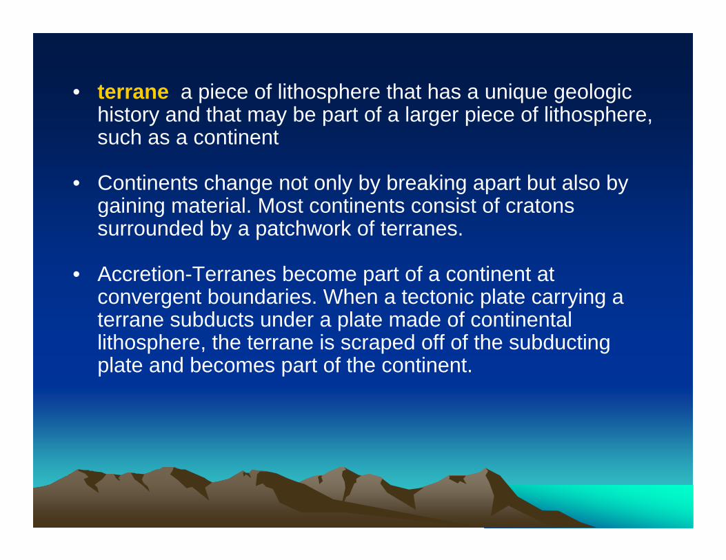
• terrane a piece of lithosphere that has a unique geologic history and that may be part of a larger piece of lithosphere, such as a continent
• Continents change not only by breaking apart but also by gaining material. Most continents consist of cratons surrounded by a patchwork of terranes.
• Accretion-Terranes become part of a continent at convergent boundaries. When a tectonic plate carrying a terrane subducts under a plate made of continental lithosphere, the terrane is scraped off of the subducting plate and becomes part of the continent.
Effects of Continental ChangeEffects of Continental Change• Modern climates are a result of past movements of tectonic
plates. When continents move, the flow of air and moisture around the globe changes and causes climates to change.
• Geologic evidence shows that ice once covered most of Earth’s continental surfaces. As continents began to drift around the globe, however, global temperatures changed and much of the ice sheet melted.
• As continents rift or as mountains form, populations of organisms are separated. When populations are separated, new species may evolve from existing species.
The Supercontinent CycleThe Supercontinent Cycle• supercontinent cycle the process by which
supercontinents form and break apart over millions of years
• Pangaea the supercontinent that formed 300 million years ago and that began to break up beginning 200 million years ago
• Panthalassa the single, large ocean that covered Earth’s surface during the time the supercontinent Pangaea existed
• Using evidence from many scientific fields, scientists can construct a general picture of continental change throughout time.
• Several times in the past, the continents were arranged into large landmasses called supercontinents.
• Supercontinents broke apart to form smaller continents that moved around the globe. Eventually, the smaller continents joined again to form another supercontinent.
• The process by which supercontinents form and break apart over time is called the supercontinent cycle.
• The movement of plates toward convergent boundaries causes continents to collide.
• Because neither continent subducts beneath the other, the plate boundary becomes inactive, and a new convergent boundary forms.
• Over time, all of the continents collide to form a supercontinent.
• Then, heat from Earth’s interior builds up under the supercontinent, and rifts form in the supercontinent. The supercontinent breaks apart, and plates carrying separate continents move around the globe.
Formation of Pangaea
• The supercontinent Pangaea formed about 300 million years ago.
• Several mountain ranges, such as the Appalachian Mountains and the Ural Mountains formed during the collisions that created Pangaea.
• A body of water called the Tethys Sea cut into the eastern edge of Pangaea.
• The single, large ocean that surrounded Pangaea was called Panthalassa.
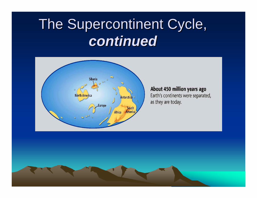
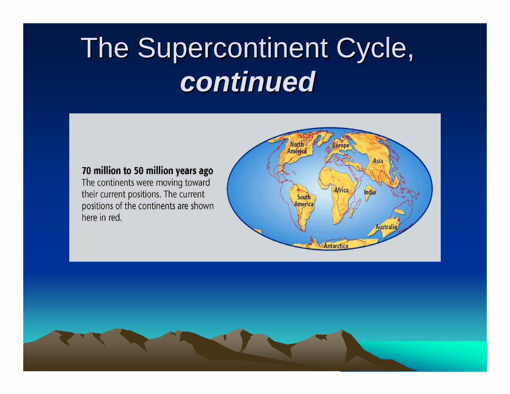
The Supercontinent Cycle, The Supercontinent Cycle, continuedcontinued
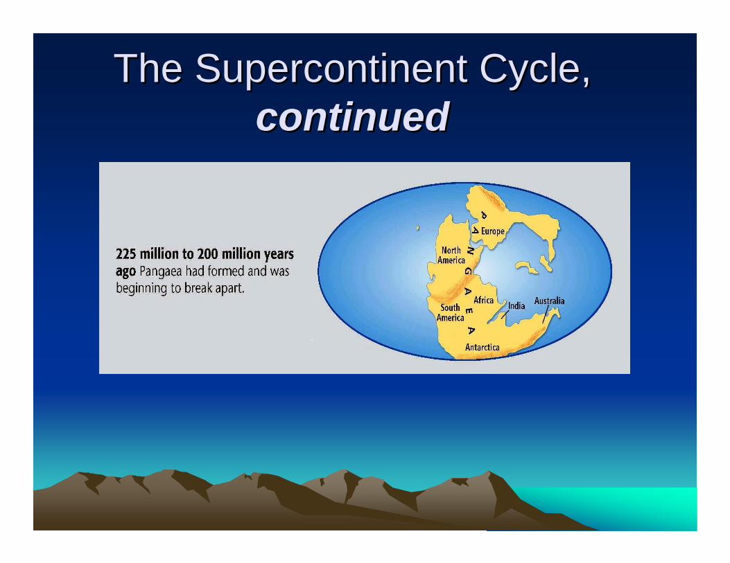
The Supercontinent Cycle, The Supercontinent Cycle, continuedcontinued
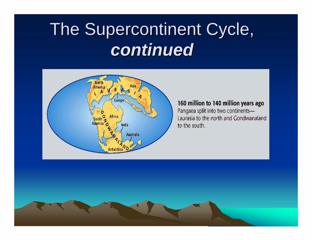
Breakup of Pangaea
• About 200 million years ago (during the Mesozoic Era), Pangaea began to break into two continents-Laurasiaand Gondwanaland.
• Laurasia became the continents of North America and Eurasia.
• Gondwanaland became the continents of Africa, South America, India, Australia, and Antarctica.
The Supercontinent Cycle, The Supercontinent Cycle, continuedcontinued
The Modern Continents
• Slowly, the continents moved into their present positions.
• As the continents drifted, they collided with terranes and other continents. New mountain ranges , such as the Rocky Mountains, the Andes, and the Alps, formed. Tectonic plate motion also caused new oceans to open up and caused others to close.
The Supercontinent Cycle, The Supercontinent Cycle, continuedcontinued
Geography of the Future
• As tectonic plates continue to move, Earth’s geography will change dramatically.
• Scientists predict that in 250 million years, the continents will come together again to form a new supercontinent.

• http://www.scotese.com/Default.htm• http://pubs.usgs.gov/gip/dynamic/historical
.html• http://geology.com/plate-tectonics.shtml• http://www.classzone.com/books/earth_sci
ence/terc/content/visualizations/es0806/es0806page01.cfm?chapter_no=visualization
• http://education.sdsc.edu/optiputer/flash/pangea_4.htm
600 mya to Present600 mya to Present

http://www.youtube.com/watch?v=puoJXyaQ50Uhttp://www.youtube.com/watch?v=puoJXyaQ50U