sculpting south carolinacurriculum.scaquarium.org/wp-content/uploads/2016/...sculpting south...
TRANSCRIPT

Sculpting South CarolinaSouth Carolina Aquarium Curriculum
by Tammy Cannada, ELP

Research Have students read over the first
page of the Region Research to
discover information on the
physical characteristics (elevation,
soil types, geologic history,
average annual precipitation,
average annual temperature) of
the five geographic regions of the
state (Mountains, Piedmont,
Sandhills, Coastal Plain, Coast).
As they find the information, they
should fill in the research
worksheet (All except last column.
They’ll do that one later). Could
also have the research online to
find answers.
Students can work in groups to collect the data.

Have students to draw lines to separate the regions on a blank map. Students may refer to a regions map as a reference, but don’t allow them to trace.

Topographic MapLet them know that they are going
to use different materials to make
a topographic map showing the
different elevations of the land
throughout South Carolina. Show
them a topographic map if you
have one and explain how to read
the map.

Sorting by Grain SizeShow the students the materials
they have to make their map. See
if they can put the materials in
order of largest to smallest.
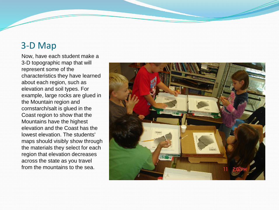
3-D MapNow, have each student make a
3-D topographic map that will
represent some of the
characteristics they have learned
about each region, such as
elevation and soil types. For
example, large rocks are glued in
the Mountain region and
cornstarch/salt is glued in the
Coast region to show that the
Mountains have the highest
elevation and the Coast has the
lowest elevation. The students'
maps should visibly show through
the materials they select for each
region that elevation decreases
across the state as you travel
from the mountains to the sea.

Pizza Boxes for Work Area and Storage

The Blue Ridge RegionStack and glue the rocks. (I recommend letting the glue dry overnight.
Complete the other regions the next day.)

Piedmont RegionNO glue needed for the clay. Then press in the kitty litter.

Only a Pinch with 2 FingersDo NOT turn cups and pour out materials. Pinch small
amounts using only 2 fingers. Use only what is needed.
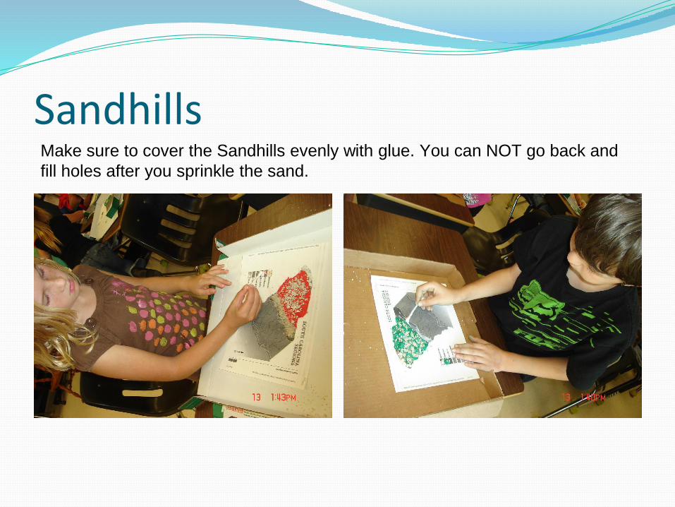
SandhillsMake sure to cover the Sandhills evenly with glue. You can NOT go back and
fill holes after you sprinkle the sand.

Coastal PlainAgain, cover the complete area evenly
before putting materials.

Coastal ZoneBe careful. Do NOT put the materials in the Atlantic Ocean.

South Carolina RegionsUsing the 3-D models of the state,
encourage students to compare
the regions based on the
attributes (elevation, temperature
and precipitation) that make each
region unique. Discuss.
Have the students make
observation of their maps while
researching each regions wildlife
communities. Add the wildlife
information into the last column on
the research data sheet.