sand mine reclamation - epa archives · the sand mining industry ... sound way of reclaiming sand...
TRANSCRIPT

SAND MINE RECLAMATION GRAND MERE STATE PARK
Project # GL985669-01-1
FINAL REPORT October 2000
Prepared by
Glenn Palmgren Stewardship Ecologist
Michigan Natural Features Inventory
for
State Park Stewardship Program Great Lakes National Program Office Parks and Recreation Bureau U.S. Environmental Protection Agency Michigan Department of Natural Resources 77 West Jackson Boulevard PO Box 30257 Chicago, Illinois 60604-3590 Lansing, Michigan 48909-7528

Table of Contents
Background and Project Objectives......................................................................................................1
Sand Mine Restoration Plan ................................................................................................................2
Native Plant Seed Collection, Propagation, & Installation .....................................................................2
The Regulators ...................................................................................................................................3
The Sand Mining Industry – TechniSand’s Component .........................................................................3
Volunteer and Community Support ......................................................................................................4
Timeline of Project Implementation.....................................................................................................4
Monitoring Results .............................................................................................................................5
Expenditure Report.............................................................................................................................9
Conclusions .....................................................................................................................................10
Acknowledgements ..........................................................................................................................10
Grand Mere Sand Mine Restorat ion Plan – Page 1
SAND MINE RECLAMATION: GRAND MERE STATE PARK
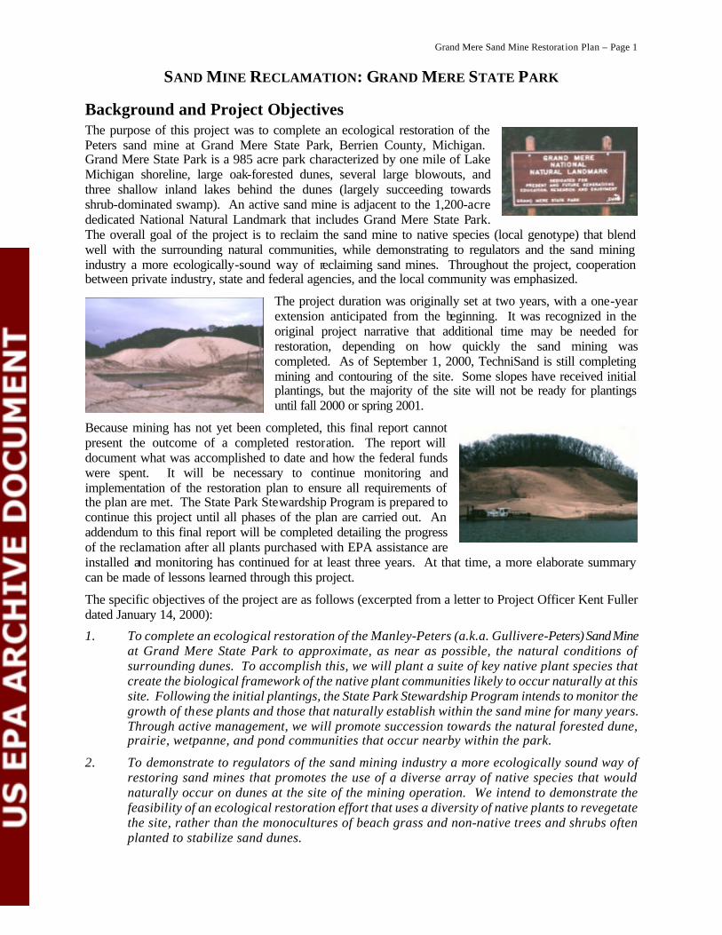
Background and Project Objectives The purpose of this project was to complete an ecological restoration of the Peters sand mine at Grand Mere State Park, Berrien County, Michigan. Grand Mere State Park is a 985 acre park characterized by one mile of Lake Michigan shoreline, large oak-forested dunes, several large blowouts, and three shallow inland lakes behind the dunes (largely succeeding towards shrub-dominated swamp). An active sand mine is adjacent to the 1,200-acre dedicated National Natural Landmark that includes Grand Mere State Park. The overall goal of the project is to reclaim the sand mine to native species (local genotype) that blend well with the surrounding natural communities, while demonstrating to regulators and the sand mining industry a more ecologically-sound way of reclaiming sand mines. Throughout the project, cooperation between private industry, state and federal agencies, and the local community was emphasized.
The project duration was originally set at two years, with a one-year extension anticipated from the beginning. It was recognized in the original project narrative that additional time may be needed for restoration, depending on how quickly the sand mining was completed. As of September 1, 2000, TechniSand is still completing mining and contouring of the site. Some slopes have received initial plantings, but the majority of the site will not be ready for plantings until fall 2000 or spring 2001.
Because mining has not yet been completed, this final report cannot present the outcome of a completed restoration. The report will document what was accomplished to date and how the federal funds were spent. It will be necessary to continue monitoring and implementation of the restoration plan to ensure all requirements of the plan are met. The State Park Stewardship Program is prepared to continue this project until all phases of the plan are carried out. An addendum to this final report will be completed detailing the progress of the reclamation after all plants purchased with EPA assistance are installed and monitoring has continued for at least three years. At that time, a more elaborate summary can be made of lessons learned through this project.
The specific objectives of the project are as follows (excerpted from a letter to Project Officer Kent Fuller dated January 14, 2000):
1. To complete an ecological restoration of the Manley-Peters (a.k.a. Gullivere-Peters) Sand Mine at Grand Mere State Park to approximate, as near as possible, the natural conditions of surrounding dunes. To accomplish this, we will plant a suite of key native plant species that create the biological framework of the native plant communities likely to occur naturally at this site. Following the initial plantings, the State Park Stewardship Program intends to monitor the growth of these plants and those that naturally establish within the sand mine for many years. Through active management, we will promote succession towards the natural forested dune, prairie, wetpanne, and pond communities that occur nearby within the park.
2. To demonstrate to regulators of the sand mining industry a more ecologically sound way of restoring sand mines that promotes the use of a diverse array of native species that would naturally occur on dunes at the site of the mining operation. We intend to demonstrate the feasibility of an ecological restoration effort that uses a diversity of native plants to revegetate the site, rather than the monocultures of beach grass and non-native trees and shrubs often planted to stabilize sand dunes.
Grand Mere Sand Mine Restorat ion Plan – Page 2
3. To demonstrate to the sand mining companies that they can do a better job of restoring sand mines to a more natural condition following mining. In addition to benefiting the environment by providing habitat for native plants and animals, such restorations would also boost the reputation of these companies as being more environmentally-conscious.
4. To cooperate with private industry, state and federal agencies, and the local community. This cooperation will foster awareness of the importance of conserving the native biological diversity of dune systems for all parties involved. Volunteerism and natural resource education will be promoted throughout the restoration. In addition, the project will involve the development of techniques to restore wetpanne and aquatic habitats, including research on the propagation of native plant species.
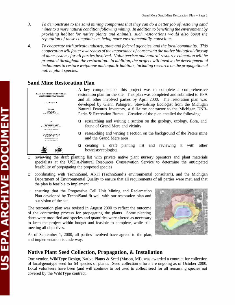
Sand Mine Restoration Plan A key component of this project was to complete a comprehensive restoration plan for the site. This plan was completed and submitted to EPA and all other involved parties by April 2000. The restoration plan was developed by Glenn Palmgren, Stewardship Ecologist from the Michigan Natural Features Inventory, a full-time contractor to the Michigan DNR-Parks & Recreation Bureau. Creation of the plan entailed the following:
q researching and writing a section on the geology, ecology, flora, and fauna of Grand Mere and vicinity
q researching and writing a section on the background of the Peters mine and the Grand Mere area
q creating a draft planting list and reviewing it with other botanists/ecologists
q reviewing the draft planting list with private native plant nursery operators and plant materials specialists at the USDA-Natural Resources Conservation Service to determine the anticipated feasibility of propagating the proposed species
q coordinating with TechniSand, ASTI (TechniSand’s environmental consultant), and the Michigan Department of Environmental Quality to ensure that all requirements of all parties were met, and that the plan is feasible to implement
q ensuring that the Progressive Cell Unit Mining and Reclamation Plan developed by TechniSand fit well with our restoration plan and our vision of the site
The restoration plan was revised in August 2000 to reflect the outcome of the contracting process for propagating the plants. Some planting dates were modified and species and quantities were altered as necessary to keep the project within budget and feasible to complete, while still meeting all objectives.
As of September 1, 2000, all parties involved have agreed to the plan, and implementation is underway.
Native Plant Seed Collection, Propagation, & Installation One vendor, WildType Design, Native Plants & Seed (Mason, MI), was awarded a contract for collection of local-genotype seed for 54 species of plants. Seed collection efforts are ongoing as of October 2000. Local volunteers have been (and will continue to be) used to collect seed for all remaining species not covered by the WildType contract.
Grand Mere Sand Mine Restorat ion Plan – Page 3
Three vendors were awarded contracts for growing plants from both volunteer-collected and contract-collected seed. The vendors included WildType Design, Native Plants & Seed (Mason, MI); VanBochove’s Greenhouse Direct (a.k.a. Nesta Prairie Perennials out of Kalamazoo, MI); and Wetlands Nursery (Saginaw, MI). All remaining plants in the planting plan that were not bid on by private businesses will be grown by the USDA Natural Resources Conservation Service, Rose Lake Plant Materials Center (East Lansing, MI). All contractors are required to report on propagation techniques that were used, and any experimental successes or failures for each species and technique.
Two planting contractors will install a total of 30 species of plants at the sand mine: Kaya Forest Services (Manistee, MI) and Olde Paths Perennial Farm (Holland, MI). All remaining species will be planted by MDNR staff. Planting is being phased in over several years as the site contouring is completed and as plants become available from the nurseries, with initial plantings beginning in 2000.
The Regulators The Michigan Department of Environmental Quality (MDEQ) has been involved in the reclamation process since the initial planning phases. They have coordinated and worked with MDNR, TechniSand, and TechniSand’s environmental consultants in the permit review process for the Peters Sand Mine. MDNR was present at MDEQ-organized public hearings to answer questions from the public on the proposed reclamation plan. MDEQ staff in charge of sand mining have reviewed the Sand Mine Reclamation Plan, and have spoken at length with the MDNR Project Manager and Ecologist regarding the techniques and specifications used for this site. MDEQ sand mining regulators are now becoming familiar with ecological reclamation techniques and how they differ from the current legal requirements in Michigan.
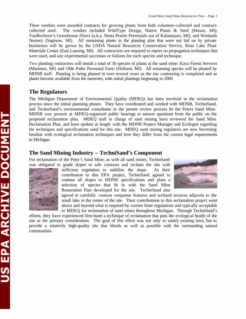
The Sand Mining Industry – TechniSand’s Component For reclamation of the Peter’s Sand Mine, as with all sand mines, TechniSand was obligated to grade slopes to safe contours and reclaim the site with
sufficient vegetation to stabilize the slope. As their contribution to this EPA project, TechniSand agreed to contour all slopes to MDNR specifications and plant a selection of species that fit in with the Sand Mine Restoration Plan developed for the site. TechniSand also agreed to carefully contour wetpanne features and wetland terraces adjacent to the small lake in the center of the site. Their contributions to this reclamation project went above and beyond what is required by current State regulations and typically acceptable to MDEQ for reclamation of sand mines throughout Michigan. Through TechniSand’s
efforts, they have experienced first-hand a technique of reclamation that puts the ecological health of the site as the primary consideration. The goal of this effort was not only to satisfy existing laws, but to provide a relatively high-quality site that blends as well as possible with the surrounding natural communities.

Grand Mere Sand Mine Restorat ion Plan – Page 4
Volunteer and Community Support Throughout this project, significant efforts have been made to involve local residents and school-age children in the reclamation process. Volunteer seed collection days have been organized annually by MDNR staff, where local community members are encouraged to visit Grand Mere State Park and assist in collecting local-genotype seed from little bluestem, sand reed grass, and other species for planting at the sand mine. So far, 172 volunteers have contributed 266 hours of time in 1998 and 1999, and equal or greater numbers are expected for 2000 and beyond. In addition, TechniSand organized many school field trips each
year (averaging 150 children per year for the last 3 years), where local school children and some of their parents learned about both sand mining and ecological restoration. MDNR staff regularly assisted with these field trips. The children each learned about mining techniques (with TechniSand staff) and learned about ecological restoration while planting red oak trees on the slopes (with MDNR staff).
Timeline of Project Implementation The following items have been comple ted at the sand mine to date:
1997-present 172 volunteers have collected over 30 pounds of native local-genotype seed (10 species).
1997-present Each year, approximately 150 children participated in field trips to the mine site to learn about sand mining and ecological restoration.
1997-1999 Most efforts during this period were directed at coordinating, negotiating, and planning among all involved parties.
Winter 2000 State Park Stewardship Program (SPSP) submitted the Sand Mine Restoration Plan to USEPA.
SPSP began establishing contracts for native plant propagation.
April 2000 After much time and coordination between all parties over the course of several years, TechniSand submitted a revised Progressive Cell Unit Mining and Reclamation Plan that closely followed the Sand Mine Restoration Plan developed for this EPA grant.
SPSP revised the Sand Mine Restoration Plan, reflecting new information and current progress on the site.
Spring 2000 TechniSand initiated planting of all “final graded” slopes to date with Ammophila breviligulata and Quercus rubra. This included many “steep slope” areas. Invasive non-native species will be foliar herbicided using 1½ -2 % glyphosate (Round-up or equivalent) as necessary prior to planting throughout this project to provide for good establishment of natives.
SPSP established three photo-monitoring points to document initial phase of planting.
SPSP continued establishing contracts for native plant propagation.
Summer 2000 SPSP took repeat photos at the photo-monitoring points to visually document progress to date.
SPSP conducted preliminary evaluation of planting success.
SPSP finished establishing all remaining contracts for native plant propagation.

Grand Mere Sand Mine Restorat ion Plan – Page 5
October 2000 SPSP wrote and submitted this “final report” to USEPA documenting expenditures of grant money, and reporting on initial success of the project to date. Additional report(s) will be submitted as additional plants are established from contracted growers and other sources, and as further ecological evaluations of the site are made. The restoration plan will be revised as plantings or management change over time to better suit the developing site conditions. This concludes the USEPA grant.
The following items are ongoing at the sand mine:
Fall 2000 -- Additional plantings are made by TechniSand and SPSP as specified in the planting ongoing plan and as final grading is completed. Evaluations of current site conditions and prior success with planting will be used to modify the planting plan as needed.
Volunteer seed collection continues, organized by SPSP, targeted at species needed for upcoming plantings.
SPSP repeats photo-monitoring points annually to document restoration success.
SPSP initiates plot sampling to document success of restoration (see Monitoring section below). Plots are established in each zone following initial planting, and data are gathered for three years following final planting of material purchased with USEPA grant money.
SPSP controls non-native invasive species as needed throughout the project.
June 17, 2003 TechniSand must complete all mining by this date, as specified in court agreement.
June 17, 2005 All reclamation of the site by TechniSand must be complete (to meet MDEQ standards). TechniSand is released from further legal obligations for reclamation of the Peters property.
June 2005 -- SPSP continues restoration and management of the site indefinitely (with cooperation ongoing and volunteer assistance from TechniSand).
SPSP continues monitoring and evaluation of reclamation success.
Additional report(s) are submitted to USEPA and other involved parties as new information becomes available and progress is documented through monitoring.
Monitoring Results Two types of monitoring were planned for monitoring the outcomes of restoration (Objective #1). They are as follows (excerpted from the restoration plan):
1. Photo-monitoring will serve as documentation of the gross structural composition and diversity of the plant community. This is a qualitative monitoring technique that will not provide any quantitative data, but will serve as documentation of progress made towards restoration. Three or more photo-monitoring points will be installed at strategic locations around the sand mine following final grading.
2. Permanent plot sampling will be used to quantitatively assess the success of restoration. Three or more permanent five-meter radius circular plots will be installed within each planting zone, except the shallow and deep water zones will be treated together for monitoring purposes. These plots will be sampled annually by creating a list of all living plant species in each plot. If an average of at least 60% of the originally planted species are surviving for three years after planting in each zone, the planting project will be considered a success. As stated before, restoration will be ongoing for many years beyond the scope of the above planting plan, during which time monitoring protocols will be re-evaluated.

Grand Mere Sand Mine Restorat ion Plan – Page 6
Permanent plot sampling has not yet been initiated as the initial phase of planting has not been completed for any entire planting zone. Plot sampling is expected to commence in 2001.
To date, three photo-monitoring points have been established at the sand mine and three complete sets of photos have been taken to document initial planting in some areas and completion of final contouring in other areas. The photos are presented below. All photos were taken from one of three photo-points (1-A, 1-B, or 1-C) with a Canon AE-1 camera with a 50mm lens mounted on an aluminum tripod at 1.3 meters above the ground surface (see photo of setup at left). A 1.5 meter tall wooden board alternating white and black (in 0.5 meter segments) was placed 10 meters from the photo-point at three angles per photo-point. Photo-point locations were marked with a fence post painted fluorescent yellow and orange, and locations were recorded with a handheld Trimble GeoExplorer II GPS unit (digitally corrected to approximately +/- 2 meter accuracy). Repeat photos were taken using the same protocols and angles as the initial set of photos.
Photopoint 1-A: Located half-way up the steep slope on the southern side of the mine. Photo angles are at azimuths of 036º, 274º, and 216º.
April 18, 2000 – 036º 274º 216º
June 13, 2000 – 036º 274º 216º
August 24, 2000 – 036º 274º 216º

Grand Mere Sand Mine Restorat ion Plan – Page 7
Photopoint 1-B: Located half-way up the steep slope on the western side of the mine. Photo angles are at azimuths of 191º, 089º, and 017º.
April 18, 2000 – 191º 089º 017º
June 13, 2000 – 191º 089º 017º
August 24, 2000 – 191º 089º 017º
Photopoint 1-C: Located half-way up the slope on the northern side of the mine. Photo angles are at azimuths of 058º, 146º, and 224º.
April 18, 2000 – 058º 146º 224º
June 13, 2000 – 058º 146º 224º
August 24, 2000 – 058º 146º 224º
Grand Mere Sand Mine Restorat ion Plan – Page 8
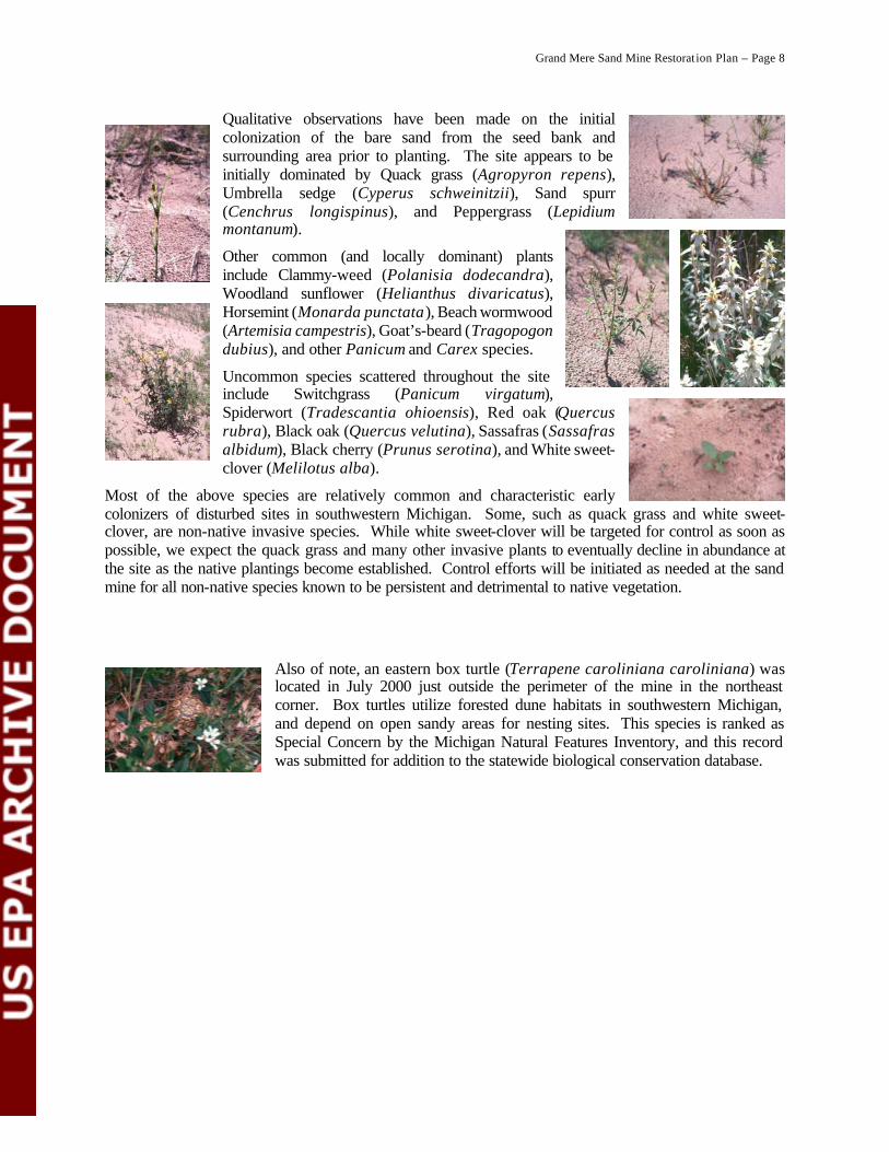
Qualitative observations have been made on the initial colonization of the bare sand from the seed bank and surrounding area prior to planting. The site appears to be initially dominated by Quack grass (Agropyron repens), Umbrella sedge (Cyperus schweinitzii), Sand spurr (Cenchrus longispinus), and Peppergrass (Lepidium montanum).
Other common (and locally dominant) plants include Clammy-weed (Polanisia dodecandra), Woodland sunflower (Helianthus divaricatus), Horsemint (Monarda punctata), Beach wormwood (Artemisia campestris), Goat’s-beard (Tragopogon dubius), and other Panicum and Carex species.
Uncommon species scattered throughout the site include Switchgrass (Panicum virgatum), Spiderwort (Tradescantia ohioensis), Red oak (Quercus rubra), Black oak (Quercus velutina), Sassafras (Sassafras albidum), Black cherry (Prunus serotina), and White sweet-clover (Melilotus alba).
Most of the above species are relatively common and characteristic early colonizers of disturbed sites in southwestern Michigan. Some, such as quack grass and white sweet-clover, are non-native invasive species. While white sweet-clover will be targeted for control as soon as possible, we expect the quack grass and many other invasive plants to eventually decline in abundance at the site as the native plantings become established. Control efforts will be initiated as needed at the sand mine for all non-native species known to be persistent and detrimental to native vegetation.
Also of note, an eastern box turtle (Terrapene caroliniana caroliniana) was located in July 2000 just outside the perimeter of the mine in the northeast corner. Box turtles utilize forested dune habitats in southwestern Michigan, and depend on open sandy areas for nesting sites. This species is ranked as Special Concern by the Michigan Natural Features Inventory, and this record was submitted for addition to the statewide biological conservation database.
Grand Mere Sand Mine Restorat ion Plan – Page 9
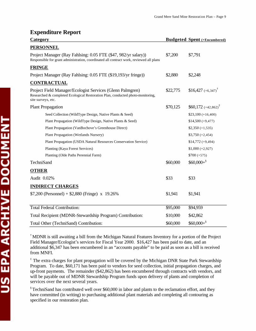
Expenditure Report Category Budgeted Spent (+Encumbered)
PERSONNEL
Project Manager (Ray Fahlsing: 0.05 FTE ($47, 982/yr salary)) $7,200 $7,791 Responsible for grant administration, coordinated all contract work, reviewed all plans
FRINGE
Project Manager (Ray Fahlsing: 0.05 FTE ($19,193/yr fringe)) $2,880 $2,248
CONTRACTUAL
Project Field Manager/Ecologist Services (Glenn Palmgren) $22,775 $16,427 (+6,347)†
Researched & completed Ecological Restoration Plan, conducted photo-monitoring, site surveys, etc.
Plant Propagation $70,125 $60,172 (+42,862)‡
Seed Collection (WildType Design, Native Plants & Seed) $23,100 (+16,400)
Plant Propagation (WildType Design, Native Plants & Seed) $14,500 (+9,477)
Plant Propagation (VanBochove’s Greenhouse Direct) $2,350 (+1,535)
Plant Propagation (Wetlands Nursery) $3,750 (+2,454)
Plant Propagation (USDA Natural Resources Conservation Service) $14,772 (+9,494)
Planting (Kaya Forest Services) $1,000 (+2,927)
Planting (Olde Paths Perennial Farm) $700 (+575)
TechniSand $60,000 $60,000+§
OTHER
Audit 0.02% $33 $33
INDIRECT CHARGES
$7,200 (Personnel) + $2,880 (Fringe) x 19.26% $1,941 $1,941
Total Federal Contribution: $95,000 $94,959
Total Recipient (MDNR-Stewardship Program) Contribution: $10,000 $42,862
Total Other (TechniSand) Contribution: $60,000 $60,000+§
† MDNR is still awaiting a bill from the Michigan Natural Features Inventory for a portion of the Project Field Manager/Ecologist’s services for Fiscal Year 2000. $16,427 has been paid to date, and an additional $6,347 has been encumbered in an “accounts payable” to be paid as soon as a bill is received from MNFI.
‡ The extra charges for plant propagation will be covered by the Michigan DNR State Park Stewardship Program. To date, $60,171 has been paid to vendors for seed collection, initial propagation charges, and up-front payments. The remainder ($42,862) has been encumbered through contracts with vendors, and will be payable out of MDNR Stewardship Program funds upon delivery of plants and completion of services over the next several years. § TechniSand has contributed well over $60,000 in labor and plants to the reclamation effort, and they have committed (in writing) to purchasing additional plant materials and completing all contouring as specified in our restoration plan.
Grand Mere Sand Mine Restorat ion Plan – Page 10
Conclusions The past three years have been largely dedicated to collaboration, planning, negotiation, and fostering awareness of ecological restoration of this sand mine. During this time, the sand mine restoration plan was completed and agreed to by all parties, annual volunteer and educational activities have been initiated, contouring of nearly all slopes has been completed, and several small local Michigan businesses have been contracted to collect seed, propagate plants, and install plants at the sand mine.
The assistance provided by USEPA has allowed the above activities to be accomplished. Without the grant, large-scale ecological reclamation would not have been possible at this site. The integrity of the natural communities within the Grand Mere State Park and National Natural Landmark will continue to benefit greatly from this project for many years to come.
Acknowledgements The project manager and project field ecologist would like to thank several people for their assistance and cooperation with this project. Will MacKinnon (former Stewardship Ecologist, MNFI) initiated the restoration planning and volunteer work at Grand Mere for this project. Bob Clancy (State Park Stewardship Program) provided assistance in many areas, including field work, volunteer coordination, reviewing drafts of planting plans, etc. The staff at TechniSand, especially Tim Stauffer, Bob Ledyard, and Joe Fodo, have cooperated and contributed greatly to the reclamation effort. We also thank the Michigan Department of Environmental Quality (MDEQ), especially Douglas Daniels and Paul Sundeen, for their contributions of time and energy to make this project work. Many people reviewed drafts of plant lists, plans, and specifications. We especially appreciate the assistance of Kim Herman (MDNR Natural Areas Coordinator) and Mike Kost (MNFI) in drafting and reviewing the planting plan. Kent Fuller and Karen Rodriguez (USEPA-GLNPO Project Officers) provided helpful comments and guidance throughout the duration of the project.
Photo credits: School group planting crew (page 4) and box turtle (page 8) by Will MacKinnon. National Natural Landmark sign (page 1) by Ray Fahlsing. All other photos by Glenn Palmgren.