sample application (complex project) - fema.gov ii-6, sample application (complex project) page 6 of...
TRANSCRIPT

Tool II-6, Sample Application (Complex Project)
Page 1 of 25
Sample Application (Complex Project)
This application is from the fictional City of Adversity, located in Prosperity County in the State of Any State (AS). It is intended to represent any community that might apply for funding under the Hazard Mitigation Grant Program (HMGP).
Adversity is a small- to medium-sized city of approximately 400,000 citizens. The heart of Adversity lies in the valley of the Quake River, while the suburbs extend to the surrounding hills and forests. The city has three main areas of economic development; downtown Adversity is the only one that is near the floodplain. However, many residents live on or near the river and approximately 5,000 property owners periodically (every 5-10 years) suffer flood damage, while 500 regularly (every 1-2 years) fight rising waters. Most recently, the Quake River flooded in April 1998, causing substantial damage to over 100 residential properties. This project proposes acquisition of approximately 50 of the properties, all of which are located in the Hillcrest neighborhood, that were damaged in this event and are flooded regularly. Adversity’s Mayor, Timothy Tide, and the Director of City Services, Taylor Gilmour, are leading efforts to implement the property acquisition project.

Tool II-6, Sample Application (Complex Project)
Page 2 of 25
Hazard Mitigation Grant Program Sub-Grant Application
THIS SECTION FOR STATE USE ONLY Standard HMGP
Initial Submission or or
5% Initiative Application Resubmission
Application Complete
Conforms with State Plan In Declared Area Statewide
Applicant Type: State or Local Government Private Non-Profit (Tax ID Received) Recognized Indian Tribe or Tribal Organization Special District/Other
Project Type(s) Flood Seismic Other: Wind
________________________ (Other)
Community NFIP Status: NFIP Participant Community ID: _________________________________ In Good Standing Non-Participating
State Application ID Application Rec’d (Date) Signed Date State Reviewer
Reviewer Phone #
Reviewer Fax #
1. FEMA - 1742 -DR- AS
Part 1: Applicant Data 2. Applicant Name: City of Adversity, AS 3. TIN: 123-45-6789 4. County Name: Prosperity 5. County Code: 6. State Code: AS 7. State Legislative District: 4th District 8. U. S. Congressional District: 23rd District 9. FIPS Code: 098-09137 10. Public Entity ID: 11. CID:
12. Primary Point of Contact Name: Taylor Gilmour Nickname: Organization: City of Adversity, AS Job Title: Director of City Services Address: City Hall, Room 410 Telephone: (111) 711-0022 35003 Tornado Alley Fax: (111) 711-0333 Adversity, AS 40009 Email: [email protected] Directions: From route 27, take Adversity exit. At stop sign, turn left onto route 31. At third stoplight, turn
right onto Tornado Alley. City Hall is the third building on the right.
13. Alternate Point of Contact Name: James Koff Nickname: Jim Organization: City of Adversity, AS Job Title: Chief Engineer Address: City Hall, Room 312 Telephone: (111) 711-0045 35003 Tornado Alley Fax: (111) 711-0335 Adversity, AS Email: [email protected]
14. Application Preparer
Name: Pat Keach Job Title: Community Development Specialist
Organization: City of Adversity, AS Telephone: (111) 711-0671 Address: City Hall, Room 430 35003 Tornado Alley Fax: (111) 711-0600 Adversity, AS Email: [email protected]

Tool II-6, Sample Application (Complex Project)
Page 3 of 25
15. Does your community participate in the NFIP? Yes No 16. If yes, what date did your community enter the NFIP? June 1974 17. If no, when do you anticipate entering the NFIP? N/A 18. What is the date of your community’s most recent Community Assistance Visit? May 1991
19. Is your community a private, nonprofit organization? Yes No 20. Is your community an American Indian or Alaska Native tribal government? Yes No
21. Assurances
If the project is funded, the applicant must adopt an ordinance or other policy that demonstrate the community shall comply with the following (applicant, not preparer, must initial each item):
TG Designate Authorized Agent for Project.
TG All participants must sign a statement acknowledging the program is voluntary and, therefore, are not entitled to relocation assistance under the URA.
TG
Each potential property owner must be notified in writing that for the purpose of this program the community shall not use its power of eminent domain to acquire the properties if a voluntary agreement is not reached.
TG The following restrictive covenants shall be conveyed in the deed to any property acquired: 1. The property shall be dedicated and maintained in perpetuity for uses compatible with
open space, recreational or wetlands management practices; and 2. No new structure(s) shall be built on the property except as indicated below:
A. A public restroom; or B. A structure that is compatible with open space, recreational or wetlands
management usage and proper floodplain management policies and practices, which the Director approves in writing before the construction of the structure begins.
3. The premises shall remain in public ownership. 4. After completion of the project, no application for additional disaster assistance shall be
made for any purpose with respect to the property to any Federal entity or source, and no Federal entity or source will provide such assistance.
In general, allowable open space, recreational and wetland management uses include parks for outdoor recreational activities, nature reserves, cultivation, grazing, camping (except where adequate warning time is not available to allow evacuation), temporary storage in the open of wheeled vehicles which are easily movable (except mobile homes), unimproved, pervious parking lots, and buffer zones.
TG Any structures built on the property according to the above stipulations (see 2 above) shall be floodproofed or elevated to the Base Flood Elevation plus one foot of freeboard.

Tool II-6, Sample Application (Complex Project)
Page 4 of 25
In addition, upon successful project approval and funding, the applicant will approve a formal, written policy, which will include all required ordinance language and applicable state policies. Applicant will be required to submit its policy to state for final approval (applicant, not preparer, must initial each):
TG A public meeting shall be conducted to explain policy and procedures.
TG Priority of acquisition or relocation of properties shall be established.
TG All structures to be demolished or relocated, including garages or outbuildings, shall be located on the acquired property.
TG A standard policy of appraisal will be established. Based on this appraisal, owners will be offered a fair market value (FMV) less any duplication of benefits as identified by FEMA.
TG
In the event that the appraisal less duplication of benefits is a negative figure or less than the land only value, and the property owner still desires to sell the property, the property owner will be offered the FMV of the land only (not the structure). However, the community will take deed to both the structure and land.
TG
If subject property was purchased after the flood/event on an “as is” basis, the amount of the new post-flood owner paid for the property plus any verifiable improvements will be the FMV offered. The post-flood property owner will not be offered the pre-flood FMV if they were not the property owner during/before the event. In addition, any benefits the previous owner received for repair of the property will not be deducted from the offer. In no event, will the offer to the post-flood owner exceed the pre-flood FMV.
TG
Any tenants renting properties 90 days prior to the start of negotiations with the owner will be offered relocation assistance. Renter relocation assistance is formula driven but in no event will the relocation payment exceed $5,250 plus actual moving expenses.
TG Each property closing will be preceded by a title search. The title must be clear of all liens before the community will take title to the property.
TG The property owner will agree to satisfy all liens or have the lien amount deducted from the purchase offer at the time of closing.
TG
Current property owners will be responsible for the property taxes from the first of the tax year through the date specified by the community buyout policy (e.g. either the date of closing or the date of the event) on a pro-rated basis.
TG Until the title is transferred, the property owner remains solely responsible for the property.

Tool II-6, Sample Application (Complex Project)
Page 5 of 25
22. Authorized Agent of the Applicant/Community
Should our community be awarded FEMA funds to implement a property acquisition project, we agree to the above stipulations as conditions of receiving funds and implementing said project. Taylor Gilmour May 27, 1998
Authorized Agent’s Signature Date Taylor Gilmour Director of City Services
Name (printed or typed) Title
Part 2: Problems and Solutions
23. Project Location Describe, in detail, the location of your community’s project. Include its topography and a map indicating all affected properties. If possible, use a flood insurance rate map (FIRM). Identify any properties located in a floodplain or floodway. Demonstrate how location contributes to the problem. FIRMs typically are available from your local floodplain administrator, often within the planning, zoning, or engineering office. You also can order maps from FEMA’s Map Service Center at 1-800-258-9616. (For more information, contact your SHMO or visit FEMA’s web page at http://www.fema.gov/home/MSC/hardcopy.htm.)
The City of Adversity is built on gently rolling hills with terraces near the Quake River, describing the 500-year, 100-year, and 10-year floodplains.
The proposed project location, in northeastern Adversity, in the subdivision of Hillcrest, is a relatively flat lowland area with an overall slope towards the river. The land adjacent to the river is one to five feet above normal (non-flood) river level, with a sharp drop off just prior to the water. The properties to be acquired fall within the high-velocity floodway and areas extending into the 100-year floodplain running parallel to the Quake River. They line both sides of the street named Hurricane Way, from the intersection of Hurricane Way and Route 32 to the intersection of Hurricane Way and Water Street on the river bank, and following Water Street to the intersection of Puddle Place. (See attached city map.)
This area, containing 54 residential properties, is a valley that surrounds the river on both sides, and is considered a Zone X area by flood insurance rate maps. Ten properties are located within the floodway and the remaining 44 lie within the 100-year floodplain. The first floor elevations of these properties range from 89 to 102 feet above sea level. The base flood elevations range from 92 - 110 feet above sea level. (See attached FIRM.)
24. Explanation of the Problem/Event Describe in detail the event precipitating the need for this project and its effects on the community. Indicate if the event is a 100- or 500-year flood, etc., as appropriate. Describe the historical effects of similar events during the past 25 years. As supporting documentation, enclose photographs, scientific data (e.g. documented health risks, the number of homes or businesses destroyed by each event), etc.

Tool II-6, Sample Application (Complex Project)
Page 6 of 25
In April 1998, the City of Adversity suffered immense real-estate damage due to a 50-year flood of the Quake River. This flood damage created severe hardship for many residents throughout the city. A preliminary evaluation of post-flood structural conditions found over 100 homes and businesses with significant damage, many of which sustained structural damage from flood depths of up to 6 to 8 feet inside the structures for a duration of not less than 7 days.
As a result of the Quake River Flood in Adversity in April, 1998:
• 517 homes were damaged
• 12 homes were completely destroyed
• 98 businesses were damaged, putting 600 jobs at risk
• 750 vehicles were destroyed
• 37 people were hospitalized; 3 people died
• 347 people were injured, treated and released
Due to Adversity’s proximity to the Quake River, the community has experienced flooding on an average of once every three to five years for over half a century. The attached Flood Insurance Study (FIS) indicates the frequency and magnitude of the events. Note that there was only one flood exceeding a Flood Stage of 40 feet between March 1939 and February 1970, and that 3 have exceeded this level since 1970. This fact suggests that the severity of the flooding is increasing. Also note that the cost of damage from each flood event is increasing from an average of 2.4 million dollars from March 1939 to February 1970, to an average of 14.4 million dollars from March 1970 to March 1998. (See the attached FIS for a more detailed history of the flooding.)
In all, Adversity has experienced millions of dollars of physical and economic damage within components of the community-at-large, private property owners, businesses, public facilities, and city, State and Federal governments. In fact, the U. S. Army of Corps of Engineers has estimated average annual damages in Adversity to be $1 million at 1998 prices. (See attached photographs of past flood damage.)
Adversity’s Response to the Flooding Problem:
Over the years, the City has become a participant in the National Flood Insurance Program (NFIP) and has implemented many flood mitigation measures in order to minimize the devastating impact of flooding. The City has established buffers, floodwalls, recreational uses and special construction and reconstruction standards for areas subjected to this periodic flooding. The City has enacted and maintained floodplain regulations, which restrict new construction of homes in the 100-year floodplain. Although uncontrolled construction of homes occurred prior to the establishment of the floodplain regulations, current aggressive enforcement of these regulations prevents the continuation of such hazardous practices.

Tool II-6, Sample Application (Complex Project)
Page 7 of 25
Chronology of Adversity’s Flood Mitigation Measures and Activities:
1939 Floodwall and Levee System Authorized.
1954 Flood Pumps Installed.
1970 Construction of North Side Floodwall and Mile High Pump Station.
1974 Adoption of Local Floodplain Management Ordinances in conjunction with joining National Flood Insurance Program (NFIP).
1978 Warning/Evacuation System Developed and Implemented.
1981 South Side Floodwall determined a cost-effective measure.
1983 Mayor Oake’s Task Force appointed to review alternative hazard mitigation measures.
1985 Task Force’s Recommended Plan includes constructing a floodwall, improving the warning/evacuation system and further restricting construction in the floodplain.
1985 Adoption of updated Floodplain Building Restriction Ordinances that limit new building and enforce higher standards of rebuilding in the floodplain.
1986 Washington Study of Levee feasibility and Warning System upgrades for Harbor View and East Adversity communities.
1987 State Legislature Appropriation of $3.1 million budget for floodwall.
1989 Participation on the Federal Interagency Hazard Mitigation Team.
1989 Elevation of Stuart Avenue and Beecher Street Pump and Lift Stations.
1989 Scheduled signing of Local Construction Agreement for Construction of South Side Floodwall.
1990 Meeting with Hillcrest area residents for proposed CDBG Relocation Application following door-to-door survey resulting in 51% supporting relocation; 25% against; 24% undecided.
1991 Initiate Floodproofing Study for other unprotected areas.
1994 Completion of South Side Floodwall.
1998 Despite construction of the new floodwall, not all areas are protected from 50-year events. City of Adversity applies for HMGP funding to institute a land acquisition project.
The homes being considered for acquisition in the proposed project were built along the river before floodplain regulations were implemented in the late 1970’s. They are located on sites that cannot be adequately protected from flooding. Due to the 1998 flood damage to these homes, most owners are interested in selling their property and moving.

Tool II-6, Sample Application (Complex Project)
Page 8 of 25
25. Solutions to the Problem
Alternative #1: Property Acquisition
Describe in detail the property acquisition alternative.
• How will your community’s acquisition (or acquisition and relocation) project solve the problem described?
• Explain how it is effective in addressing a recurrent or repetitive problem.
• Calculate the estimated cost including the present cost of implementation and the future cost of maintenance of the acquired property, as well as the potential future losses from natural disasters.
The present mitigation and disaster relief plan for the 1998 flooding offers acquisition to affected property owners on a voluntary basis. (Relocation may be considered on a case-by-case basis.) Approximately 100 properties, in 2 residential neighborhoods and 1 business district, were flooded to some degree in the 1998 event. The proposed project would remove some 54 residential properties located in the Hillcrest area described above. All properties in this area sustained over 50% damage in the 1998 floods, are located in the floodway or the 100-year floodplain, and have sustained at least 10% damage in at least 3 other floods over the past 30 years. A second project is being proposed to remove the remaining properties, located in another area of the floodplain. To date, 43 of the affected property owners in the Hillcrest area have expressed an interest in selling their homes to the City or relocating their houses to less flood-prone areas within the City.
By acquiring the proposed properties, The City of Adversity will remove flood-prone structures from the floodway and floodplain, thereby eliminating future damages, and health and safety risks for those homeowners and any potential rescuers. This includes eliminating the need to provide emergency response services, subsidized flood insurance and federal disaster assistance to the residents.
As noted previously, all of these properties sustained considerable damage on numerous occasions. Together with the costs of the most recent disaster, the total amount far exceeds the fair market value of the properties. On various occasions in the past, residents have received some form of financial assistance, including federal disaster aid. See the table on the next page for more information about previous disaster assistance.
Other Considerations
NFIP coverage: 32 of the 54 homes (60%) have NFIP policies for structural coverage as of February 1, 1998. It is likely that additional policies were purchased before the floods occurred. Fifteen homes (nearly 50% of those with flood insurance) had structural coverage that exceeded the combined assessed value of the building. Furthermore, 10 homes had structural coverage that exceeded the combined assessed value of the building and land. These statistics show a commitment by most of the flood victims in the proposed project area to protect themselves against flood losses.

Tool II-6, Sample Application (Complex Project)
Page 9 of 25
Sample of previous disaster assistance received by Hillcrest neighborhood property owners:
Owner’s Name Estimated FMV
Est. $ Loss in 1998 % Damage $ Loss in
1991 % Damage Est. Replacement Value as of June
1998
1. Cress $54,630 $52,000 95% $7,300 13% $51,898
2. Flaxman $50,724 $42,000 83% $14,500 29% $47,6803. Mostovich $41,850 $42,000 100% $13,000 31% $38,920
4. Brome $60,012 $52,000 87% $6,500 11% $56,4115. Turkanis $256,104 $139,000 54% $4,300 2% $243,298
6. Tubbs $73,908 $70,000 95% $37,000 50% $69,4737. Garcia $74,448 $60,000 81% $8,000 11% $69,236
8. Smith $41,652 $18,700 45% $9,000 22% $38,7369. Kogan $69,372 $40,000 58% $17,000 25% $65,209
10. DeSilva $65,196 $35,000 54% $10,000 15% $60,63211. Savage $55,098 $23,000 42% $4,250 8% $52,343
12. Edwards $55,000 $37,000 67% $5,000 9% $51,70013. Ross $78,350 $41,000 52% $17,000 22% $74,432
14. Levine $45,980 $28,000 61% $13,000 28% $43,68115. Jones $67,772 $65,000 96% $42,000 62% $64,383
16. Tabiri $75,050 $58,000 77% $3,500 5% $70,54717. Lewis $53,900 $34,000 63% $12,000 22% $50,666
18. Chung $62,500 $62,500 100% $20,000 32% $59,37519. Nelson $68,840 $28,000 41% $5000 7% $64,709
20. Gordon $72,990 $47,500 65% $7,200 10% $68,610
Totals $1,423,376 $983,200 $255,550
$1,341,939
The combined total of the fair market values of these 20 sample properties is $1,423,376. The combined total of damages paid, in just the last five years, is $1,238,750. Therefore, in just the last five years, these twenty property owners have collected disaster assistance approximately equal to the fair market value of all 20 sample properties. If the City of Adversity acquires these properties, we will eliminate the need for this payment in the future, despite any flooding in the area.
Estimated Cost:
Implementation & maintenance: $ 4,067,876
Potential future losses: $ 0
Tool II-6, Sample Application (Complex Project)
Page 10 of 25
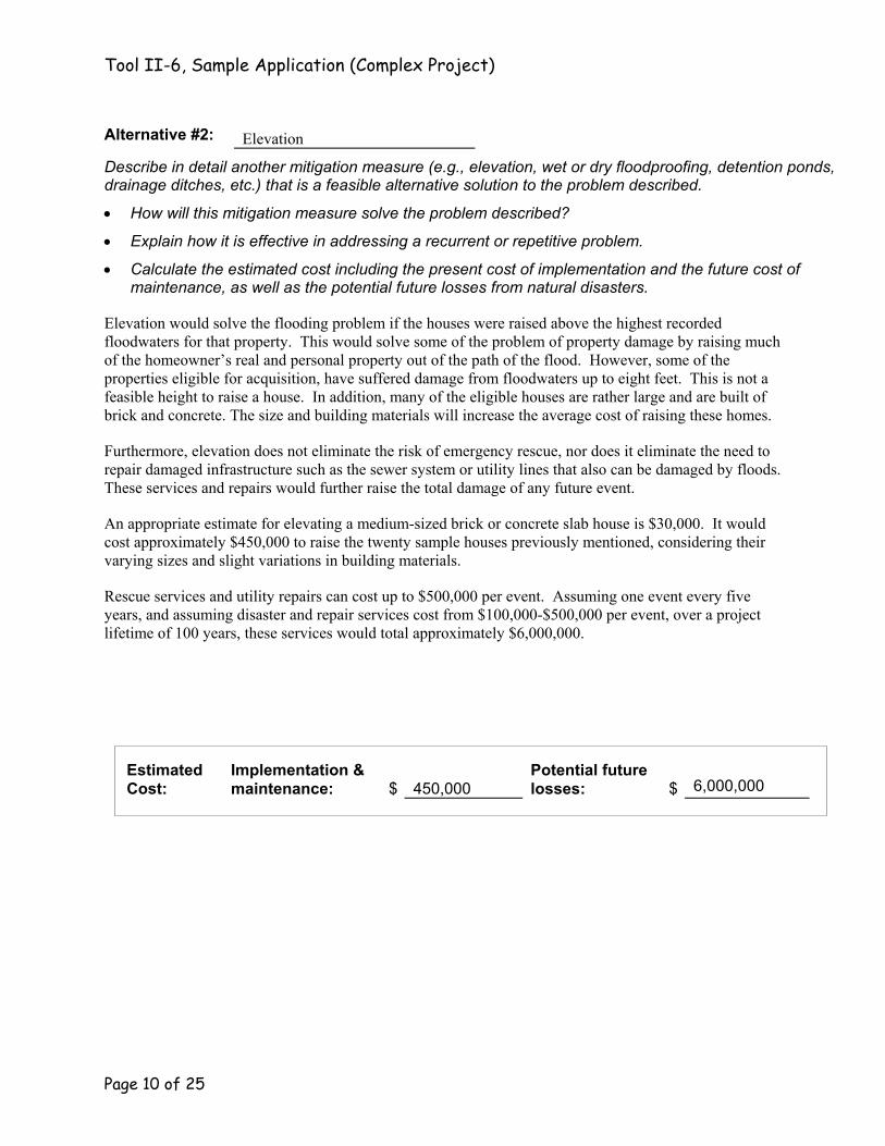
Alternative #2: Elevation
Describe in detail another mitigation measure (e.g., elevation, wet or dry floodproofing, detention ponds, drainage ditches, etc.) that is a feasible alternative solution to the problem described.
• How will this mitigation measure solve the problem described?
• Explain how it is effective in addressing a recurrent or repetitive problem.
• Calculate the estimated cost including the present cost of implementation and the future cost of maintenance, as well as the potential future losses from natural disasters.
Elevation would solve the flooding problem if the houses were raised above the highest recorded floodwaters for that property. This would solve some of the problem of property damage by raising much of the homeowner’s real and personal property out of the path of the flood. However, some of the properties eligible for acquisition, have suffered damage from floodwaters up to eight feet. This is not a feasible height to raise a house. In addition, many of the eligible houses are rather large and are built of brick and concrete. The size and building materials will increase the average cost of raising these homes.
Furthermore, elevation does not eliminate the risk of emergency rescue, nor does it eliminate the need to repair damaged infrastructure such as the sewer system or utility lines that also can be damaged by floods. These services and repairs would further raise the total damage of any future event.
An appropriate estimate for elevating a medium-sized brick or concrete slab house is $30,000. It would cost approximately $450,000 to raise the twenty sample houses previously mentioned, considering their varying sizes and slight variations in building materials.
Rescue services and utility repairs can cost up to $500,000 per event. Assuming one event every five years, and assuming disaster and repair services cost from $100,000-$500,000 per event, over a project lifetime of 100 years, these services would total approximately $6,000,000.
Estimated Cost:
Implementation & maintenance: $ 450,000
Potential future losses: $ 6,000,000

Tool II-6, Sample Application (Complex Project)
Page 11 of 25
Alternative #3: No Action
Describe in detail the “no-action” alternative solution to the problem described.
• Explain the present and future effects of doing nothing to solve the problem.
• Identify the estimated present and future costs and losses of doing nothing.
Calculations based on the history of flooding in Adversity indicate that, with no action, Adversity could expect to suffer further damage, injury, or death of even greater magnitude in the future. Assuming property owners would collect a similar amount of disaster assistance every five years, and assuming a 100-year lifetime of the project, the no action alternative could result in future disaster assistance payments of approximately $24,775,000 over the next 100 years.
Estimated Cost:
Implementation & maintenance: $ 0
Potential future losses: $ 24,775,000

Tool II-6, Sample Application (Complex Project)
Page 12 of 25
26. Proposed Solution
Of the three alternative solutions described above, which does your community propose is the best?
The Hazard Mitigation Plan developed by the State has established the acquisition of flood-prone properties as its highest priority. In addition, as individual residents and local officials became aware of the extent of damage again inflicted by spring flooding, they became increasingly interested in an acquisition project as a possible solution. This was confirmed at town meetings held on May 26, May 28, and May 30. Representatives of FEMA, the State, and the City met and discussed how property acquisition could greatly reduce future disaster losses, save lives, and lessen overall taxpayer costs. Therefore, the City of Adversity has determined that an aggressive program of acquisition of flood-prone properties is its best alternative for reducing future losses.
Explain why your community proposes that solution over the other two alternatives. Demonstrate that it is the best solution of the three. Compare the costs of future floods (e. g., disaster response, recovery, repair, reconstruction, etc.) to demonstrate its cost-effectiveness.
Owners of this project area have reported repeated physical danger, monetary loss, and emotional stress due to repeated flooding.
No Action: The No action option does nothing to reduce or eliminate future risk to City residents or damage to their property. Nor does it offer a means to reduce or eliminate the need for future disaster assistance.
Elevation: While the elevation option would reduce risk of both physical danger and property damage, it does not eliminate it. Residents could still be trapped by rapidly rising waters, causing the need for emergency evacuation. Utility lines would still be required for decent and sanitary living. Therefore, the high likelihood remains that the City, the State and the Federal Government will repeatedly be asked to spend funds on emergency disaster assistance and repairs of infrastructure.
Property Acquisition: Acquiring this property and converting it to open space in perpetuity is the only means of ensuring the safety of residents and eliminating future government disaster assistance and repair expenses. The present cost of repair is over 50% of the cost required to fund a property acquisition project. By removing residents from the path of danger, we will ensure that no future aid is required.

Tool II-6, Sample Application (Complex Project)
Page 13 of 25
Part 3: Estimated Budget
27. Budget Worksheet
Unit Cost # of Units Total Cost
Site Acquisition (total estimated FMV’s from Property Inventory—Summary) $ 3,185,376Appraisal $ 500 54 $ 27,000Property Survey $ 500 14 $ 7000Title Search and Closing $ 1,000 54 $ 54,000Structure Demolition $ 10,000 54 $ 540,000Structure Relocation $ 0 0 $ 0Tenant or Housing relocation assistance $ 6,000 37 $ 222,000
Legal fees $ 32,500
Other: $
Other: $
Total Cost Estimate (sum of all total costs) $ 4,067,876
NOTE: Administrative funds will be provided in addition to grant award if project is approved. Do not include administrative expenses in above Total Cost Estimate.
28. Basis of FMV:
Fair market value will be based on pre-disaster property values. The City of Adversity used property tax assessment data to estimate a working budget. However, we plan to base final purchase offers on appraisals completed by a certified professional appraiser from Prosperity County. For those property owners who are interested in obtaining a second appraisal, the City will provide a list of appraisers from the county whose appraisals will be considered acceptable.
29. Projected Source of Funds: Source Percent Amount Federal Share: FEMA 75% $ 3,050,907
State 20% $ 813,575
CDBG 5% $ 203,394Non-federal Share: (State, local, private)
$

Tool II-6, Sample Application (Complex Project)
Page 14 of 25
30. Work Schedule: Include a work schedule showing milestones and their anticipated periods of performance.
Projected Work Schedule Task Estimated time to complete
1. Announce receipt of grant 2. Update list of interested property owners 3. Appraise properties 4. Distribute offer letters 5. Accept any second appraisals 6. Begin closing proceedings 7. Close on properties 8. Relocate or demolish any remaining structures 9. Implement open space plan 10. Maintain open space
1-2 weeks 2-4 weeks 6-10 weeks 3-6 weeks 4-6 weeks 1-2 week 4-8 weeks 8-16 weeks 12-24 weeks Ongoing
Total Time Estimate 9-18 months
*Please note that some tasks may overlap or occur simultaneously.
Part 4: Property Inventory
Use the property inventory forms (items 31, 32, and 33) to document properties targeted for acquisition. Make copies of the forms, as necessary, number copies, and attach. Also please answer the following questions. If the question is not applicable to your project, write “N/A” or “not applicable” in the blank.
The average cost of one square foot of residential rental property in Adversity is $ .50-.60
FOR PUBLIC FACILITIES ONLY (attach additional pages, if necessary, to answer for each public facility to be acquired):
Type of facility (e.g. fire station, community center, etc.): N/A
Annual Budget: $
Rental Income (if any): $

Tool II-6, Sample Application (Complex Project)
Page 15 of 25
31. Property Inventory—Summary Sequential
# Lot or Parcel # Property Owner’s Name Property’s Street Address & Zip Code Estimated FMV
1375 Hurricane Way 1 301-0011-008 Mr. Jerome Cress 40241 $54,630
1377 Hurricane Way 2 301-0011-010 Mr. and Mrs. Mehrdad Mostovich 40241 $50,724
1382 Hurricane Way 3 301-0011-013 Geoffrey and Aimee Flaxman 40241 $41,850
1385 Hurricane Way 4 301-0011-016 Ms. Patrice Brome 40241 $60,012
1387 Hurricane Way 5 301-0011-018 Richard Turkanis 40241 $256,104
1390 Hurricane Way 6 301-0011-021 Sharon Tubbs 40241 $73,908
1400 Hurricane Way 7 301-0012-010 Dario and Pilar Garcia 40241 $74,448
1402 Hurricane Way 8 301-0012-012 Mr. and Mrs. Henry Smith 40241 $41,652
1405 Hurricane Way 9 301-0012-015 Ms. Sandra Kogan 40241 $69,372
1901 Water Street 10 370-0088-055 Mr. Daniel DeSilva 40241 $65,196
1904 Water Street 11 370-0088-058 Christopher and Monica Savage 40241 $55,098
1905 Water Street 12 370-0088-059 Robert and Marian Edwards 40241 $55,000
1913 Water Street 13 370-0088-064 Mr. Brett Ross 40241 $78,350
Total Estimated FMVs this page $796,344

Tool II-6, Sample Application (Complex Project)
Page 16 of 25
32. Property Inventory—Individual Sequential #: 1 of 54
A. Owner(s) Data Name: Jerome Cress Social Security #: 081-33-7725
Phone Day: (111) 426-3371 Evening: (111) 228-1085
Mailing Address: P.O. Box 7510 Adversity, AS 40233
Name: N/A Social Security #:
Phone Day: Evening: Mailing Address:
B. Tenant Data (if applicable) (If more than one tenant, use 33, Property Inventory—Tenant Data sheet.) Name: N/A Social Security #:
Phone Day: Evening: Mailing Address:
Identify Possible Sources of Disaster Assistance for DOB (check all that apply): NFIP Settlement State IFG Program SBA Loans Disaster Housing (DH) Program Hazard Minimization Funds
Other:
Summarize building permit data below (include date of permit and purpose). 1992—Permit to add outdoor deck
Has this structure ever been flooded before? Yes FOR BUSINESSES ONLY: If yes, complete the following: Type of business: N/A
Monthly cost of rental space: Date Water depth above first finished floor Estimated value of contents:
1998 8 feet 1991 4 inches 1989 2 feet
Description of contents:
1978 18 inches Number of lost business days: Est. income lost per day:
Attach a detailed street map with exact location of property. Is map attached? YES

Tool II-6, Sample Application (Complex Project)
Page 17 of 25
C. Property Data Lot or Parcel #: 301-0011-008 Street Address: 1375 Hurricane Way Zip Code: 40241
Type of Property (check one): Single-family Home House of Worship Mobile Home with Pad Multiple-family Home Vacant Lot Own home pad Commercial Other Rent home pad
Number of stories? (Not including basement) 2 Does the building have a basement? Yes No
Type of Construction (e.g. wood frame, masonry, etc.) Brick
Type of Foundation (e.g. post and pier, continuous perimeter, etc.) Concrete Slab
What is the date of initial construction? 1971
What is the total square footage of all buildings? 1025 square feet
As of the date of application, are any structures on the property 50 years old or older? Yes No
What is the property’s Flood Zone Symbol or Designation? X
Is property in a floodway? Yes No What percentage of the property is damaged? 95 %
Is property in a floodplain? Yes No If yes, describe floodplain (e.g., 10-, 25-, 50-, 100-, or 500-year): -year
What is the first floor elevation (FFE) of the property? 91 feet above sea level (NGVD)*
What is the base flood elevation (BFE) of the property? 95 feet above sea level (NGVD)
What is the flood water elevation for the current event? 99 feet above sea level (NGVD)
*National Geodetic Vertical Datum
Attach color photographs.

Tool II-6, Sample Application (Complex Project)
Page 18 of 25
32. Property Inventory—Individual
Sequential #: 5 of 54 A. Owner(s) Data Name: Richard Turkanis Social Security #: 556-22-0317
Phone Day: (111) 517-5336 Evening: (111) 714-1799
Mailing Address: 12 Deepwood Court Adversity, AS 40235
Name: NA Social Security #:
Phone Day: Evening: Mailing Address:
B. Tenant Data (if applicable) (If more than one tenant, use 33, Property Inventory—Tenant Data Sheet) Name: See attachment Social Security #:
Phone Day: Evening: Mailing Address:
Identify Possible Sources of Disaster Assistance for DOB (check all that apply): NFIP Settlement State IFG Program SBA Loan Disaster Housing (DH) Program Hazard Minimization Funds
Other:
Summarize building permit data below (include date of permit and purpose). 1981-3—approved rental units 1980—1000-square foot addition (3rd floor and rear extension)
Has this structure ever been flooded before? Yes FOR BUSINESSES ONLY: If yes, complete the following: Type of business: NA
Monthly cost of rental space: Date Water depth above first finished floor Estimated. value of contents:
1998 6.5 feet 1991 6 inches 1989 26 inches
Description of contents:
1984 5 feet Number of lost business days: Estimated lost income per day:
Attach a detailed street map with exact location of property. Is map attached? YES

Tool II-6, Sample Application (Complex Project)
Page 19 of 25
C. Property Data Lot or Parcel #: 301-0011-018 Street Address: 1387 Hurricane Way Zip Code: 40241
Type of Property (check one): Single-family Home House of Worship Mobile Home with Pad Multiple-family Home Vacant Lot Own home pad Commercial Other 3 rental units Rent home pad
Number of stories? (Not including basement) 2 Does the building have a basement? Yes No
Type of Construction (e.g. wood frame, masonry, etc.) Brick
Type of Foundation (e.g. post and pier, continuous perimeter, etc.) Continuous Perimeter
What is the approximate date of construction? June;1971; August 1980
What is the total square footage of all buildings? 2500 square feet
As of the date of application, are any structures on the property 50 years old or older? Yes No
What is the property’s Flood Zone Symbol or Designation? A
Is property in a floodway? Yes No What percentage of the property is damaged? 54 %
Is property in a floodplain? Yes No If yes, describe floodplain (e.g., 10-, 25-, 50-, 100-, or 500-year): 100 -year
What is the first floor elevation (FFE) of the property? 95 feet above sea level (NGVD)*
What is the base flood elevation (BFE) of the property? 98 feet above sea level (NGVD)
What is the flood water elevation for the current event? 101.5 feet above sea level (NGVD)
*National Geodetic Vertical Datum
Attach color photographs.

Tool II-6, Sample Application (Complex Project)
Page 20 of 25
33. Property Inventory—Tenant Data Property Owner: Richard Turkanis Telephone Day: (111)517-5336 Evening: (111)714-1799 Property Address: 1387 Hurricane Way Adversity, AS 40241 Total Annual Rental Income: $12,000
Tenant Name Social Security No. Telephone Mailing Address Day: 426-1132 921 4th Street, Apt. 4G
Jill Ann Rehman 181-09-3372 Evening: 425-9899 Adversity City, AS 40211 Day: 425-7676 13507 Hucksburg Lane
Edward Hawkins 675-70-1159 Evening: 770-8710 Shilling, AS 40377 Day: 714-4880 2716 North Long Street, #15
Donald Yates 574-72-7834 Evening: 436-5465 Pine Tree, AS 40212 Day:
Evening: Day:
Evening: Day:
Evening: Day:
Evening: Day:
Evening: Day:
Evening: Day:
Evening: Day:
Evening: Day:
Evening: Day:
Evening:

Tool II-6, Sample Application (Complex Project)
Page 21 of 25
Part 5: Environmental and Sociological Considerations
For each Hazard Mitigation alternative your community is considering, answer “Yes,” “No,” or “Possibly,” or “Don’t Know” to each question. Then compare the columns. The column with the most “No” answers is the most community-friendly alternative.
34. Matrix of Environmental and Sociological Effects
Proposed
Action Alternative
#2 No Action Land Use & Socioeconomic Issues 1. Will project hinder or violate general land use in the area? No Possibly Yes
2. Will project conflict with local zoning ordinances? No No No
3. Will any structures be relocated? Possibly Possibly No
4. Will project negatively affect area economic activities? Yes Possibly Yes
5. Will project have a disproportionately high or adverse affect on a minority/low-income population? No No Possibly
6. Will project decrease or hinder prime farmland? No No Possibly
Natural Resources 7. Will marine, aquatic or terrestrial vegetation be removed? No Possibly No
8. Will there be construction in marshlands or wetlands? Will the project adversely affect any wetlands areas? No No No
9. Do endangered or rare species live in the project area? Possibly Possibly Possibly
10. Is the project area in or near a wildlife conservation area? No No No
Archeological and Historical Resources 11. Does project area have any archeological, cultural or historical significance? Possibly Possibly Possibly
12. Will project require excavation or disturbance of soil? No Possibly No
Total “No” Responses: 9 5 6

Tool II-6, Sample Application (Complex Project)
Page 22 of 25
Also consider hazardous materials that may be found on the properties you plan to acquire. Answer “Yes,” “No,” or “Possibly,” or “Don’t know” to each of the following questions. If the answer is “Yes” for even one property, then answer “Yes” to the question. For any question to which you answered “Yes” or “Possibly,” please attach additional pages explaining each hazardous material and planned abatement.
Hazardous Materials 1. Were the properties previously or are the properties currently used for commercial, light industrial, transportation or institutional purposes? No
2. Are there any above ground storage tanks, underground storage tanks, or leaking storage tanks present on the properties? Yes
3. Is there presently, or has there been in the past, any generation, treatment, storage, disposal, release, or spill of petroleum products, solid or hazardous substances and/or wastes, other than normal quantities of household substances on the properties?
Possibly
4. Have unusual odors or discoloration been noticed in the soil, or drinking or surface water on or near the properties? No
5. Are there any past or ongoing environmental investigations conducted by federal, state, local government agencies, or private firms; or Occupational Safety and Health Administration (OSHA) citations or notices of violation on the properties related to environmental or toxic hazards?
No
6. Are there any other issues or concerns associated with hazardous or toxic materials on the properties? Don’t Know
35. Agency Contacts
Identify the state and federal agencies contacted in the development of the project and in the preparation of this environmental analysis. In Part 6: Attachments, be sure to include letters from the State Historic Preservation Officer regarding historic buildings and archeological resources; and the U.S. Fish and Wildlife Service regarding endangered and threatened species, and fish and wildlife conservation issues.
State Historic Preservation Office
U.S. Fish and Wildlife Service
State Division of Environmental Protection
State Division of Natural Resources
U.S. Department of the Interior
U.S. Environmental Protection Agency
U.S. Geological Survey
U.S. Natural Resources Conservation Service
Other: State Dept. of Social Services

Tool II-6, Sample Application (Complex Project)
Page 23 of 25
36. Sociological Questions
Please respond to the following in regards to your community’s proposed solution.
1. Identify and describe any historic resources on or near any of the properties. Explain how the project will effect those historic resources.
The project area has no historical significance.
2. Identify and describe any archeological sites on or near any of the properties. Explain how the project will effect those archeological sites.
There is high probability that prehistoric or historic archaeological resources are located in the project area. There are several recorded archaeological sites on the same land forms in surrounding areas. However, according to the SHPO (see letter in Attachments), the project should have no effect on the archaeological resources as long as off-site fill is used to fill the house foundations and no grading of the previously undisturbed soil surrounding the house foundations is done.
3. Identify and explain any significant cultural or social issues that might affect or be affected by the project.
There are no minority families living in the project area. Some properties are owned by low-income residents, however it is the position of the City that acquisition of their properties will benefit them by providing an opportunity to purchase a new residence where they will not have to live with the fear and trauma associated with living in a floodplain.
4. Identify and explain any economic concerns or issues that might affect or be affected by the project.
The county has no economic concerns or issues as no business areas are affected by this project. However, 12 property owners and 2 tenants living in project properties will probably qualify as low-to-moderate income (LMI) and may require additional relocation assistance.
Tool II-6, Sample Application (Complex Project)
Page 24 of 25
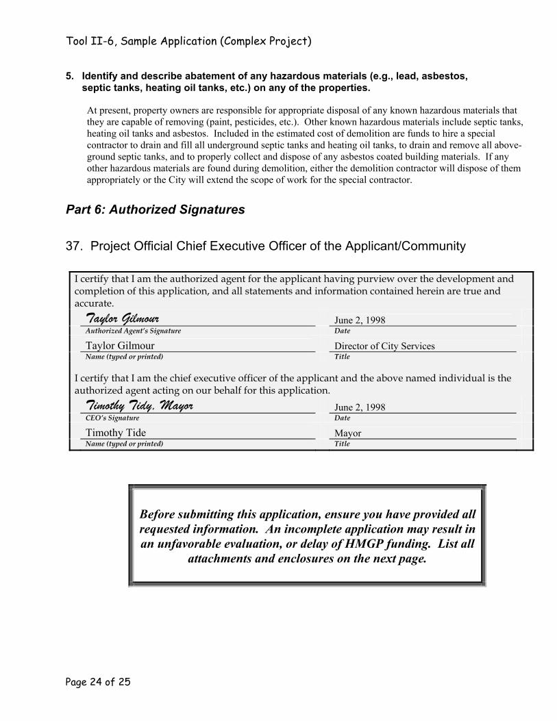
5. Identify and describe abatement of any hazardous materials (e.g., lead, asbestos, septic tanks, heating oil tanks, etc.) on any of the properties.
At present, property owners are responsible for appropriate disposal of any known hazardous materials that they are capable of removing (paint, pesticides, etc.). Other known hazardous materials include septic tanks, heating oil tanks and asbestos. Included in the estimated cost of demolition are funds to hire a special contractor to drain and fill all underground septic tanks and heating oil tanks, to drain and remove all above-ground septic tanks, and to properly collect and dispose of any asbestos coated building materials. If any other hazardous materials are found during demolition, either the demolition contractor will dispose of them appropriately or the City will extend the scope of work for the special contractor.
Part 6: Authorized Signatures
37. Project Official Chief Executive Officer of the Applicant/Community
I certify that I am the authorized agent for the applicant having purview over the development and completion of this application, and all statements and information contained herein are true and accurate. Taylor Gilmour June 2, 1998 Authorized Agent’s Signature Date Taylor Gilmour Director of City Services Name (typed or printed) Title
I certify that I am the chief executive officer of the applicant and the above named individual is the authorized agent acting on our behalf for this application. Timothy Tidy, Mayor June 2, 1998 CEO’s Signature Date Timothy Tide Mayor Name (typed or printed) Title
Before submitting this application, ensure you have provided all requested information. An incomplete application may result in an unfavorable evaluation, or delay of HMGP funding. List all
attachments and enclosures on the next page.

Tool II-6, Sample Application (Complex Project)
Page 25 of 25
Part 7: Attachments and Enclosures
38. Attachments
Use the space below to name and number all attachments and enclosures. Use as many pages as necessary to list all documents neatly and completely.
Be sure to include copies of the following:
Maps of project area: Street map FIRM Topographical and other maps, if available
Other supporting documentation: Copies of letters from environmental agencies Advertisements for project meetings Photographs of damage and other evidence Property data
List of Attachments and Enclosures
Number Title or Description

This page intentionally left blank