s p a c e t e c h n o l o g i e s f o r p u b l i c a d m...
TRANSCRIPT

Copernicus EU
Copernicus EU www.copernicus.eu
Copernicus EU
S P A C E T E C H N O L O G I E S F O R P U B L I C A D M I N I S T R A T I O N S I N C H A R G E O F C O N T R O L S R E L A T E D T O T H E E L I G I B I L I T Y O F F A R M E R S F O R E U A I D S I N A G R I C U L T U R E
Copernicus for Local and Regional Authorities
N. Pergola, C. Filizzola, V. Tramutoli, R. Corrado, A. Falconieri, M. Faruolo, N. Genzano, M. Lisi, G. Mazzeo, R. Paciello
Consiglio Nazionale delle Ricerche – Istituto di Metodologie per l’Analisi Ambientale Università della Basilicata, Scuola di Ingegneria Geospazio Italia srl
In collaboration with
NEREUS – Network of European Regions Using Space Technologies

Copernicus
I N T R O D U C T I O N O F U S E C A S E
• The Common Agricultural Policy (CAP) implements a system of agricultural subsidies and other programs which represent about 40% of the EU’s yearly budget.
• To ensure that CAP funds are properly spent, each Member State is responsible for subsidy administration and control, which are done by a National Control and Paying Agency (NCPA). AGEA (Agenzia per le Erogazioni in Agricoltura) is the Italian NCPA.
• Farmers requiring EU financial support have to declare precise localization and crop type of their agricultural parcels.
• NCPA has to control at least 5% of those declarations and to find those farmers who submit incorrect information as well as those who are eligible for funding.
2
Copernicus
I N T R O D U C T I O N O F U S E C A S E
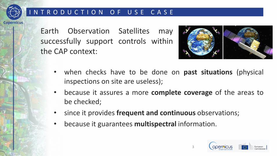
• when checks have to be done on past situations (physical inspections on site are useless);
• because it assures a more complete coverage of the areas to be checked;
• since it provides frequent and continuous observations;
• because it guarantees multispectral information.
3
Earth Observation Satellites may successfully support controls within the CAP context:

Copernicus
U S E C A S E : F A C T S
Multi-spectral capability: Spectral signatures of different land covers
4

Copernicus
U S E C A S E : F A C T S
Spectral signatures of different kinds of vegetation:
5 In general: low reflectivity in VIS, high reflectivity in NIR

Copernicus
VISNIR
VISNIR
RR
RRNDVI
M O N I T O R I N G V E G E T A T I O N F R O M S P A C E
NDVI (Normalized Difference Vegetation Index) is a “measure” of the vegetation (content, status, health, etc.) which is present within an image pixel. It is based on the measure of reflectance in VIS and NIR spectral regions
Multi-spectral EO systems may provide information about vegetation presence and status
VIS NIR

Copernicus
U S E C A S E : M E T H O D O L O G Y
Different vegetation types have typical NDVI annual patterns enabling to discriminate them by means of a multi-temporal analysis.
7
0
0,1
0,2
0,3
0,4
0,5
0,6
0,7
0,8
0,9
ND
VI
Arable land
Fodder
Vineyard
Broad-leaved Forest
Pasture

Copernicus
U S E C A S E : M E T H O D O L O G Y
The difference in NDVI maps computed in two different periods will help to distinguish arable from non-arable lands (the Temporal NDVI Difference - TeND index):
8
TeND(x,y,t1,t2) = NDVI(x,y,t1) - NDVI(x,y,t2)
-0,6
-0,4
-0,2
0,0
0,2
0,4
0,6
0,8
TeN
D t 1
- t
2
Filizzola et al. 2017, IJRS, under review.
ARABLE
NON-ARABLE

Copernicus
U S E C A S E : T E S T A R E A B a s i l i c a t a R e g i o n ( S o u t h e r n I t a l y )
9
• Basilicata Regional Authority activated the Council Reg. 2078/1992 through a local program approved by the European Commission in 1994. The program was based on six 'measures' aiming at protecting environment, defending public health, and guaranteeing farmers adequate incomes by:
– reducing the use of polluting vehicles;
– extensification of grass, arboreal, and zootechnical productions in order to reduce overproductions;
– set-aside (no use for twenty years) to restore hydro-geological balance of the main basins.
Basilicata farmers actively participated to the EU program, with a large participation of farms (4162) and about 78000 ha of land interested during the period 1994-1997.
In recent years, the Italian NCPA (AGEA) suspected frauds. Unfortunately, many of suspected applications referred to parcel situations in the 1995 and 1997 for which only ortho-photos taken in 1997 were available. In order to take a decision, ortho-photo interpretations were not possible or not sufficient, thus a working group was specifically established by Basilicata Region required to provide an independent method to verify that some areas were actually ‘arable lands’ before farmers’ applications for EU contributions, as requested by the Council Reg. n. 2078/1992.

Copernicus
U S E C A S E : T E C H N O L O G Y
Landsat data (30m spatial resolution 16 days temporal repetition rate), have been used because they offer a historical archive availability as long as 30+ years to identify and monitor land cover changes during the last decades.
10

Copernicus
11
Arable lands
Non-arable lands
U S E C A S E : E O D A T A P R O D U C T S
Example of a TeND map (1997)
Earth Observation data supported Basilicata Region, Department of Agriculture, to take decisions about local farmers’ EU funds eligibility

Copernicus
U S E C A S E : R E S U L T S ( 1 )
12 Satellite imagery analysis confirmed the presence of non arable lands (forests)
TeND > 0
Copernicus
U S E C A S E : R E S U L T S ( 2 )
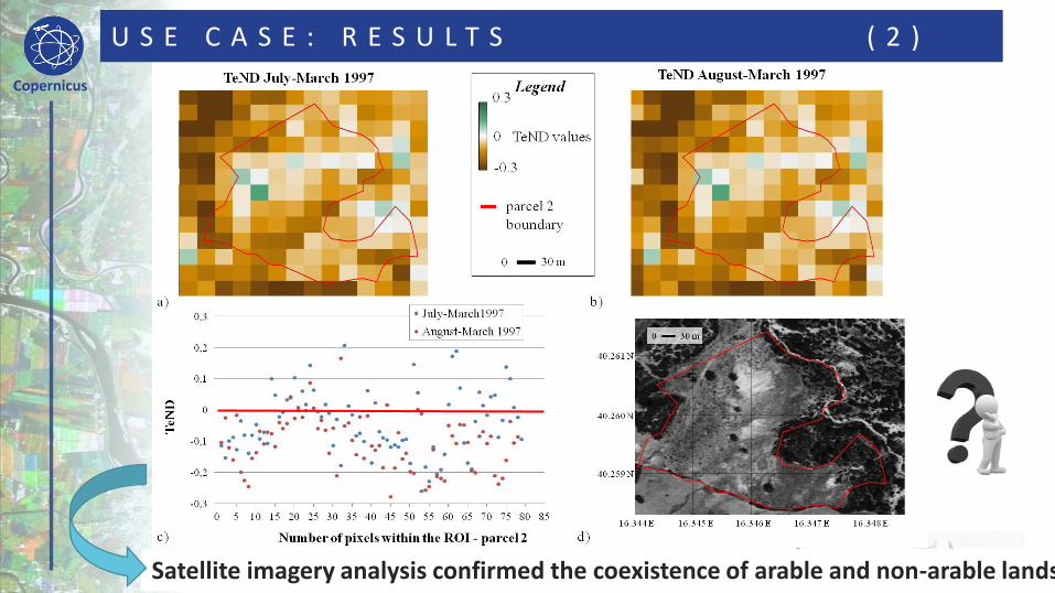
13 Satellite imagery analysis confirmed the coexistence of arable and non-arable lands

Copernicus
U S E C A S E : R E S U L T S ( 3 )
14 Satellite imagery analysis suggested the presence of arable lands only
TeND < 0

Copernicus
U S E C A S E : A C C U R A C Y A N D S E N S I T I V I T Y
15 A minimum percentage of ~35% of arable land within the LANDSAT pixel is required for the methodology to sucseed (for a two component pixel)
0% 10% 20% 30% 40% 50% 60% 70% 80% 90% 100%
-0,5
-0,4
-0,3
-0,2
-0,1
0
0,1
0,2
0,3
0% 10% 20% 30% 40% 50% 60% 70% 80% 90% 100%
Percentage of vineyard within Landsat pixel Te
ND
Percentage of arable land within Landsat pixel
July-March
August-March

Copernicus
U S E C A S E : A C C U R A C Y A N D S E N S I T I V I T Y
17
An overall accuracy of ~75% has been achieved for the Basilicata territory
CLC classes
Number
of points
of the two
grids
No data
Number of
points with
actual
TeND
values
Correctly identified
by TeND
NOT correctly
identified by TeND
[A] [B] [A-B] [C] [C]/[A-B] % [D] [D]/[A-B] %
Arable
land
211 876 207 669 548 82% 121 18%
212 0 0 0 0
0
213 0 0 0 0
0
Non-arable
(all other classes) 1452 480 972 665 68% 307 32%
TOT 2328 687 1641 1213 74% 428 26%
Validation with Corine Land Cover (CLC)

Copernicus
U S E C A S E : E X P O R T A B I L I T Y
The here presented methodology was designed by University of Basilicata and implemented by Geospazio Italia srl. The TeND index is basically independent from the specific satellite data. The same approach can be easily exported over new generation satellite images, such as data acquired by the Multi-Spectral Instrument (MSI) onboard Sentinel-2. Sentinel-2a is already orbiting around Earth and has been operational since June 2015. Sentinel-2b has been successfully launched on March 7, this year and it is planned to go operational very soon!
18 EU-ESA Mission Status Report 91, 3-10 June 2017

Copernicus
U S E C A S E : E X P O R T A B I L I T Y
Benefits from the use of Multi-Spectral Instrument (MSI) onboard Sentinel-2 may be expected for this application especially because it is characterized by: – a 10-day revisit time (5 days after the
launch of Sentinel-2b) which could allow having a larger number of cloud-free images over the area of interest and more accurate NDVI maps;
– a higher spatial resolution (10/20 m) that can enable to identify smaller areas with arable lands.
19
Spatial Res. Temporal Res.
LANDSAT 30 m 16 days
SENTINEL-2 10 m 5 days

Copernicus
U S E C A S E : A D D I T I O N A L I N F O R M A T I O N
The European Commission, produced a short video tutorial, briefly describing this EO-based use case for Local and Regional Authorities and practically showing how implementing it within common ICT tools (e.g. Qgis). The video, made with the contribution of NEREUS, is now available on-line at:
https://www.youtube.com/
watch?v=9Fd1yNobCGw
20

Copernicus EU
Copernicus EU www.copernicus.eu
Copernicus EU
T H A N K S F O R Y O U R A T T E N T I O N
For information: