resource consent application form 4 - orc.govt.nz · resource consent application form 4 ......
TRANSCRIPT

Resource consent application form 4 To take and use surface water
This application is made under Section 88 of the
Resource Management Act 1991 Phone: 0800 474 082
Website: www.orc.govt.nz
IMPORTANT ADVICE TO THE APPLICANT Disclaimer: If Otago Regional Council (the council) accepts your application for processing, this does not constitute a guarantee that water allocation is available. You should contact the council about water availability before you lodge your application. Ensure that you complete this form and resource consent application Form 1 in full before lodging. For any consent application to be processed efficiently in the minimum time possible and at minimum cost to you, it is important that you include all relevant information with your application. If the necessary information is not entered on the form or supplied with the application then the council may reject your application, request further information, or publicly notify your application. This will lead to delays in the processing of your application and may increase processing costs. The council advises as a precaution that applications for replacement water permits should be lodged at least six months before their expiry, to ensure allocation is retained. Please note that an application to replace an existing water permit that has not been lodged and received by the council at least three months before its expiry may lose its allocation. This form, when properly completed, should provide a complete application, where the adverse effects of a proposal are not significant. However, this can only be determined upon receipt of an application. Guidance notes are attached at the back of this form to assist you in filling in the questions where applicable.
PART A: GENERAL A.1 Is this application for (tick, which applies):
a NEW surface water take? an application to REPLACE a current Water Permit? Water Permit number:____________________ Expiry date:_____________ an application to REPLACE a current Deemed Permit? Deemed Permit number:__________________ Expiry date:_1 Oct 2021____ an application to REPLACE a current Mining Privilege? Mining Privilege number: ______________________
If you are applying to take groundwater, move the point of any lawful take, or vary a condition of an existing permit, stop now and please use forms 5, 16, or 22 instead.
1
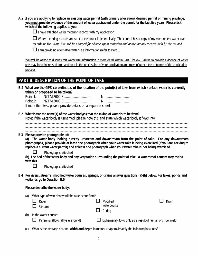
A.2 If you are applying to replace an existing water permit (with primary allocation), deemed permit or mining privilege, you must provide evidence of the amount of water abstracted under the permit for the last five years. Please tick which of the following applies to you: I have attached water metering records with my application
Water metering records are sent to the council electronically. The council has a copy of my most recent water use records on file. Note: You will be charged for all time spent retrieving and analysing any records held by the council
I am providing alternative water use information (refer to Part E)
You will be asked to discuss this water use information in more detail within Part E below. Failure to provide evidence of water use may incur increased time and cost in the processing of your application and may influence the outcome of the application process.
PART B: DESCRIPTION OF THE POINT OF TAKE B.1 What are the GPS co-ordinates of the location of the point(s) of take from which surface water is currently
taken or proposed to be taken? Point 1: NZTM 2000 E .............................. N ............................. Point 2: NZTM 2000 E .............................. N ............................. If more than two, please provide details on a separate sheet B.2 What is/are the name(s) of the water body(s) that the taking of water is to be from?
Note: if the water body is unnamed, please note this and state which water body it flows into ....................................................................................................................................................................................................... ....................................................................................................................................................................................................... .......................................................................................................................................................................................................
B.3 Please provide photographs of: (a) The water body looking directly upstream and downstream from the point of take. For any downstream photographs, please provide at least one photograph when your water take is being exercised (if you are seeking to replace a current water permit) and at least one photograph when your water take is not being exercised.
Photographs attached (b) The bed of the water body and any vegetation surrounding the point of take. A waterproof camera may assist with this.
Photographs attached
B.4 For rivers, streams, modified water courses, springs, or drains answer questions (a)-(h) below. For lakes, ponds and wetlands go to Question B.5
Please describe the water body:
(a) What type of water body will the take occur from?
River Stream
Modified watercourse
Spring
Drain
(b) Is the water course: Perennial (flows all year around) Ephemeral (flows only as a result of rainfall or snow melt) (c) What is the average channel width and depth in metres at approximately the following locations?
2
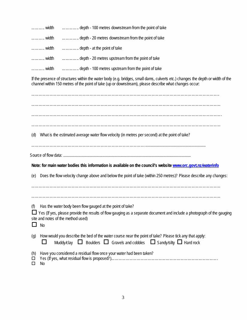
……….. width ………….. depth - 100 metres downstream from the point of take ……….. width ………….. depth - 20 metres downstream from the point of take ……….. width ………….. depth - at the point of take ……….. width ………….. depth - 20 metres upstream from the point of take ……….. width ………….. depth - 100 metres upstream from the point of take If the presence of structures within the water body (e.g. bridges, small dams, culverts etc.) changes the depth or width of the channel within 150 metres of the point of take (up or downstream), please describe what changes occur: ……………………………………………………………………………………………………………………………………….. ………………………………………………………………………………………………………………………………………… …………………………………………………………………………………………………………………………………………. ………………………………………………………………………………………………………………………………………… (d) What is the estimated average water flow velocity (in metres per second) at the point of take? …………………………………………………………………………………. ........................................................... Source of flow data: .............................................................................................................................. Note: for main water bodies this information is available on the council’s website www.orc.govt.nz/waterinfo (e) Does the flow velocity change above and below the point of take (within 250 metres)? Please describe any changes: ………………………………………………………………………………………………………………………………………... ………………………………………………………………………………………………………………………………………... (f) Has the water body been flow gauged at the point of take?
Yes (If yes, please provide the results of flow gauging as a separate document and include a photograph of the gauging site and notes of the method used)
No (g) How would you describe the bed of the water course near the point of take? Please tick any that apply:
Muddy/clay Boulders Gravels and cobbles Sandy/silty Hard rock
(h) Have you considered a residual flow once your water had been taken? Yes (If yes, what residual flow is proposed?)……………………………………………………………………………. No
3

B.5 For lakes, ponds, and wetlands, answer points (a)-(f) below.
(a) What type of water body will the take occur from? Lake Pond Wetland
If identified as a wetland, is the wetland classified as a Regionally Significant Wetland? Yes No
(Note: if unsure of this please contact the council or visit the council website www.orc.govt.nz) (b) Has the water body been formed by artificial means? Yes No (c) What is the surface area of the lake/pond/wetland?...... .................................................................................................... (d) How deep is the lake/pond/wetland? ................................................................................................................................ (e) Does the lake/pond/wetland have an outlet? i.e. does water flow out of it? Yes No (f) What is the main source of water that fills the lake/pond/wetland? Tick the relevant boxes
Springs Groundwater Runoff from surrounding land Direct rainfall Stream/rivers name: ............................................................................................................................
4
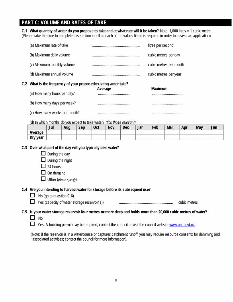
PART C: VOLUME AND RATES OF TAKE C.1 What quantity of water do you propose to take and at what rate will it be taken? Note: 1,000 litres = 1 cubic metre (Please take the time to complete this section in full as each of the values listed is required in order to assess an application) (a) Maximum rate of take .................................................. litres per second (b) Maximum daily volume .................................................. cubic metres per day
(c) Maximum monthly volume .................................................. cubic metres per month (d) Maximum annual volume .................................................. cubic metres per year
C.2 What is the frequency of your proposed/existing water take? Average Maximum (a) How many hours per day? ................................. ................................. (b) How many days per week? ................................. ................................. (c) How many weeks per month? ................................. ................................. (d) In which months do you expect to take water? (tick those relevant)
Jul Aug Sep Oct Nov Dec Jan Feb Mar Apr May Jun Average Dry year
C.3 Over what part of the day will you typically take water?
During the day During the night 24 hours On demand Other (please specify)
C.4 Are you intending to harvest water for storage before its subsequent use? No (go to question C.6) Yes (capacity of water storage reservoir(s)) ........................................................ cubic metres
C.5 Is your water storage reservoir four metres or more deep and holds more than 20,000 cubic metres of water? No Yes. A building permit may be required; contact the council or visit the council website www.orc.govt.nz.
(Note: If the reservoir is in a watercourse or captures catchment runoff, you may require resource consents for damming and
associated activities; contact the council for more information).
5
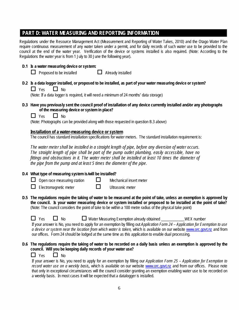
PART D: WATER MEASURING AND REPORTING INFORMATION Regulations under the Resource Management Act (Measurement and Reporting of Water Takes, 2010) and the Otago Water Plan require continuous measurement of any water taken under a permit, and for daily records of such water use to be provided to the council at the end of the water year. Verification of the device or systems installed is also required. (Note: According to the Regulations the water year is from 1 July to 30 June the following year).
D.1 Is a water measuring device or system:
Proposed to be installed Already installed D.2 Is a data logger installed, or proposed to be installed, as part of your water measuring device or system?
Yes No (Note: If a data logger is required, it will need a minimum of 24 months’ data storage) D.3 Have you previously sent the council proof of installation of any device currently installed and/or any photographs
of the measuring device or system in place? Yes No (Note: Photographs can be provided along with those requested in question B.3 above)
Installation of a water-measuring device or system
The council has standard installation specifications for water meters. The standard installation requirement is:
The water meter shall be installed in a straight length of pipe, before any diversion of water occurs. The straight length of pipe shall be part of the pump outlet plumbing, easily accessible, have no fittings and obstructions in it. The water meter shall be installed at least 10 times the diameter of the pipe from the pump and at least 5 times the diameter of the pipe.
D.4 What type of measuring system is/will be installed? Open race measuring station Mechanical insert meter Electromagnetic meter Ultrasonic meter
D.5 The regulations require the taking of water to be measured at the point of take, unless an exemption is approved by
the council. Is your water measuring device or system installed or proposed to be installed at the point of take? (Note: The council considers the point of take to be within a 100 metre radius of the physical take point)
Yes No Water Measuring Exemption already obtained ____________WEX number If your answer is No, you need to apply for an exemption by filling out Application Form 24 – Application for Exemption to use a device or system near the location from which water is taken, which is available on our website www.orc.govt.nz and from our offices. Form 24 should be lodged at the same time as this application to enable dual processing.
D.6 The regulations require the taking of water to be recorded on a daily basis unless an exemption is approved by the
council. Will you be keeping daily records of your water use? Yes No If your answer is No, you need to apply for an exemption by filling our Application Form 25 – Application for Exemption to record water use on a weekly basis, which is available on our website www.orc.govt.nz and from our offices. Please note that only in exceptional circumstances will the council consider granting an exemption enabling water use to be recorded on a weekly basis. In most cases it will be expected that a datalogger is installed.
6
PART E: HISTORICAL WATER USE EVIDENCE
If the council already holds your most up-to-date water use information, you are not required to complete this section. An analysis of any data held on file will be undertaken as part of the processing of the application. However, please be aware that you will be charged for any time incurred obtaining and assessing such information.
E.1 Based on the water use evidence provided, please state the maximum rate and volumes of take within the last five years.
(a) Maximum rate of take .................................................. litres per second (b) Maximum daily volume .................................................. cubic metres per day
(c) Maximum monthly volume .................................................. cubic metres per month (d) Maximum annual volume .................................................. cubic metres per year
E.2 If known, please state in which year(s) the above values have been recorded ……………………………… If the above values are taken from water metering records please proceed to question F.1. If you are using alternative water use evidence please complete the rest of Section E below. E.3 Please state what alternative water use evidence you have provided (please refer to guidance notes attached to this form on evidence options):
.................................................................................................................................................................................................... .................................................................................................................................................................................................... ....................................................................................................................................................................................................
E.4 Please discuss in detail how you have calculated the values provided in question E.1:
.................................................................................................................................................................................................... .................................................................................................................................................................................................... .................................................................................................................................................................................................... .................................................................................................................................................................................................... .................................................................................................................................................................................................... .................................................................................................................................................................................................... .................................................................................................................................................................................................... .................................................................................................................................................................................................... .................................................................................................................................................................................................... .................................................................................................................................................................................................... ....................................................................................................................................................................................................
7

PART F: WATER USE AND MANAGEMENT F.1 Will the water take be managed as part of an existing water allocation committee or water management group? Yes – water allocation committee --------------------------------------------------------------------------- Yes – water management group ------------------------------------------------------------------------------ No
If Yes, please describe how the allocation committee/management group operates:
.................................................................................................................................................................................................... .................................................................................................................................................................................................... .................................................................................................................................................................................................... ....................................................................................................................................................................................................
F.2 Please describe the property(s) on which the water is to be used:
(a) Name of owner(s) ............................................................................................................................................................ (b) Address/location ............................................................................................................................................................ (c) Legal description (as shown on certificates of title) ................................................................................................................................................................................................. If there is more than one property (legal description) please provide these details on a separate sheet.
F.3 Show on a map (no smaller than A4 size) or a coloured aerial photograph the following details:
(a) The location of the point(s) of take (b) The location of the water measuring device or system (c) The total property area boundary (d) The area(s) to be irrigated (if relevant) by water applied for under this application (e) The area of the community supply (if relevant) (f) Distances to any discharge activities (g) Other surface water bodies and wetlands, and distances from the point of take(s) to them (h) The coastline and the distance to it (if relevant) (i) The location of any dairy shed(s)
Efficiency of water use
In this section you are required to only answer the questions relevant to your intended use of water. As a guide, the questions are as follows: ................................................................................................................................................................................ F.4 Irrigation of land (pasture etc)
F.5 Irrigation of crops or horticulture F.6 Frost fighting F.7 Industrial use F.8 Private community water supply F.9 Public community water supply F.10 Dairy shed use F.11 Other
8

F.4 Irrigation of land – includes pasture, turf (golf courses), lifestyle blocks and sports fields (not crops or horticulture)
(j) How many hectares will be irrigated under this permit (if granted)? ......................................................................................
(k) What is the total property area (not just that proposed to be irrigated)?.......................... ......................................................
(l) Show the area of land to be irrigated on the map specified in F.3 and attach to this application. .........................................
(m) What type of irrigation system is proposed to be used or is currently being used? K-line Centre pivot Travelling irrigator Border-dyke/flood irrigation Other______________________________
(n) How many hectares will be irrigated in one day?.............. ....................................................................................................
(o) For how many hours per day?............... ................................................................................................................................
(p) What is the target (net) application rate?...............................................................................................................................
(q) How many days are there between irrigating the same block?............... ..............................................................................
(r) Please describe the soil types of the areas to be irrigated and state the source of this information:
.............................................................................................................................................................................................. .............................................................................................................................................................................................. .............................................................................................................................................................................................. ..............................................................................................................................................................................................
(s) How have you calculated the amount of water you need? (a separate sheet may be needed and attached to this application form). Please note that the council will only grant volumes that have been assessed as efficient, and will assess the volumes sought for efficiency, taking into consideration the local climate, soils, and crop type. .............................................................................................................................................................................................. .............................................................................................................................................................................................. .............................................................................................................................................................................................. .............................................................................................................................................................................................. ..............................................................................................................................................................................................
(t) Is the area to be irrigated: Presently irrigated/developed Partly irrigated/developed ( ..........................................ha complete, ..................ha under development) Proposed to be irrigated/developed ( .................................................. likely completion date)
9
F.5 Irrigation of crops or horticulture
(a) What is the total area to be irrigated under this permit (if granted)? ..................................................................................... (b) Show the area of land to be irrigated on the map specified in F.3 and attach to this application. (c) What is the total property area (not just that proposed to be irrigated)? .............................................................................. (d) If glass/plastic houses are used, what area do they cover? ................................................................................................. (e) What type of crops will be irrigated?
Grain/wheat Pip fruit Stone fruit Market garden Flowers Nursery Viticulture ................................................................................................................... (vines/hectare) Nuts Other ..........................................................................................................................................................
(f) What type of irrigation system is currently being used or is proposed to be used? Trickle Sprinkler Other ........................................................................
(g) How many hectares will be irrigated in one day? ..................................................................................................................
(h) For how many hours per day? ............................................................................................................................................
(i) What is the target (net) application rate? .............................................................................................................................
(j) How many days will there be between irrigating the same block?........ ................................................................................
(k) Please describe the soil type(s) of the area(s) to be irrigated and state the source of this information:
.............................................................................................................................................................................................. .............................................................................................................................................................................................. .............................................................................................................................................................................................. .............................................................................................................................................................................................. ..............................................................................................................................................................................................
(l) How have you calculated the amount of water you need? (a separate sheet may be needed and attached to this application form). Please note that the council will only grant volumes that have been assessed as efficient, and will assess the volumes sought for efficiency, taking into consideration the local climate, soils, and crop type. .............................................................................................................................................................................................. .............................................................................................................................................................................................. .............................................................................................................................................................................................. .............................................................................................................................................................................................. ..............................................................................................................................................................................................
10
(m) Is the area to be irrigated: Presently irrigated/developed Partly irrigated/developed (… ........................................ha complete, ..................ha under development) Proposed to be irrigated/developed ( ........................................................... likely completion date)
F.6 Frost fighting
(a) List the crops, and the area (ha) of each crop, for which frost fighting may be undertaken: ...................................................................................................................................................................................... ......................................................................................................................................................................................
(b) How many hours a day?........ .......................................................................................................................................
(c) How many days per year?..... .......................................................................................................................................
(d) How many days on average do you expect a frost when frost fighting is required?......................................................
(e) How have you calculated the amount of water you need? (a separate sheet may be needed and attached to this application form). The council does not have published guidelines on recommended volumes for frost fighting but agrees with Environment Bay of Plenty guidelines, which recommend a maximum application depth of 2.5- 3.0 mm of water per hour (25- 30 m3/ha/hr) and maximum frost fighting duration of 10 hours per event.
...................................................................................................................................................................................... ...................................................................................................................................................................................... ...................................................................................................................................................................................... ...................................................................................................................................................................................... ......................................................................................................................................................................................
F.7 Industrial use (a) What type of industry/process will be using the water and how will the water be used?
...................................................................................................................................................................................... ...................................................................................................................................................................................... ...................................................................................................................................................................................... ...................................................................................................................................................................................... ...................................................................................................................................................................................... ...................................................................................................................................................................................... ...................................................................................................................................................................................... ......................................................................................................................................................................................
(b) How have you calculated the amount of water you need? (a separate sheet may be needed and attached to this form)
...................................................................................................................................................................................... ...................................................................................................................................................................................... ...................................................................................................................................................................................... ......................................................................................................................................................................................
11
...................................................................................................................................................................................... F.8 Private community water supply
The council considers efficient water use for a household is 1,000 litres a day in winter and 3,000 litres a day in summer (average 2,000 litres a day). This is derived from wastewater volumes in ASNZ 1547:2000. (a) Which type of institution uses the water? Households – number of households to be supplied……. ................................................................................... Camping grounds – maximum number of visitors and staff a year…. ................................................................ Schools - maximum number of students and staff a year................................................................................. Motel units – number of units and expected occupancy........................ ............................................................... Other….. ...............................................................................................................................................................
(b) For applications to supply water to households what is the minimum, maximum and average lot size? ........................................................................... square metres (minimum) ........................................................................... square metres (average) ........................................................................... square metres (maximum)
(c) How have you calculated the amount of water you need? (a separate sheet may be needed and attached to this
form) ...................................................................................................................................................................................... ...................................................................................................................................................................................... ...................................................................................................................................................................................... ...................................................................................................................................................................................... ......................................................................................................................................................................................
F.9 Public community water supply
The council considers efficient water use for a household is 1,000 litres a day in winter and 3,000 litres a day in summer (average 2,000 litres per day). This is derived from wastewater volumes in ASNZ 1547:2000. (a) What population(s) will be served by the supply? ........................................................................... general location of population(s) ........................................................................... approximate number of households
(b) How have you calculated the amount of water you need? (a separate sheet may be needed and attached to this
application form) ...................................................................................................................................................................................... ...................................................................................................................................................................................... ...................................................................................................................................................................................... ...................................................................................................................................................................................... ......................................................................................................................................................................................
12
F.10 Stock Water and/or Dairy Shed Use The council considers the following values as efficient use of water for stock:
Sheep 5 litres per day per head Beef cattle 40 litres per day per head Dairy cows 70 litres per day per head Deer 1.5 litres per day per head Dairy shed use 50 litres per day per head
(a) What type and how much stock will be supplied with water? Sheep number: .............................water required: ...................................litres/head/day Beef cattle number: ..................... water required: ...................................litres/head/day Dairy cows* number: ....................water required: ...................................litres/head/day Other number: ............................. water required: ...................................litres/head/day * excluding dairy shed usage (b) If you have dairy cows and require water for your dairy shed, please state the estimated volume required:
....................................................................................................................................litres/head/day
(c) If seeking more than that recommended by the council please state reasoning and the source of any data discussed:
...................................................................................................................................................................................... ...................................................................................................................................................................................... ......................................................................................................................................................................................
F.11 Other
How have you calculated the amount of water you need? (a separate sheet may be needed and attached to this application form)
...................................................................................................................................................................................... ...................................................................................................................................................................................... ...................................................................................................................................................................................... ...................................................................................................................................................................................... ......................................................................................................................................................................................
For all Water Takes F.12 Do you intend to install or do you already have in place any water distribution infrastructure? (for example
pipes, storage tanks, open races etc.)
Yes No (go to Section G)
13

F.13 Please describe the type of infrastructure in place (or to be installed) and how you intend to ensure that it is maintained in good working order? (e.g. do you intend to have a maintenance or leak detection program, will the scheme be managed by an external company). Please discuss: ...................................................................................................................................................................................... ...................................................................................................................................................................................... ...................................................................................................................................................................................... ...................................................................................................................................................................................... ...................................................................................................................................................................................... ...................................................................................................................................................................................... ...................................................................................................................................................................................... ...................................................................................................................................................................................... ...................................................................................................................................................................................... ...................................................................................................................................................................................... ......................................................................................................................................................................................
PART G: ASSESSMENT OF ENVIRONMENTAL EFFECTS (AEE) An AEE should assess effects relative to the scale and significance of the proposed activity. Where your proposed take could have significant effects on the surface water resource a more detailed environmental assessment is required. For most applications the completion of this form should provide sufficient detail. Note: Environment includes ecosystems, people, communities, all natural and physical resources and amenity values, and social and economic, aesthetic and cultural conditions that affect them.
G.1 Are there any of the following present within 500 metres (up or downstream) of the proposed point of take? (a) Areas where food (e.g. fish) is obtained from a water body Yes No (b) Natural wetlands Yes No (c) Waste discharges Yes No (d) Recreational activities Yes No (e) Areas of special aesthetic value Yes No (f) Areas or aspects of significance to iwi Yes No (g) Other water takes (ground or surface) Yes No
If you have answered Yes to any of the above, describe the listed value in detail (e.g. name/location type of activities etc.). If referring to any other water users in proximity to your take, please identify the permit numbers or holder’s name, if possible:
.............................................................................................................................................................................................. .............................................................................................................................................................................................. .............................................................................................................................................................................................. ..............................................................................................................................................................................................
14

.............................................................................................................................................................................................. G.2 Considering any values/other water users identified in question G.1, please discuss what effects your proposed take
will have on these values and how you propose to avoid, remedy or mitigate any effects caused? .............................................................................................................................................................................................. .............................................................................................................................................................................................. .............................................................................................................................................................................................. .............................................................................................................................................................................................. .............................................................................................................................................................................................. .............................................................................................................................................................................................. .............................................................................................................................................................................................. ..............................................................................................................................................................................................
G.3 Please state what natural or ecosystem values are present in the water body or downstream waterbodies (e.g. the
presence of native fish, trout, or native vegetation along its margins):
............................................................................................................................................................................................. .............................................................................................................................................................................................. .............................................................................................................................................................................................. .............................................................................................................................................................................................. .............................................................................................................................................................................................. .............................................................................................................................................................................................. .............................................................................................................................................................................................. ..............................................................................................................................................................................................
G.4 Have you provided an independent ecological assessment/instream assessment of the water body? It is recommended that all takes not from the main stem of a catchment have this assessment carried out.
Yes (attached to application) No (please outline reasons why an independent ecological assessment has not been undertaken)
............................................................................................................................................................... .............................................................................................................................................................................................. ..............................................................................................................................................................................................
G.5 Does the taking of water from the water body cause it to dry up during summer or does the water body naturally dry up downstream of the take? Yes
No (go to Question G.6)
If Yes, approximately how far downstream from your take does this occur and in approximately which month in a wet year, average year and dry year does it happen? Please discuss and attach any evidence to the application (e.g. photographs of water body downstream):
15
.............................................................................................................................................................................................. .............................................................................................................................................................................................. ..............................................................................................................................................................................................
G.6 Please outline any effects on any natural or ecosystem values your proposed take will have on the water body or downstream water body:
.............................................................................................................................................................................................. .............................................................................................................................................................................................. .............................................................................................................................................................................................. ..............................................................................................................................................................................................
G.7 What mitigation do you propose to offset any effects (e.g. are you proposing a residual flow)? If you are not providing any mitigation, please state why:
.............................................................................................................................................................................. .............................................................................................................................................................................................. .............................................................................................................................................................................................. .............................................................................................................................................................................................. .............................................................................................................................................................................................. .............................................................................................................................................................................................. .............................................................................................................................................................................................. ..............................................................................................................................................................................................
G.8 Can your instantaneous abstraction rate (litres per second) be reduced by increasing the length of time over which water is taken? Yes Over what period would you take water and at what rate? .............................................................................................................................................................................................. .............................................................................................................................................................................................. ..............................................................................................................................................................................................
No Why not? .............................................................................................................................................................................................. .............................................................................................................................................................................................. ..............................................................................................................................................................................................
G.9 What are the positive effects of your proposed take and use? (examples can include any environmental, social and economic benefits. If you are part of a water management group, are there any benefits/good environmental outcomes associated with being part of this management group). Please discuss: ....................................................................................................................................................................................................... .......................................................................................................................................................................................................
16

....................................................................................................................................................................................................... ....................................................................................................................................................................................................... .......................................................................................................................................................................................................
G.10 What measures are you proposing to minimise wastage of water and maximise its efficient use? ....................................................................................................................................................................................................... ....................................................................................................................................................................................................... ....................................................................................................................................................................................................... ....................................................................................................................................................................................................... .......................................................................................................................................................................................................
G.11 How far from the point of taking the water is the use of the water? If the distance is greater than 5 km, please outline the reasons for this and why a closer source of water is not available: ....................................................................................................................................................................................................... ....................................................................................................................................................................................................... ....................................................................................................................................................................................................... .......................................................................................................................................................................................................
PART H: ALTERNATIVE WATER SUPPLIES H.1 Does your property have alternative water sources available? (e.g. other water bodies, reticulated supplies, groundwater,
other water permits, irrigation schemes? Yes No If Yes, please detail the sources, quantities, uses and any current Water Permit numbers or any takes authorised by permitted activity rules in the Otago Water Plan: ....................................................................................................................................................................................................... ....................................................................................................................................................................................................... .......................................................................................................................................................................................................
H.2 Have you considered the option of using other sources of water?
Yes No If Yes, please detail the sources, quantities, uses and any water permit numbers: ....................................................................................................................................................................................................... ....................................................................................................................................................................................................... .......................................................................................................................................................................................................
H.3 Outline why you have decided to take water from the proposed surface water source rather than any alternative
source? ....................................................................................................................................................................................................... ....................................................................................................................................................................................................... .......................................................................................................................................................................................................
17

PART I: CONSULTATION I.1 Please describe any consultation undertaken with people and/or parties potentially affected by your proposed
surface water take. If no parties are affected please say why not. .............................................................................................................................................................................................. .............................................................................................................................................................................................. .............................................................................................................................................................................................. ..............................................................................................................................................................................................
Written approvals are required from parties who are considered by the Otago Regional Council to be affected by your proposed water take. To reduce costs and processing times, we recommended that written approval is obtained and submitted with the application for parties, which may be affected. When considering parties which may be potentially affected, your answers to Questions G.1 - G.3 should be used as a guide. Potential affected parties for surface water takes:
• Director General of Conservation (DoC) • Fish and Game (Otago or Central South Island) • Kai Tahu ki Otago Limited • Nearby consented and permitted activity takers
I.2 Written approvals may be provided using the council’s standard Form 1 – Resource Consent Application, available
on our website. PART J: STATUTORY ASSESSMENT The Resource Management Act as of March 2015 requires this application to include an assessment of the proposed activity against the relevant documents. In this case, the Regional Policy Statement, the Otago Water Plan and iwi management plans are the most relevant documents. Answering the following questions will satisfy this requirement. If you are unable to answer the questions below, or you believe your proposal is inconsistent with the relevant policies and documents discussed, it is recommended you seek professional planning assistance to help you with your application. J.1. Regional Policy Statement (RPS) The objectives and policies of Chapter 6 (Water) are relevant to this application. Is the activity consistent with the relevant provisions of the RPS? Yes No If No, please say why:
....................................................................................................................................................................................................... ....................................................................................................................................................................................................... ....................................................................................................................................................................................................... .......................................................................................................................................................................................................
J.2 Proposed Regional Policy Statement (RPS) The proposed Regional Policy Statement (RPS) was notified on 23 May 2015. The RPS needs to be given consideration. The relevant provisions of the RPS may include the following: • taking the principles of Te Tiriti o Waitangi into account (Policy 1.1.2) • managing the natural environment to support Kāi Tahu wellbeing (Policy 1.2.1) • recognising and protecting important sites and values of cultural significance to Kāi Tahu (Policy 1.2.2 and 1.2.3) • managing for freshwater values, including:
o support healthy ecosystems in all Otago’s rivers, lakes, wetlands, and their margins
18
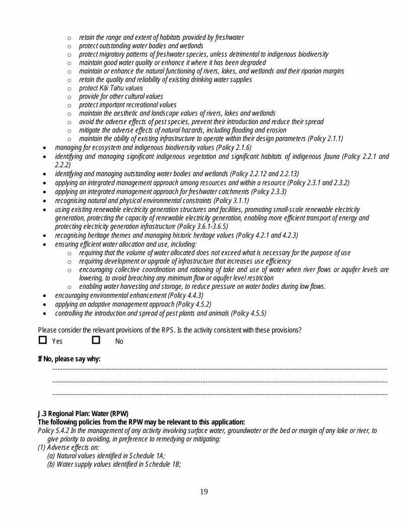
o retain the range and extent of habitats provided by freshwater o protect outstanding water bodies and wetlands o protect migratory patterns of freshwater species, unless detrimental to indigenous biodiversity o maintain good water quality or enhance it where it has been degraded o maintain or enhance the natural functioning of rivers, lakes, and wetlands and their riparian margins o retain the quality and reliability of existing drinking water supplies o protect Kāi Tahu values o provide for other cultural values o protect important recreational values o maintain the aesthetic and landscape values of rivers, lakes and wetlands o avoid the adverse effects of pest species, prevent their introduction and reduce their spread o mitigate the adverse effects of natural hazards, including flooding and erosion o maintain the ability of existing infrastructure to operate within their design parameters (Policy 2.1.1)
• managing for ecosystem and indigenous biodiversity values (Policy 2.1.6) • identifying and managing significant indigenous vegetation and significant habitats of indigenous fauna (Policy 2.2.1 and
2.2.2) • identifying and managing outstanding water bodies and wetlands (Policy 2.2.12 and 2.2.13) • applying an integrated management approach among resources and within a resource (Policy 2.3.1 and 2.3.2) • applying an integrated management approach for freshwater catchments (Policy 2.3.3) • recognising natural and physical environmental constraints (Policy 3.1.1) • using existing renewable electricity generation structures and facilities, promoting small-scale renewable electricity
generation, protecting the capacity of renewable electricity generation, enabling more efficient transport of energy and protecting electricity generation infrastructure (Policy 3.6.1-3.6.5)
• recognising heritage themes and managing historic heritage values (Policy 4.2.1 and 4.2.3) • ensuring efficient water allocation and use, including:
o requiring that the volume of water allocated does not exceed what is necessary for the purpose of use o requiring development or upgrade of infrastructure that increases use efficiency o encouraging collective coordination and rationing of take and use of water when river flows or aquifer levels are
lowering, to avoid breaching any minimum flow or aquifer level restriction o enabling water harvesting and storage, to reduce pressure on water bodies during low flows.
• encouraging environmental enhancement (Policy 4.4.3) • applying an adaptive management approach (Policy 4.5.2) • controlling the introduction and spread of pest plants and animals (Policy 4.5.5)
Please consider the relevant provisions of the RPS. Is the activity consistent with these provisions? Yes No If No, please say why:
....................................................................................................................................................................................................... ....................................................................................................................................................................................................... .......................................................................................................................................................................................................
J.3 Regional Plan: Water (RPW) The following policies from the RPW may be relevant to this application: Policy 5.4.2 In the management of any activity involving surface water, groundwater or the bed or margin of any lake or river, to
give priority to avoiding, in preference to remedying or mitigating: (1) Adverse effects on:
(a) Natural values identified in Schedule 1A; (b) Water supply values identified in Schedule 1B;
19

(c) Registered historic places identified in Schedule 1C, or archaeological sites in, on, under or over the bed or margin of a lake or river;
(d) Spiritual and cultural beliefs, values and uses of significance to Kai Tahu identified in Schedule 1D; (e) The natural character of any lake or river, or its margins; (f) Amenity values supported by any water body; and
(2) Causing or exacerbating flooding, erosion, land instability, sedimentation or property damage. Policy 5.4.3 In the management of any activity involving surface water, groundwater or the bed or margin of any lake or river, to
give priority to avoiding adverse effects on: (a) Existing lawful uses; and (b) Existing lawful priorities for the use, of lakes and rivers and their margins.
Policy 5.4.4 To recognise Kai Tahu’s interests in Otago’s lakes and rivers by promoting opportunities for their involvement in
resource consent processing. Policy 5.4.8 To have particular regard to the following features of lakes and rivers, and their margins, when considering adverse
effects on their natural character: (a) The topography, including the setting and bed form of the lake or river; (b) The natural flow characteristics of the river; (c) The natural water level of the lake and its fluctuation; (d) The natural water colour and clarity in the lake or river; (e) The ecology of the lake or river and its margins; and (f) The extent of use or development within the catchment, including the extent to which that use and development has influenced matters (a) to (e) above.
Policy 5.4.9 To have particular regard to the following qualities or characteristics of lakes and rivers, and their margins, when
considering adverse effects on amenity values: (a) Aesthetic values associated with the lake or river; and (b) Recreational opportunities provided by the lake or river, or its margins.
6.4.0A To ensure that the quantity of water granted to take is no more than that required for the purpose of use taking into account:
(a) How local climate, soil, crop or pasture type and water availability affect the quantity of water required; and (b) The efficiency of the proposed water transport, storage and application system
Is the activity consistent with the above relevant provisions of the RPW? Yes No If No, please provide reasons why (refer to your comments in Section H to answer this question):
.............................................................................................................................................................................................. .............................................................................................................................................................................................. ..............................................................................................................................................................................................
6.4.12A To promote, approve and support water management groups to assist the council in the management of water by the exercise of at least one of the following functions:
(a) Coordinating the take and use of water authorised by resource consent (b) Rationing the take and use of water to comply with relevant regulatory requirements (c) Recording and reporting information to the council on the exercise of resource consents as required by consent conditions and other regulatory requirements, including matters requiring enforcement.
20

6.4.12C Where appropriate, to include in water permits to take water a condition that consent holders comply with any council approved rationing regime.
6.4.11. To provide for the suspension of the taking of water at the minimum flows and aquifer restriction levels set under this plan. 6.4.7. The need to maintain a residual flow at the point of take will be considered with respect to any take of water, in order to provide for the aquatic ecosystem and natural character of the source water body. 6.4.16 In granting resource consents to take water, or in any review of the conditions of a resource consent to take water, to require the volume and rate of take to be measured in a manner satisfactory to the council unless it is impractical or unnecessary to do so. Policies 6.4.12C, 6.4.11, 6.4.7 and 6.4.16 can be met by conditions of consent on your permit as follows: Do you agree to a consent condition requiring your take to be exercised in accordance with a water management group, should one be present? Yes No Do you agree to a consent condition for a minimum flow and/or residual flow restriction on taking water if required? Yes No Do you agree to a condition requiring the take to be measured and a review condition on the permit that is related to the measuring records? Yes No If you have replied No to any of the above conditions you must provide an alternative assessment against the relevant policy (ies) outlining how you propose to meet them. Please discuss:
.............................................................................................................................................................................................. .............................................................................................................................................................................................. .............................................................................................................................................................................................. .............................................................................................................................................................................................. .............................................................................................................................................................................................. .............................................................................................................................................................................................. .............................................................................................................................................................................................. .............................................................................................................................................................................................. .............................................................................................................................................................................................. ..............................................................................................................................................................................................
J.3 Kai Tahu ki Otago Natural Resource Management Plan 2005 (NRMP). The following sections are relevant to this application: To require that resource consent applications seek only the amount of water actually required for the purpose specified in the
application To require that all water takes are metered and reported on, and information be made available upon request to Kai
Tahi ki Otago To oppose the granting of water take consents for 35 years To encourage those that extract water for irrigation to use the most efficient method of application
21
To discourage over-watering. Please assess your application in accordance with the above:
.............................................................................................................................................................................................. .............................................................................................................................................................................................. ..............................................................................................................................................................................................
PART K: DEPOSIT A deposit is required upon lodgement of your application. Refer to the fees on Form 1. This deposit is not the final or maximum cost of your application. Further charges are incurred in accordance with the council’s scale of fees and charges. K.1 Deposit enclosed:
Yes No
PART L: CHECK LIST
L.1 To submit a complete application, have you remembered to?
Complete this application form and Form 1 For replacement applications, provide evidence of how much water has historically been used under that consent
(unless information held by the council) (refer A.2) Attached photographs of the water body (refer B.3) Attached a Non-Standard installation form if required (refer D.5) Attached an Exemption application Form for the point of take (refer D.6) Attached an Exemption application form for weekly records (refer D.7) For water management groups, provide evidence that the group meets the requirements of Appendix 2A of the
Regional Plan: Water for Otago (refer F.1) A detailed site map or aerial photograph (refer F.3) Attached independent ecological report (refer G.4) Attached any written approvals (refer I.1) Paid your deposit or attached a cheque (refer K.1)
To keep consent processing costs to a minimum, we strongly recommend you ensure you have completed all the tasks on this checklist and that all required items are attached before you lodge your application to the Otago Regional Council.
Guidance notes for completing the above form: Part A: General Question A.1 A “new consent application” is made when consent is sought for a new activity, and there are no existing consents for that activity. An application to replace an existing consent is where the provisions of Section 124 of the RMA apply, and may commonly be sought
because the existing consent is expiring, or because significantly different conditions or a different term are sought. If you are unsure whether there is an existing or expired resource consent check with the council.
22
A Deemed Permit is issued pursuant to Sections 413 – 417 of the RMA and would have replaced a current mining privilege (which is not to use and maintain a water race or special site). A full assessment of the current status and use of a privilege would have been confirmed to ensure it still equates to what was originally granted and what currently occurs on the ground.
Mining Privileges were licences issued under the Mining Act 1926 and subsequent amendments. Historic mining privileges start with a “W”, then the number of the licence, and then an abbreviation to show which warden court issued it e.g. W3208A. Under the RMA, all current mining privileges and rights granted under the WSCA 1967 in substitution of a mining privilege that were current immediately before the commencement of RMA (1 October 1991) are deemed to carry on under the provisions of the WSCA 1971 as if it were not repealed until the 30th anniversary of the RMA (1 October 2021) as “deemed permits”.
The Otago Water Plan seeks to promote shared use and management of water, as such arrangements may promote efficiencies in water use and infrastructure development. There are various ways shared use and management can be achieved by individual water users, including surrendering individual consents in favour of a single consent (e.g. with multiple points of take), or undertaking a transfer or a variation of consent conditions. To facilitate this process, only a single consent application form is needed, regardless of whether the point(s) of take are from multiple catchments or water bodies, where it is proposed that those takes are to be managed together. Question A.2 In considering applications for replacement consents for primary allocation, only water historically accessed will be considered for approval. Some existing consents are not fully exercised, because, for example, the consent holder does not need the full allocation available, or because the water cannot be physically accessed. Re-granting such consents is not sustainable management of the water resource, and is unfair to potential users. If water can only be accessed at high flows, then it may be reconsidered as supplementary allocation, rather than primary allocation. If you have been supplying the council with metering information on a regular basis as part of your existing consent, note that here. If you have not previously supplied the council with such information, you will need to provide evidence with your application of your taking during the last five years. If you have not been metering your take, evidence could include the area of land irrigable by your irrigation system, intake pipe size, maintenance records for your irrigation system, and/or photographic evidence of irrigated land (such as dated aerial photography) and a description/ photographs of the existing distribution system that supplies water to these lands. Evidence of historical water use is not required to be supplied when seeking a replacement permit that does not hold existing primary allocation. Part B: Description of Environment Question B.1 New Zealand Transverse Mercator map series (NZTM 2000) are generally available from public libraries or may be purchased from Government bookshops. The council also holds copies of these maps for viewing at council offices. A seven-digit northing and easting value from a Global Positioning System (GPS) is required to ensure accurate locations are given. A GPS can be hired from many retail outlets. In many cases, irrigation consultants will be able to provide you with the GPS positions of your take. Question B.2 If you are unsure of the name of the water body, and your application is to replace an existing consent, check the name given on that consent. In many instances, tributaries to larger water bodies do not have official (or legally recognised) names. If this is the case, describe the water body as “an unnamed tributary of …….”. If the water body has an unofficial local name you could continue to write “… locally known as…….” . You can determine if a name is legally recognised by seeing if it is written on published topographic maps, or if any road bridges crossing it state the name of the water body (i.e. NZ Transport Agency or Automobile Association signs). If you still need assistance determining the name of a water body, the council may be able to assist you. Question B.3 Photographs of the water body are necessary for the council to understand the environment and any values important to the water body. Photographs should be recent and provide an indication of the size and nature of the watercourse, and include enough detail to show the type of vegetation within the surrounding area and condition of the water body to support any fish or fish habitat. It is important the photographs are taken from the edge of the water body looking directly up and downstream to get the best view. When looking downstream, photographs taken both when your take is in use and not being used are important to be able to better understand any changes in water level caused by the take. Questions B.4 and B.5 These questions seek information on the water body from which water is proposed to be taken. The questions should be self-explanatory but the measurements should reflect the conditions of the water body during the summer months (i.e. when flows and depths are at their lowest). The flow velocity can be estimated by measuring the time it takes a stick or other floating object to travel a set distance downstream. Flows in your river may be measured at certain locations by the council or other organisations (e.g. NIWA). Go to www.orc.govt.nz/waterinfo If the take is from a river, stream, modified watercourse, spring or drain, and will affect another river, stream, modified watercourse, spring or drain, then please note details of both water bodies in this section.
23
Note whether the water body has a natural outlet. Some may not while others may be drained by a stream. Please also describe how the water body is filled; as some have streams flowing into them whereas others are filled up mainly from rain falling directly on the surface or through runoff from surrounding land. Regionally Significant Wetlands are identified in the F series of maps attached to the Regional Plan: Water for Otago. The values for each wetland, boundaries and maps can be found on the council’s website at http://www.orc.govt.nz/Information-and-Services/Wetlands-Inventory/ Part C: Volume and rates of take Question C.1 The quantity of water you are applying to take must be specified. If you are applying for a replacement consent, please check your existing consent to see if the quantity stated will meet your current (and likely future) needs, or if you now require less water. If you require a greater rate or volume than is currently consented, this water may not be available to you under the same conditions as your expiring/existing consent, as water in many Otago catchments is fully (or over) allocated. If any water is available to be allocated, it may have to be taken at higher river flows (i.e. as “supplementary” allocation). If you do require a greater rate or volume, please discuss available allocations with the council before submitting your application. Note: 1,000 litres = 1 cubic metre (m³), 1 Gallon = 4.5 litres, 1 head = 100,000 litres per hour (or 27.8 litres per second). Question C.2 Specify the typical number of hours, days, weeks and/or months that you plan to take water and the maximum you plan to take during a “worst case scenario”. Questions C.4 and C.5 If water is stored before use, please give the maximum volume that your reservoir can hold. Confirmation of the reservoir dimensions are required to identify whether any additional resource or building consents are required. Part D: Water measuring and reporting information Questions D.1, D.2, D.3, D.4 . Water measuring devices include water meter and water measuring stations. Question D.5 The measuring device or system needs to be installed either at or immediately next to the point of take. This will not be possible in all circumstances due to the location of the take, flood hazard etc. An exemption application should be made at the time of lodging the water permit application so that it can be processed concurrently. Part E: Historical water use evidence Question E.1 Please review your water use records and summarise how much water has been used within the last five years. Specify your maximum rate of take as a minimum, as well as what your maximum daily, monthly and annual volumes have been. The maximum values may come from different water use years (e.g. you may have taken the most water in 2009 overall but recorded the highest rate of take in 2012). Ideally we want to see all the above information broken down for each of the preceding five years. You are welcome to use graphs or other data to show water use. If you are providing alternative water use information in this section, write the maximum values you have calculated. Question E.2 If possible, please state in which years the maximum water use values have been determined. The council will review this information against any climate data it holds. If you do not have water records to show historical water use such information may not be available. Please state this if you are unsure. Question E.3 Please state what alternative water use information/records you are providing. As many sources as possible should be used to verify historical use, e.g. operational details of any irrigation systems in place, calculation based around the size of the intake pipe, maintenance records, photographic evidence of irrigated land (such as dated aerial photography) or other details/ descriptions/ photographs of the existing water distribution system that supplies water to the irrigated areas specified in the application. You must be able to show or describe how any existing infrastructure uses the quantity of water being applied for. For example, your existing centre pivot may require a minimum water pressure to be maintained to operate effectively. Such operational knowledge could be used to calculate a minimum rate of abstraction required. Please contact an irrigation consultant or planning consultant if you are unsure how to provide this information. Question E.4 Please provide any calculations or formulas you have used to show or demonstrate water use. This information is necessary to support the volumes of water being applied for in Question C.1. As noted above you may need to seek professional assistance to help you with this question.
24

Part F: Water Use and Management Question E.1 Water allocation committees assist the council to manage the region’s water resources when approaching minimum flows. The committees effectively manage water rationing to avoid or delay reaching the minimum flow. The committees are made up of local representatives of people taking water from the catchment and the council appoints such committees as subcommittees of the council. The rationing regimes require council approval. Water management groups are supported, approved, and promoted by the council, as such arrangements may promote efficiencies in both water use and infrastructure development. They provide flexibility for two or more consent holders to cooperate in exercising their consents. Evidence that a water management group meets the criteria and functions described in Appendix 2A of the water plan is required. Briefly, this is: Criteria (a) A schedule that specifies the resource consents that are
to be managed by the water management group (b) The water management group has an appropriate form
and rules (c) The water management group seeks to be granted
authority and responsibility to act as an agent of the council for the specified consents
(d) The water management group is able to provide documentary evidence that their members and scheduled consent holders agree to be bound by the group.
Other features (a) May have a terminating date or criteria (b) May apply to have other resource consents included
within its management (c) Must have amendments of its form and rules approved
by the council (d) May have its authority to act as an agent of the council
revoked, in part or in full, either: (i) On its request; or (ii) On receipt of not less than 6 months written notice
by the council (e) Must report annually to the council on the operation of
the group and the exercise of powers as an agent of the council
(f) May have a rationing regime approved by the council. Question F.2 Please provide the name and address of the owner and occupier (if relevant) of the land where the water will be used. A copy of your certificate of title may be obtained from Land Information New Zealand (www.linz.govt.nz). Where water will be used across large areas, such as the command area of an irrigation company, or an area where a water management group operates, then a plan showing accurate legal boundaries of the area is acceptable. Question F.3 A plan showing as much detail of the location of your proposed take and surrounding land as possible should be provided. This will assist the council’s assessment of your application and may reduce processing time and costs. Questions F.4 and F.5 Pasture includes all kinds of grasses grown for agricultural purposes, as well as turf (i.e. sports fields and golf courses). Crops are cultivated plants or agricultural produce grown for harvest. The total area to be irrigated under this consent is required, as well as the total property area (e.g. of the farm, golf course, orchard or vineyard). It should also be noted that as grape vines can be planted at different densities, the number of vines per hectare is also required. A map showing your property layout and the areas to be irrigated will also assist in assessing your application (refer to F.3). A description of how you will apply this water is required – your type of irrigation system, and your irrigation management (how you irrigate), as well as a description of your soil types and how you have calculated the rate and volume of water required. You may supply this information based on past practises and knowledge of your property and irrigation requirements, or you may have had an irrigation management plan prepared by an irrigation consultant. Soil information may be obtained from the councils “growOTAGO” maps, available to view at the council offices or the council website (www.orc.govt.nz). Question F.6 – Frost fighting Provide data for worst-case scenarios, and how you have calculated the required amount applied for. Question F.7 – Industrial use “Industrial Use” can vary widely. If you plan to use the water for an industrial purpose, please explain how the water will be used, and how you have calculated the required amount applied for. Question F.8 – Private community supply Private community water supplies are typically owned and operated by private individuals, trusts or institutions, and supply more than one household, or institutions that may accommodate large numbers of people (e.g. campgrounds or hospitals). For applications to supply water to households, the average, minimum and maximum property size is required. This may be known (e.g. developers of subdivisions), or may be estimated. For all applications the calculation of water requirements is needed.
25

Question F.9 – Public community supply Public community water supplies are typically owned and operated by local authorities (or their subcommittees). The number and type of water users supplied must be given (i.e. number of households, commercial/industrial properties or farms using the water, and/or the population supplied). It is recommended you contact the council to discuss your application before applying. Evidence of historical water use is required where able to be provided. Question F.10 –Stock water and dairy shed use Reasonable stock drinking water requirements are outlined in this section. If you require more than these amounts, please provide justifications for greater quantities. Question F.11 – Other If your proposed use of water is not specified in F.4-F.10, provide details in F.11. Question F.13 and F.14 Please describe any water distribution equipment being used on your property e.g. pipes, water races etc. and how this infrastructure will be maintained in good order. For example, do you have a maintenance schedule or contract with an external party? Part G: Assessment of Environmental Effects In this section, you need to consider what the effects of your proposed take and use will have on the environment, and use under the “worst case scenario”. For most water takes, the worst case scenario is when the quantity of water being taken is greatest and this coincides with flows in the river, stream or spring being the lowest (or for lakes when the lake level is at its lowest). Questions G.1 and G.2 The items listed in this question are those that are commonly affected by water takes. Consider if any of these are present near your proposed take. If they are, discuss how your proposed take will affect them. Some water takes can lower the water levels of the water body (e.g. the taking may reduce the depth of water in a stream downstream of the point of taking). This will depend on the type of water body from which you are taking and the amount of water you are proposing to take, as well as the actual pumping rate. You need to identify if there are any effects on these values and how you propose to mitigate or avoid such effects. Question G.3 and G.4 Often, even within heavily modified water bodies, there are numerous natural or ecosystem values. These questions ask you to identify any such values. Such values could include the presence of native fish, or a trout habitat, or specific natural vegetation. If you are unsure, contact us l to discuss this. Question G.5 It is important for us understand how your take currently alters or will alter the water body, and of flow conditions during summer or low flow periods. If the water body naturally runs dry during the summer, please specify this here. Questions G.6 and G.7 Summarise your answers to these questions assessing any potential effects and what mitigation is offered. Note the findings of the independent ecological assessment here. Question G.9 There are a number of possible positive effects that water takes can have including economic benefits to the community (e.g. jobs), and providing security of supply to households. Question G.10 Under the RMA and the water plan, the council must ensure the water resource is used efficiently. Measures applied to minimise wastage and maximise efficient use will differ depending on the end use. Examples of possible measures include: For irrigation takes, only applying water at night and in calm weather conditions. Irrigation consultants can provide technical
information on exactly how much water certain soil and pasture types require in different areas of Otago. For industrial purposes, a known volume of water may be required for certain purposes. Maintenance of equipment may minimise
leakages. For community water supplies, applying water restrictions during water-short periods e.g. hand-held watering of gardens only, and
restricting car washing. Some public supplies may have flow restrictors. Part H: Alternative water supplies Questions H.1, H.2 and H.3 Please identify all alternative water sources potentially available to you (irrigation company water, groundwater, and other surface water resources). How much water (if any) do you obtain from these alternative sources for the purpose stated in this application? Please provide reason(s) why have you not chosen to use any of these alternative water sources. It is crucial that you consider alternative water supplies, particularly when you seek to export water for use outside of a water-short catchment. In such instances, if viable alternatives exist, your application may be declined, or your consent term may be shorter than what you applied for.
26

Part I: Consultation Question I.1 We can advise you of those parties which may be considered to be potentially adversely affected by your proposed activity, and outline how you should consult iwi. In some instances, the council may not be able to determine affected parties until the application has been lodged and thoroughly reviewed. If an application is submitted without potentially affected parties’ written approvals, the application goes “on hold” until these have been received. Failure to obtain written approvals within a reasonable timeframe can result in your application being limited notified (where affected parties are invited to make a submission). Part J Statutory Assessment As stated, the RMA now requires that applicants assess their application against all relevant documents. Please read this section carefully as the relevant documents and polices are summarised. Where appropriate, conditions of consent are offered as a means of ensuring compliance with specific policies. If you do not agree to these conditions, you must provide an alternative means of complying with the specific policies. Part K: Is your application complete? Question K.1 A complete application will assist us in efficiently processing your application. If information is missing or inadequate, your application may be returned to you or declined. Applications that are incomplete or do not provide sufficient information will be delayed and will cost more.
27