report to ghrsst14 from australia …imos.org.au/fileadmin/user_upload/shared/srs/beggs...mtsat-1r...
TRANSCRIPT

REPORT TO GHRSST14 FROM AUSTRALIA – BLUELINK AND IMOS
Helen Beggs(1)
, Leon Majewski(2)
, Christopher Griffin(2)
, Ruslan Verein(1)
, Pavel Sakov(1)
, Xinmei Huang
(2), Luke Garde
(2) and Christopher Tingwell
(1)
(1) Centre for Australian Weather and Climate Research, Bureau of Meteorology, Melbourne (Australia),
Email: [email protected], [email protected], [email protected], [email protected] (2) Bureau of Meteorology, Melbourne (Australia), Email: Leon.Majewsk [email protected],
[email protected], [email protected], [email protected]
5 September 2013
ABSTRACT
Since June 2012 there have been a number of new and updated sea surface temperature (SST) products
released by the Australian Bureau of Meteorology with support from the Bluelink Project and the Integrated Marine Observing System (IMOS). In addition to upgrades to the operational regional and global SST analyses (RAMSSA and GAMSSA) contributed to the GHRSST Global Data Assembly Centre (GDAC) and
the GHRSST Multi-Product Ensemble Project, the Bureau is also producing operational real-time and reprocessed High Resolution Picture Transmission (HRPT) AVHRR SST in GDS v2.0 L2P, L3U, L3C and L3S formats which we intend to supply to the GDAC before December 2013. Other new products produced
by the Bureau over the past year which may be of interest to the GHRSST community are the reprocessed MTSAT-1R skin SST L3 files for the GHRSST TWP+ Project, validation-quality, near real-time SSTdepth data from eighteen ships of opportunity and a high resolution, operational coral reef stress monitoring
system, ReefTemp NextGen. This report summarises the advances made in the research and development of new SST products by Bluelink and IMOS from 1 June 2012 to 1 June 2013 and plans for the coming year.
1. Introduction For the past ten years, the Australian Government, through the Australian Bureau of Meteorology (Bureau,
http://www.bom.gov.au), Royal Australian Navy and CSIRO have contributed to Bluelink Ocean forecasting Australia (Brassington et al., 2007; http://wp.csiro.au/bluelink ), a project to deliver ocean forecasts for the Australian region. Bluelink includes ocean model, analysis and assimilation systems, and provides timely
information and forecasts on oceans around Australia. Phases I and II of the project have completed and
Phase III will run until June 2014. Operational high resolution (0.1 horizontal resolution) ocean analyses and forecasts are available as maps from http://www.bom.gov.au/oceanography/forecasts/ and netCDF files
from http://godae.bom.gov.au. One of the aims of Bluelink has been to provide the best possible SST products for ingest into and validation
of research and operational Numerical Weather Prediction (NWP), ocean and atmosphere-ocean coupled models. To this end it was decided at the commencement of Bluelink I to align with many of the goals of the Group for High Resolution SST (GHRSST: http://www.ghrsst.org) and modify the Bureau’s existing
operational SST analysis and direct broadcast Advanced Very High Resolution Radiometer (AVHRR) SST processing systems to produce a range of products in GHRSST formats containing uncertainty estimates for each SST value. These satellite SST products have been produced in various GHRSST file formats ranging
from geolocated SST from one satellite to gridded SST from multiple satellites (L2P, L3U, L3C, L3S and L4 – see Casey et al., 2011) at various spatial and temporal resolutions designed for a wide range of research and operational applications (Beggs, 2010; Beggs et al., 2011a; Garde et al., 2013).
Commencing in 2007, the Bluelink support for development of GHRSST products has been strongly augmented by funding from the Integrated Marine Observing System (IMOS, http://www.imos.org.au), a
nation-wide collaborative program designed to observe the oceans around Australia, with guaranteed funding until September 2014, likely to be extended until June 2015.
The main Bluelink and IMOS contribution to GHRSST is through an Australian Regional Data Assembly Centre (RDAC) system based at the Bureau of Meteorology, delivering the following types of GHRSST data products:

MTSAT-1R hourly, 1/20 resolution, SST L3U (gridded, single scene) files using different algorithms for day and night and reprocessed for the GHRSST TWP+ Project using the same algorithm for day and
night (Section 3)
Locally received High Resolution Picture Transmission (HRPT) Advanced Very High Resolution Radiometer (AVHRR) SST L2P (geolocated, single swath), L3U (gridded, single swath), L3C (gridded,
single sensor) and L3S (gridded, multiple sensor) files using different algorithms for day and night and a recently improved method for deriving sensor specific error statistics (Section 4)
L4 (gridded, gap-free) files from “RAMSSA”, the operational, daily, 1/12 resolution, SST analysis over
the region 20°N to 70°S, 60°E to 170°W (Section 5), and the operational, global, daily, 1/4 resolution SST analysis system (“GAMSSA”) (Section 6).
Other SST-related contributions include:
Quality assured in situ SST available via the GTS and IMOS Ocean Portal in near real-time from vessels of the Australian Volunteer Observing Fleet (AVOF) fitted with Automatic Weather Stations and other ships of opportunity and research vessels in the Australian region (Section 2)
Quality assured meteorological, SSTdepth and calculated air -sea flux data available via the IMOS Ocean Portal (http://imos.aodn.org.au/webportal) from three research vessels in the Australian region (http://imos.org.au/airseaflux.html)
Quality assured in situ meteorological, SSTdepth and calculated air-sea flux data available via the IMOS ocean portal in near real-time from a Southern Ocean mooring (http://imos.org.au/asfs.html)
Provision of in situ and satellite SST and NWP and wave model forecasts for the GHRSST Tropical Warm Pool Diurnal Variability (TWP+) Project (https://www.ghrsst.org/ghrsst-science/science-team-
groups/dv-wg/twp/; Section 7)
Research into the frequency and amplitude of diurnal warming events over the Tropical Warm Pool using TWP+ data from multiple satellites (Section 7)
Testing the impact of assimilating WindSat GHRSST-format L2P-gridded SSTsubskin data into the
Bureau’s Operational ocean model, OceanMAPS 2.1 (Huang, 2012) - decreased standard deviation of
OceanMAPS analysis SST2.5m with respect to buoy SSTfnd by 0.1 to 0.2C over region 90E – 180E,
70S – 15N
Developing an operational coral reef stress monitoring system for the Great Barrier Reef, “ReefTemp NextGen”, based on the GHRSST-format IMOS HRPT AVHRR L3S products (Garde et al., 2013)
Ten years of global, daily, 1/10º resolution, Bluelink Ensemble-based SST (BESST) re-analyses (Beggs
et al., 2012b)
Regional hourly and Global 3-hourly skin SST analyses in a GHRSST L4-like format (“RAMSSA_skin” and “GAMSSA_skin”: Beggs et al. 2009 and Beggs et al., 2011b) – available from
http://godae.bom.gov.au
Evaluating the use of hourly RAMSSA_skin SSTs in the data assimilation cycle of the Bureau of Meteorology's regional ACCESS NWP system (Puri et al., 2010). (It is hoped that the use of realistic
diurnally varying SSTs will have a positive impact on the quality control of satellite radiance observations, and therefore on forecast skill.)
2. SST from Ships of Opportunity Typically, SST observations from engine intake sensors on volunteer observing ships (VOS) in the Australian
region are significantly noisier than those obtained from drifting buoys . Until recently, the more accurate SST observations from Australian research vessels have been difficult to access in a timely manner in consistent formats. Therefore, prior to 2010, ship SST observations in the Australian region have not been
used for near real -time validation of satellite SST observations. From 2008, the IMOS Project has enabled accurate, quality controlled, SST data to be supplied in near real-time (within 24 hours) to the Global Telecommunications System (GTS) from VOS, passenger ferries and research vessels in the Australian
region. As part of IMOS, the Bureau of Meteorology (Bureau) has instrumented eight Australian commercial vessels
with hull temperature sensors (Sea Bird SBE 48), supplying high-quality bulk SST observations every hour. In addition, the Bureau has provided near real-time access to one minute averaged SST and salinity data streams from seven research vessels (RV Southern Surveyor, RSV Aurora Australis, RV L’Astrolabe, RV
Solander, RV Cape Ferguson, RV Tangaroa and RV Linnaeus), two tourist ferries (PV SeaFlyte and P V Fantasea One) and one commercial vessel (MV Pacific Celebes). In total, eighteen vessels have

contributed near real-time data to IMOS and the GTS (Table 1 and Figure 1). Due to sales of vessels over the years, currently only 12 of these vessels provide data to IMOS and the GTS.
Table 1. Details of IMOS Ship SST Data Available Via the GTS and IMOS Ocean Portal
Vessel Callsign Data Start
SST Sensor
RV Southern Surveyor
VLHJ 4 Feb 2008
SBE 3
RV L’Astrolabe FHZI 30 Dec 2008
SBE 38
RSV Aurora
Australis VNAA
12 Oct
2008
SBE 38
PV SeaFlyte
(Rottnest Is Ferry) VHW5167
30 Apr
2008
SBE 38
PV Fantasea One (Whitsunday Ferry)
VJQ7467 5 Nov 2008
AD590
PV Spirit of Tasmania II
(Bass Strait Ferry) VNSZ
10 Dec 2008
SBE 48
MV Portland VNAH 20 Jun
2009
SBE 48
MV Stadacona C6FS9 10 Aug 2009
SBE 48
MV Highland Chief VROB 30 Sep 2009
SBE 48
MV Iron Yandi VNVR 10 Feb 2010
SBE 48
PV Pacif ic Sun 9HA2479 12 Dec 2010
SBE 48
RV Solander VMQ9273 24 Feb
2010
SBE 38
RV Cape Ferguson VNCF 5 Dec
2010
SBE 38
RV Tangaroa ZMFR 27 Apr 2011
SBE 38
MV Pacif ic Celebes VRZN9 11 May 2008
Aanderaa 4050
RV Linnaeus VHW6500 21 Dec 2011
SBE 38
MV Xutra Bhum HSB3402 3 Jul
2012
SBE 48
MV Wana Bhum HSB3403 5 Aug
2012
SBE 48
All SST data are quality assured (Beggs et al., 2012a) and placed in real-time on the Global
Telecommunications System (GTS) as either SHIP or TRACKOB reports. The quality controlled (QC ’d) SST data are also available in netCDF format with QC flags and metadata via the IMOS ocean data portal (http://imos.aodn.org.au/webportal ) or directly from
http://thredds.aodn.org.au/thredds/catalog/IMOS/SOOP/SOOP-SST/catalog.html , http://thredds.aodn.org.au/thredds/catalog/IMOS/SOOP/SOOP-ASF/catalog.html or http://thredds.aodn.org.au/thredds/catalog/IMOS/SOOP/SOOP-TRV/catalog.html.
Comparisons between AATSR, AVHRR, buoy and IMOS ship SST observations indicate that at least twelve of the IMOS ship data streams, including all those from hull temperature sensors, have comparable errors to
those obtained from drifting buoys (Beggs et al. 2012a). In waters with little or no coverage by buoys, satellite SST validation and bias -correction should be improved by using IMOS ship SST observations in addition to available drifting buoy SST data.
The IMOS ship SST data have been used in real-time SST analysis systems (including RAMSSA and GAMSSA) and for validation of
satellite SST, SST analyses and ocean models (Beggs et al., 2012a). There are plans to provide quality assured SSTskin data to IMOS from an autonomous “ISAR” SST
radiometer to be installed in early 2014 on Australia’s new research vessel, RV Investigator.

Figure 1. Locations of all IMOS QC’d ship SST observations to 3 June 2013 from 18 vessels.
3. Geostationary MTSAT-1R skin SST
The MTSAT-1R satellite is in geostationary orbit above 140°E and carries the Japanese Advanced Meteorological Imager (JAMI) on board. JAMI captured full-disc imagery on an hourly basis during the period 2005-2010 in five spectral channels (0.6-12.0 µm). The observations from spectral channels centred at 3.7,
10.8 and 12.0 µm were used to calculate SST. Since mid-2007, the Bureau has routinely generated SSTskin products from the MTSAT-1R, using the NOAA-developed Geostationary Satellite Derived Sea Surface Temperature Processing System (Maturi et al., 2008). The software has been modified at the Bureau to
accept locally generated NWP fields, University of Edinburgh/NOAA Baysean cloud clearing and use regression against drifting buoy SST rather than physical retrieval to convert from brightness temperatures to SST (version 4).
The v4 MTSAT-1R SSTskin 0.05 x 0.05 gridded, single scene L3U files (Figure 2) back to June 2006 are available via ftp://aodaac2-cbr.act.csiro.au/imos/GHRSST/L3U/ABOM-L3U_GHRSST-SSTskin-
MTSAT_1R/. Initial comparison to the network of drifting buoys indicated that the difference between MTSAT-1R and buoy
SST observations varied spatially and temporally, with biases on the order of ±0.2 K and standard deviations on the order of 0.8-1.2 K. Additionally, the use of different algorithms for day (2-channel) and night (3-channel) scenes introduced hour-to-hour differences in the bias of > 0.2 K. This order of uncertainty reduces
the utility of the data for temporal studies of diurnal variability.

(a)
(b)
Figure 2. An example of the output from the v4 MTSAT-1R processing system of L3U SSTsk in for (a) 0530 UT (day) and (b) 1630 UT (night) on 10 April 2009. SST is plotted for cloud-free pixels (quality level = 3 to
5).
In order to reduce the temporal and spatial biases in the MTSAT-1R SST data, the following correction factors were developed from a number of geometric and temporal properties, including pixel/line position,
observation hour, solar declination and Earth-Sun distance.
TFACDFACGFACSSTskinSSTskinCorrected (1)
Where DFAC is the SST correction caused by the solar declination/earth sun distance, TFAC is a correction for the time of day and GFAC is a correction associated with the scan pattern and these various SST
components are parameterised thus:
sec)()( 54254140 TTpTTpTpSSTskin (2)
2
5
2
43 )( YIDXppXIDXpGFAC (3)
)1(76 ESDISTpDECLpDFAC (4)
)12/2sin()12/sin( 98 OBSHOURpOBSHOURpTFAC (5)
Where T4 = Brightness temperature of Channel 4 (11 micron channel)
T5 = Brightness temperature of Channel 5 (12 micron channel)
= satellite zenith angle,

XIDX = pixel number in longitude direction YIDX = pixel number in latitude direction
DECL = solar declination ESDIST = distance between Earth and Sun OBSHOUR = Integer hour of observation in UTC
The application of these correction factors reduced the spatial and temporal differences between buoy and MTSAT-1R SST observations (Figure 3). The resulting bias is < 0.1 K with a standard deviation of ~0.7 K
and hour-to-hour differences < 0.1 K. (a)
-0.4
-0.3
-0.2
-0.1
0
0.1
0.2
0.3
0.4
0 5 10 15 20 25
MTS
AT
-Bu
oy
[K]
Local Hour
Median Bias at Local Hour (pre-correction)
Day Obs Night Obs
(b)
-0.4
-0.3
-0.2
-0.1
0
0.1
0.2
0.3
0.4
0 5 10 15 20 25
MTS
AT
-Bu
oy
[K]
Local Hour
Median Bias at Local Hour (post-correction)
Day Obs Night Obs
Figure 3. MTSAT-1R SSTsk in – buoy SSTsk in versus local sidereal time in hours for the entire study period
and MTSAT-1R domain (a) without correction and (b) with the correction described in equation 1. Note: The buoy SSTdepth measurements were converted to SSTsk in by subtracting 0.17ºC.
The corrected version 5 MTSAT-1R SSTskin values were converted to the GHRSST Tropical Warm Pool Diurnal Variability (TWP+) Project L3 format for the period 1 January to 30 April 2010 and released for
testing by the TWP+ Project Team in January 2013. Preliminary results of their use to quantify diurnal warming in the Tropical Warm Pool region are described in Section 7.
4. Locally Received AVHRR SST
The highest resolution (1.1 km) data from Advanced Very High Resolution Radiometer (AVHRR) sensors on
the NOAA series of polar-orbiting meteorological satellites can only be obtained through receiving direct broadcast High Resolution Picture Transmission (HRPT) data from the satellite as these data are not stored
onboard. In Australia HRPT data is received by a consortium of agencies (Bureau of Meteorology, WASTAC, AIMS and CSIRO) at ground-stations located in Darwin, Townsville, Melbourne, Hobart, Perth and

Alice Springs and in Antarctica at Casey and Davis Stations. As part of the IMOS Project the Bureau of Meteorology, in collaboration with CSIRO Marine and Atmospheric Research, produces real-time, HRPT
AVHRR SSTskin data (Paltoglou et al., 2010) from operational NOAA polar-orbiting satellites in the GHRSST GDS v2.0 L2P, L3U, L3C and L3S formats (Casey et al., 2011).
During the past 12 months, the Bureau has tested revised SST regression algorithms based on modified Non-Linear SST (NLSST – Walton et al., 1998) algorithms. The dataset has a number of features and
processing methodologies which target a range of user expertise, and attempt to provide a consistent , accurate record. These features include a dynamic retuning of SST regression algorithms, dynamic estimates of sensor specific error statistics (SSES - based on matchups with SST from drifting buoys), multi-
swath, multi-instrument composites over time periods from single day to monthly, and a consistent evaluation of day/night SST (Griffin et al., 2013).
The SSESs (bias and standard deviation of the median SST compared with drifting buoys) are a function of
the estimated proximity to cloud in kilometers, latitude, longitude, satellite zenith angle and whether day or
night, with daytime defined as sun zenith angle < 90º. Recently, the method used to calculate the SSES statistics for gridding and merging multiple SSTs from the same sensor as well as SSTs from multiple sensors has been modified to better reflect the matchup accuracy of the data sources (Griffin et al, 2013).
(a)
(b)
Figure 4. Example of 1-day (a) day (~1330 LT) and (b) night (~0130 LT) 0.02 x 0.02 L3C SSTsk in from
NOAA-18 HRPT AVHRR SST data for 10 April 2009. SST is plotted for cloud-free pixels (quality level 3).
Each L2P file is gridded to a cylindrical equidistant projection (0.02 latitude x 0.02 longitude) over the region 70ºE to 190ºE, 70ºS to 20ºN to form a GDS v2.0 format L3U file (Casey et al., 2011). These L3U files

are in turn combined to form single sensor day/night L3C and Multiple sensor (one, three, six, fourteen and
monthly) day/night and day+night L3S composite 0.02 x 0.02 resolution HRPT AVHRR SSTskin files in
GHRSST GDS v2.0 formats (Casey et al., 2011) over the region 70ºE to 190ºE, 70ºS to 20ºN (eg. Figure 4). Each gridded cell contains the average of all the highest available quality SSTs that overlap with this cell,
weighted by area of overlap. Only quality level 2 SSTs are included in the L3U, L3C or L3S products.
Using the Paltoglou et al (2010) methodology, HRPT AVHRR SSTskin GDS v2.0 L2P and L3U files from
NOAA-15, 16, 17, 18 and 19 (back to 1998) are currently available from the IMOS FTP server ( ftp://aodaac2-cbr.act.csiro.au/imos/GHRSST/) with L3C available back to 2009 and L3S files (from NOAA -15, 17, 18 and 19) available back to 2002. Using the new SST algorithms and SSES method described in Griffin et al.
(2013), the archived raw HRPT AVHRR data from all operational NOAA polar -orbiting satellites over the Australian and Antarctic regions back to 1992 will be progressively reprocessed into day/night SSTskin L2P, L3U, L3C and L3S files, and day+night SSTfnd L3S files, by June 2014.
The IMOS AVHRR L2P products are being ingested into several SST analysis systems (Bureau’s RAMSSA,
GAMSSA, JPL OurOcean’s G1SST and Medspiration’s ODYSSEA Great Barrier Reef analysis). The L3U and L3S products are used for real-time mapping of meso-scale ocean currents in the Australian region (http://oceancurrent.imos.org.au/). The L3C products are being used in the GHRSST TWP+ project
(https://www.ghrsst.org/ghrsst-science/science-team-groups/dv-wg/twp/). The L3S products are used within the Bureau for the ReefTemp NextGen coral bleaching nowcast system (Garde et al. 2013).
Future work for the period to June 2014 will include:
Routinely validating HRPT AVHRR SST against drifting buoys and IMOS in situ SST data (eg. ships, Argo, seals)
Providing real-time HRPT AVHRR SSTskin L3U files from Casey Antarctic station
Providing reprocessed (back to 1992) HRPT AVHRR SSTskin L2P, L3U, L3C and L3S files incorporating Australian and Antarctic data via IMOS and the GHRSST GDAC – all ready providing real-time files from Australian ground stations via IMOS and Bureau OPeNDAP servers
5. RAMSSA – Regional Australian Multi-Sensor SST Analysis
A real-time, high-resolution, Regional Australian Multi-Sensor Sea surface temperature Analysis (RAMSSA) system has been developed at the Australian Bureau of Meteorology as part of the Bluelink Ocean
Forecasting Australia project, and has been operational since 13 June 2007. The pre-existing operational,
1/4 resolution, regional SST analysis system (Smith et al., 1999) was modified to produce 1/12 resolution, daily SST analyses over the Australian region (20°N - 70°S, 60°E - 170°W) (Figure 5).
Figure 5. An example of the RAMSSA v1.3 daily regional 1/12 resolution SST analysis for 10 April 2009.
Over the years, the RAMSSA system has combined SST data from infrared (AVHRR and AATSR) and microwave (AMSR-E/WindSat) sensors on polar-orbiting satellites with in situ (ship, buoy, Argo and XBT) measurements to produce daily foundation SST estimates (SSTfnd), largely free of nocturnal cooling and
diurnal warming effects (Beggs et al., 2011c). REMSS AMSR-E L2P stopped being ingested on 10 October

2011 and ESA AATSR L2 SST on 12 April 2012. On 11 December 2012, REMSS WindSat L2P-gridded SSTsubskin data started to be ingested into the operational RAMSSA analyses. The various data streams
that have been used to form each daily RAMSSA analysis are listed in each L4 file header. By ~0400 UT each day, the operational analyses of the previous day’s observations can be downloaded as GDS v1.7 netCDF3 L4 files from the GHRSST GDAC (via ftp://podaac-
ftp.jpl.nasa.gov/allData/ghrsst/data/L4/AUS/ABOM/RAMSSA_09km/) or viewed as maps of SST and SST anomalies from http://www.bom.gov.au/marine/sst.shtml. Archived RAMSSA L4 files back to 12 June 2006 are available from http://godae.bom.gov.au/ and back to 1 April 2008 from the GHRSST Long -Term
Stewardship Facility at NODC (ftp://ftp.nodc.noaa.gov/pub/data.nodc/ghrsst/L4/AUS/ABOM/RAMSSA_09km/).
The RAMSSA analyses are used in real-time as the boundary condition for the Bureau’s regional numerical weather prediction models (ACCESS-R, ACCESS-A and ACCESS-C) and to validate the Bluelink operational ocean model (OceanMAPS2) SST(2.5m) forecasts/analyses (Huang 2012). They are used
experimentally in regional skin SST analyses (Beggs et al., 2009b) and the GHRSST TWP+ experiment. Future work on RAMSSA in 2013/2014 will include updating the file format to GDS2 netCDF4 L4 (Casey et
al., 2011) and investigating the ingestion of new GHRSST L2P and L3U files from AMSR-2 (on GCOM-W1), VIIRS (on S-NPP), AVHRR (on METOP-B) and possibly Himawari-8.
6. GAMSSA – Global Australian Multi-Sensor SST Analysis A real-time Global Australian Multi-Sensor Sea surface temperature Analysis (GAMSSA) system was
developed at the Australian Bureau of Meteorology as part of the Bluelink project, and has been operational
since 2 October 2008. The operational, RAMSSA 1/12 resolution, regional SST analysis system (Beggs,
2007; Beggs et al., 2011c) was modified to produce 1/4 resolution, daily global foundation SST analyses
(Beggs, 2008; Zhong and Beggs, 2008) (Figure 6).
Figure 6. An example of the GAMSSA v1.1 daily global 1/4 resolution SSTfnd analysis for 10 April 2009.
The operational GAMSSA analysis system currently uses the following data streams (i) REMSS WindSat L2P-gridded SSTsubskin (since 11 Dec 2012)
(ii) IMOS HRPT AVHRR L2P SSTskin from NOAA-18 and NOAA-19 (iii) NAVOCEANO GAC AVHRR SSTblend from NOAA-18, NOAA-19 and METOP-A (iv) in situ SST from the GTS (ships and buoys)
By ~0500 UT each day, the operational analyses of the previous day’s observations can be downloaded as GDS v1.7 L4 files from the GHRSST GDAC (via ftp://podaac-
ftp.jpl.nasa.gov/allData/ghrsst/data/L4/GLOB/ABOM/GAMSSA_28km/). Archived GAMSSA L4 files back to 23 July 2008 are available from http://godae.bom.gov.au/ and back to 24 August 2008 from the GHRSST

Long-Term Stewardship Facility at NODC (ftp://ftp.nodc.noaa.gov/pub/data.nodc/ghrsst/L4/GLOB/ABOM/GAMSSA_28km/ ).
Prior to 11 December 2012, the input satellite SST data streams were corrected for global biases by subtracting the SSES_bias_error values from SSTs in the GDS v1.6 format files. However, it was unclear
whether applying this bias correction was reducing errors, so since that date no bias correction has been applied to the operational GAMSSA (or RAMSSA) systems. Figure 7 shows the results of applying and not applying the bias-correction to the input data streams for the period 1 January to 30 April 2013. It would
appear from this small study that applying the bias-correction reduces the bias in the NAVOCEANO GAC AVHRR SST data streams but increases the bias in the REMSS WindSat SST data. It was reported at the 14
th GHRSST Science Team Meeting that the calculation of SSES_bias_error in WindSat L2P-gridded files
was modified in early June 2013. The Bureau intends to evaluat e these updated SSES_bias_error values later in 2013 before applying the bias-correction to the WindSat SST values ingested into the GAMSSA and RAMSSA systems.
Mean (Satellite SST - Buoy SSTfnd)
-0.2
-0.1
0
0.1
Not Bias Corrected Bias Corrected
De
gre
es
Ce
lciu
s
N-18 GAC AVHRR
N-19 GAC AVHRR
METOP-A GAC AVHRR
WINDSAT
Figure 7. Global satellite SST inputs to GAMSSA with and without applying the correction SST – SSES_bias_error for the period 1 January to 30 April 2013.
Since 10 March 2009, GAMSSA analyses have contributed as one of 11 global SST analyses to the
GHRSST Multi-Product Ensemble (GMPE: Martin et al., 2012) and Analysis Intercomparison Project (http://ghrsst-pp.metoffice.com/pages/latest_analysis/sst_monitor/daily/ens/index.html). During 2010, the GAMSSA SSTfnd analyses contributed the third highest percentage of SST values to the GMPE median
SST (10.3%) compared with the Canadian Meteorological Centre (CMC) 0.2º SSTfnd analysis (12.9%) and Met Office OSTIA SSTfnd analysis (12.3%) (Martin et al., 2012). Global match-ups with independent SST observations from Argo floats indicate that during 2010 GAMSSA had a standard deviation of 0.49ºC
compared with 0.46ºC from CMC and OSTIA analyses (Martin et al., 2012). Although globally GAMSSA was
on average only 0.03C colder than Argo SST during 2010, it was on average 0.13C warmer than Argo SST over the Southern Ocean (Matthew Martin, pers. com., 2011).
Hovmöller diagrams of L4 minus L4 analyses produced by the NOAA SST Quality Monitor (L4-SQUAM: http://www.star.nesdis.noaa.gov/sod/sst/squam/L4/index.html) show that GAMSSA SSTfnd is on average
between 0C and 0.5C warmer than the GMPE daily SSTblend analysis over the Southern Ocean (Dash et al., 2012). It has been shown that the AVHRR and AMSR-E L2P SST data streams ingested into GAMSSA
are on average biased warm by between 0C and 0.3C south of 40S between 60E and 170W (Beggs et
al., 2011c).
The GAMSSA analyses are used in real -time as the boundary condition for the Bureau’s operational global
NWP model (ACCESS-G: Puri et al., 2010) based on the Met Office’s Unified Model. They are also used to initialise the Bureau’s seasonal forecast model (POAMA 2.0: http://poama.bom.gov.au).
Future work on GAMSSA in 2013/2014 will include updating the file format to GDS2 netCDF4 L4 (Casey et al., 2011) and investigating the ingestion of new GHRSST L2P and L3U files from AMSR-2 (on GCOM-W1), VIIRS (on S-NPP), AVHRR (on METOP-B) and possibly Himawari-8.

7. Using the TWP+ Data Set to quantify diurnal variation over the Tropical Warm Pool
A new comprehensive dataset, the TWP+, has been compiled by the Australian Bureau of Meteorology (BoM) in collaboration with the Group for High Resolution SST (GHRSST), Australian Integrated Marine
Observing System (IMOS), Météo-France, University of Edinburgh (UoE) and Remote Sensing Systems (REMSS) for the study of diurnal variability over the Tropical Warm Pool region. The TWP+ data set comprises satellite and in situ SST observations and high-resolution model forecasts of ocean/atmospheric
parameters at the ocean surface over the region 25S to 15N, 90E to 170E for the periods 1 January to 30 April 2009 and 1 January to 30 April 2010. The data set contains SST observations ranging in depth from 20
cm to several metres from drifting and moored buoys and ships, and the following gridded skin (~10 m
depth) or subskin (~ 1 mm depth) SST data from radiometers on polar-orbiting and geostationary satellites:
UoE ATSR Reprocessing for Climate (ARC) AATSR on EnviSat (skin, 0.1 resolution)
IMOS/BoM HRPT AVHRR on NOAA-17, NOAA-18 and NOAA-19 (skin, 0.02 resolution)
EUMETSAT FRAC AVHRR on METOP-A (skin, 0.025 resolution)
IMOS/BoM Imager on MTSAT-1R (skin, 0.05 resolution)
REMSS AMSR-E version 7 on Aqua (subskin, 0.25 resolution)
REMSS WindSat version 7 on Coriolis (subskin, 0.25 resolution)
Other SST products included are a gridded, daily, composite of “foundation” (pre-dawn) SST using night-
time MTSAT-1R skin SST data for the hours 10 pm to 5 am LST (at native 0.05 resolution and regridded to
0.375 resolution), and a gridded, daily, gap-free analysis of satellite and in situ SST approximating a
foundation SST (RAMSSA) (at native 1/12 resolution and regridded to 0.375 resolution). Forecast
products included in TWP+ are the Bureau’s hourly, 0.375 resolution, ACCESS-R Numerical Weather Prediction forecasts of surface parameters (short-wave and long-wave flux, friction velocity, sensible and latent heat flux, wind stress, accumulated precipitation, winds, pressure, air temperature and humidity) (Puri
et al., 2010), and the Bureau’s AUSWAM 12-hourly, 0.5º resolution forecast of sea state parameters (significant wave height and direction, wind speed and direction and peak wave period).
Day SST - Night SST
1
10
100
1000
10000
100000
1000000
10000000
100000000
-9.5 -8.5 -7.5 -6.5 -5.5 -4.5 -3.5 -2.5 -1.5 -0.5 0.5 1.5 2.5 3.5 4.5 5.5 6.5 7.5 8.5 9.5
DSST 1K ranges
Perc
en
tag
e o
f o
ccu
rren
ce/1
0**
5
NOAA-18
NOAA-19
METOP-A
AMSR-E
WindSat
MTSAT-1R
Figure 8. Percentage occurrence/100,000 of 1C ranges of daytime SST – night-time SST for the various
TWP+ satellite data streams, for the period 1 January to 30 April 2010 over the region 25S to 15N, 90E to
170E. The data were filtered for 2 x 2 good SSTs using the proximity_confidence levels in each L2P, L3U or L3C file. A mininum proximity_confidence of 4 was used for SSTs from NOAA-18 and NOAA-19 AVHRR,
2 for AMSR-E/WindSat and 5 for MTSAT-1R. The TWP+ data are currently being used to quantify diurnal warming events and test diurnal variation models
as part of the GHRSST Tropical Warm Pool Diurnal Variability (TWP+) Project
(https://www.ghrsst.org/ghrsst-science/science-team-groups/dv-wg/twp/). Recent studies show that different satellite sensors measure different diurnal warming events due to differing spatial coverage and observation
times. For the period 1 January to 30 April 2010 over the TWP+ domain daytime minus night -time SSTs of
up to 6C were measured using multiple satellite sensors for NWP wind speeds less then 3 m/s (Figure 8),
implying that models need to be able to predict diurnal warming up to at least 6C. All TWP+ data are available to TWP+ project collaborators in netCDF format from the Bureau of Meteorology OPeNDAP server. Contact [email protected] for access.
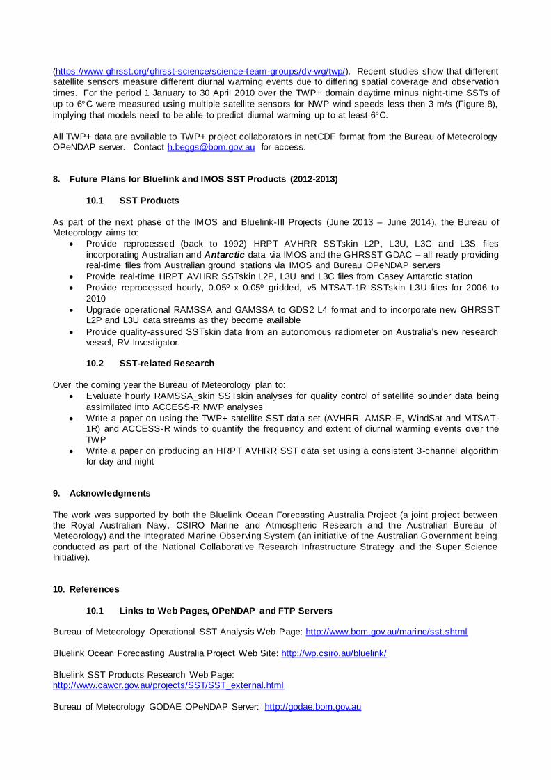
8. Future Plans for Bluelink and IMOS SST Products (2012-2013)
10.1 SST Products
As part of the next phase of the IMOS and Bluelink-III Projects (June 2013 – June 2014), the Bureau of Meteorology aims to:
Provide reprocessed (back to 1992) HRPT AVHRR SSTskin L2P, L3U, L3C and L3S files
incorporating Australian and Antarctic data via IMOS and the GHRSST GDAC – all ready providing real-time files from Australian ground stations via IMOS and Bureau OPeNDAP servers
Provide real-time HRPT AVHRR SSTskin L2P, L3U and L3C files from Casey Antarctic station
Provide reprocessed hourly, 0.05º x 0.05º gridded, v5 MTSAT-1R SSTskin L3U files for 2006 to
2010
Upgrade operational RAMSSA and GAMSSA to GDS2 L4 format and to incorporate new GHRSST L2P and L3U data streams as they become available
Provide quality-assured SSTskin data from an autonomous radiometer on Australia’s new research vessel, RV Investigator.
10.2 SST-related Research
Over the coming year the Bureau of Meteorology plan to:
Evaluate hourly RAMSSA_skin SSTskin analyses for quality control of satellite sounder data being
assimilated into ACCESS-R NWP analyses
Write a paper on using the TWP+ satellite SST data set (AVHRR, AMSR-E, WindSat and MTSAT-1R) and ACCESS-R winds to quantify the frequency and extent of diurnal warming events over the
TWP
Write a paper on producing an HRPT AVHRR SST data set using a consistent 3-channel algorithm for day and night
9. Acknowledgments
The work was supported by both the Bluelink Ocean Forecasting Australia Project (a joint project between the Royal Australian Navy, CSIRO Marine and Atmospheric Research and the Australian Bureau of Meteorology) and the Integrated Marine Observing System (an initiative of the Australian Government being
conducted as part of the National Collaborative Research Infrastructure Strategy and the Super Science Initiative).
10. References
10.1 Links to Web Pages, OPeNDAP and FTP Servers
Bureau of Meteorology Operational SST Analysis Web Page: http://www.bom.gov.au/marine/sst.shtml
Bluelink Ocean Forecasting Australia Project Web Site: http://wp.csiro.au/bluelink/
Bluelink SST Products Research Web Page: http://www.cawcr.gov.au/projects/SST/SST_external.html
Bureau of Meteorology GODAE OPeNDAP Server: http://godae.bom.gov.au

Bureau of Meteorology Seasonal Forecast Model (POAMA) Web Site: http://poama.bom.gov.au.
Bureau of Meteorology Web Site: http://www.bom.gov.au
Group for High Resolution SST (GHRSST) Web Site: http://www.ghrsst.org GHRSST Global Data Assembly Centre Web Page: http://ghrsst.jpl.nasa.gov
GHRSST Long-Term Stewardship Facility at NODC Web Site: http://ghrsst.nodc.noaa.gov/
GHRSST Multi-Product Ensemble (GMPE) and Analysis Intercomparison Project Web Page: http://ghrsst-pp.metoffice.com/pages/latest_analysis/sst_monitor/daily/ens/index.html
GHRSST Tropical Warm Pool Diurnal Variability (TWP+) Project Web Page: https://www.ghrsst.org/ghrsst-science/science-team-groups/dv-wg/twp/
Integrated Marine Observing System (IMOS) Web Site: http://www.imos.org.au IMOS GHRSST SST Products Web Page: http://imos.org.au/sstproducts.html
IMOS Ocean Data Portal: http://imos.aodn.org.au/webportal
IMOS Remote Sensing Data Web Page: http://imos.org.au/srs_data.html IMOS Remote Sensing FTP Server for GHRSST data: ftp://aodaac2-cbr.act.csiro.au/imos/GHRSST
IMOS Research Vessel Air-Sea Fluxes web page: http://imos.org.au/airseaflux.html
IMOS Research Vessel Meteorological, SST and Flux Data OPeNDAP site: http://thredds.aodn.org.au/thredds/catalog/IMOS/SOOP/SOOP-ASF/catalog.html
IMOS Ship of Opportunity SST web page: http://imos.org.au/sst.html IMOS Ship of Opportunity SST Data OPeNDAP site:
http://thredds.aodn.org.au/thredds/catalog/IMOS/SOOP/SOOP-SST/catalog.html IMOS Southern Ocean Flux Station Web Page:
http://imos.org.au/sofs.html IMOS Tropical Research Vessel Data OPeNDAP site:
http://thredds.aodn.org.au/thredds/catalog/IMOS/SOOP/SOOP-TRV/catalog.html NOAA/NESDIS SST Quality Monitor Site (SQUAM):
http://www.star.nesdis.noaa.gov/sod/sst/squam/index.html
10.2 Journals/Reports
Andreu-Burillo, Isabel, Gary Brassington, Peter Oke and Helen Beggs (2010) Including a new data stream in in Bluelink Ocean Data Assimilation System, Australian Meteorological and Oceanographic Journal, 59:77-86.
Beggs, Helen (2007) A High-Resolution Blended Sea Surface Temperature Analysis over the Australian Region, BMRC Research Report, Bureau of Meteorology, Melbourne, Australia, 43 pp.
http://www.bom.gov.au/bmrc/pubs/researchreports/RR130.pdf Beggs, Helen (2008) GAMSSA – A New Global Australian Multi-Sensor SST Analysis, Submitted to
Proceedings of the 9th GHRSST–PP Science Team Meeting, Perros-Guirec, France, 9-13 June 2008. http://cawcr.gov.au/bmrc/ocean/BLUElink/SST/GHRSST9/9th_GHRSST-PP_Meeting_GAMSSA_paper.doc

Beggs, H., R. Verein, H. Kippo, M. Underwood, I. Barton, C. Steinberg, E. Schulz, R. Hibbins, A. Thomas
and G. Ball (2009a). Enhancing Ship of Opportunity Sea Surface Temperature Observations in the Australian Region, GHRSST 2009 International Users Symposium Conference Proceedings, Santa Rosa, USA, pp. 147-150. http://imos.org.au/soopdoc.html
Beggs, Helen, Chelle Gentemann and Peter Steinle (2009b) Real-time skin sea surface temperature analyses for quality control of data assimilated into NWP models, extended abstract, The Fifth WMO International Symposium on Data Assimilation of Observations in Meteorology, Oceanography and
Hydrology, Melbourne, Australia, 5-9 October 2009. http://cawcr.gov.au/projects/SST/5WMO_DASymp_Extended_Abstract_Beggs_Sep2009.pdf
Beggs H. (2010) Use of TIR from Space in Operational Systems, In: Oceanography from Space Revisited, Ed. V. Barale, J.F.R. Gower and L. Alberotanza, Pub. Springer Science+Business Media B.V. p.249-271.
Beggs, H., R. Verein and G. Paltoglou (2010a) Calibration and validation of AVHRR sea surface temperatures using observations from ships of opportunity, In: Proceedings “Oceans from Space” Venice 2010, 26-30 April, 2010, p. 37-38.
Beggs H., L. Majewski, G. Paltoglou, E. Schulz, I. Barton and R. Verein (2010b) Report to GHRSST11 from Australia - Bluelink and IMOS, In: Proceedings of the 11th GHRSST Science Team Meeting, Lima, 21-25
June 2010, p. 21-31. https://www.ghrsst.org/documents/q/category/ghrsst-science-team-meetings/ghrsst-xi-lima/
Beggs H., P. Sandery, V. Barras and P. Steinle (2011a) Australian Bureau of Meteorology SST Requirements for NWP and Atmosphere-Ocean Coupled Models, In: Proceedings of the GHRSST XII Science Team Meeting, Edinburgh, 27 June - 1 July 2011, p. 180-184.
https://www.ghrsst.org/files/download.php?m=documents&f=110927105711 -Proceedings260911Final.pdf Beggs H., L. Majewski, G. Paltoglou, R. Verein and A. Zhong (2011b) Report to GHRSST12 from Australia –
Bluelink and IMOS, In: Proceedings of the GHRSST XII Science Team Meeting, Edinburgh, 27 June - 1 July 2011, p. 90-105. https://www.ghrsst.org/files/download.php?m=documents&f=110927105711-Proceedings260911Final.pdf.
Beggs, H., A. Zhong, G. Warrren, O. Alves, G. Brassington and T. Pugh (2011c) RAMSSA - An Operational, High-Resolution, Multi-Sensor Sea Surface Temperature Analysis over the Australian Region. Australian
Meteorological and Oceanographic Journal, 61, 1-22. http://www.bom.gov.au/amoj/papers.php?year=2011
Beggs H., R. Verein, G. Paltoglou, H. Kippo and M. Underwood (2012a) Enhancing ship of opportunity sea surface temperature observations in the Australian region, Journal of Operational Oceanography, (ISSN: 1755-8778), 5, 59-73.
http://www.ingentaconnect.com/content/imarest/joo/2012/00000005/00000001/art00006 Beggs H, L. Majewski, G. Kruger, R. Verein, P. Oke, P. Sakov, C. Tingwell, V. Barras, P. Sandery and C.
Griffin (2012b) Report to GHRSST13 from Australia - Bluelink and IMOS, In: Proceedings of the GHRSST XIII Science Team Meeting, Tokyo, 4 – 8 June 2012, p. 149-163. https://www.ghrsst.org/files/download.php?m=documents&f=121207144549 -
GHRSSTXIIIProceedingsIssue1Rev0.pdf Brassington, G. B., Tim Pugh, Claire Spillman, Eric Schulz, Helen Beggs, Andreas Schill er and Peter R. Oke
(2007) Bluelink Development of Operational Oceanography and Servicing in Australia, J. Res. Practice in Information Technology, 39, 151-164.
Casey, K, C. Donlon and the GHRSST Science Team (2011) The Recommended GHRSST Data Specification (GDS) 2.0, Revision 4 [online], 7 November 2011, 123 pp. https://www.ghrsst.org/documents/q/category/gds-documents/operational/
Dash, P., A. Ignatov, M. Martin, C. Donlon, B. Brasnett, R. Reynolds, V. Banzon, H. Beggs, D. May, B. McKenzie, J-F. Cayula, Y. Chao, R. Grumbine, E. Maturi, A. Harris, J. Mittaz, J. Sapper, T. Chin, J. Vazquez,

E. Armstrong, C. Gentemann, J. Cummings, F-F. Piolle, E. Autret, J. Roberts-Jones, S. Ishizaki, J. Hoyer, D. Poulter (2012) Group for High Resolultion SST (GHRSST) Analysis Fields Inter-Comparisons Part 2. Near
real-time web-based Level 4 SST Quality Monitor (L4-SQUAM). Deep Sea Research II, 77-80, 31–43. http://www.star.nesdis.noaa.gov/sod/sst/squam/documents/DSRII_2011_Revision/DSRII_IC-TAG_Part2_L4_SQUAM.pdf.
Garde L.A., C.M. Spillman, L. Majewski, C. Griffin, G. Kruger and H. Beggs (2013) ReefTemp Next Generation, CAWCR Technical Report, No. 63, 35 pp.
http://cawcr.gov.au/publications/technicalreports/CTR_063.pdf Griffin, C, L. Majewski and H. Beggs (2013) Computing sea surface temperatures and Sensor Specific Error
Statistics for GHRSST compliant AVHRR products over the Australian region, http://imos.org.au/srsdoc.html Huang (2012) Operational Implementation of OceanMAPS version 2.1 (BLUElink> Ocean Forecasting
System), NMOC Operations Bulletin, Number 94, 17 pp. http://www.bom.gov.au/australia/charts/bulletins/apob94.pdf
Martin M., P. Dash, A. Ignatov, V. Banzon, H. Beggs, B. Brasnett, J-F. Cayula, J. Cummings, C. Donlon, C. Gentemann, R. Grumbine, S. Ishizaki, E. Maturi, R. Reynolds, J Roberts_Jones (2012) Group for High Resolution SST (GHRSST) Analysis Fields Intercomparisons: Part 1. A GHRSST Multi-Product Ensemble
(GMPE). Deep Sea Research II, 77-80, 21–30. http://dx.doi.org/10.1016/j.dsr2.2012.04.013. Maturi E., A. Harris, C. Merchant, J.Mittaz, R. Potash, W. Meng and J. Sapper (2008) NOAA’s Sea Surface
Temperature Products from Operational Geostationary Satellites, Bull. American Met. Soc., Dec 2008, 1877-1888.
Oke P. R, Brassington G. B., Griffin D. A. and Schiller A. (2008), The Bluelink ocean data assimilation system (BODAS). Ocean Modelling, 21, 46-70.
Paltoglou, G., H. Beggs and L. Majewski (2010) New Australian High Resolution AVHRR SST Products from the Integrated Marine Observing System, In: Extended Abstracts of the 15
th Australasian Remote Sensing
and Photogrammetry Conference, Alice Springs, 13-17 September, 2010. http://imos.org.au/srsdoc.html
Puri, K., Dietachmayer, G., Mills, G.A., Davidson, N.E., Bowen, R.A. and Logan, L.W. 1998. The new BMRC Limited Area Prediction System, LAPS. Aust. Met. Mag., 47, 203–33.
Puri, K. et al. (2010) Preliminary results from Numerical Weather Predic tion implementation of ACCESS. CAWCR Research Letters 5, 15–22.
http://www.cawcr.gov.au/publications/researchletters/CAWCR_Research_Letters_5.pdf
Smith N. S., B. Ebert and G. Warren (1999) The Bureau of Meteorology SST Analysis System, An informal paper produced as background for the OOPC/AOPC Workshop on SST Analyses for Climate, International Research Institute, LDEO, Palisades NY USA, Nov 10-12, 1998.
http://www.bom.gov.au/bmrc/ocean/BLUElink/SST/The_Bureau_of_Meteorology_SST_analysis_system.doc Walton, C.C., Pichel, W.G., Sapper, J.F. and May, D.A. (1998) The development and operational application
of nonlinear algorithms for the measurement of sea surface temperatures with the NOAA polar-orbiting environmental satellites. J. Geophys. Res. 103, No. C12, 27999-280.
Zhong, Aihong and Helen Beggs (2008) Analysis and Prediction Operations Bulletin No. 77 - Operational Implementation of Global Australian Multi-Sensor Sea SurfaceTemperature Analysis, 2 October 2008. http://cawcr.gov.au/projects/SST/GAMSSA_BoM_Operational_B ulletin_77.pdf