report of the planning and development department...
TRANSCRIPT

2014-0142 AWH
REPORT OF THE PLANNING AND DEVELOPMENT DEPARTMENT FOR
APPLICATION FOR REZONING ORDINANCE 2014-0142
TO PLANNED UNIT DEVELOPMENT
MARCH 27, 2014 The Planning and Development Department hereby forwards to the Planning Commission, Land Use and Zoning Committee and City Council its comments and recommendation regarding Application for Rezoning Ordinance 2014-0142 to Planned Unit Development. Location: 2630 State Road A1A; on the west side of A1A south of
Wonderwood Drive and north of Assisi Lane Real Estate Number(s): 168369-0020 Current Zoning District: Planned Unit Development (PUD) (Ord. 2006-1074-E) Proposed Zoning District: Planned Unit Development (PUD) Current Land Use Category: Medium Density Residential (MDR) Planning District: Greater Arlington/Beaches - 2 City Council District: The Honorable Ray Holt, District 11 Applicant/Agent: Michael Saylor Black Dog Planning, Inc. 1450 Flagler Avenue Jacksonville, Florida 32207 Owner(s): John Baker JDB Real Property Investors, LLC 200 W. Forsyth Street, Suite 700 Jacksonville, Florida 32202 Staff Recommendation: APPROVE WITH CONDITIONS
GENERAL INFORMATION
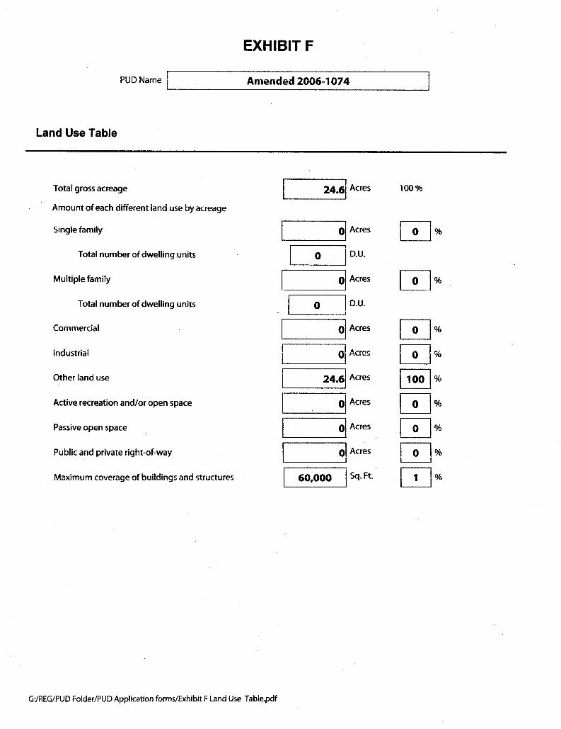
Application for Planned Unit Development 2014-0142 seeks to rezone approximately 24.6± acres of property from PUD to PUD. The purpose of the new PUD rezoning is to permit an alternative/additional development plan for a school use (school and accessory uses to a school). The existing PUD (Ordinance 2006-1074) approved a 534 multi-family unit development on three parcels totaling 45.12 acres. Under this plan, a small school campus
2014-0142 March 27, 2014
Page 2
(approximately 275 students) is proposed for the middle 24.6 acre parcel until such time as the real estate market supports redevelopment of the site as the multi-family residential use described in PUD Ord. 2006-1074. It is anticipated that the school use will be active for such period of time, at the discretion of the property owner, and pursuant to a lease on the property. At the time the school shall cease to operate, the original site plan and conditions of approval for multi-family residential development in accordance with the original 2006-1074 PUD will remain as the effective, approved plan of development. This PUD only amends the existing PUD to allow for this additional (alternative) use.
CRITERIA FOR REVIEW Pursuant to the provisions of Section 656.125 of the Zoning Code, the Planning and Development Department, Planning Commission and City Council (including the appropriate committee) shall evaluate and consider the following criteria of an application for rezoning to Planned Unit Development. (1) Is the proposed zoning district consistent with the 2030 Comprehensive Plan? Yes. The Planning and Development Department finds that the subject property is located in the Medium Density Residential (MDR) functional land use category as defined by the Future Land Use Map series (FLUMs) contained within the Future Land Use Element (FLUE) adopted as part of the 2030 Comprehensive Plan. The MDR functional land use category is intended to provide compact medium to high density residential development and transitional uses between low density residential uses and higher density residential uses, commercial uses and public and semi-public use areas, and provides for a range of secondary and supporting institutional uses, including private schools s. In the Suburban Area it’s intended to provide compact low to medium density mixed use development. This PUD proposes an alternative plan of development for a 275 student charter school, and therefore, is consistent with the FLUMs adopted as part of the 2030 Comprehensive Plan pursuant to Chapter 650 Comprehensive planning for future development of the Ordinance Code. The proposed rezoning would further Future Land Use Element (FLUE) Policy 2.1.8 which calls for the City to allow schools in all future land use categories. Further, the 2030 Comprehensive Plan FLUE provides support for schools in that “Certain secondary and supporting non-residential uses are permitted in all residential categories subject to the provisions of this and other elements of the 2030 Comprehensive Plan. These uses may include neighborhood supporting recreation facilities and public facilities, such as schools, churches, day care centers, fire stations, branch libraries, community centers, essential services, as well as supporting commercial and service establishments and home occupations.” FLUE Policy 1.1.7: states that the City shall promote the “gradual transition of densities and intensities between land uses in conformance with the provisions of this element shall be achieved through zoning and development review process.” A public Charter school on this site may be considered a transitional use.
2014-0142 March 27, 2014
Page 3
FLUE Policy 3.2.6: calls for the City to “allow a broad mixture of supporting recreational, commercial, public facilities and services in mixed use residential developments.” The alternative development plan proposed would provide an additional essential service to and for the surrounding area. This PUD proposes an alternative plan of development for a 275 student charter school, and incorporates all the commitments, conditions of approval and entitlements of the original PUD, 2006-1074, and adds schools, including private schools, as a permitted use by right on the aforementioned 24.6 acre parcel. Therefore, the request is consistent with the FLUMs adopted as part of the 2030 Comprehensive Plan pursuant to Chapter 650 Comprehensive planning for future development of the Ordinance Code. (2) Does the proposed rezoning further the goals, objectives and policies of the 2030 Comprehensive Plan? The evaluation of the goals, objectives and policies of the Comprehensive Plan can be found later in this report. (3) Does the proposed rezoning conflict with any portion of the City’s land use Regulations? The written description and the site plan of the intended plan of development meet all portions of the City’s land use regulations and further their intent by providing specific development standards. Pursuant to the provisions of Section 656.341(d) of the Zoning Code, the Planning and Development Department, Planning Commission and City Council (including the appropriate committee) shall evaluate and consider the following criteria for rezoning to Planned Unit Development district: (1) Consistency with the 2030 Comprehensive Plan In accordance with Section 656.129 Advisory recommendation on amendment of Zoning Code or rezoning of land of the Zoning Code, the subject property is within the following functional land use categories as identified in the Future Land Use Map series (FLUMs): Medium Density Residential (MDR). This proposed rezoning to Planned Unit Development is consistent with the 2030 Comprehensive Plan, and furthers the following goals, objectives and policies contained herein, including: FLUE Objective 1.1 Ensure that the type, rate, and distribution of growth in the City results in compact and compatible land use patterns, an increasingly efficient urban service delivery system and discourages proliferation of urban sprawl through implementation of regulatory programs, intergovernmental coordination mechanisms, and public/private coordination. FLUE Policy 1.1.7 states that the City shall promote the “gradual transition of densities and intensities between land uses in conformance with the provisions of this element shall be
2014-0142 March 27, 2014
Page 4
achieved through zoning and development review process.” A public Charter school on this site may be considered a transitional use. FLUE Policy 1.1.9 Permit development only if it does not exceed the densities and intensities established in the Future Land Use Element as defined by the Future Land Use map category description and their associated provisions. FLUE Policy 1.1.12 Promote the use of Planned Unit Developments (PUDs), cluster developments, and other innovative site planning and smart growth techniques in all commercial, industrial and residential plan categories, in order to allow for appropriate combinations of complementary land uses, and innovation in site planning and design, subject to the standards of this element and all applicable local, regional, State and federal regulations. FLUE Policy 3.2.6 calls for the City to “allow a broad mixture of supporting recreational, commercial, public facilities and services in mixed use residential developments.” The alternative development plan proposed would provide an additional essential service to and for the surrounding area. The proposed PUD differs from the usual application of the Zoning Code because it allows for the development option of a school or a residential community with up to 534 multi-family dwellings. (2) Consistency with the Concurrency Mobility and Management System Pursuant to the provisions of Chapter 655 Concurrency Mobility and Management System of the Ordinance Code, the development will be required to comply with all appropriate requirements of the Concurrency Mobility and Management System Office (CMSO) prior to development approvals. An existing Development Agreement # 75420 / City Dev # 7541.002 is reserved for 487 apartments. The agent/owner would need to apply for a companion CCAS/CRC under DA#75420 to move forward with this project. (3) Allocation of residential land use This proposed Planned Unit Development intends to add the use of a school, and will not exceed the projected holding capacity reflected in Table L-20, Land Use Acreage Allocation Analysis For 2030 Comprehensive Plan’s Future Land Use Element, contained within the Future Land Use Element (FLUE) of the 2030 Comprehensive Plan. (4) Internal compatibility This proposed PUD is consistent with the internal compatibility factors with specific reference to the following: The existence or absence of, and the location of open spaces, plazas, recreational areas and common areas: The PUD proposes a school campus primarily comprised of modular,

2014-0142 March 27, 2014
Page 5
temporary classroom buildings and modular administrative offices, comparable to those found on public school campuses in Duval County. The total number of classrooms are expected to be in the range of 8 to 10 prototypical modular buildings and the total space requirement for administrative offices is not expected to exceed two buildings. The buildings will be clustered in a central core area. The type and number of accessory buildings, if any, are not determined at this time, but there will be no permanent building construction undertaken as part of the school activity. Traffic and pedestrian circulation patterns: The PUD proposes one access point off of SR A1A, and that within the property, internal school access shall be provided using existing driveways that remained after the abandonment of the previous mobile home park use. Off street parking spaces for school personnel and visitors will be provided by adaptation and demarcation of existing driveway stub-outs that were built as part of the initial site infrastructure development. Student drop-off will be accommodated by a one-way loop system indicated on the site plan and pedestrian access for the school shall be provided by existing paved sidewalks external to the site and designated pedestrian pathways internal to the site, to be determined and pursuant to the City of Jacksonville Plans Review for permitting the project. The required construction of new, paved sidewalks internally to the property, as part of the interim use as a school, is waived. Staff does not support a school use (even interim) without any onsite improvements. The proposed interim school should meet the same requirements as any other school. Recommended conditions of approval are: a) Provide internal sidewalks (concrete or asphalt [separated from vehicles] that connect to external sidewalk (required by ADA & FL Building Code for life safety). b) Provide parking per Section 656.604 and designed to 656.607 (space dimensions, backup/drive aisle & sidewalk widths). [Not existing stub outs]. c) Minimum width of one-way drop off shall be 16’ in width and be separate from entrance. Fire Marshall’s review may require 20’ unobstructed access. d) All two-way drive aisles shall be a minimum of 20’ in width where no parking exists and 24’ where parking exists. The use and variety of building setback lines, separations, and buffering: The Design guidelines for future residential uses under 2006-1074 are as depicted in the original PUD. The following criteria is proposed for the school use only: (1) Minimum lot area: No less than 2 acres (2) Minimum lot width: NA (3) Maximum lot coverage: NA (4) Minimum front yard: 20' from the nearest property line (5) Minimum side yard: 20' from the nearest property line (6) Minimum rear yard: 20' from the nearest property line (7) Maximum height of structures: 35 feet (8) Minimum distance between buildings: per Fire Code or other applicable school facility siting rules.

2014-0142 March 27, 2014
Page 6
The proposed school site is somewhat isolated, being the middle 24 acre parcel within the overall 45+ acre three parcel existing PUD. The Mayport Elementary School and Schooners Bay residential community are to the east across SR A1A. Signage: The applicant proposes up to two (2), single faced identity signs; or one (1), double faced sign not to exceed 15 feet in height at the entrance driveway with State Road A1A and directional signs, internal to the school campus, not to exceed 8 square feet in area and 6 feet in height, and not limited in number. Any other factor deemed relevant to the privacy, safety, preservation, protection or welfare of any use within the proposed Planned Unit Development: The property is located in an existing diverse undeveloped and residential area on the westside of SR A1A between Mayport Road and Wonderwood Drive. The proposed project will be beneficial to the surrounding neighborhood and community and will allow the sustainable reuse of existing urban infrastructure on a stated interim use while the marketplace recovers to the point where the highest and best utilization of the site as multi-family residential uses will be feasible. Further, the aesthetic and design guidelines contained in the PUD will positively contribute to the residential developments in the general area. (5) External Compatibility Based on the written description of the intended plan of development and site plan, the Planning and Development Department finds that external compatibility is achieved by the following: The type, number and location of surrounding external uses: The proposed project is within an area where residential and institutional (school) development dominates the area. The project area is suburban in nature and this new development option will aid growth in this community. If approved as conditioned the PUD would add another essential service with flexibility in the location, type and size of the use. The Comprehensive Plan and existing zoning on surrounding lands: The adjacent uses, zoning and land use categories are as follows: Adjacent Land Use Zoning Current Use Property Category District ____ North MDR PUD Undeveloped land (part of orig. PUD 2006-1074) South MDR PUD Undeveloped land (part of orig. PUD 2006-1074) East LDR/MDR RLD-60/PBF-1 SF residential subdivision/school West MDR CCG-2 The Lakes of Mayport multi-family community (6) Intensity of Development The PUD is appropriate at this location with specific reference to the following:

2014-0142 March 27, 2014
Page 7
The existing residential density and intensity of use of surrounding lands: The use is consistent with the residential density and intensity of surrounding lands. This PUD proposes a 275 student school use on a small portion of the over 24 acres site. It will provide for a significant amount of recreational, active and passive open space, and differs from the usual application of the Zoning Code because it contains an option of a multi-family community in keeping with the area’s pattern of development or a school use. The request use will not result in the creation of objectionable or excessive noise, lights, vibrations, fumes, odors, dust or physical activities. Noise will be limited to the sounds typically associated with any other school. The facility will not be open during evening hours and therefore will not require significant lighting on the site other than related to security and seasonal events. A wooded area along the north, south and west property lines will serve as a buffer between the school use and nearby residential development. The availability and location of utility services and public facilities and services: This property is not in the JEA water and sewer service territory. The owner must contact Atlantic Beach Public Works for water and sewer availability. Electric service will be provided by the JEA. (7) Usable open spaces plazas, recreation areas. The PUD will provide a recreation/common area for the community of approximately 1.0 acres in size. In addition, ponds and wetlands will comprise a total approximately 3.0 acres, providing additional passive open space. (8) Impact on wetlands Surveying of a 2004 Geographical Information Systems shape file did identify wetlands on-site. It is noted that approximately 50% of property on the west side of the parcel is within the 100 year floodplain (AE and A)', while a ribbon of land that divides the parcel into east and west segments, has been designated as a "0.2 Percent Annual Chance Flood Hazard-Floodway." Special design and construction techniques will be required for development proposed in the floodway, and the proposed interim usage as a school and accessory uses to a school for approximately 275 students must be designed, permitted and constructed to mitigate for the known hazards within the area, including flooding and storm surge. Any development impacting wetlands will be permitted pursuant to local, state and federal permitting requirements. (9) Listed species regulations No wildlife survey is required as the project is less than the 50-acre threshold. (10) Off-street parking including loading and unloading areas. The written description indicates that for purposes of the interim use of the property as a school, parking requirements shall be consistent with the requirements of Part 6 of the Zoning Code, but then states that off-street parking spaces for school personnel and visitors will be

2014-0142 March 27, 2014
Page 8
provided by adaptation and demarcation of existing driveway stub-outs that were built as part of the initial site infrastructure development.. Staff recommends the condition that the school use shall provide parking per Section 656.604 and designed to 656.607 (space dimensions, backup/drive aisle & sidewalk widths). (11) Sidewalks, trails, and bikeways The agent/owner proposes that pedestrian access for the school shall be provided by existing paved sidewalks external to the site and designated pedestrian pathways internal to the site, to be determined and pursuant to the City of Jacksonville Plans Review for permitting the project, and that the required construction of new, paved sidewalks internal to the property as part of the interim use as a school be waived. Staff recommends the condition that the project shall provide internal sidewalks (concrete or asphalt [separated from vehicles] that connect to external sidewalks (required by ADA & FL Building Code for life safety) meeting the 2030 Comprehensive Plan requirements.
SUPPLEMENTAL INFORMATION Upon visual inspection of the subject property on March 18, 2014, the required Notice of Public Hearing signs were posted.
RECOMMENDATION Based on the foregoing, it is the recommendation of the Planning and Development Department that Application for Rezoning 2014-0142 be APPROVED with the following conditions:
1. The subject property is legally described in the original legal description dated December 6, 2013.
2. The subject property shall be developed in accordance with the revised written
description dated February 6, 2014.

2014-0142 March 27, 2014
Page 9
3. The subject property shall be developed in accordance with the original site plan dated December 17, 2013.
4. The subject property shall be developed in accordance with the Development
Services Division Memorandum dated March 11, 2014 or as otherwise approved by the Planning and Development Department.
2014-0142 March 27, 2014
Page 10
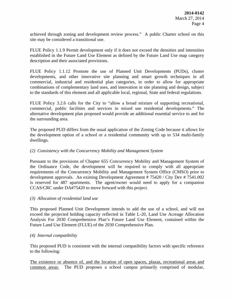
Aerial view of the subject site facing north
The subject site on the right facing south along SR A1A
2014-0142 March 27, 2014
Page 11
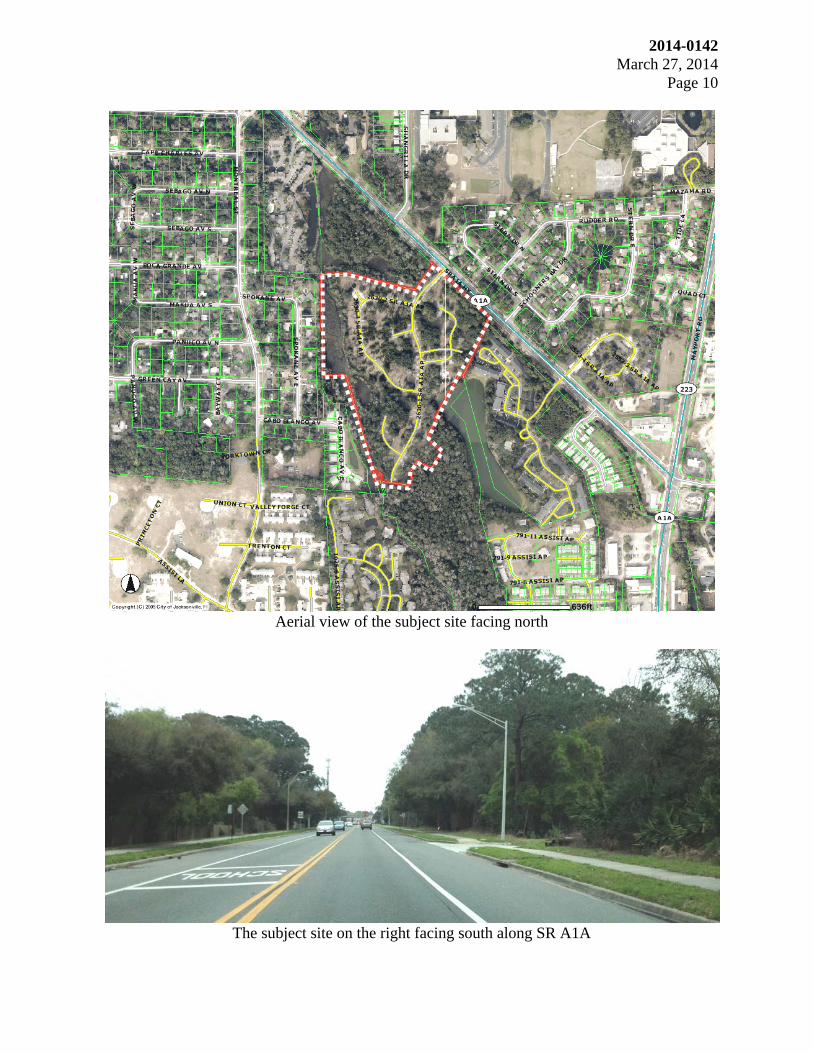
The subject site ahead on the left facing north along SR A1A
The existing entrance to the subject site on the left facing north along SR A1A
2014-0142 March 27, 2014
Page 12
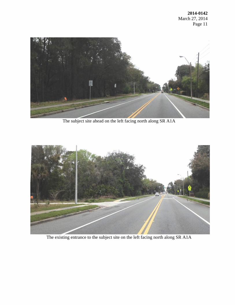
The subject site facing west from SR A1A
Facing west into the subject site

2014-0142 March 27, 2014
Page 13
ORDINANCE _2014_0142
TO:
FROM:
REQUEST SOUGHT:
11COUNCIL DISTRICT:
0 100 Feet
N
EW
S
FILE COPY
#
STATE ROAD A-1-A HIGHWAY
MO
NT
RE
AL
STR
EE
T
STERN DRIVE SOUTH
SP
OK
AN
E A
VE
NU
E E
AS
T
CABO BLANCO AVENUE
SCHOONERS B
AY DRIV
E
CA
BO
BL
AN
CO
AV
EN
UE
EA
ST
RM
D-C
RLD-60
RLD-60
RR-Acre
PB
F-1
RMD-C
RMD-C
RM
D-C
PUD
PUD
PUD
PUD
PUD
RM
D-D PBF-1
RLD-60
RLD-60
RMD-C
RMD-C
RMD-C
CCG-1
PUD
PUD
D E V E L O P M E N T S E R V I C E S
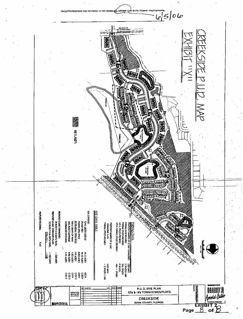
Creekside PUD R-2014-0142 fka R-2006-1074
P L A N N I N G AND D E V E L O P M E N T
214 N. Hogan Street Suite 2100 Jacksonville, FL 32202 Phone: 904 255 8310 Fax: 904 255 8311 www.coj.net
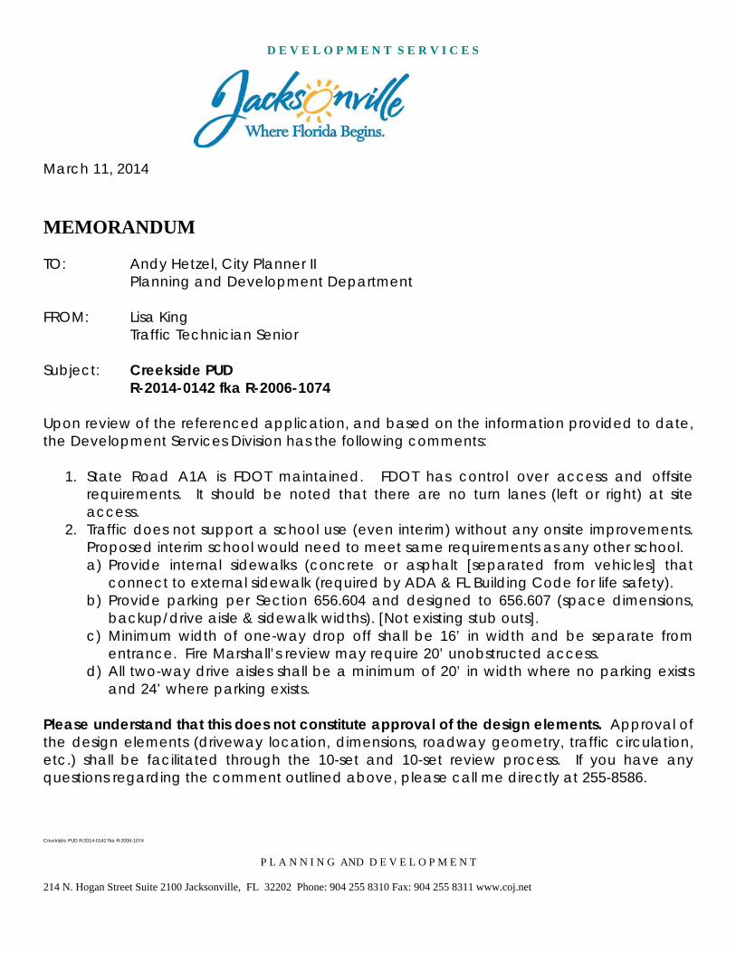
March 11, 2014
MEMORANDUM TO: Andy Hetzel, City Planner II
Planning and Development Department FROM: Lisa King Traffic Technician Senior Subject: Creekside PUD R-2014-0142 fka R-2006-1074
Upon review of the referenced application, and based on the information provided to date, the Development Services Division has the following comments:
1. State Road A1A is FDOT maintained. FDOT has control over access and offsite requirements. It should be noted that there are no turn lanes (left or right) at site access.
2. Traffic does not support a school use (even interim) without any onsite improvements. Proposed interim school would need to meet same requirements as any other school. a) Provide internal sidewalks (concrete or asphalt [separated from vehicles] that
connect to external sidewalk (required by ADA & FL Building Code for life safety). b) Provide parking per Section 656.604 and designed to 656.607 (space dimensions,
backup/drive aisle & sidewalk widths). [Not existing stub outs]. c) Minimum width of one-way drop off shall be 16’ in width and be separate from
entrance. Fire Marshall’s review may require 20’ unobstructed access. d) All two-way drive aisles shall be a minimum of 20’ in width where no parking exists
and 24’ where parking exists. Please understand that this does not constitute approval of the design elements. Approval of the design elements (driveway location, dimensions, roadway geometry, traffic circulation, etc.) shall be facilitated through the 10-set and 10-set review process. If you have any questions regarding the comment outlined above, please call me directly at 255-8586.
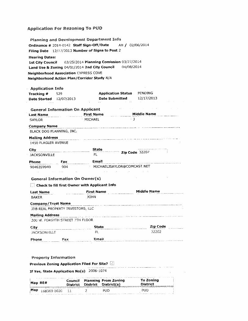

EXHIBIT 1
Legal Description
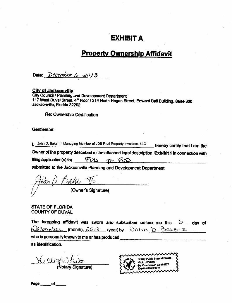


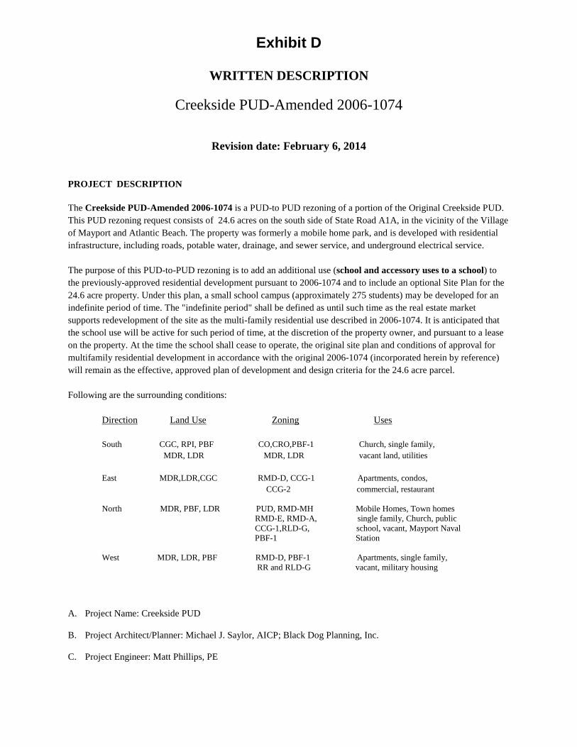
Exhibit D
WRITTEN DESCRIPTION
Creekside PUD-Amended 2006-1074
Revision date: February 6, 2014
PROJECT DESCRIPTION The Creekside PUD-Amended 2006-1074 is a PUD-to PUD rezoning of a portion of the Original Creekside PUD. This PUD rezoning request consists of 24.6 acres on the south side of State Road A1A, in the vicinity of the Village of Mayport and Atlantic Beach. The property was formerly a mobile home park, and is developed with residential infrastructure, including roads, potable water, drainage, and sewer service, and underground electrical service. The purpose of this PUD-to-PUD rezoning is to add an additional use (school and accessory uses to a school) to the previously-approved residential development pursuant to 2006-1074 and to include an optional Site Plan for the 24.6 acre property. Under this plan, a small school campus (approximately 275 students) may be developed for an indefinite period of time. The "indefinite period" shall be defined as until such time as the real estate market supports redevelopment of the site as the multi-family residential use described in 2006-1074. It is anticipated that the school use will be active for such period of time, at the discretion of the property owner, and pursuant to a lease on the property. At the time the school shall cease to operate, the original site plan and conditions of approval for multifamily residential development in accordance with the original 2006-1074 (incorporated herein by reference) will remain as the effective, approved plan of development and design criteria for the 24.6 acre parcel. Following are the surrounding conditions: Direction Land Use Zoning Uses South CGC, RPI, PBF CO,CRO,PBF-1 Church, single family, MDR, LDR MDR, LDR vacant land, utilities East MDR,LDR,CGC RMD-D, CCG-1 Apartments, condos,
CCG-2 commercial, restaurant North MDR, PBF, LDR PUD, RMD-MH Mobile Homes, Town homes RMD-E, RMD-A, single family, Church, public CCG-1,RLD-G, school, vacant, Mayport Naval PBF-1 Station West MDR, LDR, PBF RMD-D, PBF-1 Apartments, single family, RR and RLD-G vacant, military housing
A. Project Name: Creekside PUD
B. Project Architect/Planner: Michael J. Saylor, AICP; Black Dog Planning, Inc.
C. Project Engineer: Matt Phillips, PE

D. Project Developer: JDB Real Property Investors and Seaside Playgarden, Inc. d/b/a Seaside Community Charter School
E. Current Land Use Designation: MDR
F. Current Zoning District: PUD
G. Requested Zoning District: PUD
H. Real Estate Number: 168369 0020;
QUANTITATIVE and other DATA This PUD to PUD amended zoning incorporates all the commitments, conditions of approval and entitlements of the original PUD, 2006-1074, and adds schools, including private schools, as a permitted use by right on the aforementioned 24.6 acre parcel. Inclusive in the school use designation are the following accessory or incidental uses, and those uses similar in character to:
• outdoor classrooms • group gardens • compost station(s), not to exceed 1000
square feet in area, nor closer than 100 feet to any property line
• areas for agricultural studies • beekeeping • chickens and chicken coops • sheep, goats, small domestic livestock, kept
in a secure compound, not to exceed more than 20 animals
• athletic spaces for yoga, meditation • astronomy lab • obstacle course or Par Course • raised bed garden
• hydroponic garden • driving range, disc golf course • biology lab • cross country track • amphitheater • sculpture lab • summer camp facilities • large outdoor meeting space, outdoor
cafeteria, playground • pool • grounds maintenance and vehicle storage
building and shop • A modular or other residential structure for a
full-time caretaker or security officer
DESIGN GUIDELINES
The school campus will be primarily comprised of modular, temporary classroom buildings and modular administrative offices, comparable to those found on public school campuses in Duval County. The total number of classrooms are expected to be in the range of 8 to10 prototypical modular buildings and the total space requirement for administrative offices is not expected to exceed two buildings. The buildings will be clustered in a central core area as depicted on the Interim Site Plan. The type and number of accessory buildings, if any, are not determined at this time, but there will be no permanent building construction undertaken as part of the school activity. Design guidelines for future residential uses under 2006-1074 are as depicted in the original PUD. The following criteria will apply only to the school use:
(1) Minimum lot area: No less than 2 acres
(2) Minimum lot width: NA
(3) Maximum lot coverage: NA
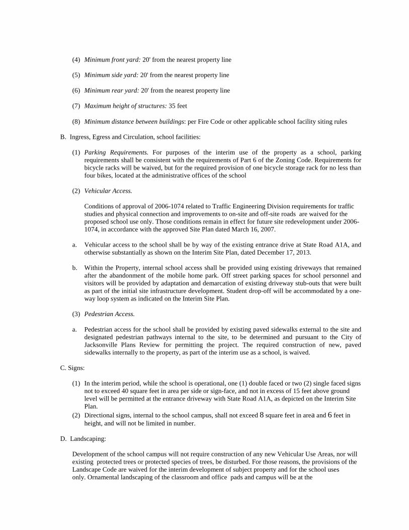
(4) Minimum front yard: 20' from the nearest property line
(5) Minimum side yard: 20' from the nearest property line
(6) Minimum rear yard: 20' from the nearest property line
(7) Maximum height of structures: 35 feet
(8) Minimum distance between buildings: per Fire Code or other applicable school facility siting rules
B. Ingress, Egress and Circulation, school facilities:
(1) Parking Requirements. For purposes of the interim use of the property as a school, parking requirements shall be consistent with the requirements of Part 6 of the Zoning Code. Requirements for bicycle racks will be waived, but for the required provision of one bicycle storage rack for no less than four bikes, located at the administrative offices of the school
(2) Vehicular Access.
Conditions of approval of 2006-1074 related to Traffic Engineering Division requirements for traffic studies and physical connection and improvements to on-site and off-site roads are waived for the proposed school use only. Those conditions remain in effect for future site redevelopment under 2006- 1074, in accordance with the approved Site Plan dated March 16, 2007.
a. Vehicular access to the school shall be by way of the existing entrance drive at State Road A1A, and
otherwise substantially as shown on the Interim Site Plan, dated December 17, 2013.
b. Within the Property, internal school access shall be provided using existing driveways that remained after the abandonment of the mobile home park. Off street parking spaces for school personnel and visitors will be provided by adaptation and demarcation of existing driveway stub-outs that were built as part of the initial site infrastructure development. Student drop-off will be accommodated by a one-way loop system as indicated on the Interim Site Plan.
(3) Pedestrian Access. a. Pedestrian access for the school shall be provided by existing paved sidewalks external to the site and
designated pedestrian pathways internal to the site, to be determined and pursuant to the City of Jacksonville Plans Review for permitting the project. The required construction of new, paved sidewalks internally to the property, as part of the interim use as a school, is waived.
C. Signs:
(1) In the interim period, while the school is operational, one (1) double faced or two (2) single faced signs not to exceed 40 square feet in area per side or sign-face, and not in excess of 15 feet above ground level will be permitted at the entrance driveway with State Road A1A, as depicted on the Interim Site Plan.
(2) Directional signs, internal to the school campus, shall not exceed 8 square feet in area and 6 feet in height, and will not be limited in number.
D. Landscaping:
Development of the school campus will not require construction of any new Vehicular Use Areas, nor will existing protected trees or protected species of trees, be disturbed. For those reasons, the provisions of the Landscape Code are waived for the interim development of subject property and for the school uses only. Ornamental landscaping of the classroom and office pads and campus will be at the

owner's/developer's and operators' option.
E. Recreation and Open Space:
The school campus will have dedicated outdoor active play and passive open areas, pursuant to Best Practices for Florida school facilities. 24.6 acres (the leased premises) of the overall Creekside PUD will be available for open space and school-oriented, afore-mentioned school accessory uses, during the interim period of development and use as a school.
F. Utilities
Water and sanitary sewer service will be provided by Atlantic Beach. Electric will be provided by JEA.
G. Wetlands
Wetlands, if affected, will be permitted according to local, state and federal requirements, as required. DEVELOPMENT PLAN APPROVAL With each request for verification of substantial compliance with this PUD, a preliminary development plan shall be submitted to the City of Jacksonville Planning and Development Department identifying all then existing and proposed uses within the Property, and showing the general layout of the leased premises. JUSTIFICATION FOR PLANNED UNIT DEVELOPMENT CLASSIFICATION FOR THIS PROJECT The proposed project is consistent with the general purpose and intent of the City of Jacksonville 2030 Comprehensive Plan and Land Use Regulations. The proposed project will be beneficial to the surrounding neighborhood and community and will allow the sustainable reuse of existing urban infrastructure in an interim use while the marketplace recovers to the point where the highest and best utilization of the site as multi-family residential uses will be feasible. Further, the PUD : A. Is more efficient than would be possible through strict application of the Zoning Code; B. Is compatible with surrounding land uses and will improve the characteristics of the surrounding area, by providing an active interim use for a portion of the property in advance of redevelopment of the entire site as medium density residential use; C. Will promote the purposes of the City of Jacksonville 2030 Comprehensive Plan. D. Upon cessation and/or abandonment of the proposed school activity, the original PUD 2006-1074 will be the governing entitlement, site plan and conditions of approval for residential use of the property. The site plan and conditions found in 2006-1074 are incorporated by reference into this PUD application. PHASING AND MAINTENANCE The construction or move-on of mobile/modular units of the Charter School will commence in mid-2014. Accessory uses to the school, as described herein, may be developed or not, as needs and the school curriculum dictate, but in any case the school facilities will be built-out within five years of the effective date of this PUD.

It is the intent of the owner and the obligation of both the tenant (Seaside Charter School) and the owner, that areas and functions described herein, and functions or facilities not otherwise provided by and maintained by the City or other municipal entity, will be perpetually operated and maintained by either the owner or tenant, or a subsequent assign or owner.

LAND USE AND ZONING COMMITTEE AMENDMENT
ATTACH
Land Use and Zoning Committee offers the following first
amendment to File No. 2006-1074:
(1) On page 2, line 24, strike “June 5, 2006” and insert “March
16, 2007”; and
(2) On page 2, line 24, strike “July 28, 2006” and insert
“March 16, 2007”; and
(3) On page 2, line 28, before “Exhibit 2” insert “Revised”;
and
(4) On page 2, line 28 ½ insert a new Section 2 to read as
follows:
“Section 2. Rezoning Approved Subject to Condition.
This rezoning is approved subject to the following
condition:
(a) Development shall proceed in accordance with the
Traffic Engineering Division Memorandum dated February 13,
2007, and the Transportation Planning Division Memorandum
dated February 12, 2007, or as otherwise approved by the
Traffic Engineering Division and the Planning and
Development Department.”; and
(5) Renumber the remaining Sections; and
(6) Strike Exhibit 2 and replace it with Revised Exhibit 2; and
(7) Amend the introduction line to reflect this Amendment.
Form Approved:

Amended 4/10/07 Enacted 4/10/07
ATTACHMENT
Introduced and amended by the Land Use and Zoning 1
Committee: 2
3
4
ORDINANCE 2006-1074-E 5
AN ORDINANCE REZONING APPROXIMATELY 45.12 6
ACRES LOCATED IN COUNCIL DISTRICT 11 ON STATE 7
ROAD A1A BETWEEN STATE ROAD A1A AND ASSISI 8
LANE (R.E. NOS. 168369-0020, 169385-0200 AND 9
168374-0000 [PORTION]), AS DESCRIBED HEREIN, 10
OWNED BY JDB REAL PROPERTY INVESTORS, LLC, JDB 11
INVESTMENTS OF FLORIDA, LLC, AND BULL-GATOR 12
PROPERTY INVESTORS, LLC, FROM PUD (PLANNED 13
UNIT DEVELOPMENT), RMD-MH (RESIDENTIAL MEDIUM 14
DENSITY-MH) AND RMD-D (RESIDENTIAL MEDIUM 15
DENSITY-D) DISTRICTS TO PUD (PLANNED UNIT 16
DEVELOPMENT) DISTRICT, AS DEFINED AND 17
CLASSIFIED UNDER THE ZONING CODE, TO PERMIT 18
MULTI-FAMILY RESIDENTIAL USES, AS DESCRIBED IN 19
THE APPROVED WRITTEN DESCRIPTION AND SITE PLAN 20
FOR THE CREEKSIDE PUD; PROVIDING AN EFFECTIVE 21
DATE. 22
23
WHEREAS, the above owners of approximately 45.12 acres 24
located in Council District 11 on State Road A1A between State Road 25
A1A and Assisi Lane (R.E. Nos. 168369-0020, 169385-0200 and 168374-26
0000 [portion]), as more particularly described in Exhibit 1, 27
attached hereto (Subject Property), have applied for a rezoning and 28
reclassification of that property from PUD (Planned Unit 29

Amended 4/10/07
- 2 -
Development), RMD-MH (Residential Medium Density-MH), and RMD-D 1
(Residential Medium Density-D) Districts to PUD (Planned Unit 2
Development) District, as described in Section 1 below; and 3
WHEREAS, the Planning Commission has considered the 4
application and has rendered an advisory opinion; and 5
WHEREAS, the Land Use and Zoning Committee, after due notice 6
and public hearing, has made its recommendation to the Council; and 7
WHEREAS, the Council finds that such rezoning is: (1) 8
consistent with the 2010 Comprehensive Plan; (2) furthers the 9
goals, objectives and policies of the 2010 Comprehensive Plan; and 10
(3) is not in conflict with any portion of the City’s land use 11
regulations; and 12
WHEREAS, the Council finds the proposed rezoning does not 13
adversely affect the orderly development of the City as embodied in 14
the Zoning Code; will not adversely affect the health and safety of 15
residents in the area; will not be detrimental to the natural 16
environment or to the use or development of the adjacent properties 17
in the general neighborhood; and will accomplish the objectives and 18
meet the standards of Section 656.340 (Planned Unit Development) of 19
the Zoning Code; now therefore 20
BE IT ORDAINED by the Council of the City of Jacksonville: 21
Section 1. Property Rezoned. The Subject Property is 22
hereby rezoned and reclassified from PUD (Planned Unit 23
Development), RMD-MH (Residential Medium Density-MH), and RMD-D 24
(Residential Medium Density-D) Districts to PUD (Planned Unit 25
Development) District, as shown and described in the approved site 26
plan dated March 16, 2007 and written description dated March 16, 27
2007 for the Creekside PUD. The PUD district for the Subject 28
Property shall generally permit multi-family residential uses, as 29
more specifically shown and described in the approved site plan and 30
written description, both attached hereto as Revised Exhibit 2. 31
Amended 4/10/07
- 3 -
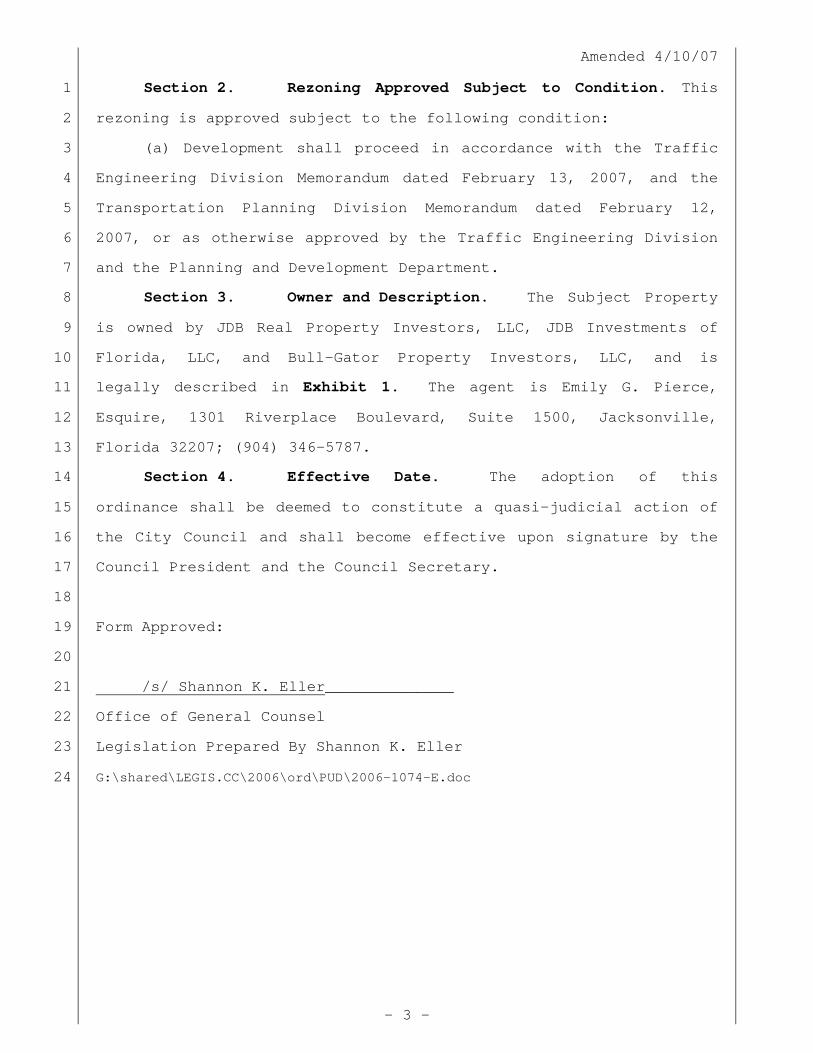
Section 2. Rezoning Approved Subject to Condition. This 1
rezoning is approved subject to the following condition: 2
(a) Development shall proceed in accordance with the Traffic 3
Engineering Division Memorandum dated February 13, 2007, and the 4
Transportation Planning Division Memorandum dated February 12, 5
2007, or as otherwise approved by the Traffic Engineering Division 6
and the Planning and Development Department. 7
Section 3. Owner and Description. The Subject Property 8
is owned by JDB Real Property Investors, LLC, JDB Investments of 9
Florida, LLC, and Bull-Gator Property Investors, LLC, and is 10
legally described in Exhibit 1. The agent is Emily G. Pierce, 11
Esquire, 1301 Riverplace Boulevard, Suite 1500, Jacksonville, 12
Florida 32207; (904) 346-5787. 13
Section 4. Effective Date. The adoption of this 14
ordinance shall be deemed to constitute a quasi-judicial action of 15
the City Council and shall become effective upon signature by the 16
Council President and the Council Secretary. 17
18
Form Approved: 19
20
/s/ Shannon K. Eller______________ 21
Office of General Counsel 22
Legislation Prepared By Shannon K. Eller 23
G:\shared\LEGIS.CC\2006\ord\PUD\2006-1074-E.doc 24