remedial investigation and feasibility study scope … · remedial investigation and feasibility...
TRANSCRIPT
REMEDIAL INVESTIGATION AND FEASIBILITY STUDY SCOPE OF WORK (FINAL)
BENNING ROAD FACILITY 3400 BENNING ROAD, N.E.
WASHINGTON, DC 20019
PREPARED FOR:
Pepco and Pepco Energy Services 701 9th Street, NW
Washington, DC 20068
PREPARED BY:
AECOM 8320 Guilford Road, Suite L
Columbia, MD 21046
April 2012
REMEDIAL INVESTIGATION AND FEASIBILITY STUDY SCOPE OF WORK (FINAL) Benning Road Facility 3400 Benning Road, N.E. Washington, DC 20019
________________________________ Prepared By: Ravi Damera, P.E Senior Project Manager, AECOM
_________________________________ Prepared By: Kevin Yue, E.I.T. Environmental Engineer, AECOM
_________________________________ Reviewed By: Gary Grinstead, P.G. Senior Technical Reviewer, AECOM

Benning Road Facility FINAL April 2012 RI/FS Scope of Work
Contents
Introduction ................................................................................................................................. 1
TASK 1: Community Relations ............................................................................................ 3
1.1 Development and Implementation of Community Involvement Plan .....................................3
1.2 Support the Administrative Record .........................................................................................3
TASK 2: Scoping and Preparation of Work Plans ............................................................. 4
2.1 Review of Existing Data and Development of Conceptual Site Model ..................................4
2.2 Planning Scope of Investigation ..............................................................................................5
2.3 Preparation of Work Plans ......................................................................................................6
2.3.1 RI/FS Work Plan ......................................................................................................................6
2.3.2 Sampling and Analysis Plan ....................................................................................................6
2.3.3 Health and Safety Plan ............................................................................................................6
2.4 Regulatory Review and Public Comment ...............................................................................7
TASK 3: Remedial Investigation .......................................................................................... 8
3.1 Field Investigation ....................................................................................................................8
3.1.1 Landside Investigation .............................................................................................................8
3.1.2 Waterside Investigation ...........................................................................................................8
3.2 Data Analysis and Management .............................................................................................9
3.3 Exposure Assessment and Risk Analysis ..............................................................................9
3.3.1 Human Health Risk Assessment ............................................................................................9
3.3.2 Ecological Risk Assessment ................................................................................................ 10
3.4 Remedial Investigation Report ............................................................................................. 11
3.5 Regulatory Review and Public Comment ............................................................................ 12
TASK 4: Feasibility Study ................................................................................................... 13
4.1 Identification of Remediation Requirements and Establishment of Remedial Objectives . 13
4.2 Development and Screening of Remedial Alternatives ....................................................... 13
4.3 Treatability Studies ............................................................................................................... 14
4.4 Detailed Analysis of Alternatives .......................................................................................... 14
4.5 Feasibility Study Report ....................................................................................................... 15
4.6 Regulatory Review and Public Comment ............................................................................ 15
Benning Road Facility FINAL April 2012 RI/FS Scope of Work
List of Tables
Table 1: Sources of Available Information Regarding Site Conditions
List of Figures
Figure 1: Site Location Map Figure 2: Site Plan and Investigation Areas
Appendices
Appendix A: RI/FS Scope of Work Outline Appendix B: Community Involvement Plan Outline Appendix C: RI/FS Work Plan Outline Appendix D: Sampling and Analysis Plan Outline Appendix E: Health and Safety Plan Outline
Benning Road Facility FINAL April 2012 RI/FS Scope of Work
List of Acronyms
CERCLA Comprehensive Environmental Response, Compensation and Liability Act CIP Community Involvement Plan COPC Contaminants of Potential Concern CSM Conceptual Site Model DDOE District Department of the Environment DPW Department of Public Works DQO Data Quality Objective ERA Environmental Risk Assessment FS Feasibility Study FSP Field Sampling Plan HASP Health and Safety Plan HHRA Human Health Risk Assessment NPS National Park Service NRDA Natural Resource Damage Assessment OSHA Occupational Safety and Health Administration PAH Polycyclic Aromatic Hydrocarbon PRG Preliminary Remedial Goal PCB Polychlorinated Biphenyl QAPP Quality Assurance Project Plan RAO Remedial Action Objectives RBSL Risk-Based Screening Level RI/FS Remedial Investigation/Feasbility Study SAP Sampling and Analysis Plan SLHHRA Screening-Level Human Health Risk Assessment SOW Scope of Work SVOC Semi-Volatile Organic Compound USCG United States Coast Guard USEPA United States Environmental Protection Agency UST Underground Storage Tank VOC Volatile Organic Compound
1
Benning Road Facility FINAL April 2012 RI/FS Scope of Work
Introduction
AECOM has prepared this Scope of Work (SOW) on behalf of Potomac Electric Power Company and Pepco
Energy Services, Inc. (collectively “Pepco”) to describe the specific tasks to be undertaken in the performance of
a Remedial Investigation and Feasibility Study (RI/FS) at Pepco’s Benning Road facility (the Site), located at 3400
Benning Road NE, Washington, D.C., and a segment of the Anacostia River adjacent to the Site. Together, the
Site and the adjacent segment of the River are referred to herein as the “Study Area”. Pepco has agreed to
perform the RI/FS pursuant to a consent decree that was entered by the U.S. District Court for the District of
Columbia on December 1, 2011 (the Consent Decree). The Consent Decree documents an agreement between
Pepco and the District of Columbia (District) which is part of the District’s larger effort to address contamination in
and along the lower Anacostia River.
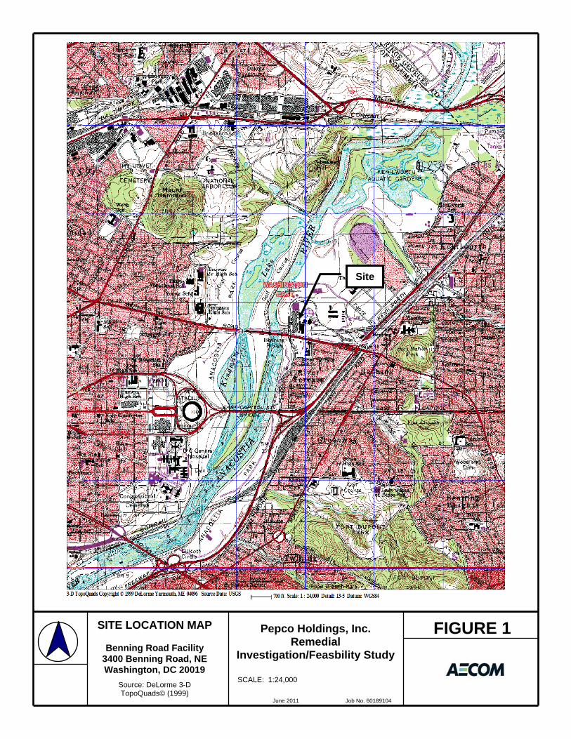
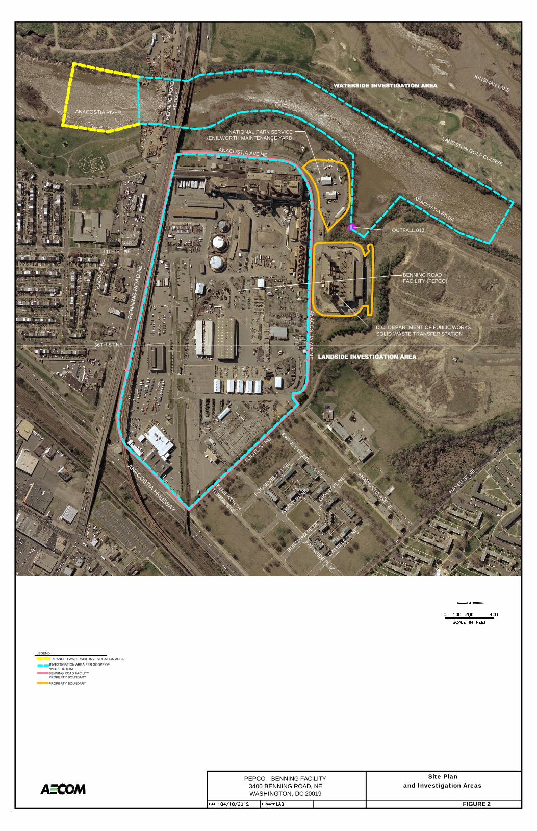
The 77-acre Site is bordered by the District Department of Public Works (DPW) Solid Waste Transfer Station to
the north, Kenilworth Maintenance Yard (owned by the National Park Service, NPS) to the northwest, the
Anacostia River to the west, Benning Road to the south and residential areas to the east and south (across
Benning Rd.). The general Site location is shown in Figure 1. A detailed Site map is provided as Figure 2. Most
of the Site is comprised of the Benning Service Center, which involves activities related to construction, operation
and maintenance of Pepco’s electric power transmission and distribution system serving the Washington, D.C.,
area. The Service Center accommodates more than 700 Pepco employees responsible for maintenance and
construction of Pepco’s electric transmission and distribution system; system engineering; vehicle fleet
maintenance and refueling; and central warehousing for materials, supplies and equipment. The Site is also the
location of the Benning Road Power Plant, which is scheduled to be shut down in 2012.
The Site is one of several properties along the Anacostia River that are suspected sources of contamination.
There have been five instances since 1985 in which materials containing polychlorinated biphenyls (PCBs) were
released at the Site. In each case, Pepco promptly cleaned up the releases in accordance with applicable legal
requirements. Nonetheless, it is suspected that these releases, and possibly other historical operations or
activities at the Site, may have contributed to contamination in the river. In particular, a site inspection conducted
for the U.S. Environmental Protection Agency (USEPA) in 2009 linked polycyclic aromatic hydrocarbons (PAH),
PCBs, and inorganic constituents detected in Anacostia River sediments to potential historical discharges from
the Site. The site inspection contractor also stated that currently the Site is properly managed and that any spills
or leaks of hazardous substances are quickly addressed and, if necessary, properly remediated. The RI will
evaluate all spills at the Site as necessary.
2
Benning Road Facility FINAL April 2012 RI/FS Scope of Work
The purpose of the RI/FS described herein is to (a) characterize environmental conditions within the Study Area,
(b) investigate whether and to what extent past or current conditions at the Site have caused or contributed to
contamination of the river, (c) assess current and potential risk to human health and environment posed by
conditions within the Study Area, and (d) develop and evaluate potential remedial actions. As described below,
the Study Area consists of a “landside” component which will focus on the Site itself, and a “waterside”
component that will focus on the shoreline and sediments in the segment of the river adjacent to and immediately
downstream of the Site. At the request of DDOE, Pepco has agreed to expand the waterside area of investigation
approximately 500 feet further downstream of the area specified in the RI/FS Scope of Work Outline that defines
Pepco’s obligations under the Consent Decree (see Appendix A). The landside and waterside areas of
investigation are depicted in Figure 2. The areas of investigation may be further adjusted or expanded during the
course of the RI as warranted based on the findings of the investigation.
The RI/FS will be overseen by the District Department of the Environment (DDOE) and will be performed in
accordance with USEPA’s Guidance for Conducting Remedial Investigations and Feasibility Studies Under
CERCLA, Office of Solid Waste and Emergency Response (OWSER) Directive 9355.3-01, dated October 1988,
and other applicable USEPA and DDOE guidance documents. This Scope of Work describes the specific tasks
to be performed as part of the RI/FS. As provided in the Consent Decree, upon approval of the Scope of Work by
DDOE (after consideration of public comments), Pepco will prepare an RI/FS Work Plan that will describe the
specific manner in which the various RI/FS tasks will be performed, including the specific sampling methodology
and the location of sampling points, and the framework and criteria for analyzing sampling data and evaluating
potential remedial options.
DDOE will use the results of the RI/FS to determine whether and to what extent remedial action is warranted and
to select appropriate remedial actions.
This RI/FS SOW consists of the following four specific tasks:
• Task 1 – Community Relations
• Task 2 – Scoping and Preparation of Work Plans
• Task 3 – Remedial Investigation
• Task 4 – Feasibility Study
Each of these tasks is described further in the following sections.

3
Benning Road Facility FINAL April 2012 RI/FS Scope of Work
TASK 1: Community Relations
1.1 Development and Implementation of Community Involvement Plan
Pepco will prepare a Community Involvement Plan (CIP) for review and approval by DDOE. The CIP will identify
issues of potential community concern regarding the ongoing environmental activities being performed in and
around the Study Area, and will outline community involvement activities to be undertaken. The plan will provide
the framework for communicating information to the public about the RI/FS, and shall incorporate procedures for
ensuring that members of the public are provided the opportunity to review and comment on the following
deliverables for at least 30 days prior to final approval by DDOE: (a) this Scope of Work ; (b) the Community
Involvement Plan; (c) the RI/FS Work Plan; (d) the Conceptual Site Model; (e) the Field Sampling Plan; (f) the
Quality Assurance Project Plan; (g) the Health and Safety Plan; (h) the Remedial Investigation Report, and (i) the
Feasibility Study Report. An outline of the CIP is provided in Appendix B.
1.2 Support the Administrative Record
Pepco will support DDOE’s efforts to compile and maintain the administrative record for the RI/FS work, and to
make the record available to the public. Pepco will provide deliverables required in the format and number
requested by DDOE for that purpose.

4
Benning Road Facility FINAL April 2012 RI/FS Scope of Work
TASK 2: Scoping and Preparation of Work Plans
Scoping is the initial planning process for the RI/FS and it is continued and refined throughout the RI/FS
project. The RI/FS planning process will include the following activities:
• Review of Existing Data and Development of Conceptual Site Model (CSM)
• Planning the Scope of Investigation
• Preparation of Work Plans
• Regulatory Review and Public Comment
These activities are further described in the following paragraphs.
2.1 Review of Existing Data and Development of Conceptual Site Model
Pepco will gather and analyze existing available data and information regarding past and present
environmental conditions at the Site and in the adjacent segment of the Anacostia River, including results
from previous investigations and sampling events and information regarding handling and disposal of
waste or hazardous substances at the Site. This information will be used to identify additional data needs
and to develop a preliminary range of potential remedial alternatives. A preliminary list of documents to
be analyzed is presented in Table 1. This list will be revised/updated as additional information becomes
available.
Information obtained from the data reviews regarding contaminant sources, pathways, and receptors will
be used to develop a preliminary Conceptual Site Model (CSM) of the Study Area to evaluate potential
risks to human health and the environment. The CSM will identify sources of contamination, affected
media, routes of migration, human and environmental receptors, and potential routes of exposure after
accounting for the existing institutional, administrative and engineering controls (e.g., 24-hour controlled
Site access, paved surfaces and employee hazard communication training program) that may eliminate or
control exposures to on-site and off-site receptors. The CSM is useful in identifying further sampling
needs and potential remedial technologies to mitigate any identified risks. A preliminary CSM will be
included in the RI/FS Work Plan. The CSM will be updated as more data becomes available through the
RI/FS activities.
5
Benning Road Facility FINAL April 2012 RI/FS Scope of Work
2.2 Planning Scope of Investigation
The field investigation will be designed to characterize conditions in soil, groundwater, surface water,
hydric soils in wetlands, and sediment, further refine the CSM, and collect data to support risk
assessment and Natural Resource Damage Assessment (NRDA). Specific data gaps identified during
the review of existing data will be used to guide the scope of the investigation. In general, the
investigation will include the following elements:
• A landside investigation of the Site and select adjacent properties to which access is provided
(e.g., the District DPW Solid Waste Transfer Station and NPS Kenilworth Maintenance Yard) will
address existing landside soil and groundwater conditions, and their effects on the Anacostia
River.
• A waterside Investigation will primarily address sediment conditions within a segment of the
Anacostia River adjacent to the Site. As specified in the Scope of Work Outline at Appendix A,
the waterside area of investigation orignally consisted of an approximately 10-15 acre portion of
the Anacostia River along 2,500 linear feet of the river, approximately 1,500 linear feet to the
south and 1,000 linear feet to the north of the Site’s main storm water outfall, with the Benning
Road Bridge as the approximate southern boundary of the study area. At the request of DDOE,
Pepco has agreed to expand the waterside area of investigation approximately 500 feet further
downstream to include the location of sediment sampling point PB-SD-04, where a sample was
collected by USEPA as part of its 2009 site inspection. The original and expanded waterside
areas of investigation are shown on Figure 2.
• Additional sampling outside of the Study Area delineated on Figure 2 will be planned as may be
warranted by the results of initial investigation activties.
• The investigation will focus on PAHs, PCBs, and metals, with limited screening samples for
volatile organic compounds (VOCs), semi-volatile organic compounds (SVOCs), pesticides, and
dioxins/furans based on knowledge of past operations.
6
Benning Road Facility FINAL April 2012 RI/FS Scope of Work
2.3 Preparation of Work Plans
2.3.1 RI/FS Work Plan
Upon completion of the scoping process, Pepco will prepare an overall RI/FS Work Plan for submittal to
DDOE. The Work Plan will describe the overall technical approach for the RI/FS. It will include a
description and analysis of data from previous investigations and remedial actions at the Site and a
description of the preliminary CSM based on information on contaminant sources, pathways and
receptors at the Site. The Work Plan will describe the data gaps to be addressed by the RI and include a
comprehensive description of the work to be performed, the media to be investigated (e.g., surface water,
ground water, soil, sediments, hydric soils in wetlands, etc.), and the methodology to be utilized, and shall
describe the project management approach, communication procedures including progress reporting to
DDOE, and permit requirements. The Work Plan also will identify each major deliverable and will include
a comprehensive schedule for completion of each major activity. An outline of the Work Plan is included
as Appendix C.
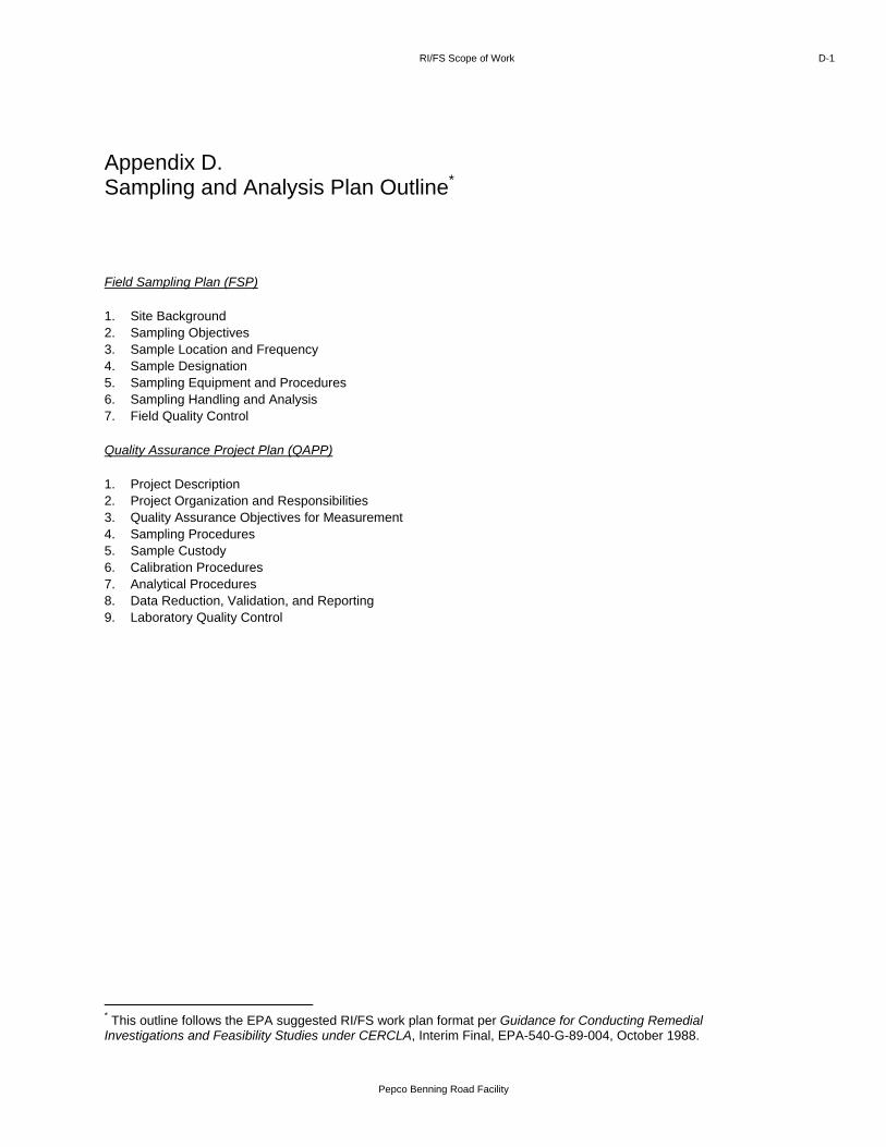
2.3.2 Sampling and Analysis Plan
A Sampling and Analysis Plan (SAP) will be prepared in conjunction with the RI/FS Work Plan. The SAP
consists of two parts: (a) a Field Sampling Plan (FSP) that provides detailed guidance for all field work by
defining in detail the sampling locations and the sampling and data gathering methods to be used; and (b)
a Quality Assurance Project Plan (QAPP) that describes quality assurance and quality control protocols
necessary to achieve Data Quality Objectives (DQOs) dictated by the intended use of the data. An
outline of the SAP document is provided in Appendix D.
2.3.3 Health and Safety Plan
A Site-specific Health and Safety Plan (HASP) will be prepared in conjunction with the RI/FS Work Plan to
ensure safety of Site workers during the investigation activities for both the landside and waterside
investigations. The HASP will be prepared in accordance with the Occupational Safety and Health
Administration (OSHA) Hazardous Waste Operations and Emergency Response Standard (29 CFR
1910.120) and the Construction Industry Standard (29 CFR 1926). The HASP will discuss task-specific
hazard analyses, air monitoring for personnel safety, personal protective equipment recommendations,
Site controls, equipment and personnel decontamination, medical monitoring and training requirements,
and emergency response procedures. With respect to the waterside investigation, the HASP will require
all personnel operating on work boats to be trained for the task at hand and familiar with the United States
Coast Guard (USCG) policies and procedures. All field activities will be conducted in accordance with the
approved HASP. A HASP outline is provided in Appendix E.

7
Benning Road Facility FINAL April 2012 RI/FS Scope of Work
2.4 Regulatory Review and Public Comment
The RI/FS Work Plan, SAP and HASP are subject to review and approval by DDOE. DDOE also may
solicit comments from other regional and federal agencies. In addition, DDOE will solicit public comments
on the RI/FS Work Plan, SAP and HASP in accordance with the CIP described above. Pepco will revise
the RI/FS Work Plan, SAP, and HASP, as appropriate to address comments from DDOE, other regulatory
agencies, and the public.
8
Benning Road Facility FINAL April 2012 RI/FS Scope of Work
TASK 3: Remedial Investigation
Pepco will perform a Remedial Investigation (RI) by implementing the SAP and related work plans with
the overall objective characterizing conditions in soil, groundwater, surface water, hydric soils in wetlands,
sediment, and collecting data to refine the CSM and support risk assessments and a Natural Resources
Damage Assessment. Various steps involved in the RI process are described in the following
paragraphs.
3.1 Field Investigation
A general description of the technical approach for the RI field investigation is provided below. Additional
technical details will be described in the Work Plan documents.
3.1.1 Landside Investigation
Based on the detailed review of Site history and prior environmental investigations pursuant to Task 2
(Scoping), the landside investigation will include collection and analysis of soil and groundwater samples
at the Site to identify areas that have potential to contribute to surface water or sediment contamination.
The areas to be sampled will include areas where historical PCB spills and cleanups occurred, areas
where petroleum underground storage tanks (USTs) were removed, and current and historical PCB
storage/handling buildings. The sampling effort will proceed in two phases to allow careful review and
consideration of the findings of the initial contaminant delineation phase of work, followed by additional
delineation and optimized risk evaluation. Phase 1 will involve soil borings and Geoprobe sampling to
screen the areas of potential concern and identify any continuing sources of contamination. Phase 2 will
be a detailed hydrogeologic investigation involving the installation and monitoring of groundwater wells
based on the Geoprobe and soil boring data collected in Phase 1. The sampling program will incorporate
a progressive elimination approach that allows the use of screening parameters to screen larger areas to
help focus resources on potential problem areas.
3.1.2 Waterside Investigation
The waterside investigation will be conducted in two primary phases of field work. Data collected during
the first phase of work will be used to refine the scope and nature of work for Phase 2. In general, Phase
1 of the waterside investigation will focus on defining the nature and extent of constituents of potential
concern in sediments adjacent to the Site and selected background locations. Following the evaluation of
Phase 1 findings, Phase 2 will be implemented to refine delineation of chemical data, and add
toxicological, benthic, and geotechnical information from selected portions of the waterside investigation
9
Benning Road Facility FINAL April 2012 RI/FS Scope of Work
area. Pepco will also incorporate a progressive elimination approach into the waterside sampling
program. This approach allows the use of screening parameters to screen larger areas to help focus
resources on potential problem areas.
3.2 Data Analysis and Management
Pepco will analyze and evaluate data collected during the field investigations to describe (a) the physical
and biological characteristics of the Site that are relevant to contaminant migration and potential receptors,
(b) the contaminant source characteristics, (c) the nature and extent of contamination, and (d) contaminant
fate and transport. The evaluation will include information relevant to characteristics of the Site and the
adjacent segment of the river necessary to the identification and evaluation of potential remedial
alternatives. The information from the Phase 1 data evaluation will be used to identify areas of interest and
significant data gaps, if any. This information will then be used to optimize the selection of Phase 2
sampling locations.
Pepco will consistently document the quality and validity of field and laboratory data compiled during the RI
according to methods to be specified in the relevant work plans. Pepco will develop an analytical database
for laboratory data and field measurements. Appropriate quality control procedures will be developed to
ensure that the data collected during the investigation are of adequate quality and quantity to support the
intended data uses. A representative sample of the collected data (~10-20%) will be validated at the
appropriate field or laboratory quality control level. The data validation reports will be included into the RI
Report appendices.
Data evaluation will include analysis and presentation of all investigation data in an organized and logical
manner so that the investigation results for each medium are apparent. The investigation results will be
reduced, compiled, and presented in tabular and graphical forms.
3.3 Exposure Assessment and Risk Analysis
As part of the RI, Pepco will perform Human Health and Ecological Risk Assessments using validated data
obtained during the RI field investigation.
3.3.1 Human Health Risk Assessment
Pepco will conduct a Human Health Risk Assessment (HHRA) in accordance with appropriate USEPA risk
assessment guidance documents. The HHRA will address complete exposure pathways for human
receptors within the Study Area as identified in the Conceptual Site Model, which will be a part of the RI/FS
Work Plan.
10
Benning Road Facility FINAL April 2012 RI/FS Scope of Work
There are institutional, administrative and engineering controls (e.g., 24-hour controlled Site access, paved
surfaces, and employee hazard communication training program) currently in place that help eliminate or
control exposures to on-site and off-site receptors. The 2009 Tetra Tech study commissioned by EPA also
concluded that soil exposure at the Site is not a significant pathway and that there are no drinking water
targets associated with the groundwater pathway. These findings and the existing controls will be further
evaluated in the RI/FS Work Plan to determine the complete exposure pathways to be included in the
HHRA.
The HHRA will evaluate potential human health effects using the four step paradigm as identified by the
USEPA in the Risk Assessment Guidance for Superfund, Volume I – Human Health Evaluation Manual
(USEPA, 1989). The steps are:
• Data Evaluation and Hazard Identification
• Toxicity Assessment
• Exposure Assessment
• Risk Characterization
Initial data evaluation and hazard identification will be conducted in a screening-level human health risk
assessment (SLHHRA). Based on the results of the SLHHRA, Constituents of Potential Concern (COPC)
and environmental media that warrant further evaluation in the baseline HHRA will be identified. The
SLHHRA will include refinement of the preliminary CSM for human health to identify potential receptors and
potential exposure pathways to environmental media at the Site. Concentrations of chemicals in Site media
will be compared to conservative, risk-based screening levels (RBSLs) determined to be protective of
human health under all exposure scenarios. Based on the outcome of the screening evaluation, the media
and COPCs for evaluation in the baseline HHRA will be identified. The HHRA will be used to evaluate
potential human health risks associated with exposure to environmental media at the Site. The results of
the HHRA will be used to help inform the need for any additional evaluation and/or remedial action for the
Study Area.
3.3.2 Ecological Risk Assessment
Pepco will conduct an Ecological Risk Assessment (ERA) based on the findings of the waterside and
landside field investigation to evaluate potential ecological risks associated with exposure to environmental
media within or along the Anacostia River adjacent to the Site. The ERA will include the following activities:
11
Benning Road Facility FINAL April 2012 RI/FS Scope of Work
• Literature review of previous investigations and assessments of conditions in the Anacostia River
• Identification of potential exposure pathways • Identification of potentially exposed populations • Screening relative to literature-based ecological risk screening values • Screening level risk assessments and targeted risk calculations • Recommendations regarding the need for additional/expanded risk assessment
The ERA will be conducted according to the general tiered approach and methodology provided by the
USEPA Ecological Risk Assessment Guidance for Superfund (ERAGS), Process for Designing and
Conducting Ecological Risk Assessment, Interim Final (USEPA, 1997), Guidelines for Ecological Risk
Assessment (USEPA, 1998), and The Role of Screening-Level Risk Assessments and Refining
Contaminants of Concern in Baseline Ecological Risk Assessments (USEPA, 2001).
Each successive tier of the ERA process requires more detailed and quantitative data analysis and
interpretation. Conducting assessments in a tiered, step-wise manner maximizes the use of available
information and sampling data, while providing the opportunity to reduce the uncertainties inherent in the
ERA process through the use of focused supplemental data collection to fill key data gaps identified in the
previous tier of the assessment, as necessary.
The results of the ERA will be used to inform the need for any additional evaluation and/or remedial action
at the Site or in the Anacostia River.
3.4 Remedial Investigation Report
Upon completion of field activities and receipt of the analytical data, Pepco will prepare a draft RI Report for
submittal to DDOE. The report will include the following elements:
• Site description with past and current operations including surrounding land use, surface features
(e.g., storm drain system, former sludge dewatering area), and on-site structures and facilities (e.g.,
USTs, ASTs, piping, underground utilities)
• Site history and previous investigations/remedial actions
• Description of field activities
• Results of field activities to determine physical characteristics (e.g., surface water hydrology,
geology/hydrogeology, ecology, etc.)
• Nature and extent of contamination
12
Benning Road Facility FINAL April 2012 RI/FS Scope of Work
• Contaminant fate and transport
• Results of the HHRA and ERA
• Findings and conclusions
• Recommendations
Geologic logs, laboratory data, validation reports, and pertinent field data logs will be included as
attachments.
Pepco will submit a final RI Report following regulatory review of the draft RI report.
3.5 Regulatory Review and Public Comment
The RI Report is subject to review and approval by DDOE. DDOE also may solicit comments from other
regional and federal agencies. In addition, DDOE will solicit public comments on the draft RI Report in
accordance with the CIP described above. Pepco will revise the RI Report as appropriate to address
comments from DDOE, other regulatory agencies, and the public.

13
Benning Road Facility FINAL April 2012 RI/FS Scope of Work
TASK 4: Feasibility Study
Pepco will conduct a Feasibility Study (FS) based on the results of the RI. The objectives of the FS are to
(a) identify remediation requirements and establish cleanup levels as necessary to eliminate or prevent
unacceptable risks to human health and the environment, and (b) identify, screen and evaluate potential
remedial alternatives. Various steps involved in the FS process are described in the following
paragraphs.
4.1 Identification of Remediation Requirements and Establishment of Remedial Objectives
The FS will identify areas and volumes of media within the Study Area for which remedial actions are
necessary either (a) to eliminate or control conditions posing an unacceptable risk to human health and
the environment (after accounting for existing institutional, administrative and engineering controls at the
Site); or (b) to prevent the migration of contamination from the Site to the river that would cause or
contribute to an unacceptable risk to human health or the environment. All calculations related to area
and volume estimates will be documented in the FS Report. For the areas where a remediation
requirement is identified, Pepco will develop remedial action objectives (RAOs) and preliminary remedial
goals (PRGs) in consultation with DDOE. The PRGs will be developed based on Site-specific risk factors
and will take into account existing institutional, administrative, and engineering controls. The FS Report
will describe the rationale for any cleanup levels established.
4.2 Development and Screening of Remedial Alternatives
Remedial alternatives are developed concurrently with the RI phase, with the results of one influencing the
other in an iterative fashion. Pepco will identify and screen a focused set of technologies that have the
potential to achieve the RAOs. This step will consider USEPA presumptive remedy guidance and USEPA’s
Contaminated Sediment Remediation Guidance for Hazardous Waste Sites (2005) and any other relevant
guidance document. Pepco will develop general response actions (such as containment, treatment,
excavation, pumping, institutional controls (e.g., deed restrictions), engineering controls (e.g.,
encapsulation), or other actions, singly or in combination) for each medium of interest (e.g., soil, sediment,
surface water, ground water, hydric soils in wetlands) to achieve RAOs, and will identify and evaluate
technologies applicable to each general response action to eliminate those that cannot be implemented at
the Study Area. Consistent with USEPA guidance, the range of remedial options to be considered will
include, at a minimum (a) alternatives in which treatment is used to reduce the toxicity, mobility or volume of
contaminants, (b) alternatives that involve containment with little or no treatment, and (c) a no-action
alternative. Screening of technologies will be based on effectiveness, implementability, and relative cost.
14
Benning Road Facility FINAL April 2012 RI/FS Scope of Work
Technologies retained after the screening process will be assembled into alternatives for each remediation
area.
4.3 Treatability Studies
Pepco will perform treatability studies as necessary to assist in the detailed analysis of alternatives.
Treatability studies are generally performed to determine the effectiveness of a technology in achieving
the targeted cleanup levels, to obtain design parameters for a full-scale process, or to screen multiple
process options of a particular technology. Treatability studies are important when technologies have not
been sufficiently demonstrated or characterization data alone is insufficient to predict treatment
performance or to estimate the size and cost of treatment units. Treatability studies can be conducted on
a bench-scale in the laboratory or on a pilot-scale at the Study Area depending on the study objectives.
The need for treatability studies will be determined once the initial screening of technologies is completed
and sufficient data from the RI are available.
4.4 Detailed Analysis of Alternatives
Pepco will conduct a detailed analysis of the alternatives that have been assembled and retained. This
analysis will consist of an individual evaluation of each alternative against the following evaluation criteria
and a comparative evaluation of all options against the evaluation criteria with respect to one another:
• Overall protection of human health and the environment
• Compliance with applicable regulations
• Long-term effectiveness
• Reduction of toxicity, mobility, or volume through treatment
• Short-term effectiveness
• Implementability
• Cost
• DDOE acceptance
• Community acceptance
15
Benning Road Facility FINAL April 2012 RI/FS Scope of Work
4.5 Feasibility Study Report
Upon completion of the detailed evaluation of alternatives, Pepco will prepare a draft FS Report for submittal
to DDOE. The report will (a) document the location and extent of media requiring remediation and describe
the associated cleanup levels and RAOs, (b) describe the results of the identification and screening of
alternatives, and the detailed evaluation of alternatives, and (c) identify a preferred alternative for remedial
action.
Pepco will submit a final FS Report following regulatory review of the draft FS Report.
4.6 Regulatory Review and Public Comment
The FS Report is subject to review and approval by DDOE. DDOE also may solicit comments from other
regional and federal agencies. In addition, DDOE will solicit public comments on the draft FS Report in
accordance with the CIP described above. Pepco will revise the FS Report as appropriate to address
comments from DDOE, other regulatory agencies, and the public.

Benning Road Facility FINAL April 2012 RI/FS Scope of Work
Table
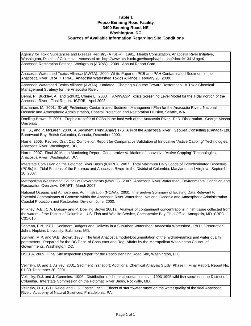
Table 1Pepco Benning Road Facility
3400 Benning Road, NEWashington, DC
Sources of Available Information Regarding Site Conditions
Agency for Toxic Substances and Disease Registry (ATSDR). 1991. Health Consultation, Anacostia River Initiative, Washington, District of Columbia. Accessed at: http://www.atsdr.cdc.gov/hac/pha/pha.asp?docid=1341&pg=0 Anacostia Restoration Potential Workgroup (ARPW). 2009. Annual Report Card.
Anacostia Watershed Toxics Alliance (AWTA). 2009. White Paper on PCB and PAH Contaminated Sediment in the Anacostia River. DRAFT FINAL. Anacostia Watershed Toxics Alliance. February 23, 2009.
Anacostia Watershed Toxics Alliance (AWTA). Undated. Charting a Course Toward Restoration: A Toxic Chemical Management Strategy for the Anacostia River.
Behm, P., Buckley, A., and Schultz, Cherie L. 2003. TAM/WASP Toxics Screening Level Model for the Tidal Portion of the Anacostia River. Final Report. ICPRB. April 2003.
Buchanon, M. 2001. (Draft) Preliminary Contaminated Sediment Management Plan for the Anacostia River. National Oceanic and Atmospheric Administration, Coastal Protection and Restoration Division, Seattle, WA.
Doelling-Brown, P. 2001. Trophic transfer of PCBs in the food web of the Anacostia River. PhD. Dissertation. George Mason University.
Hill, S., and P. McLaren. 2000. A Sediment Trend Analysis (STA®) of the Anacostia River. GeoSea Consulting (Canada) Ltd. Brentwood Bay, British Columbia, Canada, December 2000.
Horne, 2005. Revised Draft Cap Completion Report for Comparative Validation of Innovative “Active Capping” Technologies, Anacostia River, Washington, DC.
Horne, 2007. Final 30 Month Monitoring Report, Comparative Validation of Innovative “Active Capping” Technologies, Anacostia River, Washington, DC.
Interstate Comission on the Potomac River Basin (ICPRB). 2007. Total Maximum Daily Loads of Polychlorinated Biphenyls (PCBs) for Tidal Portions of the Potomac and Anacostia Rivers in the District of Columbia, Maryland, and Virginia. September 28, 2007.
Metropolitan Washington Council of Governments (MWCG). 2007. Anacostia River Watershed: Environmental Condition and Restoration Overview. DRAFT. March 2007.
National Oceanic and Atmospheric Administration (NOAA). 2000. Interpretive Summary of Existing Data Relevant to Potential Contaminants of Concern within the Anacostia River Watershed. National Oceanic and Atmospheric Administration. Coastal Protection and Restoration Division. June, 2000.
Pinkney, A.E., C.A. Dobony and P. Doelling Brown 2001a. Analysis of contaminant concentrations in fish tissue collected fromthe waters of the District of Columbia. U.S. Fish and Wildlife Service, Chesapeake Bay Field Office, Annapolis, MD CBFO-C01-01b
Scatena, F.N. 1987. Sediment Budgets and Delivery in a Suburban Watershed: Anacostia Watershed., Ph.D. Dissertation; Johns Hopkins University, Baltimore, MD.
Sullivan, M.P. and W.E. Brown, 1988. The tidal Anacostia model-Documentation of the hydrodynamics and water quality parameters. Prepared for the DC Dept. of Consumer and Reg. Affairs by the Metropolitan Washington Council of Governments, Washington, DC.
USEPA. 2009. Final Site Inspection Report for the Pepco Benning Road Site, Washington, D.C.
Velinsky, D. and J. Ashley. 2001. Sediment Transport: Additional Chemical Analysis Study, Phase II. Final Report. Report No. 01-30. December 20, 2001.
Velinsky, D.J. and J. Cummins. 1996. Distribution of chemical contaminants in 1993-1995 wild fish species in the District of Columbia. Interstate Commission on the Potomac River Basin, Rockville, MD.
Velinsky, D.J., G.H. Reidel and G.D. Foster. 1999. Effects of stormwater runoff on the water quality of the tidal Anacostia River. Academy of Natural Sciences, Philadelphia, PA.
Page 1 of 1

Benning Road Facility FINAL April 2012 RI/FS Scope of Work
Figures
SITE LOCATION MAP
Benning Road Facility 3400 Benning Road, NE Washington, DC 20019
Job No. 60189104
Pepco Holdings, Inc. Remedial
Investigation/Feasbility Study
FIGURE 1
Source: DeLorme 3-D TopoQuads© (1999)
SCALE: 1:24,000
June 2011
Site
BEN
NIN
G R
OA
D N
E
FOOTE ST NE
ROOSEVELT PL N
E
GRANT PL NE
GRANT PL NE
HAYES ST NEANACOSTIA FREEW
AY
KENILWORTH
TERRACE NE
PARKSIDE PL NE
BURNHAM PL NE
CASSELL PL N
E
BARNES ST NE
ANACOSTIA AVE NE
JAY ST NE
ANACOSTIA RIVER
LANGSTON GOLF COURSE
KINGMAN LAKE
OUTFALL 013
36TH ST NE
EAD
S S
T N
E
34TH ST NE
ANACOSTIA AVE NE
AN
AC
OS
TIA AVE
NE
BEN
NIN
G R
OAD
BR
IDG
E
BENNING ROADFACILITY (PEPCO)
NATIONAL PARK SERVICEKENILWORTH MAINTENANCE YARD
D.C. DEPARTMENT OF PUBLIC WORKSSOLID WASTE TRANSFER STATION
ANACOSTIA RIVER
INVESTIGATION AREA PER SCOPE OFWORK OUTLINEBENNING ROAD FACILITYPROPERTY BOUNDARY
PROPERTY BOUNDARY
LEGEND:
Site PlanPEPCO - BENNING FACILITY3400 BENNING ROAD, NEWASHINGTON, DC 20019
EXPANDED WATERSIDE INVESTIGATION AREA
and Investigation Areas
FIGURE 2
Benning Road Facility FINAL April 2012 RI/FS Scope of Work
Appendix A
RI/FS Scope of Work Outline
FINAL December 10, 2010
PEPCO BENNING ROAD SITE
RI/FS SCOPE OF WORK OUTLINE
Page 1 of 3
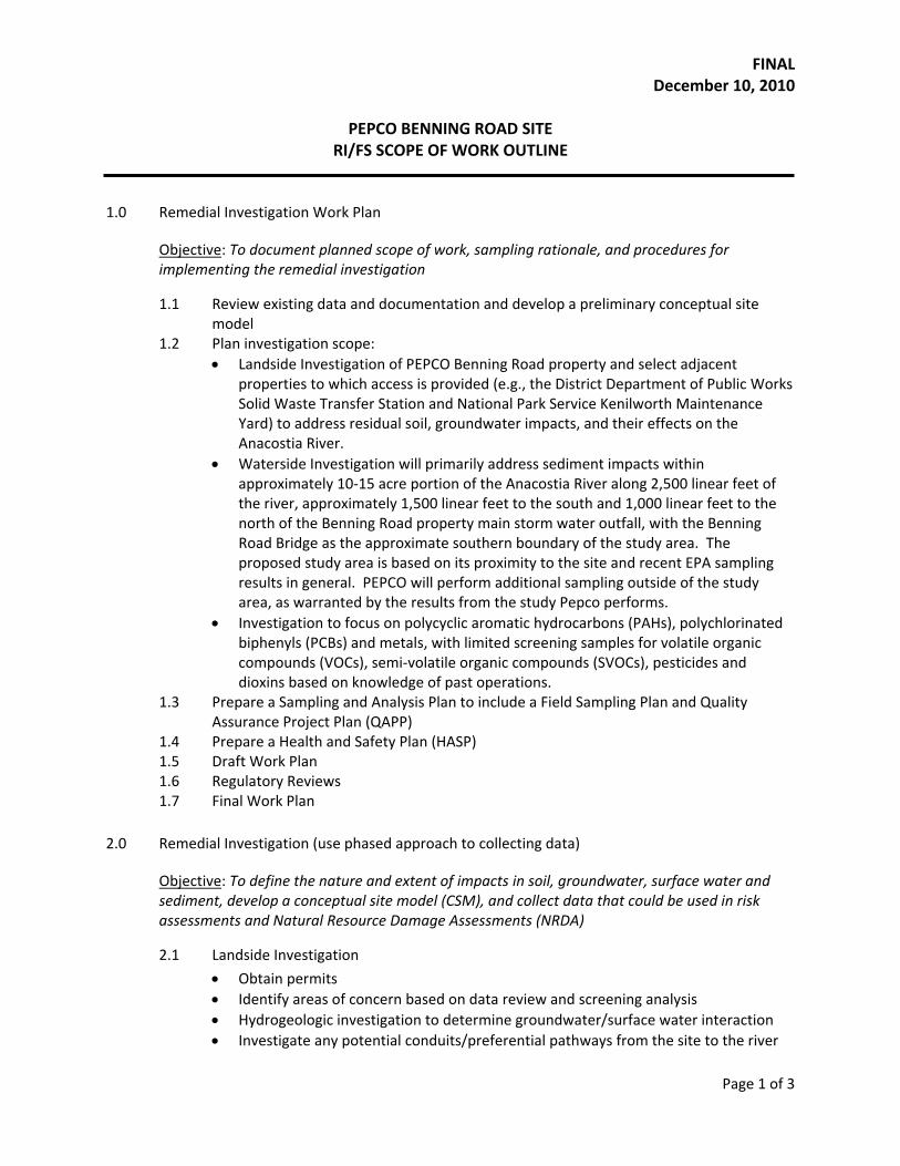
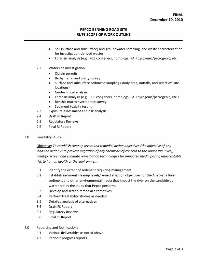
1.0 Remedial Investigation Work Plan
Objective: To document planned scope of work, sampling rationale, and procedures for implementing the remedial investigation
1.1 Review existing data and documentation and develop a preliminary conceptual site model
1.2 Plan investigation scope: • Landside Investigation of PEPCO Benning Road property and select adjacent
properties to which access is provided (e.g., the District Department of Public Works Solid Waste Transfer Station and National Park Service Kenilworth Maintenance Yard) to address residual soil, groundwater impacts, and their effects on the Anacostia River.
• Waterside Investigation will primarily address sediment impacts within approximately 10‐15 acre portion of the Anacostia River along 2,500 linear feet of the river, approximately 1,500 linear feet to the south and 1,000 linear feet to the north of the Benning Road property main storm water outfall, with the Benning Road Bridge as the approximate southern boundary of the study area. The proposed study area is based on its proximity to the site and recent EPA sampling results in general. PEPCO will perform additional sampling outside of the study area, as warranted by the results from the study Pepco performs.
• Investigation to focus on polycyclic aromatic hydrocarbons (PAHs), polychlorinated biphenyls (PCBs) and metals, with limited screening samples for volatile organic compounds (VOCs), semi‐volatile organic compounds (SVOCs), pesticides and dioxins based on knowledge of past operations.
1.3 Prepare a Sampling and Analysis Plan to include a Field Sampling Plan and Quality Assurance Project Plan (QAPP)
1.4 Prepare a Health and Safety Plan (HASP) 1.5 Draft Work Plan 1.6 Regulatory Reviews 1.7 Final Work Plan
2.0 Remedial Investigation (use phased approach to collecting data)
Objective: To define the nature and extent of impacts in soil, groundwater, surface water and sediment, develop a conceptual site model (CSM), and collect data that could be used in risk assessments and Natural Resource Damage Assessments (NRDA)
2.1 Landside Investigation
• Obtain permits • Identify areas of concern based on data review and screening analysis • Hydrogeologic investigation to determine groundwater/surface water interaction • Investigate any potential conduits/preferential pathways from the site to the river
FINAL December 10, 2010
PEPCO BENNING ROAD SITE
RI/FS SCOPE OF WORK OUTLINE
Page 2 of 3
• Soil (surface and subsurface) and groundwater sampling, and waste characterization for investigation‐derived wastes
• Forensic analysis (e.g., PCB congeners, homologs, PAH pyrogenic/petrogenic, etc. 2.2 Waterside Investigation
• Obtain permits • Bathymetric and utility survey • Surface and subsurface sediment sampling (study area, outfalls, and select off‐site
locations) • Geotechnical analysis • Forensic analysis (e.g., PCB congeners, homologs, PAH pyrogenic/petrogenic, etc.) • Benthic macroinvertebrate survey • Sediment toxicity testing
2.3 Exposure assessment and risk analysis 2.4 Draft RI Report 2.5 Regulatory Reviews 2.6 Final RI Report
3.0 Feasibility Study
Objective: To establish cleanup levels and remedial action objectives (the objective of any landside action is to prevent migration of any chemicals of concern to the Anacostia River); identify, screen and evaluate remediation technologies for impacted media posing unacceptable risk to human health or the environment
3.1 Identify the extent of sediment requiring management 3.2 Establish sediment cleanup levels/remedial action objectives for the Anacostia River
sediment and other environmental media that impact the river on the Landside as warranted by the study that Pepco performs
3.3 Develop and screen remedial alternatives 3.4 Perform treatability studies as needed 3.5 Detailed analysis of alternatives 3.6 Draft FS Report 3.7 Regulatory Reviews 3.8 Final FS Report
4.0 Reporting and Notifications
4.1 Various deliverables as noted above 4.2 Periodic progress reports

FINAL December 10, 2010
PEPCO BENNING ROAD SITE
RI/FS SCOPE OF WORK OUTLINE
Page 3 of 3
5.0 Community Relations
5.1 Develop and execute an approved community involvement plan 5.2 Support the Administrative Record as established, developed and maintained by DDOE
6.0 RI/FS Schedule (to be provided in the work plan)
7.0 Guidance
The RI/FS will be conducted pursuant to relevant US EPA guidelines and standards, i.e., “Guidance for Conducting Remedial Investigations and Feasibility Studies under CERCLA”, OSWER Directive 9355.3‐01, dated October 1988.
Benning Road Facility FINAL April 2012 RI/FS Scope of Work
Appendix B
Community Involvement Plan Outline
RI/FS Scope of Work B-1
Pepco Benning Road Facility
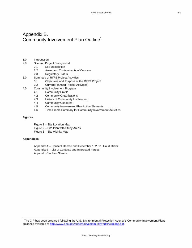
1.0 Introduction 2.0 Site and Project Background
2.1 Site Description 2.2 Areas and Contaminants of Concern 2.3 Regulatory Status
3.0 Summary of RI/FS Project Activities 3.1 Objectives and Purpose of the RI/FS Project 3.2 Current/Planned Project Activities
4.0 Community Involvement Program 4.1 Community Profile 4.2 Community Organizations 4.3 History of Community Involvement 4.4 Community Concerns 4.5 Community Involvement Plan Action Elements 4.6 Time Frame Summary for Community Involvement Activities
Figures
Figure 1 – Site Location Map Figure 2 – Site Plan with Study Areas Figure 3 – Site Vicinity Map
Appendices Appendix A – Consent Decree and December 1, 2011, Court Order Appendix B – List of Contacts and Interested Parties Appendix C – Fact Sheets
* The CIP has been prepared following the U.S. Environmental Protection Agency’s Community Involvement Plans guidance available at http://www.epa.gov/superfund/community/pdfs/7clplans.pdf.
Appendix B. Community Involvement Plan Outline*

Benning Road Facility FINAL April 2012 RI/FS Scope of Work
Appendix C
RI/FS Work Plan Outline
RI/FS Scope of Work C-1
Pepco Benning Road Facility
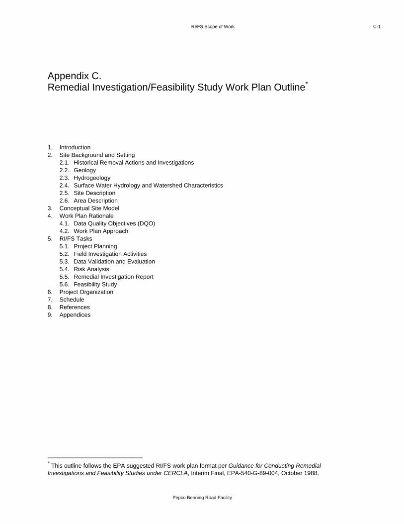
1. Introduction 2. Site Background and Setting
2.1. Historical Removal Actions and Investigations 2.2. Geology 2.3. Hydrogeology 2.4. Surface Water Hydrology and Watershed Characteristics 2.5. Site Description 2.6. Area Description
3. Conceptual Site Model 4. Work Plan Rationale
4.1. Data Quality Objectives (DQO) 4.2. Work Plan Approach
5. RI/FS Tasks 5.1. Project Planning 5.2. Field Investigation Activities 5.3. Data Validation and Evaluation 5.4. Risk Analysis 5.5. Remedial Investigation Report 5.6. Feasibility Study
6. Project Organization 7. Schedule 8. References 9. Appendices
* This outline follows the EPA suggested RI/FS work plan format per Guidance for Conducting Remedial Investigations and Feasibility Studies under CERCLA, Interim Final, EPA-540-G-89-004, October 1988.
Appendix C. Remedial Investigation/Feasibility Study Work Plan Outline*
Benning Road Facility FINAL April 2012 RI/FS Scope of Work
Appendix D
Sampling and Analysis Plan Outline
RI/FS Scope of Work D-1
Pepco Benning Road Facility
Field Sampling Plan (FSP)
1. Site Background 2. Sampling Objectives 3. Sample Location and Frequency 4. Sample Designation 5. Sampling Equipment and Procedures 6. Sampling Handling and Analysis 7. Field Quality Control
Quality Assurance Project Plan (QAPP)
1. Project Description 2. Project Organization and Responsibilities 3. Quality Assurance Objectives for Measurement 4. Sampling Procedures 5. Sample Custody 6. Calibration Procedures 7. Analytical Procedures 8. Data Reduction, Validation, and Reporting 9. Laboratory Quality Control
* This outline follows the EPA suggested RI/FS work plan format per Guidance for Conducting Remedial Investigations and Feasibility Studies under CERCLA, Interim Final, EPA-540-G-89-004, October 1988.
Appendix D. Sampling and Analysis Plan Outline*

Benning Road Facility FINAL April 2012 RI/FS Scope of Work
Appendix E
Health and Safety Plan Outline
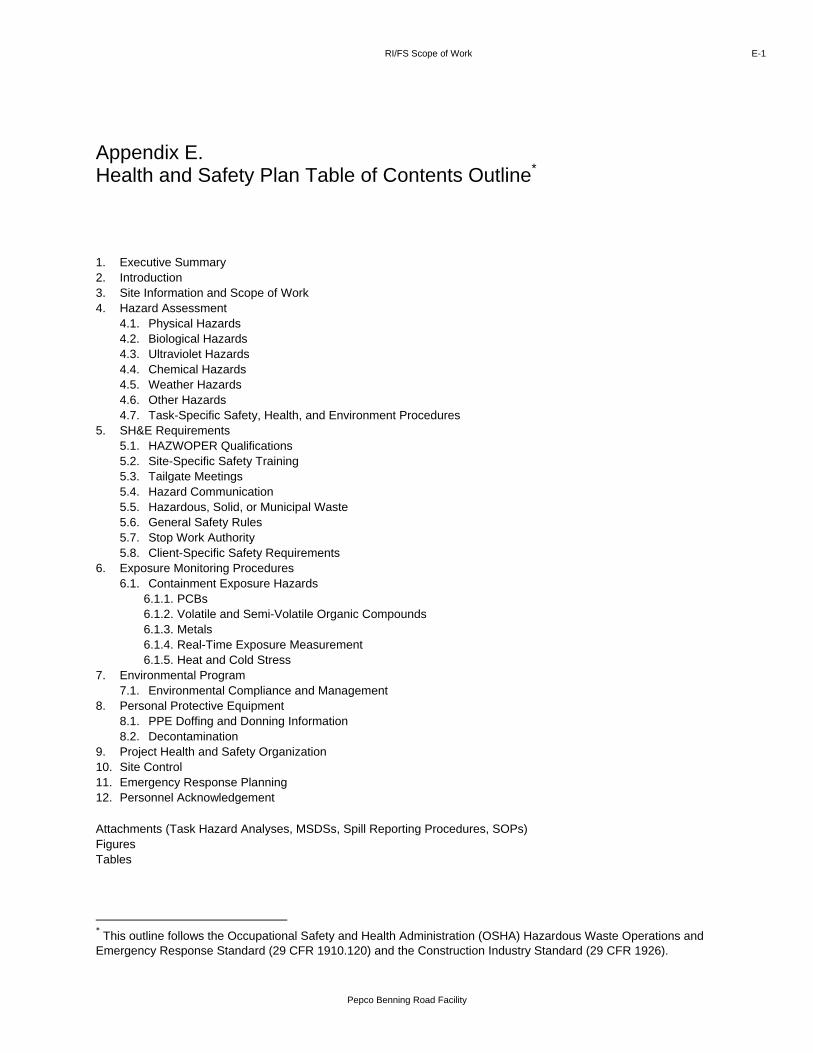
RI/FS Scope of Work E-1
Pepco Benning Road Facility
1. Executive Summary 2. Introduction 3. Site Information and Scope of Work 4. Hazard Assessment
4.1. Physical Hazards 4.2. Biological Hazards 4.3. Ultraviolet Hazards 4.4. Chemical Hazards 4.5. Weather Hazards 4.6. Other Hazards 4.7. Task-Specific Safety, Health, and Environment Procedures
5. SH&E Requirements 5.1. HAZWOPER Qualifications 5.2. Site-Specific Safety Training 5.3. Tailgate Meetings 5.4. Hazard Communication 5.5. Hazardous, Solid, or Municipal Waste 5.6. General Safety Rules 5.7. Stop Work Authority 5.8. Client-Specific Safety Requirements
6. Exposure Monitoring Procedures 6.1. Containment Exposure Hazards
6.1.1. PCBs 6.1.2. Volatile and Semi-Volatile Organic Compounds 6.1.3. Metals 6.1.4. Real-Time Exposure Measurement 6.1.5. Heat and Cold Stress
7. Environmental Program 7.1. Environmental Compliance and Management
8. Personal Protective Equipment 8.1. PPE Doffing and Donning Information 8.2. Decontamination
9. Project Health and Safety Organization 10. Site Control 11. Emergency Response Planning 12. Personnel Acknowledgement
Attachments (Task Hazard Analyses, MSDSs, Spill Reporting Procedures, SOPs) Figures Tables
* This outline follows the Occupational Safety and Health Administration (OSHA) Hazardous Waste Operations and Emergency Response Standard (29 CFR 1910.120) and the Construction Industry Standard (29 CFR 1926).
Appendix E. Health and Safety Plan Table of Contents Outline*