recovery observatory richard moreno cnes – wgiss chair wgiss-40 harwell – united kingdom 28 th...
TRANSCRIPT

Recovery Observatory
Richard Moreno
CNES – WGISS chair
WGISS-40
Harwell – United Kingdom
28th September – 02nd October 2015
Committee on Earth Observation Satellites
The concept
Committee on Earth Observation Satellites
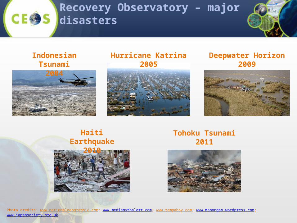
Recovery Observatory – major disasters
Indonesian Tsunami2004
Hurricane Katrina2005
Deepwater Horizon2009
Tohoku Tsunami2011
Haiti Earthquake2010
Photo credits: www.nationalgeographic.com; www.mediamythalert.com; www.tampabay.com; www.manongeo.wordpress.com; www.japansociety.org.uk.
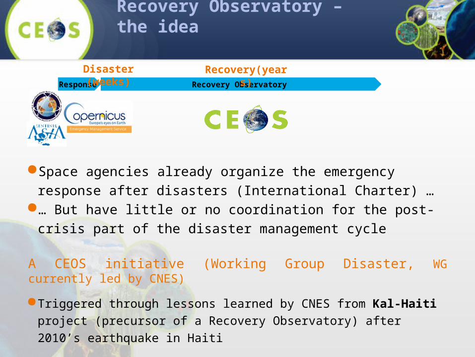
Recovery Observatory – the idea
Space agencies already organize the emergency response after disasters (International Charter) …
… But have little or no coordination for the post-crisis part of the disaster management cycle
A CEOS initiative (Working Group Disaster, WG currently led by CNES)
Triggered through lessons learned by CNES from Kal-Haiti project (precursor of a Recovery Observatory) after 2010’s earthquake in Haiti
Response Recovery Observatory
Disaster (weeks) Recovery(years)
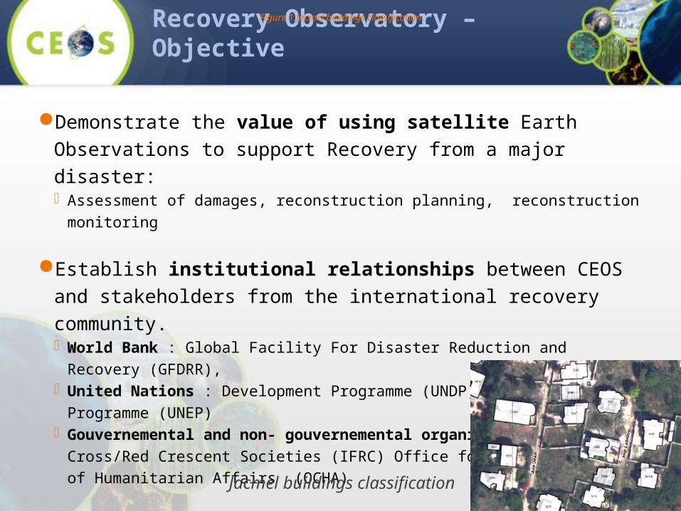
Recovery Observatory – Objective
Demonstrate the value of using satellite Earth Observations to support Recovery from a major disaster: Assessment of damages, reconstruction planning, reconstruction monitoring
Establish institutional relationships between CEOS and stakeholders from the international recovery community. World Bank : Global Facility For Disaster Reduction and Recovery (GFDRR), United Nations : Development Programme (UNDP) Environment Programme (UNEP) Gouvernemental and non- gouvernemental organisations Red Cross/Red Crescent Societies
(IFRC) Office for the Coordination of Humanitarian Affairs (OCHA)
Promote innovation around high-technology applications to support recovery.
Figure 1:Jacmel buildings classification
Jacmel buildings classification

Recovery Observatory : Rationale
Duration of a RO instance ≈ 3 years
Plan coordinated acquisitions to support: Damage assessment (built areas, natural resources); Reconstruction planning; Reconstruction monitoring;
Install a DotCloud instance (collaborative web IT workspace) to share products and user data
Monitoring of grouping of people and camps
WGISS implication
Committee on Earth Observation Satellites
End 2013 - Proposal from the CEOS Recovery Observatory Oversight Team (ASI, CNES, ESA, JAXA, NASA)
13/02/2014 – proposal from WGISS to contribute to the development of the Recovery Observatory
18/03/2014 – participation to WG disaster meeting in Paris to discuss on the project
20/03/2014 – presentation of the project in WGISS37 (Florida) meeting
11/07/2014 – kick-off with THALES & AKKA companies
WGISS38 (Russia) & WGIS39 (Japan) : technical discussions with our technical support AKKA
01/01/2015 – Delivery of the 1st version of the Recovery Observatory
15/08/2015 – Delivery of the complete version of the Recovery Observatory
Recovery Observatory : Planning
Good example of cooperation between two CEOS working groups WG Disasters and WGISS
WG Disasters has participated to the design and to the development of the Recovery Observatory
The schedule was tight, but Recovery Observatory has been developed on time The planning is the one that was presented in WGISS37
Recovery Observatory : WGISS
Main features of what has been developed
Committee on Earth Observation Satellites
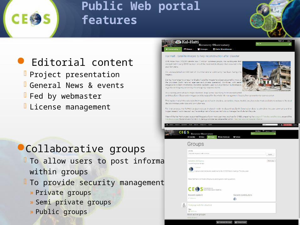
Public Web portal features
Editorial content Project presentation General News & events Fed by webmaster License management
Collaborative groups To allow users to post information & data
within groups To provide security management
» Private groups» Semi private groups» Public groups
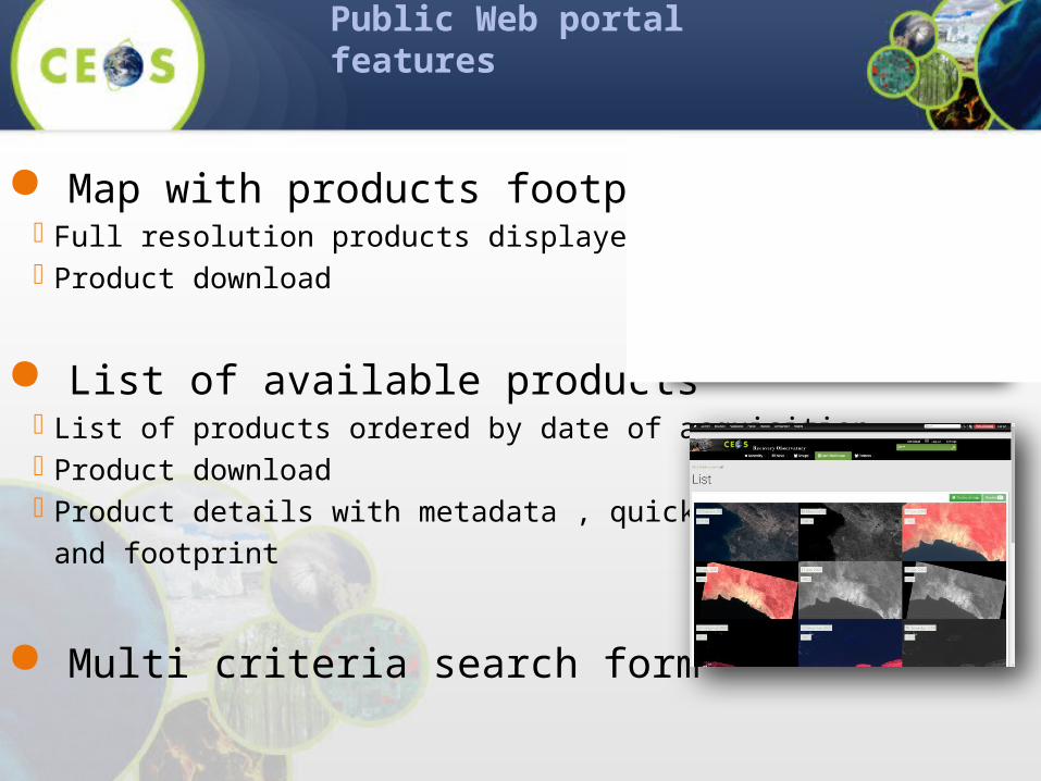
Public Web portal features
Map with products footprints Full resolution products displayed on the map Product download
List of available products List of products ordered by date of acquisition Product download Product details with metadata , quicklook
and footprint
Multi criteria search form
Design and COTS
Committee on Earth Observation Satellites

Technologies & COTS
Main technologies PHP Java (Spring, Spring Boot, Spring MVC) HTML5, CSS3, JavaScript, OpenLayers
COTS Drupal 7 with Acquia Commons PostgreSQL & PostGIS MapServer, GDAL, RESTo, iTag
(map display backoffice) Mapshup (map display frontoffice)
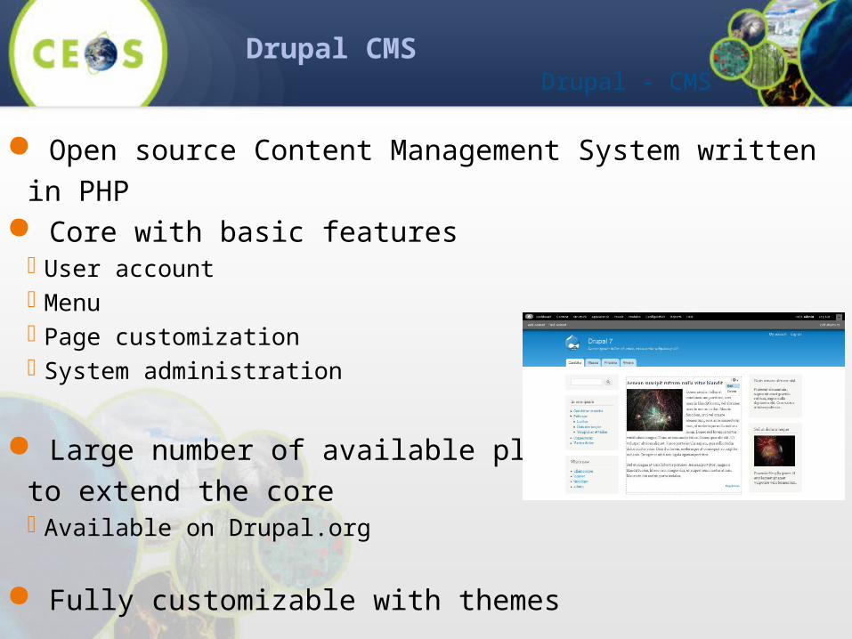
Drupal CMS
Open source Content Management System written in PHP Core with basic features User account Menu Page customization System administration
Large number of available pluginsto extend the core Available on Drupal.org
Fully customizable with themes
Drupal - CMS
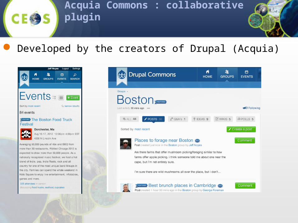
Acquia Commons : collaborative plugin
Developed by the creators of Drupal (Acquia)
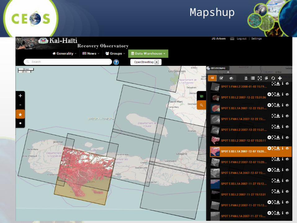
Mapshup

Drupal / RESTo integration
RESTo stores the products + metadata Product download licenses rights are defined in RESTo.
Drupal stores the articles and documents.
Interaction RESTo Drupal Shared user session Imagery products stored as content item in Drupal as well Multi criteria search form allowed by Drupal GUI Search results : easy navigation from the list view (Drupal) and map view
(Mapshup/resto)

DotCloud Architecture

Product ingestion
An “Ingestion Unit” is a set of products to be added in the database
Consists of a ZIP file containing : A metadata.json (with metadata of all
products) The list of Product Archives
» Full Product» Thumbnail» Quicklook
metadata.json
{
"type": "FeatureCollection",
"features": [
{
"type": "Feature",
"geometry": { ... },
"crs": { ... },
"properties": {
"productArchive":
"product_xxxx.zip",
...
}
},
... {
"type": "Feature",
"geometry": { ... },
"crs": { ... },
"properties": {
"productArchive":
"product_yyyy.zip",
...
}
}]
}
metadata.json
product_xxxx.zip
product_yyyy.zip
INGESTION UNIT (ZIP file)IU_abcd.zip
...

Current and future enhancements
After this first version, other functional improvements will have to be done : new data formats have to be added like TerraSAR-X, Landsat 8, Sentinel 2, Spot 6/7, Sentinel-
1, Alos-2, US VHR sensors, etc.) automatic harvesting of external OpenSearch catalogues to other data types such as digital images taken from a smartphone or a camera with GPS
location, user documents related to a toponym, etc.

Postface (before demo)
Whatever the functionalities, the success of the first instance of the recovery observatory will heavily rely on a person with the dedicated task to animate and trigger the discussions, and to feed the group contents on a regular purpose.
Users will contribute and visit the group board on a regular process only if there is a steady activity in it

DEMO
Committee on Earth Observation Satellites