rebuilding the countryside - the rspb
TRANSCRIPT
Rebuilding the CountrysideThe Garron Plateau : an example of
blanket bog restoration and managementin Northern Ireland
Rebuilding theCountryside
The Garron Plateau : an exampleof blanket bog restoration and
management in Northern Ireland

contentsForeword . . . . . . . . . . . . . . . . . . . . . . . . . . . . . . . . . . . .4
Introduction . . . . . . . . . . . . . . . . . . . . . . . . . . . . . . . . .7
Section 1 Rebuilding the Countryside Programme . . . . . . . .9
Section 2 What is so special about blanket bog? . . . . . . . . .10
Section 3 Threats to blanket bog . . . . . . . . . . . . . . . . . . . . . . .15
Section 4 Project Area . . . . . . . . . . . . . . . . . . . . . . . . . . . . . . . . .19
Section 5 Project Objectives . . . . . . . . . . . . . . . . . . . . . . . . . . .23
Section 6 Restoring Active blanket bog . . . . . . . . . . . . . . . . .24
Section 7 Budgets . . . . . . . . . . . . . . . . . . . . . . . . . . . . . . . . . . . . .30
Section 8 Raising Awareness . . . . . . . . . . . . . . . . . . . . . . . . . . . .31
Section 9 Working with the Farming Community . . . . . . . .32
Section 10 Next Steps? . . . . . . . . . . . . . . . . . . . . . . . . . . . . . . . . .37
Acknowledgements . . . . . . . . . . . . . . . . . . . . . . . . . .38
Appendices Appendix 1 – Wildfire Response Plan . . . . . . . . . .39
Appendix 2 – Who oversees themanagement of protected areas? . . . . . . . . . . . . .44
References . . . . . . . . . . . . . . . . . . . . . . . . . . . . . . . . . .45
3
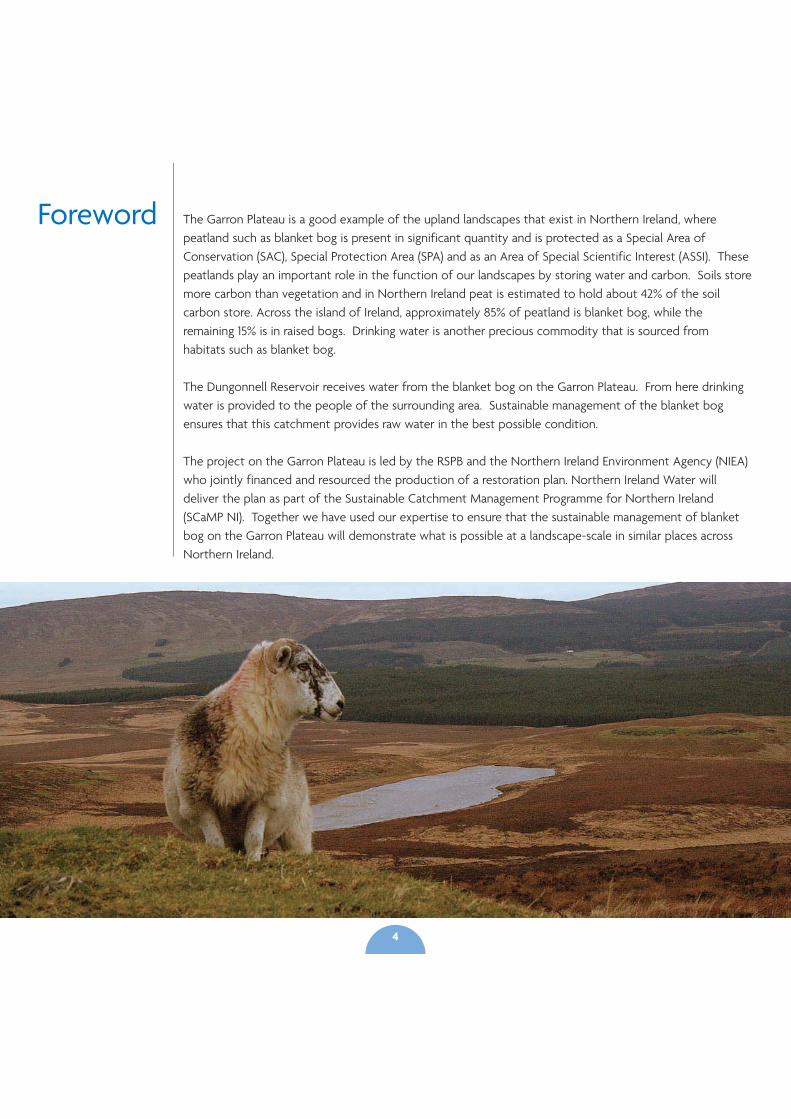
Foreword The Garron Plateau is a good example of the upland landscapes that exist in Northern Ireland, wherepeatland such as blanket bog is present in significant quantity and is protected as a Special Area ofConservation (SAC), Special Protection Area (SPA) and as an Area of Special Scientific Interest (ASSI). Thesepeatlands play an important role in the function of our landscapes by storing water and carbon. Soils storemore carbon than vegetation and in Northern Ireland peat is estimated to hold about 42% of the soilcarbon store. Across the island of Ireland, approximately 85% of peatland is blanket bog, while theremaining 15% is in raised bogs. Drinking water is another precious commodity that is sourced fromhabitats such as blanket bog.
The Dungonnell Reservoir receives water from the blanket bog on the Garron Plateau. From here drinkingwater is provided to the people of the surrounding area. Sustainable management of the blanket bogensures that this catchment provides raw water in the best possible condition.
The project on the Garron Plateau is led by the RSPB and the Northern Ireland Environment Agency (NIEA)who jointly financed and resourced the production of a restoration plan. Northern Ireland Water willdeliver the plan as part of the Sustainable Catchment Management Programme for Northern Ireland(SCaMP NI). Together we have used our expertise to ensure that the sustainable management of blanketbog on the Garron Plateau will demonstrate what is possible at a landscape-scale in similar places acrossNorthern Ireland.
4
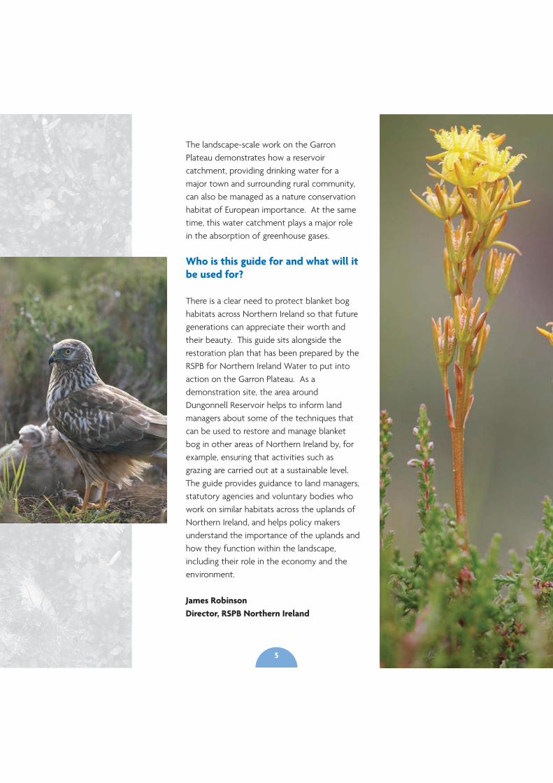
The landscape-scale work on the GarronPlateau demonstrates how a reservoircatchment, providing drinking water for amajor town and surrounding rural community,can also be managed as a nature conservationhabitat of European importance. At the sametime, this water catchment plays a major rolein the absorption of greenhouse gases.
Who is this guide for and what will itbe used for?
There is a clear need to protect blanket boghabitats across Northern Ireland so that futuregenerations can appreciate their worth andtheir beauty. This guide sits alongside therestoration plan that has been prepared by theRSPB for Northern Ireland Water to put intoaction on the Garron Plateau. As ademonstration site, the area aroundDungonnell Reservoir helps to inform landmanagers about some of the techniques thatcan be used to restore and manage blanketbog in other areas of Northern Ireland by, forexample, ensuring that activities such asgrazing are carried out at a sustainable level.The guide provides guidance to land managers,statutory agencies and voluntary bodies whowork on similar habitats across the uplands ofNorthern Ireland, and helps policy makersunderstand the importance of the uplands andhow they function within the landscape,including their role in the economy and theenvironment.
James RobinsonDirector, RSPB Northern Ireland
5
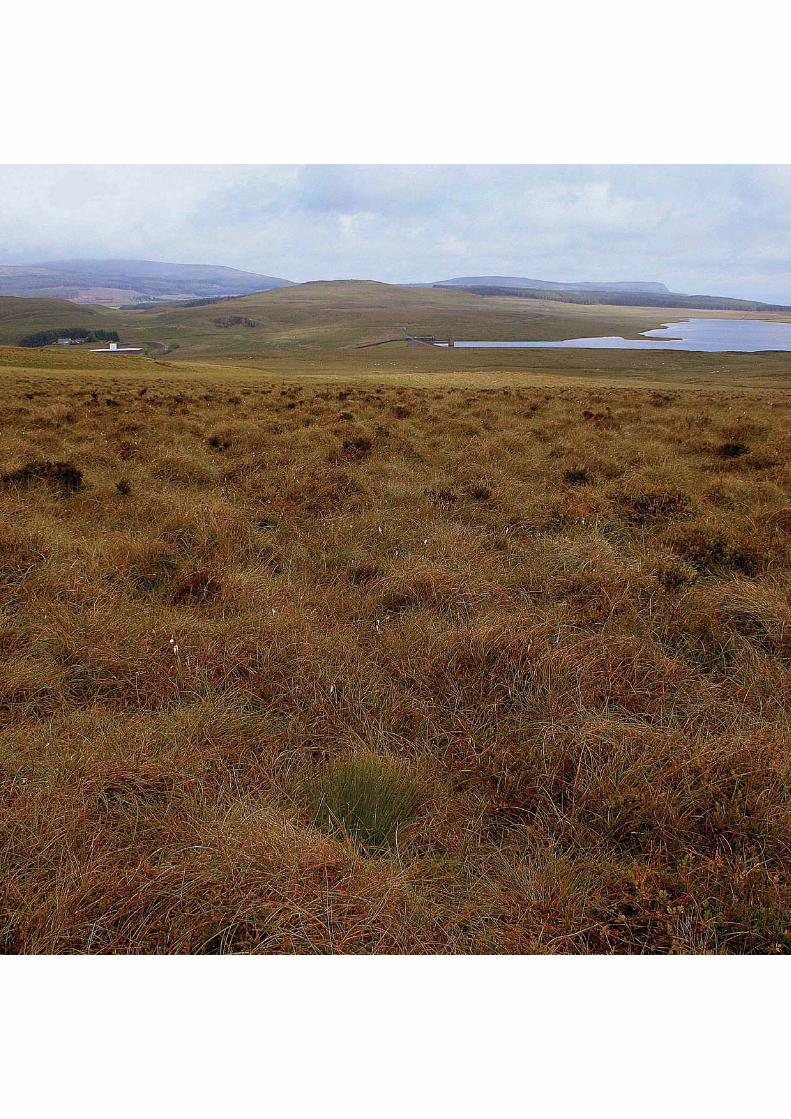
Why blanket bog?
Blanket bogs are one of the most importanthabitats found in Ireland, if not globally. Theyare home to rare wildlife, provide much of ourdrinking water, and underpin the rural economythrough activities such as farming. Their role asstores of carbon has been recognised in recentyears.
Blanket bogs form part of an upland landscapethat we must protect and enhance for thebenefit of all. Blanket bogs in Northern Irelandhave suffered as a result of activities such asovergrazing, forestry planting, burning anddrainage. Only in recent years have we come tounderstand how valuable the habitat is in itsintact state.
Upland landscapes in Northern Ireland havebeen intensively grazed, planted with forestry,burned and frequently drained to such anextent that many of the natural habitats andspecies have been lost. In many areas, this hasdegraded blanket bog and produced largemonocultures of cottongrass or purple moor-grass. Intensive management is required torestore these back to natural blanket bogvegetation.
Why do we need a plan?
The restoration work on the Garron Plateau isthe beginning of a large landscape-scaleapproach to restore and manage peatlands inNorthern Ireland through an initiative calledRebuilding the Countryside, a project led bythe Royal Society for the Protection of Birds(RSPB) and the Northern Ireland EnvironmentAgency (NIEA). The RSPB and NIEA are workingin partnership with others to address the loss
of biodiversity at a scale not seen in NorthernIreland before. Work on the Garron Plateauwill prioritise appropriate grazing to ensure thatvegetation cover is adequate to protect thepeat. It will also include drain blocking to raisewater levels and allow the bog to functionwithin the landscape as it should.
The Garron Plateau is a protected area. It hasEuropean protection as a Special Area ofConservation (SAC), a Special Protection Area(SPA) and is protected by the Northern IrelandEnvironment Order as an Area of SpecialScientific Interest (ASSI). It is a Ramsar wetlandof international importance, and one of thebest examples of blanket bog in Ireland. In2004 the ASSI was surveyed by theEnvironment & Heritage Service - EHS (nowNIEA) and found to be in unfavourableecological condition due mainly to overgrazing.The site was surveyed again in 2010 andremains unfavourable while showing some signsof recovery. NIEA and the RSPB startedworking in partnership with Northern IrelandWater, the largest landowner on the GarronPlateau, to begin to help remedy the situationand to bring the site into favourable ecologicalcondition. This will include the large-scalerestoration of almost 2,000ha of peatland,mainly blanket bog primarily throughappropriate grazing which is the single biggestthreat facing this habitat here, and across mostareas of Northern Ireland. By demonstratinghow landscapes of this size can be sustainablymanaged, NI Water will be working at a scalewhich can be repeated across Northern Irelandto help meet the targets set by the NIBiodiversity Strategy to halt the decline ofpriority habitats and species by 2016.
Introduction
7
Rebuilding the Countryside is a landscape-scaleconservation initiative led by the RSPB andNIEA. It is funded by the NIEA’s NaturalHeritage Grant Programme and by the RSPB.Rebuilding the Countryside delivers landscape-scale habitat restoration as part of the RSPBFuturescapes programme.
What area does it cover?
The Rebuilding the Countryside initiativeincludes a focus on the large-scalemanagement of upland blanket bog. TheGarron Plateau was prioritised for the first partof this work, to ensure our best sites arerestored and sustainably managed. Once thishas been achieved the site will demonstratehow the landscape-scale approach can betaken forward in other water catchments andblanket bog areas in the Antrim Hills and acrossNorthern Ireland.
Section 1Rebuilding the
CountrysideProgramme
“...to ensure our bestsites are restored andsustainably managed.”
9
Section 2What is so
special aboutblanket bog?
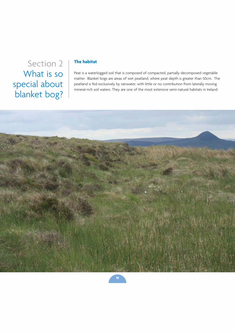
The habitat
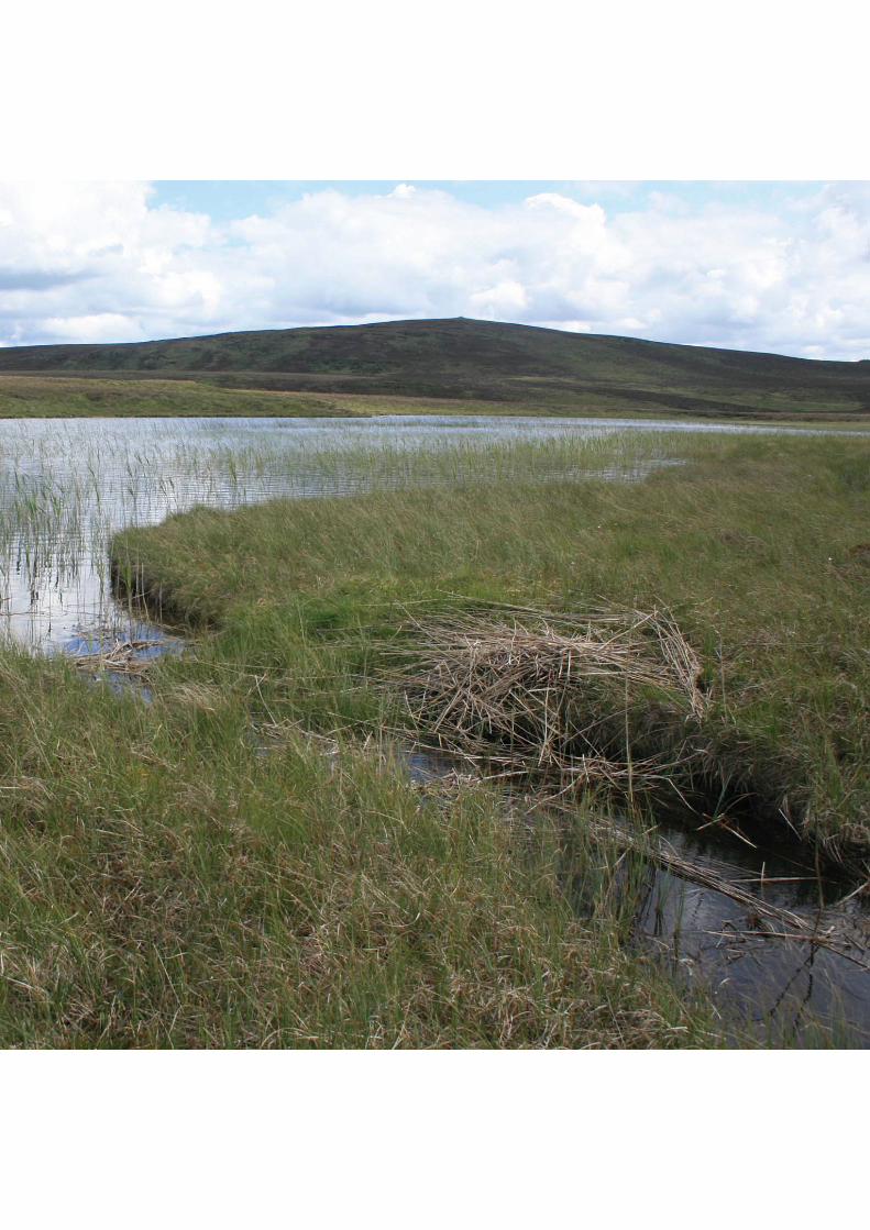
Peat is a waterlogged soil that is composed of compacted, partially decomposed vegetablematter. Blanket bogs are areas of wet peatland, where peat depth is greater than 50cm. Thepeatland is fed exclusively by rainwater, with little or no contribution from laterally movingmineral-rich soil waters. They are one of the most extensive semi-natural habitats in Ireland.
10
Most blanket bogs began to form between5,000 and 6,000 years ago, though some mayhave begun as much as 9,000, or as recentlyas 1,500 years ago. Before then, much ofIreland was clothed in native trees such asoak and hazel. It is likely that blanket bogswere formed due to a combination of nativeforest clearances and a wetter climateresulting in increased water logging andleaching of soils. This encouraged bog mossesto develop. The removal of trees would havefurther increased water logging, making thearea less suitable for trees, and furtherencouraging the bog mosses. The increasingdominance of bog mosses and the resultanthigh water content of the soil would havereduced pH, slowed decomposition oforganic matter, and encouraged peat to form.Blanket bogs are defined as a peatland that isnot confined by the surrounding topography.The conditions required for its formationallows blanket bog to develop across thelandscape, rather than be limited to individualdepressions or catchments. It is from this‘blanketing’ of the landscape that the habitatderives its name. Blanket bog that supportssignificant areas of peat-forming plants isreferred to as active blanket bog, a priorityhabitat under the EU Habitats Directive. Anactive blanket bog on average increases thepeat depth by 0.5-1mm per annum over deeppeat and is dependent on a layer of peatforming vegetation and a high water table. Inmost peat bogs, Sphagnum (moss) isresponsible for laying down the majority ofthe accumulated peat. Large areas of blanketbog and deep peat soils persist despite notactively forming peat, something that mayhave a significant bearing on theirconservation management or restoration.
The Landscape
Blanket bog is found in areas with a highrainfall and cool climate, climatic conditionsrequired for its formation. As a result it has alimited global distribution. In Europe, blanketbogs are found primarily in Ireland and theUK. This is one of the habitats found on themoorlands that are distributed across theuplands. These moorlands are a significantpart of our cultural heritage. They can beimportant places for archaeological materialwhere people have lived and worked forthousands of years. This continues today asthe uplands are primarily used for agriculture– especially grazing sheep – and for sportingmanagement such as shooting and for otherrecreational activities like walking andmountain biking.
Natural bogs consist of a protective livingsurface layer of soft conductive peat which isaerobic. This layer covers a layer of denseranaerobic peat. Many peatbogs have losttheir protective surface layer. When bogslose their surface layer, the carbon store is atrisk and may be steadily lost. The plants inthe surface layer capture CO2 from theatmosphere into their tissues, and carbonpasses to be stored in the denser anaerobicpeat as plants die.
The water table in intact peatlands fluctuatesa little, but is usually close to the surface. Thecapacity to store significant additional wateris therefore low and rain runs off intactpeatlands quickly. However, the creation ofdrainage channels accelerates the rate atwhich water leaves a peatland. This meansthat in the process of restoring a peatlandthat contains drains a lot of water is retained
11
and stored. Blocking drains is likely to lead to alonger water retention time and therefore slowerrun off rates. Run off is also accelerated by theloss of vegetation which leads to increased areasof bare peat caused by overgrazing, a widespreadproblem in many blanket bog areas of NorthernIreland, and desiccation in damaged peatland.This can lead to peat becoming so dry that waterwill no longer infiltrate and so runs off thesurface quickly into streams and rivers,potentially exacerbating flooding downstream.Conversely, in areas where grazing levels aresuitable for blanket bog vegetation to provideadequate cover, flow peaks can be reduced andslightly delayed compared to bare peat.
Water derived from functioning peatlands isnaturally of very high quality. However theamount of dissolved organic carbon (DOC), thebrown colour of peaty water, has doubled acrossmany catchments due to erosion often causedby overgrazing and by drainage. To meet drinkingwater quality standards set out in the EuropeanDrinking Water Directive, DOC has to beremoved from drinking water supplies, asotherwise chlorination during water treatmentresults in the production of carcinogens.Removing DOC can be extremely costly,especially if new treatment processes need to beadded. Erosion also reduces water quality forfish, affecting for example rivers used for anglingdownstream.
The wildlife
Sphagnum
Compared to vascular plant species Sphagna areslow to decay. As a result Sphagnum (moss) isresponsible for laying down the majority of theaccumulated peat in bogs. It survives where the
water table remains within -10cm of ground levelall year round. Drainage results in the death ofthe Sphagnum and the peat bog loses its abilityto capture and store carbon and remain active.Sphagnum is the life blood of a peatlandbecause the bog simply can not function andgrow without it. The peatland that is created bySphagnum is a priority for conservation inNorthern Ireland.
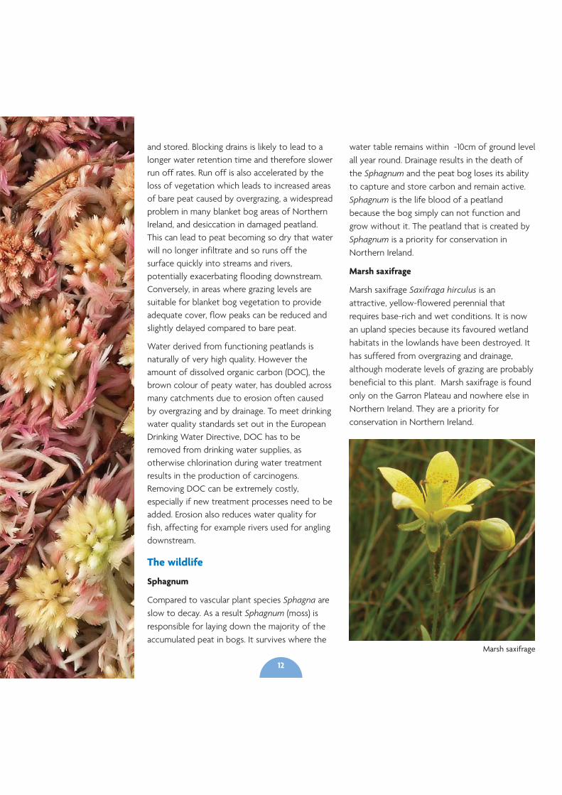
Marsh saxifrage
Marsh saxifrage Saxifraga hirculus is anattractive, yellow-flowered perennial thatrequires base-rich and wet conditions. It is nowan upland species because its favoured wetlandhabitats in the lowlands have been destroyed. Ithas suffered from overgrazing and drainage,although moderate levels of grazing are probablybeneficial to this plant. Marsh saxifrage is foundonly on the Garron Plateau and nowhere else inNorthern Ireland. They are a priority forconservation in Northern Ireland.
Marsh saxifrage
12
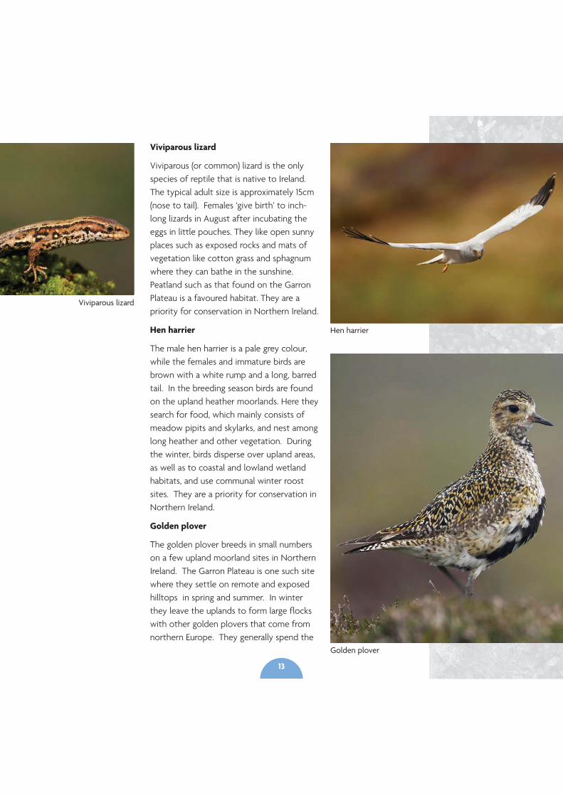
Viviparous lizard
Viviparous (or common) lizard is the onlyspecies of reptile that is native to Ireland.The typical adult size is approximately 15cm(nose to tail). Females ‘give birth’ to inch-long lizards in August after incubating theeggs in little pouches. They like open sunnyplaces such as exposed rocks and mats ofvegetation like cotton grass and sphagnumwhere they can bathe in the sunshine.Peatland such as that found on the GarronPlateau is a favoured habitat. They are apriority for conservation in Northern Ireland.
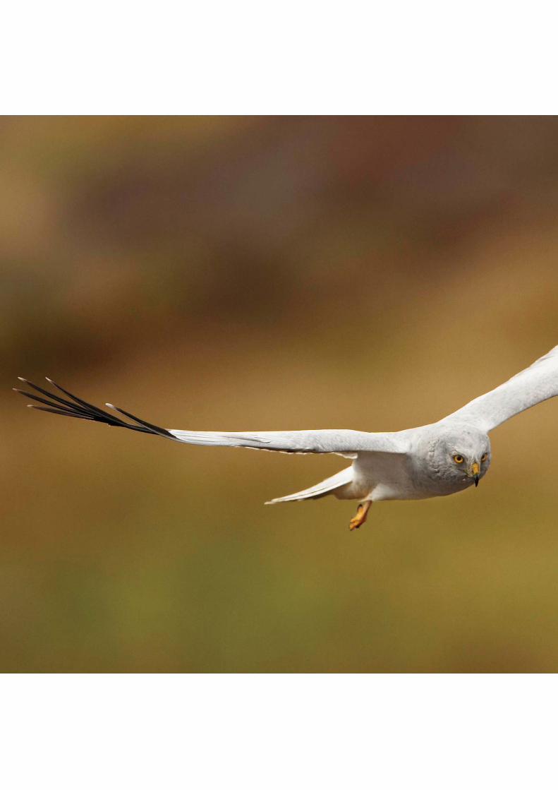
Hen harrier
The male hen harrier is a pale grey colour,while the females and immature birds arebrown with a white rump and a long, barredtail. In the breeding season birds are foundon the upland heather moorlands. Here theysearch for food, which mainly consists ofmeadow pipits and skylarks, and nest amonglong heather and other vegetation. Duringthe winter, birds disperse over upland areas,as well as to coastal and lowland wetlandhabitats, and use communal winter roostsites. They are a priority for conservation inNorthern Ireland.
Golden plover
The golden plover breeds in small numberson a few upland moorland sites in NorthernIreland. The Garron Plateau is one such sitewhere they settle on remote and exposedhilltops in spring and summer. In winterthey leave the uplands to form large flockswith other golden plovers that come fromnorthern Europe. They generally spend the
Viviparous lizard
Hen harrier
Golden plover
13
winter around lowland wetland and coastal areas, often in thecompany of lapwings and other wading birds, but small groupsare also seen in upland areas. They are a priority forconservation in Northern Ireland.
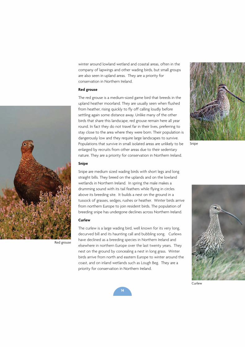
Red grouse
The red grouse is a medium-sized game bird that breeds in theupland heather moorland. They are usually seen when flushedfrom heather, rising quickly to fly off calling loudly beforesettling again some distance away. Unlike many of the otherbirds that share this landscape, red grouse remain here all yearround. In fact they do not travel far in their lives, preferring tostay close to the area where they were born. Their population isdangerously low and they require large landscapes to survive.Populations that survive in small isolated areas are unlikely to beenlarged by recruits from other areas due to their sedentarynature. They are a priority for conservation in Northern Ireland.
Snipe
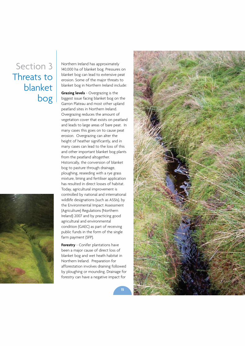
Snipe are medium sized wading birds with short legs and longstraight bills. They breed on the uplands and on the lowlandwetlands in Northern Ireland. In spring the male makes adrumming sound with its tail feathers while flying in circlesabove its breeding site. It builds a nest on the ground in atussock of grasses, sedges, rushes or heather. Winter birds arrivefrom northern Europe to join resident birds. The population ofbreeding snipe has undergone declines across Northern Ireland.
Curlew
The curlew is a large wading bird, well known for its very long,decurved bill and its haunting call and bubbling song. Curlewshave declined as a breeding species in Northern Ireland andelsewhere in northern Europe over the last twenty years. Theynest on the ground by concealing a nest in long grass. Winterbirds arrive from north and eastern Europe to winter around thecoast, and on inland wetlands such as Lough Beg. They are apriority for conservation in Northern Ireland.
Red grouse
Snipe
Curlew
14
Section 3Threats to
blanketbog
Northern Ireland has approximately140,000 ha of blanket bog. Pressures onblanket bog can lead to extensive peaterosion. Some of the major threats toblanket bog in Northern Ireland include:
Grazing levels - Overgrazing is thebiggest issue facing blanket bog on theGarron Plateau and most other uplandpeatland sites in Northern Ireland.Overgrazing reduces the amount ofvegetation cover that exists on peatlandand leads to large areas of bare peat. Inmany cases this goes on to cause peaterosion. Overgrazing can alter theheight of heather significantly, and inmany cases can lead to the loss of thisand other important blanket bog plantsfrom the peatland altogether.Historically, the conversion of blanketbog to pasture through drainage,ploughing, reseeding with a rye grassmixture, liming and fertiliser applicationhas resulted in direct losses of habitat.Today, agricultural improvement iscontrolled by national and internationalwildlife designations (such as ASSIs), bythe Environmental Impact Assessment(Agriculture) Regulations (NorthernIreland) 2007 and by practicing goodagricultural and environmentalcondition (GAEC) as part of receivingpublic funds in the form of the singlefarm payment (SFP).
Forestry - Conifer plantations havebeen a major cause of direct loss ofblanket bog and wet heath habitat inNorthern Ireland. Preparation forafforestation involves draining followedby ploughing or mounding. Drainage forforestry can have a negative impact for
15
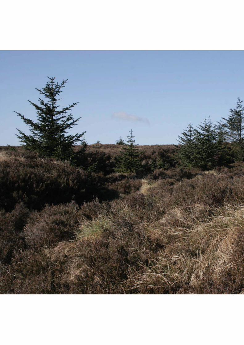
a considerable distance into adjacent peatland habitats. As treesgrow they draw more water, and high evaporation rates fromtheir leaves lowers the water table further.
Forestry plantations require fertilisation, pest control and oftenliming to make the soil less acidic, and trees intercept airbornepollutants and incorporate them into the soil water. These alldirectly affect water quality and biodiversity. The effects ofpesticides and additional nutrients is damaging as the bogecosystem is naturally poor in nutrients and comprises sensitivespecies that have adapted to extreme conditions.
Self-seeded conifers such as Sitka spruce have becomeestablished on bogs adjacent to forestry across uplands inNorthern Ireland where they detract from the naturalness of thebog vegetation. Plantations also provide cover for predatorssuch as fox and hooded crow, introducing a significant predationpressure on ground nesting birds.
Peat cutting and peat extraction - Both domestic peat cuttingand commercial extraction of peat can have significantdetrimental impacts upon peat bogs and can damagearchaeological sites. Organic carbon stored within the blanketpeat, which has accumulated over thousands of years, can belost in days due to extraction. Bogs are drained to facilitateextraction, adding to the degradation of the habitat. Thesituation is much worse for commercial peat cutting and peatextraction using machinery over a large area, compared to small-
scale domestic peat cutting by hand.
Burning - Inappropriate burning can result in the loss of keyplant species, the breakdown of the peat structure, or increasederosion. In the worst cases, re-vegetation of bare peat isprevented by grazing and frequent burning can make thevegetation less diverse. Damage can be irreversible when this iscombined with overgrazing and/or drainage. Burning is notpermitted on blanket bogs in Northern Ireland for this reason.
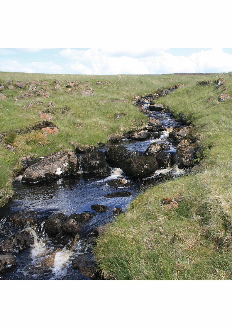
Drainage - Drains intercept and divert overland flow to removewater rapidly from the peatland system. All drains affect thewater table, causing changes in vegetation. Peat formation onblanket bog is dependent upon the existence of Sphagnum(moss) which occurs where the peat is sufficiently waterlogged.Drains are therefore a major threat to the ability of a blanketbog to remain active. Drains accelerate the rate at which waterleaves a peatland, increasing flood risk downstream, andcontributing to erosion which can increase DOC - the amountof dissolved organic carbon which causes the brown colour inpeaty water).
Development - A wide range of developments and theirassociated infrastructure may result in direct or indirect loss ofblanket bog habitat. These developments may includecommunication masts, wind farms, hydroelectric schemes androads.
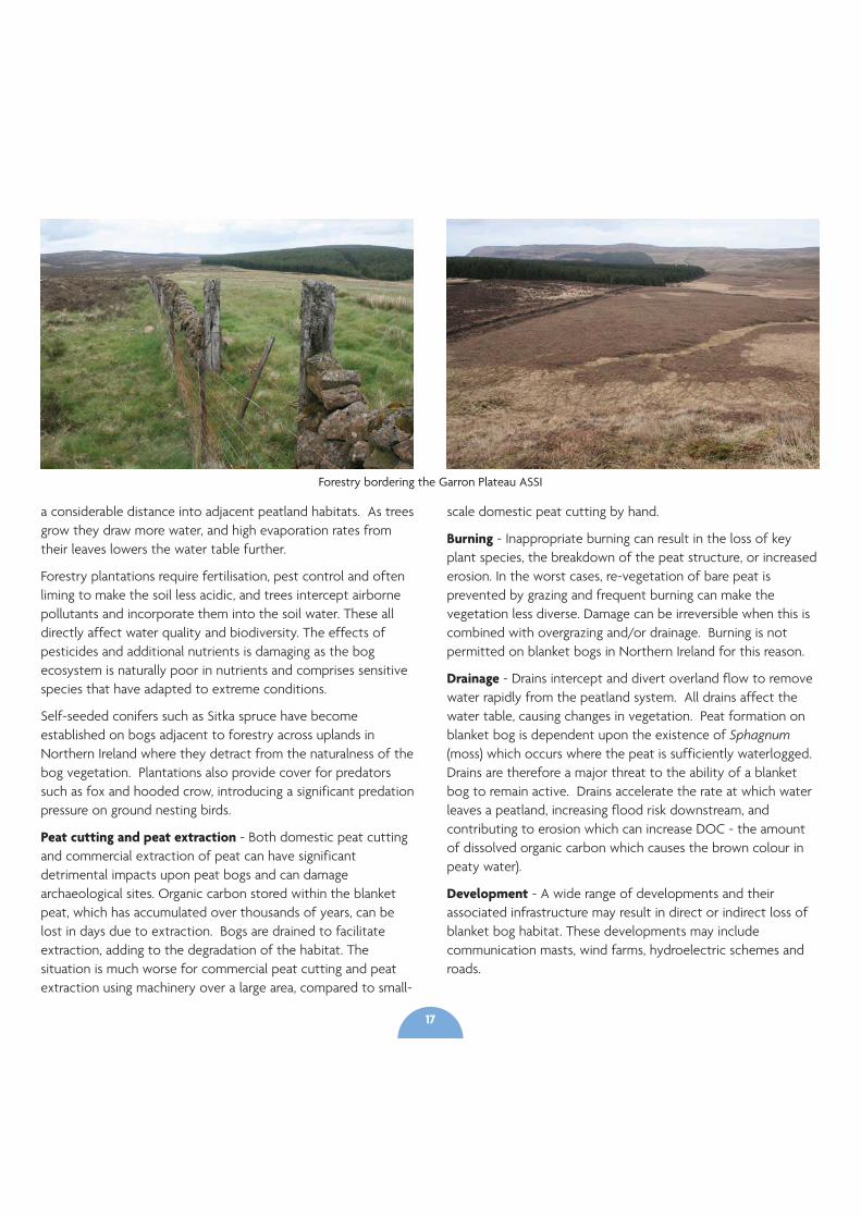
Forestry bordering the Garron Plateau ASSI
17
Encroachment by rhododendron and Sitka spruce - The spread ofRhododendron ponticum and Piceasitchensis (two non-native andinvasive plant species) from forestry plantations, areas managed for gamebirds and from gardens results in a change to the species composition,habitat structure, and hydrology. It is well known that rhododendronsaffect soil and light so that nothing grows beneath them.
Climate Change - Drier summers and stormier winters, predicted as aconsequence of global climate change, may have a profound impact onblanket bogs through a lowering of the water table, drying of peat, andloss of peat forming plant species such as Sphagnum.
Phytophthora species - Phytophthora ramorum is a fungus-likepathogens of plants that are causing extensive damage and mortality totrees and other plants, such as rhododendron and bilberry, in parts ofBritain and Ireland. This situation is developing and the spread of thesepathogens could have a detrimental impact on blanket bog plant species.
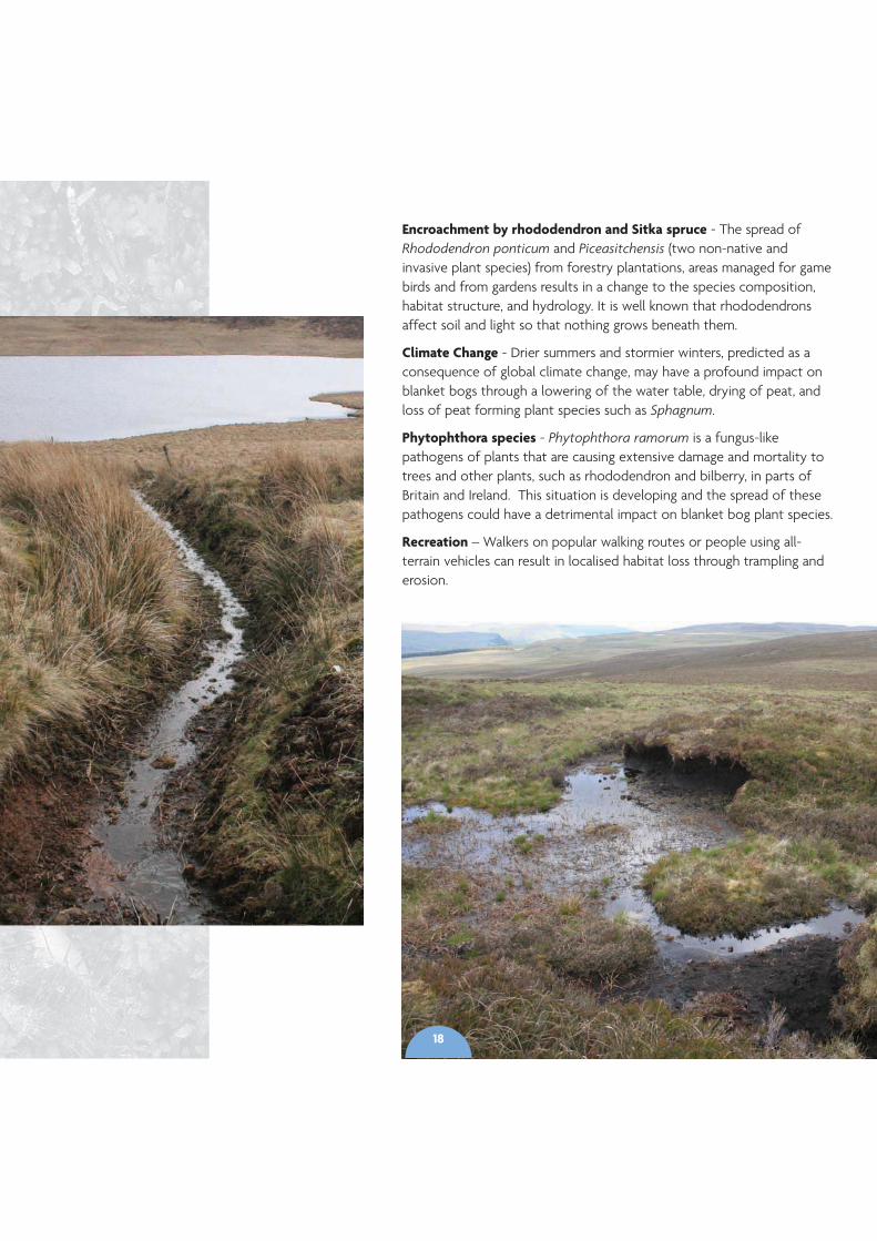
Recreation – Walkers on popular walking routes or people using all-terrain vehicles can result in localised habitat loss through trampling anderosion.
18
Section 4Project
Area
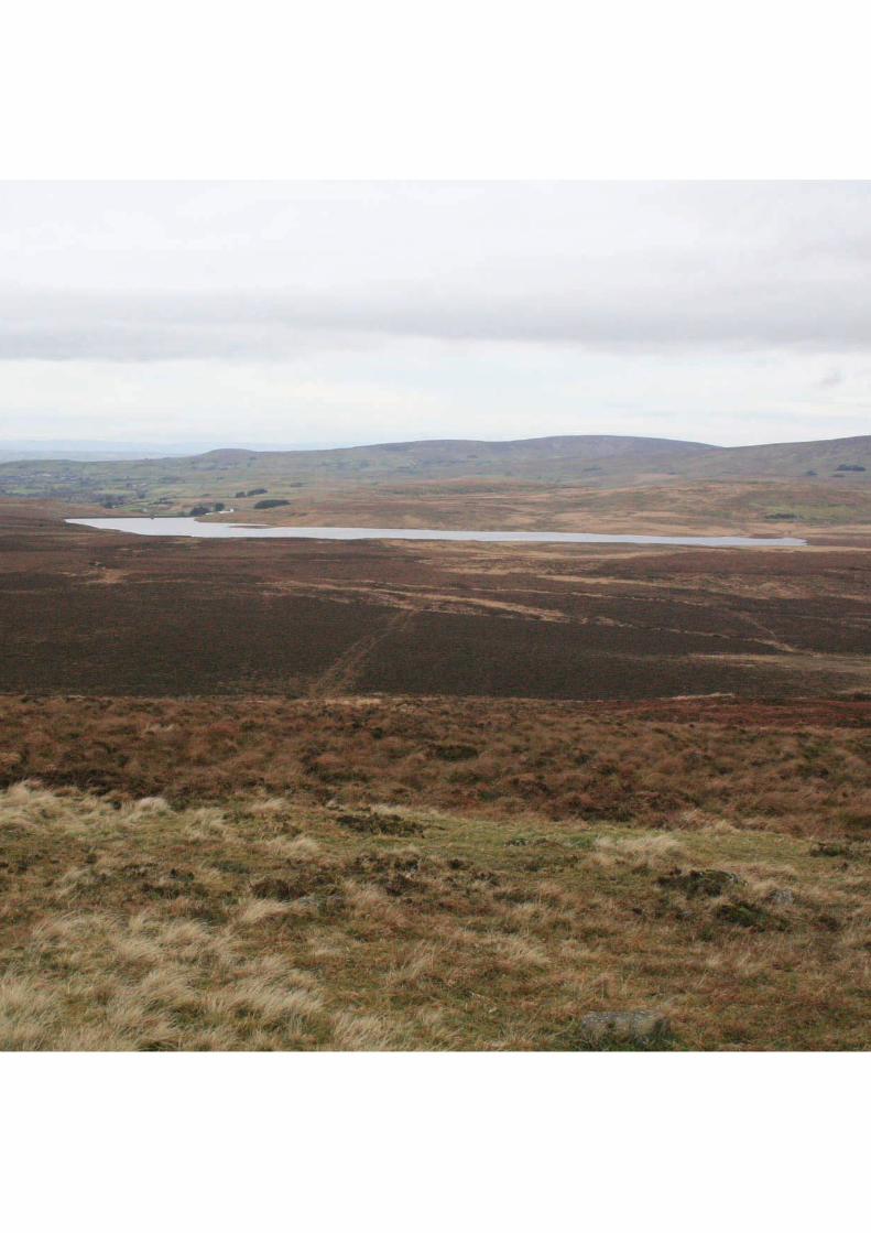
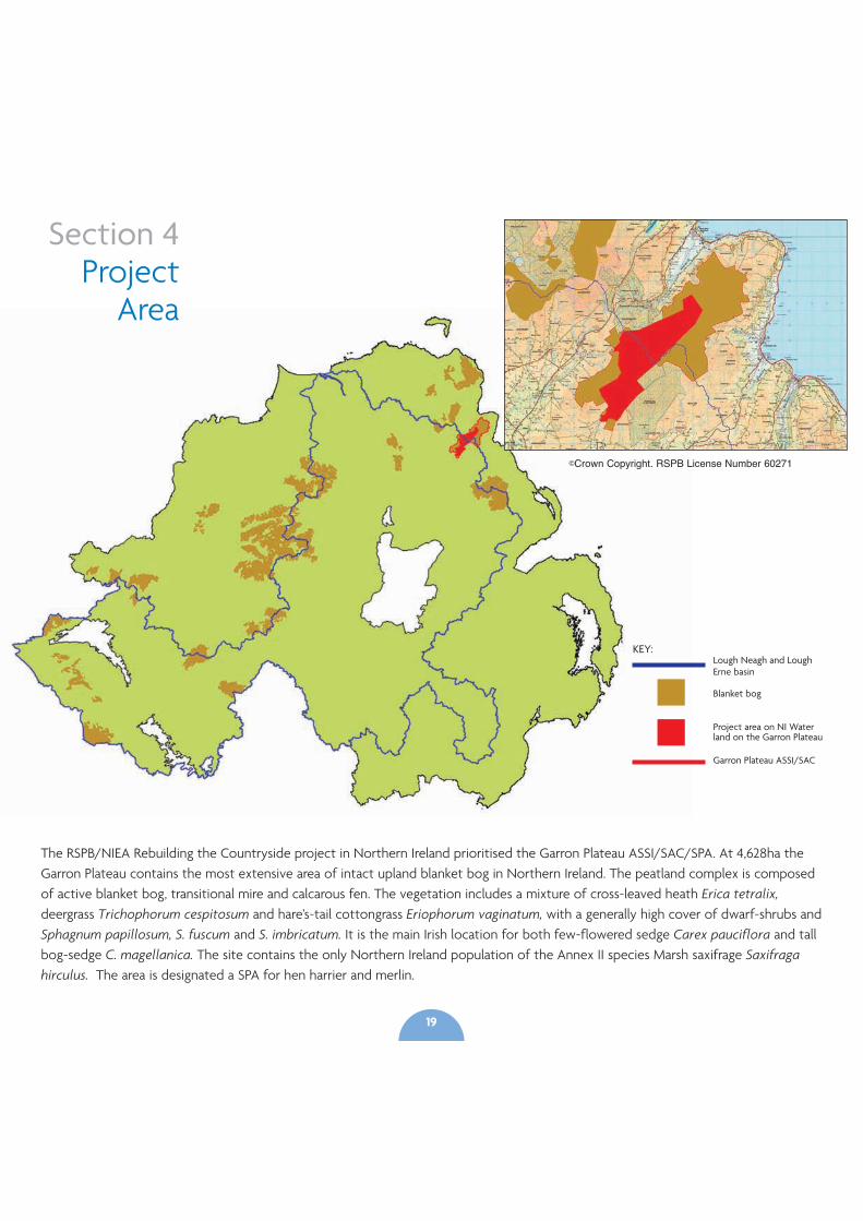
The RSPB/NIEA Rebuilding the Countryside project in Northern Ireland prioritised the Garron Plateau ASSI/SAC/SPA. At 4,628ha theGarron Plateau contains the most extensive area of intact upland blanket bog in Northern Ireland. The peatland complex is composedof active blanket bog, transitional mire and calcarous fen. The vegetation includes a mixture of cross-leaved heath Erica tetralix,deergrass Trichophorum cespitosum and hare’s-tail cottongrass Eriophorum vaginatum, with a generally high cover of dwarf-shrubs andSphagnum papillosum, S. fuscum and S. imbricatum. It is the main Irish location for both few-flowered sedge Carex pauciflora and tallbog-sedge C. magellanica. The site contains the only Northern Ireland population of the Annex II species Marsh saxifrage Saxifragahirculus. The area is designated a SPA for hen harrier and merlin.
©Crown Copyright. RSPB License Number 60271
KEY:Lough Neagh and LoughErne basin
Blanket bog
Project area on NI Waterland on the Garron Plateau
Garron Plateau ASSI/SAC
19
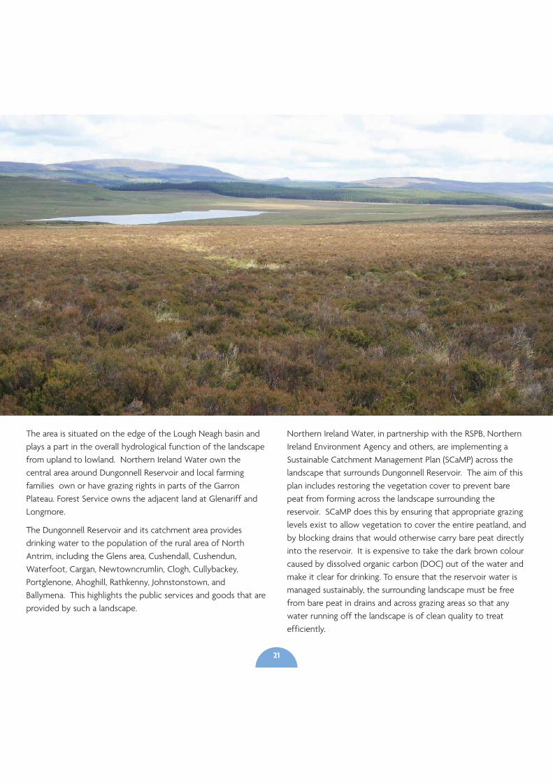
The area is situated on the edge of the Lough Neagh basin andplays a part in the overall hydrological function of the landscapefrom upland to lowland. Northern Ireland Water own thecentral area around Dungonnell Reservoir and local farmingfamilies own or have grazing rights in parts of the GarronPlateau. Forest Service owns the adjacent land at Glenariff andLongmore.
The Dungonnell Reservoir and its catchment area providesdrinking water to the population of the rural area of NorthAntrim, including the Glens area, Cushendall, Cushendun,Waterfoot, Cargan, Newtowncrumlin, Clogh, Cullybackey,Portglenone, Ahoghill, Rathkenny, Johnstonstown, andBallymena. This highlights the public services and goods that areprovided by such a landscape.
Northern Ireland Water, in partnership with the RSPB, NorthernIreland Environment Agency and others, are implementing aSustainable Catchment Management Plan (SCaMP) across thelandscape that surrounds Dungonnell Reservoir. The aim of thisplan includes restoring the vegetation cover to prevent barepeat from forming across the landscape surrounding thereservoir. SCaMP does this by ensuring that appropriate grazinglevels exist to allow vegetation to cover the entire peatland, andby blocking drains that would otherwise carry bare peat directlyinto the reservoir. It is expensive to take the dark brown colourcaused by dissolved organic carbon (DOC) out of the water andmake it clear for drinking. To ensure that the reservoir water ismanaged sustainably, the surrounding landscape must be freefrom bare peat in drains and across grazing areas so that anywater running off the landscape is of clean quality to treatefficiently.
21

Section 5Project
Objectives
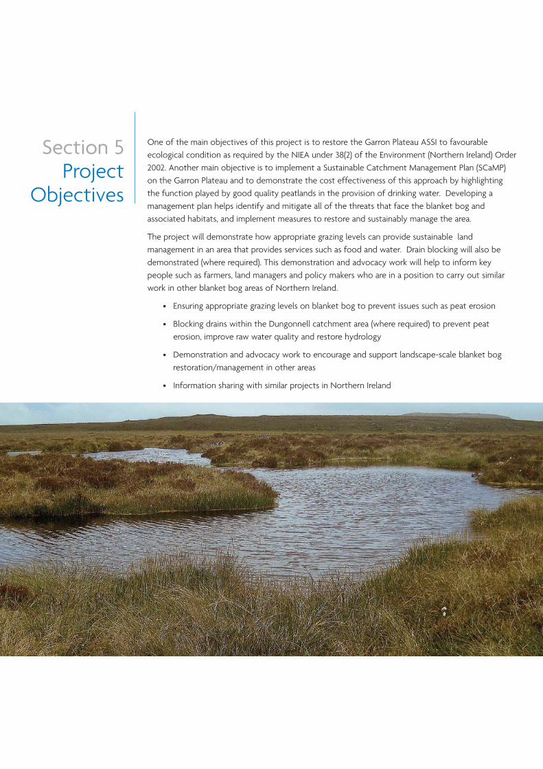
One of the main objectives of this project is to restore the Garron Plateau ASSI to favourableecological condition as required by the NIEA under 38(2) of the Environment (Northern Ireland) Order2002. Another main objective is to implement a Sustainable Catchment Management Plan (SCaMP)on the Garron Plateau and to demonstrate the cost effectiveness of this approach by highlightingthe function played by good quality peatlands in the provision of drinking water. Developing amanagement plan helps identify and mitigate all of the threats that face the blanket bog andassociated habitats, and implement measures to restore and sustainably manage the area.
The project will demonstrate how appropriate grazing levels can provide sustainable landmanagement in an area that provides services such as food and water. Drain blocking will also bedemonstrated (where required). This demonstration and advocacy work will help to inform keypeople such as farmers, land managers and policy makers who are in a position to carry out similarwork in other blanket bog areas of Northern Ireland.
• Ensuring appropriate grazing levels on blanket bog to prevent issues such as peat erosion
• Blocking drains within the Dungonnell catchment area (where required) to prevent peaterosion, improve raw water quality and restore hydrology
• Demonstration and advocacy work to encourage and support landscape-scale blanket bogrestoration/management in other areas
• Information sharing with similar projects in Northern Ireland
Section 6Restoring
activeblanket
bog
Thankfully in most situations where blanketbogs have been damaged through overgrazingand other activities such as drainage,restoration is a realistic option. The bestresults for regaining blanket bog biodiversitywill occur where appropriate grazing levels canbe achieved (0.075LU/ha) on sites that havesuffered from overgrazing, and where naturalhydrology can be restored when drainage hastaken place.
To fully restore an area of blanket bog it isnecessary to look at all the issues affecting thesite, principally grazing, hydrology, and burning.On the Garron Plateau, grazing is the mainissue. This is similar to most blanket bog areasin Northern Ireland. Hydrology is affected ononly parts of the site where drains have beencut through the peat for agricultural andforestry operations. Burning does not takeplace. Key management interventions torestore blanket bog habitat in all parts ofNorthern Ireland, should have two main aims:
• to provide appropriate grazing levels toencourage the growth of native plantspecies, protect the underlying peat fromerosion, and discourage non-native species;
• to raise the water table to allow the nativeblanket bog plant species to thrive andcontinue forming peat.
Grazing
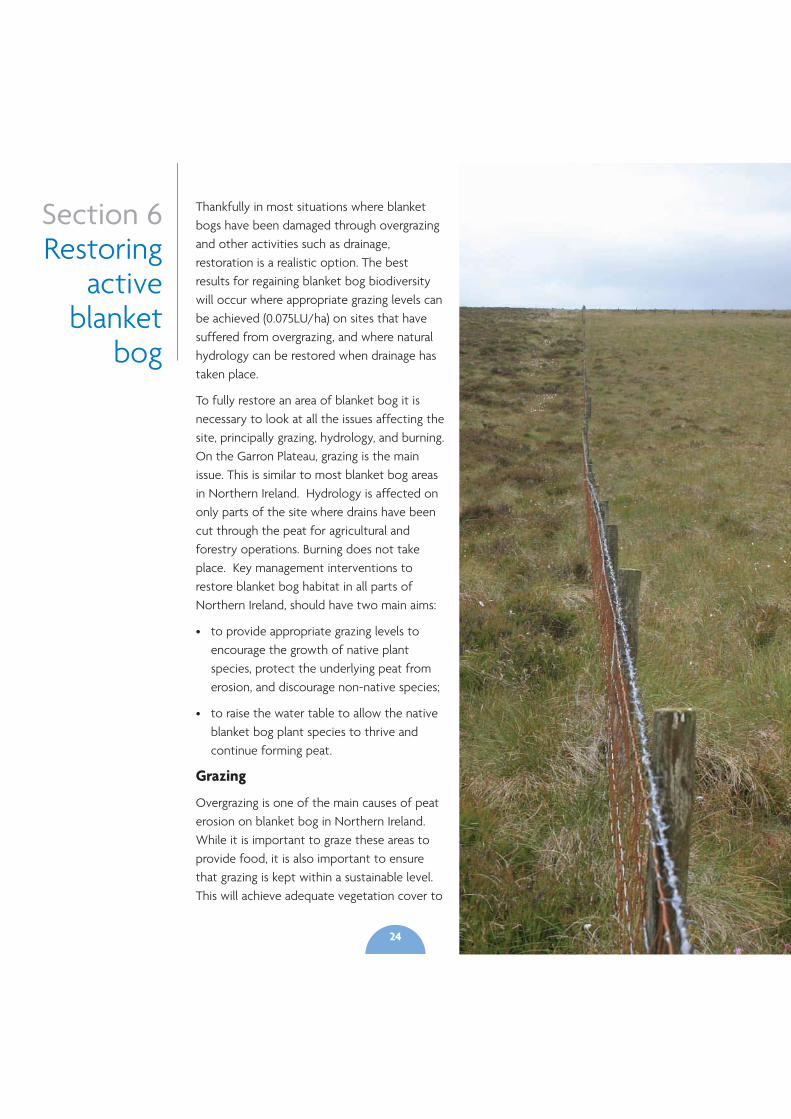
Overgrazing is one of the main causes of peaterosion on blanket bog in Northern Ireland.While it is important to graze these areas toprovide food, it is also important to ensurethat grazing is kept within a sustainable level.This will achieve adequate vegetation cover to
24
prevent bare peat and peat erosion.Adequate blanket bog vegetationcover will also ensure that peatcontinues to form on the bog,providing a store for water andcarbon. Blanket bogs should begrazed by sheep only. The grazinglevel should not exceed 0.075LU/ha(1 Livestock Unit is equivalent to :-6.6 sheep - all ages). Blanket bogshould be grazed from 1st March -31st October only. There should beno grazing from 1st November –28/29th February.
The key for active bog is thepresence of a Sphagnum layer ,which is relatively fragile and reactsto over grazing/trampling pressure.In some instances there will be aneed to have no grazing at all onblanket bog to allow vegetation torecover after overgrazing hasoccurred. There might becircumstances where an intactfunctioning blanket bog with poolsand/or extensive Sphagnum willhave its structure maintained bythe hydrology. In this situationgrazing may not provide anythingfrom an ecological perspective.Therefore while grazing takes placeon blanket bog as a farming activityit may not be required on someintact, undamaged bogs.
Recommended stocking densitiesand grazing periods for otherpeatland types may vary. Where a
mix of peatland types such as dry heath, wet heath andblanket bog (at least 20% of each type) occur within thesame grazing unit, an average stocking density, based onthe ratio of different types, may be applied to the wholeunit. The precautionary measure for peatland sites thatare principally made up of blanket bog is to reducegrazing levels to the recommended 0.075LU/ha. Blanketbog typically grades into wet and dry heath on manysites. For wet and dry heath, recommended grazinglevels range between 0.20LU/ha and 0.30LU/harespectively. However, any increase in grazing pressure inthe direction of these levels should only be instated on acase by case basis after a period of vegetationmonitoring has shown the need for such an approach.
On the area around Dungonnell Reservoir, Garron Plateau,it is expected that the 0.075LU/ha grazing level will beappropriate. It is not anticipated that any changes will bemade to that level in the short term. The vegetationresponse will be monitored and small adjustments maybe made as a result in the medium to longer term.
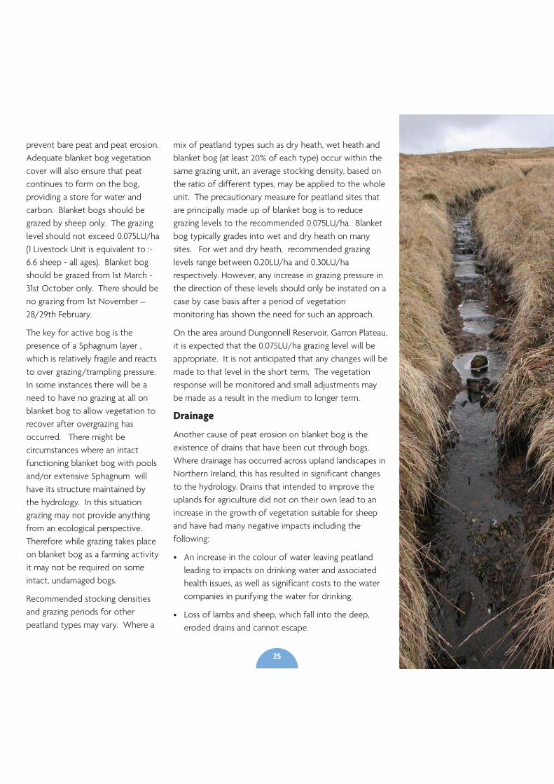
Drainage
Another cause of peat erosion on blanket bog is theexistence of drains that have been cut through bogs.Where drainage has occurred across upland landscapes inNorthern Ireland, this has resulted in significant changesto the hydrology. Drains that intended to improve theuplands for agriculture did not on their own lead to anincrease in the growth of vegetation suitable for sheepand have had many negative impacts including thefollowing:
• An increase in the colour of water leaving peatlandleading to impacts on drinking water and associatedhealth issues, as well as significant costs to the watercompanies in purifying the water for drinking.
• Loss of lambs and sheep, which fall into the deep,eroded drains and cannot escape.
25
• A decrease in the diversity of characteristic plant species associated with a variety of wet soil conditions.
• Possible localised flash flooding caused by greatly increased speed of run-off (an example of this includesthe impact from drains in blanket bog on Cuilcagh Mountain in Fermanagh in the 1990s when the MarbleArch Caves experienced flooding up until Fermanagh District Council and the RSPB worked in partnershipand blocked drains as part of a blanket bog restoration project).
• An increase in erosion and destruction of the peat body resulting in the silting up of streams.
The blocking of drains in peatland has become a recognised management technique to “re-wet” the habitatby restoring natural drainage patterns and, through long term regeneration of the blanket bog, reverse thenegative effects of drainage. Within the catchment area of Dungonnell Reservoir on the Garron Plateau,drainage is restricted to two main areas, where up to 16450m (16.4km) of drains have been mapped forattention.
Drain blocking methods
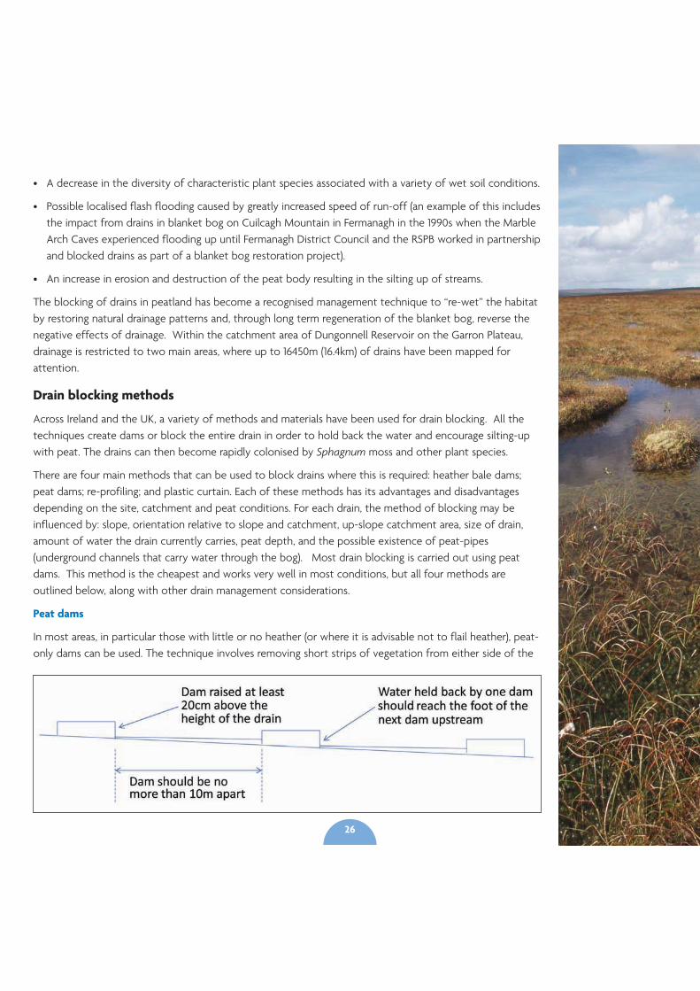
Across Ireland and the UK, a variety of methods and materials have been used for drain blocking. All thetechniques create dams or block the entire drain in order to hold back the water and encourage silting-upwith peat. The drains can then become rapidly colonised by Sphagnum moss and other plant species.
There are four main methods that can be used to block drains where this is required: heather bale dams;peat dams; re-profiling; and plastic curtain. Each of these methods has its advantages and disadvantagesdepending on the site, catchment and peat conditions. For each drain, the method of blocking may beinfluenced by: slope, orientation relative to slope and catchment, up-slope catchment area, size of drain,amount of water the drain currently carries, peat depth, and the possible existence of peat-pipes(underground channels that carry water through the bog). Most drain blocking is carried out using peatdams. This method is the cheapest and works very well in most conditions, but all four methods areoutlined below, along with other drain management considerations.
Peat dams
In most areas, in particular those with little or no heather (or where it is advisable not to flail heather), peat-only dams can be used. The technique involves removing short strips of vegetation from either side of the
26
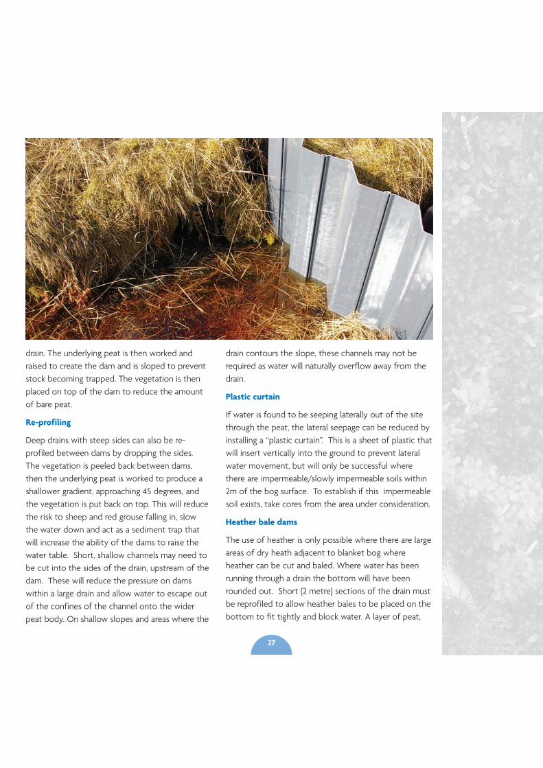
drain. The underlying peat is then worked andraised to create the dam and is sloped to preventstock becoming trapped. The vegetation is thenplaced on top of the dam to reduce the amountof bare peat.
Re-profiling
Deep drains with steep sides can also be re-profiled between dams by dropping the sides.The vegetation is peeled back between dams,then the underlying peat is worked to produce ashallower gradient, approaching 45 degrees, andthe vegetation is put back on top. This will reducethe risk to sheep and red grouse falling in, slowthe water down and act as a sediment trap thatwill increase the ability of the dams to raise thewater table. Short, shallow channels may need tobe cut into the sides of the drain, upstream of thedam. These will reduce the pressure on damswithin a large drain and allow water to escape outof the confines of the channel onto the widerpeat body. On shallow slopes and areas where the
drain contours the slope, these channels may not berequired as water will naturally overflow away from thedrain.
Plastic curtain
If water is found to be seeping laterally out of the sitethrough the peat, the lateral seepage can be reduced byinstalling a “plastic curtain”. This is a sheet of plastic thatwill insert vertically into the ground to prevent lateralwater movement, but will only be successful wherethere are impermeable/slowly impermeable soils within2m of the bog surface. To establish if this impermeablesoil exists, take cores from the area under consideration.
Heather bale dams
The use of heather is only possible where there are largeareas of dry heath adjacent to blanket bog whereheather can be cut and baled. Where water has beenrunning through a drain the bottom will have beenrounded out. Short (2 metre) sections of the drain mustbe reprofiled to allow heather bales to be placed on thebottom to fit tightly and block water. A layer of peat,
27
taken from upstream of the dam, is placed on top and on the upstream side of the heather bale with asloping face. Vegetation is then placed on top of the dam to prevent the exposure and erosion of barepeat. A short drainage channel can be created to move overflowing water away from the drain. Thesides of the drain behind the dam should be “pushed-in” slightly for stock safety.
For drains on a significant slope or on shallow peat, the drain may need to be fully blocked. This iswhere lengths of drain can be in-filled with heather bales to act as sediment traps between peat dams.
It is important the machine operator has a good understanding of the objectives. Whatever method isused, it is important that there is permanent water between each dam and that bare peat is kept to anabsolute minimum.
Other drain management considerations
Practical work should only take place outside the bird breeding and lambing seasons to minimisedisturbance and only specialist machinery and competent contractors should be used.
Use of machinery should minimise the amount of compaction and rutting of the peat, which wouldfurther increase run-off. Contractors should avoid driving up and down the slopes to reduce ruttingthat may develop into drainage channels.
When creating the dams, whichever method is used, it is important to know how deep the peat isbeneath the base of the drain. This is necessary to reduce the amount of mineral soil found within thedam, which can cause it to fail.
A thin layer of clay is often found under the peat. It is vitally important that this layer remains intact.
On steep slopes, it is important that pools behind the dam are kept to a minimum. This reduces thepossibility that the “pooled” water will flow directly around the dam and back into the drain.
Installing dams on slopes with shallow peat at the base of the drain may not hold back water as theseal with the underlying soil is unlikely to be water tight.
Complete infilling of drains will be necessary on certain drains either by re-profiling or using heatherbales, as dams may not be sufficient on their own.
Techniques will continue to evolve but at the time of writing, large areas of suitable drains are blockedusing re-profiling in association with peat dams.
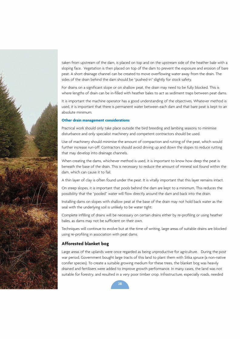
Afforested blanket bog
Large areas of the uplands were once regarded as being unproductive for agriculture. During the postwar period, Government bought large tracts of this land to plant them with Sitka spruce (a non-nativeconifer species). To create a suitable growing medium for these trees, the blanket bog was heavilydrained and fertilisers were added to improve growth performance. In many cases, the land was notsuitable for forestry, and resulted in a very poor timber crop. Infrastructure, especially roads, needed
28
29
for commercial forestry has also caused damage to blanket bogs. Many of the areas of upland that arecurrently forested have been identified by a Forest Service woodland creation map as unsuitable forwoodland creation.
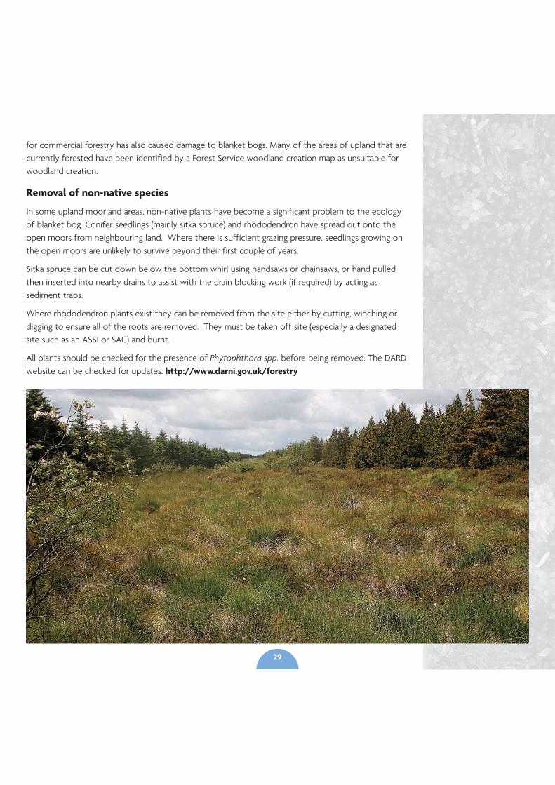
Removal of non-native species
In some upland moorland areas, non-native plants have become a significant problem to the ecologyof blanket bog. Conifer seedlings (mainly sitka spruce) and rhododendron have spread out onto theopen moors from neighbouring land. Where there is sufficient grazing pressure, seedlings growing onthe open moors are unlikely to survive beyond their first couple of years.
Sitka spruce can be cut down below the bottom whirl using handsaws or chainsaws, or hand pulledthen inserted into nearby drains to assist with the drain blocking work (if required) by acting assediment traps.
Where rhododendron plants exist they can be removed from the site either by cutting, winching ordigging to ensure all of the roots are removed. They must be taken off site (especially a designatedsite such as an ASSI or SAC) and burnt.
All plants should be checked for the presence of Phytophthora spp. before being removed. The DARDwebsite can be checked for updates: http://www.darni.gov.uk/forestry

A key success of taking a landscape-scale approach to restoring peatlands is the value for public moneythat it achieves. Pooling resources from voluntary and statutory bodies allows us to access additionalfunding, for delivery of both government and EU priority. The outcomes delivered by such an approachcan be significantly greater than the contribution any individual partner could achieve acting alone. Thisis particularly pertinent where partnership working can help to deliver on statutory responsibilities onland owned or managed by government partners to several times the value contributed by the publicpurse.
For example, a management plan for the Dungonnell catchment area on the Garron Plateau has beenproduced through funding from NIEA and the RSPB. Implementation of the plan will be funded byNorthern Ireland Water through the Sustainable Catchment Management Programme in NorthernIreland (SCaMP NI), and by DARD Countryside Management Unit through the Northern IrelandCountryside Management Scheme (NICMS). By working in partnership it is possible to pool fundingstreams and make best use of existing resources to deliver peatland restoration on a much wider scaleacross similar landscapes in Northern Ireland.
Grazing rates are the most important issue to get right on blanket bog. Farmers with blanket bog ontheir land can join the Northern Ireland Countryside Scheme and receive payment to restrict grazingrates to 0.075 LU/Ha. Where drainage is an issue, peat dams can cost an estimated £1.30 - £2 per metreand heather bale dams cost an estimated £5.50 per metre. Re-profiling costs an estimated £1 per metre.The costs for removing self seeding trees from blanket bog varies dramatically depending on the densityand age of the trees. In areas where chainsaws are required to remove the majority of the trees, and thedensity is around 0.5 tree/m2, the estimated costs would reach £1,000/ha.
Within the Common Agricultural Policy (CAP) there is a need to improve funds to better reflectecosystem service benefits and contribute to wider government objectives for biodiversity, water andcarbon. CAP could:
• Ensure an appropriate range of payments across peatland management activities at the right level ofpayment to incentivise initial and ongoing management
• Explore opportunities to integrate private / public initiatives to fund payment for ecosystemservices as a means of helping ensure payments reflect the costs to a land manager of peatlandrestoration and management
• Promote whole farm conservation and management encompassing payment for maintaining andrestoring peatlands. A coordinated approach to support collaborative payment applications forpeatland management at a landscape-scale across multiple land holdings
• Improve monitoring of environmental objectives under the payment schemes to allow properassessment of effectiveness and progress
Section 7Budgets
30
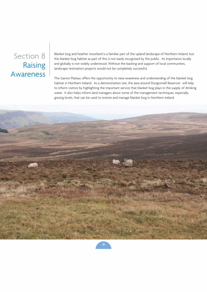
Blanket bog and heather moorland is a familiar part of the upland landscape of Northern Ireland, butthe blanket bog habitat as part of this is not easily recognised by the public. Its importance locallyand globally is not widely understood. Without the backing and support of local communities,landscape restoration projects would not be completely successful.
The Garron Plateau offers the opportunity to raise awareness and understanding of the blanket boghabitat in Northern Ireland. As a demonstration site, the area around Dungonnell Reservoir will helpto inform visitors by highlighting the important service that blanket bog plays in the supply of drinkingwater. It also helps inform land managers about some of the management techniques, especiallygrazing levels, that can be used to restore and manage blanket bog in Northern Ireland.
Section 8Raising
Awareness
31

Section 9Workingwith theFarming
Community
Practical upland restoration work is reliant on landowners and managers to carry out works.Projects on sites such as the Garron Plateau will provide an opportunity to see some restorationand management work being carried out, and to find out more about how and why a similarlandscape-scale approach can be applied to upland management elsewhere in Northern Ireland.
32
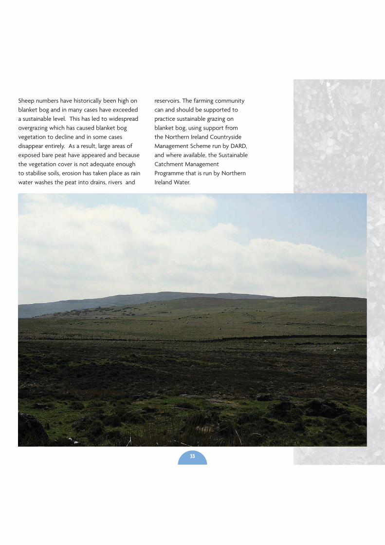
Sheep numbers have historically been high onblanket bog and in many cases have exceededa sustainable level. This has led to widespreadovergrazing which has caused blanket bogvegetation to decline and in some casesdisappear entirely. As a result, large areas ofexposed bare peat have appeared and becausethe vegetation cover is not adequate enoughto stabilise soils, erosion has taken place as rainwater washes the peat into drains, rivers and
reservoirs. The farming communitycan and should be supported topractice sustainable grazing onblanket bog, using support fromthe Northern Ireland CountrysideManagement Scheme run by DARD,and where available, the SustainableCatchment ManagementProgramme that is run by NorthernIreland Water.
33
Where drainage occurred on the uplands ofNorthern Ireland, one of the initial aimswould have been to increase livestockproduction. However, there is little evidencethat a drained peatland can sustain the largeincreases in stock that usually follow thedrainage operations.
Where drains exist, and can be blocked,restoration can help increase sheep use,probably because dams provide a greaternumber of drain crossing points. Research hasshown that drain blocking does not lead toany changes in grass abundance. In contrast,sedges increase and dwarf shrubs decreasemarginally in areas directly adjacent toblocked drains. Therefore drain blocking isunlikely to alter the availability of grazing, butmay increase stock access to wetter areas.
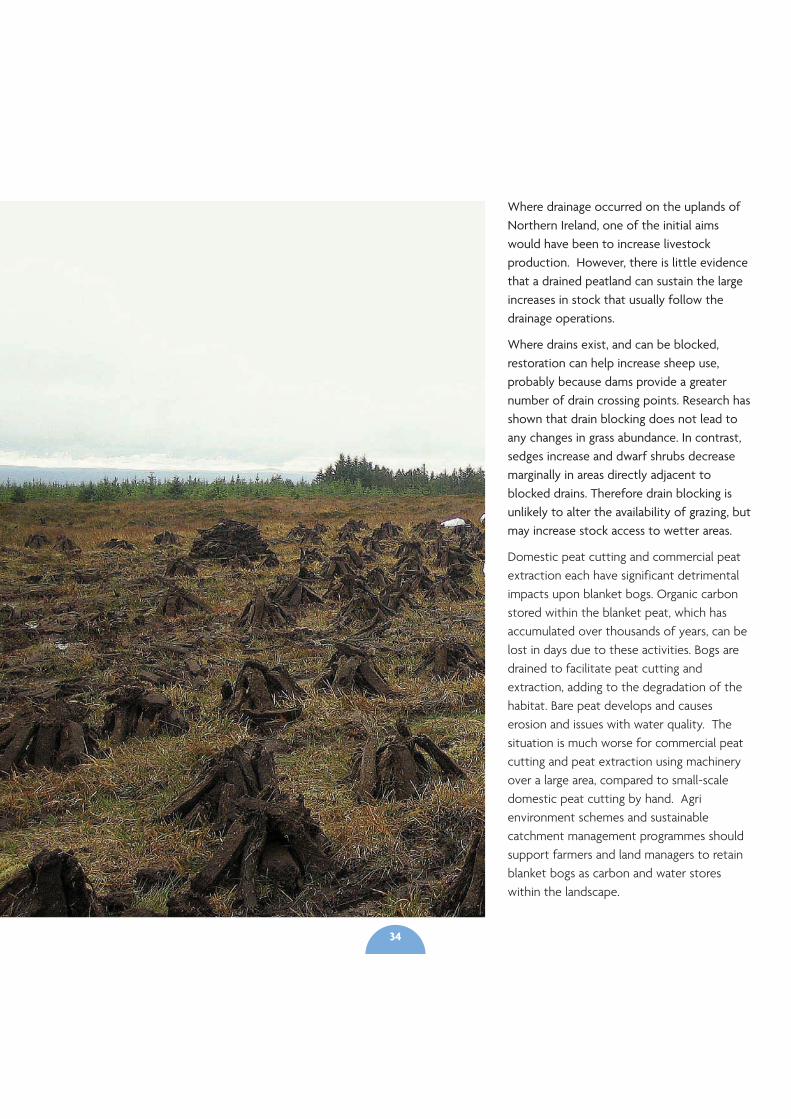
Domestic peat cutting and commercial peatextraction each have significant detrimentalimpacts upon blanket bogs. Organic carbonstored within the blanket peat, which hasaccumulated over thousands of years, can belost in days due to these activities. Bogs aredrained to facilitate peat cutting andextraction, adding to the degradation of thehabitat. Bare peat develops and causeserosion and issues with water quality. Thesituation is much worse for commercial peatcutting and peat extraction using machineryover a large area, compared to small-scaledomestic peat cutting by hand. Agrienvironment schemes and sustainablecatchment management programmes shouldsupport farmers and land managers to retainblanket bogs as carbon and water storeswithin the landscape.
34
Forestry and farming in the future
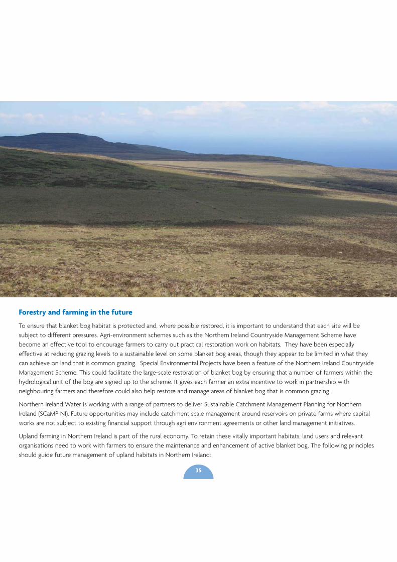
To ensure that blanket bog habitat is protected and, where possible restored, it is important to understand that each site will besubject to different pressures. Agri-environment schemes such as the Northern Ireland Countryside Management Scheme havebecome an effective tool to encourage farmers to carry out practical restoration work on habitats. They have been especiallyeffective at reducing grazing levels to a sustainable level on some blanket bog areas, though they appear to be limited in what theycan achieve on land that is common grazing. Special Environmental Projects have been a feature of the Northern Ireland CountrysideManagement Scheme. This could facilitate the large-scale restoration of blanket bog by ensuring that a number of farmers within thehydrological unit of the bog are signed up to the scheme. It gives each farmer an extra incentive to work in partnership withneighbouring farmers and therefore could also help restore and manage areas of blanket bog that is common grazing.
Northern Ireland Water is working with a range of partners to deliver Sustainable Catchment Management Planning for NorthernIreland (SCaMP NI). Future opportunities may include catchment scale management around reservoirs on private farms where capitalworks are not subject to existing financial support through agri environment agreements or other land management initiatives.
Upland farming in Northern Ireland is part of the rural economy. To retain these vitally important habitats, land users and relevantorganisations need to work with farmers to ensure the maintenance and enhancement of active blanket bog. The following principlesshould guide future management of upland habitats in Northern Ireland:
35
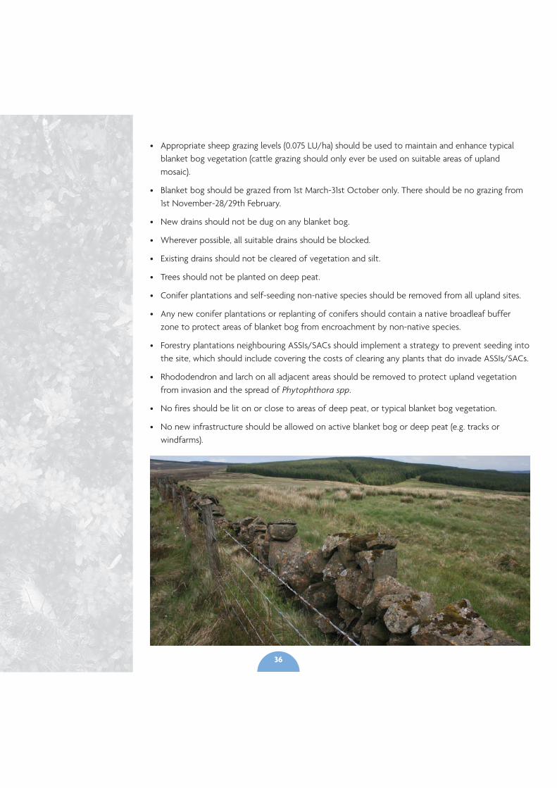
• Appropriate sheep grazing levels (0.075 LU/ha) should be used to maintain and enhance typicalblanket bog vegetation (cattle grazing should only ever be used on suitable areas of uplandmosaic).
• Blanket bog should be grazed from 1st March-31st October only. There should be no grazing from1st November-28/29th February.
• New drains should not be dug on any blanket bog.
• Wherever possible, all suitable drains should be blocked.
• Existing drains should not be cleared of vegetation and silt.
• Trees should not be planted on deep peat.
• Conifer plantations and self-seeding non-native species should be removed from all upland sites.
• Any new conifer plantations or replanting of conifers should contain a native broadleaf bufferzone to protect areas of blanket bog from encroachment by non-native species.
• Forestry plantations neighbouring ASSIs/SACs should implement a strategy to prevent seeding intothe site, which should include covering the costs of clearing any plants that do invade ASSIs/SACs.
• Rhododendron and larch on all adjacent areas should be removed to protect upland vegetationfrom invasion and the spread of Phytophthora spp.
• No fires should be lit on or close to areas of deep peat, or typical blanket bog vegetation.
• No new infrastructure should be allowed on active blanket bog or deep peat (e.g. tracks orwindfarms).
36
Section 10Next
steps?
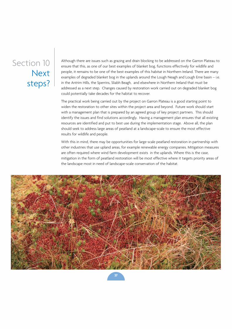
Although there are issues such as grazing and drain blocking to be addressed on the Garron Plateau toensure that this, as one of our best examples of blanket bog, functions effectively for wildlife andpeople, it remains to be one of the best examples of this habitat in Northern Ireland. There are manyexamples of degraded blanket bog in the uplands around the Lough Neagh and Lough Erne basin – i.e.in the Antrim Hills, the Sperrins, Sliabh Beagh, and elsewhere in Northern Ireland that must beaddressed as a next step. Changes caused by restoration work carried out on degraded blanket bogcould potentially take decades for the habitat to recover.
The practical work being carried out by the project on Garron Plateau is a good starting point towiden the restoration to other sites within the project area and beyond. Future work should startwith a management plan that is prepared by an agreed group of key project partners. This shouldidentify the issues and find solutions accordingly. Having a management plan ensures that all existingresources are identified and put to best use during the implementation stage. Above all, the planshould seek to address large areas of peatland at a landscape-scale to ensure the most effectiveresults for wildlife and people.
With this in mind, there may be opportunities for large-scale peatland restoration in partnership withother industries that use upland areas, for example renewable energy companies. Mitigation measuresare often required where wind farm development exists in the uplands. Where this is the case,mitigation in the form of peatland restoration will be most effective where it targets priority areas ofthe landscape most in need of landscape-scale conservation of the habitat.
37

AcknowledgementsThe RSPB and the Northern Ireland Environment Agency (NIEA) have jointlytaken the lead role in developing this document as part of the Rebuilding theCountryside project that aims to restore habitats at a landscape-scale acrossNorthern Ireland. This landscape-scale initiative has received funding from theNIEA and the RSPB towards the production of management plans for peatlandon the Garron Plateau in the Antrim Hills. We are also pleased to acknowledgethe financial commitment from Northern Ireland Water for theimplementation of the management plan for the catchment area aroundDungonnell Reservoir on the Garron Plateau through Sustainable CatchmentManagement Planning (SCaMP), to enable this site to act as a demonstration ofbest practice, and the Department of Agriculture & Rural Development (DARD)for supporting moorland management in key areas through the NorthernIreland Countryside Management Scheme (NICMS).
38
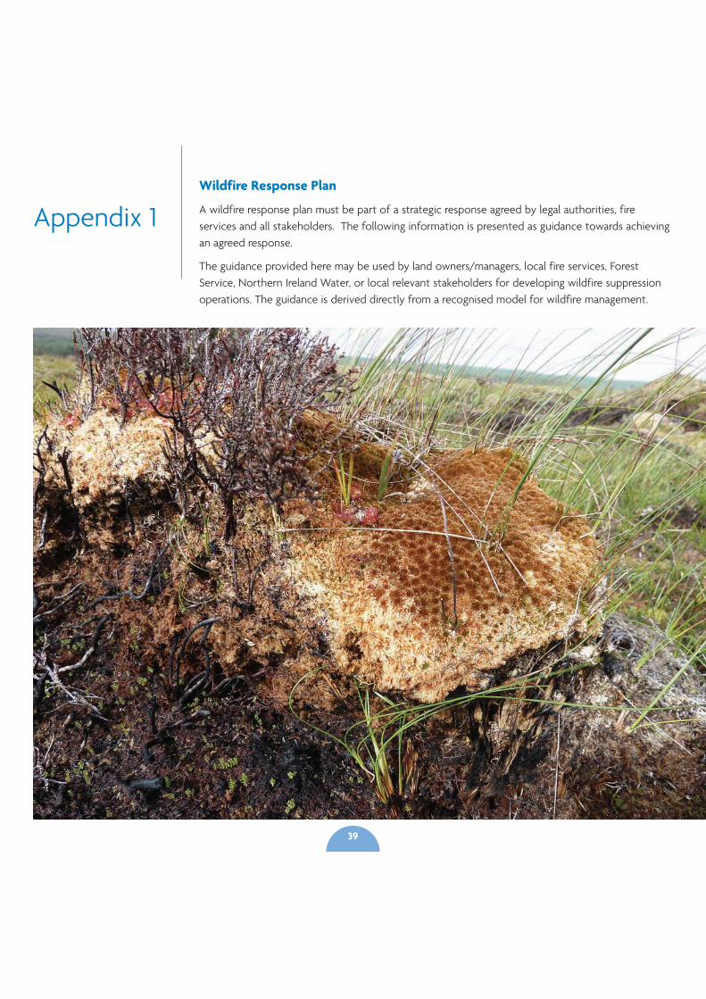
Appendix 1Wildfire Response Plan
A wildfire response plan must be part of a strategic response agreed by legal authorities, fireservices and all stakeholders. The following information is presented as guidance towards achievingan agreed response.
The guidance provided here may be used by land owners/managers, local fire services, ForestService, Northern Ireland Water, or local relevant stakeholders for developing wildfire suppressionoperations. The guidance is derived directly from a recognised model for wildfire management.
39
Wildfire Response Plan
Emergency Contacts
Primary Contact Information
A. Emergency Response - NI Fire and Rescue Service contactNumber: 999(NI) or 112(RoI)
Regional Wildfire coordinator – establishment of volunteercoordinator and personnel rota from local community basedstakeholder group recommended.
Local Community members are most likely to be first todetect fires so knowledge of who to contact should bedisseminated as widely as possible (local communityassociations, local media, signage in upland areas, local publicbuildings etc).
Disseminate the following advice:
When reporting a wildfire, please supply the followinginformation
• Location of the wildfire (with Map Reference if possible)
• Best Access to the wildfire if Known
• Approximate size of the wildfire
B. Secondary Response - If known, contact the land manageror owner on whose land fire is occurring
Secondary Contact Information (for information only, notemergency response)
NI:
Local District Headquarters for Northern Ireland Fire andRescue Service
Northern Ireland Environment Agency 0044 (0) 845 302 0008
Local Forest Service Regional Office (if fire is close toForestry)
Initial response to wildfire
Upon sighting/arrival to an unattended wildfire incidentconsider the following while calling 999:
• Location of the fire
• Approximate size of fire
• Best access to the fire, if known
Before the Fire Service arrives on scene, and without puttingyourself at risk (Personal Safety overrides all other factors),find out the following information to pass to fire officers:
• Type of vegetation on fire/surrounding vegetation
• Terrain type
• Fire behaviour (rate of spread, direction of spread etc.)
• Current/expected weather conditions
• Priority areas at risk
• Hazards or safety concerns
Safety Guidelines for Coordinator and Lookouts
Monitoring
• Appoint lookouts to observe fire behaviour
• Lookouts should communicate any development of the firethat might endanger operational teams
Awareness
• All personnel should remain alert to any changes on thewildfire ground that might affect their safety
Communications
• Remain in communication with team members, supervisorsand incident commanders
Escape Routes
• Identify and communicate accessible escape routes that leadto a place of safety
40
Safety Zones
• Safety zones must be identified and their locationunderstood by everyone on the wildfire ground
Wildfire site briefing checklist
It is imperative that contact is made by the land manager, ordelegated coordinator, with the first fire crew to attend thewildfire. An exchange of information about the wildfire mustoccur between the manager/representative, to receivepermission for non-fire service volunteers to act on the wildfiresite. All new staff arriving at incident site must make themselvesknown to the incident coordinator, or delegated official, toreceive permission to act on the wildfire site. Incidentcoordinators must provide a formal briefing and establish aworking relationship with all new staff arriving at site.
The briefing should include the following:
• Location (map orientation if possible)
• Personnel or resources on site
• Vegetation and type of terrain
• Weather conditions (current and expected)
• Fire behaviour (current and expected)
• Priority areas
• Incident commander (or delegate) to provide briefing to staff:
Strategy/Tactics
• Name of incident coordinator
• Incident action plan
• Specific tactical assignments (suppression of fire spread or‘jump’ around edges, creation of fire breaks, watercollection/pumping etc.)
Resources
• People on the fire ground
• Available resources (water, equipment, people)
Communications
• Communication Plan (radios and mobile phones)
• Mobile phone numbers/Radio frequencies
Safety
• Hazards/control measures in place
• Escape routes
• Safety zones
Working together on wildfire incidents
One of the goals of the fire plan is to establish and developcooperation between legal landowners, statutory and non-statutory land managers and Fire Services. Working together willincrease the effectiveness of wildfire suppression operations by:
• Allowing for the planning and execution of a coordinatedincident action plan
• Making use of local and specialist knowledge
• Increasing available resources
• Increasing communications between organizations andindividuals on the fire scene
• Providing safer working conditions through increasedcommunication and coordination
Follow the guidelines below to ensure good teamwork on awildfire incident:
• Upon arrival, all personnel must establish and maintaineffective liaison with the incident coordinator or delegatedofficial
• Rural organizations and the Fire Service must establish andmaintain effective communication for the duration of thewildfire
41
• Small spot fires may be put out relatively easily by stampingon the fire, or by using fire beaters or similar equipmentprovided there is no risk. Moorland fires can flare up quicklyand can travel over the ground very fast so extreme care isessential to avoid injury.
• Any fire that is well alight or likely to get out of control willrequire a more substantial response. The Fire Service shouldbe notified as soon as possible and given precise informationof the location of the fire and the closest access route to it.Where the location is difficult to describe it may be necessaryto arrange to meet the fire crews at an obvious rendezvouspoint and guide them to the fire.
• The Fire Service will assume control of all fire fighting activity.The local coordinator should direct the effort of other staffand liaise with the senior Fire Officer, comply exactly with hisinstructions and render any possible assistance to the FireService.
• Other staff should be brought in to help if needed.Neighbouring landowners should be notified if possible. Fireson or close to Forestry land should be reported to ForestService. NIEA and DARD staff should be advised of any fires atthe time or as soon as possible later for designated area andagri-environment monitoring purposes.
• Post-fire briefings should be held to discuss fire and anyproblem or issues to use in future
• Brief written report by incident coordinator submitted to FireGroup and kept as part of ongoing fire recording system
Extinguishing the fire
Methods of fire extinguishing may be conveniently classifiedunder the following headings:
1. Starvation or the limitation of fuel.
2. Smothering or the limitation of oxygen.
3. Cooling or the limitation of temperature.
Many methods of fire fighting often involve more than one ofthese methods but it is convenient to look at them separately:
1. Starvation
Techniques which are useful on moorland fires involvemaking a fire break by digging trenches, cutting vegetationor spreading foam. When the fire reaches the fire break itwill hopefully die out through lack of fuel. Similarly thesideways spread of a moorland fire can be contained bybeating to direct the fire to existing fire breaks such as tracksor streams. Care is needed to ensure that the wind does notcarry burning material past the fire break to start more fireson the other side.
2. Smothering
Smothering a fire cuts off the supply of oxygen or air. Firebeaters are often used to smother moorland fires where thefire fighters work in from the edges of the fire snuffing itout with the beaters. Eventually the fire is contained andcan be put out. Note that the term “beater” is misleading asbeating a fire with a shovel or flat metal sheet on a pole willonly fan more air to the fire causing it to flare up while atthe same time quickly tiring the person using the beater.The correct technique is to snuff out the flames by pressingthe flat blade of the beater on to the fire, perhaps alsomoving the blade back and forward in a scrubbing action.
3. Cooling
A fire will go out if the amount of heat lost from the seat ofthe fire is greater than the heat generated by the fire. Theuse of a jet or spray of water is the most common methodof cooling a fire. Provided sufficient water is applied thenthe temperature of the fire will eventually drop to the pointwhere the fire goes out through lack of heat.
Fire crews often continue to damp down large fire sites afterthe fire appears to be out. This is to ensure that the residualheat in the mass of burnt material is too low to allow thefire to spring up again. Moorland fires can also flare up again
42
even when they appear to be out. It is important to ensurethat there is no chance of the fire re-igniting before leavingthe scene.
Some areas of moorland are remote and inaccessible tomost vehicles, creating difficulties in transporting people andequipment to the site of some fires. In many cases it willnot be practical to get fire pumps and hoses to the site. Themost common method of fighting moorland fires is to sendfire fighters in on foot each equipped with a fire beater.They may have a considerable distance to walk before theyeven reach the fire.
Where a fire crew can bring pumps and hoses to the sitethey will need a supply of water. Local coordinators shouldadvise the Fire Officer of the location of the nearest waterbodies where water may be obtained.
Back-pack sprayers are useful for containing the spread offires or for putting out small fires springing up due toburning material blown out from larger fires by the wind.They are limited by the amount of water that can be carriedbut can be refilled easily from a stream. A self-powered high-pressure sprayer should be held as part of the fireequipment. This can be used to lay down a carpet of foamas a fire break for larger fires. It too is limited by the quantityof water that can be transported to the site in drums.Remember that the power washer has a petrol tank which ispotentially explosive so be careful not to get too close tofires.
Recommended Equipment List
Fire Service equipment to operate on fires where accessible
• Quad 4x4 ATV
• 4x4 off road vehicle
• Trailer (towable by both the ATV and the Landrover)
• Fire beaters x 10
• Back-pack sprayers x 4
• Water pump & hose
• Self-powered pressure sprayer
• Spades, shovels, etc.
• Safety visors & goggles
• Strimmer with brush cutter to cut fire breaks (if the fire issevere and likely to burn for a long time consider bringing outthe ‘sit and ride’).
• First Aid Kits
Follow-up Action
• Once a fire is properly extinguished the first priority is tocheck that all persons are accounted for safely.
• All equipment should be recovered, checked over and leftready for immediate use. Any damage to Park propertyshould be reported for action.
• A short report on the incident should be prepared. Copiesmay be forwarded to the relevant legal authorities for theirinformation.
• An assessment of any environmental impacts of the fire willbe carried out so that appropriate conservation measures canbe put into action.
43
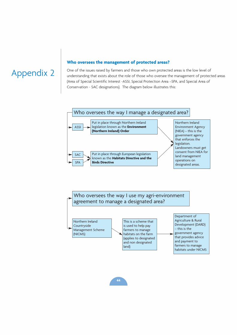
Appendix 2Who oversees the management of protected areas?
One of the issues raised by farmers and those who own protected areas is the low level ofunderstanding that exists about the role of those who oversee the management of protected areas(Area of Special Scientific Interest -ASSI, Special Protection Area –SPA, and Special Area ofConservation - SAC designations). The diagram below illustrates this:
Who oversees the way I manage a designated area?
Northern IrelandEnvironment Agency(NIEA) – this is thegovernment agencythat enforces thelegislation.Landowners must getconsent from NIEA forland managementoperations ondesignated areas.
Put in place through Northern Irelandlegislation known as the Environment(Northern Ireland) Order
Put in place through European legislationknown as the Habitats Directive and theBirds Directive
ASSI
SAC
SPA
Who oversees the way I use my agri-environmentagreement to manage a designated area?
Northern IrelandCountrysideManagement Scheme(NICMS)
This is a scheme thatis used to help payfarmers to managehabitats on the farm(applies to designatedand non designatedland)
Department ofAgriculture & RuralDevelopment (DARD)– this is thegovernment agencythat provides adviceand payment tofarmers to managehabitats under NICMS
44
References
Bain, C.G., Bonn, A., Stoneman, R., Chapman, S., Coupar,A., Evans, M., Gearey, B., Howat, M., Joosten, H.,Keenleyside, C., Labadz, J., Lindsay, R., Littlewood, N.,Lunt, P., Miller, C.J., Moxey, A., Orr, H., Reed, M., Smith, P.,Swales, V., Thompson, D.B.A., Thompson, P.S., Van deNoort, R., Wilson, J.D. & Worrall, F. (2011) IUCN UKCommission of Inquiry on Peatlands. IUCN UK PeatlandProgramme, Edinburgh.
RSPB Scotland (2011) Realising the Benefits of Peatlands -Overcoming policy barriers to peatland restoration
Environment Agency, Countryside Council for Wales,Forestry Commission Wales, Royal Society for theProtection of Birds (2011) Active Blanket Bog in Wales
Lindsay, R.A (2010) Peatbogs and carbon – a criticalsynthesis to inform policy development in oceanic peatbog conservation and restoration in the context ofclimate change.
RSPB (2010) Futurescapes – Space for Nature, Land forLife (Northern Ireland)
RSPB Northern Ireland (2010) Sliabh Beagh ManagementPlan
Scottish Natural Heritage (2005) The Peatlands ofCaithness & Sutherland. Management Strategy 2005 –2015.
Allen, D., Mellon ,C., Mawhinney, K., Milburn, J., Looney,D.(2004) The Status of Red Grouse in Northern Ireland
Environment & Heritage Service (2003) Northern IrelandHabitat Action Plan – Blanket Bog Final Draft
45
Key Contact Details
RSPB Northern IrelandBelvoir Park ForestBELFASTBT8 7QTTel: 028 9049 1547
Northern Ireland Environment AgencyKlondyke BuildingCromac AvenueGasworks Business ParkLower Ormeau RoadBelfastBT7 2JATel: 0845 302 0008
Northern Ireland WaterNorthern Ireland WaterPO Box 1026BelfastBT1 9DJTel: Waterline 08457 440088
Department of Agriculture & Rural DevelopmentDundonald HouseUpper Newtownards RoadBallymiscawBelfast BT4 3SBTel: 0300 200 7852
All photo credits to RSPB Northern Ireland, theNorthern Ireland Environmant Agency, and torspb-images.com
46