raster data. the raster data model the raster data model is used to model spatial phenomena that...
Post on 19-Dec-2015
230 views
TRANSCRIPT
Raster Data

The Raster Data Model
• The Raster Data Model is used to model spatial phenomena that vary continuously over a surface and that do not have discrete dimension– Elevation– Temperature– Rainfall– Noise Levels
Surfaces Have Numeric Values
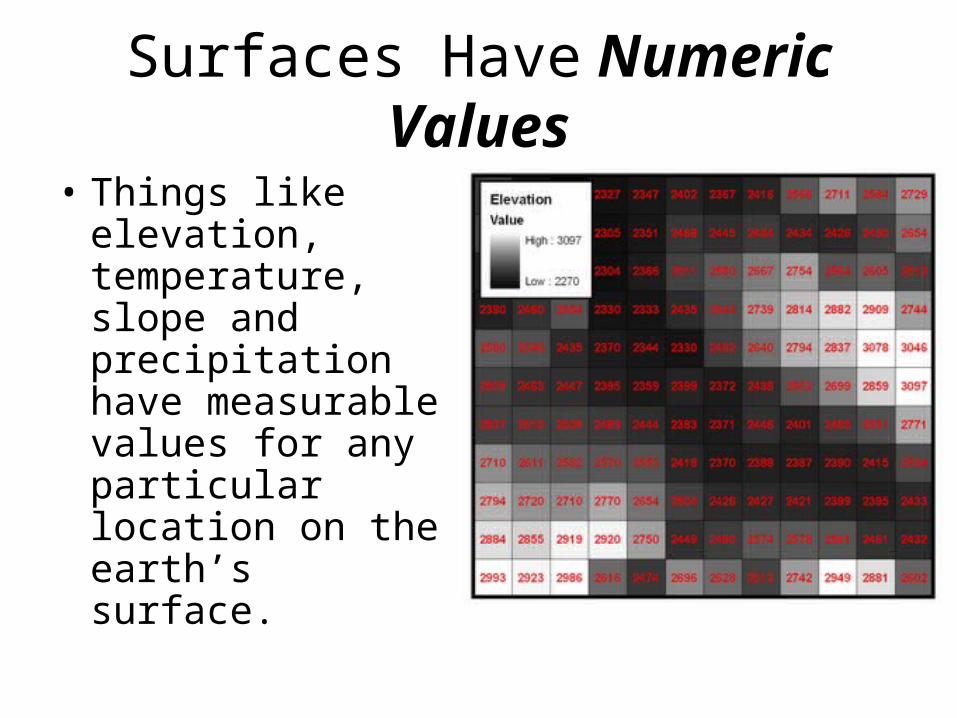
• Things like elevation, temperature, slope and precipitation have measurable values for any particular location on the earth’s surface.

Surfaces Have Numeric Values
• To model these phenomena, an area of interest is divided into an array of identically sized squares
• The centers of these squares then become the ‘sample points’
Surfaces Have Numeric Values
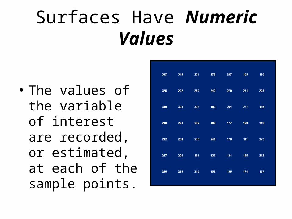
• The values of the variable of interest are recorded, or estimated, at each of the sample points.
Surfaces Have Numeric Values
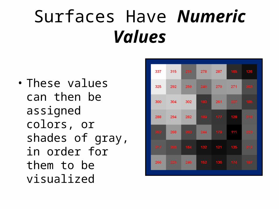
• These values can then be assigned colors, or shades of gray, in order for them to be visualized
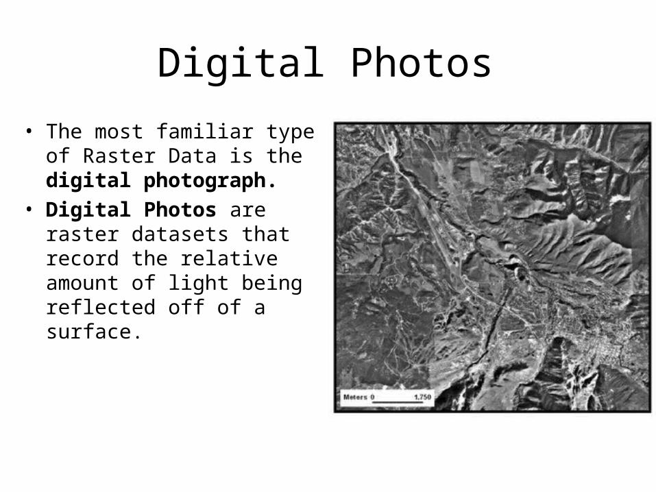
Digital Photos
• The most familiar type of Raster Data is the digital photograph.
• Digital Photos are raster datasets that record the relative amount of light being reflected off of a surface.
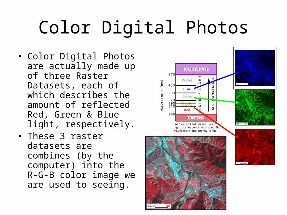
Color Digital Photos
• Color Digital Photos are actually made up of three Raster Datasets, each of which describes the amount of reflected Red, Green & Blue light, respectively.
• These 3 raster datasets are combines (by the computer) into the R-G-B color image we are used to seeing.
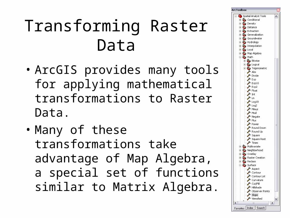
Transforming Raster Data
• ArcGIS provides many tools for applying mathematical transformations to Raster Data.
• Many of these transformations take advantage of Map Algebra, a special set of functions similar to Matrix Algebra.
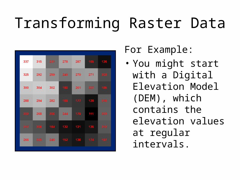
Transforming Raster Data
For Example:
• You might start with a Digital Elevation Model (DEM), which contains the elevation values at regular intervals.
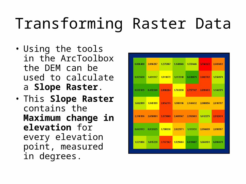
Transforming Raster Data
• Using the tools in the ArcToolbox the DEM can be used to calculate a Slope Raster.
• This Slope Raster contains the Maximum change in elevation for every elevation point, measured in degrees.
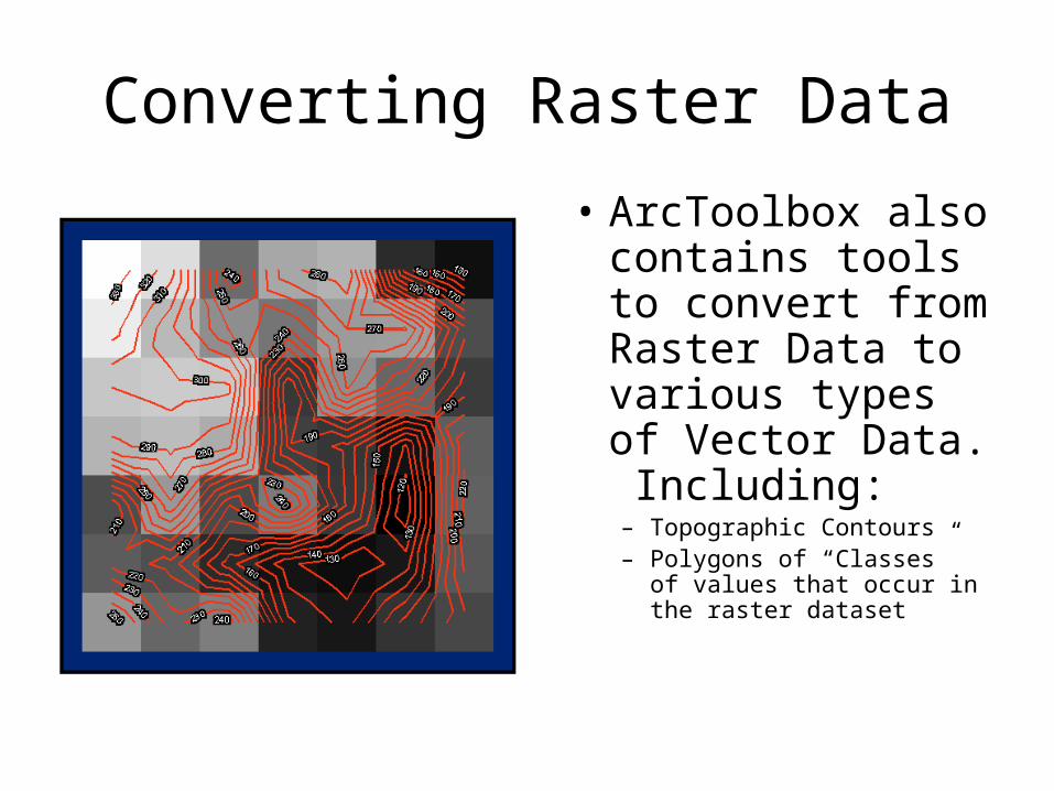
Converting Raster Data
• ArcToolbox also contains tools to convert from Raster Data to various types of Vector Data. Including:– Topographic Contours– Polygons of “Classes” of
values that occur in the raster dataset
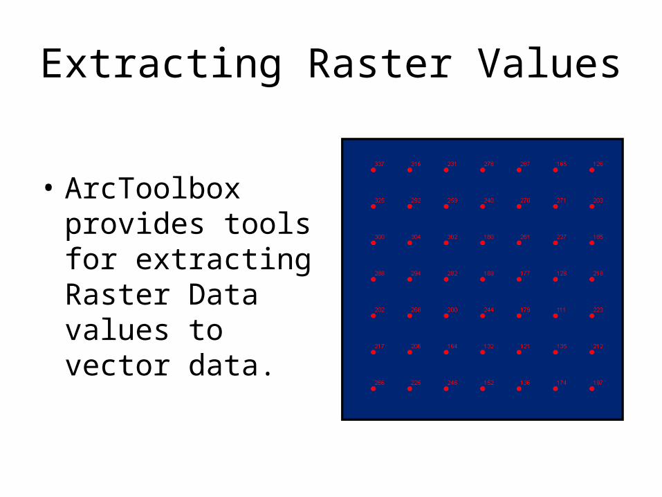
Extracting Raster Values
• ArcToolbox provides tools for extracting Raster Data values to vector data.

Creating Raster Data
• Finally, there are a number of tools in ArcToolbox that allow one to Create Raster Data.
• For example, you can create a Raster Dataset that contains the Distance from some feature to every other point in the area of interest.
• The distance values can then be extracted to other datasets for use as an attribute for analysis.