publicpublic workshop workshop may 19, 2011 gwinnett
TRANSCRIPT

PublicPublic WorkshopWorkshop May 19, 2011May 19, 2011Gwinnett Technical CollegeGwinnett Technical College

Workshop AgendaWorkshop Agenda
• 4:30 Welcome & Presentation of Assessment Findings
• 5:15 Interactive Exercise
What should change and not change?
BREAKBREAK
• 5:35 Small Group Discussions
Conceptual PlanningConceptual Planning
• 6:35 Group Reporting
• 7:00 Adjourn7:00 Adjourn
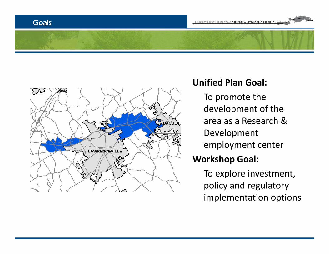
GoalsGoals
ifi d l lUnified Plan Goal:
To promote the development of thedevelopment of the area as a Research & Development
l t temployment center
Workshop Goal:
To explore investmentTo explore investment, policy and regulatory implementation options
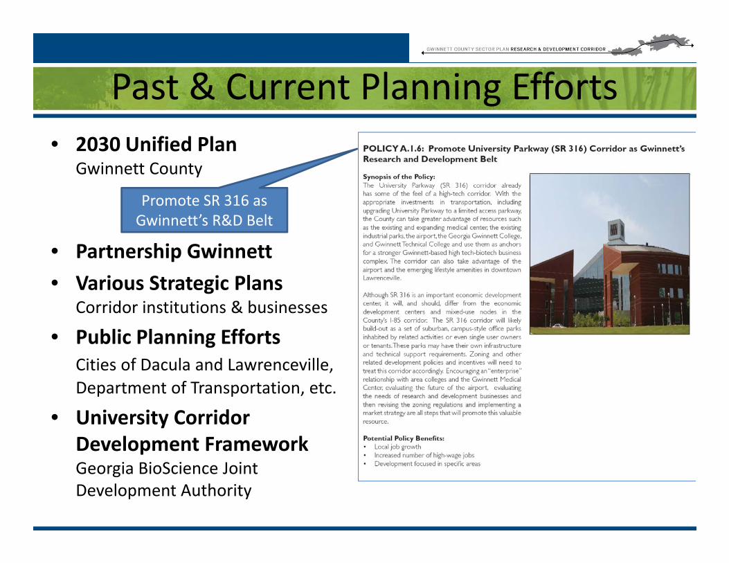
Past & Current Planning Effortsg• 2030 Unified Plan
Gwinnett Countyy
P t hi G i tt
Promote SR 316 as Gwinnett’s R&D Belt
• Partnership Gwinnett
• Various Strategic PlansCorridor institutions & businesses
• Public Planning EffortsCities of Dacula and Lawrenceville, Department of Transportation etcDepartment of Transportation, etc.
• University Corridor Development Framework Georgia BioScience Joint Development Authority

GBJDA Recommendations
University Corridor Development Framework University Corridor Development Framework
GBJDA Recommendations
• Deals primarily with building human, investment, and institutional capital
• Physical capital action items:• Physical capital action items:– Ensure zoning is in place to
encourage development compatible with adopted visualcompatible with adopted visual identity
– Ensure residential, recreational and retail opportunities areand retail opportunities are available
– Designate specific locations for new R&D corporate ornew R&D, corporate or manufacturing facilities

CASE STUDIESWhat are the characteristics of other
R&D areas?R&D areas?

Case StudiesCase Studies
• Silicon Valley, California• Red River Valley Research Corridor• Red River Valley Research Corridor,
North Dakota• Florida High Tech Corridor• Research Triangle, Raleigh-DurhamResearch Triangle, Raleigh Durham
Area, North Carolina• I-64 corridor in St. Charles County,
Missouri• State of Virginia, R&D
Concentrations• Knoxville Oak Ridge
Innovation Valley, TN• West Virginia I-79
Development Council
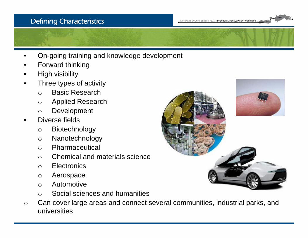
Defining CharacteristicsDefining Characteristics
• On-going training and knowledge development• Forward thinking• High visibility• High visibility• Three types of activity
o Basic Researcho Applied Researchppo Development
• Diverse fieldso Biotechnologyo Nanotechnology o Pharmaceuticalo Chemical and materials science
El t io Electronics o Aerospace o Automotive o Social sciences and humanitieso Social sciences and humanities
o Can cover large areas and connect several communities, industrial parks, and universities
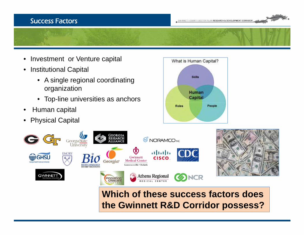
Success FactorsSuccess Factors
• Investment or Venture capital • Institutional Capitalp
• A single regional coordinating organization
• Top-line universities as anchors • Human capital• Physical Capital
Whi h f th f t dWhich of these success factors does the Gwinnett R&D Corridor possess?

Policies to Foster GrowthPolicies to Foster Growth
• Land Use Policeso Limit uses to targeted industries and supportive useso Promote or develop uses that attract desired labor force - cultural
amenities, planned communities, recreation facilitieso Design Guidelines to promote a unified look and charactero Designate through planning and zoning specific locations for residentialo Designate through planning and zoning specific locations for residential,
recreational, employment, and shopping
What policies are we willing to support?

Is the 316 corridor a good place for a R&D Corridor?
• What is the one Big Idea that will transfer this corridor to the vision we are describing?
• What are the Big Decisions that going to be made?What are the Big Decisions that going to be made? • What will it take to implement the Big Idea?

Technology Park ExampleHow do we tie the area together?How do we tie the area together?
gy p
• AH To add image of • AH To add image ofAH To add image of Research triangle
AH To add image of Charlottesville R&D campus

Assessment: Study AreaAssessment: Study Area
• Unified Plan splits into two halves, east and west of Lawrenceville
• 6,500 acres total, 4,400 acres outside the cities
34% l t d ithi Citi• 34% located within Cities
• 60% located in industrial parks
• 13% in institutional campuses -Gwinnett Medical Gwinnett Gwinnett Medical, Gwinnett Public Safety Complex
• 3% school campuses, Georgia Gwinnett College and Gwinnett Technical CollegeGwinnett Technical College
• Corridor is currently warehouse and distribution oriented
• Does contain some R&D oriented companies – CISCO, Ricoh, Motorola

Assessment: Green InfrastructureAssessment: Green Infrastructure
• 56% Shallow Soil
• 6% Floodplain
• Only 30 acres or less Parks, Recreation or Conservation areas

Assessment: Existing Land UseAssessment: Existing Land Use
Outside of Cities:• 24% Industrial
• 22% Public/Institutional
20% U d l d• 20% Undeveloped
• 8% Agriculture
• 7% Office Professional7% Office Professional
• 6% Commercial
• Less than 3% Residential, though large residential areas just outside
• Less than 1% Park, though Rabbit Hill Park is adjacent
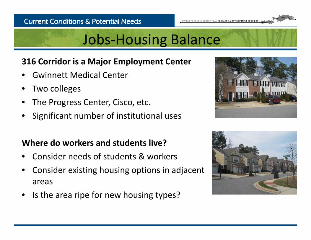
Current Conditions & Potential NeedsCurrent Conditions & Potential Needs
Jobs‐Housing Balance316 Corridor is a Major Employment Center
• Gwinnett Medical Center
Jobs Housing alance
• Gwinnett Medical Center
• Two colleges
• The Progress Center, Cisco, etc.The Progress Center, Cisco, etc.
• Significant number of institutional uses
Where do workers and students live?
• Consider needs of students & workers
• Consider existing housing options in adjacent areas
• Is the area ripe for new housing types?Is the area ripe for new housing types?

Assessment: BuildAssessment: Build--out Land Useout Land Use
What would the corridor look like if developable land were built as zoned?What would the corridor look like if developable land were built as zoned?
Undeveloped or Underutilized LandUnderutilized Land• 42% Zoned Industrial
• 32% Zoned Commercial
• 26% Zoned Agricultural
If developed as zoned would result in:would result in:• 50% Industrial
• 15% Commercial
• 11% Agricultural
• 8% Office
• 16% Other uses

Assessment: TransportationAssessment: Transportation
• SR 316, the railroad, and the airport all combine to make this area and excellent location for warehouse and distributionand excellent location for warehouse and distribution
• These assets also combine to make the area difficult for pedestrians and cyclists
• Plans for Georgia Highway 316 – grade separation • Work on interchanges at Collins Hill Road and SR 20 with
Collector/Distributor System will start this Summer
C lli Hill R dCollins Hill Road
SR 316
SR 20

Assessment: Transportation ProjectsAssessment: Transportation Projects
Transportation Investment Act (TIA) SubmittalsTransportation Investment Act (TIA) Submittals
• Wish list of projects for funding considerationfunding consideration
• Widening projects:• Hurricane Shoals Road• Hosea Road• US 29
• Grade separation on 316• US 29• Cedars Road/Hi Hope
Road• Hurricane Shoals Road

Corridor StrengthsStakeholder Interview FindingsStakeholder Interview Findings
g• “Gwinnett County is an excellent place for business.” • Presence of Gwinnett Technical College, Georgia Gwinnett
College, Gwinnett Medical Center, Cisco, the airport, and the Progress Center
• Strong infrastructure and the ability to expand and improve it over titime
• Good sewer, water, gas, electric, and other infrastructure • Major transportation investments• Synergies with two colleges suppliers and Chamber of• Synergies with two colleges, suppliers, and Chamber of
Commerce

Corridor Issues & ConcernsStakeholder Interview FindingsStakeholder Interview Findings
Corridor Issues & Concerns• “Unmanageable” traffic congestion, particularly at “saturated
intersections”intersections• Visual blight, resulting from billboards, poor buffers, & vacant
uses along 316• Relaxed planning and zoning policyRelaxed planning and zoning policy• Rezoning of industrial land to other uses• Perceived lack of overall planning for transportation in area• Limited water supply in the areapp y

Opportunities and ThreatsStakeholder Interview FindingsStakeholder Interview Findings
ppLand Use & Design• Redevelopment should be a priority• Tighter and more focused regulations• Tighter and more focused regulations• Consistent development style (e.g. signage, crosswalks, sidewalks)• Aesthetic Standards - overlay zoning and a new style of industrial buildings
TransportationTransportation • Mixed opinions on airport expansion• Making 316 limited access will help alleviate congestion• Transitioning University Pkwy to limited access
G i i & l i d l i d d• Greater connectivity & multimodal options needed
Economic Development • Additional professional jobs
F b fit f i f iliti d l d i l• Focus on benefits of services, facilities, and resources already in place• Greater collaboration with Lawrenceville and Dacula
Housing • Need to accommodate workforce housing needs• Need to accommodate workforce housing needs• More diverse options from garden apartments and single family homes
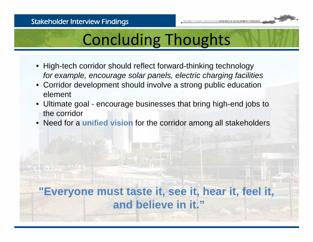
Concluding ThoughtsStakeholder Interview FindingsStakeholder Interview Findings
Concluding Thoughts• High-tech corridor should reflect forward-thinking technology
for example encourage solar panels electric charging facilitiesfor example, encourage solar panels, electric charging facilities• Corridor development should involve a strong public education
element• Ultimate goal - encourage businesses that bring high-end jobs toUltimate goal encourage businesses that bring high end jobs to
the corridor• Need for a unified vision for the corridor among all stakeholders
"Everyone must taste it, see it, hear it, feel it, yand believe in it.”
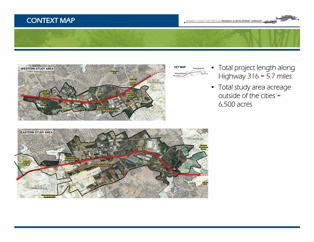
CONTEXT MAPCONTEXT MAP
• Total project length along Highway 316 5 7 milesHighway 316 = 5.7 miles
• Total study area acreage outside of the cities = 6 500 acres6,500 acres

Urban Design Analysis : DEVELOPMENTUrban Design Analysis : DEVELOPMENT
• Traffic congestion in eastern study area detrimental to commercialdetrimental to commercial/ workforce uses
• Perceived lack of architectural standards, ,signage regulations, pedestrian amenities
• Locals, travelers, potential investors eager to pass-though through rather than stay
• Lack of gateway signage • Lack of gateway signage to historic Lawrenceville and Dacula
• Distance from I-85 slight Distance from I 85 slight disadvantage to future econ. development

Urban Design Analysis : CIRCULATIONUrban Design Analysis : CIRCULATION
• Western Study Area = Grade-Separated Access
• Eastern Study Area = At-Grade Access
• At-grade intersections are huge issue
• “Daytime” goods and i l b services can only be
accessed by car
• Lack of pedestrian/bike connections that might connections that might reduce short-distance vehicle trips

Group Exercise: What should stay and change?Group Exercise: What should stay and change?

Small Group DiscussionSmall Group DiscussionSmall Group DiscussionSmall Group Discussion
Conceptual PlanningConceptual Planningp gp g
Considerations• Opportunities and issues related to circulation, land use, and design
• How is the study area different from other R&D areas?
• How does Gwinnett offer a unique quality to the area that is different from what other places offer?

Questions or Questions or Comments?Comments?

Contact UsContact Us
Nancy Lovingood, AICPGwinnett Planning & Development Department
Phone: 678 518 6214Phone: 678.518.6214
Email: [email protected]
Jim Summerbell, AICPJacobs Engineering
Ph 678 333 0476Phone: 678.333.0476
Email: [email protected]
www gwinnettudo comwww.gwinnettudo.com