public shoreline access in maine · 1. getting to coastal waters in maine can sometimes be a...
TRANSCRIPT

Public Shoreline Access in Maine:
A Citizen’s Guide to Ocean and Coastal Law
Produced by the Maine Sea Grant College
Program, Maine Coastal Program/Department
of Agriculture, Conservation and
Forestry, and Wells National Estuarine
Research Reserve
Third Edition August 2016

Public Shoreline Access in Maine is the revised edition of the guide published in 2004 by the University of Maine Sea Grant College Program and the University of Maine School of Law.
Funding for this publication is provided by the Maine Outdoor Heritage Fund, Maine Sea Grant, Maine Coastal Program/Department of Agriculture, Conservation and Forestry, and the Wells National Estuarine Research Reserve.
Principal Author: John Duff, University of Massachusetts-Boston, with assistance from Liana James and Victoria LaBate
Editor: Catherine Schmitt, Maine Sea Grant
Designer: Kathlyn Tenga-González, Maine Sea Grant
Project coordinators: Paul Dest, Wells National Estuarine Research Reserve and Kristen Grant, Maine Sea Grant and University of Maine Cooperative Extension
Copies of this guide are available at accessingthemainecoast.com and from:
Maine Sea Grant College Program5784 York Complex, Suite 66Orono, ME 04469-5784207.581.1435seagrant.umaine.edu
Wells National Estuarine Research Reserve342 Laudholm Farm RoadWells, ME 04090207.646.1555wellsreserve.org
Photo credits: Cover, p 4-courtesy of the Town of Wells; p 1, back cover-Jacques Trempe; pp 2, 3, 7, 10, 12-Kathlyn Tenga-González; pp 9, 11-courtesy of Kennebunkport Conservation Trust
Illustration: p 2-Kathlyn Tenga-González based on original by Anne Bernard
Suggested citation:
Duff, John. 2016. Public Shoreline Access in Maine: A Citizen’s Guide to Ocean and Coastal Law, Third Edition. Orono, ME: Maine Sea Grant College Program.

1
Getting to coastal waters in Maine can sometimes be a challenge, for despite the state’s 5,400 miles of mainland and island shoreline, only about 12% is in public ownership.1
Yet the public does have longstanding, although limited, rights to support traditional coastal uses along privately owned shoreline. In addition to the rights to “fish, fowl, and navigate,” members of the public have a variety of other means to secure access to shoreline areas and ocean waters. With more people attracted to Maine’s coastline for a variety of uses, it is important to understand the range of access rights that accommodate public interests. At the same time, it is helpful to understand the legal balance that respects private property.
Public Shoreline Access in Maine: A Citizen’s Guide to Ocean and Coastal Law

2
Who has rights to the shoreline? In Maine, the answer is usually some combination of the following:
Private property holders typically own the shore all the way down to the low water mark;
The state or town may own shoreline areas including beaches;
The public has certain rights to use the shoreline, even where a private owner holds legal title.
For each space and each given use of that space, there is a balance between public and private property rights.
Location, location, locationWhen it comes to coastal access in Maine, three general locations are important to consider and distinguish. Public and private rights along the Maine coast vary considerably from the submerged land and ocean areas through the in-tertidal zone and onto “upland” areas.
While property interests in the submerged lands and ocean areas are relatively clear, property rights in the intertidal zone have been the subject of dispute and litigation, leading to rulings by the Maine Supreme Judicial Court that have es-tablished who has which rights in the area between the high and low water marks. Even upland areas, including sandy
beaches above the high water mark, have been the subject of a number of conflicts that have prompted Maine courts to reconcile private property interests with a collection of public access claims.
1 Submerged lands and ocean spaceThe State of Maine owns submerged land below the mean low-water line, out to three nautical miles, and holds this land in trust for public use. The state also has authority and public trust responsibility to manage coastal waters out to three nautical miles. The public generally has unrestricted use of the water and sea bottom, subject to state regulations.
High tide
Low tide
1 BELOW LOW TIDE 2 INTERTIDAL 3 UPLAND
Submerged lands
OW
NER
SHIP Typically private with
public rights to “fish” “fowl” and “navigate”
Typically private with public rights as granted by
gift, easement, etc.State of Maine
held in public trust

3
However, public rights may be restricted by leases between the state and private individuals that provide exclusive use, such as for aquaculture or marinas, to certain submerged lands.
2 The intertidal areaIn the intertidal zone or wet shoreline areas in Maine, there is a mix of public and private rights. Private coastal upland owners usually hold title to the adjacent land between the mean high-water mark and the mean low-water mark. How-ever, those rights are subject to the public’s rights to “fish, fowl, and navigate.” This brief descriptive list of public interests resides at the center of a debate about whether the public has only those limited use rights, or whether “fishing, fowling, and navigation” merely alludes to certain primary uses and allows for an evolving range of additional uses. As outlined in this document, a few decisions by Maine’s Supreme Judicial Court (also known as the Law Court) explain how the range of public rights in the intertidal area is interpreted today.
3 The upland areaThe dry sand area and rocky shore above mean high water and adjacent uplands are generally privately owned. As a result, the public has no right to use that privately owned land for recreation, fishing, fowling, navigation, or any oth-er purpose without the owner’s permission. Neither does the public have a general right to pass over privately-owned upland to obtain access to the intertidal area to engage in the permitted uses of “fishing, fowling, or navigation.” However, the public has rights to use the upland if it is publicly owned, subject to any governmental regulations. The public also may acquire certain rights to use upland areas through a variety of transactions or claims. A private owner of coastal uplands may provide the public with a dedication (a gift), easement, right-of-way, lease, and/or a license. Non-owners may also acquire a “prescriptive easement” under certain conditions (see page 8).
How can this be? Isn’t property ownership an all-or-nothing system? When it comes to property in the United States, our legal history and our economic desires have led to a system of laws that accommodate and even encourage the splitting of legal interests in real proper-ty. This system allows people to use loans and mortgages to buy and “own” property (acknowledging the interests of the lend-ers). It allows a community to share some spaces while recognizing sole ownership in others. And it allows a landowner to reserve some rights to a piece of property while selling, giving, or sharing others. On Maine’s coast, the nature and extent of pub-lic and private rights depends on location. And still this varied nature of public and private rights continues to create conflicts, which often end up in court where judges’ decisions shape Maine’s evolving law re-garding public and private rights to access and use the coast.

4
Public and private interests in submerged lands and ocean spaceThe nature and extent of public and private interests is clear-est in Maine’s coastal waters and submerged lands. The pre-sumption that those areas are held by the State for the benefit of the public stands as the rule to which there are relatively few exceptions. Even where the State affords a private entity a special right to use an area of submerged land or coastal waters (such as an aquaculture lease), Maine law requires
that the public be provided notice as well as an opportuni-ty to comment on an application for such use. And if the State does grant a lease that provides private rights to such areas to the exclusion of the public, the review process is designed to ensure that public access to the general area is sufficiently maintained.
The balance of interests in the intertidal area: fishing, fowling, and navigatingThe phrase “fishing, fowling and navigation” comes from Maine’s history and laws regarding the intertidal area. The references to fishing, fowling, and navigation can be found in the Colonial Ordinances of the 1640s that governed the colony of Massachusetts and the district of Maine before they became states.2 Those terms have been interpreted by courts in the ensuing centuries.
Maine and Massachusetts are exceptional in their approach to the intertidal zone. In most states, private owners hold title to the high-water mark and the states hold the inter-tidal zone, submerged lands, and coastal waters as trustees for the benefit of the public. This is known as the “Public Trust Doctrine,” a legal principle that dates back centuries to English law (and ancient Roman law before that) and was a protection against those, including kings and emperors, who might impede the public’s interests in important activities such as fishing, commerce, and navigation.
The Public Trust Doctrine is a common law principle that supports the public’s right of coastal access for certain coast-al-dependent activities. While the Public Trust Doctrine has certain elements that apply to all states (i.e., the state holds certain legal interests in the coastal area for the benefit of its citizens), each state has developed and applied the Public Trust Doctrine in accordance with its property law and his-torical background. At the same time, the public may acquire coastal access rights in a variety of other forms, such as an easement.3 While these concepts and terms may seem like legal technicalities and jargon, their impact on public access
is something everyone who has an interest in the coast can understand, especially when the issues are illustrated by some recent legal cases. Since the benefits and the operation of the Public Trust Doctrine strongly parallel the way the Colonial Ordinance works in Maine, some refer to the Co-lonial Ordinance as part of Maine’s variation of the Public Trust Doctrine. Maine legislators and judges sometimes use the names of the rules interchangeably.
The background and history of both the Public Trust Doc-trine in Maine and the Colonial Ordinance of 1647 are extensively set out in the 1989 decision Bell v. Town of Wells (“Moody Beach”), as well as in the 2011 McGarvey v. Whittredge case.
5
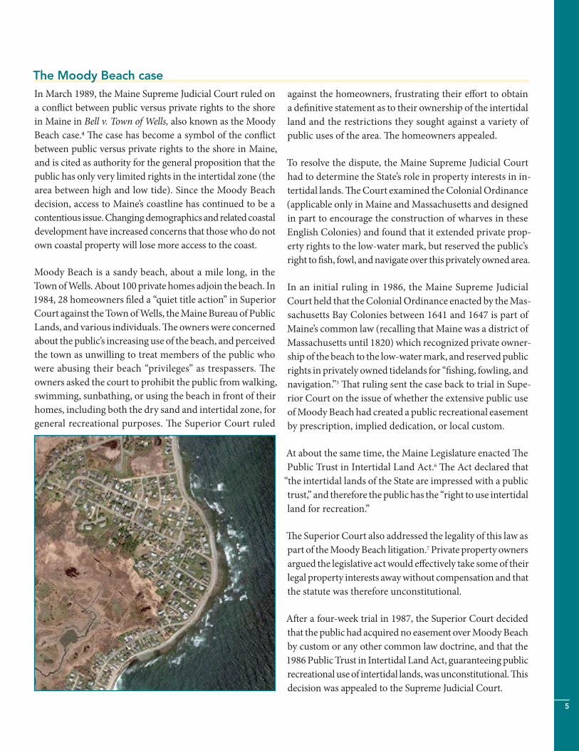
The Moody Beach caseIn March 1989, the Maine Supreme Judicial Court ruled on a conflict between public versus private rights to the shore in Maine in Bell v. Town of Wells, also known as the Moody Beach case.4 The case has become a symbol of the conflict between public versus private rights to the shore in Maine, and is cited as authority for the general proposition that the public has only very limited rights in the intertidal zone (the area between high and low tide). Since the Moody Beach decision, access to Maine’s coastline has continued to be a contentious issue. Changing demographics and related coastal development have increased concerns that those who do not own coastal property will lose more access to the coast.
Moody Beach is a sandy beach, about a mile long, in the Town of Wells. About 100 private homes adjoin the beach. In 1984, 28 homeowners filed a “quiet title action” in Superior Court against the Town of Wells, the Maine Bureau of Public Lands, and various individuals. The owners were concerned about the public’s increasing use of the beach, and perceived the town as unwilling to treat members of the public who were abusing their beach “privileges” as trespassers. The owners asked the court to prohibit the public from walking, swimming, sunbathing, or using the beach in front of their homes, including both the dry sand and intertidal zone, for general recreational purposes. The Superior Court ruled
against the homeowners, frustrating their effort to obtain a definitive statement as to their ownership of the intertidal land and the restrictions they sought against a variety of public uses of the area. The homeowners appealed.
To resolve the dispute, the Maine Supreme Judicial Court had to determine the State’s role in property interests in in-tertidal lands. The Court examined the Colonial Ordinance (applicable only in Maine and Massachusetts and designed in part to encourage the construction of wharves in these English Colonies) and found that it extended private prop-erty rights to the low-water mark, but reserved the public’s right to fish, fowl, and navigate over this privately owned area.
In an initial ruling in 1986, the Maine Supreme Judicial Court held that the Colonial Ordinance enacted by the Mas-sachusetts Bay Colonies between 1641 and 1647 is part of Maine’s common law (recalling that Maine was a district of Massachusetts until 1820) which recognized private owner-ship of the beach to the low-water mark, and reserved public rights in privately owned tidelands for “fishing, fowling, and navigation.”5 That ruling sent the case back to trial in Supe-rior Court on the issue of whether the extensive public use of Moody Beach had created a public recreational easement by prescription, implied dedication, or local custom.
At about the same time, the Maine Legislature enacted The Public Trust in Intertidal Land Act.6 The Act declared that
“the intertidal lands of the State are impressed with a public trust,” and therefore the public has the “right to use intertidal land for recreation.”
The Superior Court also addressed the legality of this law as part of the Moody Beach litigation.7 Private property owners argued the legislative act would effectively take some of their legal property interests away without compensation and that the statute was therefore unconstitutional.
After a four-week trial in 1987, the Superior Court decided that the public had acquired no easement over Moody Beach by custom or any other common law doctrine, and that the 1986 Public Trust in Intertidal Land Act, guaranteeing public recreational use of intertidal lands, was unconstitutional. This decision was appealed to the Supreme Judicial Court.

6
In 1989, the Supreme Judicial Court upheld the lower court ruling and found that the only public rights recognized in the intertidal areas were those articulated in the Colonial Ordinance—fishing, fowling, and navigation—and that the Public Trust in Intertidal Land Act
constitutes a taking of private property for a public use. Since the Act provides no compensation for the landowners whose property is burdened by the gen-eral recreational easement taken for public use, it vio-lates the prohibition contained in both our State and Federal Constitutions against the taking of private property for public use without just compensation.8
Private property rights in the intertidal zone after Moody Beach: In the Moody Beach decision, the Supreme Judicial Court affirmed that, in Maine, owners of beachfront property or property adjoining tidelands (also called litto-ral or riparian owners) have private property rights to the low-water mark or low tide area, subject only to a public easement for “fishing, fowling, and navigation.” As a result, the owners may bring an action for trespass against mem-bers of the public who enter upon private tidelands without permission except for limited activities.9
While coastal property owners may hold title to intertidal ar-eas, they must still obtain all necessary local, state, and federal permits prior to any tideland development. Environmental laws prevent most construction activities in tidelands except for wharves, piers, and—in exceptional circumstances—fill for residential, commercial, or industrial development.
Public rights in the intertidal zone after Moody Beach: The Moody Beach ruling noted that the public still had the right, by virtue of the public easement originating in the Colonial Ordinance, to use privately-owned intertidal land, but only if engaged in fishing, fowling, or navigation. The land to which this easement applies is the area between mean high water and mean low water (or to 1,650 feet sea-ward from the high water, if the mean low watermark is even farther seaward). If the shoreline is beach, this is the wet sand area. If the shoreline is marsh, mudflat, or ledge, the intertidal area will commonly consist of gravel beaches or mud flats. However, the decision in the Moody Beach case was close (a 4-3 ruling regarding the issue of public rights in the intertidal area), tempting those who argue that the public’s rights ought to be interpreted more broadly.
What is meant by the terms “fishing,” “fowling,” and “navigation”?The Maine Supreme Judicial Court has been addressing this question on a case-by-case basis since the early nine-teenth century. While there is no comprehensive statement of appropriate public uses in the intertidal zone under the Colonial Ordinance, the Court has held that the easement includes uses reasonably incidental or related to fishing, fowling, or navigation, and also that the Court will apply a
“sympathetically generous” interpretation of these terms.10
In addition, the Court has noted that the easement applies equally to protect those individuals involved in fishing, fowl-ing, or navigation for sustenance, business, or pleasure.11
Since many of the cases defining fishing, fowling, and navi-gation date from the mid-nineteenth century, the case law is of limited help in defining the modern parameters of these terms. Nonetheless, the case law does demonstrate that the legal meaning of “fishing,” “fowling,” and “navigation” extends beyond a simple dictionary definition of each individual term.
Fishing: Maine law defines “fishing” as taking, or attempting to take, marine organisms, which include any animal, plant, or other life that inhabits waters below the head of tide. Fishing activities include harvesting finfish (cod and herring, for example), digging for clams and worms, and taking float-ing seaweed and sea manure (organic detritus and waste of marine organisms).12 However, some court decisions have placed apparent restrictions on removing some resources from the intertidal area, including “mussel bed manure” or seaweed cast upon the beach from within that zone.13 The cases also suggest that the public may not remove sand or empty shells from the intertidal area. The public’s right to fish does not include the right to erect fish weirs or fasten seine or fishing equipment to private tidelands.14
At the time of this publication, it is unknown whether har-vesting seaweed attached to rocks in the intertidal zone is included in the definition of “fishing.” Maine’s common law is unclear if this seaweed is owned by the public generally or by the upland property owner. This is an unsettled question that only Maine courts can definitively answer; a case that would answer this question is working its way through the Maine courts (Ross v. Acadian Seaplants Ltd.). Because of the uncertainty, the State of Maine, when it issues licenses for seaweed harvesting, takes no position on (1) whether the public may harvest seaweed from those areas without inter-
7
fering with the private property rights of the upland owner, or (2) whether the upland property owners may prohibit the public harvest of seaweed in those areas.
Fowling: The term “fowling” has not received nearly the same judicial scrutiny, but is generally interpreted to mean bird hunting. Some commentators have suggested that the meaning should be widened to include bird watching, but there is no indication that the Court would be willing to ex-tend the ordinance beyond the obvious meaning of the word.
Navigation: The term “navigation” has always been con-strued to mean that the public may sail over the intertidal lands, may moor craft upon them, and may allow vessels to rest upon the intertidal land when the tide is out. These activities may be conducted for profit, such as ferry services in which the boat operator picks up and discharges passen-gers on intertidal land.
As an incidental use, if a person reaches the intertidal land by means of navigation, the person can walk on the intertidal lands for purposes related to navigation.15 This right to travel through the intertidal lands does not, however, include the right to remain on the intertidal lands for bathing, sunbath-ing, or recreational walking, or to cross privately owned dry sand or upland areas.
Additionally, a boat operator may moor a vessel to discharge and take on cargo in the intertidal zone, provided that the cargo does not spill over onto the uplands and provided that the flats are unoccupied.16 In keeping with the importance of the intertidal area for travel, it has also been held that the public may ride or skate over the intertidal area when it is covered with ice.17
The Maine Supreme Judicial Court has determined that “nav-igation” does not include the right to use private tidelands for general recreational uses such as strolling along the beach, sunbathing, picnicking, bathing, or Frisbee-throwing.18 But
“navigation” continues to draw a substantial amount of ju-dicial scrutiny.
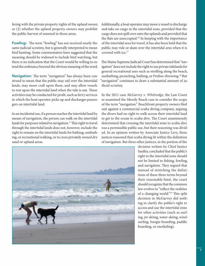
In the 2011 case McGarvey v. Whittredge, the Law Court re-examined the Moody Beach case to consider the scope of the term “navigation.” Beachfront property owners filed suit against a commercial scuba diving company, arguing the divers had no right to walk across their intertidal land to get to the ocean to scuba dive. The Court unanimously determined that crossing the intertidal zone to scuba dive was a permissible public use, but their reasoning was divid-ed. In an opinion written by Associate Justice Levy, three justices reasoned that scuba diving fit within the definition of navigation. But three other justices, in the portion of the
decision written by Chief Justice Saufley, concluded that the public’s right to the intertidal zone should not be limited to fishing, fowling, and navigation. They argued that instead of stretching the defini-tions of these three terms beyond their reasonable limit, the court should recognize that the common law evolves to “reflect the realities of a changing world.”19 This split decision in McGarvey did noth-ing to clarify the public’s right to access and use the intertidal zone for other activities (such as surf-ing, jet-skiing, water-skiing, wind-surfing, boogie-boarding, paddle boarding, or snorkeling).

8
The balance of interests in upland area dry sand beachesThe challenge of securing access to Maine’s coastal shore-line grows when new property owners, unwilling to allow old patterns of usage to continue, close or block traditional access points. Conflicts increase as more people use the remaining access points. The Moody Beach and McGarvey cases did little to satisfy the public’s desire to access and use intertidal and dry sand areas along the entire coast. As a result, the people have turned to other legal remedies or methods to acquire access rights to the shoreline, including Maine’s prescriptive easement law. This law was the subject of both the 2000 Eaton v. Town of Wells case, the 2014 Almeder v. Town of Kennebunkport case , and the 2016 Cedar Beach case.
Prescriptive easement law as method of acquiring public access to Maine’s shoreline In general, the holder or owner of an easement is entitled to a limited use of land owned by another. Private individuals and the public can acquire an easement through several methods, including purchasing the right or through a le-gal doctrine known as prescription. Prescription allows a non-property-owner to acquire a legal interest in or over another’s property if the non-property-owner’s use of the property is longstanding (20 years or more), continuous, against the wishes of the owner (or adverse to the owner), and where the owner either knows or should know of the non-owners use.
Eaton v. Town of Wells: a prescriptive easement success for the public For generations, the Town of Wells maintained a stretch of beach for the benefit of the public. But the Town did not own the beach. As a result, a private property owner sued the Town in the late 1990s, arguing that the Town’s actions and the public use of the beach constituted trespass. The Town responded and defended its actions and the rights of the public by claiming that the public had acquired legal rights to the beach by their long-standing use of the property. The property owner argued that the public’s use did not meet the legal requirements of a prescriptive easement claim. In Eaton v. Town of Wells (2000), the Law Court held that the Town (and effectively the public) had successfully acquired an easement by prescription for general recreational pur-poses and maintenance because of the Town’s long history of preserving and maintaining the beach and treating it as public without the permission of, and in fact contrary to desire of, the owners.20
Prescriptive easement claims and the presumption of permission Since the decision in Eaton, the Law Court has added some detail to its interpretation of prescriptive easement claims. In Lyons v. Baptist School of Christian Training, a 2002 case involving public access claims to open fields and woodlands located in Chapman, the Law Court made it clear that when the general public uses private land, it is presumed from the property owner’s silence that the public has permission to use the land.21 This “presumption of permission” essentially protects a landowner against prescriptive easement claims, which require the public to show their use of the land was adverse or against the owner’s wishes. But would this deci-sion apply to shoreline areas where both the land and the public’s use of the land are readily visible to property owners?
The Goose Rocks Beach case: In 2014, the Law Court explored the presumption of permission in a beach access case, Almeder v. Town of Kennebunkport, also known as the Goose Rocks Beach case. Goose Rocks Beach is a two-mile stretch of sand beach located in Kennebunkport. In 2009, numerous beachfront landowners initiated a lawsuit against the Town of Kennebunkport, which claimed to have acquired a prescriptive right to use both dry sand and the intertidal zone for recreational purposes. After analyzing several of the requirements that non-property owners have to establish in order to acquire a prescriptive easement, the Law Court once again emphasized that public recreational uses are presumed to be undertaken with the permission of the landowner. The Court noted that the presumption of permission offers the double benefit of allowing the public to continue using the property for recreational purposes, while also protecting landowners from legal claims.22 Yet, because of the way in which the case was argued, it was impossible for the Court to rule for or against the prescriptive easement claims, since the Town had based its claim of longstanding use on a large expanse of the beach rather than on a series of parcel-by-parcel claims against individual property own-ers.23 As a result, in 2014 the Maine Supreme Judicial Court highlighted the rules to be applied and sent the issue back to the Maine Superior Court to allow the Town to restate its claims in that lot-by-lot fashion.24 While the results remain to be determined, the rules are much clearer.25 The Town must show that use of particular parcels of private land has occurred for 20 or more years, and that the use was open, adverse, and unpermitted (keeping in mind that silence is presumed to allow permission).
9
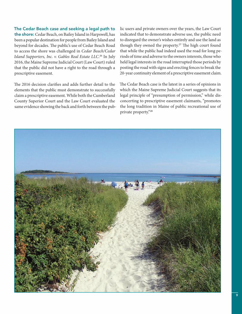
The Cedar Beach case and seeking a legal path to the shore: Cedar Beach, on Bailey Island in Harpswell, has been a popular destination for people from Bailey Island and beyond for decades. The public’s use of Cedar Beach Road to access the shore was challenged in Cedar Beach/Cedar Island Supporters, Inc. v. Gables Real Estate LLC.26 In July 2016, the Maine Supreme Judicial Court (Law Court) ruled that the public did not have a right to the road through a prescriptive easement.
The 2016 decision clarifies and adds further detail to the elements that the public must demonstrate to successfully claim a prescriptive easement. While both the Cumberland County Superior Court and the Law Court evaluated the same evidence showing the back and forth between the pub-
lic users and private owners over the years, the Law Court indicated that to demonstrate adverse use, the public need to disregard the owner’s wishes entirely and use the land as though they owned the property.27 The high court found that while the public had indeed used the road for long pe-riods of time and adverse to the owners interests, those who held legal interests in the road interrupted those periods by posting the road with signs and erecting fences to break the 20-year continuity element of a prescriptive easement claim.
The Cedar Beach case is the latest in a series of opinions in which the Maine Supreme Judicial Court suggests that its legal principle of “presumption of permission,” while dis-concerting to prescriptive easement claimants, “promotes the long tradition in Maine of public recreational use of private property.”28
10
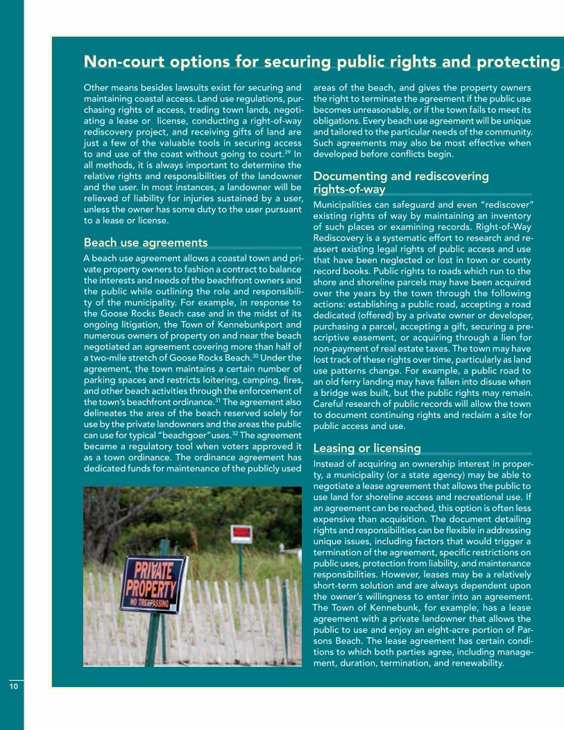
Other means besides lawsuits exist for securing and maintaining coastal access. Land use regulations, pur-chasing rights of access, trading town lands, negoti-ating a lease or license, conducting a right-of-way rediscovery project, and receiving gifts of land are just a few of the valuable tools in securing access to and use of the coast without going to court.29 In all methods, it is always important to determine the relative rights and responsibilities of the landowner and the user. In most instances, a landowner will be relieved of liability for injuries sustained by a user, unless the owner has some duty to the user pursuant to a lease or license.
Beach use agreements A beach use agreement allows a coastal town and pri-vate property owners to fashion a contract to balance the interests and needs of the beachfront owners and the public while outlining the role and responsibili-ty of the municipality. For example, in response to the Goose Rocks Beach case and in the midst of its ongoing litigation, the Town of Kennebunkport and numerous owners of property on and near the beach negotiated an agreement covering more than half of a two-mile stretch of Goose Rocks Beach.30 Under the agreement, the town maintains a certain number of parking spaces and restricts loitering, camping, fires, and other beach activities through the enforcement of the town’s beachfront ordinance.31 The agreement also delineates the area of the beach reserved solely for use by the private landowners and the areas the public can use for typical “beachgoer”uses.32 The agreement became a regulatory tool when voters approved it as a town ordinance. The ordinance agreement has dedicated funds for maintenance of the publicly used
areas of the beach, and gives the property owners the right to terminate the agreement if the public use becomes unreasonable, or if the town fails to meet its obligations. Every beach use agreement will be unique and tailored to the particular needs of the community. Such agreements may also be most effective when developed before conflicts begin.
Documenting and rediscovering rights-of-wayMunicipalities can safeguard and even “rediscover” existing rights of way by maintaining an inventory of such places or examining records. Right-of-Way Rediscovery is a systematic effort to research and re-assert existing legal rights of public access and use that have been neglected or lost in town or county record books. Public rights to roads which run to the shore and shoreline parcels may have been acquired over the years by the town through the following actions: establishing a public road, accepting a road dedicated (offered) by a private owner or developer, purchasing a parcel, accepting a gift, securing a pre-scriptive easement, or acquiring through a lien for non-payment of real estate taxes. The town may have lost track of these rights over time, particularly as land use patterns change. For example, a public road to an old ferry landing may have fallen into disuse when a bridge was built, but the public rights may remain. Careful research of public records will allow the town to document continuing rights and reclaim a site for public access and use.
Leasing or licensingInstead of acquiring an ownership interest in proper-ty, a municipality (or a state agency) may be able to negotiate a lease agreement that allows the public to use land for shoreline access and recreational use. If an agreement can be reached, this option is often less expensive than acquisition. The document detailing rights and responsibilities can be flexible in addressing unique issues, including factors that would trigger a termination of the agreement, specific restrictions on public uses, protection from liability, and maintenance responsibilities. However, leases may be a relatively short-term solution and are always dependent upon the owner’s willingness to enter into an agreement. The Town of Kennebunk, for example, has a lease agreement with a private landowner that allows the public to use and enjoy an eight-acre portion of Par-sons Beach. The lease agreement has certain condi-tions to which both parties agree, including manage-ment, duration, termination, and renewability.
Non-court options for securing public rights and protecting private property owners
11
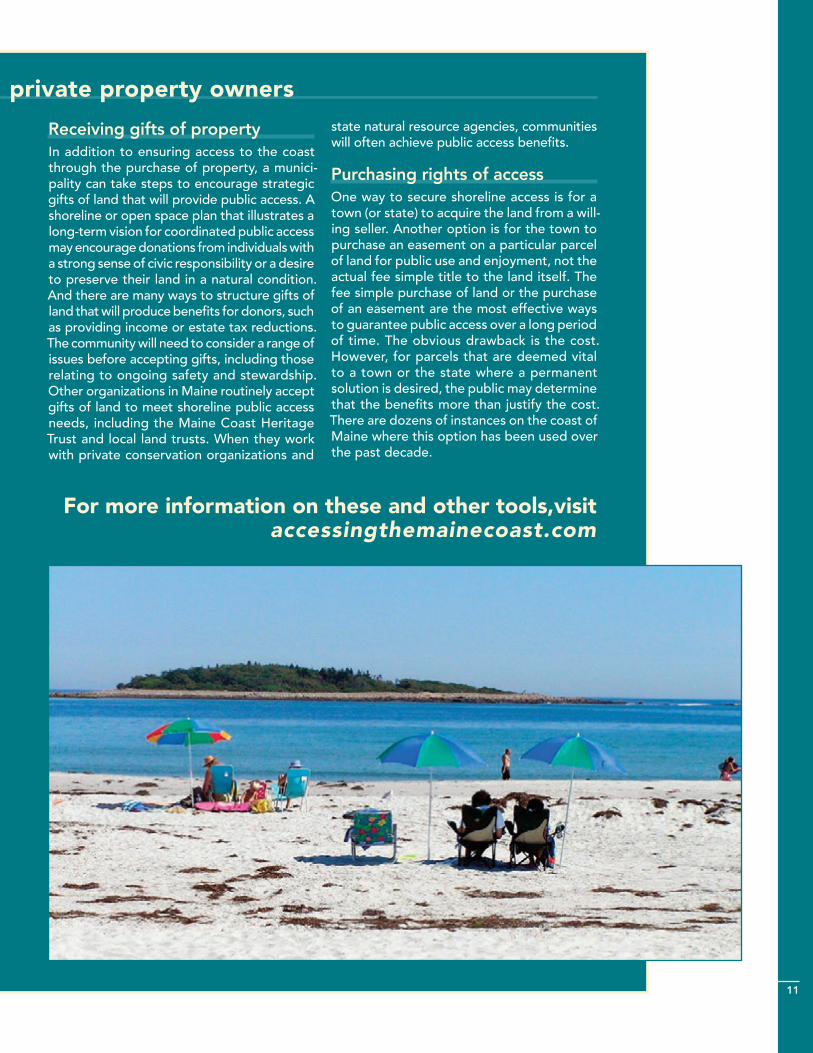
Receiving gifts of propertyIn addition to ensuring access to the coast through the purchase of property, a munici-pality can take steps to encourage strategic gifts of land that will provide public access. A shoreline or open space plan that illustrates a long-term vision for coordinated public access may encourage donations from individuals with a strong sense of civic responsibility or a desire to preserve their land in a natural condition. And there are many ways to structure gifts of land that will produce benefits for donors, such as providing income or estate tax reductions. The community will need to consider a range of issues before accepting gifts, including those relating to ongoing safety and stewardship. Other organizations in Maine routinely accept gifts of land to meet shoreline public access needs, including the Maine Coast Heritage Trust and local land trusts. When they work with private conservation organizations and
state natural resource agencies, communities will often achieve public access benefits.
Purchasing rights of accessOne way to secure shoreline access is for a town (or state) to acquire the land from a will-ing seller. Another option is for the town to purchase an easement on a particular parcel of land for public use and enjoyment, not the actual fee simple title to the land itself. The fee simple purchase of land or the purchase of an easement are the most effective ways to guarantee public access over a long period of time. The obvious drawback is the cost. However, for parcels that are deemed vital to a town or the state where a permanent solution is desired, the public may determine that the benefits more than justify the cost. There are dozens of instances on the coast of Maine where this option has been used over the past decade.
For more information on these and other tools,visit accessingthemainecoast.com
Non-court options for securing public rights and protecting private property owners
12
Where are we today and where do we go in the future?More than a quarter of a century of litigation and a series of important shoreline access cases heard by the Maine Su-preme Judicial Court suggest one thing: the nature and ex-tent of public and private rights regarding coastal access will continue to be an issue in Maine into the future. While a level of uncertainty remains for both private property owners and the public regarding coastal ownership and use, the court cases and actions by the people of Maine have provided us with some guidance and important reminders:
�� Providing their deed states ownership to the “low wa-ter mark,” people or institutions with title to land on coastal waters own the land between low and high tide in addition to the dry sand and upland areas. This area is private property; or in the case of state, federal, or municipal ownership, public property.
�� The public has limited rights to use the intertidal area of privately owned land for “fishing,” “fowling,” and
“navigation” as those terms have been interpreted by Maine courts. At the time of this publication, general recreational uses such as sunbathing are not among the public’s rights.
�� In the McGarvey case, the Law Court provided a broad-er interpretation of public rights in the intertidal area when it recognized scuba diving as a permissible use. Future court cases and decisions may provide additional detail in the interpretation (and therefore the range of activities) of public rights to the intertidal area.
�� Legal claims of “prescriptive easements” have been suc-cessfully used to secure public access and use of Maine beaches, as in the Wells Beach case (Eaton v. Town of Wells). But the Law Court’s explicit application of “pre-sumption of permission” in the Goose Rocks Beach case (Almeder v. Town of Kennebunkport) and the Cedar Beach case (Cedar Beach/Cedar Island Supporters v. Ga-bles Real Estate) makes the prescriptive easement claim daunting. In the Cedar Beach case, the Law Court noted that in addition to the primary legal owner of a piece of land, lesser legal interests (such as a private easement holder) can take actions to interrupt the continuous adverse use of the area by the public. Further, the Cedar Beach opinion by the Law Court notes that “adverse use” means use of the property as a rightful owner might use it—treating the property objectionably, such as by being loud or littering, is not sufficient.
�� The Goose Rocks Beach (Almeder v. Town of Kenne-bunkport) case sends a clear signal that unless an owner explicitly restricts access to undeveloped coastal areas, the public can “presume permission” to use it. Most states presume otherwise.
�� Because the private ownership rights documented in property deeds in Maine vary widely, uncertainties and conflicts will remain. In many instances they may only be reconciled via litigation. Due to the length and cost of court cases, tensions and conflict might be better addressed by means other than litigation.
�� Public access to the shoreline and waters of Maine is evident along the state’s thousands of miles of coastline. Some stretches are dedicated to public use, while many other private coastal properties are accessible under a
“presumption of permission.” Where private owners of coastal property are opposed to, or wary of, public use, tensions may flare. But thoughtful discussions between private owners and public stakeholders may lead to con-structive agreements that allow some public use while protecting the interests of the property owners.
�� An alternative to litigation that shows promise is pro-vided in the model of the Town of Kennebunkport’s beachfront ordinance, which provides a framework for a contract to balance the interests and needs of the beach-front owners and the general public while outlining the role and responsibility of the municipality.

13
References1. Maine Coastal Program/Department of Agriculture, Conservation and Forestry,
personal communication.
2. The Book of the General Lawes and Libertyes Concerning the Inhabitants of the Massachusets (Reproduced in facsimile from the unique 1648 edition in the Huntington Library, Edited with an Introduction by Thomas G. Barnes, Huntington Library, San Marino CA, 1975), available at mass.gov/courts/docs/lawlib/docs/colonialordinancesof1651.pdf.
3. See accessingthemainecoast.com for examples and definitions of ways to secure public access.
4. Bell v. Town of Wells, 557 A.2d 168 (Me. 1989) [hereinafter Bell II].
5. Bell v. Town of Wells, 510 A.2d 509 (Me. 1986).
6. 12 M.R.S.A. §§571–573.
7. Similar to the principle of adverse possession (also known as “squatter’s rights”); that is, open, continuous, notorious, and uninterrupted use of pri-vate property for a certain period of time (20 years in Maine), a claim of right adverse to the owner, will create a “prescriptive easement” to continue such use. Such an easement for public use may also be created by “implied dedication” where the owner clearly acquiesces to public use and the public’s enjoyment has lasted for such a length of time that the public would be materially affected by a denial or interruption of the enjoyment. Town of Manchester v. Augusta County Club, 477 A.2d 1124 at 1128-1129 (Me. 1984).
8. Bell II, 557 A.2d at 177.
9. Storer v. Freeman, 6 Mass. 435 (1810).
10. Bell II, 557 A.2d 173.
11. Barrows v. McDermott, 73 Me. 441, 449 (1882).
12. 12 M.R.S. § 6001 (17)
13. Moore v. Griffin, 22 Me. 350, 356 (1843); Hill v. Lord, 48 Me. 83, 86 (1861), Marshall v. Walker, 93 Me. 532, 536–37. The terms “sea manure” and “mussel manure” refer generally to the organic detritus and waste of marine organisms.
14. Matthews v. Treat, 75 Me. 594 (1884).
15. Andrews v. King, 124 Me. 361 (1925).
16. Id. at 364.
17. French v. Camp, 18 Me. 433 (1841).
18. Bell II, 557 A.2d at 175-176 (Me. 1989).
19. McGarvey v. Whittredge, 28 A.3d 620, 624 (Me. 2011).
20. Eaton v. Town of Wells, 760 A.2d 232 (Me. 2000).
21. Lyons v. Baptist Sch. Of Christian Training, 804 A.2d 364, 370-371 (Me. 2002).
22. Almeder v. Town of Kennebunkport, 106 A.3d 1099, 1111 (Me. 2014).
23. Almeder, 106 A.3d at 1114.
24. Id. at 1115.
25. Id. at 1114–1115.
26. Cedar Beach/Cedar Island Supporters, Inc., et al. v. Gables Real Estate, 2016 ME 114, para. 20.
27. Id. at para. 20.
28. Id. at para. 15. See also 14 M.R.S. § 812 Acquisition of rights-of-way and easements by adverse possession; notice to prevent.
29. For information on issues related to coastal access and specific tools to coop-eratively address access issues, based on research by the University of Maine School of Law and National Sea Grant Law Center, see the comprehensive web resource, accessingthemainecoast.com.
30. Kennebunkport Beach Use Agreement, 2012, preservegooserocksbeach.org.
31. Id. and Beach Use Ordinance for Goose Rocks Beach, Kennebunkport, Maine.
32. Kennebunkport Beach Use Agreement, 2012.
Updated information is available at accessingthemainecoast.comLaws and policies regarding the use and ownership of the Maine coast continually change. Keep up with the latest changes on the Accessing the Maine Coast website. In addition to updated information, the site is a comprehensive resource for Maine residents and visitors on a range of topics relating to access, use, and ownership of the Maine coast.

The University of Maine does not discriminate on the grounds of race, color, religion, sex, sexual orientation, including transgender status and gender expression, national origin, citizenship status, age, disability, genetic information or veteran status in employment, education, and all other programs and activities. The following person has been designated to handle inquiries regarding nondiscrimination policies: Director, Office of Equal Opportunity, 101 North Stevens Hall, 207.581.1226.
MSG-E-16-53000