psp property 38 (being lot 4 lp 138528) troups road south ... · (dss), which are also known as...
TRANSCRIPT

BEACON PLANNING
PSP Property 38 (being Lot 4 LP 138528) Troups Road South, Mount Cottrell
Report for Beacon Planning re drainage and PSP1082
Date: 8 September 2016
V1159_001

BEACON PLANNING
PSP PROPERTY 38 (BEING LOT 4 LP 138528) TROUPS ROAD SOUTH, MOUNT COTTRELL
JOB NO. AND PROJECT NAME: V1159_001 - 248 Troups Rd South
DOC PATH V:\Projects\V1159 Beacon Town Planning\V1159_001 248 Troups Rd South PSP Review\07 Deliverables\Documents\Report\Report of Panel Sept 2016\V1159_001 Engeny Report PSP Property 38 Mount Cottrell 08 Sept 2016
REV DESCRIPTION AUTHOR REVIEWER APPROVED BY DATE
Client Issue Andrew Prout 08/09/2016
Signatures
Job No. V1159_001 Page i 08/09/2016
DISCLAIMER
This report has been prepared on behalf of and for the exclusive use of Beacon Planning and is
subject to and issued in accordance with Beacon Planning instruction to Engeny Water
Management (Engeny). The content of this report was based on previous information and studies
supplied by Beacon Planning
Engeny accepts no liability or responsibility whatsoever for it in respect of any use of or reliance
upon this report by any third party. Copying this report without the permission of Beacon Planning
or Engeny is not permitted.

BEACON PLANNING
PSP PROPERTY 38 (BEING LOT 4 LP 138528) TROUPS ROAD SOUTH, MOUNT COTTRELL
Job No. V1159_001 Page ii 08/09/2016
CONTENTS
1. INTRODUCTION .......................................................................................................1
1.1 Author Details ............................................................................................................1
1.2 Subject Site ...............................................................................................................2
2. PREVIOUS REPORT ................................................................................................3
3. REFERENCE DOCUMENTS .....................................................................................4
4. UPDATED ASSESSMENT ........................................................................................5
4.1 Review of Information ................................................................................................5
4.2 Proposed PSP ...........................................................................................................5
4.3 Proposed Melbourne Water DSS ...............................................................................5
4.4 Site Visit.....................................................................................................................6
4.5 Consideration of Melbourne Water response to previous report ............................... 10
4.6 Responses to Issues................................................................................................ 11
5. CONCLUSION ......................................................................................................... 14
6. STATEMENT ........................................................................................................... 15
7. QUALIFICATIONS ................................................................................................... 16
Appendices
APPENDIX A Andrew Prout’s CV
APPENDIX B Locality, Zoning and Overlay Plans
APPENDIX C Alternative DSS layout 1
APPENDIX D Alternative DSS layout 2
APPENDIX E Melbourne Water response to Engeny May 2016 report

BEACON PLANNING
PSP PROPERTY 38 (BEING LOT 4 LP 138528) TROUPS ROAD SOUTH, MOUNT COTTRELL
Job No. V1159_001 Page iii 08/09/2016
List of Figures
Figure 4-1 Melbourne Water Dry Creek Upper DSS (May 2016) .....................................6
Figure 4-2 Subject site, looking east from Troups Road South ........................................7
Figure 4-3 Looking west from Troups Road South...........................................................8
Figure 4-4 Dry Creek through subject site, looking north .................................................8
Figure 4-5 Subject site left of fence, proposed conservation area right of fence, looking east 9
Figure 4-6 Subject site, proposed WI-09 site, looking NE towards Mt Atkinson ...............9
Figure 4-7 Proposed conservation area, alternative WI-09 site, looking south ............... 10
Figure 4-8 Plan of proposed changes to drainage system ............................................. 12

BEACON PLANNING
PSP PROPERTY 38 (BEING LOT 4 LP 138528) TROUPS ROAD SOUTH, MOUNT COTTRELL
Job No. V1159_001 Page 1 08/09/2016
1. INTRODUCTION
This report has been commissioned by Beacon Planning (on behalf of the landowner).
This report relates to drainage and the proposed PSP for PSP Property 38 (being Lot 4 LP
138528), Mount Cottrell.
Details of the report author and reviewer are provided below.
1.1 Author Details
1.1.1 Name and Address
Andrew Prout
Suite 15, 333 Canterbury Road
Canterbury, Victoria, 3126
1.1.2 Qualifications
Andrew Glen Prout has the following qualifications and professional memberships:
Education
Bachelor of Engineering (Civil), Swinburne Institute of Technology, 1984
Postgraduate Diploma in Management Studies, Melbourne University, 1992
Registrations/Affiliations
Member, Institution of Engineers, Australia
Member, College of Civil Engineers, I.E. Aust.
1.1.3 Experience and Expertise of the Author / Reviewer
Andrew is a Senior Principal Engineer in the Melbourne branch of Engeny Water
Management (Engeny). Andrew has gained more than 30 years’ professional experience
both in the consulting engineering field and with government and semi-government
authorities. Andrew is a leader in the surface water management field, having updated
Melbourne Water’s Drainage Design Guide and having lectured at university level.
Andrew’s has extensive experience in the design and construction of retarding basins,
wetlands, and drainage works. Andrew is also highly experienced in flood mapping,
hydrology, hydraulics, water sensitive design and waterways. Andrew is familiar with the
changes in drainage design standards in Victoria over the years and the standards,
policies and other issues related to urban drainage.

BEACON PLANNING
PSP PROPERTY 38 (BEING LOT 4 LP 138528) TROUPS ROAD SOUTH, MOUNT COTTRELL
Job No. V1159_001 Page 2 08/09/2016
Andrew is highly experienced with Melbourne Water Development Services Schemes
(DSS), which are also known as drainage schemes. Andrew has been involved in
designing drainage schemes and technical reviews of schemes since the 1980s and has
recently signed off on the reviews for over a dozen schemes for Melbourne Water (MW).
Andrew is therefore very familiar with Melbourne Water's “Principles for Provision of
Waterway and Drainage Services for Urban Growth”.
Andrew has undertaken expert witness work for a number of clients, including Melbourne
Water, Southern Rural Water, Goulburn Murray Water, Councils and landowners.
Andrew has prepared this report.
This report has been reviewed in accordance with Engeny’s Quality Assurance system.
A CV with more details regarding Andrew’s experience is included in Appendix A.
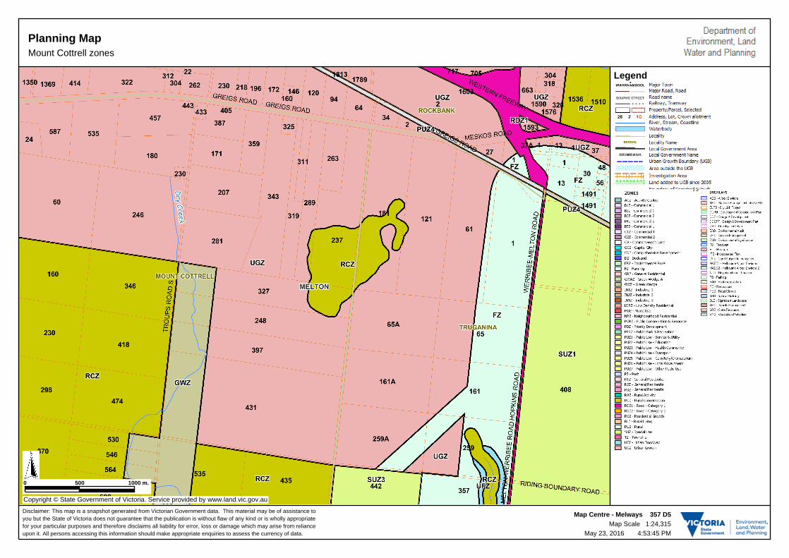
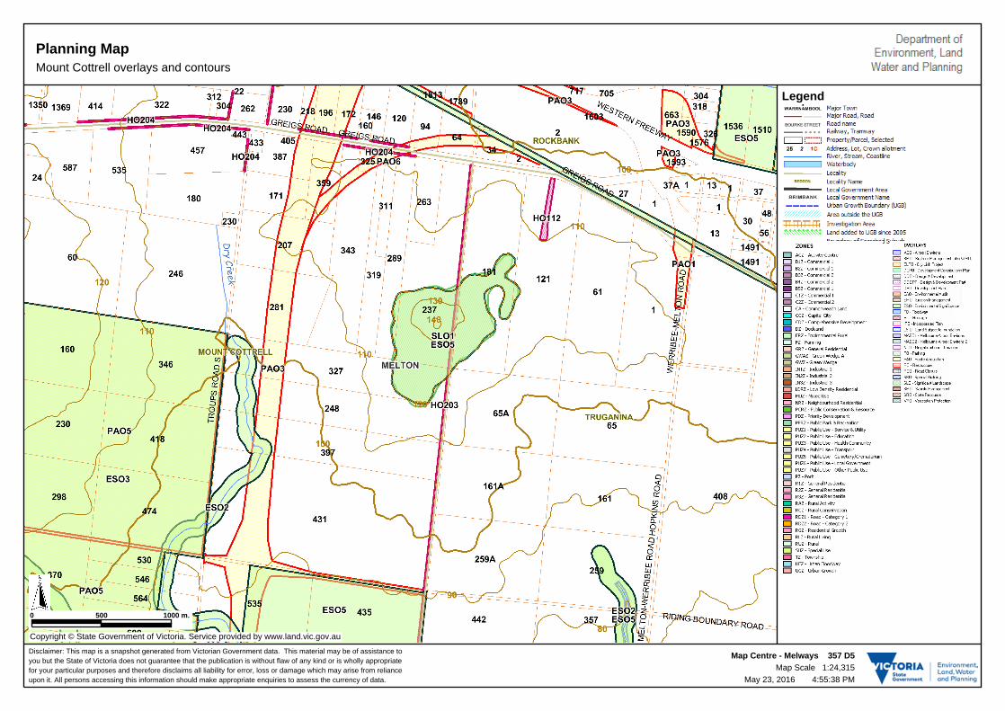
1.2 Subject Site
The subject site is located in Mount Cottrell in the City of Melton. Plans showing the
subject site are provided in Appendix B (plans also show planning zones and overlays).
It should be noted that there are no flooding related overlays that apply to the property.
On the plans in Appendix B the subject site is on the east side of Troups Road South and
has the property number label 248 on the property.

BEACON PLANNING
PSP PROPERTY 38 (BEING LOT 4 LP 138528) TROUPS ROAD SOUTH, MOUNT COTTRELL
Job No. V1159_001 Page 3 08/09/2016
2. PREVIOUS REPORT
Engeny prepared a report dated 26 May 2016 regarding the subject site. The May 2016
report considered alternative options for the drainage layout proposed by the Melbourne
Water DSS and the exhibited PSP and concluded that:
1. The Mount Atkinson PSP proposes a wetland / retarding basin (WI-09) on the subject
site.
2. I have reviewed the Mount Atkinson PSP and proposed Melbourne Water Dry Creek
Upper Development Services Scheme in relation to WI-09 and the subject site.
3. The wetland / retarding basin WI-09 is required and its location is a good, logical
design that treats stormwater as required by the VPPs, avoids conflict with the
proposed conservation zone to the south and minimises the cost of drainage
infrastructure that will need to cross the proposed Outer Metropolitan Ring Road
(OMRR).
4. It should be noted that Melbourne Water will acquire the land for WI-09 as part of the
implementation of the Dry Creek Upper DSS and the aim in determining the amount
paid for the acquisition is to ensure that the owner is appropriately compensated for
the land.
5. I have identified two alternatives to locating WI-09 on the subject site that are
described in Section 3.4.2 of this report and shown in Appendices C and D. The two
alternatives have both advantages and disadvantages to the layout proposed in the
PSP and further consultation and work would be required to determine if the
alternatives could / should be implemented.
6. A third alternative that I have considered is to move WI-09 onto the proposed
conservation area south of the subject site. From a drainage pattern perspective this
option is entirely feasible and would free up land on the subject site for residential
development.
Note : In my May 2016 report the subject site was referred to as 248 Troups Road South.
In this report I have changed and underlined the italicised text above to instead refer to
the “subject site”. Elsewhere in this September report the subject site is referred to as
PSP Property 38 (being Lot 4 LP 138528), Mount Cottrell.

BEACON PLANNING
PSP PROPERTY 38 (BEING LOT 4 LP 138528) TROUPS ROAD SOUTH, MOUNT COTTRELL
Job No. V1159_001 Page 4 08/09/2016
3. REFERENCE DOCUMENTS
Documents were provided to Engeny by Beacon Planning in May 2016. These
documents were:
a planning property report, including zones and overlays
a land capability report by Jacobs, dated 2 July 2015.
In addition to referring to the documents supplied we also sought additional information
and/or were supplied with extra information including the following documents:
Melbourne Water plan of part of the draft Dry Creek Upper Development Services
Scheme (DSS) that includes the subject site
proposed Mount Atkinson PSP 1082, obtained from http://www.mpa.vic.gov.au/planning-
activities/greenfields-planning/precinct-structure-plans/melton/mt-atkinson/
In August / September 2016 I have received and/or reviewed the following additional
documents:
aerial images from Google Maps and NearMaps
letter from Melbourne Water responding to my May 2016 report, as provided in
Appendix E
plan information from www.land.vic.gov.au
letter of advice from Chad Browning, Ecology and Heritage Partners, 27 May 2016
beacon Town Planning report dated 30 May 2016, project number 16-021
MPA letter dated 14 July 2016 (ref COR/16/7398) to Beacon Town Planning.

BEACON PLANNING
PSP PROPERTY 38 (BEING LOT 4 LP 138528) TROUPS ROAD SOUTH, MOUNT COTTRELL
Job No. V1159_001 Page 5 08/09/2016
4. UPDATED ASSESSMENT
In August 2016 I was asked to provide an updated assessment of options for the layout of
the Development Services Scheme and PSP in relation to PSP Property 38 (being Lot 4
LP 138528), Mount Cottrell.
The issues raised in my correspondence and discussions with Jennie Jones of Beacon
Planning for the updated assessment is:
From a drainage perspective could wetland / retarding basin WI-09 proposed on PSP
Property 38 (being Lot 4 LP 138528), Mount Cottrell, be located to the south onto the
proposed conservation area?
How would the relocation of WI-09 onto the property to the south impact on the design
of the proposed DSS and the cost of providing drainage services for the area?
4.1 Review of Information
I have reviewed all of the supplied information listed in Section 3 of this report. Following
my review of this information I have assessed the issues that I have been asked to
address.
4.2 Proposed PSP
I have reviewed the proposed PSP in relation to proposed drainage and water sensitive
urban design elements in the vicinity of PSP Property 38 (being Lot 4 LP 138528), Mount
Cottrell. I have considered other constraints in the PSP that may impact on the drainage
and water sensitive design elements of the PSP.
The PSP on page 60, proposes a wetland / retarding basin on PSP Property 38 (being Lot
4 LP 138528), Mount Cottrell, with an outlet pipe to Dry Creek. This proposed wetland /
retarding basin is referred to in the PSP as WI–09. The proposed land area for WI-09 in
the PSP is 4.41 hectares (Table 8 on page 62 of the PSP).
4.3 Proposed Melbourne Water DSS
Melbourne Water has considered the development proposed in the Mount Atkinson PSP
and has prepared preliminary Development Services Schemes (DSS) to provide main,
drainage, waterways, flood retardation and water sensitive design features for the PSP
area.
PSP Property 38 (being Lot 4 LP 138528), Mount Cottrell is located within Melbourne
Water’s Dry Creek Upper DSS. Stephen Miller of Melbourne Water provided me with a
copy of the part of the Dry Creek Upper DSS by email on Monday 23 May 2016. A copy
of the plan provided by Melbourne Water is shown in Figure 4.1 below.

BEACON PLANNING
PSP PROPERTY 38 (BEING LOT 4 LP 138528) TROUPS ROAD SOUTH, MOUNT COTTRELL
Job No. V1159_001 Page 6 08/09/2016
The Melbourne Water DSS layout appears to be consistent with the exhibited PSP in
terms of the layout for wetlands / retarding basins on and in the vicinity of PSP Property
38 (being Lot 4 LP 138528), Mount Cottrell.
The Melbourne Water DSS locates the proposed basin WI-09 on the subject site and east
of the proposed OMRR. If the OMRR was not proposed in this location then WI-09 would
be unlikely to be in its proposed location. I expect that WI-09 would be located closer to
Dry Creek in a westerly and/or southerly direction without the OMRR.
Figure 4-1 Melbourne Water Dry Creek Upper DSS (May 2016)
4.4 Site Visit
A site visit was undertaken to the subject site on Monday 5 September 2016. Attendees
for the site visit were:
Andrew Prout, Engeny
Jennie Jones, Beacon Town Planning
Brett Lane, Brett Lane and Associates

BEACON PLANNING
PSP PROPERTY 38 (BEING LOT 4 LP 138528) TROUPS ROAD SOUTH, MOUNT COTTRELL
Job No. V1159_001 Page 7 08/09/2016
Brett MacDonald, Brett Lane and Associates
David Hodge.
We visited the subject site and viewed the area from adjacent roads.
We had not been in contact with the owners of the proposed conservation area to the
south of the subject site and therefore did not enter the proposed conservation area.
Selected photographs from the site visit are provided below.
Figure 4-2 Subject site, looking east from Troups Road South

BEACON PLANNING
PSP PROPERTY 38 (BEING LOT 4 LP 138528) TROUPS ROAD SOUTH, MOUNT COTTRELL
Job No. V1159_001 Page 8 08/09/2016
Figure 4-3 Looking west from Troups Road South
Figure 4-4 Dry Creek through subject site, looking north

BEACON PLANNING
PSP PROPERTY 38 (BEING LOT 4 LP 138528) TROUPS ROAD SOUTH, MOUNT COTTRELL
Job No. V1159_001 Page 9 08/09/2016
Figure 4-5 Subject site left of fence, proposed conservation area right of fence, looking east
Figure 4-6 Subject site, proposed WI-09 site, looking NE towards Mt Atkinson
BEACON PLANNING
PSP PROPERTY 38 (BEING LOT 4 LP 138528) TROUPS ROAD SOUTH, MOUNT COTTRELL
Job No. V1159_001 Page 10 08/09/2016
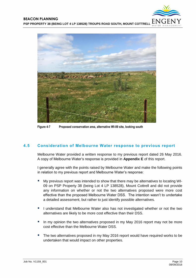
Figure 4-7 Proposed conservation area, alternative WI-09 site, looking south
4.5 Consideration of Melbourne Water response to previous report
Melbourne Water provided a written response to my previous report dated 26 May 2016.
A copy of Melbourne Water’s response is provided in Appendix E of this report.
I generally agree with the points raised by Melbourne Water and make the following points
in relation to my previous report and Melbourne Water’s response:
My previous report was intended to show that there may be alternatives to locating WI-
09 on PSP Property 38 (being Lot 4 LP 138528), Mount Cottrell and did not provide
any information on whether or not the two alternatives proposed were more cost
effective than the proposed Melbourne Water DSS. The intention wasn’t to undertake
a detailed assessment, but rather to just identify possible alternatives.
I understand that Melbourne Water also has not investigated whether or not the two
alternatives are likely to be more cost effective than their DSS.
In my opinion the two alternatives proposed in my May 2016 report may not be more
cost effective than the Melbourne Water DSS.
The two alternatives proposed in my May 2016 report would have required works to be
undertaken that would impact on other properties.

BEACON PLANNING
PSP PROPERTY 38 (BEING LOT 4 LP 138528) TROUPS ROAD SOUTH, MOUNT COTTRELL
Job No. V1159_001 Page 11 08/09/2016
Given Melbourne Water’s response and further consideration my advice to the Panel is
that the two alternatives in my May 2016 report may not be preferable to the Melbourne
Water DSS layout, but that they do demonstrate that there are alternatives available.
A third option was mentioned in my May 2016 report which would involve relocating WI-09
onto the proposed conservation area to the south of PSP Property 38 (being Lot 4 LP
138528), Mount Cottrell. The remainder of this report further considers the drainage and
cost implications of this alternative.
4.6 Responses to Issues
I have responded to the following issues raised by Beacon Town Planning for this report.
From a drainage perspective, could the wetland / retarding basin WI-09 proposed on
PSP Property 38 (being Lot 4 LP 138528), Mount Cottrell be located to the south onto
the proposed conservation area?
How would the relocation of WI-09 onto the property to the south impact on the design
of the proposed DSS and the cost of providing drainage services for the area?
In each of the following sub-sections the question from the issues raised are provided in
italics and the response below in normal font.
4.6.1 Could WI-09 be relocated to the south?
The issue raised was:
From a drainage perspective could wetland / retarding basin WI-09 proposed on
PSP Property 38 (being Lot 4 LP 138528), Mount Cottrell, be located to the south
onto the proposed conservation area?
My response to this issue is:
Yes, WI-09 could be relocated onto the proposed conservation area to the south
from a drainage (and waterways) point of view.
I have prepared an alternative layout for the DSS showing the changes required to
move WI-09 to the south. This revised drainage layout plan is provided in Figure
4.8 below. The changes consist of moving the wetland / retarding basin WI-09
south from the subject site to the property to the south and provision of a
constructed waterway through the subject site. My opinion is that this revised layout
would comply with Melbourne Water’s “Principles for Provision of Waterway and
Drainage Services for Urban Growth”. It would also have the additional benefit of
providing a drainage outlet for the proposed conservation area that would otherwise
have to drain through an extra culvert under the OMRR or into the proposed
industrial area to the south.

BEACON PLANNING
PSP PROPERTY 38 (BEING LOT 4 LP 138528) TROUPS ROAD SOUTH, MOUNT COTTRELL
Job No. V1159_001 Page 12 08/09/2016
Figure 4-8 Plan of proposed changes to drainage system
4.6.2 Cost implications of moving WI-09 to the south?
The issue raised was:
How would the relocation of WI-09 onto the property to the south impact on the
design of the proposed DSS and the cost of providing drainage services for the
area?
My response to this question is:
Moving WI-09 to the south would have the following changes to reduce the cost to
the DSS:
o Deletion of land acquisition of 4.41 hectares of PSP Property 38 (being Lot 4
LP 138528), Mount Cottrell.
Moving WI-09 to the south would have the following changes to increase the cost to
the DSS:
o Addition of acquisition of approximately 0.81 ha of land acquisition for a
constructed waterway along the proposed boundary of PSP Property 38 (being
Lot 4 LP 138528), Mount Cottrell adjacent to the proposed Outer Metropolitan
Ring Road (OMRR). I have reviewed the proposed waterway corridor width in
the PSP to the north of the subject site and have calculated that the PSP

BEACON PLANNING
PSP PROPERTY 38 (BEING LOT 4 LP 138528) TROUPS ROAD SOUTH, MOUNT COTTRELL
Job No. V1159_001 Page 13 08/09/2016
proposes a 15.5 m wide waterway corridor in this location (based on
information regarding areas on pages 61 and 62 of the PSP, and measurement
of the length of the proposed constructed waterway WI-08). From our
knowledge of Melbourne Water’s Guidelines for Waterway corridors we have
allowed for a 30 metre wide overall waterway corridor should this be extended
through PSP Property 38 (being Lot 4 LP 138528), Mount Cottrell.
o Addition of construction cost for a constructed waterway along the proposed
boundary of PSP Property 38 (being Lot 4 LP 138528), Mount Cottrell and the
OMRR.
In relation to the land acquisition I have been advised that the value of land within
the vicinity that will be developable for residential purposes is within the range of
$500,000 to $700,000 per hectare. I have used this range for comparison purposes
(note that we are not valuers and this amount is approximate). Therefore the
savings to the DSS by removing the need to acquire 4.41 hectares of land from the
cost of the scheme would save $2.205M to $3.087M.
Cost estimates for works have been prepared using the Melbourne Water DSS
spreadsheet template, that include cost rates used by MW to develop schemes
including MW allowances for survey, design, scheme administration and
contingencies. We have used the Melbourne Water DSS spreadsheet and
estimated the cost of construction of the waterway (including design and
contingencies) to be $300,000.
In relation to the proposed constructed waterway along the proposed boundary of
PSP Property 38 (being Lot 4 LP 138528), Mount Cottrell and the OMRR, I would
expect that the land acquisition would be funded by the Melbourne Water DSS.
Under Melbourne Water’s “Principles for Provision of Waterway and Drainage
Services for Urban Growth” the scheme has to acquire land that is otherwise
developable. I have reviewed the existing waterways in the area on my site visit
and by reference to plans from land.vic.gov.au. As shown on the first plan in
Appendix B of this report there is no existing waterway in this area other than Dry
Creek, the land is otherwise developable and therefore there would be no need for
the owner to set aside this proposed constructed waterway land without
compensation. Therefore creation of a constructed waterway would require the MW
DSS to acquire the land for the waterway through the subject site. The MW DSS
would need to acquire 0.81 hectares for the constructed waterway at a cost of
$405,000 to $567,000.
The overall change to the cost the DSS would therefore be a saving of $1,320,000 to
$2,220,000 depending on land value.
In addition the contribution rate per hectare for the MW DSS would be further reduced due
to receipt of contributions from an additional 3.60 hectares of development on PSP
Property 38 (being Lot 4 LP 138528), Mount Cottrell.
These changes would reduce the contribution payable by all developments within the
proposed Melbourne Water Dry Creek Upper Development Services Scheme.

BEACON PLANNING
PSP PROPERTY 38 (BEING LOT 4 LP 138528) TROUPS ROAD SOUTH, MOUNT COTTRELL
Job No. V1159_001 Page 14 08/09/2016
5. CONCLUSION
In relation to the contents of this report I conclude that:
1. The Mount Atkinson PSP proposes a wetland / retarding basin (WI-09) on PSP
Property 38 (being Lot 4 LP 138528), Mount Cottrell.
2. I have reviewed the Mount Atkinson PSP and proposed Melbourne Water Dry Creek
Upper Development Services Scheme in relation to WI-09 and PSP Property 38
(being Lot 4 LP 138528), Mount Cottrell.
3. The wetland / retarding basin WI-09 is required and its location is a good, logical
design that treats stormwater as required by the VPPs, avoids conflict with the
proposed conservation zone to the south and minimises the cost of drainage
infrastructure that will need to cross the proposed Outer Metropolitan Ring Road
(OMRR).
4. It should be noted that Melbourne Water will acquire the land for WI-09 as part of the
implementation of the Dry Creek Upper DSS and the aim stated in Melbourne Water's
“Principles for Provision of Waterway and Drainage Services for Urban Growth” for
determining the amount paid for the acquisition is to ensure that the owner is
appropriately compensated for the land.
5. I have considered the option to move WI-09 onto the proposed conservation area
south of PSP Property 38 (being Lot 4 LP 138528), Mount Cottrell. From a drainage
pattern perspective this option is entirely feasible and would free up land on PSP
Property 38 (being Lot 4 LP 138528), Mount Cottrell for residential development.
6. I have considered the changes that would be required to the Melbourne Water DSS to
relocate WI-09 onto the proposed conservation area south of PSP Property 38 (being
Lot 4 LP 138528), Mount Cottrell and prepared a revised DSS layout.
7. I have considered the changes to the costs of the DSS if WI-09 were relocated onto
the proposed conservation area south of PSP Property 38 (being Lot 4 LP 138528),
Mount Cottrell and conclude that there would be a cost saving of $1,320,000 to
$2,220,000 depending on land value, as well as receipt of contributions from an
additional 3.60 hectares of development on PSP Property 38 (being Lot 4 LP
138528), Mount Cottrell. These changes would reduce the contribution payable by all
developments within the proposed Melbourne Water Dry Creek Upper Development
Services Scheme.

BEACON PLANNING
PSP PROPERTY 38 (BEING LOT 4 LP 138528) TROUPS ROAD SOUTH, MOUNT COTTRELL
Job No. V1159_001 Page 15 08/09/2016
6. STATEMENT
I have made all the inquiries that I believe are desirable and appropriate at this time and
that no matters of significance which I regard as relevant have to my knowledge been
withheld from the Panel.
I have read the Planning Panel’s Victoria “Guide to Expert Evidence” and agree to be
bound by it.
Andrew Prout
BE Civil, PDMS, MIE Aust.

BEACON PLANNING
PSP PROPERTY 38 (BEING LOT 4 LP 138528) TROUPS ROAD SOUTH, MOUNT COTTRELL
Job No. V1159_001 Page 16 08/09/2016
7. QUALIFICATIONS
a. In preparing this document, including all relevant calculation and modelling, Engeny Water Management (Engeny) has exercised the degree of skill, care and diligence normally exercised by members of the engineering profession and has acted in accordance with accepted practices of engineering principles.
b. Engeny has used reasonable endeavours to inform itself of the parameters and
requirements of the project and has taken reasonable steps to ensure that the works and document is as accurate and comprehensive as possible given the information upon which it has been based including information that may have been provided or obtained by any third party or external sources which has not been independently verified.
c. Engeny reserves the right to review and amend any aspect of the works performed
including any opinions and recommendations from the works included or referred to in the works if:
(i) Additional sources of information not presently available (for whatever reason)
are provided or become known to Engeny; or
(ii) Engeny considers it prudent to revise any aspect of the works in light of any information which becomes known to it after the date of submission.
d. Engeny does not give any warranty nor accept any liability in relation to the completeness or accuracy of the works, which may be inherently reliant upon the completeness and accuracy of the input data and the agreed scope of works. All limitations of liability shall apply for the benefit of the employees, agents and representatives of Engeny to the same extent that they apply for the benefit of Engeny.
e. This document is for the use of the party to whom it is addressed and for no other
persons. No responsibility is accepted to any third party for the whole or part of the contents of this report.
f. If any claim or demand is made by any person against Engeny on the basis of
detriment sustained or alleged to have been sustained as a result of reliance upon the report or information therein, Engeny will rely upon this provision as a defence to any such claim or demand.
g. This report does not provide legal advice.

BEACON PLANNING
PSP PROPERTY 38 (BEING LOT 4 LP 138528) TROUPS ROAD SOUTH, MOUNT COTTRELL
Job No. V1159_001 Appendix 08/09/2016
APPENDIX A
Andrew Prout’s CV

Melbourne Office Suite 15 / 333 Canterbury Road (PO Box 452), Canterbury VIC 3126
P: 03 9888 6978 F: 03 9830 2601 E: [email protected] W: www.engeny.com.au
Andrew Prout Senior Principal Water Resources Engineer BE(Civil), PDMS, MIEAust
SUMMARY Andrew established Engeny Water Management in Victoria and has gained more than 30 years professional experience both in the consulting engineering field and with government and semi-government authorities. Andrew is a leader in the surface water management field, having prepared Melbourne Water’s current Drainage Design Guide and having lectured at university level. He has undertaken a number of drainage and flood studies as well as water conservation studies and projects to minimise the overall environmental footprints of projects. This included being project Director for the Werribee Plains Urban Water Conservation Study for the Australian Conservation Foundation.
Andrew has undertaken projects for a wide range of clients, including Councils, Melbourne Water, Catchment Management Authorities, Water Authorities, VicRoads, VicTrack and many public companies and land owners. He has also done work related to water issues for numerous major projects including Principal Surface Water designer or Peer Reviewer for Eastlink, Peninsula Link, Monash Upgrade, City Link as well as work on Federation Square, various windfarms, landfills, quarries and mines. His work has taken projects through all stages from studies to designs and construction.
Andrew has done a significant amount of work for local Councils over the last 20 years. This has included strategic drainage studies, preparation of drainage design guides, expert witness services, preparation of Development Contribution Plans and flood mapping. This work has covered most of the municipalities in Greater Melbourne, as well as a number of rural Victorian Councils, including Ballarat, Geelong, Corangamite, Warrnambool, Moyne, Moira, Bass Coast, Surf Coast and South Gippsland and some Councils in New South Wales and Queensland. He has spoken at conferences and made a number of professional presentations and been active in debates in the industry on topics such as water conservation, climate change impacts on water systems, urban flooding and catchment management. Andrew has provided professional advice to a wide variety of clients in a range of forums, including VCAT, Panel Hearings and court proceedings. His work in this area and in regional Victoria is summarised on the following pages
KEY AREAS OF EXPERTISE
◦ Flood mapping and Flood Mitigation ◦ Flood hazards and impacts on developments ◦ Coastal flooding and climate change impacts ◦ Wetlands and waterways ◦ Stormwater harvesting and water reuse ◦ Stormwater management and Water Sensitive Urban Design ◦ Drainage and stormwater treatment master planning and drainage schemes ◦ Surface water management for quarries and landfills ◦ EES and EIS work in relation to surface water, erosion and catchments

Curriculum Vitae – ANDREW PROUT Page | 2
EXPERIENCE Ballarat West PSP and DCP: City of Ballarat: Andrew and the team at Engeny were part of a large team that produced the Ballarat West Precinct Structure Plan and Development Contributions Plan for 1000 hectares in Ballarat. The work included catchment modelling for flooding and water quality and development of a master plan for development of the area. Andrew also prepared cost estimates for the works and produced an Expert Witness report for the Panel hearing for the Development Contributions Plan.
Marchington Avenue, Mornington, Flooding Related Expert Witness Report, Melbourne Water: In 2012 Andrew and his colleague Maria Verrocchi prepared a report related to a proposed residential development adjacent to Tanti Creek in Mornington. The report clearly described the flood hazards related to one of the proposed dwellings in terms of the Land Subject to Inundation and Floodway Overlays. Andrew presented the report at VCAT and Melbourne Water obtained a successful outcome.
Kerang / Dingwall Flooding Expert Witness project – Goulburn Murray Water: In 2013 Andrew undertook a detailed assessment of complex flooding patterns that occurred in 2011. The flooding was related to the catchments of the Loddon River and Wandella Creek and the interaction of the flood with the large floodplains and various infrastructure including roads, bridges, embankments, irrigation channels and syphons. Andrew also oversaw complex 2D flood modelling of the actual flood behaviour undertaken by his colleague Scott Dunn.
Toora Coastal Flood Risk Report, South Gippsland Shire. Andrew undertook a site review and prepared an Expert report for the South Gippsland Shire for a VCAT hearing in relation to six proposed dwellings in the Grip Road area in Toora. The report covered issues including local drainage and flooding, coastal flooding, sea level rise, climate change, wastewater disposal and related issues. Andrew gave evidence at VCAT which contributed to a successful outcome for the Shire and a report that has been referenced in various hearings and publications since the hearing.
Maribyrnong River Flood Hazard Report, Melbourne Water: In 2009 Andrew was engaged by Melbourne Water to provide a comprehensive report on flood hazards in the Maribyrnong Township in response to a development application. Andrew prepared a detailed report that covered historic flooding since 1870, flood warning systems and flood hazards and also provided expert witness services at a VCAT hearing. The work undertaken by Andrew was influential in a successful outcome for Melbourne Water.
Victorian Flood Review, Melbourne Water: Andrew was engaged by Melbourne Water to prepare a report that documented the roles of Melbourne Water and the Bureau of Meteorology in flood prediction and forecasting. The work involved liaison with Melbourne Water, Bureau of Meteorology, VicSES and production of a report in response to a recommendation from the Victorian Flood Review prepared by Neil Comrie.
Banyule Flood Mapping and Special Building Overlays, City of Banyule: Andrew and his colleague Paul Clemson have provided the City of Banyule with detailed advice regarding flood mapping of the flow paths associated with all of Councils drainage system. In addition to the flood mapping done by Paul and the team, detailed written advice in 2014 regarding how to determine process flood mapping results and options for using the results to control building and planning

Curriculum Vitae – ANDREW PROUT Page | 3
processes. Lockerbie Property Kalkallo, Surface Water Master Plan, Stockland. Andrew
has been working with Stockland and National Pacific on a significant master planning project for the future urban development of over 1100 hectares in the Kalkallo area. The work involved consultation with the landowners, the Growth Area Authority, Melbourne Water, Council and other consultants. The master planning focussed on the drainage, wetlands and retarding basin components of a Structure Plan for the overall development as well as a creek corridor master plan for Merri Creek.
Modella Poultry Farm surface water report, landowner: In 2012 Andrew and his colleague Maria Verrocchi prepared a report related to surface water issues for a proposed poultry farm in Modella in the Koo Wee Rup district. Andrew presented the report at VCAT.
Powling Street Wetland, Port Fairy, community group: In 2013/14 Andrew represented a local community group in relation to a proposed residential subdivision adjacent to a sensitive wetland. Andrew provided advice, undertook a site visit and prepared a report regarding local flooding, coastal inundation and water quality issues. Andrew represented the community group at a VCAT hearing and the hearing resulted in a reduction in the subdivision that had been proposed.
Botanic Ridge Estate, City of Casey: In 2013/14 Andrew represented the City of Casey in relation to the Botanic Ridge Estate in Cranbourne. Andrew assessed the effectiveness of construction control measures, stormwater harvesting, stormwater treatment and flood control works for the Estate and impacts on the downstream property. Andrew produced a detailed report that considered reports from other parties and made recommendations to resolve the issues.
Sunshine North Industrial Estate Drainage review, Brimbank City Council: In 2013/14 Andrew undertook a review of the constructed drainage systems in this estate. A number of the drainage pipes were found to be damaged prior to handover to Council. Andrew reviewed CCTV footage, drainage design plans, contracts and specifications and provided an Expert Report to Council on the issues and how to manage them.
Bungower Road Kennels, Moorooduc for landowner: In 2013/14 Andrew prepared a report related to the suitability of the site for a proposed kennel development in relation to the land capability for wastewater disposal as well as stormwater harvesting and drainage requirements. Andrew prepared a report and made a presentation at VCAT that assisted the applicant to obtain a permit.
Maribyrnong River LSIO rezoning, Keilor, Melbourne Water: In 2012 Andrew undertook an independent review of a proposed Land Subject to Inundation Overlay for Melbourne Water along the Maribyrnong River in Keilor and Calder Park. Andrew’s report assisted Melbourne Water to effectively negotiate all issues with an adjacent landowner.
O’Gradys Ridge Road Dam Break Expert Report, Southern Rural Water: In 2013 Andrew investigated the circumstances related to the failure of a large licensed farm dam. Andrew visited the site, assessed the role of Southern Rural Water, documented the downstream consequences of the dam failure and

Curriculum Vitae – ANDREW PROUT Page | 4
completed a risk assessment and a report. Werribee Flood Expert Report, Southern Rural Water: In 2012/13 Andrew
studied flooding patterns in the Werribee East area associated with a severe storm in February 2011. Andrew oversaw work by his colleague Glenn Ottrey that included detailed hydrologic and 2D hydraulic modelling of the flooding behaviour for a range of scenarios. Andrew and Glenn’s work was able to demonstrate how recent works had effected flooding in some locations and not in others. Andrew produced reports that assisted all parties to reach agreement where recent works had worsened flooding patterns and to defend claims where there has been no change in flooding.
Keysborough Expert Witness Report, landowner: In 2011/12 Andrew investigated the drainage issues associated with an industrial development in Keysborough South. This work included review of recent developments, Melbourne Water Drainage Scheme, temporary retarding and stormwater treatment works and the downstream system. Andrew produced a comprehensive report and appeared at hearings at VCAT.
Sheyna Drive Subdivision, Numurkah, Shire of Moira: In 2013 Andrew prepared a report regarding a proposed residential subdivision on flood prone land in Numurkah. Andrew reviewed the flooding of the site in 2012 and flood mapping of the area, as well as drainage patterns, the effect of irrigation infrastructure and the potential risks and issues associated with the proposed subdivision. Andrew obtained information from the Goulburn Broken CMA and Council. Andrew presented his report at VCAT and his evidence assisted Council in having the subdivision refused.
Tyers Street, Portland, Drainage Expert Witness Report, multiple parties: Andrew was engaged by a number of briefing parties to investigate urban flooding in Portland in Victoria and to recommend flood alleviation works to mitigate the flood risk for commercial properties in Portland. This 2010 report recommended a highly efficient, cost effective solution to the existing flooding problem, which was adopted by all parties.
Melbourne Water Drainage Scheme Reviews, Melbourne Water. Andrew has been project director for a number of drainage scheme reviews for Melbourne Water, including hydrologic modelling, stormwater quality modelling and development and costing for drainage infrastructure for proposed urban areas.
City of Knox, City wide drainage strategy: Andrew was Project Director for this municipality wide study into all aspects of the Council drainage system. The study assessed flooding risks, drain capacities and opportunities for Water Sensitive Design. Outputs included overland flow maps, capital works program and recommended planning scheme amendments and funding scheme.
City of Maribyrnong and City of Moreland Drainage Strategies: Responsible for management of these projects which involved preparation of a comprehensive strategy to enable Council to identify drainage problems and prioritise a capital works program to resolve all problems, including flooding and water quality related works. Information was supplied in MapInfo format including maps, reports, calculations and photographs.
Stormwater Drainage Strategies for Councils: Andrew developed methodologies and undertook comprehensive municipality wide strategies for a

Curriculum Vitae – ANDREW PROUT Page | 5
number of councils in greater Melbourne. The strategies included risk based drainage flooding mapping and works programs as well as water sensitive design programs of works, funding advice, design guides and planning advice. Andrew has done studies of this type for many Councils including Darebin, Glen Eira, Manningham, Monash, Whitehorse and Stonnington.
Monash Flood Management Plan, Melbourne Water. Andrew was responsible for overseeing this project. The work included workshops, identifying flooding hot spots and developing a detailed action plan for Council, Melbourne Water and VicSES. Andrew brought his decades of experience in the area and working relationships to the project and contributed to a comprehensive plan for managing flood risks in the City of Monash.
Geelong Racecourse stormwater harvesting, Racing Victoria: Andrew developed this project with Racing Victoria and was Project Director for the completed study that identified a low cost and viable source of water for the racecourse by harvesting stormwater. Andrew then followed up with the detailed design and implementation of the works that provide over 70ML/annum of water to irrigate the racecourse. Major regional racecourses are important employers and are required for a viable training and racing industry. The Geelong project led to similar studies that Andrew undertook at Ballarat and Bendigo Racecourses.
Water Sensitive Road Drainage Scheme, Bandiana Link Road, VicRoads: Andrew has undertaken work for VicRoads in Wodonga to develop a water sensitive road design system for the Bandiana Link Road and to prepare a cost apportionment scheme to obtain contributions from all benefiting landowners. The results of the study have been used in negotiations with benefitting landowners to offset the value of the works built by VicRoads against the land acquisition compensation.
Surface Water assessment, Crowlands Windfarm: Andrew undertook a detailed surface water assessment of the proposed Crowlands windfarm in the Pyrenees in north western Victoria. His work included a site assessment, input to the windfarm design, assessment of erosion risks, concept design of waterway crossings (including the Wimmera River) and erosion control works and a detailed report.
Merri River and Russell Creek flood studies, Warrnambool, Glenelg Hopkins CMA and Shire of Warrnambool: Andrew was project manager for this flood study and undertook hydrologic modelling and hydraulic modelling, as well as producing the flood study report and recommendations.
Moyne River Flood Study, Port Fairy, Glenelg Hopkins CMA and Shire of Moyne: Andrew was project manager for this flood study and undertook hydrologic modelling and hydraulic modelling, as well as producing the flood study report and recommendations.
Shire of Moira Drainage Strategy: Andrew was project manager for a comprehensive drainage strategy for Council that included consideration of drainage patterns and urban pollutant loads and management for towns including Numurkah, Nathalia, Cobram, Katamatite, Katunga and Waaia.
Blackburn Creek rehabilitation, Melbourne Water: Andrew was Project Director for the design and superintendent for the construction of two stages of

Curriculum Vitae – ANDREW PROUT Page | 6
waterway rehabilitation works on Blackburn Creek Surface Water study for Nowingi waste facility EES, Office of Major
Projects: Andrew was project manager for the surface water study for the proposed long term waste facility at Nowingi. Andrew prepared the EES specialist report and an Expert witness statement and gave evidence to the Panel hearing. The study covered issues including flooding risk, water balance and risk of surface water discharges from the site.
Baddaginnie Flood Study, Office of Major Projects: Andrew was Project Manager for this flood study in central Victoria. The project involved hydrology and hydraulic modelling for four creeks north of Violet Town and south of Baddaginnie. Andrew also undertook significant public consultation, including presentations at public meetings and briefing of Ministerial advisers and his work was central to Government decisions that the site was not appropriate for use for a long term waste facility due to flooding risks.
Dickson and Lyneham Wetlands, ACT Government: Andrew was Project Director for the design, approvals and then construction of two major wetlands in the northern suburbs of Canberra in 2009 and 2010. The wetlands will play a vital role in stormwater treatment and harvesting approximately 400 ML/annum of stormwater for use in open space irrigation. Andrew has overseen the preparation of the Final Sketch Plans, flood study, water treatment and water harvesting modelling and has developed a number of the technical solutions for this project. Andrew has also had a leading role in the agency and public consultation for the projects and the approval process.
Surface Water Study for Environmental Effects Statement for Mount Shamrock Quarry Extension: Andrew completed the surface water EES report and made an Expert Witness statement and presentation to the panel assessing the EES. Andrew’s work related to the site water balance, surface water quality, interaction of surface water and groundwater, discharge licensing and flooding risks.
Ruffey Creek rehabilitation, Melbourne Water: Andrew was Project Director for the design and superintendent for the construction of works on Ruffey Creek in Doncaster in 2007/08. The creek was deeply incised and in poor condition. The works included rock work, batter works, planting and an off stream wetland.
Dollar Wind Farm Expert Witness Report and Presentation, Southern Hydro: Andrew was peer reviewer for the civil design study for the Dollar Wind Farm in South Gippsland for Southern Hydro. His report related to surface water management and erosion control for the proposed development of the wind turbine project. Andrew made a presentation and was cross examined at the panel hearing in Foster in 2005.
Spindrift Avenue waterway impact report, landowner: In 2010 Andrew prepared an expert witness report and assisted a landowner in mediation in relation to development and works on a property in Spindrift Avenue, Flinders.
Lower Stony Creek VCAT report, Melbourne Water. Andrew represented Melbourne Water in relation to filling and realignment of Lower Stony Creek in Tottenham. Andrew’s role included briefing of Melbourne Water’s barrister on technical issues, preparation of reports and maps and appearances at VCAT hearings.
Curriculum Vitae – ANDREW PROUT Page | 7
Lower Stony Creek Flood Impact Study, Melbourne Water. Andrew was project manager for a flood study that analysed the flooding impact of recent fill and creek alignment works on Stony Creek in Tottenham.
Lower Stony Creek Waterway Design, Melbourne Water. To mitigate the effects of recent filling and realignment of the creek a design was prepared to reduce the flooding impact, stabilise the creek, improve the creek environment and to allow for access across the creek.
Yarra River Flood Risk report, City of Boroondara: Andrew investigated the flooding risks associated with a property in Coppin Grove, Hawthorn. The property is adjacent to the Yarra River and the owner had made an application to Council for a Planning Permit for dwellings on the high part of the site. Andrew prepared a flood risk report in accordance with the Planning and Environment Act to assist Council in deciding on the limit of residential development, the location of a path and the extent of Council’s Public Acquisition Overlay.
Flood Risk Report, Jacksons Creek: In 2002 Andrew prepared a flood risk report in relation to a proposed supermarket adjacent to Jacksons Creek in Gisborne. The report was prepared for the owner of a nearby supermarket as part of their submission to VCAT.
Drainage Design Guide, Melbourne Water: Andrew was personally responsible for reviewing the previous design guides and rewriting them to produce the current Melbourne Water Drainage Design Guide. This guide is the industry standard for drainage throughout the greater Melbourne area.
Development Contributions Plan, City of Monash: Andrew prepared the City of Monash’s Development Contribution Plan (DCP) for drainage works and worked with Council manager’s to obtain approval from the Department of Infrastructure (now DPCD) to the DCP. The DCP meets all of the requirements of the Planning and Environment Act and could provide Council with substantial funds every year towards the cost of drainage improvement works.
Porter Street Retarding Basin, Manningham City Council: Andrew analysed the drainage in the catchment in relation to a proposed subdivision on land in Porter Street, Templestowe. Part of the site was low lying and flood prone. Andrew made a presentation to VCAT that resulted in a retarding basin being set aside as part of the subdivision.
Wensleydale Coal Mine, Winchelsea, Victoria: The project involved risk assessment and design of stabilisation works for this disused mine in south-west Victoria. Severe erosion of the creek through the site occurred following a flood in 1995. Andrew developed a site management plan and detailed design of major stabilisation works.
Waterway Condition Assessment, Melbourne Water: Manager of waterway condition assessment studies for the Bunyip River, Tarago River, King Parrot Creek and Woori Yallock Creek catchments.
Dromana Flood Study: Andrew was project director for this project for the Mornington Peninsula Shire in Victoria. The flood mapping was done with the 2D flood model TUFLOW. Scenarios modelled included a range of storms as well as potential climate change scenarios considering sea level rise and increases in rainfall intensity. Andrew provided a report and policy advice on the implications of the study results.

Curriculum Vitae – ANDREW PROUT Page | 8
Gunbower Forest Watering, Goulburn Broken CMA and Goulburn Murray Water: Andrew undertook technical and peer reviews for the design of the water diversion scheme to provide additional environmental water for the Gunbower Forest.
Racecourse Lake / Murray Valley Highway irrigation channel technical review, Goulburn Murray Water: Andrew oversaw hydraulic analysis and recommendations to improve channel capacity without impacting on flooding patterns for this irrigation system between Kerang and Swan Hill.
Lake Mokoan alternative water supply, Goulburn Murray Water: Andrew undertook technical reviews of proposed channel and pipe works to provide irrigation water to customers following the decommissioning of Lake Mokoan near Benalla.
Hattah Lakes environmental watering, Mallee CMA: Andrew developed concepts for water diversions for Hattah Lakes including channel works and regulating structures to provide environmental watering that would closely replicate flow patterns prior to regulation of flows in the Murray River catchment.
Surface Water Study for Learmonth Saleyards and abattoir for the City of Ballarat. This work included a flood study, drainage study and design of surface water quality management systems. Andrew’s work included an expert report and appearance at a Panel Hearing.
PROFESSIONAL HISTORY
2010 - present Senior Principal Engineer, Engeny Water Management, Melbourne 2003 - 2010 Principal Water Surface Engineer, URS Australia Pty Ltd 2002 - 2003 Business Development Manager, Waterways & Water Resources, GHD Pty Ltd 2001 - 2002 Manager of Water Resources, Egis Consulting Australia Southern Region 1997 - 2001 Principal Engineer, Hyder Consulting 1994 - 1996 Senior Project Manager, Sinclair Knight Merz 1992 - 1994 Consulting Engineer, AGP Consulting 1993 - 1994, 1999 - 2001
Part-time Lecturer, Swinburne University
1990 - 1992 Works Program Engineer, Dandenong Valley and Western Port Authority 1986 - 1989 Planning and Investigation Engineer, Dandenong Valley Authority 1984 - 1986 Planning Engineer, Port of Melbourne Authority 1982 - 1984 Dandenong Valley Authority
EDUCATION
1992 Postgraduate Diploma in Management Studies, Melbourne University
1984 Bachelor of Engineering (Civil), Swinburne Institute of Technology
REGISTRATIONS / AFFILIATION
Member, Institution of Engineers, Australia

BEACON PLANNING
PSP PROPERTY 38 (BEING LOT 4 LP 138528) TROUPS ROAD SOUTH, MOUNT COTTRELL
Job No. V1159_001 Appendix 08/09/2016
APPENDIX B
Locality Plan, zones plan and overlays plan

248 Troups Road South locality plan
Legend
Disclaimer: This map is a snapshot generated from Victorian Government data. This material may be of assistance toyou but the State of Victoria does not guarantee that the publication is without flaw of any kind or is wholly appropriatefor your particular purposes and therefore disclaims all liability for error, loss or damage which may arise from relianceupon it. All persons accessing this information should make appropriate enquiries to assess the currency of data.
Map Scale 1:26,208May 25, 2016 4:52:59 PM
0 550 1100 m.
Copyright © State Government of Victoria. Service provided by www.land.vic.gov.au
Map Centre - Melways 357 C5
Planning MapMount Cottrell zones
Legend
Disclaimer: This map is a snapshot generated from Victorian Government data. This material may be of assistance toyou but the State of Victoria does not guarantee that the publication is without flaw of any kind or is wholly appropriatefor your particular purposes and therefore disclaims all liability for error, loss or damage which may arise from relianceupon it. All persons accessing this information should make appropriate enquiries to assess the currency of data.
Map Scale 1:24,315May 23, 2016 4:53:45 PM
0 500 1000 m.
Copyright © State Government of Victoria. Service provided by www.land.vic.gov.au
Map Centre - Melways 357 D5
Planning MapMount Cottrell overlays and contours
Legend
Disclaimer: This map is a snapshot generated from Victorian Government data. This material may be of assistance toyou but the State of Victoria does not guarantee that the publication is without flaw of any kind or is wholly appropriatefor your particular purposes and therefore disclaims all liability for error, loss or damage which may arise from relianceupon it. All persons accessing this information should make appropriate enquiries to assess the currency of data.
Map Scale 1:24,315May 23, 2016 4:55:38 PM
0 500 1000 m.
Copyright © State Government of Victoria. Service provided by www.land.vic.gov.au
Map Centre - Melways 357 D5

BEACON PLANNING
PSP PROPERTY 38 (BEING LOT 4 LP 138528) TROUPS ROAD SOUTH, MOUNT COTTRELL
Job No. V1159_001 Appendix 08/09/2016
APPENDIX C
Alternative DSS layout 1


BEACON PLANNING
PSP PROPERTY 38 (BEING LOT 4 LP 138528) TROUPS ROAD SOUTH, MOUNT COTTRELL
Job No. V1159_001 Appendix 08/09/2016
APPENDIX D
Alternative DSS layout 2


BEACON PLANNING
PSP PROPERTY 38 (BEING LOT 4 LP 138528) TROUPS ROAD SOUTH, MOUNT COTTRELL
Job No. V1159_001 Appendix 08/09/2016
APPENDIX E
Melbourne Water response to Engeny May 2016 report
1
11 August 2016
Jennie Jones
Beacon Town Planning
Level 1, 61-63 Commercial Road
SOUTH YARRA VIC 3141
Dear Ms Jones,
Re: 248-316 Troups Rd, Mt Cottrell
Melbourne Water has considered your submission dated: 30 May 2016. The issue
relevant to Melbourne Water is the request to relocate the drainage basin asset WI-09
(Section 4.4). Two alternative locations were suggested for the drainage basin. Each
alternative has been considered and an assessment of each alternative is outlined
below.
Alternative 1 is to relocate the basin to the powerline easement in PSP Property 51.
There are several disadvantages to this location. It would require diverting flows away
from natural flow paths, compared to the DSS which directs flows to the nearby
waterway. It would require construction of a waterway through the downstream
conservation area, which would be an additional impact to that area. Melbourne Water
also requires stormwater to be treated before it is discharged to waterways, both
constructed and natural. Therefore, a stormwater quality treatment system would still
be needed within the property to achieve compliance with this requirement. Finally, it
may be difficult to construct larger treatment assets in the electricity easement with the
need to avoid powerline towers.
Alternative 2 is to relocate the asset to part of PSP Property 46 that is outside of the
urban growth boundary. Disadvantages discussed above also apply to this alternative.
The alternative would divert flows away from the natural flow paths, require
construction of a waterway through the downstream conservation area and also require
stormwater to be treated prior to the constructed waterway. In addition, large flows
would need to be conveyed under the Outer Metropolitan Ring Road which would likely
increase the DSS rate above current calculations. Finally, it is difficult to justify locating
assets that service urban growth on land that is not within the urban growth boundary.
Melbourne Water does not support alternative 1 or 2 proposed; as it considers the
current location of the retarding basin / wetland (RB/WL) is the most appropriate based
on the factors outlined above. The current location and size shown in the PSP is
consistent with the Retarding Basin/Wetland in Melbourne Water’s Dry Creek Upper
Development Services Scheme (DSS).
If you would like to discuss this response further, please call me on 9679 6657 or

2
Yours sincerely
MICHAEL PRIOR
DEVELOPMENT SERVICES