proposed action - u.s. fish and wildlife service
TRANSCRIPT
United States Department of the Interior U.S. Fish and Wildlife Service
2321 West Royal Palm Road, Suite 103 Phoenix, Arizona 85021-4951
Telephone: (602) 242-0210 FAX: (602) 242-2513 In Reply Refer To: AESO/SE 02-21-03-F-0409-R1
November 2, 2006 Memorandum To: Field Manager, Hassayampa Field Office, Bureau of Land Management, Phoenix,
Arizona From: Field Supervisor Subject: Biological Opinion for the Existing Phoenix Field Office Planning Decisions and
Associated Activities on Gila Chub in the Agua Fria National Monument
Thank you for your request for reinitiation of formal section 7 consultation on the Existing Phoenix Field Office Planning Decisions and Associated Activities on Gila Chub in the Agua Fria National Monument (AFNM), pursuant to the Endangered Species Act of 1973 (16 U.S.C. 1531-1544), as amended (ESA). Topics addressed in this consultation include effects of your proposed action on the endangered Gila chub (Gila intermedia) and its critical habitat. This consultation is a reinitiation of your earlier conference opinion (02-21-03-C-0409); because there are few changes from the previous conference opinion, we hereby incorporate it by reference.
Consultation History
• July 20, 2004. We issued a Conference Opinion (02-21-03-C-0409) addressing the effects of the Existing Phoenix Resource Management Plan for the AFNM on the proposed Gila chub and its proposed critical habitat.
• November 2, 2005. The Gila chub was listed an endangered species and its critical
habitat designated. • February 1, 2006. We received your final biological assessment and request for
consultation on the Bradshaw-Harquahala and Agua Fria National Monument Resource Management Plan (which incorporates the Phoenix Resource Management Plan). We initiated formal consultation on the new land-use plan in response to your request.
• April 17, 2006. We received a memo from the Phoenix District, BLM, informing us that
incidental take of Gila chub in Silver Creek exceeded that anticipated in the July 20, 2004, conference opinion. Streambank alteration was measured and had exceeded the thresholds established in the earlier conference opinion.

2 • July 31, 2006. We met with the BLM to discuss future consultation on Gila chub on the
AFNM. We determined that since incidental take had been exceeded, the existing conference opinion could not be converted to a biological opinion as part of the ongoing land use plan consultation.
• August 4, 2006. We received a memo from the Hassayampa Field Office (FO) requesting
reinitiation of consultation on the Existing Phoenix FO Planning Decisions and Associated Activities on Gila chub in the AFNM, Conference Opinion (02-21-03-C-0409), hereafter referred to as the Reinitiation Letter. We initiated formal consultation on this issue per your request.
• September 18, 2006. We sent a draft biological opinion to the Hassayampa Field Office
for their review.
• October 2, 2006. We received comments on the draft biological opinion and were asked to finalize the document.
BIOLOGICAL OPINION
SCOPE OF THIS BIOLOGICAL OPINION This consultation addresses effects of livestock grazing on Gila chub and its critical habitat on the AFNM. Effects from other management actions authorized in the AFNM Plan, and effects to other listed species, have been consulted upon separately in the Bradshaw-Harquahala and Agua Fria National Monument RMP biological opinion (FWS file number 02-21-05-F-0785). We are conducting this consultation separately because the RMP and the RMP biological opinion address effects to listed species primarily at a broad, general, planning level. This consultation is for a site-specific project (livestock grazing on the Agua Fria National Monument) and provides detail not provided in the RMP about how this action will be implemented. As stated in the RMP, most site-specific projects implemented under the RMP will require separate section 7 analyses and consultation.
DESCRIPTION OF THE PROPOSED ACTION Livestock grazing on the Horseshoe, Box Bar, and Cross Y Allotments will continue at currently authorized levels. Grazing use may be modified by implementation of the BLM’s Standards for Rangeland Health or other BLM efforts designed to improve or maintain upland conditions, riparian-wetland conditions, and desired plant community objectives. Grazing permits for this proposed action are 10 years in duration. Monitoring for all allotments will occur at least twice a year in Gila chub habitat. Upland pastures will be monitored according to the requirements for BLM rangeland standard and guides. Horseshoe Allotment (Silver Creek and Larry Creek Tributary): The Horseshoe Ranch conducts livestock grazing using a rest-rotation grazing system established in the 1998

3Coordinated Resource Management Plan (CRMP) for the Copper Creek Allotment-Cave Creek Ranger District, Tonto National Forest and Horseshoe Allotment-Phoenix Field Office, Bureau of Land Management. An allotment evaluation of the Horseshoe Allotment was conducted in 1999. The Horseshoe Allotment has four pastures. The Gila chub habitat is monitored twice a year. The upland pastures are monitored as part of the requirements for BLM rangeland standard and guides According to the Reinitiation Letter, all livestock will be removed from the Horseshoe Allotment for at least two years, from November 2006 to November 2008. If or when livestock grazing resumes in 2008, use will be restricted to the winter season, November 1 to March 1, and will include rotations between three winter riparian pastures. The Gila chub (GC) population and critical habitat in Silver Creek are in the Boone Pasture of this allotment. Boone Pasture is one of the three riparian pastures involved in this rotation. Livestock will use Silver Creek for approximately six to ten weeks depending upon forage production that particular year. This action will reduce the length of stay in any one riparian pasture and improve the likelihood that livestock use will remain below these established thresholds:
• Utilization of key species of grasses on the uplands is limited to 40% of the current year’s growth and 50% utilization of herbaceous growth in the riparian areas.
• Bank alteration caused by livestock hoof action will be limited to 25%.
• Woody riparian seedling utilization will be limited to 30% of apical stems.
Monitoring of the GC habitat in Silver Creek will be conducted annually within one month after livestock are moved into and within one month after they are moved out of Boone Pasture. Salt and other livestock nutritional supplements will not be placed within 0.25 mile of any spring or riparian area. If the established thresholds (40% upland utilization, 50% riparian herbaceous utilization, 25% bank alteration, 30% woody riparian seedling utilization) are exceeded at any in time in the life of the permit, BLM will reinitiate consultation and consider available management options to conserve Gila chub and its critical habitat. Cross Y Allotment (Lousy Canyon): The Cross Y Ranch uses a rest-rotation grazing system using several unnamed pastures. An allotment evaluation has not been conducted on this allotment. Box Bar Allotment (Indian Creek): The BLM issued a decision on the Box Bar Allotment permitting winter use of livestock in GC critical habitat in Indian Creek. That decision was appealed and subsequently stayed by a Department of Interior Administrative Law Judge. As a result, yearlong livestock grazing in Indian Creek has continued. However, the proposed action in Indian Creek for this consultation will be to return the allotment to winter use, as described in the original July 2004 conference opinion.

4The Box Bar Allotment has four pastures. Cross S and Bald Hill Pastures will be grazed only during the fall-winter (November 1 – March 1) annually, effective upon permit renewal. Cattle would be permitted to trail across the winter use pastures for up to two weeks during the eight month growing season. Along with the winter season of use, the same use thresholds and monitoring requirements described above for the Horseshoe Allotment would be proposed. The duration of the proposed action (winter use only in Gila chub habitats) is the ten-year grazing permit. ACTION AREA The action area for this project consists of the Horseshoe, Cross Y, and Box Bar allotments on the AFNM, and includes all of the Lousy and Larry creek watersheds and those portions of Silver Creek, Indian Creek, and Agua Fria watersheds within the AFNM. The location of the critical habitat areas within and adjacent to the AFNM are depicted on Map 1. The upland areas of the action area are semi-desert grasslands dominated by tobosa grass (Hilaria mutica), curly mesquite (Hilaria berlangeri), and red brome (Bromus rubens). The sides of the drainages are occupied by shrub live oak (Quercus turbinella), catclaw (Acacia greggii), netleaf hackberry (Celtis reticulata), and juniper (Juniperus monosperma). Riparian vegetation is dominant along the major streams. Silver Creek Silver Creek originates on the Tonto National Forest and runs from east to west, entering the Agua Fria National Monument approximately five miles above its confluence with the Agua Fria River. This stream is usually perennial between the boundary with the Tonto National Forest and a point approximately one mile above the confluence with the Agua Fria River, where it flows only seasonally. During drought, some portions of this upper reach may dry. The upper four miles of this stream on the Agua Fria National Monument is an alternating series of riffles, runs, and pools. The elevation ranges from 3,760 feet to 3,320 feet. The creek is interspersed with an often dense overstory canopy of velvet ash (Fraxinus velutina), cottonwood (Populus fremontii), Gooddings willow (Salix gooddingi), Arizona sycamore (Platanus wrightii), and open areas dominated by herbaceous plants. Vegetation in the open areas and understory includes seep willow (Baccharis salicifolia), red brome, bulrush (Scirpus sp.), sedges (Carex sp.), cattail (Typha latifolia), rabbit’s foot grass (Polypogon monspeliensis), and Bermuda grass (Cynodon dactylon). GC critical habitat on Silver Creek starts approximately 0.25 mile upstream of the BLM/Forest Service boundary downstream to the waterfall/barrier in Section 10, Township 10 North, Range 3 East, Section 10, SE ¼ SE ¼ (Map 1). Indian Creek The perennial reach of this stream within the AFNM starts on private land at the boundary with the Prescott National Forest and runs southwesterly for approximately 2.4 miles to the confluence with Red Rock Gulch, where it becomes intermittent or interrupted. Although this reach is normally perennial, during droughts, as in 2000-2003, flows are reduced to a few isolated pools. In the summers of 2002 and 2003, the channel became dry. During most years, this reach of Indian Creek is an alternating series of riffles, runs, and shallow pools. The

5elevation ranges from 3,840 feet to 3,560 feet. The upper portion of the creek is interspersed with an often dense overstory canopy of velvet ash, cottonwood, willow, Arizona sycamore and open areas dominated by herbaceous plants. Herbaceous understory species include seep willow, red brome, sedges, bulrush, cattail, rabbit’s foot grass and Bermuda grass. The lower portion is mostly scattered willow and ash trees with a bulrush and Bermuda grass herbaceous layer. Lousy Canyon
The perennial reach of this stream flows for approximately one mile downstream of the spring source, from an elevation of 3,080 feet to 2,600 feet. This reach flows through a steep, narrow, boulder-strewn gorge with several waterfalls. The upper waterfall is approximately 15 feet high with a large plunge pool (50 x 50 x 10 feet deep). A second waterfall is approximately 25 feet high with a deep plunge pool (50 x 20 x 25 feet deep). The lower waterfall (approximately 40 feet high) occurs approximately 0.25 mile below the upper fall but has no associated plunge pool. The vegetative overstory of large velvet ash, Arizona sycamore, cottonwood, and willow shades most of the reach. Where there is no overstory, bulrush, sedges, seep willow, canyon grape (Vitis arizonica), raspberry (Rubus arizonensis), cattail, and common reed (Phragmites australis) occur along the margins of the numerous pools. The stream channel consists of mostly pools with a few shallow runs. Larry Creek Tributary The perennial reach of this stream is approximately 0.5 mile long. This reach starts at an elevation of 3,200 feet and drops to 2,860 feet. It flows down a narrow canyon as a series of pools and runs to the confluence, with Larry Creek. Larry Creek, below this confluence, dries during the summer. The vegetative overstory along the perennial reach consists of dense stands of velvet ash, Arizona sycamore, cottonwood, and willow. The stream channel is lined with thick stands of common reed, bulrush, sedges, and seep willow. The tributary of Larry Creek is in the Lousy Pasture on the Horseshoe Allotment. Due to topography, this stream is never used by livestock. This stream is in the Larry Canyon ACEC and was closed to grazing in the Phoenix Resource Management Plan (1988). STATUS OF THE SPECIES AND CRITICAL HABITAT Gila Chub and its Critical Habitat The GC was listed as endangered with critical habitat on November 2, 2005 (USFWS 2005). Historically, GC have been recorded from rivers, streams, and spring-fed tributaries throughout the Gila River basin in southwestern New Mexico, central and southeastern Arizona, and northern Sonora, Mexico (Miller and Lowe 1967, Rinne and Minckley 1970, Minckley 1973, Rinne 1976, DeMarais 1986, Weedman et al. 1996). Today the GC has been restricted to small, isolated populations scattered throughout its historical range. Critical habitat for GC includes approximately 163 mi of stream reaches in Arizona and New Mexico (USFWS 2005). The seven primary constituent elements (PCE) are:

6• Perennial pools, areas of higher velocity between pools, and areas of shallow water
among plants or eddies all found in headwaters, springs, and cienegas, generally of smaller tributaries;
• Water temperatures for spawning ranging from 17 to 24 °C (62.6 to 75.2 °F), and
seasonally appropriate temperatures for all life stages (varying from approximately 10 °C to 30 °C);
• Water quality with reduced levels of contaminants, including excessive levels of
sediments adverse to Gila chub health, and adequate levels of pH (e.g. ranging from 6.5 to 9.5), dissolved oxygen (e.g. ranging from 3.0 to 10.0 ppm), and conductivity (e.g. 100 to 1000 mmhos);
• Food base consisting of invertebrates (e.g. aquatic and terrestrial insects) and aquatic
plants (e.g. diatoms and filamentous green algae);
• Sufficient cover consisting of downed logs in the water channel, submerged aquatic vegetation, submerged large tree root wads, undercut banks with sufficient overhanging vegetation, large rocks and boulders with overhangs, a high degree of streambank stability, and a healthy, intact riparian vegetation community;
• Habitat devoid of nonnative aquatic species detrimental to Gila chub or habitat in which
detrimental nonnatives are kept at a level that allows Gila chub to continue to survive and reproduce; and
• Streams that maintain a natural flow pattern including periodic flooding.
Rangewide Population Status GC currently occur in Turkey Creek in New Mexico, and in approximately 24 streams in the Agua Fria, Gila, Santa Cruz, and San Pedro drainages in Arizona (USFWS 2005). GC also may still occur in Cienega los Fresnos and Cienega la Cienegita, Mexico (Weedman et al. 1996), although recent surveys have not detected them there. Of all the known extant GC populations, most are small; about two thirds are considered stable but threatened, and a third are unstable and threatened (Weedman et al. 1996, USFWS 2005). Reestablishment of GC has been attempted in four Arizona sites; the three believed to be extant are, Romero Canyon in southern Arizona, and Lousy Canyon and Larry Creek within the AFNM.

7ENVIRONMENTAL BASELINE The environmental baseline includes past and present impacts of all Federal, State, or private actions in the action area, the impacts of all proposed Federal actions in the action area that have undergone formal or early section 7 consultation, and the impact of State and private actions which are contemporaneous with the consultation process. The environmental baseline defines the current status of the species and its habitat in the action area to provide a platform to assess the effects of the action now under consultation. Status of the species within the action area Four GC populations occur in the action area, all of which are located on the AFNM (Map 1): Silver Creek, Lousy Canyon, Larry Creek, and Indian Creek. The status of GC in each stream is discussed below. The Agua Fria River downstream of all four areas is occupied by green sunfish (Lepomis cyanellus) and mosquitofish (Gambusia affinis). Nonnative fishes likely contributed to the extirpation of GC from the Agua Fria River and the lower portions of Silver Creek and Indian Creek and represent a biological barrier that precludes the GC from becoming re-established there. The Agua Fria River, including the confluences with Silver Creek, Indian Creek, Lousy Canyon, and Larry Creek, is proposed for designation as a wild reach in the Arizona Statewide Wild and Scenic Rivers Legislative Environmental Impact Statement, December, 1994. Silver Creek The GC occupies Silver Creek from a point approximately one mile upstream of the BLM/Forest Service boundary downstream to approximately one mile below the waterfall/barrier. The BLM-administered portion of the habitat for this population was included in the Agua Fria National Monument in 2000. The Silver Creek GC population was considered stable but vulnerable in 1996 (Weedman et al. 1996). The occupied habitat extends from approximately one mile above the boundary with the Tonto National Forest downstream approximately five miles. Much of the lower half of the occupied habitat in Silver Creek dried during 2002-2004. GC were abundant in all of the larger pools and recruitment was evident in the upper 1.5 mile of the creek during the spring of 2005. The habitat for this population occurs in the Horseshoe and Copper Creek allotments (on the Tonto National Forest, outside of the action area) which are under a management plan that will ensure the constituent elements are protected. There are two roads crossing Silver Creek; the upper crossing is inside the critical habitat area where the primitive road bed crosses the creek on a shallow bedrock shelf; the lower crossing is where the Bloody Basin Road crosses approximately 0.25 mile above the confluence with the Agua Fria River. The upper crossing is usually dry during base flow and the lower crossing is dry except during spring runoff and following storm events. There is a small waterfall along the stream where it passes through a narrow canyon in Township 10 North, Range 3 East, Section 10, SE ¼ SE ¼ approximately two miles downstream of the Tonto National Forest boundary. This waterfall apparently serves as a barrier to fish movement upstream. GC is the only fish species that occurs above the waterfall/barrier. Below the barrier, the fish fauna consists of green sunfish, fathead minnow (Pimephales promelas), longfin dace (Agosia chrysogaster), desert sucker (Catostomus clarki), and GC. Nonnative virile crayfish

8(Orconectes virilis) are also abundant below the barrier. GC are less abundant and generally larger in size below the barrier where green sunfish are present than those found above the barrier where green sunfish are absent. This difference in size and abundance increases with the distance below the barrier until the chubs cease to exist, and there is no evidence of young-of-year GC below the barrier, indicating green sunfish likely preclude recruitment of GC below the barrier (BLM unpublished data in 2003 biological evaluation for formal consultation of FWS file number 02-21-03-C-0409). These findings are consistent with GC – green sunfish interactions investigated in other parts of Arizona (Minckley et al. 1977, Dudley 1995). GC were salvaged from Silver Creek in June 2005 in response to the Cave Creek Complex Fire and were returned in August 2005 after surveys indicated that Gila chub were still common in the stream (despite a severe burn of the entire upper watershed above the Bloody Basin Road and severe flooding from monsoonal storm events in early September 2005). Recreational use in the vicinity of Silver Creek is generally light but has increased since the designation of the AFNM. It consists mostly of dispersed use associated with equestrian use, small and big game hunting, hiking, and sightseeing. Cattle grazing in winter 2005 and spring 2006 led to overuse in Silver Creek in the Boone Pasture of the Horseshoe Allotment. Streambank alteration was documented at 47% on December 14, 2005. The permittee was unable to move livestock because of on-going calving. Streambank alteration was measured again on April 4, 2006 and documented at 62%, again exceeding the allowable use of 25 percent as defined in the July 2004 conference opinion (FWS file number 02-21-03-C-0409). The exceedence during the authorized livestock season of use was likely a result of the lack of upland waters due to the ongoing drought (April 13, 2006 letter from the Hassayampa FO to AESO). The two-mile reach of Silver Creek, downstream from the Tonto National Forest boundary, was rated as “Functioning-at-Risk,” with a downward trend as a result of recent excessive livestock use. The remaining BLM-administered Silver Creek reaches, downstream to one mile above the Agua Fria River confluence, were rated as being in “Proper Functioning Condition”. All riparian habitat assessments follow the BLM Technical Reference, 1737-9, 1993, "Process for Assessing Proper Functioning Condition." Lousy Canyon and Larry Creek Tributary Lousy Canyon is located in a steep canyon carved into a densely vegetated mesa. This topography protects the riparian area from most human impacts, although livestock grazing does occur on the uplands of the watershed. GC were introduced into Lousy Canyon in 1995 and have become established. No fish existed above the upper waterfall until 2000 when Gila topminnows (Poeciliopsis occidentalis occidentalis) were stocked there. Desert pupfish (Cyprinodon macularius) were stocked in Lousy Canyon in spring 2006. Gila topminnow coexist with GC between the 2nd and 3rd waterfalls. GC were present below the lower waterfall during the April 2003 visit. Longfin dace were collected in Lousy Canyon below the lower waterfall in 1993. It is extremely unlikely that GC have or will become established in the Agua Fria River downstream of the introduction site due to the presence of invasive green sunfish, mosquitofish, and other non-native fishes. Gila topminnow were stocked in the Larry Creek tributary in fall 2005; desert pupfish were stocked at this site in spring 2006 (FWS file number

902-21-99-F-031). Larry Creek tributary is very similar to Lousy creek, and is also a small canyon-bound stream. Gila chub were also successfully introduced here in 1995; the GC population and its critical habitat in Larry Creek tributary are also at the bottom of a steep canyon that is inaccessible to livestock, although grazing does occur in the watershed and uplands outside of the canyon. Both Lousy Canyon and Larry Creek tributary GC were monitored in April 2005 and appeared to be healthy and stable with all size classes represented. The riparian habitat condition along the entire reach of Lousy Canyon, from the source downstream to the confluence with the Agua Fria River, is in Proper Functioning Condition. This stream is in the Perry Mesa Area ACEC. The riparian habitat condition along the entire reach of the Larry Creek tributary is in also Proper Functioning Condition. Both streams are visited infrequently by hikers. Indian Creek Based on fish-sampling efforts during the early 1990’s, Indian Creek near the confluence with Red Rock Gulch was occupied by only longfin dace and desert sucker. GC were discovered in 1995 in a few larger pools approximately 1 mile downstream of the National Forest boundary. Subsequent survey efforts by the Forest Service and Arizona Game and Fish Department documented GC further upstream in Indian Creek on the Prescott National Forest. GC critical habitat along Indian Creek starts approximately one mile upstream of the BLM/Forest Service boundary and downstream to the confluence with Red Rock Gulch approximately 2.6 miles below the boundary (Map 1). There is currently no occupied habitat on BLM-administered lands in Indian Creek. Prior to the summer of 2002, GC were found in a few isolated pools in the Cross S Pasture. Critical habitat occurs in the Cross S Pasture, Red Rock Pasture, and the Bald Hill Pasture. The lower end of the critical habitat is the confluence with Red Rock Gulch near the downstream extent of the Bald Hill Pasture. Although Gila chub do not currently occur on the Box Bar Allotment, they are likely in wetter years to disperse into sections of Indian Creek on the allotment from currently occupied areas upstream. We anticipate that GC will immigrate to portions of Indian Creek in the Box Bar Allotment during the term of this biological opinion. Riparian conditions along Indian Creek vary by pasture. Proper Functioning Condition assessments were conducted along Indian Creek in June 2001. The assessment indicated that the condition within the Cross S Pasture was Functioning at Risk with an upward trend and the remainder of the stream was in Proper Functioning Condition. Recreational use in the vicinity of Indian Creek is very light. It consists mostly of dispersed use associated with hiking and small and big game hunting. Public access to the area is limited because there are no legal public access roads to the area. GC critical habitat designated in Indian Creek is within the Cross S, Red Rock and Bald Hill pastures of the Box Bar allotment. The Indian Creek GC population was considered unstable and vulnerable in 1996. At that time, the population was known only from a few small pools on BLM-administered lands approximately 1 mile downstream of the National Forest boundary. Survey efforts by Tonto National Forest and Arizona Game and Fish Department personnel have

10determined that the population extends upstream onto the Prescott National Forest (outside of the action area) for approximately 1 mile. During the summer of 2002, Indian Creek was dry for approximately 1.5 miles above Red Rock Gulch. During the summer of 2003, the entire critical habitat stream segment along Indian Creek in the AFNM was dry. The GC population in Indian Creek on the AFNM is likely present during years of average or above average precipitation and is subject to extirpation during prolonged drought. Livestock use may contribute to the loss of habitat during drought. GC from Indian Creek (Prescott National Forest) were salvaged in July 2005 in response to the Cave Creek Complex Fire. Despite much of the watershed burning, GC persisted in the upper reaches of Indian Creek after the fire. The salvaged fish were returned to Indian Creek in November 2005. The BLM surveyed Indian Creek in June 2006. Pools that were previously occupied by GC were unoccupied by any fish species. Sampling efforts in critical habitat failed to find any GC in Indian Creek within the AFNM. However, we anticipate that GC will re-colonize previously occupied habitat in Indian Creek in wet years from currently occupied upstream reaches on the Prescott National Forest because this has happened in the past. Status of Critical Habitat in the Action Area There are four GC critical habitat areas designated on the AFNM; Indian, Larry, and Silver creeks, and Lousy Canyon (USFWS 2005). These streams are described above in the Action Area Description, and the critical habitat PCEs are described above in the Status of the Species section. The entire segments of critical habitat on Lousy Canyon and Larry Creek occur on the AFNM (both segments are 0.4 mile long). Roughly half of the 5.2 miles of critical habitat on Indian Creek and the 5.3 miles of critical habitat on Silver Creek occur on the AFNM, with the upstream halves of these two critical habitat segments occurring outside the action area. Little Sycamore and Sycamore creeks contain critical habitat for GC, but are located on the Prescott National Forest, immediately upstream of the AFNM boundary. Lousy Canyon and the Larry Creek Tributary both contain fairly pristine GC habitat and GC critical habitat contains all PCEs. Both streams are isolated by steep topography and thick vegetation; very little human influence intrudes into these small canyons. Critical habitat in Silver Creek also contains all of the GC PCEs. However, below the barrier (downstream of critical habitat), nonnative species, primarily crayfish and green sunfish, greatly diminish the value of the habitat for GC. Indian Creek was thought to contain perennial pools on BLM lands on the AFNM; however, as noted above, these pools became dry in 2002-2003. These pools returned in recent years, but are now fishless. Livestock use may have contributed to these pools becoming dry during the drought. BLM’s improvements and shift to winter only grazing in Indian Creek in the Box Bar Allotment should improve critical habitat in Indian Creek on BLM land.
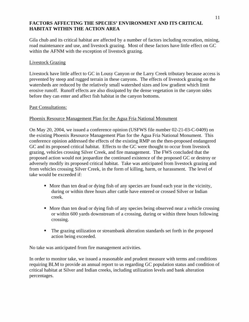
11FACTORS AFFECTING THE SPECIES’ ENVIRONMENT AND ITS CRITICAL HABITAT WITHIN THE ACTION AREA Gila chub and its critical habitat are affected by a number of factors including recreation, mining, road maintenance and use, and livestock grazing. Most of these factors have little effect on GC within the AFNM with the exception of livestock grazing. Livestock Grazing Livestock have little affect to GC in Lousy Canyon or the Larry Creek tributary because access is prevented by steep and rugged terrain in these canyons. The effects of livestock grazing on the watersheds are reduced by the relatively small watershed sizes and low gradient which limit erosive runoff. Runoff effects are also dissipated by the dense vegetation in the canyon sides before they can enter and affect fish habitat in the canyon bottoms. Past Consultations: Phoenix Resource Management Plan for the Agua Fria National Monument On May 20, 2004, we issued a conference opinion (USFWS file number 02-21-03-C-0409) on the existing Phoenix Resource Management Plan for the Agua Fria National Monument. This conference opinion addressed the effects of the existing RMP on the then-proposed endangered GC and its proposed critical habitat. Effects to the GC were thought to occur from livestock grazing, vehicles crossing Silver Creek, and fire management. The FWS concluded that the proposed action would not jeopardize the continued existence of the proposed GC or destroy or adversely modify its proposed critical habitat. Take was anticipated from livestock grazing and from vehicles crossing Silver Creek, in the form of killing, harm, or harassment. The level of take would be exceeded if:
More than ten dead or dying fish of any species are found each year in the vicinity, during or within three hours after cattle have entered or crossed Silver or Indian creek.
More than ten dead or dying fish of any species being observed near a vehicle crossing
or within 600 yards downstream of a crossing, during or within three hours following crossing.
The grazing utilization or streambank alteration standards set forth in the proposed
action being exceeded.
No take was anticipated from fire management activities. In order to monitor take, we issued a reasonable and prudent measure with terms and conditions requiring BLM to provide an annual report to us regarding GC population status and condition of critical habitat at Silver and Indian creeks, including utilization levels and bank alteration percentages.

12BLM Arizona Statewide Land Use Plan Amendment for Fire, Fuels, and Air Quality Management On September 3, 2004, we issued a biological opinion (USFWS file number 02-21-03-F-0210) for the BLM Arizona Statewide Land Use Plan Amendment for Fire, Fuels, and Air Quality Management. That opinion addressed the effects of the BLM’s fire suppression and fire and fuels management treatments on 31 listed species and designated critical habitat for nine species. We anticipated that incidental take of Gila chub from the plan would be primarily in the form of: 1. Injury to the species from the increased runoff in burned areas, resulting in physiological effects of reduced water quality and loss of habitat through sedimentation. 2. Mortality of those individuals transported from a site into unsuitable habitat. 3. Injury or mortality during emergency salvage operations. We anticipated that Gila chub inhabiting any of 19 sites on BLM lands (including 6 populations on or near the AFNM) could be incidentally taken by the direct and indirect effects of prescribed fire, with individual fishes experiencing effects ranging from harassment to mortality, on two occasions during the 10-year term of the land use plan. We did not anticipate that wildland fire use or mechanical or chemical treatments would result in incidental take because these actions were not planned in watersheds where GC occur. In order to minimize the effects of harassment and mortality of Gila chub, we issued terms and conditions that included BLM coordinating all fire suppression actions in watersheds containing GC with FWS, and salvaging GC if take is likely to occur due to suppression actions, provided that collection and salvage operations could be accomplished safely. In order to minimize the loss of Gila chub habitat, we issued terms and conditions that included monitoring the effects of fire suppression actions on Gila chub, including: presence/absence and abundance (catch per unit effort or population estimates) of Gila chub, and water quality data, including temperature, pH, dissolved oxygen, total dissolved solids, and turbidity. In instances of GC mortality, BLM would also monitor post-fire levels of sediment, debris, and fire-fighting chemicals. EFFECTS OF THE ACTION Effects of the action refer to the direct and indirect effects of an action on the species or critical habitat, together with the effects of other activities that are interrelated and interdependent with that action, which will be added to the environmental baseline. Interrelated actions are those that are part of a larger action and depend on the larger action for their justification. Interdependent actions are those that have no independent utility apart from the action under consideration. Indirect effects are those that are caused by the proposed action and are later in time, but are still reasonably certain to occur. Livestock grazing on Indian Creek (Box Bar Allotment - Cross S, Red Rock, and Bald Hill pastures) will occur only during fall-winter (November 1 – March 1) annually, effective upon permit renewal. Cattle will trail across the winter-use pastures for up to two weeks during the eight-month growing season. Gila chub do not currently occur on the Box Bar Allotment, however, they are likely in wetter years to disperse into sections of Indian Creek on the allotment from currently occupied areas upstream. Once winter-use rest rotation is implemented across the

13Box Bar Allotment, we expect that conditions across the allotment and in Indian Creek, including areas of Gila chub critical habitat in Indian Creek, will improve. The Horseshoe Allotment, which includes Silver Creek, will be ungrazed for at least the next two years (November 2006 to November 2008). This two-year rest would allow the stream banks that were adversely altered to recover, if no large flood events were to occur during this time. Streambank recovery would improve PCE 5 of critical habitat that addresses sufficient cover for sheltering when undercut banks are formed and protected and riparian vegetation establishes to shade the water and stabilize the streambanks. When livestock are returned to the fall-winter pastures during the November 1 to March 1 period they will be rotated between three different riparian pastures. One of the pastures, Boone Pasture, contains the Silver Creek GC population and GC critical habitat. This rotational system will allow livestock access to Silver Creek for six to ten weeks during the winter. Low measurable livestock grazing impacts on riparian vegetation and streambanks are therefore anticipated. If utilization levels are exceeded, Silver Creek will be fenced and excluded from livestock grazing. The March 1 season-of-use end date will reduce the impacts to eggs and fry. GC spawn in warmer water temperatures than generally occur at on the AFNM in the winter (Nelson 1993, Weedman et al. 1996). Livestock use of streambanks as movement corridors, regardless of time-of-year, can effect GC habitat. Gila chubs are highly secretive, preferring quiet deeper waters, especially pools, or remaining near cover including overhanging terrestrial vegetation, boulders, undercut banks and fallen logs (Rinne and Minckley 1991, Nelson 1993). Steep vertical banks which develop undercuts are easily sheared off by hoof action (Rosgen 1996). Undercut banks are also lost when streambank vegetation is removed. Dense roots help support undercut banks; reduced plant vigor from livestock overgrazing can reduce root mass and increase erosion and mass wasting of undercut and vertical banks (Micheli and Kirchner 2002). This decreases GC habitat suitability and increases the lateral erosion of the stream reach. The major effects to GC will be increased susceptibility to predators from the loss of cover and the direct losses of preferred deep-pool and undercut-bank habitats. Reduced riparian vegetation reduces streambank stability which increases the width while decreasing the depth of the channel (Simon and Collison 2002). This morphologic change decreases the stream’s ability to transport sediment through the system. Increased streambank erosion can increase sediment into a stream; up to 85% of the overall sediment yield into a stream can be attributed to streambank erosion (Simon et al. 2000). Decreased depths reduce generated shear stress needed to move sediment. If there is an increased supply of sediment from excessive upland or streambank erosion, fine sediments can accumulate and reduce the volume and depth of pools used by GC (Hilton and Lisle 1993). Excessive sediment deposition in riffle habitats between pools can act as barriers to fish movement throughout the reach during low-flow periods (Schaefer 2001). During low-flow periods fish can be concentrated in small pools with limited water volume. The effects of low water volume and decreased water quality can be exacerbated by dry weather and/or drought (Magoulick and Kobza 2003), which can reduce the quality of or eliminate GC habitat. The effects of livestock wading in stream courses are of particular concern in the intermittent reaches of streams where GC could be found. Between the period of spring runoff and summer monsoons, GC can be stranded in pools ranging in size from several thousand square feet to just
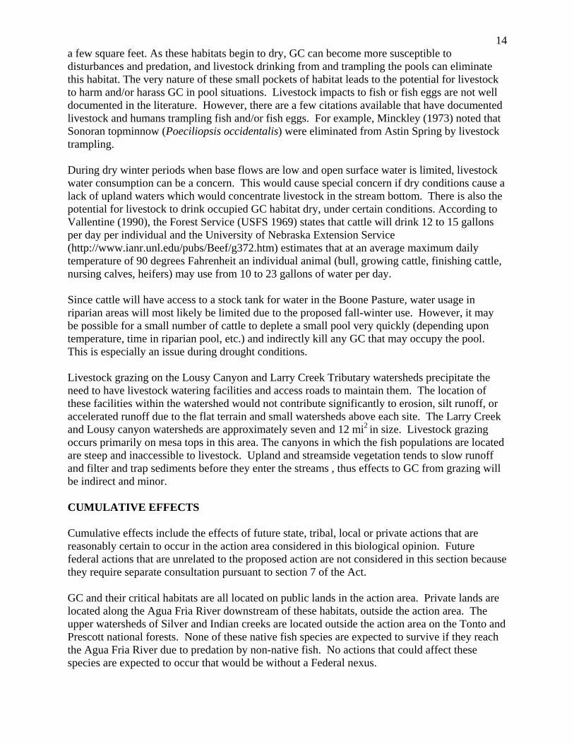
14a few square feet. As these habitats begin to dry, GC can become more susceptible to disturbances and predation, and livestock drinking from and trampling the pools can eliminate this habitat. The very nature of these small pockets of habitat leads to the potential for livestock to harm and/or harass GC in pool situations. Livestock impacts to fish or fish eggs are not well documented in the literature. However, there are a few citations available that have documented livestock and humans trampling fish and/or fish eggs. For example, Minckley (1973) noted that Sonoran topminnow (Poeciliopsis occidentalis) were eliminated from Astin Spring by livestock trampling. During dry winter periods when base flows are low and open surface water is limited, livestock water consumption can be a concern. This would cause special concern if dry conditions cause a lack of upland waters which would concentrate livestock in the stream bottom. There is also the potential for livestock to drink occupied GC habitat dry, under certain conditions. According to Vallentine (1990), the Forest Service (USFS 1969) states that cattle will drink 12 to 15 gallons per day per individual and the University of Nebraska Extension Service (http://www.ianr.unl.edu/pubs/Beef/g372.htm) estimates that at an average maximum daily temperature of 90 degrees Fahrenheit an individual animal (bull, growing cattle, finishing cattle, nursing calves, heifers) may use from 10 to 23 gallons of water per day. Since cattle will have access to a stock tank for water in the Boone Pasture, water usage in riparian areas will most likely be limited due to the proposed fall-winter use. However, it may be possible for a small number of cattle to deplete a small pool very quickly (depending upon temperature, time in riparian pool, etc.) and indirectly kill any GC that may occupy the pool. This is especially an issue during drought conditions. Livestock grazing on the Lousy Canyon and Larry Creek Tributary watersheds precipitate the need to have livestock watering facilities and access roads to maintain them. The location of these facilities within the watershed would not contribute significantly to erosion, silt runoff, or accelerated runoff due to the flat terrain and small watersheds above each site. The Larry Creek and Lousy canyon watersheds are approximately seven and 12 mi2 in size. Livestock grazing occurs primarily on mesa tops in this area. The canyons in which the fish populations are located are steep and inaccessible to livestock. Upland and streamside vegetation tends to slow runoff and filter and trap sediments before they enter the streams , thus effects to GC from grazing will be indirect and minor. CUMULATIVE EFFECTS Cumulative effects include the effects of future state, tribal, local or private actions that are reasonably certain to occur in the action area considered in this biological opinion. Future federal actions that are unrelated to the proposed action are not considered in this section because they require separate consultation pursuant to section 7 of the Act. GC and their critical habitats are all located on public lands in the action area. Private lands are located along the Agua Fria River downstream of these habitats, outside the action area. The upper watersheds of Silver and Indian creeks are located outside the action area on the Tonto and Prescott national forests. None of these native fish species are expected to survive if they reach the Agua Fria River due to predation by non-native fish. No actions that could affect these species are expected to occur that would be without a Federal nexus.
15
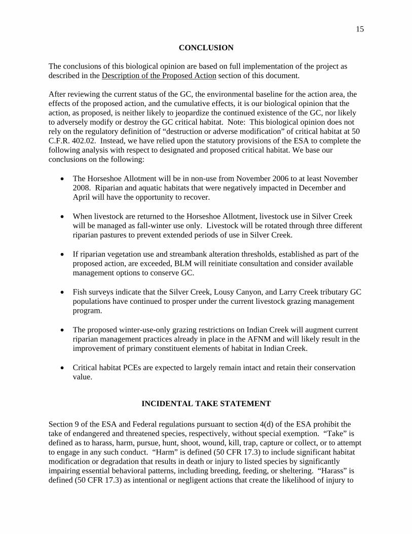
CONCLUSION The conclusions of this biological opinion are based on full implementation of the project as described in the Description of the Proposed Action section of this document. After reviewing the current status of the GC, the environmental baseline for the action area, the effects of the proposed action, and the cumulative effects, it is our biological opinion that the action, as proposed, is neither likely to jeopardize the continued existence of the GC, nor likely to adversely modify or destroy the GC critical habitat. Note: This biological opinion does not rely on the regulatory definition of “destruction or adverse modification” of critical habitat at 50 C.F.R. 402.02. Instead, we have relied upon the statutory provisions of the ESA to complete the following analysis with respect to designated and proposed critical habitat. We base our conclusions on the following:
• The Horseshoe Allotment will be in non-use from November 2006 to at least November 2008. Riparian and aquatic habitats that were negatively impacted in December and April will have the opportunity to recover.
• When livestock are returned to the Horseshoe Allotment, livestock use in Silver Creek
will be managed as fall-winter use only. Livestock will be rotated through three different riparian pastures to prevent extended periods of use in Silver Creek.
• If riparian vegetation use and streambank alteration thresholds, established as part of the
proposed action, are exceeded, BLM will reinitiate consultation and consider available management options to conserve GC.
• Fish surveys indicate that the Silver Creek, Lousy Canyon, and Larry Creek tributary GC
populations have continued to prosper under the current livestock grazing management program.
• The proposed winter-use-only grazing restrictions on Indian Creek will augment current
riparian management practices already in place in the AFNM and will likely result in the improvement of primary constituent elements of habitat in Indian Creek.
• Critical habitat PCEs are expected to largely remain intact and retain their conservation
value.
INCIDENTAL TAKE STATEMENT Section 9 of the ESA and Federal regulations pursuant to section 4(d) of the ESA prohibit the take of endangered and threatened species, respectively, without special exemption. “Take” is defined as to harass, harm, pursue, hunt, shoot, wound, kill, trap, capture or collect, or to attempt to engage in any such conduct. “Harm” is defined (50 CFR 17.3) to include significant habitat modification or degradation that results in death or injury to listed species by significantly impairing essential behavioral patterns, including breeding, feeding, or sheltering. “Harass” is defined (50 CFR 17.3) as intentional or negligent actions that create the likelihood of injury to

16listed species to such an extent as to significantly disrupt normal behavior patterns which include, but are not limited to, breeding, feeding or sheltering. “Incidental take” is defined as take that is incidental to, and not the purpose of, the carrying out of an otherwise lawful activity. Under the terms of section 7(b)(4) and section 7(o)(2), taking that is incidental to and not intended as part of the agency action is not considered to be prohibited taking under the ESA provided that such taking is in compliance with the terms and conditions of this Incidental Take Statement. The measures described below are non-discretionary, and must be undertaken by the BLM so that they become binding conditions of any grant or permit issued to an applicant, as appropriate, for the exemption in section 7(o)(2) to apply. The BLM has a continuing duty to regulate the activity covered by this incidental take statement. If the BLM (1) fails to assume and implement the terms and conditions or (2) fails to require the (applicant) to adhere to the terms and conditions of the incidental take statement through enforceable terms that are added to the permit or grant document, the protective coverage of section 7(o)(2) may lapse. In order to monitor the impact of incidental take, the BLM must report the progress of the action and its impact on the species to the FWS as specified in the incidental take statement. [50 CFR §402.14(i)(3)].
AMOUNT OR EXTENT OF TAKE The GC and its critical habitat in Larry Creek and Lousy Canyon are located in areas inaccessible to livestock grazing. Indirect effects from the upland watershed are minimal due to the small watershed size and dense canyon vegetation. We do not anticipate any take of GC from the proposed action in Larry Creek and Lousy Canyon. We anticipate that indirect take (harm and/or harassment) associated with temporary increases in sedimentation, and direct take (kill or harm), of GC will occur at a level that will result in no more than 10 dead or dying fish, of any species, being observable near cattle crossing in Silver or Indian creeks, or within 600 yards downstream of cattle activity, where dead or dying fish are attributable to cattle activity. Finding more than 10 dead or dying fish of any species each year in the vicinity, during or within three hours after cattle enter or cross Silver or Indian creeks, where dead or dying fish are attributable to cattle activity, will indicate take of GC over and above that anticipated herein.
REASONABLE AND PRUDENT MEASURES AND TERMS AND CONDITIONS In order to be exempt from the prohibitions of section 9 of the ESA, the BLM must comply with the terms and conditions of the following reasonable and prudent measures, and monitoring requirements. These terms and conditions are non-discretionary. The reasonable and prudent measures, with the implementing terms and conditions, are designed to minimize or monitor the impact of incidental take from the proposed action. Reasonable and Prudent Measures and Terms and Conditions: The BLM shall provide an annual monitoring report to the FWS regarding GC population status and condition of its habitat at Silver and Indian creeks, including riparian vegetation use levels and streambank alteration.

17
• The annual report shall include any noted incidences of fish deaths, harm, or harassment related to livestock as described in the above take statement, and measures used to reduce the take.
• The annual report shall also include a summary of any research in the action area
completed pertaining to GC. • The annual report shall include the results of any soil/watershed or ecological condition
assessments completed, including monitoring of established utilization thresholds (40% upland utilization, 50% riparian herbaceous utilization, 25% bank alteration, and 30% woody riparian seedling utilization) and other commitments of this proposed action.
• The annual report shall be submitted to the AESO by December 31 of each year.
Disposition of Dead or Injured Listed Species Upon locating a dead, injured, or sick listed species initial notification must be made to the FWS's Law Enforcement Office, 2450 W. Broadway Rd, Suite 113, Mesa, Arizona, 85202, telephone: 480/967-7900) within three working days of its finding. Written notification must be made within five calendar days and include the date, time, and location of the animal, a photograph if possible, and any other pertinent information. The notification shall be sent to the Law Enforcement Office with a copy to this office. Care must be taken in handling sick or injured animals to ensure effective treatment and care, and in handling dead specimens to preserve the biological material in the best possible state.
CONSERVATION RECOMMENDATIONS Section and 7(a)(1) of the ESA directs Federal agencies to utilize their authorities to further the purposes of the ESA by carrying out conservation programs for the benefit of endangered and threatened species. Conservation recommendations are discretionary agency activities to minimize or avoid adverse effects of a proposed action on listed species or critical habitat, to help implement recovery plans, or to develop information. In furtherance of the purposes of the ESA, we recommend implementing these discretionary actions.
We recommend that you:
1. Coordinate with the FWS in development and implementation of a recovery plan for the GC.
2. Coordinate with the Arizona Game and Fish Department and us to begin a program to control non-native aquatic species on BLM lands.
REINITIATION NOTICE This concludes formal consultation on the action of the FRMP as described in the requests. As provided in 50 CFR §402.16, reinitiation of formal consultation is required where discretionary Federal agency involvement or control over the action has been retained (or is authorized by law)

18and if: (1) the amount or extent of incidental take is exceeded; (2) new information reveals effects of the agency action that may affect listed species or critical habitat in a manner or to an extent not considered in this opinion; (3) the agency action is subsequently modified in a manner that causes an effect to the listed species or critical habitat not considered in this opinion; or (4) a new species is listed or critical habitat designated that may be affected by the action. In instances where the amount or extent of incidental take is exceeded, any operations causing such take must cease pending reinitiation. We appreciate your efforts to identify and minimize effects to listed species from this project. For further information please contact David Smith (928) 226-0614 (x109) or Debra Bills (602) 242-0210 (x239). Please refer to the consultation number 02-21-05-F-0409 in future correspondence concerning this project.
/s/ Steven L. Spangle cc: Assistant Field Supervisor, Fish and Wildlife Service, Flagstaff, AZ
Habitat Branch Chief, Bob Broscheid, Arizona Game and Fish Department, Phoenix, AZ
W:\David Smith\agua fria gila chub final.doc:cgg
19
LITERATURE CITED
DeMarais. B.D. 1986. Morphological variation in Gila (Pisces, Cyprinidae) and geologic history:
Lower Colorado River Basin. Unpublished M.S. Thesis. Arizona State University, Tempe, Arizona.
Dudley, R.K. 1995. The effects of green sunfish on the distribution, abundance and habitat use of
Gila chub in Sabino Creek, Tucson, Arizona. M.S. thesis. The University of Arizona, Tucson, Arizona.
Hilton, S., and T.E. Lisle. 1993. Measuring the fraction of pool volume filled with fine
sediment. Research Note PSW-RN-414. Pacific Southwest. Res. Sta. USDA Forest Service.
Magoulick, D.D. and R.M Kobza. 2003. The role of refugia for fishes during drought: a review
and synthesis. Freshwater Biology. 48(7):1186-1198. Micheli, E.R. and J.W. Kirchner. 2002. Effects of wet meadow riparian vegetation on
streambank erosion. 2. Measurements of vegetated bank strength and consequences for failure mechanics. Earth Surface Processes and Landforms. 27 (7):687-697.
Millar, R.G. 2000. Influence of bank vegetation on alluvial channel patterns. Water Resources
Research. 36(4):1109-1118. Miller, R.R. and C.H. Lowe. 1967. Fishes of Arizona. Pp. 133-151 in C.H. Lowe (ed.), The
vertebrates of Arizona. University of Arizona Press, Tucson, Arizona. Minckley, W.L. 1973. The fishes of Arizona. Arizona Game Fish Department, Phoenix, Arizona. Minckley, W.L., J.N. Rinne, and J.E. Johnson. 1977. Status of the Gila topminnow and co-
occurrence with mosquitofish. USDA Forest Service Research Paper RM-198. Rocky Mountain Forest and Range Experimental Station, Flagstaff, Arizona.
Nelson B. 1993. Spawning characteristics of Gila chub (Gila intermedia) in Cienega Creek, Pima
County, Arizona. Report for U.S. Department of Interior, Bureau of Land Management, Tucson Resource Area, Arizona. 18 pp.
Rinne, J.N. 1976. Cyprinid fishes of the genus Gila from the Lower Colorado River basin.
Wassmann Journal Biology, 34(1):65-107. Rinne, J.N. and W.L. Minckley. 1970. Native Arizona Fishes. Part III-the minnows called chubs.
Arizona Wildlife Views. 17(5):12-19. Rinne, J.N. and W.L. Minckley. 1991. Native fishes of arid lands: a dwindling resource of the
desert southwest. USDA Forest Service General Technical Report RM-206. Rosgen, D. 1996. Applied River Morphology. Wildland Hydrology, Colorado Springs, CO.

20 Schaefer, J. 2001. Riffles as barriers to interpool movement by three cyprinids (Notropis boops,
Campostoma anomalum and Cyprinella venusta). Freshwater Biol. 46(3):379-388. Simon, A., A. Curini, S.E. Darby, and E.J. Langendoen. 2000. Bank and near bank processes in
an incised channel. Geomorphology 35(3-4):193-217. Simon, A. and A.J.C. Collison. 2002. Quantifying the mechanical and hydrologic effects of
riparian vegetation on streambank stability. Earth Surface Processes and Landforms. 27: 527-546.
Unmack, P., G.W. Knowles, and M. R. Baltzly. 2003. Green sunfish impacts on Gila chub, a
natural experiment thanks to a waterfall. Proceedings of the Desert Fishes Council 35: 86-87.
U.S. Fish and Wildlife Service. 2005. Endangered and Threatened Wildlife and Plants; Listing
Gila Chub as Endangered With Critical Habitat. Fed. Reg. 70(211): 66664-66721. U.S. Forest Service. 1969. Structural range improvement handbook. U.S. Forest Service
Intermountain Region. Ogden, Utah. Vallentine, J.F. 1990. Grazing management. Academic Press, Inc., San Diego, CA. 533 pp. Weedman, D., A.L. Girmendonk, and K. Young. 1996. Status Review of Gila Chub, Gila
intermedia, in the United States and Mexico. Technical Report 91, Nongame and Endangered Wildlife Program, Arizona Game and Fish Department, Phoenix, Arizona. 120 pp.
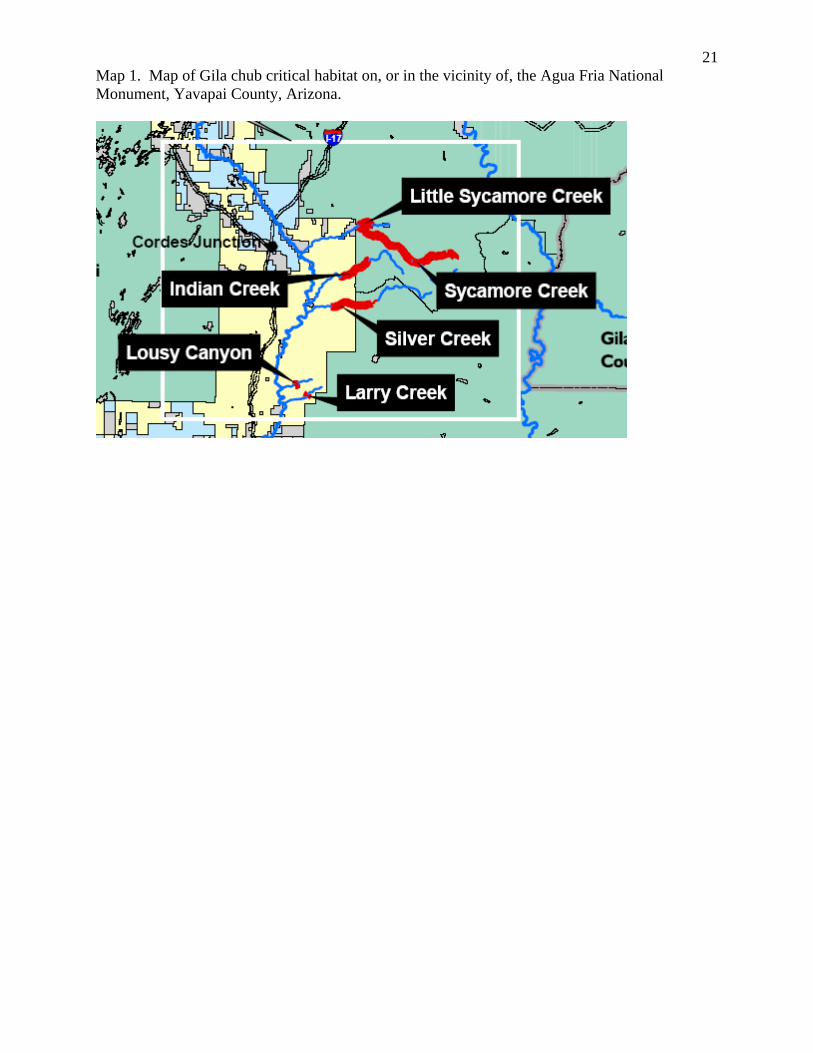
21Map 1. Map of Gila chub critical habitat on, or in the vicinity of, the Agua Fria National Monument, Yavapai County, Arizona.