procedures for developing scopes of work … · scope of work for a drainage/stormwater management...
TRANSCRIPT
PROCEDURES FOR DEVELOPING SCOPES OF WORK FOR
A DRAINAGE/STORMWATER
MANAGEMENT PROJECT
January 2005

Scope of Work for a Drainage/Stormwater Management Project January 2005
Federal Emergency Management Agency Page 1
PROCEDURES SAMPLE DATA FOR THE SCOPE OF WORK
PROCEDURES FOR DEVELOPING SCOPES OF WORK FOR DRAINAGE/STORMWATER MANAGEMENT PROJECTS
1. PURPOSE
The Federal Emergency Management Agency (FEMA) administers three grant programs to assist communities in mitigating the effects of natural hazards: the Flood Mitigation Assistance (FMA) Program, the Hazard Mitigation Grant Program (HMGP), and the Pre-Disaster Mitigation (PDM) grant program. State, Tribal, and local government agencies may apply through the States to receive funds for these programs. FEMA requires these applicants to meet a specific set of requirements when applying for the funds to ensure that proposed projects meet the program requirements, Federal environmental laws and regulations, and cost-effectiveness requirements.
The purpose of this document is to provide guidance for applicants applying for funding under FEMA’s mitigation grant programs, including collection of the administrative and technical data FEMA requires as part of the grant review and approval process. This document is designed to compliment the FEMA electronic grants (e-Grants) management system accessible at: https://portal.fema.gov/famsVu/dynamic/mitigation.html
By submitting the data described in Section 2, the applicant facilitates both State and FEMA review of the funding application. SOWs without the data may result in delays or a

Scope of Work for a Drainage/Stormwater Management Project January 2005
Federal Emergency Management Agency Page 2
PROCEDURES SAMPLE DATA FOR THE SCOPE OF WORK
decline of project funding. An example application exhibiting the components described in this guidance is included.
The information in the left column (Procedures) provides information on the format and requirements for an applicant to provide technical and other data in support of their request for funding. The right column (Sample Data) provides an applicant with examples of data and the presentation or format of the data that the State and FEMA will need to review during their evaluation of the application.
Specific information regarding the administrative and eligibility requirements for mitigation programs is not presented here. Furthermore, this represents a summary of areas that should be covered in a SOW for a mitigation project application. Some areas can be significantly expanded via FEMA or other guidance for implementing specific programs and conducting an environmental review and a benefit-cost analysis (BCA) to determine cost-effectiveness. The State Hazard Mitigation Officer (SHMO) or FEMA Regional Office should be contacted for additional information.
One method of reducing future damage from floods is for the community to modify existing drainage or stormwater management facilities to increase conveyance and capacity and reduce the risk of damage from local flooding.

Scope of Work for a Drainage/Stormwater Management Project January 2005
Federal Emergency Management Agency Page 3
PROCEDURES SAMPLE DATA FOR THE SCOPE OF WORK
2. DEVELOPING THE SCOPE OF WORK FOR A DRAINAGE/STORMWATER MANAGEMENT PROJECT
One of the primary goals of FEMA’s mitigation programs is to reduce future flood damage to existing development, particularly to structures that are insured under the National Flood Insurance Program (NFIP). To achieve this goal, FEMA may provide funding to communities for the reduction of flood hazards through improvements to, or implementation of, drainage or stormwater management systems.
A drainage/stormwater management project is typically implemented in situations where existing drainage facilities are inadequate or non-existent. In such situations, high intensity rainfall causes heavy runoff that overwhelms the drainage system.
• In urban settings, this condition may result in flooding of streets and nearby structures.
• On hillsides, excessive runoff at upper elevations may damage structures and facilities at lower elevations, or cause slopes to fail.
• In arid environments, runoff may carry large quantities of rock and sediment, which may jam storm drains, block streets, and damage structures.
To reduce such effects, the community may implement or modify the system for collecting and transporting stormwater,

Scope of Work for a Drainage/Stormwater Management Project January 2005
Federal Emergency Management Agency Page 4
PROCEDURES SAMPLE DATA FOR THE SCOPE OF WORK
and reducing damages due to flooding during heavy rainfall. Such measures must be undertaken to reduce flood hazards to existing development. FEMA will not provide grant funding for reduction of flood hazards solely to areas that are currently vacant but would be subject to development once flood hazards are eliminated.
As described below, local flooding problems are often not shown on FEMA’s Flood Insurance Rate Maps (FIRMs). Nonetheless, the existence and severity of local flood hazards should not be underestimated even though they are not identified on FIRMs. Many structures identified by the NFIP as repetitive loss structures are located outside of the flood hazards identified on FIRMs but are flooded repeatedly due to inadequate drainage.

Scope of Work for a Drainage/Stormwater Management Project January 2005
Federal Emergency Management Agency Page 5
PROCEDURES SAMPLE DATA FOR THE SCOPE OF WORK
Summary of Required Application Information
When a community applies for funding for a drainage/stormwater management project, the following information must be submitted with the application:
1. Basic applicant, contact, and community information. (Section 2.1).
2. Information regarding the applicable Hazard Mitigation Plan for the jurisdiction in which the project is being implemented. (Section 2.1).
3. Descriptions of the hazard, the problem, and the project. (Section 2.1).
4. Information regarding the effective Flood Insurance Study (FIS) and FIRM; and additional hydrologic and hydraulic data necessary to identify the effects of the project. (Section 2.2).
5. Description of the decision-making process and evaluation of alternatives. (Section 2.3).
6. BCA and supporting documentation. (Section 2.4).
7. Detailed SOW which includes a project description. (Section 2.5).
8. Sources of the Cost Share. (Section 2.6).
The City has followed the FEMA Required Application Information checklist in providing and organizing the data to support the funding request.

Scope of Work for a Drainage/Stormwater Management Project January 2005
Federal Emergency Management Agency Page 6
PROCEDURES SAMPLE DATA FOR THE SCOPE OF WORK
9. Schedule for completing the scope of work and for operating and maintaining the drainage/stormwater management system, once the work is completed. (Section 2.6).
10. Cost estimate. (Section 2.6).
11. Description of environmental considerations and supporting documentation. (Section 2.7).
Internet Resources for Applicants
The FEMA website (www.fema.gov) and the e-Grants portal (https://portal.fema.gov/famsVu/dynamic/mitigation.html) have a wealth of useful information to assist applicants through the funding request process. These include:
• FEMA Mitigation Division, Education and Training (www.fema.gov/fima/education).
• FEMA Mitigation Division, Mitigation Grant Programs, FMA, (www.fema.gov/fima/fma).
• FEMA Mitigation Division, Mitigation Grant Programs, HMGP, (www.fema.gov/fima/hmgp).
• FEMA Mitigation Division, Mitigation Grant Programs, PDM, (www.fema.gov/fima/pdm).
• FEMA Mitigation Division, Best Practices and Case Studies, (http://www.fema.gov/fima/bp.shtm)
Field Code Changed
Field Code Changed
Field Code Changed
Field Code Changed
Scope of Work for a Drainage/Stormwater Management Project January 2005
Federal Emergency Management Agency Page 7
PROCEDURES SAMPLE DATA FOR THE SCOPE OF WORK
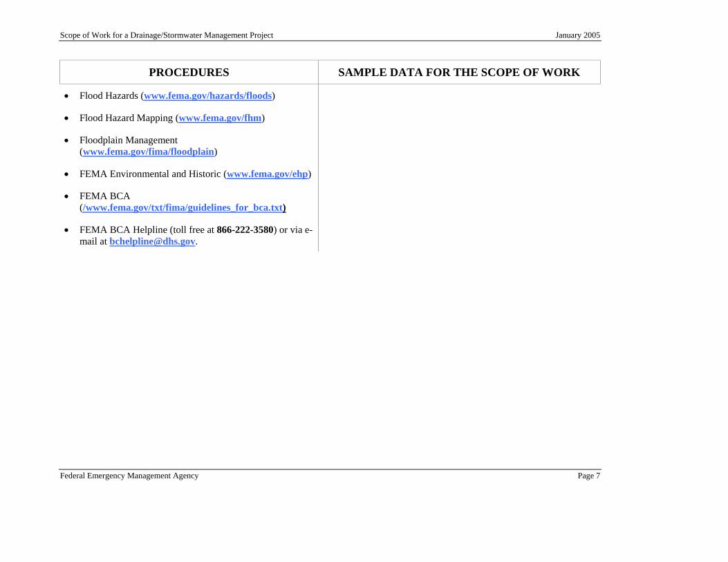
• Flood Hazards (www.fema.gov/hazards/floods)
• Flood Hazard Mapping (www.fema.gov/fhm)
• Floodplain Management (www.fema.gov/fima/floodplain)
• FEMA Environmental and Historic (www.fema.gov/ehp)
• FEMA BCA (/www.fema.gov/txt/fima/guidelines_for_bca.txt)
• FEMA BCA Helpline (toll free at 866-222-3580) or via e-mail at [email protected].

Scope of Work for a Drainage/Stormwater Management Project January 2005
Federal Emergency Management Agency Page 8
PROCEDURES SAMPLE DATA FOR THE SCOPE OF WORK
2.1 STEP 1: OBTAIN BASIC PROJECT INFORMATION
The applicant must obtain the following basic information to apply for funds for a drainage/stormwater management project:
• Information regarding the organization applying for the grant, including:
- Legal status and function.
- State and Federal employer tax identification numbers.
- Program eligibility category - that is, State, Tribal, or local government, special government district, or eligible private nonprofit group or agency.
- State and Federal legislative district information.
Applicant: City of Adversity, located in Prosperity County in the State of Any State (AS).
State Employer Tax Identification Number: 4576-3456-7782
Federal Employer Tax Identification Number: 8897-5643-7743
Program Eligibility Category: Local government
Legislative Districts: 1st Congressional District; 2nd State Assembly District; 3rd State Senate District
• Information for primary and alternate State and local contacts. Contacts for data clarification or additional data and all consultants should also be clearly identified.
Primary Local Point of Contact:
Taylor Gilmour Job Title: Director of City Services
City of Adversity, AS Telephone: (111) 711-0022
City Hall, Room 410 Fax: (111) 711-0333
35003 Tornado Alley Email: [email protected]
Adversity, AS 40009
Scope of Work for a Drainage/Stormwater Management Project January 2005
Federal Emergency Management Agency Page 9
PROCEDURES SAMPLE DATA FOR THE SCOPE OF WORK
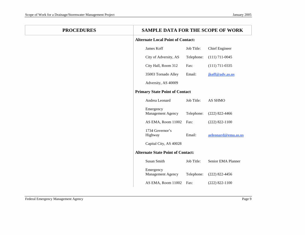
Alternate Local Point of Contact:
James Koff Job Title: Chief Engineer
City of Adversity, AS Telephone: (111) 711-0045
City Hall, Room 312 Fax: (111) 711-0335
35003 Tornado Alley Email: [email protected]
Adversity, AS 40009
Primary State Point of Contact
Andrea Leonard Job Title: AS SHMO
Emergency Management Agency Telephone: (222) 822-4466
AS EMA, Room 11002 Fax: (222) 822-1100
1734 Governor’s Highway Email: [email protected]
Capital City, AS 40028
Alternate State Point of Contact:
Susan Smith Job Title: Senior EMA Planner
Emergency Management Agency Telephone: (222) 822-4456
AS EMA, Room 11002 Fax: (222) 822-1100

Scope of Work for a Drainage/Stormwater Management Project January 2005
Federal Emergency Management Agency Page 10
PROCEDURES SAMPLE DATA FOR THE SCOPE OF WORK
1734 Governor’s Highway Email: [email protected]
Capital City, AS 40028
Application Preparer:
Philip Champagne Job Title: Engineer II
City of Adversity, AS Telephone: (111) 711-0045
City Hall, Room 312 Fax: (111) 711-0335
35003 Tornado Alley Email: [email protected]
Adversity, AS 40009
• NFIP community name, Community Identification Number (CID), participation status, and compliance history.
NFIP Community Name: City of Adversity, located in Prosperity County in the State of Any State (AS); CID = 006006.
NFIP Participation Status: Participating since June 1974. Last Community Assistance Visit conducted in January 2000.
Compliance History: The City has adopted the minimum floodplain management criteria required under the NFIP. Although uncontrolled construction of homes occurred prior to the establishment of the floodplain regulations, current enforcement of these regulations has eliminated construction of new or substantially improved homes in floodplains. The City’s zoning includes buffers around floodplains and only allows for recreational or open space use within floodplains.

Scope of Work for a Drainage/Stormwater Management Project January 2005
Federal Emergency Management Agency Page 11
PROCEDURES SAMPLE DATA FOR THE SCOPE OF WORK
• Information for properties insured under the NFIP, including claim amounts that will be protected by the project; and Repetitive Loss properties insured under the NFIP. Repetitive Loss properties are those that have experienced at least two claim payments of over $1,000 each within any 10-year rolling period. Loss dates within 10 days of each other are counted as a single claim. A primary focus for FEMA’s mitigation programs is reduction of costs under the NFIP, particularly through the elimination of repetitive loss properties. The applicant may obtain repetitive loss information through the state.
Of the 22 homes damaged in the 12/15/02 event, 5 homes are insured under the NFIP, and all are repetitive loss properties. Eight homes in the vicinity that were not damaged during that storm are also insured under the NFIP; but none of these are repetitive loss properties.
• Information clearly defining the location of the proposed project, including latitude and longitude. Attach mapping showing the location of the project. Acceptable formats include recent topographic mapping or aerial photographs, and U.S. Geological Survey (USGS) quadrangle maps. Also, note the existence of any deeds or restrictions that might limit Federal funding for the project.
The project is located in the southwestern section of the City of Adversity, adjacent to and within the Hillcrest subdivision. The elements of the project will be implemented at several locations within the subdivision and along the base of the foothills lying to the south of the subdivision. The attached aerial map (dating from 1997) shows the locations of project elements, with GPS coordinates given for each. At all but two of the sites, the work will take place within city rights-of-way or drainage easements. The City must negotiate easements for the remaining two sites.
• Identification of any FEMA grant funds previously received for the project. For example, if the facility was damaged during an event that the President declared to be a disaster, the applicant may have received a grant to repair the facility under the FEMA Public Assistance program.
The City has not previously received disaster assistance for the permanent repair of public facilities in the area. However, the City received assistance from FEMA for emergency response and debris removal following the Presidential disaster declaration for the 12/15/02 event.

Scope of Work for a Drainage/Stormwater Management Project January 2005
Federal Emergency Management Agency Page 12
PROCEDURES SAMPLE DATA FOR THE SCOPE OF WORK
• A description of any projects or components of this project, whether funded by FEMA or another entity, that will be completed in the vicinity of the project. Projects in the same watershed should be considered. FEMA must evaluate cumulative effects of projects when conducting the environmental review.
No other projects are currently projected for the project area or the watershed in which the project is to be implemented.
• A description of the proposed mitigation project that is the preferred solution (i.e., Solution No. 1).
Solution #1 (Preferred Solution)
The City proposes to construct three steel-and-concrete debris barriers, regrade a swale, replace culverts to prevent backwater and overtopping, install concrete stormwater aprons, raise the downslope bank of laterals to increase capacity and prevent overflow, install energy dissipating devices at the points where stormwater from the streets and swale enters the laterals.
• A description of the problem that will be solved through implementation of the drainage/stormwater management project.
The Hillcrest subdivision was constructed on what was once an alluvial fan. A series of steep swales and canyons drain the small watersheds of the foothills lying south of the subdivision. The largest of these drainages, Big Fry Canyon, flows into a flood control channel constructed by the county flood control district. The remaining drainages flow on to the streets of the subdivision, where the flow collects in gutters, or into swales separating the backyards of the homes. Two small concrete laterals capture this runoff and transport it to the county flood control channel.
This system is undersized, given the volume of runoff from both the foothills and the subdivision streets and yards. During heavy rains, the conveyance system routinely overflows, and the homes lying downslope of the laterals are subject to shallow flooding. The problem is aggravated by rock and sediment, which routinely flow

Scope of Work for a Drainage/Stormwater Management Project January 2005
Federal Emergency Management Agency Page 13
PROCEDURES SAMPLE DATA FOR THE SCOPE OF WORK
out of the foothills and are deposited in the conveyance system. The periodic occurrence of wildfires in the hills greatly increases the volume of material carried by stormwater into the subdivision. After the most recent fire, a storm (12/15/02) caused flows laden with rock and sediment to damage 22 homes; additionally, debris accumulated to depths of up to two feet in three streets, which remained closed for two days.
The conditions affecting the Hillcrest area can be described as flash flooding. These conditions are most likely to occur during and after short, intense rainfall events, and they typically occur with very little warning. Debris carried by stormwater poses an additional hazard. While no one has been killed as a result of these conditions, the fact remains that these events are life-threatening.
• A description of how the proposed drainage/stormwater management project will solve the problem.
The proposed project will accomplish the following:
• Remove the bulk of rock and sediment from runoff before it enters the subdivision. This will reduce the bulked condition of the runoff and reduce the risk that this material will jam the swales and laterals. It will also reduce the risk that this material will affect nearby homes.
• Increase the carrying capacity of the swales and laterals designed to carry runoff into the county flood control channel.
• Reduce the risk that overflow from the swales and laterals will reach the homes lying adjacent to the system.

Scope of Work for a Drainage/Stormwater Management Project January 2005
Federal Emergency Management Agency Page 14
PROCEDURES SAMPLE DATA FOR THE SCOPE OF WORK
• The scheduled completion date for the project. The City anticipates completing the project by October 2006. This date assumes approval of the grant application by October 2005.
• If applicable, community’s Community Rating System (CRS) status and the status of the FMA plan. This information should include the date that FEMA approved the FMA plan and a reference of how this project is included in the plan.
The City does not participate in the Community Rating System and has not received a FMA grant for planning.
• If applicable, the status of the community’s multi-hazard mitigation plan should be provided. If the community has a plan, but no recorded approval such as a letter from FEMA, a copy of the plan may be required.
The City is a signatory to the multi-jurisdictional plan prepared for Prosperity County. The City adopted the plan on July 1, 2003, and the plan was approved by FEMA on September 1, 2003. This plan includes a specific section addressing flood mitigation and repetitive loss properties.
• If the community has an approved multi-hazard plan, the application should reference how the plan recommends mitigating the problem.
The July 1, 2003, multi-jurisdictional plan for Prosperity County referenced reduction of the flood hazard in the Hillcrest subdivision as one of the mitigation action items for the City of Adversity.
Additional information that will be required to support the project application is described below. Include any information, such as photographs, newspaper accounts, damage surveys, substantial damage determinations, homeowner receipts for repairs, or NFIP claims information.

Scope of Work for a Drainage/Stormwater Management Project January 2005
Federal Emergency Management Agency Page 15
PROCEDURES SAMPLE DATA FOR THE SCOPE OF WORK
2.2 STEP 2: GATHER HAZARD INFORMATION FOR THE PROJECT AREA
2.2.1 NFIP Flood Hazard Data
Information regarding flood hazards can usually be obtained from the NFIP maps for the community in which the project is located. Floodplain boundaries and flood elevations are shown on the FIRM for the community. Additional information, including flood profiles (a graph showing the relationship of the water surface elevation of a flood event to a location along a body of water) and supporting technical information, may be found in the accompanying FIS. FIRMs and FIS reports may be obtained through the FEMA Map Service Center at www.msc.fema.gov or by calling a toll free number at 800-358-9616.
FISs and FIRMs provide information regarding the 100-year flood, also known as the base flood, which is the flood having a 1 percent chance of being equaled or exceeded in any given year. On FIRMs, the 100-year floodplain in areas where riverine flooding sources have been studied by detailed methods is designated Zone AE (or on older maps, the designation may be a numbered A zone, such as “Zone A1”). The 100-year floodplain in coastal areas is designated Zone VE (or as a numbered V zone on older maps). Areas of ponding (depth up to 3 feet) are designated as Zone AH; and areas of shallow flooding (sheet flow with an average depth of up to 3 feet) are designated as Zone AO.
The effective Flood Insurance Rate Map (FIRM) for the project area is from the Flood Insurance Study (FIS) for the City of Adversity, CID No. 006006. The project area is shown on panel 0025C, dated March 6, 1994 (See attached FIRM). The FIRM does not show an identified Special Flood Hazard Area for the Hillcrest subdivision. As stated above, the county has constructed a flood control channel to capture the outflow from Big Fry Canyon; this channel flows from south to north through the subdivision. The FIRM indicates that the 500-year flood is contained within this channel.

Scope of Work for a Drainage/Stormwater Management Project January 2005
Federal Emergency Management Agency Page 16
PROCEDURES SAMPLE DATA FOR THE SCOPE OF WORK
FIRMs may also show the Base Flood Elevation (BFE), which is the expected elevation (relative to a datum, usually sea level) of the 100-year flood. However, for areas of shallow flooding, an average depth is provided instead of a BFE.
Typically, however, FIRMs do not show the occurrence of flooding due to inadequate or non-existent drainage systems. Historically, FEMA has not prepared flood hazard data for drainage areas that are less than 1 square mile. Since most local flooding issues occur in drainage basins that are less than 1 square mile in size, these flood hazards are not shown on FIRMs. Additionally, only the 100- and 500-year floodplains are shown on the FIRM; local flooding often occurs during storms of greater frequency and less magnitude. For severe situations, or when requested to do so by the community, FEMA may identify local flooding on the FIRM. Oftentimes, these flood hazards are studied using approximate methods and are designated Zone AO due to the relatively shallow flood depth that is likely to occur.
If BFEs are shown on the FIRM, the corresponding FIS may contain profiles of the 10-, 50-, 100-, and 500-year flood elevations for the flooding source in question. Using features such as bridges and lettered cross-sections that are labeled on the profile, it is possible to measure to a location on the profile adjacent to the project area and read the BFE from the profile. To determine the distance a structure may be located from a road or bridge, measure the distance on the FIRM
There are no BFEs shown on the FIRM in the vicinity of the Hillcrest subdivision.

Scope of Work for a Drainage/Stormwater Management Project January 2005
Federal Emergency Management Agency Page 17
PROCEDURES SAMPLE DATA FOR THE SCOPE OF WORK
along the centerline of the river and then find the corresponding location on the flood profile. This is an acceptable method for obtaining a BFE.
The following data should be submitted with the application:
• A copy of the FIRM with FIRM title block, including the NFIP CID number, effective date, and panel number and suffix. The FIRM should be copied at the same scale as other maps of the project area. The applicant should determine if the community has requested a change to these maps that has not yet been incorporated, and if so, whether the change would affect the project area.
See attached FIRM (at same scale as original FIRM) and copy of local aerial map (dating from 1997) with project locations marked on each map.
There are no previous or pending FEMA map revisions requested for the project area.
• A copy of the FIS profile with the location(s) of the project, if applicable. However, in cases where local flooding appears on the FIRM, it is likely that the flood hazard was identified by approximate methods, and no flood profile exists.
The flood hazard associated with the project area is not shown on the FIRM; consequently, no flood profile exists.
• Flood hazard boundaries and flood elevations for the project area. For situations in which the FIRM does not provide this information, hydrologic and hydraulic analyses must be performed to establish discharges and flood elevations. This information should be prepared by a qualified engineer or hydrologist.
• An analysis of the project’s effects on flood hazards. This analysis must include hydrologic and hydraulic analyses identifying the extent to which flood hazards are reduced.
The attached engineer’s report provides hydrologic and hydraulic analyses of existing conditions and post-project conditions. Because the FIS does not provide flood hazard data for the area of the Hillcrest subdivision, the City’s engineer developed hydrologic data for each of the watersheds draining into the subdivision (with

Scope of Work for a Drainage/Stormwater Management Project January 2005
Federal Emergency Management Agency Page 18
PROCEDURES SAMPLE DATA FOR THE SCOPE OF WORK
the exception of Big Fry Canyon). Discharges were developed for the 1-, 2-, 5-, 10-, 25- and 100-year rainfall events under both “clearwater” and bulked flow conditions.
2.2.2 Flood History
The applicant should document the history of flooding problems in the project area. Essential information includes date(s) of flooding events, flood characteristics, flood location, extent of flooding, and cost of damage. Other key data include:
Even minor rainfall events have created hazardous conditions in the Hillcrest subdivision, due to the inadequacies of the existing stormwater conveyance system. In addition to street flooding, these events usually require cleanup of sediment deposited on streets and in laterals. More significant rainfall events have resulted damage within the subdivision. Since the subdivision was completed in the late 1970s, the City has recorded damage during the rainfall events listed below. When available, recurrence intervals for storms have been obtained from the National Weather Service, which maintains several rainfall gages in the area; or the USGS.
• Flood elevation, discharge, and flood frequency data including the source and methodology used to determine the frequency. Also, include nearby high watermarks (if available) and any interior highwater marks that show the depth of flooding above the first floor elevation (FFE) in the structure(s).
02/15/81 – recurrence interval unavailable
02/28/81 – recurrence interval unavailable
12/26/87 – 2-year storm following wildfire in the watershed
12/02/91 – 2-year storm
02/19/95 – 5-year storm
02/24/95 – <1-year storm
03/01/98 – recurrence interval unavailable
12/15/02 – 5-year storm following wildfire in the watershed

Scope of Work for a Drainage/Stormwater Management Project January 2005
Federal Emergency Management Agency Page 19
PROCEDURES SAMPLE DATA FOR THE SCOPE OF WORK
• Cost of damage to buildings, contents, and infrastructure (broken out by each of these three components, if possible).
Note: The amounts listed below represent estimate damage for the Hillcrest area (including residential damage, damage to infrastructure, emergency response, and removal of debris), adjusted to current dollar values.
02/15/81 – 8 homes damaged; $200,000
02/28/81 – 4 homes damaged; $150,000
12/26/87 – 18 homes damaged; $1.5 million
12/02/91 – 2 homes damaged; $50,000
02/19/95 – 2 homes damaged; $60,000
02/24/95 – 3 homes damaged; $60,000
03/01/98 – 5 homes damaged; $200,000
12/15/02 – 22 homes damaged; $2.3 million
• Whether use of structures, public services, utilities, roads or bridges was lost, and if so for how long.
Streets in the subdivision are routinely closed during rain events so that city crews can remove accumulated rock and sediment. Significant street closures occurred after the 12/26/87 and 12/15/02 events; average time for closure was 3 days.
• Depth-damage functions (that is, percent damage of the building replacement value at each flood depth) for the structures to be protected, if available.
The depth damage functions in the FEMA Riverine Full Data BCA module are representative of the damages for this project.
The FEMA FIS may provide historical flood information. However, other potential sources of this information include:
Scope of Work for a Drainage/Stormwater Management Project January 2005
Federal Emergency Management Agency Page 20
PROCEDURES SAMPLE DATA FOR THE SCOPE OF WORK
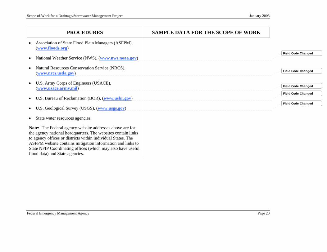
• Association of State Flood Plain Managers (ASFPM), (www.floods.org)
• National Weather Service (NWS), (www.nws.noaa.gov)
• Natural Resources Conservation Service (NRCS), (www.nrcs.usda.gov)
• U.S. Army Corps of Engineers (USACE), (www.usace.army.mil)
• U.S. Bureau of Reclamation (BOR), (www.usbr.gov)
• U.S. Geological Survey (USGS), (www.usgs.gov)
• State water resources agencies.
Note: The Federal agency website addresses above are for the agency national headquarters. The websites contain links to agency offices or districts within individual States. The ASFPM website contains mitigation information and links to State NFIP Coordinating offices (which may also have useful flood data) and State agencies.
Field Code Changed
Field Code Changed
Field Code Changed
Field Code Changed
Field Code Changed

Scope of Work for a Drainage/Stormwater Management Project January 2005
Federal Emergency Management Agency Page 21
PROCEDURES SAMPLE DATA FOR THE SCOPE OF WORK
2.3 STEP 3: DEVELOP ALTERNATIVE SOLUTIONS TO THE PROBLEM
FEMA will evaluate the project for feasibility and cost-effectiveness, and the applicant must describe why the proposed project is the best solution to the problem. In addition, because the project will be considered for funding under a Federal program, it will be subject to review under the National Environmental Policy Act (NEPA). NEPA requires that the impacts of several alternatives be evaluated. Consequently, the applicant should consider multiple alternatives to meeting the purpose of, and need for, the project. NEPA requirements are further discussed on Section 2.7 of this document.
Solution #2: Subsurface Stormwater Drains Under this solution, the City would construct three subsurface, 48-inch diameter, reinforced concrete pipes to carry runoff from the canyons that contribute the most runoff to the system. Two of these pipes would be installed beneath streets; the third would be constructed beneath a swale between houses. These pipes would be tied into the county flood control channel. A debris basin or barrier would be installed the inlet to each pipe to reduce the entry of rock and sediment into the system.
This solution would involve the following:
• Excavation of city streets to install the pipes, and adjustments to other utilities that lie beneath the streets.
• Design of 90-degree bends in the pipes to allow tie-in with the county flood control channel
• Securing easements from two property owners for excavation on their property to bury the pipes; and easements from two additional property owners for construction of pipe inlets and debris basins.
• Modification to the channel walls of the county flood control channel; and installation of flap gates to prevent backflow into the pipes. This design must be coordinated with the county flood control district.
This option would remove stormwater from surface streets, swales, and laterals, eliminating the safety hazard posted by rapid surface flow. Additionally, once the work is complete, the visual impact of the project will be minimal, which is desirable to nearby homeowners.

Scope of Work for a Drainage/Stormwater Management Project January 2005
Federal Emergency Management Agency Page 22
PROCEDURES SAMPLE DATA FOR THE SCOPE OF WORK
The cost of this option would be significantly higher, due to the design complexities, materials, excavation, complications of working below ground, and expense of tying into the county’s flood control channel. Additionally, the need to gain approval from the county flood control board before modifying the channel could delay the project significantly. The fact that the system will be underground could complicate maintenance and repairs, which could be a concern due to the amount of rock and sediment that may pass through the debris barriers at the inlets.
The impacts of this option in terms of natural and cultural resources would be similar to the impacts of Solution #1.
Typically, at least three alternative solutions to the problem should be considered. One of the alternatives should be the proposed drainage/stormwater management project. The analysis should also consider the “no-action” alternative; this alternative reflects conditions that would exist if no further action were taken. Finally, consider at least one additional alternative.
Solution #3: No Action
It is evident from the history of flooding in the vicinity of the Hillcrest subdivision that, with no action, the area could expect to suffer further damage, along with possible injury or death, in the future. Assuming a similar level of damage to homes in the future and similar costs to the City for response and cleanup, and assuming a 35-year lifetime of the project, the no-action alternative could result in future flood insurance and disaster assistance payments of approximately $3,500,000 over the next 35 years.
The No Action option does nothing to reduce or eliminate future risk to city residents or damage to their property or the need for emergency response; and it does not offer a means to reduce or eliminate the need for future flood insurance payouts or disaster assistance.

Scope of Work for a Drainage/Stormwater Management Project January 2005
Federal Emergency Management Agency Page 23
PROCEDURES SAMPLE DATA FOR THE SCOPE OF WORK
For each alternative, consider the local hazard mitigation goals, the project cost, economic benefits, potential for repetitive damage, environmental impacts, and public health and safety risks. Document alternatives that are not preferred over the proposed alternative and provide reasons.
2.4 STEP 4: PREPARE A BENEFIT-COST ANALYSIS
A BCA is FEMA’s method for determining whether a drainage/stormwater management project is cost-effective, and therefore, a viable option for flood mitigation. It is recommended that a preliminary BCA be completed using rough estimates of the project costs and benefits to evaluate the project. Once a detailed scope of work had been determined, a more thorough and precise BCA should be prepared using specific data. A complete BCA is required for all FEMA-funded mitigation projects.
The BCA is completed using the flood hazard information and flood history for the project area, the values at risk from flooding (that is, the value of benefits obtained by completing the project), and the estimated project costs. All information used to prepare the BCA must be documented, including data sources, dates, assumptions, and analysis procedures. Data from recognized sources such as FEMA FISs, the U.S. Geological Survey (USGS), the U.S. Army Corps of Engineers (USACE), the Natural Resources Conservation Service (NRCS) and state agencies have a high degree of credibility. When local data are used, supporting documentation from an engineer or other qualified source must be submitted.
Scope of Work for a Drainage/Stormwater Management Project January 2005
Federal Emergency Management Agency Page 24
PROCEDURES SAMPLE DATA FOR THE SCOPE OF WORK
The following information presents general guidance regarding the application of BCAs to drainage/stormwater management projects. More detailed information regarding BCAs may be obtained from the FEMA website at www.fema.gov/fima/pdm.shtm or by obtaining the FEMA Mitigation BCA Toolkit CD, dated January 2005.
FEMA has also established a BCA Helpline, which can be reached through a toll free number 866-222-3580, or by email at [email protected].
Along with the BCA for each property or group of similar aggregated properties, the applicant should include a completed Data Documentation Template (DDT) to support the values used in the BCA. The DDTs are available on the FEMA Mitigation BCA Toolkit CD, dated January 2005.
During 2003, FEMA introduced a pilot program that allows a simplified, alternate, FEMA-approved methodology to conduct BCAs for certain repetitively flooded properties insured under the NFIP. This pilot effort is designed to support the mitigation of these NFIP-insured structures by providing a framework that allows States, Tribal, or local government applicants to use NFIP-provided data to determine the “benefits” portion of the BCA to demonstrate cost-effectiveness of proposed mitigation projects.
The City did not use the alternate BCA approach because the City had no properties on the FEMA Repetitive Loss list that accompanied the guidance.
Applicants requesting mitigation funds may use this alternative cost-effectiveness methodology and data for any project meeting the guidelines described herein from the date of this memorandum through September 30, 2004, or until the

Scope of Work for a Drainage/Stormwater Management Project January 2005
Federal Emergency Management Agency Page 25
PROCEDURES SAMPLE DATA FOR THE SCOPE OF WORK
pilot NFIP repetitive loss properties list is superseded by updated data.
Generally, applicants use a FEMA-approved software-based BCA to determine the cost-effectiveness of projects. The pilot alternate methodology applies to all FEMA Mitigation Grant Programs including: FMA, HMGP, PDM, and Supplemental Mitigation Grants. Projects submitted for consideration under any of these programs must adhere to all requirements set forth in the various governing statutes and program regulations.
2.4.1 Using FEMA’s BCA Modules
FEMA has developed software and guidance to prepare BCAs in accordance with agency requirements. The BCA software involves modules for different hazards, including floods. Applicants are encouraged to use the FEMA BCA software to ensure that the calculations and methods are standardized. Alternative BCA software may be used only if approved by FEMA in advance of submitting an application based on the alternative software.
The standard FEMA Riverine Full Data BCA module was used for all BCAs associated with this project.
Many of the FEMA BCA modules contain typical or default data. Use of such data is acceptable as long as the data are applicable to the drainage/stormwater management project being proposed. Several of the modules are applicable for drainage/stormwater management projects.
The default values in the FEMA Riverine Full Data BCA module were used in the analyses for this project.
The Riverine Limited Data Module is a frequency-damage module that can be used for areas without quantitative flood hazard data, such as areas outside of mapped floodplains on
Scope of Work for a Drainage/Stormwater Management Project January 2005
Federal Emergency Management Agency Page 26
PROCEDURES SAMPLE DATA FOR THE SCOPE OF WORK
the FIRM, areas studied by approximate methods, or situations where lowest floor elevation data are not available. The information needed to complete this module may include, but is not limited to:
• Documentation of event frequency. See the information cited in Flood History.
• Damage and losses in high frequency events (1- to 10-year recurrence interval); moderate frequency events (10- to 50-year recurrence interval); and low frequency events (greater than a 50-year recurrence interval).
See the information cited in Flood History.
• Damages or losses with high value. Possible sources of information include damage surveys, substantial damage determinations, homeowner receipts for repairs, and NFIP claims amounts.
The damages were not broken out as high or low damages.
• Estimates of deaths and injuries due to flood events. There were no deaths and documentation for the injuries is explained under the “Benefits” category below. The values used for injuries were in accordance with the guidance provided on the FEMA Mitigation BCA Toolkit CD, dated January 2005.
The Riverine, Coastal A-Zone, and Coastal V-Zone Full Data Modules use quantitative data to determine the frequency and severity of flood events, and engineering data to calculate damages and losses before and after mitigation. Given the proper input data, the results are more accurate than those obtained with the Limited Data Module. Common data inputs may include, but are not limited to:

Scope of Work for a Drainage/Stormwater Management Project January 2005
Federal Emergency Management Agency Page 27
PROCEDURES SAMPLE DATA FOR THE SCOPE OF WORK
• Building data for structures to be protected by the project, including:
o Type of building (residential, commercial, public).
o Building size (area in square feet).
o Building replacement value or BRV ($ per square feet).
The City has developed an inventory of residences in the project area. The inventory includes replacement value (developed using tax assessor’s information) but does not include specific information about size or elevation. All of the homes are of similar construction (one- or two-story wood frame homes with two car garages built slab-on-grade) and size (approximately 2,500 to 4,000 square feet, depending on number of stories). Estimates of elevation have been taken from available topographic mapping.
o Replacement value of contents and the method used for determining the value. The standard FEMA value for residential structures is 30 percent of the BRV of the structure, or a minimum of $20,000, whichever is greater. Contents values that exceed 30 percent should include documentation, such as homeowner receipts for replacement contents.
The City used the FEMA standard contents value of 30 percent of the BRV.
o Lowest floor elevation (excluding basement, unless the basement is a fully-finished, livable space), and lowest adjacent grade to the structure. Ideally, FEMA Elevation Certificates should prepared by a state Licensed Land Surveyor (LLS) or state registered Professional Engineer (PE). If these elevations are estimated from available sources, the community must document the way in which the estimate was derived and submit the documentation.
• Flood elevation data (typically 10-, 50-, 100-, and 500-year flood elevations), which can be found using the flood profile in the FIS or in other acceptable sources of flood information from the USACE, NRCS, USGS, or state
Flood elevation data are not available. Generally, flow travels overland and downward to enter conveyance structures. The depth of flow does not exceed 1 foot and damages may be caused by

Scope of Work for a Drainage/Stormwater Management Project January 2005
Federal Emergency Management Agency Page 28
PROCEDURES SAMPLE DATA FOR THE SCOPE OF WORK
water resources agencies. inundation, deposition of sediment, and impacts from rock.
• Flood discharge data, which can be found in the FIS or obtained from other Federal or state agencies.
The FIS does not provide discharge data for Hillcrest area. Discharge data is provided in the attached engineer’s report.
• FEMA Elevation Certificates or other elevation documentation, certified by a licensed land surveyor (LLS) or a registered professional engineer (PE) should be provided as support data for all FFEs. The LLS or PE must be licensed in the State where the proposed project will occur.
FEMA Elevation Certificates that provide the FFEs are included for all structures involved in the proposed project.
• Depth-damage functions (if BCA default data are not used).
The default BCA values for the depth-damage function were used.
• The amount of damage (as a percentage of the pre-event building replacement value) that would result in demolition of the building. The standard amount of damage used in a BCA for structures not on the National Registry of Historic Structures is 50 percent. Values other than 50 percent must be documented and justified.
The BCA analysis uses the standard figure of 50 percent as the amount of damage per structure that would result in demolition.
• Displacement times and costs for displaced tenants (if default values are not used).
The average displacement time for the 22 structures damaged during the 2002 storm was 20 days.
• Net business income (if the building houses commercial activities).
• Annual operating budget (if the building houses public/non-profit services).
There are no businesses or public/non-profit agencies involved in this project.

Scope of Work for a Drainage/Stormwater Management Project January 2005
Federal Emergency Management Agency Page 29
PROCEDURES SAMPLE DATA FOR THE SCOPE OF WORK
2.4.2 Preparing the BCA
Considerations for preparing the BCA are described below. It should be noted that net social benefits and total costs (both Federal and local share), as opposed to the benefits and costs to the Federal Government, should be the basis for evaluating whether a project is cost-effective. Therefore, all social benefits would be considered for minor structural flood control projects, not just benefits for repetitive loss properties.
2.4.2.1. Benefits
The benefits of drainage/stormwater management improvements are equivalent to the avoided damages, losses, and casualties that would occur if the project were not implemented and flooding continued to occur. For example, if the project area has been flooded 10 times, and public utilities and homes have been repaired each time, then improving drainage will remove the need to repair and replace these structures in the future.
The benefits claimed for residential structure and contents damage, displacement costs, emergency response costs, removal of debris from streets and other public areas, and injuries (there were no deaths) are documented with the attached benefits data. The data followed the guidance from the Data Documentation Templates on the FEMA Mitigation BCA Toolkit CD, dated January 2005.
Examples of common benefits include avoided (or reduced):
• Damages to the structures and contents, including public buildings, commercial structures, and residences; as well as damage to nearby roads and other infrastructure serving the residences.
• Displacement costs incurred by residents living elsewhere while homes are repaired.
Scope of Work for a Drainage/Stormwater Management Project January 2005
Federal Emergency Management Agency Page 30
PROCEDURES SAMPLE DATA FOR THE SCOPE OF WORK
• Emergency response costs for police, fire, and other public services when the residences are flooded.
• Removal of debris from streets and public areas such as municipal parking lots and recreation areas.
• Loss of utility services to the residences, as well as repairs to damaged utilities.
• Economic losses resulting from displacement of commercial or light industrial uses of the structures.
• Deaths and injuries. Casualty benefits cannot be counted for flooding, except in flash flooding or dam failures, because residents are usually given sufficient warning time to evacuate their homes. Refer to the Mitigation BCA Toolkit for current statistical values for deaths, major injuries, and minor injuries.
“Multiplier” effects cannot be counted. A multiplier effect is an indirect or secondary benefit. For example, if improvements to drainage result in compliance with state water quality regulations, the benefits of compliance to the community cannot be counted, as they are not a direct effect of the project.
The City has determined that the BCA does not reflect secondary benefits.
Scope of Work for a Drainage/Stormwater Management Project January 2005
Federal Emergency Management Agency Page 31
PROCEDURES SAMPLE DATA FOR THE SCOPE OF WORK
2.4.2.2. Project Costs
All costs should be reflected in the project SOW. Only costs that are relevant to the implementation of the project should be counted in the total project cost. Project costs should:
• Include all costs associated with drainage/stormwater management improvements. Costs to be included in the estimate are described in more detail in Section 2.6 below.
A detailed breakdown of the project costs is attached. All costs are relevant to the project (per guidance from the FEMA Regional Office).
• Be based on a reasonable estimate – that is, there should be no obvious over- or underestimate of the true cost of the project. If construction will be completed using a contractor, all elements of the contractor’s costs, including overhead and profit, should be included.
• Be calculated using present-day dollars.
• Reflect current project information.
• Be well documented and from a credible source.
• Reflect the total project cost, not just the FEMA share.

Scope of Work for a Drainage/Stormwater Management Project January 2005
Federal Emergency Management Agency Page 32
PROCEDURES SAMPLE DATA FOR THE SCOPE OF WORK
2.4.3 Cost-Effectiveness
As with all mitigation projects, a drainage/stormwater management project is considered cost-effective if the ratio of benefits to costs is 1.0 or greater. FEMA does not fund projects with a benefit-cost ratio (BCR) less than 1.0. Some States may use the BCR as a ranking factor for selecting projects to submit to FEMA for funding when the number of projects is greater than the available funds. When used as a ranking factor, a project with a higher BCR is considered to be more cost-effective than a project with a lower BCR.
If there is more than one BCA submitted for the project, the applicant should include a calculation page showing how the overall project BCR was calculated. The project BCR involves dividing the total benefits from all project components by the total costs for all project components.

Scope of Work for a Drainage/Stormwater Management Project January 2005
Federal Emergency Management Agency Page 33
PROCEDURES SAMPLE DATA FOR THE SCOPE OF WORK
2.5 STEP 5: PREPARE A SCOPE OF WORK FOR THE PROJECT
The scope of work serves as the basis for FEMA’s review of eligibility, feasibility, and cost-effectiveness, and establishes the framework for expenditure of grant funds. The scope of work should include all elements for implementation of the project, from design through project completion.
2.5.1 Define the overall scope of work Provide a description of the scope of work for the project.
The City proposes to implement the following as Solution No. 1:
• Construct three steel-and-concrete debris barriers at the outflow of canyons lying uphill of Nevada Circle, Alameda Circle, and the swale lying east of Nevada Circle. Excavate areas upstream of these debris barriers to provide storage for rock and sediment.
• Regrade the swale lying east of Nevada Circle. Replace the culverts that currently carry the swale beneath Nevada Circle to prevent backwater and overtopping.
• Install concrete aprons at the points where stormwater carried by Nevada Circle and Alameda Circle exits the streets and flows into the laterals.
• Raise the down slope bank of the laterals to increase capacity and prevent overflow.
• Install energy dissipating devices at the points where stormwater from the streets and swale enters the laterals.

Scope of Work for a Drainage/Stormwater Management Project January 2005
Federal Emergency Management Agency Page 34
PROCEDURES SAMPLE DATA FOR THE SCOPE OF WORK
2.5.2 Include specific elements
The scope of work should reflect the following:
• Planning and design: Includes completion of property surveys, structure elevation surveys, channel surveys, technical analyses (such as hydrologic and hydraulic analyses), engineering drawings, special provisions, and detailed cost-estimating.
The community should identify the first floor elevations for any structures protected by the proposed project.
The City will hire an engineering consultant (or retain the current consultant) to accomplish the following:
• Conduct preliminary surveys and confirm easement boundaries.
• Refine hydrologic and hydraulic analyses.
• Prepare wetlands report and data for a stormwater permit.
• Produce engineering drawings and specifications.
• Prepare a detailed cost estimate.
• Section 60.3 of the NFIP Regulations requires that a Conditional Letter of Map Revision (CLOMR) be prepared and submitted to FEMA for approval when proposing modifications to detailed areas (numbered Zone A or Zone AE areas) of the SFHA. Use of a consultant for this work should be identified.
A CLOMR is not necessary for this site, since there is no flood hazard presently mapped on the FIRM.
• Obtain easements and secure permits: If the improvements will occur on property that does not belong to the applicant, it may be necessary to obtain a right of access or an easement. This process may require surveys and legal support.
With the exception of two of the debris barrier sites, all of the work will be conducted within city rights-of-way and drainage easements. The City will negotiate easements for the two sites that are located on private property.
Scope of Work for a Drainage/Stormwater Management Project January 2005
Federal Emergency Management Agency Page 35
PROCEDURES SAMPLE DATA FOR THE SCOPE OF WORK
The scope of work should also account for analyses and reports needed to secure permits, such as wetlands delineations required for a Section 404 permit from the USACE; a state water quality permit; and compliance with state environmental process laws.
The consultant will prepare data for possible submittal to the USACE and for submittal to regional and state stormwater permitting agencies.
• Prepare bid package and obtain contractor: Specifications developed in the steps above will be used to prepare bid documents and select a contractor. If a consultant will be used to oversee the bid process, the applicant should include that fact in the scope.
The consultant will prepare the bid package and assist the City with contractor selection.
• Complete construction: The scope of work should reflect all facets of construction, including:
o Site access, storage, staging, and security
o Site preparation
o Temporary construction, such as a coffer dam to allow de-watering of a stream bed
o Earthwork, including importation or disposal of fill
o Installation of the conveyance features, such as reinforced concrete pipe
o Repairs to infrastructure that must be damaged during construction, such as streets that must be excavated so that subsurface components can be installed
o Installation of grade structures, scour protection, and
Construction will have the following elements.
• Establish a staging site on Nevada Circle and Alameda Circle; install security fencing; and install temporary utilities. Minor cleanup and restoration will be necessary when the staging areas are broken down.
• Clear the debris basin sites, swale, and lateral banks of existing vegetation.
• Excavate the debris basins. Each basin will have a total volume of approximately 75 CY.
• Construct the debris barriers. Each debris barrier will have a nominal length of 20 feet and will be constructed using 6-inch diameter steel pipes. Posts will be spaced at 2.5 feet OC (total of 10 posts) and will be welded to a continuous top post. Three steel back braces (1V:1H) will be welded to the top rail on the downstream side of the structure and be anchored at the base by
Scope of Work for a Drainage/Stormwater Management Project January 2005
Federal Emergency Management Agency Page 36
PROCEDURES SAMPLE DATA FOR THE SCOPE OF WORK
other appurtenances
o Fencing and landscaping
o Mitigation measures required for compliance with environmental laws
o On-site project management
o Construction inspection
When the project involves a modification to an identified SFHA, a Letter Of Map Revision (LOMR) is required. Section 60.3 of the NFIP regulations requires that after as-built data is available, a LOMR request be prepared and submitted to FEMA for approval.
extensions of the concrete footing. The footing will be at least 7 feet deep and 4 feet wide along the horizontal axis of the debris barrier, with 3 extensions for the diagonal braces. Approximately 30 CY of riprap will be placed along the horizontal axis to prevent scour.
• Replace the two existing 18-inch corrugated metal pipe culverts that carry the swale beneath Nevada Circle with 36-inch reinforced concrete pipe culverts. Install concrete wingwalls at the upstream entrances to these culverts. Replace the road surface, curb-and-gutter, and sidewalks following culvert installation.
• Regrade the swale, which is approximately 400 feet long and 8 feet wide.
• Install reinforced concrete aprons on Nevada Circle and Alameda Circle. Each apron will be 10 feet wide, 10 feet long, and 1 foot thick.
• Add compacted fill to the downhill bank of the laterals, creating a berm to increase bank height and width. The bank will be raised for a total length (both laterals) of 500 feet. The bank height will be raised 2 feet; the base width of the berm will be 10 feet.
• Install grouted riprap at the three points where stormwater enters the laterals. Volume of riprap at each location is approximately 3 CY.
• Construction inspection, performed by the City’s consultant.

Scope of Work for a Drainage/Stormwater Management Project January 2005
Federal Emergency Management Agency Page 37
PROCEDURES SAMPLE DATA FOR THE SCOPE OF WORK
• Preparation of as-built plans by the City’s consultant.
• When as-built data are available, the City will submit a request for a LOMR to FEMA to update the FIRM for this currently unmapped area.
• Prepare operation and maintenance plan: FEMA cannot pay for operation and maintenance of a facility under a hazard mitigation grant. However, the design of the facility must include an operation and maintenance plan to ensure the long-term effectiveness of the project. The responsible entity must be identified, along with the schedule and estimated annual cost.
The City public works department will assume responsibility for system maintenance once the work is complete. Maintenance includes:
• Removal debris from the debris basins, swale, and laterals on an annual basis; or as needed following major storms.
• Annual inspection of the debris barriers, swale, culverts, riprap, and laterals.
• Mowing of the swale and banks along the lateral.
The annual maintenance budget is set at $20,000.
Scope of Work for a Drainage/Stormwater Management Project January 2005
Federal Emergency Management Agency Page 38
PROCEDURES SAMPLE DATA FOR THE SCOPE OF WORK
2.6 STEP 6: PREPARE A COST ESTIMATE AND SCHEDULE
2.6.1 Cost Estimate
The application must be accompanied by a cost estimate for completion of the project. Cost data must be provided for each of the items identified in the scope of work, above. An example cost estimate is attached.
The applicant may determine the appropriate source for cost data. Possible sources includes:
• Historical data for similar projects completed by the applicant or neighboring communities.
• Engineer’s cost estimates, based on the design for the project.
• Commercially available cost information, such as cost data published by R.S. Means.
• Cost data available from a state or Federal agency responsible for similar projects, such as the U.S. Army Corps of Engineers.
The cost estimate is based on the estimate prepared by the City’s engineering consultant. The estimate is based on a preliminary design for the project. The consultant used the City’s historical information on costs for infrastructure projects to develop this estimate. The total estimated cost for the project is $239,010.
The cost estimate is attached.

Scope of Work for a Drainage/Stormwater Management Project January 2005
Federal Emergency Management Agency Page 39
PROCEDURES SAMPLE DATA FOR THE SCOPE OF WORK
The cost estimate should reflect the expected actual costs for completing the project. For construction to be completed by a contractor, all costs that would make up the contractor’s bid for the project should be included. Consequently, the cost estimate should reflect the following:
• “In-place” unit costs – that is, unit costs that reflect labor, equipment, and materials for installation.
• The construction contractor’s on-site costs (also referred to as mobilization), such as temporary utilities, field supervision, site security, and quality control.
• An estimate for the contractor’s overhead and profit.
• The applicant’s costs for managing the project, overseeing construction, conducting construction inspections, and preparing “as-built” plans.
• Environmental and historic preservation mitigation costs
The cost estimate cannot include a factor for contingencies. Additionally, FEMA cannot provide funding for the applicant’s administrative costs.
Prior to accepting grant funds and initiating work, the applicant must establish a financial tracking system for incoming grant funds, local matching funds, and payments for services.
A copy of the City’s initial spreadsheet for tracking finances is attached.

Scope of Work for a Drainage/Stormwater Management Project January 2005
Federal Emergency Management Agency Page 40
PROCEDURES SAMPLE DATA FOR THE SCOPE OF WORK
In addition to estimating project costs, the applicant must identify potential sources of funding for the project. The mitigation grant will cover 75 percent of project costs. Matching funds from other sources must be obtained.
Matching funds will be obtained from the City’s public works and infrastructure budget; the City Council has approved this expenditure.
2.6.2 Schedule
A schedule for completing the work must be submitted with the application. This schedule must include time frame for all actions described in the Scope of Work, from preliminary design through operation of the completed drainage/stormwater management system. The duration of each phase of the project should be identified. The schedule may be presented in terms of time frames following certain activities; for example, bids will be accepted from construction contractors within one month of completion of design work.
An example schedule is attached.
The project will be completed within 12 months of the award of the grant. A schedule is attached.
Scope of Work for a Drainage/Stormwater Management Project January 2005
Federal Emergency Management Agency Page 41
PROCEDURES SAMPLE DATA FOR THE SCOPE OF WORK
2.7 STEP 7: CONSIDER ALL ENVIRONMENTAL AND HISTORIC PRESERVATION IMPACTS
2.7.1 National Environmental Protection Act (NEPA)
NEPA requires FEMA to evaluate the effects of its actions and actions it funds, on the natural and human environments. FEMA must also ensure that its actions comply with all other applicable Federal environmental laws and regulations, such as the Endangered Species Act and the National Historic Preservation Act (NHPA). Although FEMA is responsible for ensuring Federal-level compliance, the applicant must provide information required for the compliance process. The applicant is also responsible for ensuring that the project complies with applicable State, tribal, and local environmental laws and permitting requirements.
Specific considerations are outlined below. The information requested is the minimum required, and should not constrain applicants from providing more information where potential impacts are identified. Lack of documentation may delay completion of FEMA’s review or cause the application to be declined.
For purposes of environmental and historic preservation review, the applicant should not only evaluate the potential impacts of the project itself, but also of any associated construction activities, such as temporary access roads, staging yards, borrow areas, and site restoration or remediation. All costs associated with avoidance and minimization measures must be included in the project cost
Scope of Work for a Drainage/Stormwater Management Project January 2005
Federal Emergency Management Agency Page 42
PROCEDURES SAMPLE DATA FOR THE SCOPE OF WORK
estimate (see Step 6).
As part of the NEPA environmental review FEMA has determined that certain categories of action normally have no significant effect on the human environment and, therefore, can be categorically excluded from the preparation of environmental impact statements and environmental assessments except if extraordinary circumstances as defined below. The following are exclusion categories that might be relevant to construction of drainage projects:
iii. Studies that involve no commitment of resources other than manpower and funding (Level 1).
iv. Inspection and monitoring activities, actions to enforce standards or regulations (Level 1).
vii. Channel construction for properties and associated demolition/removal when the acquired property will be dedicated in perpetuity to uses that are compatible with open space, recreational, or wetland practices (Level 2).
ix. Acquisition, installation, or operation of utility and communication systems that use existing distribution systems or facilities, or currently used infrastructure rights-of-way (Level 2).
xi. Planting of indigenous vegetation (Level 1).
xii. Demolition of structures and other improvements or disposal of uncontaminated structures and other
Scope of Work for a Drainage/Stormwater Management Project January 2005
Federal Emergency Management Agency Page 43
PROCEDURES SAMPLE DATA FOR THE SCOPE OF WORK
improvements to permitted off-site locations, or both (Level 2).
xv. Repair, reconstruction, restoration, elevation, retrofitting, upgrading to current codes and standards, or replacement of any facility in a manner that substantially conforms to the preexisting design, function, and location (Level 2).
xvi. Improvements to existing facilities and the construction of small scale hazard mitigation measures in existing developed areas with substantially completed infrastructure, when the immediate project area has already been disturbed, and when those actions do not alter basic functions, do not exceed capacity of other system components, or modify intended land use; provided the operation of the completed project will not, of itself, have an adverse effect on the quality of the human environment (Level 3).
The documentation required varies depending on whether the CATEX is a Level 1, Level 2, or Level 3.
Level 1. The project file should indicate the CATEX for which the project or action qualifies and justification, if necessary.
Level 2. Requires indication and justification of the specific CATEX(s) being used. Also requires an indication that there are no extraordinary conditions or, where appropriate, documentation of consultations.

Scope of Work for a Drainage/Stormwater Management Project January 2005
Federal Emergency Management Agency Page 44
PROCEDURES SAMPLE DATA FOR THE SCOPE OF WORK
Level 3. CATEX xvi requires full review, consultation and documentation as appropriate and as described in the NEPA Desk Reference for:
• National Historic Preservation Act
• Archeological & Historical Preservation Act;
• Endangered Species Act;
• Farmlands Protection Policy Act;
• Section 404 of the Clean Water Act;
• Executive Orders 11988, 11990, 12898;
• Any other environmental laws and executive orders if they apply and;
• Extraordinary circumstances
If one or more of the following extraordinary circumstances exist and may be impacted by the project, the project may no longer qualify as a CATEX and an Environmental Assessment will need to be prepared.
(i) Greater scope or size than normally experienced for a particular category of action;
(ii) Actions with a high level of public controversy;
(iii) Potential for degradation, even though slight, of already

Scope of Work for a Drainage/Stormwater Management Project January 2005
Federal Emergency Management Agency Page 45
PROCEDURES SAMPLE DATA FOR THE SCOPE OF WORK
existing poor environmental conditions;
(iv) Employment of unproven technology with potential adverse effects or actions involving unique or unknown environmental risks;
(v) Presence of endangered or threatened species or their critical habitat, or archaeological, cultural, historical or other protected resources;
(vi) Presence of hazardous or toxic substances at levels which exceed Federal, state or local regulations or standards requiring action or attention;
(vii) Actions with the potential to affect special status areas adversely or other critical resources such as wetlands, coastal zones, wildlife refuge and wilderness areas, wild and scenic rivers, sole or principal drinking water aquifers;
(viii) Potential for adverse effects on health or safety; and
(ix) Potential to violate a Federal, State, local or tribal law or requirement imposed for the protection of the environment.
(x) Potential for significant cumulative impact when the proposed action is combined with other past, present and reasonably foreseeable future actions, even though the impacts of the proposed action may not be significant by themselves.

Scope of Work for a Drainage/Stormwater Management Project January 2005
Federal Emergency Management Agency Page 46
PROCEDURES SAMPLE DATA FOR THE SCOPE OF WORK
2.7.2 Historic Properties: Structures
Under Section 106 of the National Historic Preservation Act, FEMA must consider the effects of its finding on buildings, structures, sites, districts, and objects that are listed or eligible for listing on the National Register of Historic Places. Consultation with the State or Tribal Historic Preservation Officer (SHPO/THPO), other consulting parties and the public is required as part of this consideration.
Even if the property is not listed on a National Register, FEMA must evaluate properties, typically 50 years or older, for their historic significance and determine whether the property is eligible for listing in the National Register. The applicant should provide information to FEMA supporting this evaluation.
Determine if any of the structures adjacent to or within close proximity to the proposed drainage/stormwater management project are potentially historic, or if the area of work lies adjacent to a historic district. Consider roads and other infrastructure as part of this evaluation. The preferred source of information to determine the original age of a structure is a review of building permit data, engineering documents, or tax or land records. The SHPO/THPO, relevant local government agency, historic commission, or historical society may be contacted to obtain information on identification of structures, local or State surveys and the presence of historic districts encompassing or adjacent to the proposed construction site.
The Hillcrest subdivision was built in the late 1930s. All of the structures in the Hillcrest subdivision are 50 years or more in age, and may have historic significance.
The City retained an architectural historian, who evaluated the subdivision and the structures in the subdivision. The architectural historian determined that neither the subdivision nor any individual structures are eligible for the National Register of Historic Places.
The City forwarded the resulting report to the State Historic Preservation Officer (SHPO). The SHPO concurred that neither the subdivision nor any structures are eligible for the National Register of Historic Places and that the project will have no affect to historic properties. A letter from the SHPO confirming this has been

Scope of Work for a Drainage/Stormwater Management Project January 2005
Federal Emergency Management Agency Page 47
PROCEDURES SAMPLE DATA FOR THE SCOPE OF WORK
attached.
If any nearby structures are over 50 years old or located within a known or potential historic district, provide:
• The property address, date of original construction, and source of documentation for each structure.
• At least two color photographs showing at least three sides of the structure. If outbuildings are present, such as a separate garage or barn, provide photographs of two sides of these structures as well.
• Documentation associated with the structure being listed or determined eligible for listing on the National Register of Historic Places.
• A detail of the property location(s) or proximity to a historic district on 1:24,000 scale USGS topographic map.
The Hillcrest subdivision was built in the late 1930s. All of the structures in the Hillcrest subdivision are 50 years or more in age, and may have historic significance. The City retained an architectural historian, who evaluated the subdivision and the structures in the subdivision. The architectural historian determined that neither the subdivision nor any individual structures are eligible for the National Register of Historic Places.
The City forwarded the resulting report to the State Historic Preservation Officer (SHPO). The SHPO concurred that neither the subdivision nor any structures are eligible for the National Register of Historic Places and that the project will have no affect to historic properties. A letter from the SHPO confirming this has been attached.
• Documentation of coordination with the SHPO/THPO or other parties.
Scope of Work for a Drainage/Stormwater Management Project January 2005
Federal Emergency Management Agency Page 48
PROCEDURES SAMPLE DATA FOR THE SCOPE OF WORK
2.7.3 Historic Properties: Archaeological Resources and Historic Sites
Consideration of effects to historic properties is not limited to buildings and other built-environment features. Previously undisturbed or agricultural areas may also be significant, either because archaeological resources may exist at the site or because the site is in an area where a historic event occurred, including sites significant to Native Americans
The excavation of the debris basins will occur in areas that were not previously disturbed. Three years ago, the City conducted a literature search and cultural resources evaluation for its general plan; no known archaeological sites are located within five miles of the project site, and Native American groups were not known to inhabit the immediate project area. The SHPO concurred with the City’s findings (see attached letter). The City has concluded, therefore, that the likelihood of affecting archaeological resources is minimal.
In most cases, drainage/stormwater management projects will require ground-disturbing activities. If so, provide documentation of:
• The area of the disturbance on a 1:24,000 USGS topographic map, including dimensions and location, and site maps.
• Past uses of the area to be disturbed, including the results of a literature search to determine if known archaeological sites exist in the area.
• Coordination with the SHPO/THPO or other parties.

Scope of Work for a Drainage/Stormwater Management Project January 2005
Federal Emergency Management Agency Page 49
PROCEDURES SAMPLE DATA FOR THE SCOPE OF WORK
2.7.4 Endangered Species and Biological Resources
Under Section 7 of the Endangered Species Act (ESA), FEMA must evaluate the effects of its actions on federally listed threatened and endangered species and their habitat. While drainage/stormwater management projects are often undertaken in urban areas that are unlikely to have suitable habitat for listed species, any project dealing with rivers and streams must be carefully evaluated for potential impacts on aquatic species and species associated with riparian habitat. Additionally, aspects of a project such as access roads and staging may have effects on nearby biological resources that should be evaluated. The applicant can speed the review process by obtaining species information and initiating contact with appropriate State wildlife agencies, the U.S. Fish and Wildlife Service (USFWS) and, if ocean-going fish are affected, with the National Marine Fisheries Service (NMFS). However, any formal consultation with Federal agencies must be handled by FEMA.
Another law that addresses waterways and associated species with a particular interest in the effects brought about by changes in hydrology is the Fish and Wildlife Coordination Act. Since this act is also overseen by the USFWS and NMFS, it should be handled at the same time as the ESA.
Scope of Work for a Drainage/Stormwater Management Project January 2005
Federal Emergency Management Agency Page 50
PROCEDURES SAMPLE DATA FOR THE SCOPE OF WORK
Potential effects on biological resources should be evaluated if aspects of the project:
• Are located within or adjacent to (typically within 200 feet) a body of water, such as a perennial, intermittent, or seasonal stream; drainage swale; seasonally wet area; pond; lake; creek; or coastal waterway.
• Result in the removal of vegetation.
The canyons draining into the subdivision are intermittent; they typically contain flow only after winter storms. Drainages within the subdivision (such as the swale east of Nevada Circle) have been modified.
• Are located within or adjacent to identified critical habitat for federally listed species known to occur in the project area; locations of critical habitat can be obtained from the USFWS and NMFS.
• Affect the hydrology or hydraulics of the waterway.
Information regarding the presence of federally listed threatened and endangered species was obtained from the U.S. Fish and Wildlife Field Office. The project area does not fall within designated critical habitat of any endangered species. The biological resources evaluation conducted for the City’s general plan update noted that the canyons provide suitable habitat for the southwest willow flycatcher and arroyo toad, both of which are federally listed. The evaluation acknowledged that neither species had been sighted in the canyons.
If biological resources have the potential to be affected, submit:
• A map showing the nearby water body, its dimensions, the proximity of the project to the water body, and the expected and possible changes to the water body, if any. Identify all water bodies regardless whether there may be an effect.
• Documentation and map showing the amount and type of vegetation affected. Discuss the presence of critical
Applicable sections of the City’s biological evaluation are attached and include information on the vegetation and conditions present in these canyons.

Scope of Work for a Drainage/Stormwater Management Project January 2005
Federal Emergency Management Agency Page 51
PROCEDURES SAMPLE DATA FOR THE SCOPE OF WORK
habitat or other significant feature with Federal or State wildlife agencies before undertaking extensive fieldwork or mapping.
• Documentation of species in or near the project area.
• Documentation of coordination with the USFWS or NMFS, or both, regarding the potential occurrence of federally listed species and potential impacts to species.
If a reviewing agency suggests redesign of the project or use of measures to reduce effects on species, the application scope of work, budget, and project decision-making description should address the suggested changes.
2.7.5 Clean Water Act and Protection of Wetlands
Waters of the United States and designated wetlands are protected through the Federal Clean Water Act (CWA) and through Executive Order 11990, Protection of Wetlands. Applicable resources include creeks, streams, ponds, lakes, and coastal waterways and include seasonal as well as perennial bodies of water. Drainage/stormwater management projects may affect Waters of the United States. Permits for work in waters of the United States are issued by the USACE under Section 404 of the Clean Water Act. The applicant is also responsible for obtaining any permits required under State law such as the CWA section 101 water quality certificate and the National Pollution Discharge Elimination System (NPDES) permit.
As stated above, the canyons draining into the subdivision are intermittent. However, the canyons drain into city streets and laterals and eventually into the county flood control channel. The City will conduct a wetlands evaluation and will request a determination from the USACE as to whether Section 404 of the Clean Water Act is applicable.

Scope of Work for a Drainage/Stormwater Management Project January 2005
Federal Emergency Management Agency Page 52
PROCEDURES SAMPLE DATA FOR THE SCOPE OF WORK
If the improvements involve excavation, fill placement or other modifications to water bodies or wetlands, submit:
• Documentation of coordination with the USACE regarding potential for wetlands, and applicability of permitting requirements.
Because the City proposes to modify the existing stormwater conveyance system, the City must request permits from both the regional stormwater agency and the state water quality control board. Because the modifications will remove rock and sediment from flow and reduce flow velocities, the impact on water quality is expected to be positive. All construction will be completed during the spring and summer dry seasons.
• Map showing the relationship of the project to National Wetlands Inventory information or other available wetlands delineations.
• Documentation of the alternatives considered to eliminate or minimize impacts to wetlands. For example, if earthwork during site remediation could result in silt-laden runoff, water quality could be affected; a plan for reducing erosion and runoff should therefore be included.
If the USACE, regional permitting agency, or state water quality control board require mitigation measures, these measures will be incorporated into the scope of work.
• Documentation that applicable permits have been applied for or obtained at time of project application.

Scope of Work for a Drainage/Stormwater Management Project January 2005
Federal Emergency Management Agency Page 53
PROCEDURES SAMPLE DATA FOR THE SCOPE OF WORK
2.7.6 Floodplain Management
Executive Order 11988, Floodplain Management, states that each Federal agency shall provide leadership and shall take action to reduce the risk of flood loss, to minimize the impact of floods on human safety, health and welfare, and to restore and preserve the natural and beneficial values served by floodplains in carrying out its responsibilities for (1) acquiring, managing, and disposing of Federal lands, and facilities; (2) providing federally undertaken, financed, or assisted construction and improvements; and (3) conducting Federal activities and programs affecting land use, including but not limited to water and related land resources planning, regulating, and licensing activities. In accordance with Executive Order 11988, FEMA must ensure that its actions avoid to the extent possible the long and short-term adverse impacts associated with the occupancy and modification of flood plains. By definition, reduction of the floodplain is consistent with the requirements of this Executive Order.
As stated above, the FIRM does not show a Special Flood Hazard Area for the Hillcrest subdivision. Therefore, the project will have no short- or long-term impacts on floodplains, nor will it increase the potential for development in the floodplain.
The project application must include an analysis of the effects of the drainage or stormwater management project on flood hazards as described in Step 2. This analysis must include hydrologic and hydraulic information from a qualified engineer or hydrologist identifying changes in discharges and flood elevations. Specifically, this analysis should identify:
• Extent to which flood hazards are reduced;
• Backwater effects (if any);
As stated above, the attached engineer’s report provides hydrologic and hydraulic analyses of existing conditions and post-project conditions. Through a comparison of the analyses of pre- and post-project conditions, the City has determined that the project will eliminate stormwater overflow during the 1-, 2-, 5-, 10-, and 25-year rainfall events. Because the debris basins, increased capacity of the laterals, and riprap will attenuate flow, the modified system is not expected to increase the rate of stormwater discharge into the county flood control channel.
Scope of Work for a Drainage/Stormwater Management Project January 2005
Federal Emergency Management Agency Page 54
PROCEDURES SAMPLE DATA FOR THE SCOPE OF WORK
• Potential scour; and
• Effects to areas downstream of the project site.
Executive Order 11988 prohibits FEMA from funding construction within the FEMA-designated floodway, unless the work can be classified as a “functionally dependent use.” However, the Executive Order prohibits funding for projects in the floodway that increase BFEs.
The project will not affect a FEMA-designated floodway.
The application must document consultation with the USACE under Section 404 of the Clean Water Act.
As stated above, the City will prepare a wetlands evaluation and consult with the USACE.
The application must also document coordination with the corresponding State agency, if applicable, with jurisdiction over modification of waterways.
As stated above, the City must request permits from both the regional stormwater agency and the state water quality control board.
Under the NFIP regulations, a community is required to request a Letter of Map Revision (LOMR) from FEMA for the FIRM in cases where flood hazard data shown on the FIRM has changed. The community must request this revision within six months of the change (after all construction and site restoration have been completed). Therefore, if a drainage project affects the flood hazard data shown on the FIRM, the community must request a revision to the FIRM to reflect this change..
Although the FIRM does not show a Special Flood Hazard Area for the project area, the City will request a LOMR to the FIRM once the project is complete.

Scope of Work for a Drainage/Stormwater Management Project January 2005
Federal Emergency Management Agency Page 55
PROCEDURES SAMPLE DATA FOR THE SCOPE OF WORK
2.7.7 Coastal Zone Management Act
Under the Coastal Zone Management Act, FEMA must ensure that its actions are consistent with the approved State Coastal Zone Management Plan. If the drainage/stormwater management project is located in the State’s designated coastal zone, the applicant must obtain a permit or clearance letter from the appropriate State agency that implements the Coastal Zone Management Plan or attach documentation regarding application of coastal zone management requirements to the project.
The project area is not located within a coastal zone.
2.7.8 Coastal Barrier Resources Act
The Coastal Barrier Resources Act (CBRA) was designed to protect barrier islands along the East Coast, Gulf of Mexico, and Great Lakes. The law prohibits Federal funding for construction of any new structure or appurtenance on barrier islands. Also, no new flood insurance coverage may be provided on or after October 1, 1983, for any new construction or substantial improvement of a structure located in a Coastal Barrier Resources System (CBRS). Therefore, the structure must be relocated outside of the CBRS.

Scope of Work for a Drainage/Stormwater Management Project January 2005
Federal Emergency Management Agency Page 56
PROCEDURES SAMPLE DATA FOR THE SCOPE OF WORK
2.7.9 Hazardous and Toxic Materials
Potential contamination and environmental liability may present concerns for applicants proposing drainage improvement projects. Contamination may result from previous uses of the property on which the improvement will be constructed, or from upstream sources that have degraded water quality. FEMA must ensure that the applicant takes steps to dispose of hazardous or toxic materials properly when they are encountered during construction.
The project does not involve hazardous or toxic materials.
Site contamination may be of concern if:
• Current or past land uses of the property or the adjacent properties are associated with hazardous or toxic materials.
• Studies, investigations, or enforcement actions exist for the property.
If contamination is suspected:
• Provide any relevant documentation regarding the contamination. It may be necessary to conduct an Environmental Site Assessment to formally identify hazardous materials concerns.
• Consult with the appropriate State or local agency to obtain permit and requirements for handling, disposing of, or addressing the effects of hazardous or toxic materials.

Scope of Work for a Drainage/Stormwater Management Project January 2005
Federal Emergency Management Agency Page 57
PROCEDURES SAMPLE DATA FOR THE SCOPE OF WORK
2.7.10 Effects on Minority and Low-Income Populations
Executive Order 12898, Environmental Justice, requires Federal agencies to identify and address, where appropriate, adverse human health, environmental, economic, and social effects when they disproportionately affect minority or low-income populations. The Executive Order also directs Federal agencies to avoid excluding persons from receiving the benefits of programs because of their race, color, or national origin. Further, Federal agencies are encouraged to integrate this Executive Order with the NEPA process to identify potential effects and related mitigation measures in consultation with affected communities. Consequently, the effects of drainage projects that are undertaken in communities with a high proportion of minority or low-income residents must be evaluated. If adverse disproportional effects are caused by a drainage project, it will be necessary to determine if the conditions of this Executive Order are triggered.
The project area does not contain a high percentage of low-income or minority residents. Further, it is the position of the City that project will have a positive impact to residents, reducing flood hazards to their homes, the occurrence of street closures, and the risk of injury.
Two conditions are indicators of the presence of minority or low-income population: 1) if the community is predominately minority or low income or 2) if the demographic profile of the area impacted by the drainage project has a significantly higher minority or low income percentage than the surrounding area which is not impacted. A third factor to consider is whether the affected population has a high proportion of limited-English speakers. These conditions can be evaluated using data collected by the U.S. Census Bureau or by local entities such as social services agencies or redevelopment authorities. If there are adverse effects from
Scope of Work for a Drainage/Stormwater Management Project January 2005
Federal Emergency Management Agency Page 58
PROCEDURES SAMPLE DATA FOR THE SCOPE OF WORK
the project and these adverse effects occur under either of the first two conditions described above, then there are disproportionate impacts which must be addressed. If adverse effects are evenly distributed among a population there are no disproportionate high and adverse effects and the Executive Order is not triggered.
If the Executive Order is triggered, it is necessary to communicate with the affected population to determine what mitigation measures can be taken to minimize or avoid the adverse impacts. In areas where a high proportion of the affected persons are limited-English speakers, public notices, public documents, and other key communication tools must be translated to ensure participation by limited-English speaking persons.
2.7.11 Land Use and Socioeconomic Effects
Under NEPA, the potential effects of the drainage improvement project on the community must be evaluated. Determine if the project will:
• Disrupt the physical and economic arrangement of an established community. For example, will the aesthetics of the community be affected?
The modifications will be visible from nearby homes. However, the overall effect of the change will be minimized by the fact that existing facilities will be modified, with the exception of the debris basins constructed at the canyon outlets. The profile of the debris basins will be low, and they will only be visible from locations in their direct vicinity.
• Affect fire or police protection, schools, maintenance of public facilities, or other governmental services.
The modifications will have no effect on public services, other than to reduce the need for emergency services during storms and the
Scope of Work for a Drainage/Stormwater Management Project January 2005
Federal Emergency Management Agency Page 59
PROCEDURES SAMPLE DATA FOR THE SCOPE OF WORK
need to remove debris from streets.
• Interrupt utilities and service systems. For example, what costs are associated with relocation of utilities that might be affected by a relocated channel?
The modifications will have no effect on utilities.
• Be consistent with the zoning and the general plan of the jurisdiction. It may be necessary to adopt changes to zoning ordinances to accommodate the change in land use, including a change in the FIRM.
The drainage improvements are consistent with zoning and general plan requirements.

Scope of Work for a Drainage/Stormwater Management Project January 2005
Federal Emergency Management Agency Page 60
(FROM STEP 6): SAMPLE COST ESTIMATE AND SCHEDULE
Cost Estimate
Item Units Unit of Measure
Unit Cost Cost
Establish staging, security, utilities 1 LS $27,500 $27,500
Clearing and grubbing 0.5 AC $4,500.00 $2,250
Excavate debris basins (3) 225 CY $7.50 $1,688
Construct debris barriers (3):
• Excavate footings 125 CY $7.50 $938
• Furnish/fabricate steel barriers 3 EA $16,000.00 $48,000
• Install concrete footings 125 CY $540.00 $67,500
• Place riprap 90 CY $35.00 $3,150
Remove street sections/existing CMPs 500 SF $10.00 $5,000
Install 36-inch RCPs (2) 50 LF $52.00 $2,600
Install headwalls (2) 5 CY $540.00 $2,700
Restore street, curb/gutter, sidewalks 500 SF $20.00 $10,000
Regrade swale 400 LF $3.40 $1,360
Install concrete aprons 7.4 CY $540.00 $3,996
Place/compact berms along laterals 370 CY $14.00 $5,180
Install grouted riprap in laterals 10 CY $50.00 $500
Seeding 1000 SY $0.35 $350
Item A Subtotal of base costs $182,712
Item B Mobilization [5% of Item A] $9,136
Item C General contractor’s overhead/profit [20% of (Items A + B)] $38,370
Item D Cost escalation to midpoint of 18-month grant approval/design/construction period [1% of (Items A + B + C)] $2,302
Item E City management of design, permitting, bid and construction [3% of (Items A + B + C + D)] $6,976
Item F A&E consultant costs for design, permitting, bid, and construction [8% of (Items A + B + C + D + E)] $19,160
Total Cost Estimate $258,656

Scope of Work for a Drainage/Stormwater Management Project January 2005
Federal Emergency Management Agency Page 61
Schedule
Task Estimated time to complete
Grant approval by state and FEMA 6 months
Procure A&E consultant to complete design/permitting 1 month
Complete working drawings 2 months
Regional stormwater agency, state water board issue permits 2 months
Prepare bid package, solicit bids, and select contractor 2 months
Mobilization 1 month
Construction 2 months
Final inspection and as-builts 2 months
Total Time Estimate 18 months
Some tasks may overlap or occur simultaneously.