prepared by: john blair sean donahue celeste hoffman kimberly klinkers megan slater
Post on 20-Dec-2015
214 views
TRANSCRIPT

Engineering Geology for Gas Pipelines in the Green River Area
Prepared By:John Blair
Sean DonahueCeleste Hoffman
Kimberly KlinkersMegan Slater
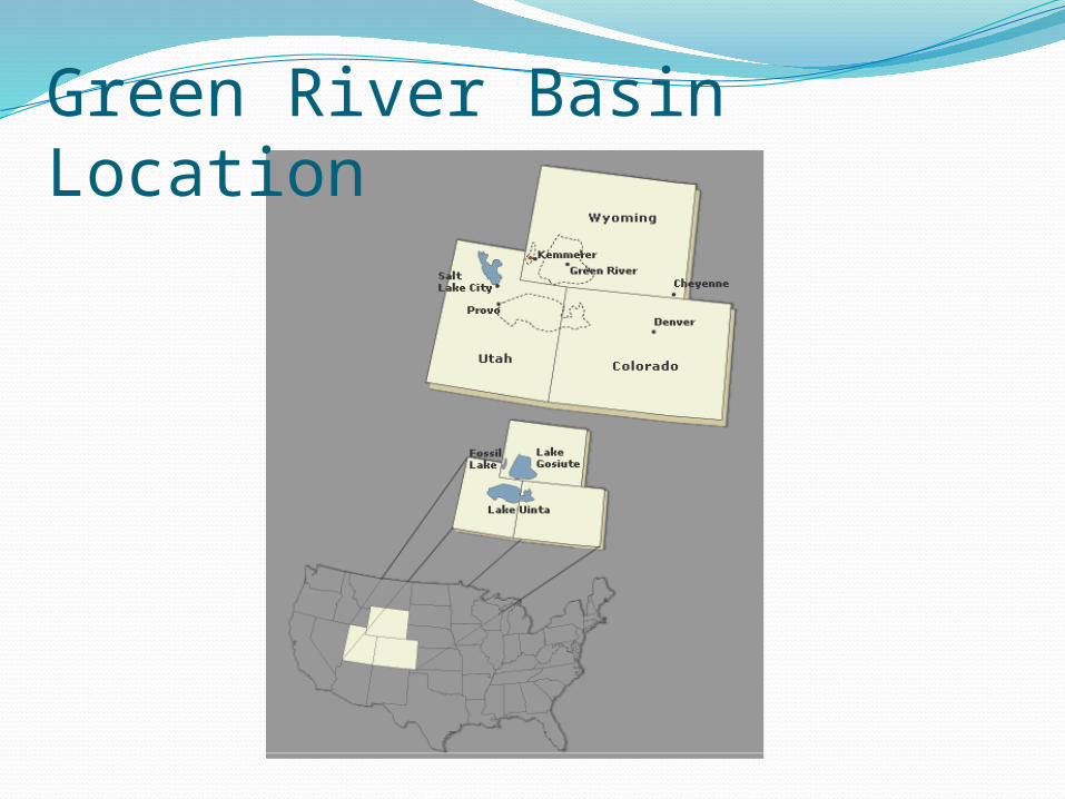
Green River Basin Location

Green River Basin Stratigraphic Correlation Chart showing Study Map Units


Sample of Existing Pipelines and Proposed Pipelines
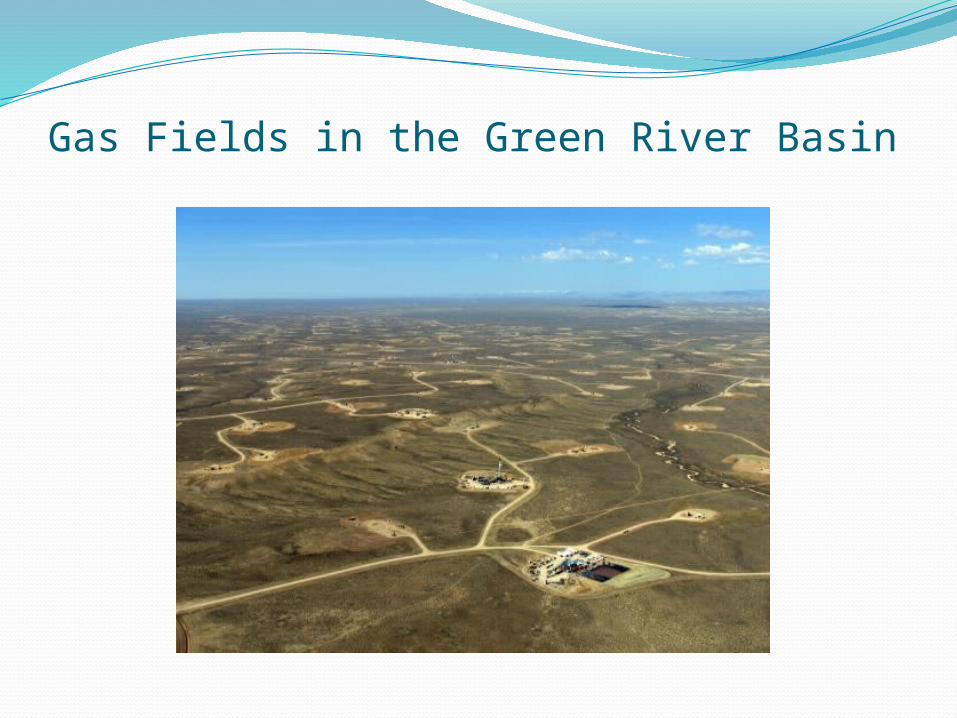
Gas Fields in the Green River Basin

Pipeline Installation ProcessClearing and gradingStringing pipes along right of wayExcavating/trenchingPipe bending, welding, and coatingLower Pipe into trenchBack fillRestoration

Geologic HazardsGeologic Hazards are natural physical
conditions that exist and if they were to become active could damage structures as well as injure people. These hazards include.Fault CrossingsSubsidenceSlope stabilityHydrogeologyEnvironmental Constraints

What is the importance?Safety of the general public.Pipelines stay safe and operational.Pipeline failure is a serious environmental
concern.
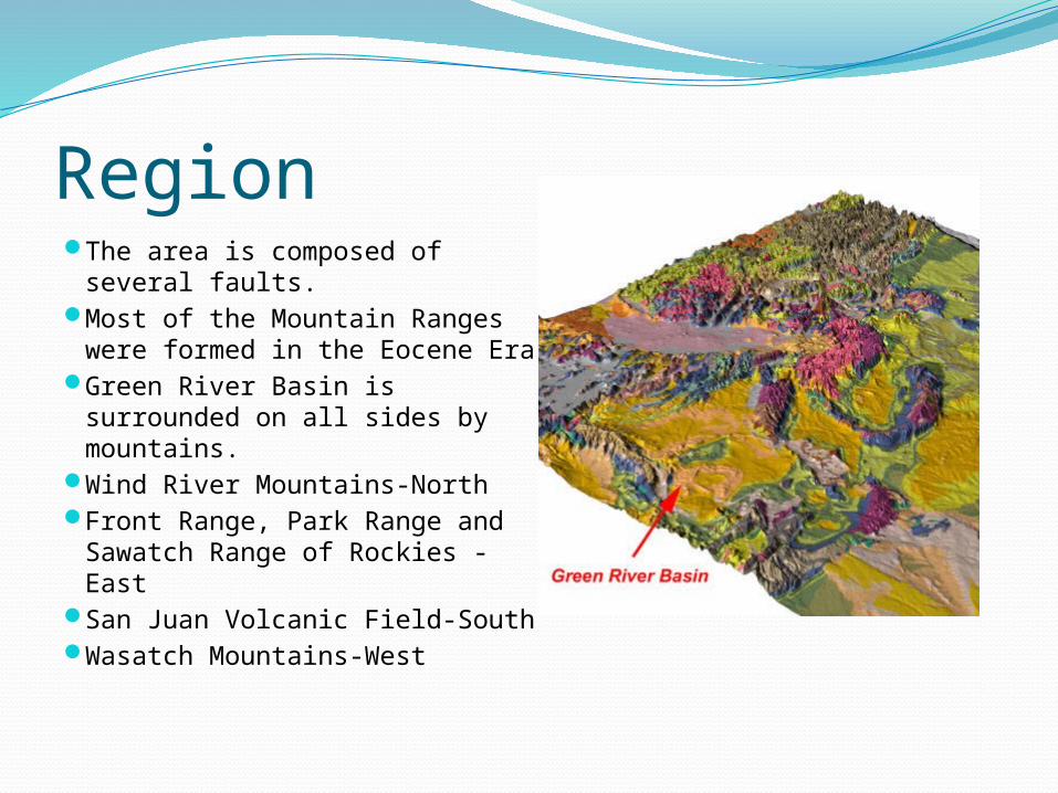
RegionThe area is composed of
several faults. Most of the Mountain Ranges
were formed in the Eocene EraGreen River Basin is
surrounded on all sides by mountains.
Wind River Mountains-NorthFront Range, Park Range and
Sawatch Range of Rockies -East
San Juan Volcanic Field-SouthWasatch Mountains-West
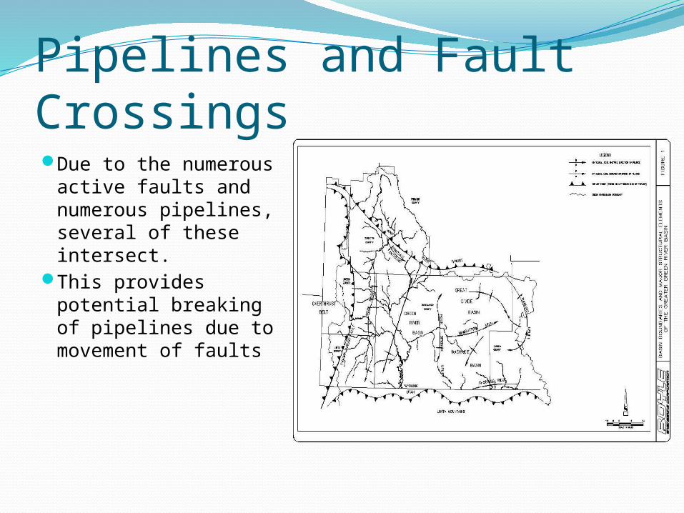
Pipelines and Fault CrossingsDue to the
numerous active faults and numerous pipelines, several of these intersect.
This provides potential breaking of pipelines due to movement of faults

Construction of PipelinesTo protect from this, all
pipelines are built of steel and treated with a protective coating.
The pipeline is carefully inspected to make sure it meets all safety requirements.
In fault zones pipes are padded with fill material to dampen vibrations and minimize damage.

Safety ConsiderationsIf there is a break in the
line, a high-tech computer monitoring system can detect a loss in pressure due to a leak and shut off all access to the length of pipe where a leak is detected. This system is monitored 24 hours a day 7 days a week
Inspections occur in the pipelines through camera inspections

SubsidenceSubsidence is the downward motion of the
earths surface relative to a datum. Causes of subsidence:Mining induced from “caving” in of excavated
material Dissolution of LimestoneExtraction of Natural GasGroundwater changes

Subsidence DamageSubsidence causes a
loss of support for the pipeline.
Damage may inhibit the functionality of the pipeline as a result of Structural damage.

Slope Stability Issues-LandslidesLandslides according the USGS are the upward
and downward movement of earth materials on a slope.
Causes of Landslide include: Steep SlopesWildfiresEarthquakesHydrological EventsHuman causes
End ResultLoss of Foundation Support
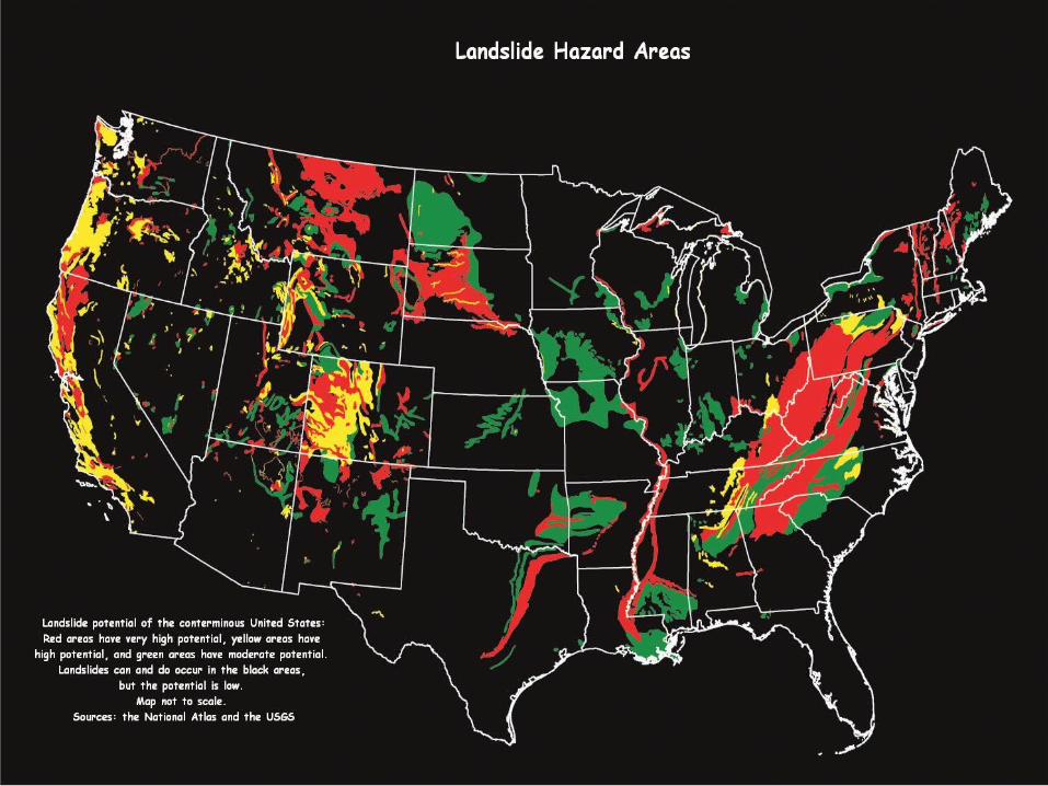

Landslides-Steep SlopesSteep slopes constrain where a pipeline line
can be placed cost effectively.Slopes greater than 30 degrees are highly
susceptible to failure. Erosion becomes a significant issue

Landslides Wildfires
Prevalent in the Green River Basin
De-vegetates the slope, which in turn reduces stability
EarthquakesSoil liquefaction due
to shaking of groundCohesion less soils are
prone to liquefaction as well as soils the are unconsolidated.

LandslidesHydrologic Events
Heavy precipitation
FloodingHuman caused
Clearing and grading before pipeline installation
Blasting when bedrock is present

Wyoming Climate5th driest state2nd highest stateMountains
Provide majority of surface water
Snow and runoffDeserts and plains
House groundwater
Aquifers recharged from surface water

Groundwater ResourcesUnconsolidated deposits
Alluvial depositsEolian sand/silt depositsGlacial depositsLacustrine deposits
Bedrock formationsSandstoneLimestone
Results in aquifer development“Water-saturated portion of an unconsolidated deposit or
geologic bedrock formation which may yield usable quantities and qualities of groundwater through springs and/or wells”

Groundwater ResourcesWater wells withdraw
groundwater from aquifers toMonitor water levels and
water qualityDischarge through
alluvial deposits and bedrock formations
Springs naturally withdraw groundwater from saturated aquifers


Environmental ConstraintsWeather:Heavy rainfall and snowmelt paired with
limited drainage of the valley can cause flash flood conditions
Snowstorms are frequent from November through MayWind frequently follows snowfall Wind can cause extreme cases of drift High winds and the low temperature of the
valley can cause blizzard or near blizzard conditions
Destructive hailstorms occasionally pass over the valley

Environmental ConstraintsTemperature Concerns:Winters are Long and ColdLow overnight
temperatures due to cold air collection in the valley can cause freezing issuesValley temperatures can be
considerably lower than surrounding mountainsides
Often valley temperatures are well below zero in the winter months

Environmental ConstraintsImpacts of the Environment:Snow, rain and hail all have an effect on slope
stability in the valley regionHigh wind storms and hail storms can
damage above ground pipingLow temperatures can cause freezing of the
groundwater causing additional stresses on buried pipes
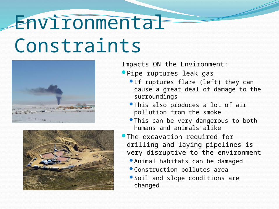
Environmental ConstraintsImpacts ON the Environment:Pipe ruptures leak gas
If ruptures flare (left) they can cause a great deal of damage to the surroundings
This also produces a lot of air pollution from the smoke
This can be very dangerous to both humans and animals alike
The excavation required for drilling and laying pipelines is very disruptive to the environment Animal habitats can be damaged Construction pollutes area Soil and slope conditions are
changed
Referenceshttp://www.dom.com/about/gas-transmission/covepoint/expansion/
construction.jsphttp://www.wsgs.uwyo.edu/surficial/http://3dparks.wr.usgs.gov/landslide/types.htmhttp://www.esa.int/esaCP/SEMX4QVLWFE_index_1.htmlhttp://www.fieldmuseum.org/expeditions/lance/map.htmlhttp://skytruth.mediatools.org/gallery/270http://www.wrds.uwyo.edu/sco/climate/wyoclimate.htmlhttp://www.wsgs.uwyo.edu/hydrology/http://www.canadiandiscovery.com/PDF/Green-River-Basin.pdfhttp://waterplan.state.wy.us/plan/green/techmemos/gwdeterm.htmlhttp://en.wikipedia.org/wiki/Green_River_Formation http://www.geology.wisc.edu/~unstable/Sedimentary/
Green_River_Basin.jpg