powerpoint presentation physical geology, 10/e geology/14_coasts ppt.pdf · sea stacks and arches ....
TRANSCRIPT
Chapter 14
The McGraw-Hill Companies, Inc.
Coasts
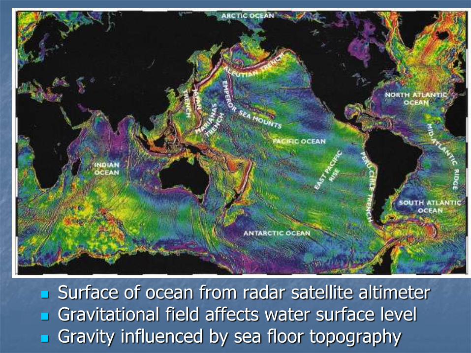
Surface of ocean from radar satellite altimeter Gravitational field affects water surface level Gravity influenced by sea floor topography
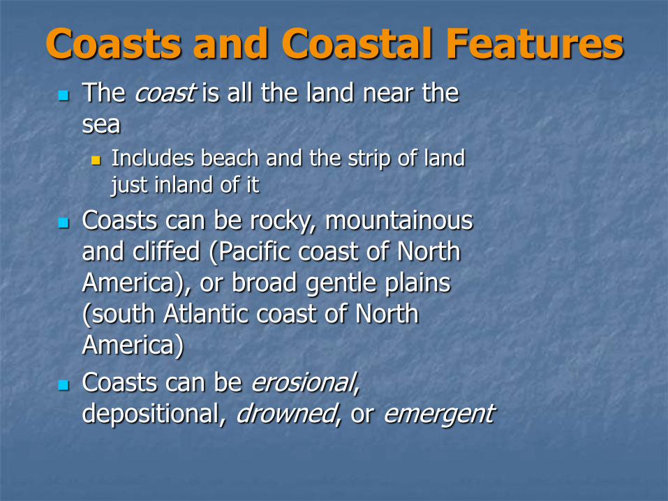
Coasts and Coastal Features The coast is all the land near the
sea
Includes beach and the strip of land just inland of it
Coasts can be rocky, mountainous and cliffed (Pacific coast of North America), or broad gentle plains (south Atlantic coast of North America)
Coasts can be erosional, depositional, drowned, or emergent

Beaches A beach is a strip of sediment (usually sand or
gravel) from the low-water line inland to a cliff or zone of permanent vegetation
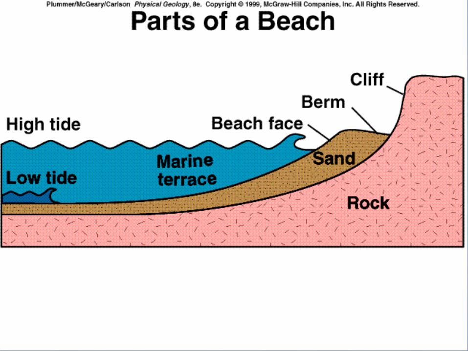
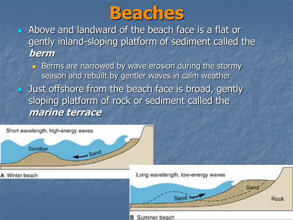
Beaches Above and landward of the beach face is a flat or
gently inland-sloping platform of sediment called the berm Berms are narrowed by wave erosion during the stormy
season and rebuilt by gentler waves in calm weather
Just offshore from the beach face is broad, gently sloping platform of rock or sediment called the marine terrace
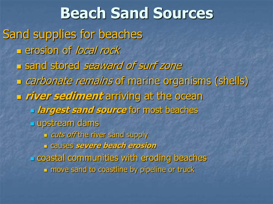
Beach Sand Sources
Sand supplies for beaches
erosion of local rock
sand stored seaward of surf zone
carbonate remains of marine organisms (shells)
river sediment arriving at the ocean
largest sand source for most beaches
upstream dams
cuts off the river sand supply
causes severe beach erosion
coastal communities with eroding beaches
move sand to coastline by pipeline or truck
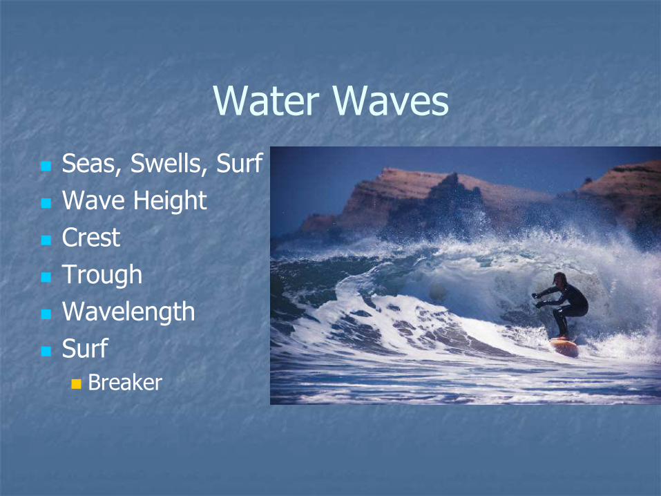
Water Waves
Seas, Swells, Surf
Wave Height
Crest
Trough
Wavelength
Surf
Breaker

Waves and Energy Transfer Ordinary ocean waves
(not tsunamis) are created by wind blowing over the surface of the water
When waves strike coastlines, wind energy is transferred to the rocks and sediments on beaches This energy is available to
erode coastlines and transport sediments
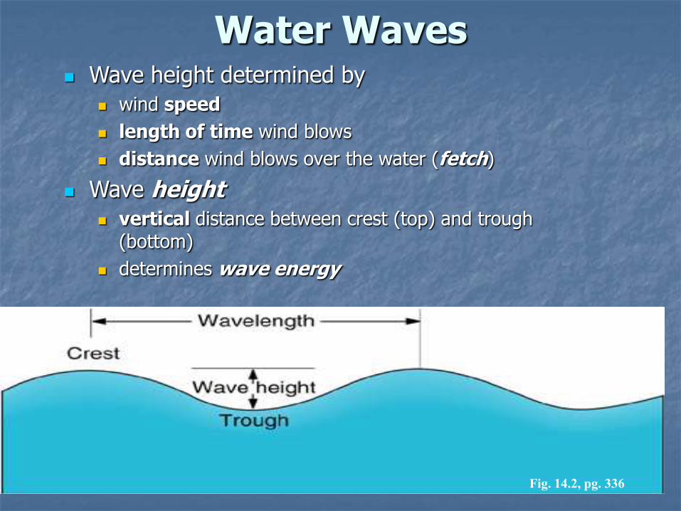
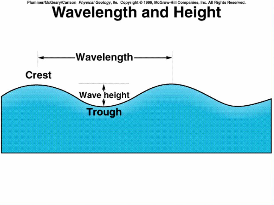
Water Waves Wave height determined by
wind speed
length of time wind blows
distance wind blows over the water (fetch)
Wave height vertical distance between crest (top) and trough
(bottom)
determines wave energy
Fig. 14.2, pg. 336
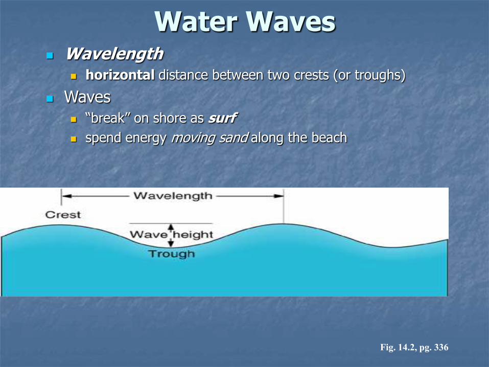
Water Waves Wavelength
horizontal distance between two crests (or troughs)
Waves
“break” on shore as surf
spend energy moving sand along the beach
Fig. 14.2, pg. 336
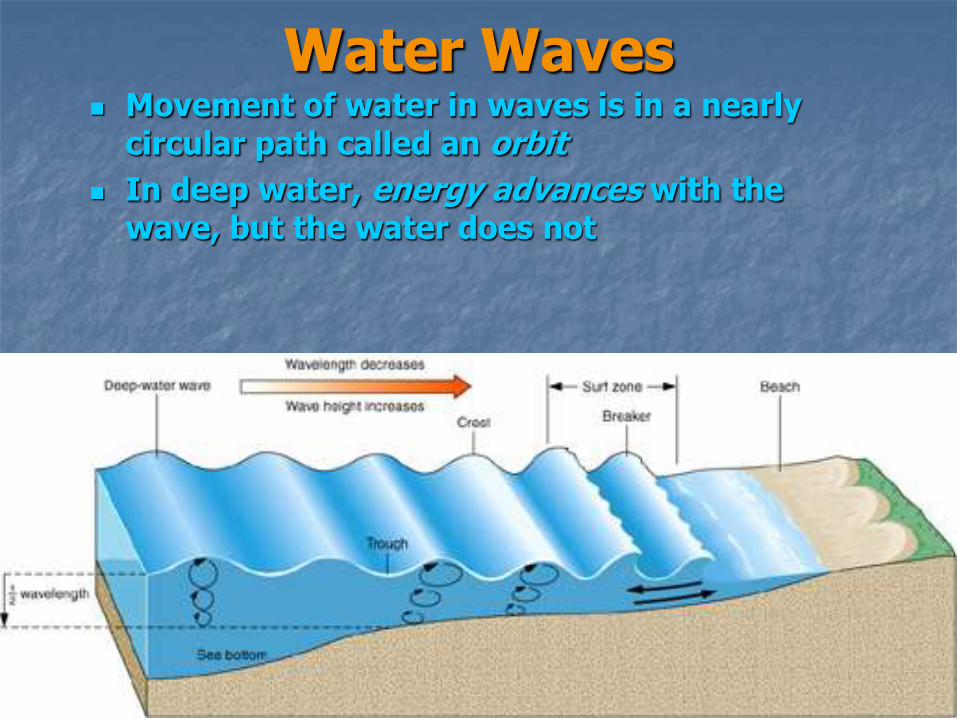
Water Waves Movement of water in waves is in a nearly
circular path called an orbit
In deep water, energy advances with the wave, but the water does not
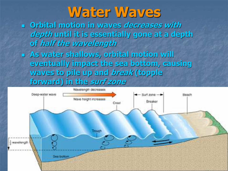
Water Waves Orbital motion in waves decreases with
depth until it is essentially gone at a depth of half the wavelength
As water shallows, orbital motion will eventually impact the sea bottom, causing waves to pile up and break (topple forward) in the surf zone
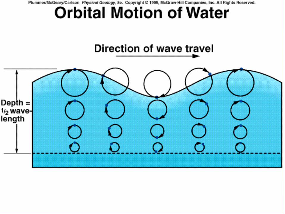
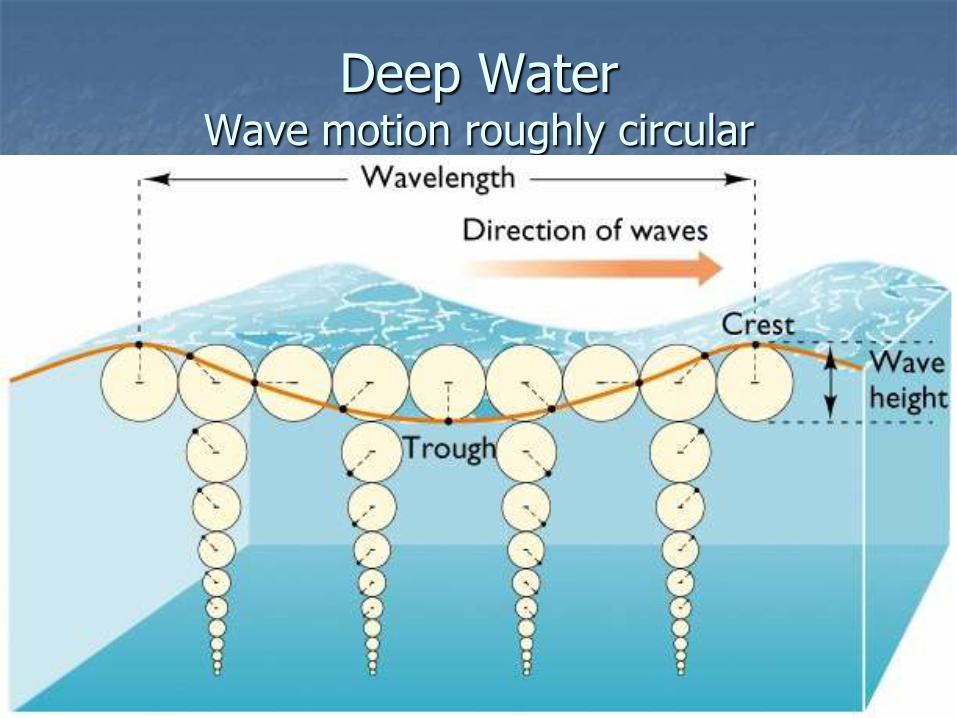
Deep Water Wave motion roughly circular
Surf Zone — Dynamics of Waves Elliptical motion, then back-and forth
horizontal, moving sediment Drag on bottom—top comes over=breakers
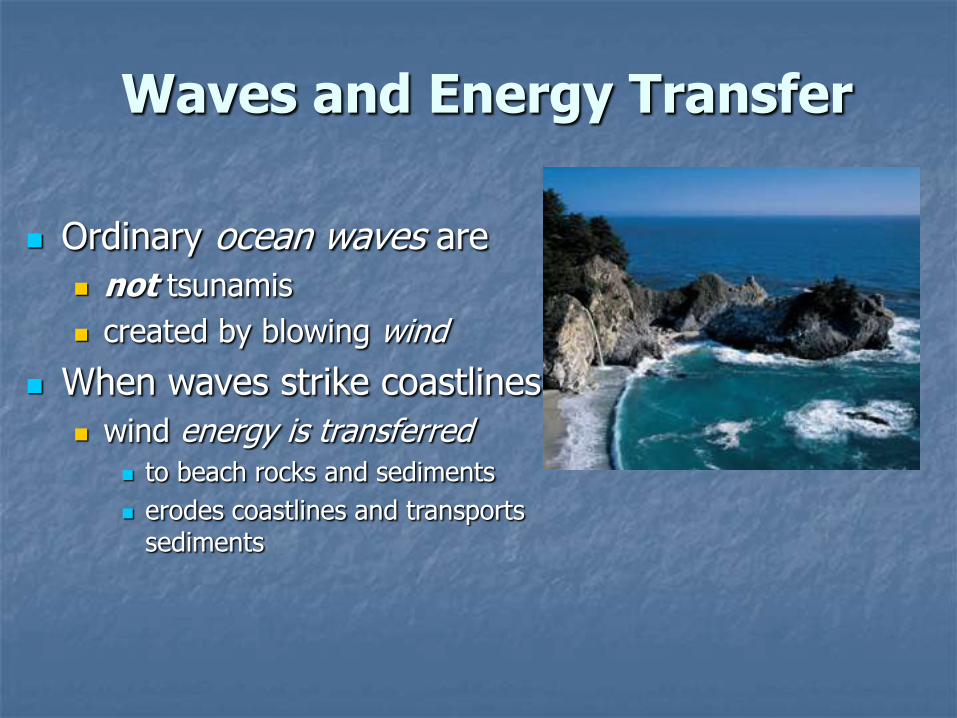
Waves and Energy Transfer
Ordinary ocean waves are
not tsunamis
created by blowing wind
When waves strike coastlines
wind energy is transferred
to beach rocks and sediments
erodes coastlines and transports sediments
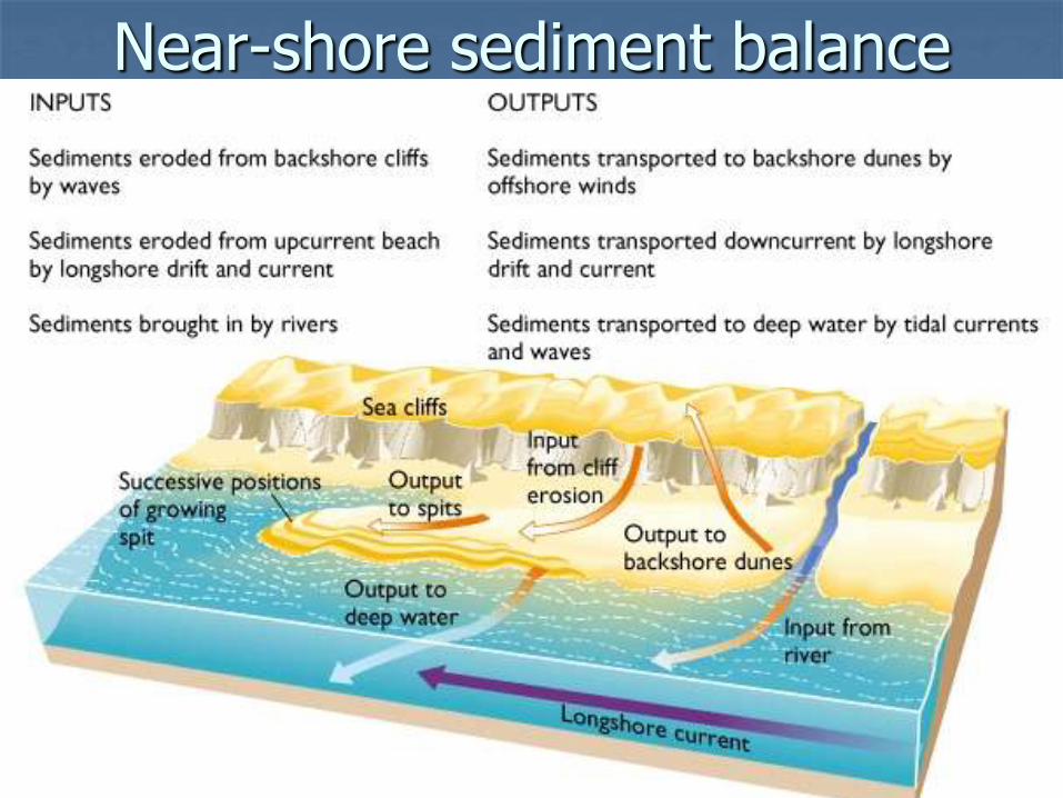
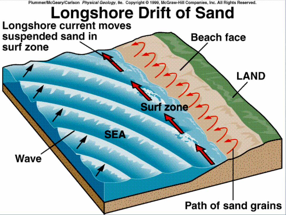
Near-shore sediment balance
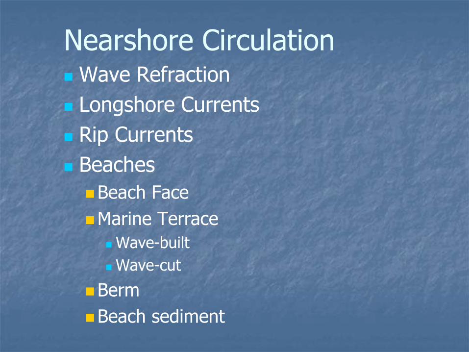
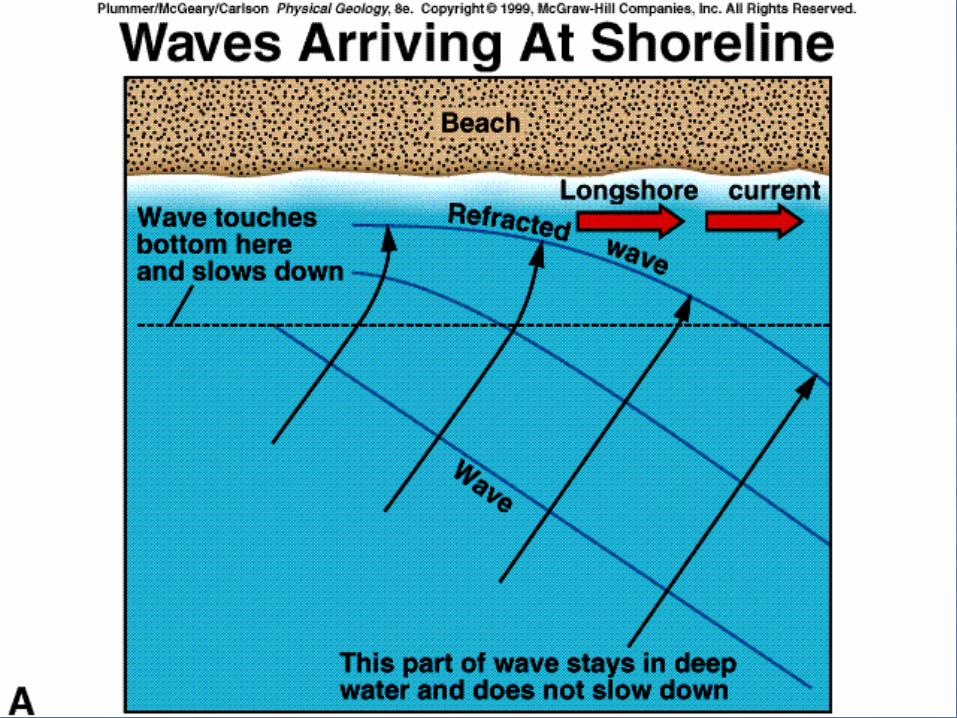
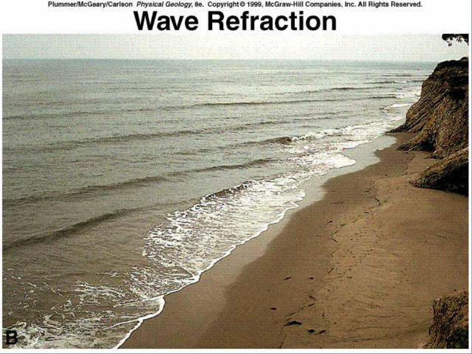
Nearshore Circulation Wave Refraction
Longshore Currents
Rip Currents
Beaches
Beach Face
Marine Terrace
Wave-built
Wave-cut
Berm
Beach sediment
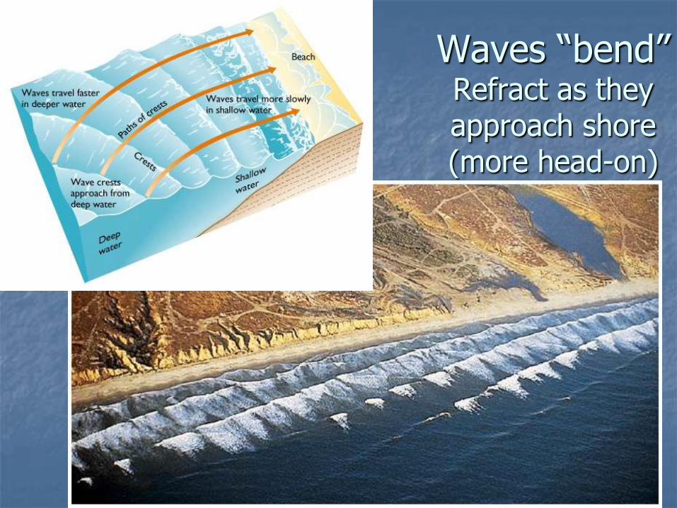
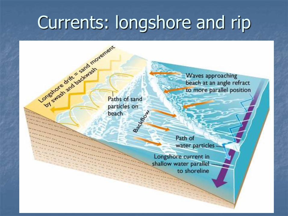
Waves “bend” Refract as they approach shore (more head-on)
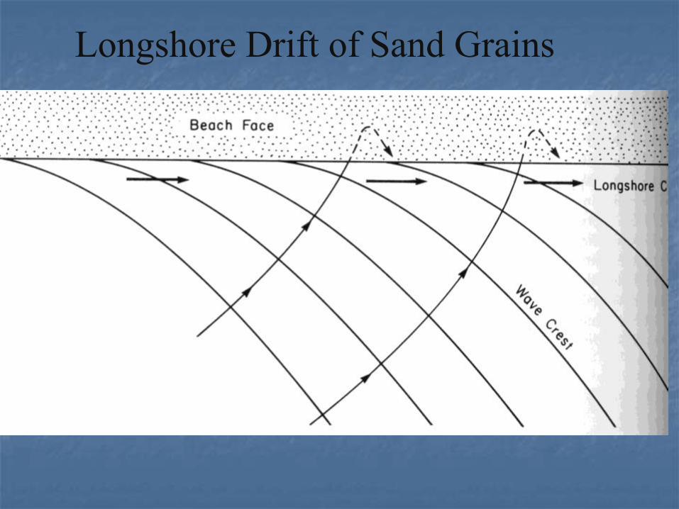
Longshore Drift Longshore drift
waves strike shoreline at an angle
sediment moves parallel to shore
Sediment
some moves as waves wash up on the beach face
most transported by longshore current in surf zone
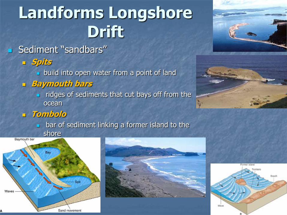
Landforms Longshore Drift
Sediment “sandbars” Spits
build into open water from a point of land
Baymouth bars
ridges of sediments that cut bays off from the ocean
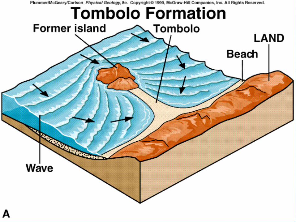
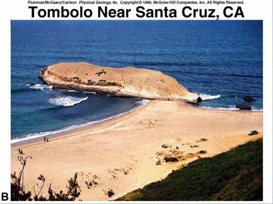
Tombolo
bar of sediment linking a former island to the shore
Slump
14.04.c
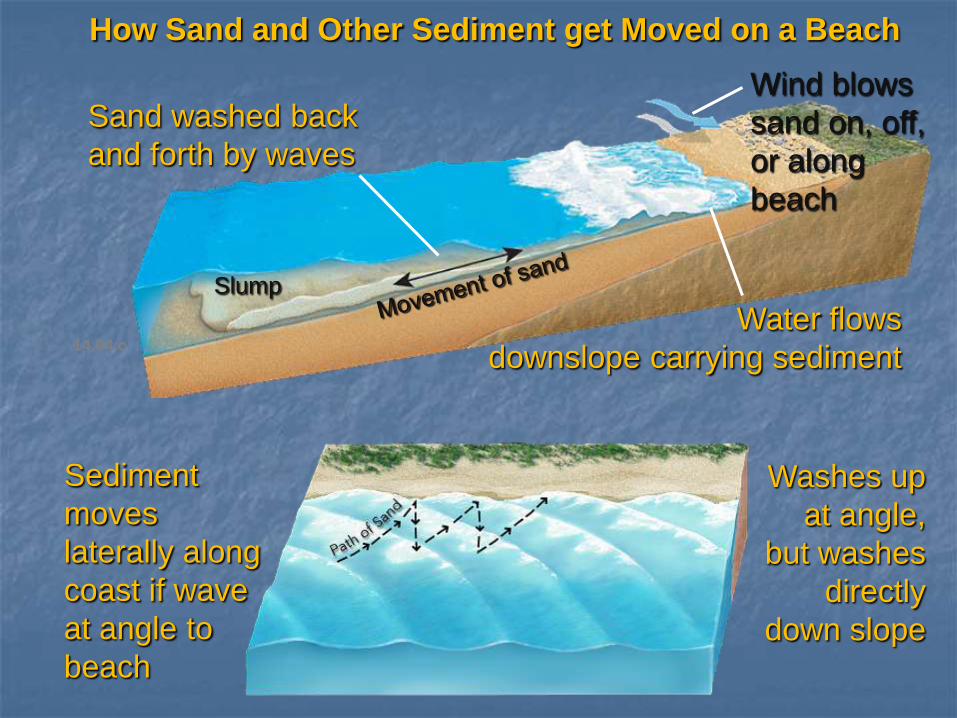
How Sand and Other Sediment get Moved on a Beach
Sand washed back
and forth by waves
Water flows
downslope carrying sediment
Wind blows
sand on, off,
or along
beach
Sediment
moves
laterally along
coast if wave
at angle to
beach
Washes up
at angle,
but washes
directly
down slope
Longshore Drift of Sediment
Longshore Drift
Swash/Backwash
Spit
Baymouth Bar
Tombolo
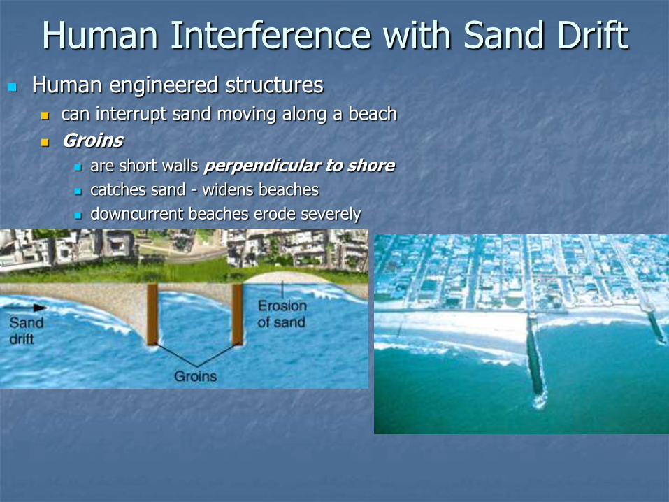
Human Interference with Sand Drift
Jetties
Groins
Breakwater
Longshore Drift of Sand Grains


Coasts and Coastal Features
Drowned Coasts
Estuaries
Fiords
Uplifted Coasts (Emergent)
Uplifted Marine Terraces
Coasts Shaped by Organisms
Algal Reefs
Branching Mangrove Roots
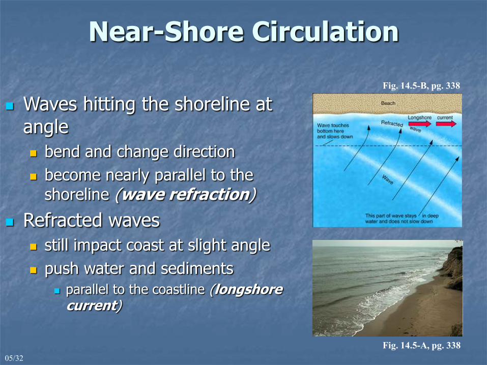
Near-Shore Circulation
Waves hitting the shoreline at angle
bend and change direction
become nearly parallel to the shoreline (wave refraction)
Refracted waves
still impact coast at slight angle
push water and sediments
parallel to the coastline (longshore current)
Fig. 14.5-B, pg. 338
Fig. 14.5-A, pg. 338
05/32
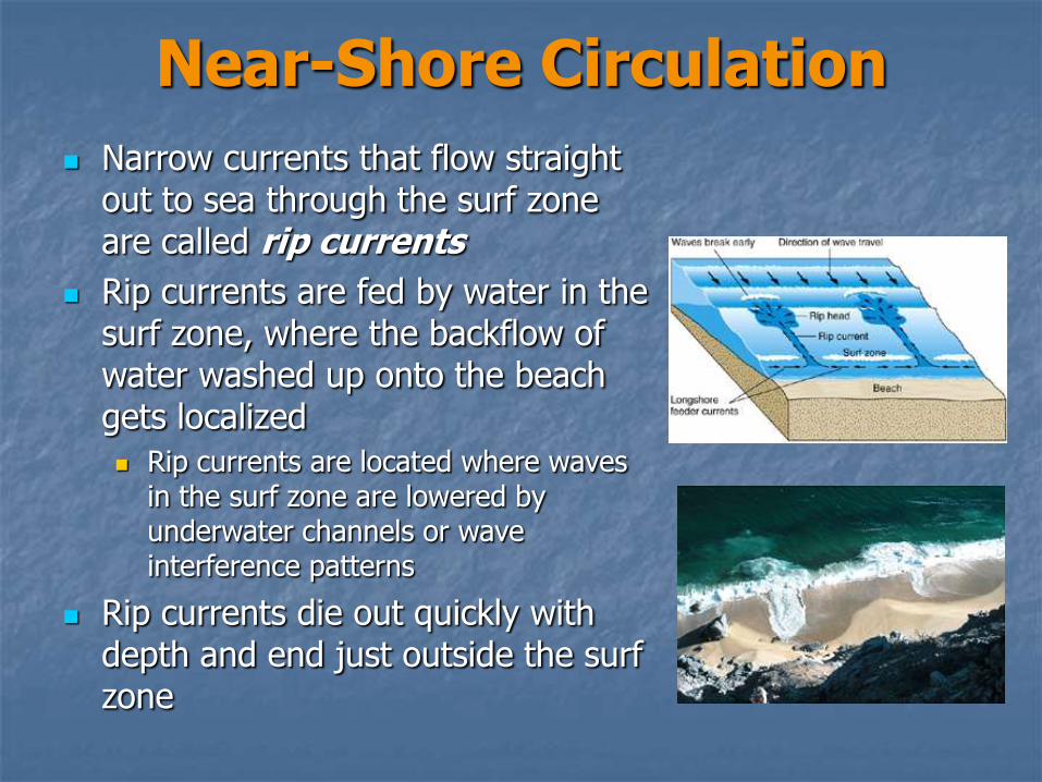
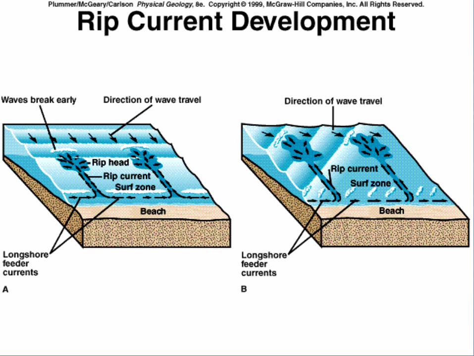
Near-Shore Circulation
Narrow currents that flow straight out to sea through the surf zone are called rip currents
Rip currents are fed by water in the surf zone, where the backflow of water washed up onto the beach gets localized
Rip currents are located where waves in the surf zone are lowered by underwater channels or wave interference patterns
Rip currents die out quickly with depth and end just outside the surf zone
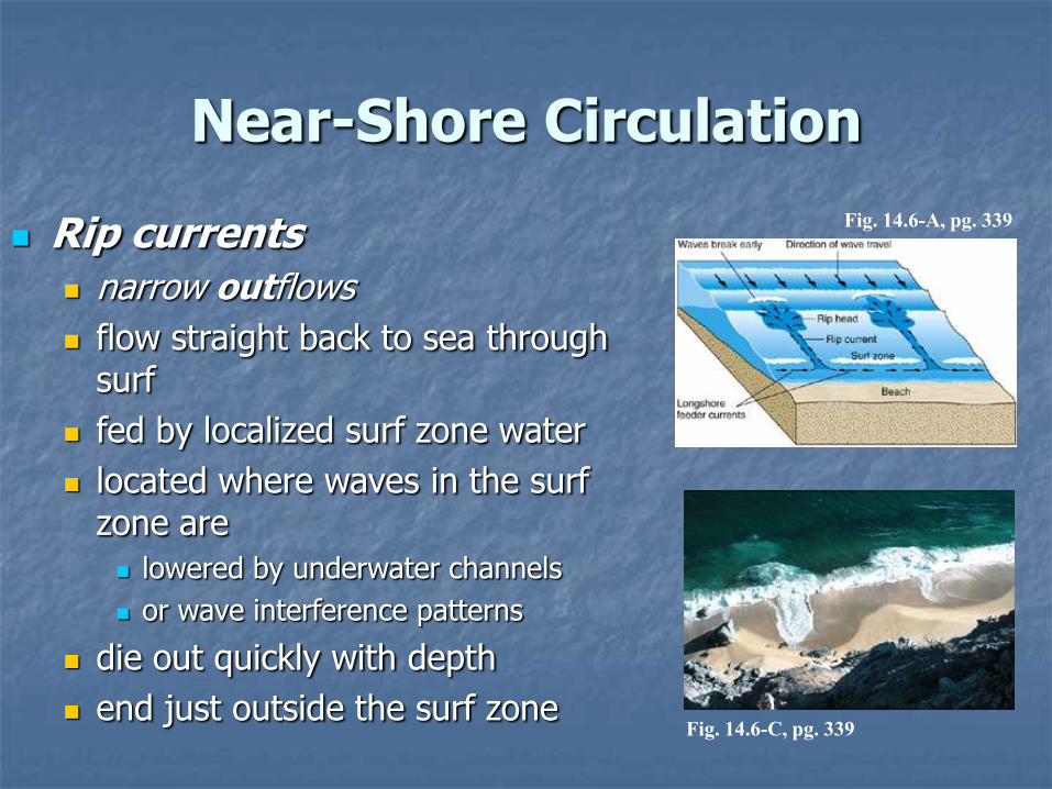
Near-Shore Circulation
Rip currents
narrow outflows
flow straight back to sea through surf
fed by localized surf zone water
located where waves in the surf zone are
lowered by underwater channels
or wave interference patterns
die out quickly with depth
end just outside the surf zone
Fig. 14.6-A, pg. 339
Fig. 14.6-C, pg. 339
Currents: longshore and rip
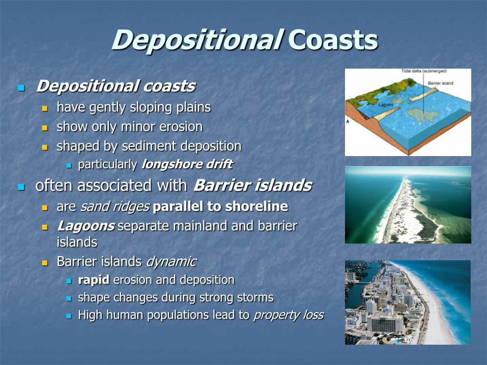
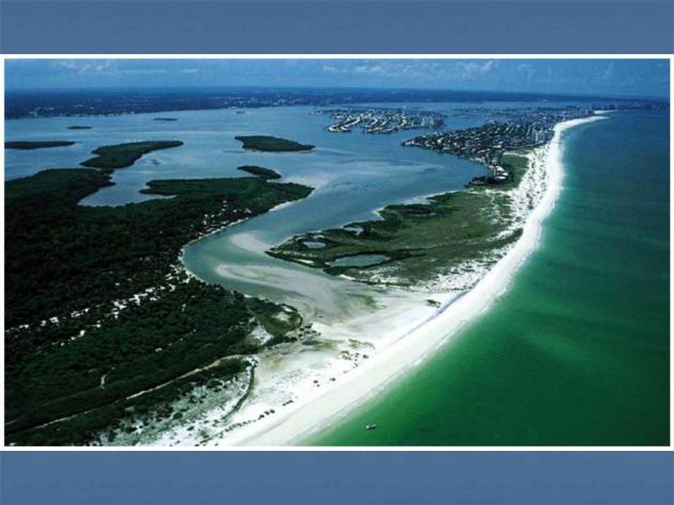
Depositional Coasts
Depositional coasts
have gently sloping plains
show only minor erosion
shaped by sediment deposition
particularly longshore drift
often associated with Barrier islands
are sand ridges parallel to shoreline
Lagoons separate mainland and barrier islands
Barrier islands dynamic
rapid erosion and deposition
shape changes during strong storms
High human populations lead to property loss
14.06.b
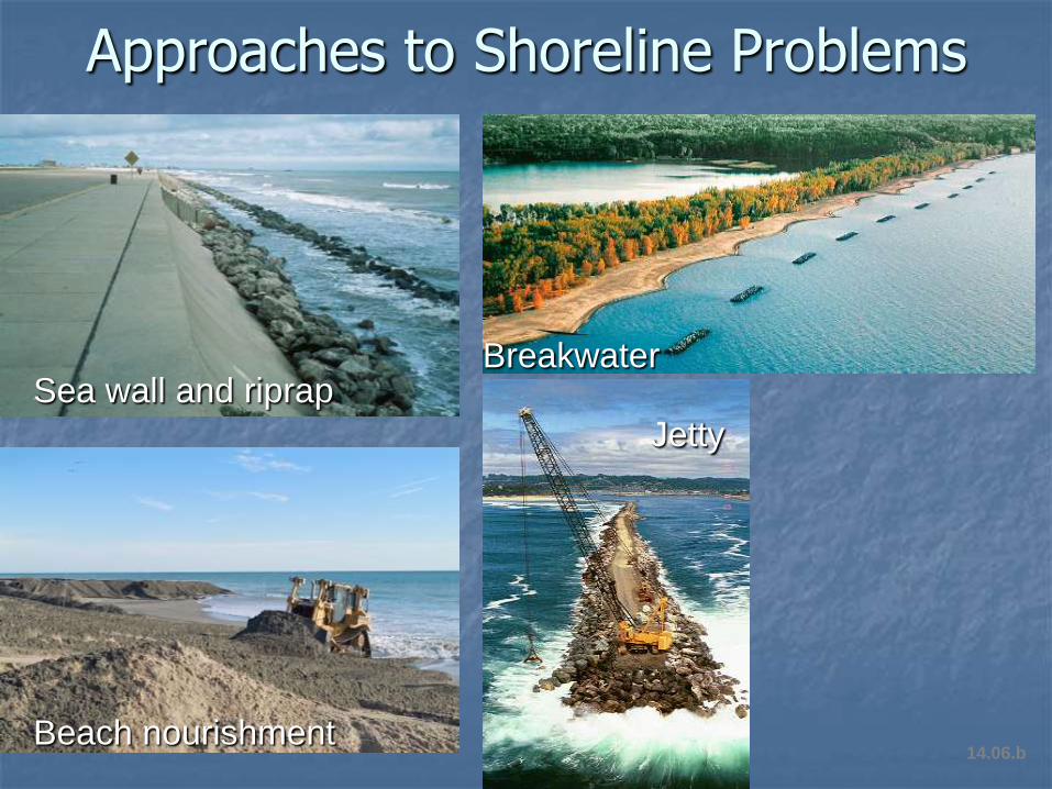
Approaches to Shoreline Problems
Sea wall and riprap
Beach nourishment
Breakwater
Jetty

Human impact
Groin
Beach filling

Human Interference with Sand Drift
Human engineered structures
can interrupt sand moving along a beach
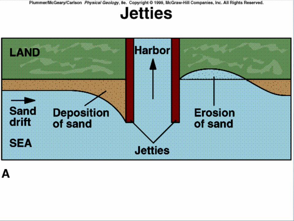
Jetties are rock walls
prevent harbor entrances from filling with sand
sand piles up at upcurrent jetty
downcurrent beaches erode severely
Human Interference with Sand Drift Human engineered structures
can interrupt sand moving along a beach
Groins
are short walls perpendicular to shore
catches sand - widens beaches
downcurrent beaches erode severely


Human Interference with Sand Drift
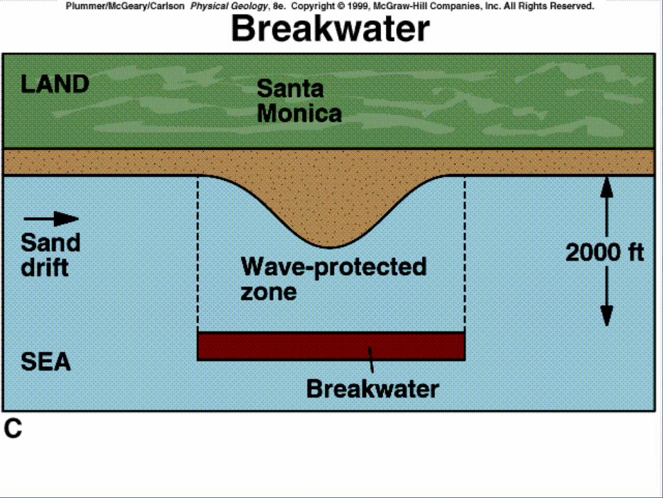
Human engineered structures
Breakwaters
offshore structures parallel to shore
absorbs force of large breakers
provides “quiet” water near shore
sand builds up shoreward of the breakwater
eventually fills in area of “quiet water”
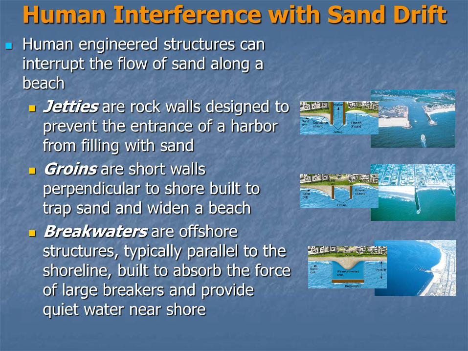
Human Interference with Sand Drift Human engineered structures can
interrupt the flow of sand along a beach
Jetties are rock walls designed to prevent the entrance of a harbor from filling with sand
Groins are short walls perpendicular to shore built to trap sand and widen a beach
Breakwaters are offshore structures, typically parallel to the shoreline, built to absorb the force of large breakers and provide quiet water near shore
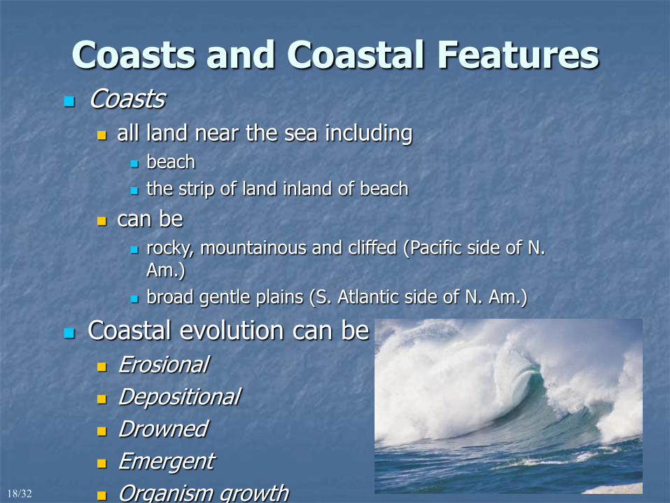
Coasts and Coastal Features Coasts
all land near the sea including
beach
the strip of land inland of beach
can be
rocky, mountainous and cliffed (Pacific side of N. Am.)
broad gentle plains (S. Atlantic side of N. Am.)
Coastal evolution can be
Erosional
Depositional
Drowned
Emergent
Organism growth 18/32
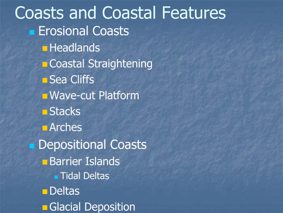
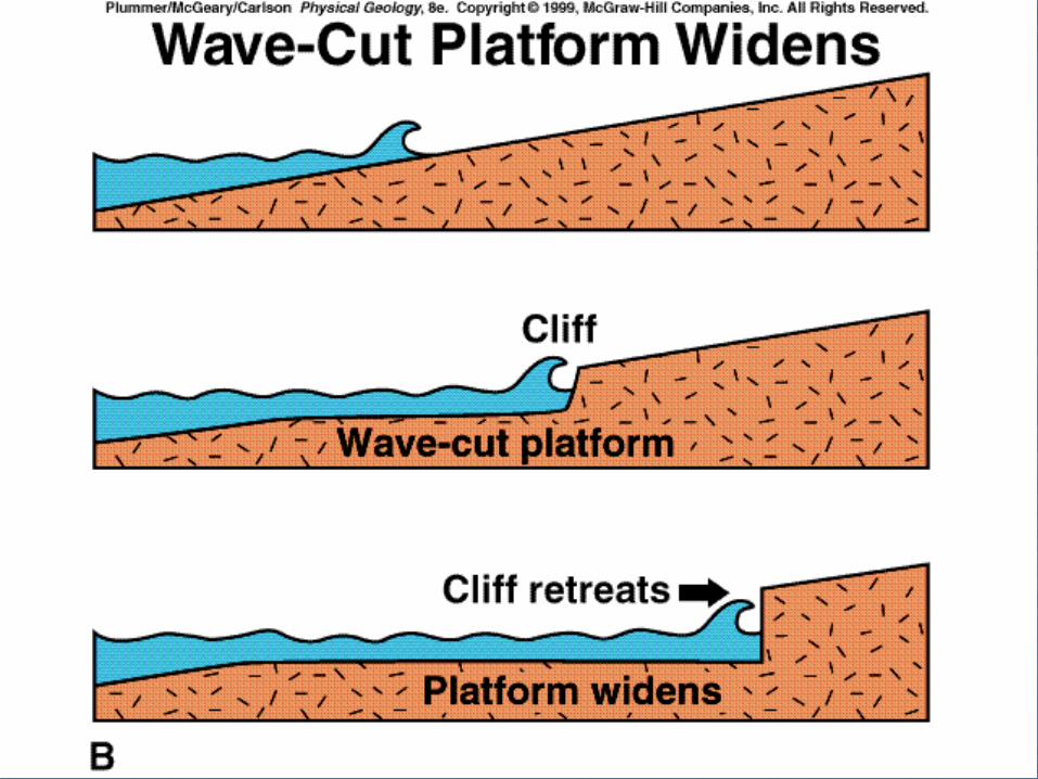
Coasts and Coastal Features Erosional Coasts
Headlands
Coastal Straightening
Sea Cliffs
Wave-cut Platform
Stacks
Arches
Depositional Coasts
Barrier Islands
Tidal Deltas
Deltas
Glacial Deposition
Erosional Coasts
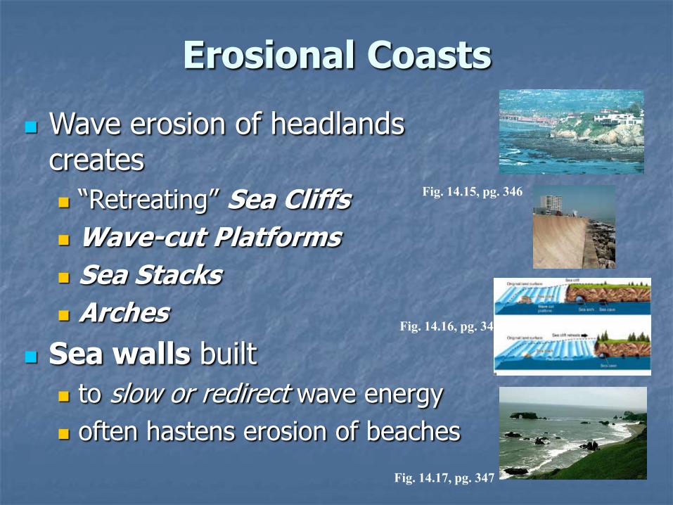
Wave erosion of headlands creates
“Retreating” Sea Cliffs
Wave-cut Platforms
Sea Stacks
Arches
Sea walls built
to slow or redirect wave energy
often hastens erosion of beaches
Fig. 14.15, pg. 346
Fig. 14.16, pg. 346
Fig. 14.17, pg. 347

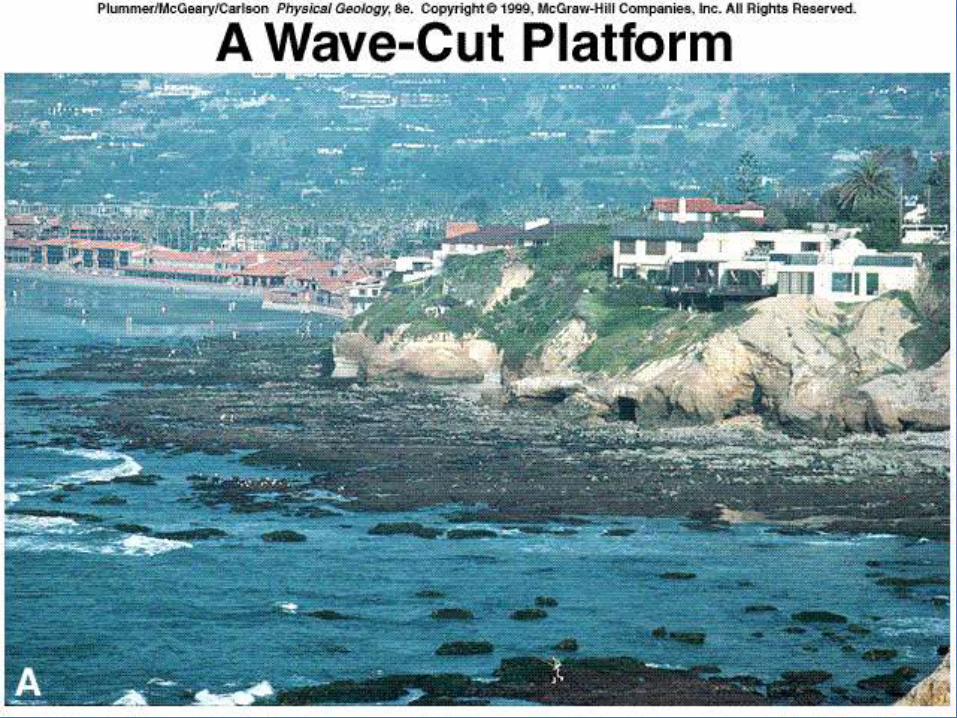
14.05.a Shoreline Features Carved by Erosion
Sea cliffs
Wave-cut platforms
Caves and sea arches
Pinnacles and sea stacks
Erosional Coasts
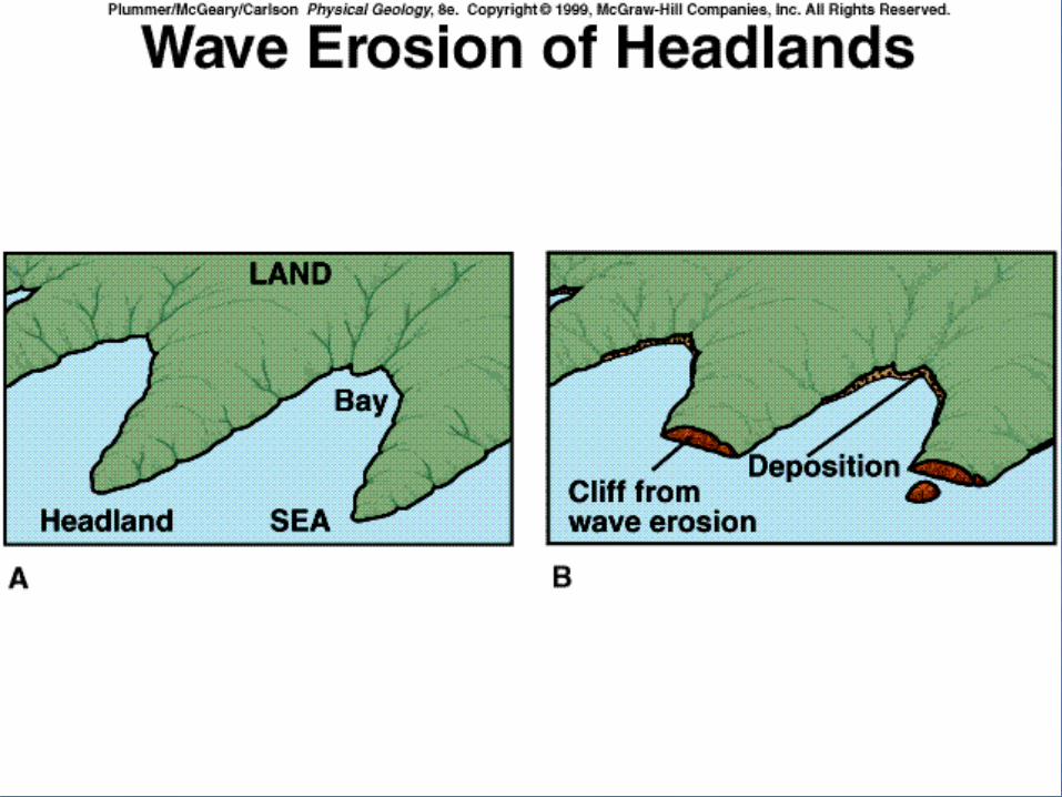
Erosional coasts common where bays separate rocky headlands jutting into
ocean
Coastal straightening occurs
wave erosion of headlands
wave deposition of sediments in bays
Fig. 14.14-A,-B,-C,-D,
pg. 345
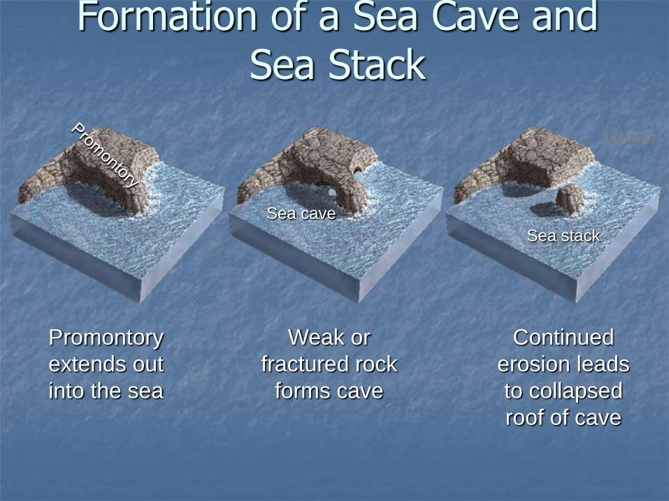
Sea cave
Sea stack
14.05.a5-7
Promontory
extends out
into the sea
Weak or
fractured rock
forms cave
Continued
erosion leads
to collapsed
roof of cave
Formation of a Sea Cave and Sea Stack
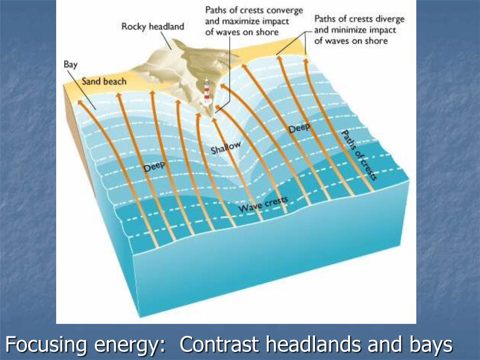
Focusing energy: Contrast headlands and bays
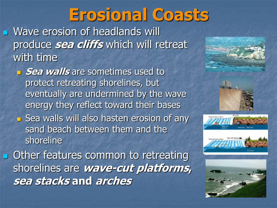
Erosional Coasts Wave erosion of headlands will
produce sea cliffs which will retreat with time
Sea walls are sometimes used to protect retreating shorelines, but eventually are undermined by the wave energy they reflect toward their bases
Sea walls will also hasten erosion of any sand beach between them and the shoreline
Other features common to retreating shorelines are wave-cut platforms, sea stacks and arches
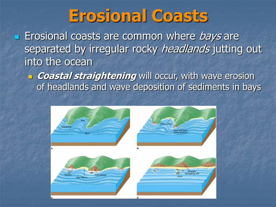
Erosional Coasts Erosional coasts are common where bays are
separated by irregular rocky headlands jutting out into the ocean
Coastal straightening will occur, with wave erosion of headlands and wave deposition of sediments in bays
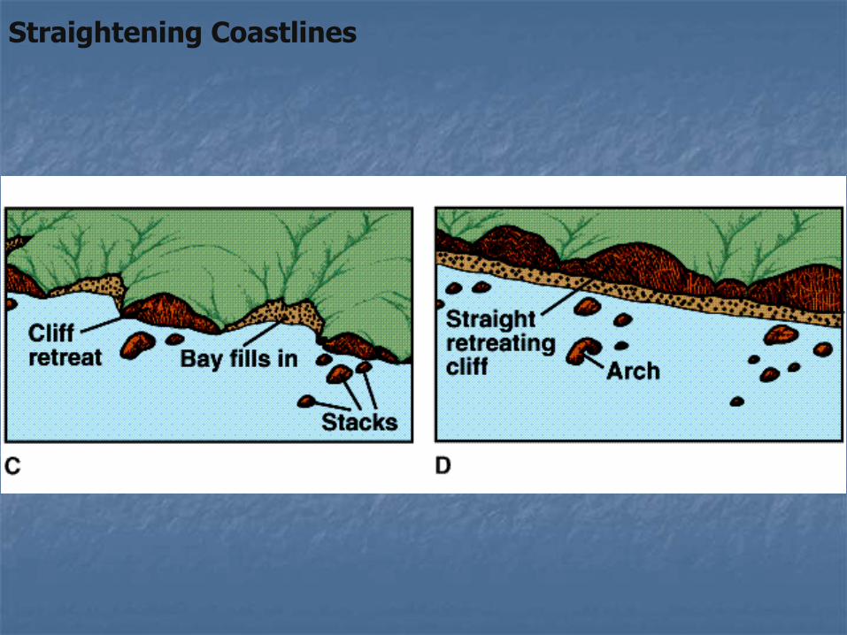
Straightening Coastlines
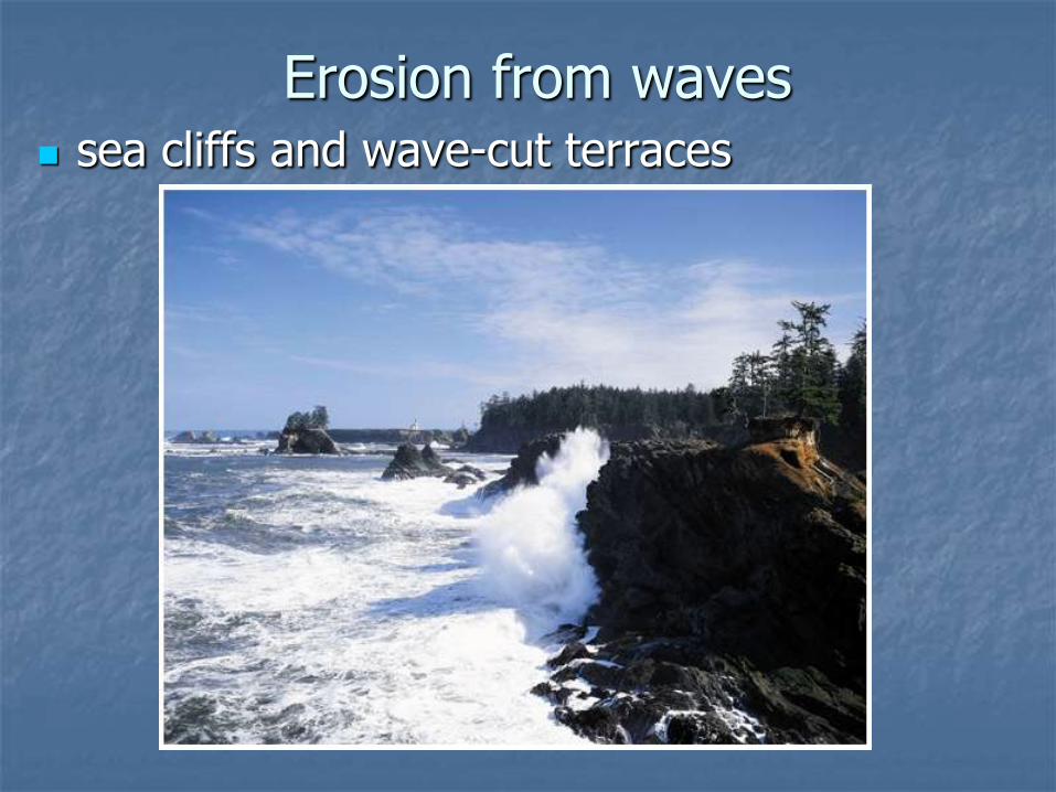
Erosion from waves sea cliffs and wave-cut terraces
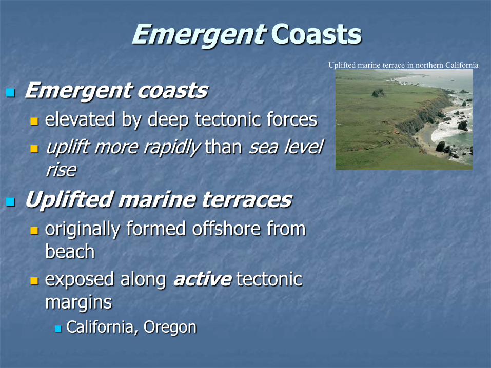
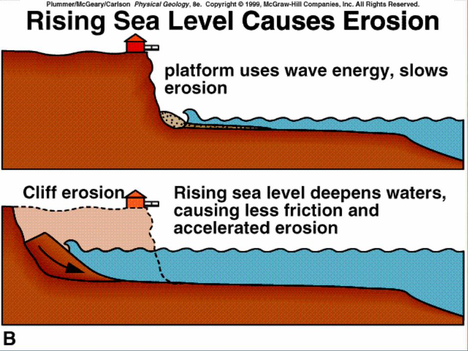
Emergent Coasts
Emergent coasts
elevated by deep tectonic forces
uplift more rapidly than sea level rise
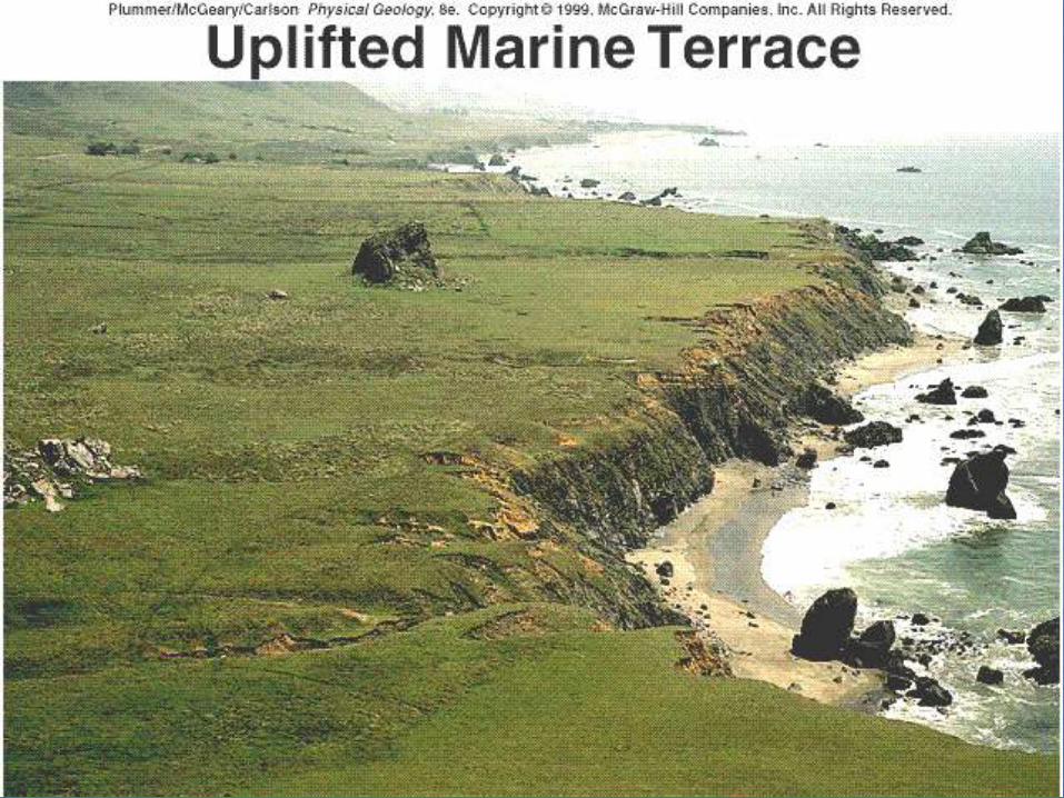
Uplifted marine terraces
originally formed offshore from beach
exposed along active tectonic margins
California, Oregon
Uplifted marine terrace in northern California
14.08.d
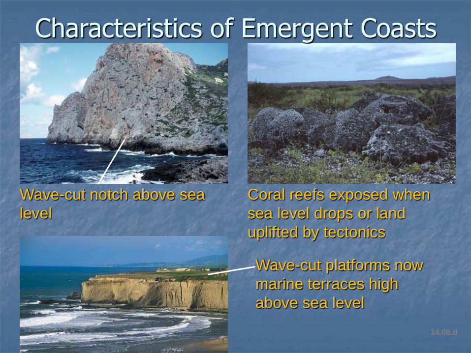
Characteristics of Emergent Coasts
Wave-cut notch above sea
level
Coral reefs exposed when
sea level drops or land
uplifted by tectonics
Wave-cut platforms now
marine terraces high
above sea level
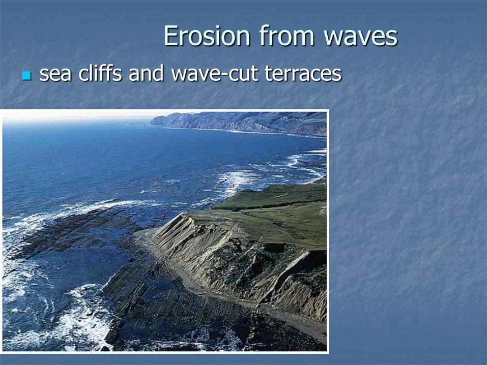
Erosion from waves
sea cliffs and wave-cut terraces

Tectonic controls — “local”
Uplifted shoreline terrace
Why is it exposed?

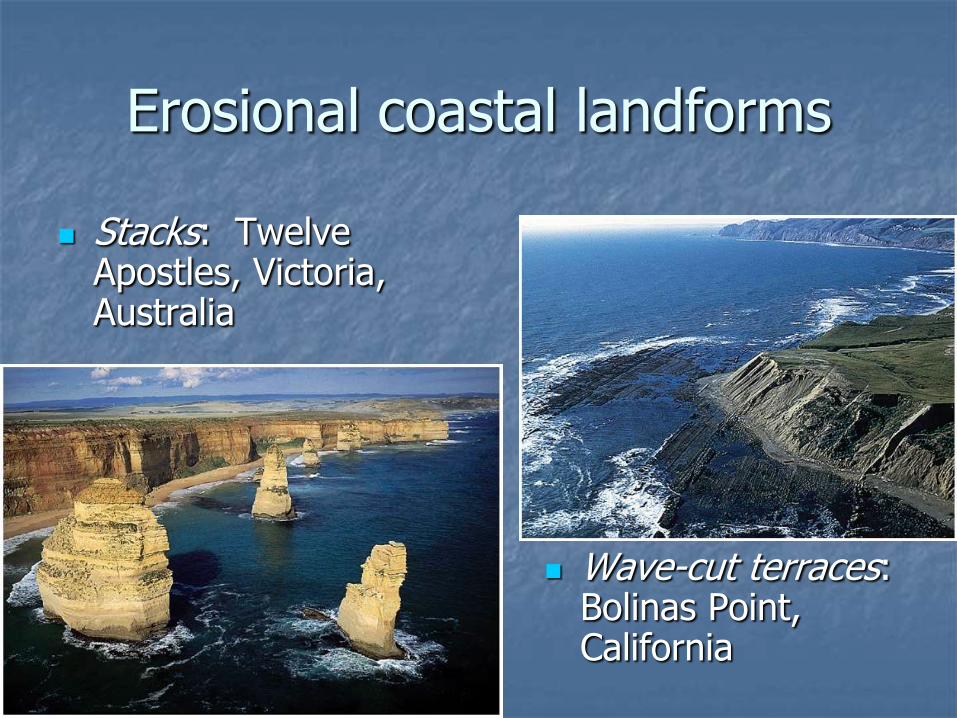
Erosional coastal landforms
Stacks: Twelve Apostles, Victoria, Australia
Wave-cut terraces: Bolinas Point, California
Emergent Coasts
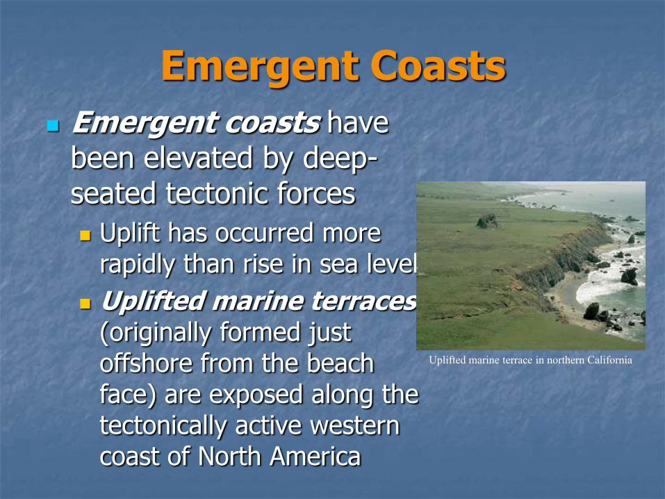
Emergent coasts have been elevated by deep-seated tectonic forces
Uplift has occurred more rapidly than rise in sea level
Uplifted marine terraces (originally formed just offshore from the beach face) are exposed along the tectonically active western coast of North America
Uplifted marine terrace in northern California
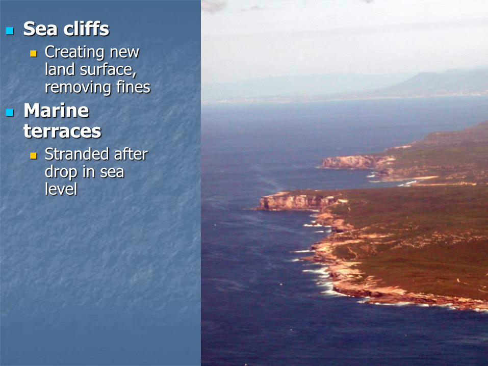
Sea cliffs Creating new
land surface, removing fines
Marine terraces Stranded after
drop in sea level
River
Dunes
Delta
Offshore
island
Currents
transport
sediment
along coast
14.04.d1
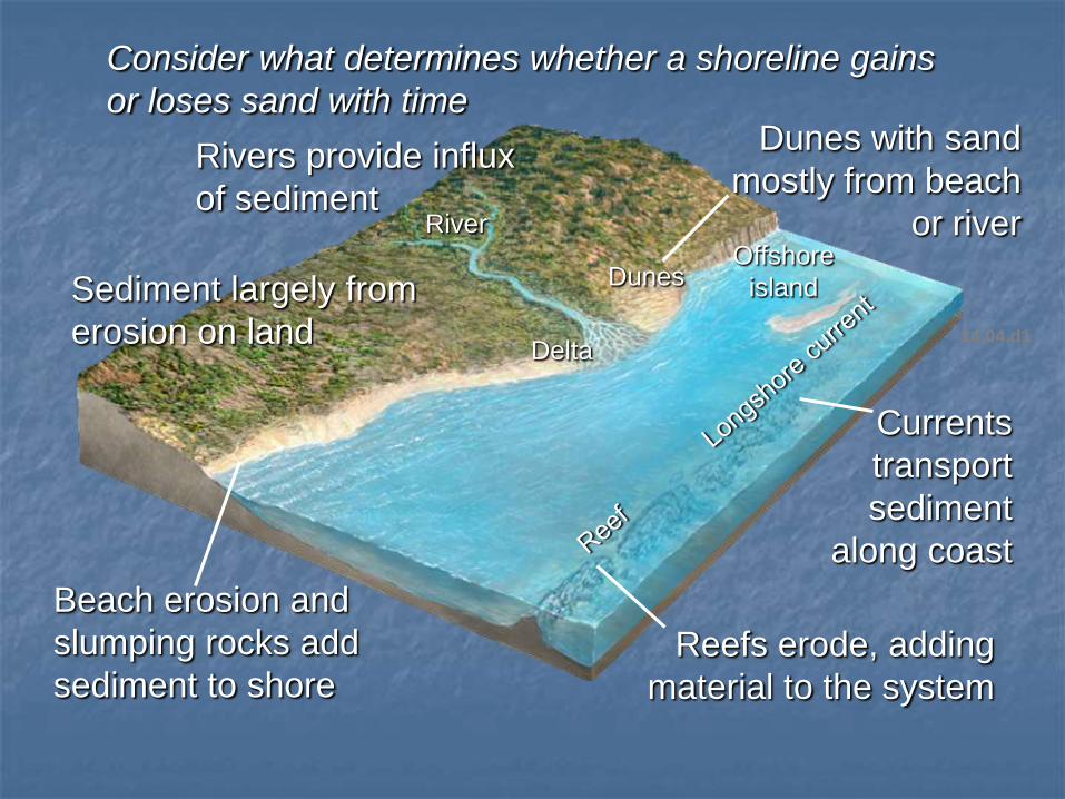
Consider what determines whether a shoreline gains
or loses sand with time
Rivers provide influx
of sediment
Sediment largely from
erosion on land
Dunes with sand
mostly from beach
or river
Reefs erode, adding
material to the system
Beach erosion and
slumping rocks add
sediment to shore
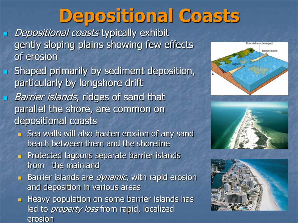
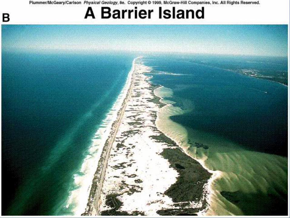
Depositional Coasts Depositional coasts typically exhibit
gently sloping plains showing few effects of erosion
Shaped primarily by sediment deposition, particularly by longshore drift
Barrier islands, ridges of sand that parallel the shore, are common on depositional coasts
Sea walls will also hasten erosion of any sand beach between them and the shoreline
Protected lagoons separate barrier islands from the mainland
Barrier islands are dynamic, with rapid erosion and deposition in various areas
Heavy population on some barrier islands has led to property loss from rapid, localized erosion
14.05.b
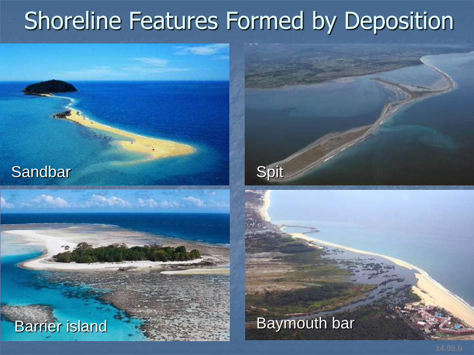
Shoreline Features Formed by Deposition
Sandbar Spit
Barrier island Baymouth bar
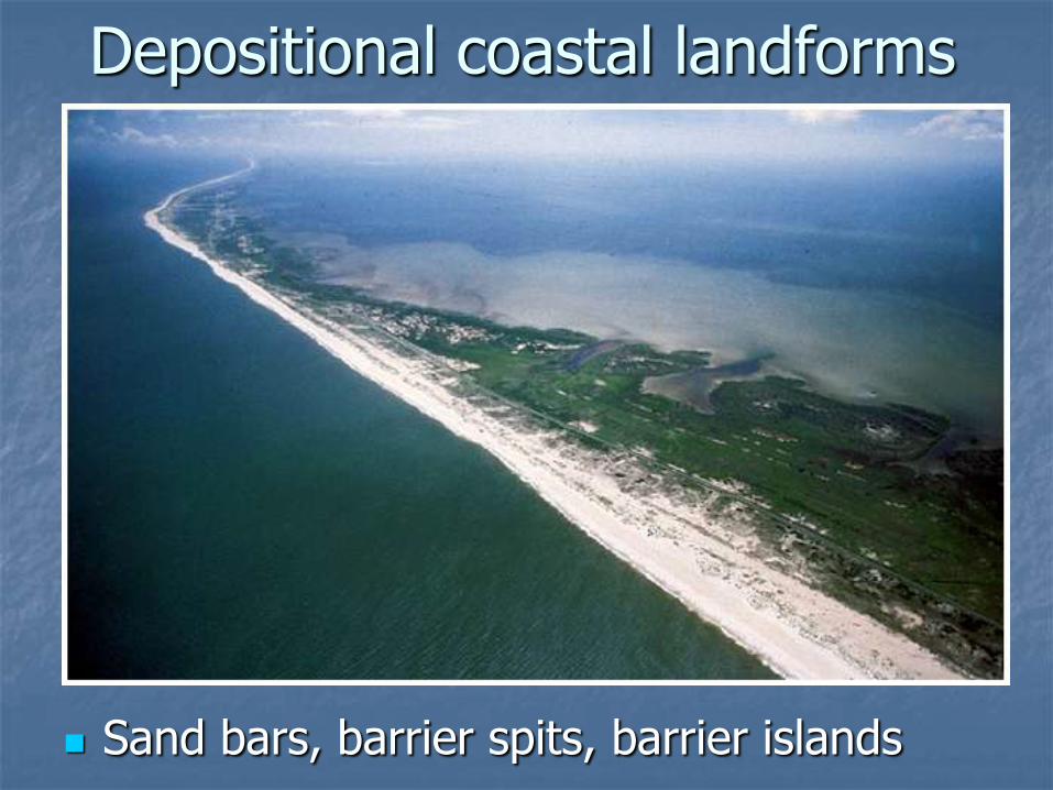
Depositional coastal landforms
Sand bars, barrier spits, barrier islands
Spit
14.05.b7
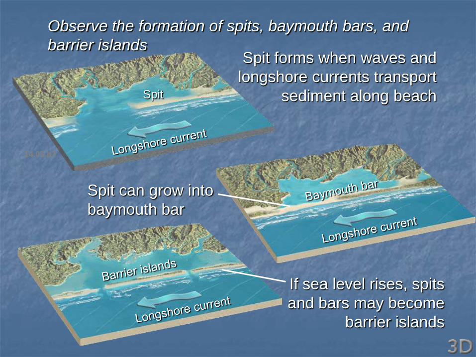
Observe the formation of spits, baymouth bars, and
barrier islands Spit forms when waves and
longshore currents transport
sediment along beach
Spit can grow into
baymouth bar
If sea level rises, spits
and bars may become
barrier islands
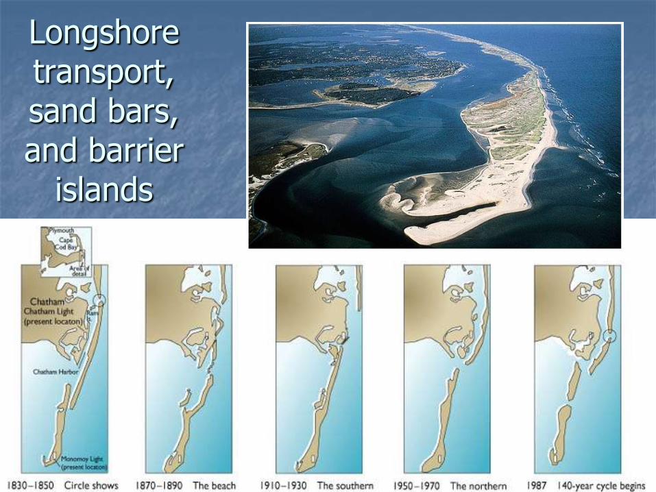
Longshore transport, sand bars, and barrier
islands
14.02.a
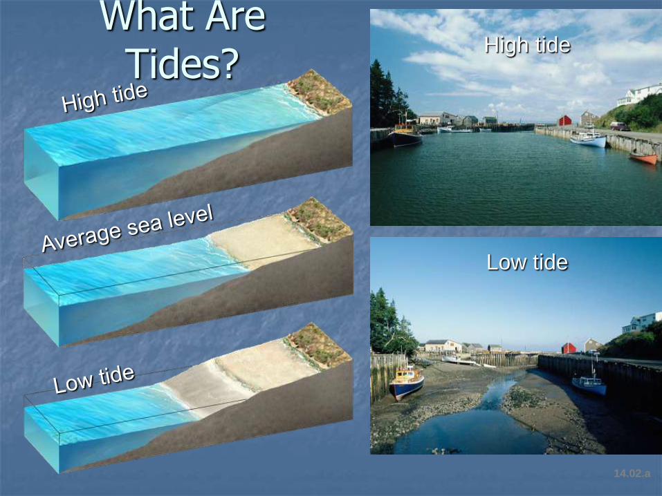
High tide
Low tide
What Are Tides?
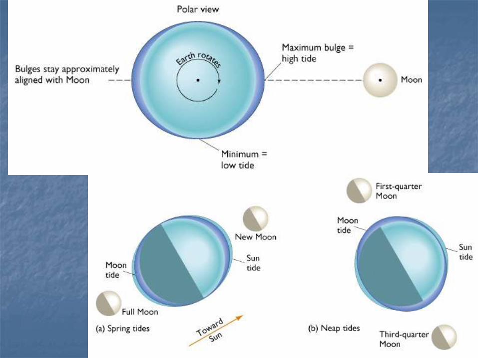
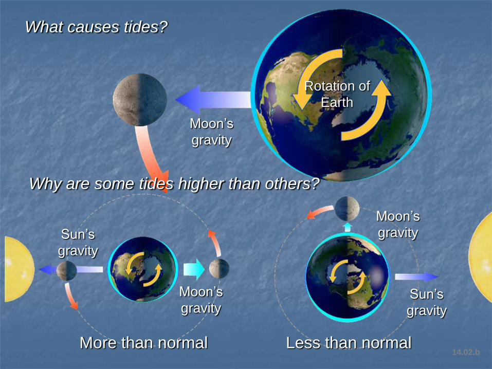
Rotation of
Earth
Moon’s
gravity
Sun’s
gravity
Moon’s
gravity Sun’s
gravity
Moon’s
gravity
14.02.b
What causes tides?
More than normal Less than normal
Why are some tides higher than others?

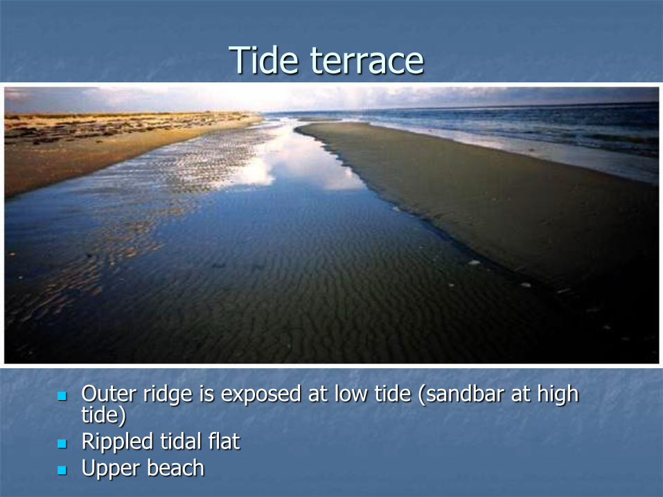
Tide terrace
Outer ridge is exposed at low tide (sandbar at high tide)
Rippled tidal flat Upper beach
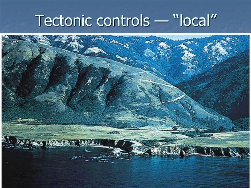
Tectonic controls — “local”
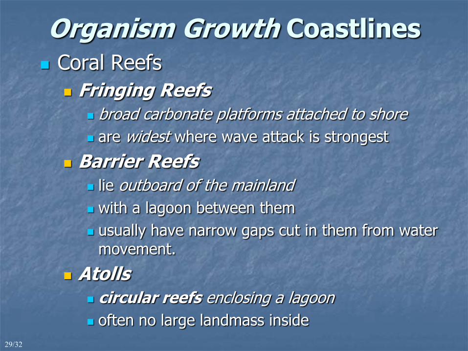
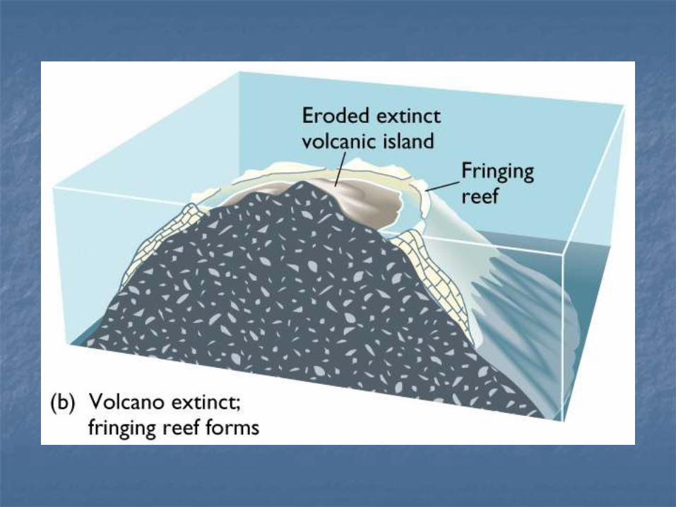
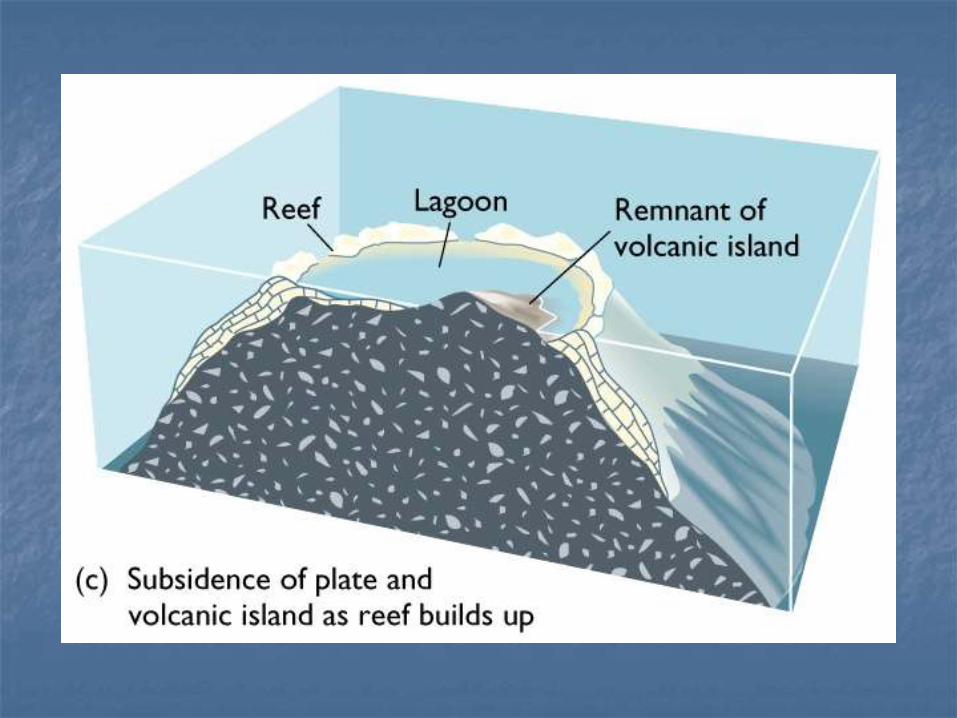
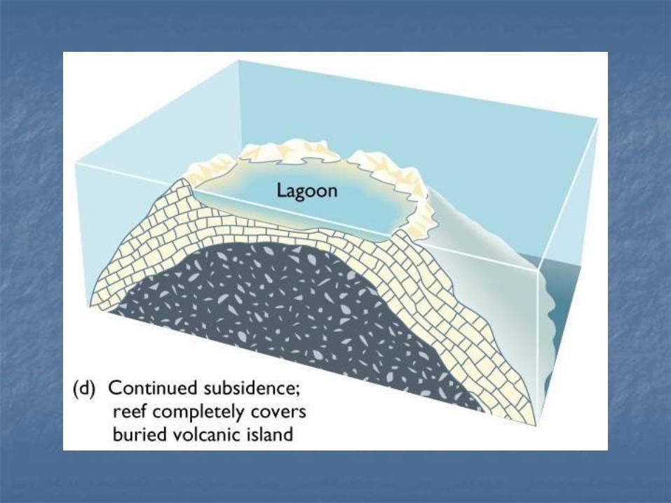
Organism Growth Coastlines
Coral Reefs
Fringing Reefs
broad carbonate platforms attached to shore
are widest where wave attack is strongest
Barrier Reefs
lie outboard of the mainland
with a lagoon between them
usually have narrow gaps cut in them from water movement.
Atolls
circular reefs enclosing a lagoon
often no large landmass inside
29/32
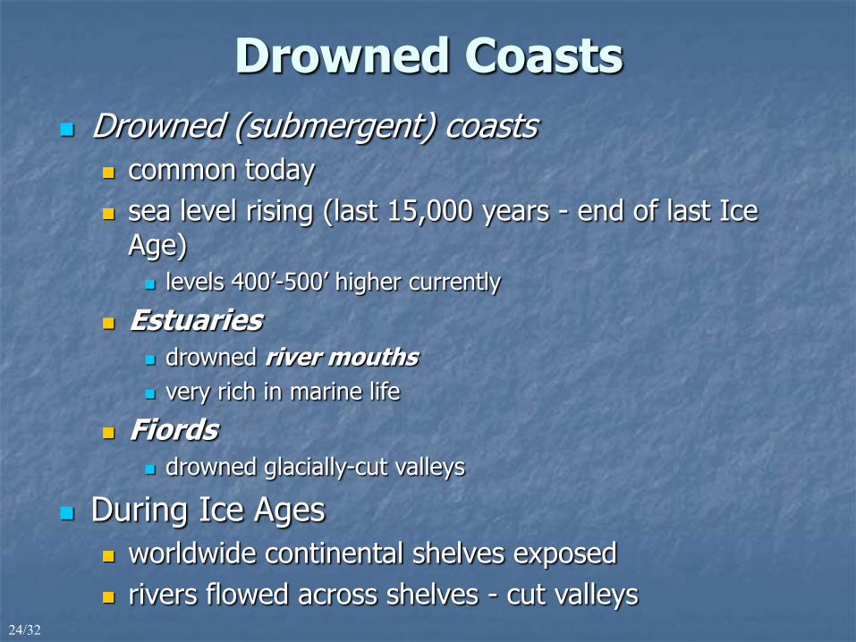
Drowned Coasts
Drowned (submergent) coasts common today
sea level rising (last 15,000 years - end of last Ice Age)
levels 400’-500’ higher currently
Estuaries
drowned river mouths
very rich in marine life
Fiords
drowned glacially-cut valleys
During Ice Ages
worldwide continental shelves exposed
rivers flowed across shelves - cut valleys 24/32
14.06.a
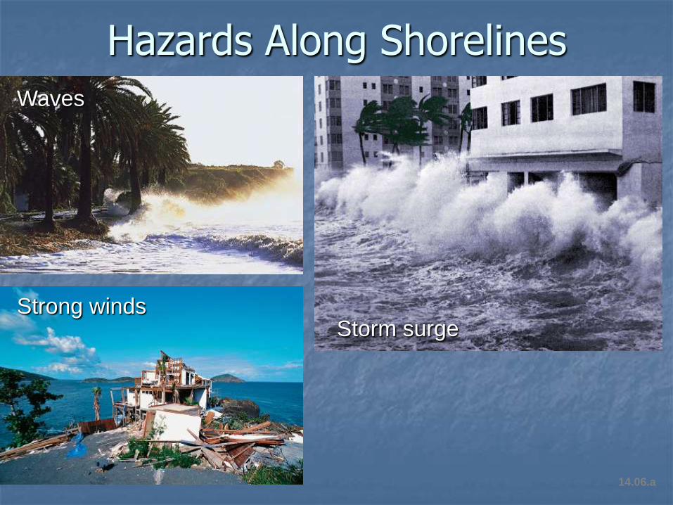
Hazards Along Shorelines
Waves
Storm surge Strong winds
14.06.a
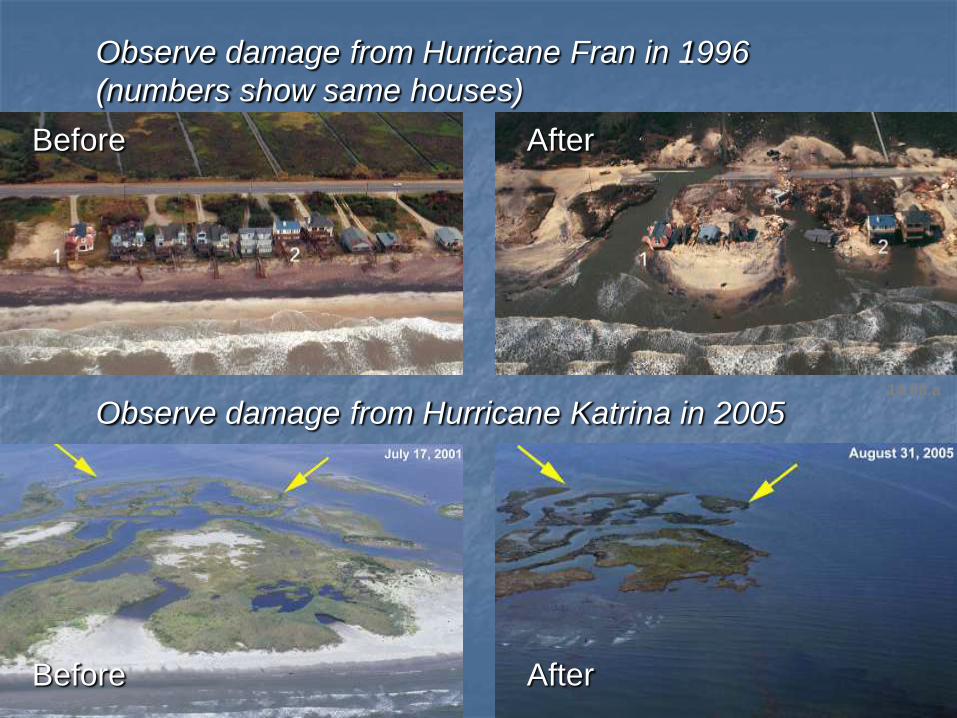
Observe damage from Hurricane Fran in 1996
(numbers show same houses)
Observe damage from Hurricane Katrina in 2005
Before After
Before After